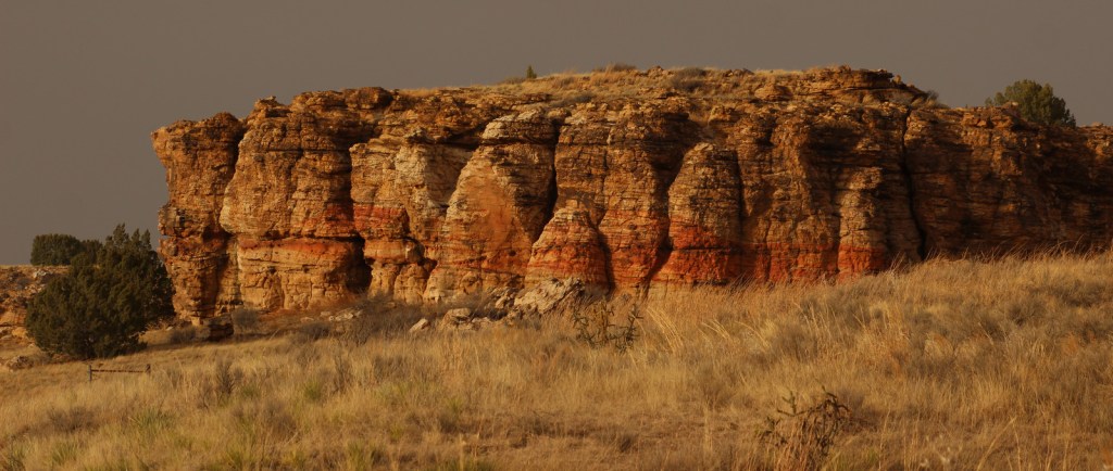
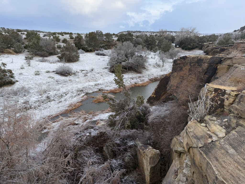
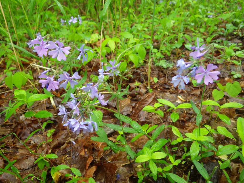
Near the Oklahoma border in southeast Colorado, Comanche National Grassland is comprised of two areas of shortgrass prairie co-managed with Pike and San Isabel National Forests and Cimarron National Grassland (in nearby Kansas). The Timpas Unit is in the watershed of the Purgatoire (or Picket Wire) River, while the more southern Carrizo Unit is mostly centered around Carrizo Creek, a tributary of the Cimarron River. There is a long history of human use of the canyons here, with petroglyphs dating back as far back as 8,000 years. Before giving the National Grassland its name, the Comanche pushed the Apache out of this area in the 1700s and their circular tipi rings can still be found. A branch of the Santa Fe National Historic Trail runs through the northern Timpas Unit with interpretive sites at Sierra Vista Overlook and Timpas Picnic Area (including a three-mile trail following the wagon tracks between the two).
Highlights
Picture Canyon, Crack Cave, Picket Wire Canyon, Dolores Mission, Rourke Ranch, Carrizo Canyon, Vogel Canyon, Santa Fe National Historic Trail
Must-Do Activity
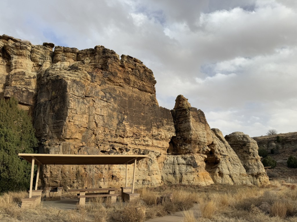
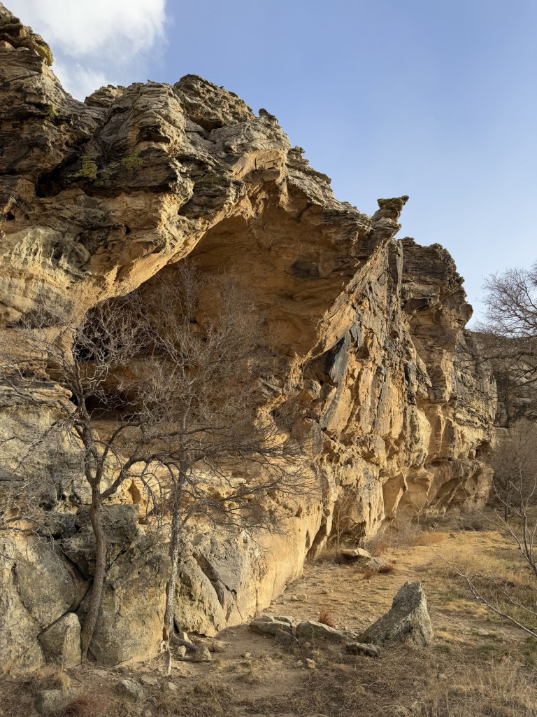
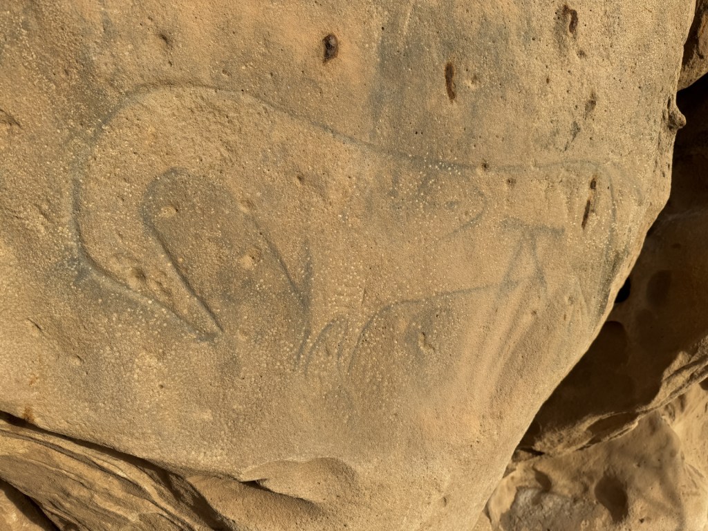
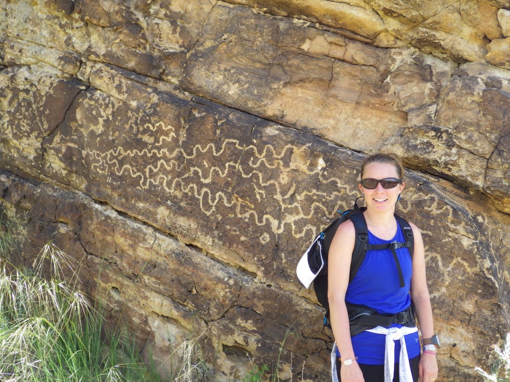
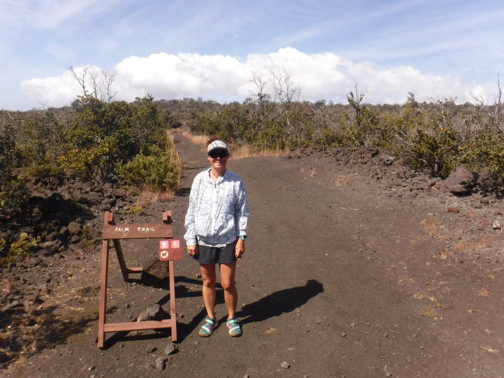
Petroglyphs can be seen on trails near Vogel Canyon and Carrizo Canyon Picnic Areas, with the most famous found in Picture Canyon. It is about 16 miles of unpaved roads to access Picture Canyon from Highway 287, and there are vault toilets and picnic tables at the site. From there, the U.S. Forest Service traditionally leads a hike on Arch Rock Trail to Crack Cave on both the spring and fall equinox, when at dawn the sun’s rays illuminate a specific petroglyph that is usually behind a locked gate that blocks a narrow opening in the sandstone. A similar petroglyph with deeply-carved lines can be seen in an opening above a blue-tinted pictograph about a quarter-mile down the trail. Rock climbing is also a draw here, with a few permanent anchors in the sandstone behind the picnic tables.
Best Trail
It is a 17-mile drive down unpaved roads to Picket Wire Canyon, where a long trail leads to dinosaur tracks (19 miles out-and-back) and Rourke Ranch National Historic District (25 miles) that dates back to 1871. There are approximately 1,900 tracks left by Apatosaurs and Allosaurs over 150-million years ago. Along the way, look for petroglyphs, a model of a dinosaur fossil, and the ruins of Dolores Mission (see Photographic Opportunity).
Watchable Wildlife
Elevations range from 3,900 to 6,200 feet atop Fallas Mesa with ponderosa pine, pinyon pine, juniper, Gambel oak, and cottonwoods trees found in moister areas. Yucca and cacti are common in the prairie, as are desert-dwelling creatures like roadrunners and tarantulas (we saw one crossing the road). Hunters come here for mule deer, elk, pronghorn, and wild turkey in season. The National Grassland contains a lek for lesser prairie chickens, but it is typically closed during mating season due to their endangered status. About 328 bird species have been identified here, including many eastern birds at the extent of their range.
Photographic Opportunity
On the way to the dinosaur track site in Picket Wire Canyon, hikers pass Dolores Mission with a cemetery and the ruins of a small Catholic church dating back to 1898.
Peak Season
Spring and fall
Fees
None
Road Conditions
We have almost gotten stuck twice on the long dirt roads in Comanche National Grassland, once in deep mud following a spring thunderstorm and another time on thick ice following a spring blizzard.
Camping
It is free to disperse camp almost anywhere not on private lands in Comanche National Grassland, with the exception of the parking lots at the following canyons: Picture, Carrizo, Vogel, and Picket Wire.
Picture Canyon Picnic AreaArch Rock TrailSurprise overnight blizzardCarrizo CreekTiff and a tarantulaTarantulaTiff in Picket Wire CanyonSunflower and ladybugTiff with petroglyphsA shoulder blade (replica) from an ApatosaurusScott with dinosaur tracksBobcat on the trailTiff getting some lunch by the Picket Wire RiverAn old cemetery at Dolores MissionPetroglyphsA storm rolling inRaven about the grassland
Explore More – The markings in Crack Cave are theorized by some people to spell out what word in Ogam (an ancient Celtic alphabet)?
Last year we published our guidebook 50 States of Great: Road Trip Guide to America, so we decided to start a new type of blog post where we create a travel itinerary for all 50 states, in addition to our usual National Forest and National Park entries. After starting with Kansas, Georgia, Idaho, Rhode Island, Minnesota, and Hawai‘i we decided to do a state in the southwest. Arizona probably needs two separate itineraries, with the southern deserts being a great destination in the winter and the high-elevation northern part of the state better in the summer (see Day 8+). We made an ambitious seven-day plan starting in the south, with plenty of options to extend the trip. Scott grew up in Arizona, so he could have easily made this a four-week itinerary and still left out many good options.
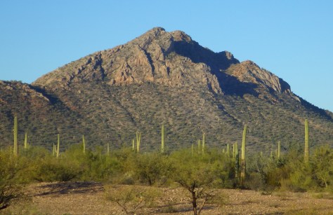
On the Mexican border sits 330,689 acres of undeveloped Sonoran Desert recognized as a UNESCO International Biosphere Reserve in 1976. Its namesake cactus is more common further south and shares this landscape with 27 other species of cacti, including the famous saguaro. The park’s jagged Ajo Mountains are mostly volcanic rhyolite and to see them at their best, we recommend driving the 21-mile dirt road loop in the evening before turning in for the night at the excellent Twin Peaks Campground, run by the National Park Service (NPS).
Arizona has 19 National Monuments (more than any other state), so if you flew into Sky Harbor Airport in Phoenix start with the one located right off Interstate 10.
Desert bighorn sheep can be seen in this remote part of southwest Arizona south of Quartzsite. Cibola and Imperial National Wildlife Refuges along the Colorado River are good spots for birding.
Southwest of Tucson, Arizona in a nondescript stretch of desert are the remains of an underground Intercontinental Ballistic Missile (ICBM) silo built in 1963, during the height of the Cold War. The nuclear warhead and rocket fuel was long ago removed from the site, but otherwise everything has been preserved. A tour guide takes you below ground in the original elevator to explain the steps required to unleash this devastating weapon.
The Catalina Highway ascends from Tucson through multiple life zones from saguaro-dotted desert to ponderosa pine forests at more than 9,000 feet in elevation. The expansive vistas along the drive are worth the many switchbacks, with Windy Point Vista is an especially beautiful wayside in the pinyon-juniper woodland zone. At the base of the Santa Catalina Mountains, also within Coronado National Forest, tram rides are available through beautiful Sabino Canyon Recreation Area.
If you didn’t get your fill of cacti the first day, you will at this park with separate sections east and west of Tucson. If you only have time for one, we recommend the eastern Rincon Mountain District.
South of Tucson in Tubac, San Cayetano de Tumacácori is a Spanish mission founded in 1691 by Padre Kino and abandoned in 1848. It became a National Monument in 1908 when it was restored to its ruined state based on photographs dating from 1868.
The highly decorated cave was not discovered until 1974, when its location was kept a tight secret while efforts were made to preserve it for future visitors. There are two guided tours on paved trails offered, and if you space out your reservations far enough you can take a hike on the 2.4-mile Foothills Loop Trail in between.
Bisbee
The copper mining center of Bisbee was once the largest city between El Paso and San Francisco. The well-maintained Victorian architecture and flights of steep staircases give this border town a unique atmosphere.
The park does not actually contain a statue or large memorial to Coronado. It does have a steep three-quarter mile trail to a 600-foot long limestone cave bearing Coronado’s name, which visitors can explore on their own with flashlights.
Tucked away in the southeastern corner of Arizona, millions of years of erosion left behind a spectacular collection of rhyolite rock formations that rise above surrounding evergreen trees. All the trails are good, but we recommend an all-day hike through Echo Canyon to the Heart of Rocks Loop where you will find formations resembling camels, ducks, and anything else you can imagine.
Salt River Canyon
Start driving north and be sure to stop for photos where U.S. Highway 60 drops steeply into this gorgeous canyon between Globe and Show Low.
Optional stop at Wilcox Playa Wildlife Area
In the winter, sandhill cranes stay in large numbers in the wetlands south of Wilcox and Interstate 10.
To visit the NPS visitor center, the literal “must-do activity” is to hike 1.5 miles from the trailhead. You do pass interpretive signs, a cemetery, and ruins along the way.
A paved walkway behind the Rainbow Forest Museum is a great place to start, as NPS rangers give guided tours there throughout the day. It is worth a hike to Agate House and a connection to the Giant Logs Trail to see more petrified wood, but be sure to bring water with you in the summer since there is no shade.
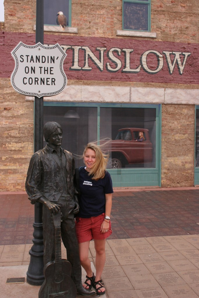
“Standin’ on the corner” statue in Winslow
Jackson Browne and Glenn Frey probably could not have guessed when they penned the 1970s anthem “Take It Easy” that it would inspire a statue in an Arizona town on historic Route 66. Perhaps even more fitting is the mural behind it that shows the reflection of a girl driving a flatbed truck. Located off Interstate 40, Winslow is a great place “to loosen your load.”
Cameron Trading Post
As a kid, Scott’s family would always spend the night at the hotel here before taking friends and family to the Grand Canyon National Park. Try the mutton stew or Indian taco in the restaurant at this historic spot.
Optional stop at Meteor Crater
There is a good museum at this big, round hole in the ground along Interstate 40. It is definitely worth seeing once in your life.
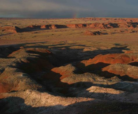
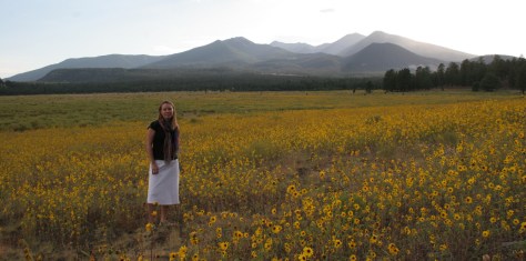
Heading north from Flagstaff, a 36-mile loop drive through Sunset Crater Volcano National Monument to adjacent Wupatki National Monument passes by the red-hued cinder cone through ponderosa pine forests and sunflower-filled meadows on its way to an arid, rocky high desert region that is dotted with Sinagua ruins from around AD 1100. Nearby cliff dwellings were built in Walnut Canyon National Monument around the same time by another group of Sinagua. To get up close with the cliff dwellings inside shallow limestone caves requires a hike down 200 stairs on the one-mile loop Island Trail.
Visit the South Rim of the park from the less busy eastern entrance and stop at the Watchtower and other scenic views along the way. It is worth spending a few nights here and hiking (or riding a mule) to the bottom of the canyon, but that is not for everyone. If you come in the summer, consider a trip to the North Rim or remote Toroweap (online permit required).
Optional stop at Little Colorado River Gorge Navajo Tribal Park
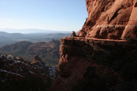
Famous for art galleries and New Age mysticism, the red rock city of Sedona offer plenty of stores and restaurants. Be sure to leave some time to explore some unpaved roads and hiking trails in the surrounding area.
There are numerous trails in the National Forest around Sedona, where sandstone buttes (like Bell Rock and Cathedral Rock) dominate the landscape. The shady West Fork Trail in Oak Creek Canyon is perfect on hot summer days, though in the winter it is also beautiful covered in snow and ice.
Optional stop at Sycamore Canyon Wilderness
This designated Wilderness (55,937 acres) is shared between three National Forests: Coconino, Kaibab, and Prescott. The easiest way in is on the Parsons Trail located outside Clarkdale, west of Sedona. The trailhead is accessed by driving the dirt Forest Road 131 for 10.5 miles from where it splits off near Tuzigoot National Monument.
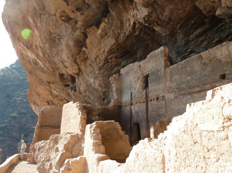
The Sinagua pueblo at Tuzigoot had about 110 rooms and is estimated to have housed 200 to 300 people. You can walk inside portions of the ruin, including a section with a reconstructed roof.
These cliff ruins east of Phoenix are worth the hike up to, as are many parts of Tonto National Forest, especially the Flat Iron, Hieroglyph Canyon, and Weaver’s Needle.
This is a unique NPS site with livestock (sheep, horses, turkeys) and a hands-on play area for children, as well as the original dusty store which allows visitors to travel back into the late-1800s. There are frequent Navajo rug weaving demonstrations and tours inside the Hubbell Home are available for a fee.
In the heart of the Navajo Nation in northeast Arizona lies this picturesque National Monument. Humans have inhabited this area for 4,500 years, leaving behind numerous pictographs and the dramatic ruins of Ancestral Puebloan cliff dwellings.
Visitors can reserve spots on the ranger-led day hike to Betatakin cliff dwelling or the 20-person backpacking trips to Keet Seel that are offered twice per month in the summer. The latter is a strenuous trip covering 17 miles total with numerous stream crossings and all water must be carried in. The hardest part is at the end, when a 1,000 foot climb awaits, but it is worth it to be one of the few who get to see Keet Seel, the 150-room ruin that is second in size only to Cliff Palace at Mesa Verde National Park.
Monument Valley Navajo Tribal Park
On the border of Arizona and Utah, entrance into Monument Valley Navajo Tribal Park allows you to see the iconic Mitten Buttes in person, which have served as a backdrop for countless films. You can even pitch your tent at The View Campground overlooking the red rock formations.
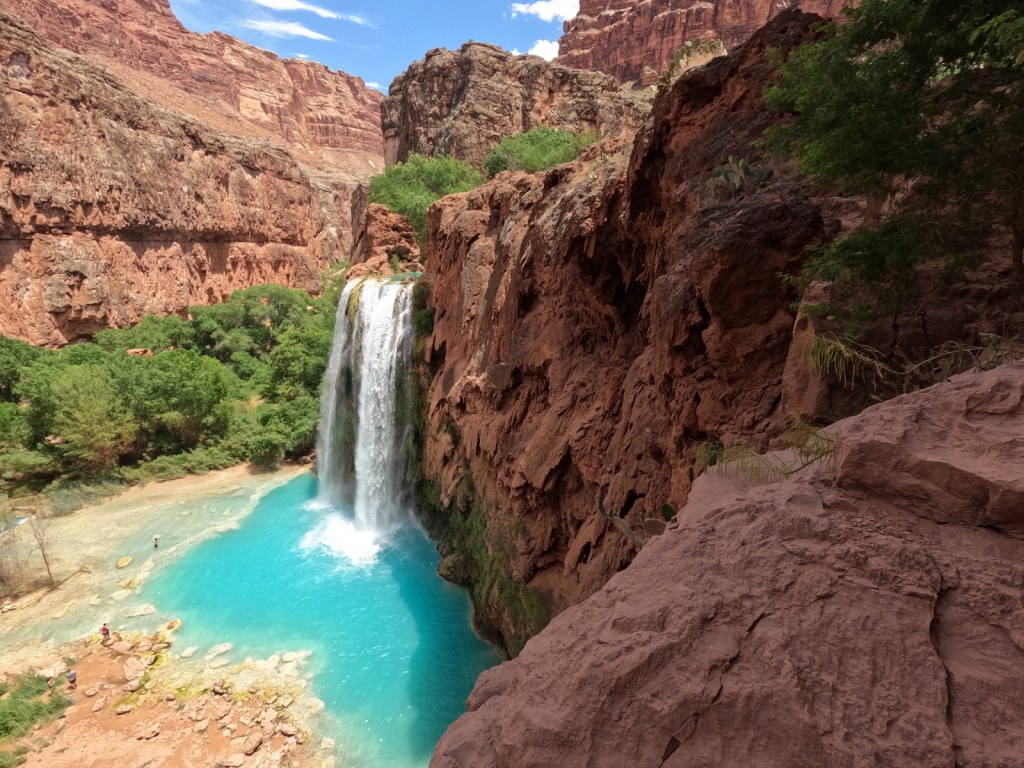
Havasupai Reservation
It is hard to argue against Mooney Falls and the other waterfalls in Havasu Canyon as being the most outstanding in the state, but it can be difficult (and expensive) to obtain one of the limited reservations available to visit the Havasupai Reservation that borders Grand Canyon National Park.
Retention ponds keep this area green in the hot summer months where ducks paddle and dragonflies buzz through the humid air. When a NPS ranger is present, you can walk around inside Winsor Castle, a Mormon fort that dates back to 1870.
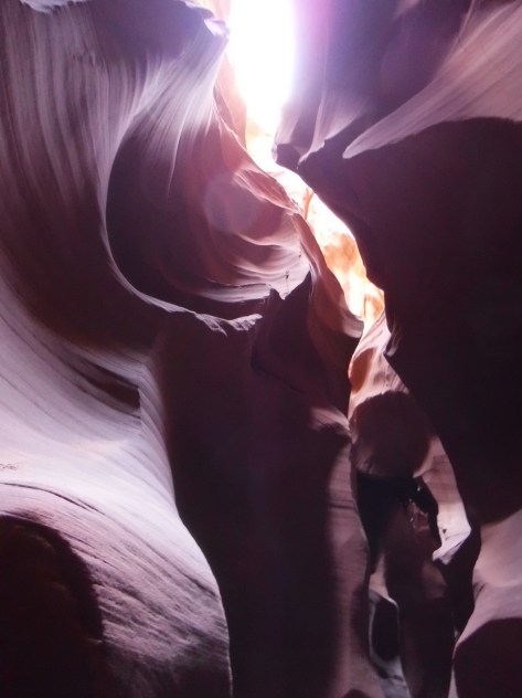
Antelope Canyon
Guided tours are required to access these beautiful slot canyons located on private land on the Navajo Nation
You might want to bring your “selfie stick” to iconic Horseshoe Bend Overlook, a short 0.7-mile one-way hike from the parking area on Highway 89 outside Page.
At Arizona Hot Springs, pools are formed by sandbags in a narrow canyon. It is accessible from Liberty Bell Trailhead by a 6.5-mile out-and-back hike through a beautiful arroyo down to Black Canyon (now the upper reaches of Lake Mohave formed by a dam) on the Colorado River. The trail is closed during the hot summer months, but you can still access it by boat from Willow Beach Marina or just downstream from the Hoover Dam (with a special permit). Further south on Lake Mohave, stop at Emerald Cove for incredible photographs.
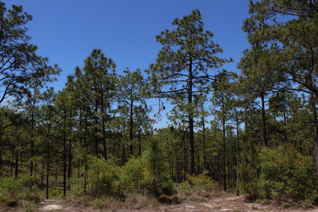
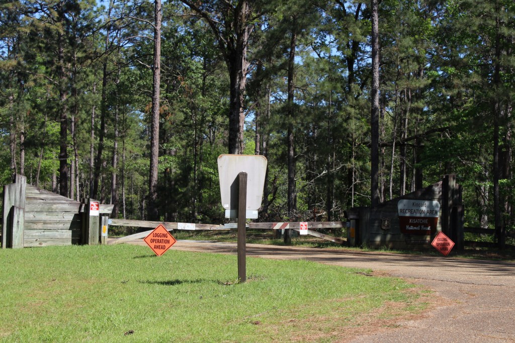
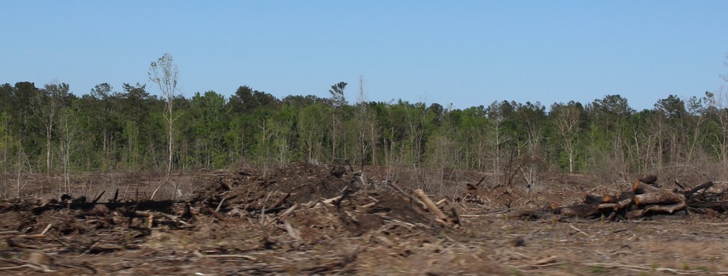
There are eight parcels that constitute Kisatchie National Forest, the only National Forest in Louisiana, which has over 40 developed recreation sites and 100 miles of trails. It encompasses several lakes for boating and swimming, plus baldcypress-lined bayous for canoeing and fishing. The National Forest protects some of the state’s last acreage of calcareous prairie and a diversity of plant species, including wild orchids and carnivorous plants. We saw a television news report that somewhere in Kisatchie National Forest they grew a loblolly pine tree from a seed that NASA took to the moon (which grew normally), then planted a comparison tree that was accidentally a different species.
Highlights
Longleaf Trail Scenic Byway, Saline Bayou, Fullerton Lake, Gum Springs Recreation Area, Kincaid Lake, Wolf Rock Cave, Castor Creek Scenic Area, Corney Lake, Camp Packard, Wild Azalea National Recreation Trail, Glenn Emery Trail, Stuart Nature Trail, Longleaf Vista Interpretive Trail, Sugar Cane National Recreation Trail
Must-Do Activity
Kisatchie National Forest is divided into five Ranger Districts: Caney, Calcasieu, Catahoula, Kisatchie, and Winn. In Winn Ranger District, Saline Bayou is a National Wild and Scenic River featuring a 13-mile-long designated water trail. Boating, fishing, and camping are also popular activities at the developed recreation areas at Caney Lake, Corney Lake, Kincaid Lake, Kisatchie Bayou, and Stuart Lake. Calcasieu is the southernmost Ranger District and contains the state’s longest trail (31-mile Wild Azalea Trail) and the only known cave in Louisiana (Wolf Rock Cave) off Parish Road 455.
Best Trail
In Kisatchie Ranger District’s Longleaf Scenic Area, a 1.5-mile-long interpretive loop at Longleaf Vista is a good place to start, since it has signs that introduce plants that inhabit ecosystems from rocky buttes to bottomland hardwood forests. Longer trails like the seven-mile Backbone Trail and 10.5-mile Caroline Dorman Trail enter the Kisatchie Hills Wilderness, an 8,700-acre area that is one of only three designated Wildernesses in Louisiana.
Watchable Wildlife
Old-growth longleaf pine forests provide habitat for endangered red-cockaded woodpeckers, areas that are easily identified by white paint markings on boundary trees. We also saw an armadillo and wild turkey in the Longleaf Scenic Area. Other rare species of management concern are the Louisiana pine snake, black bear, and Louisiana pearlshell mussel. We saw signs warning of alligators, so if you do enter the water be aware of that, especially in the roadless Cunningham Brake and Saline Bayou. Winn Ranger District and Catahoula National Wildlife Refuge are popular destinations for fishermen and hunters of white-tailed deer, turkeys, and waterfowl. The Catahoula Hummingbird and Butterfly Garden is located near the Catahoula Ranger District Office in Bentley. Iatt Lake Observation Pier in the Catahoula Ranger District is a good place to watch for migratory birds in the spring and fall.
Photographic Opportunity
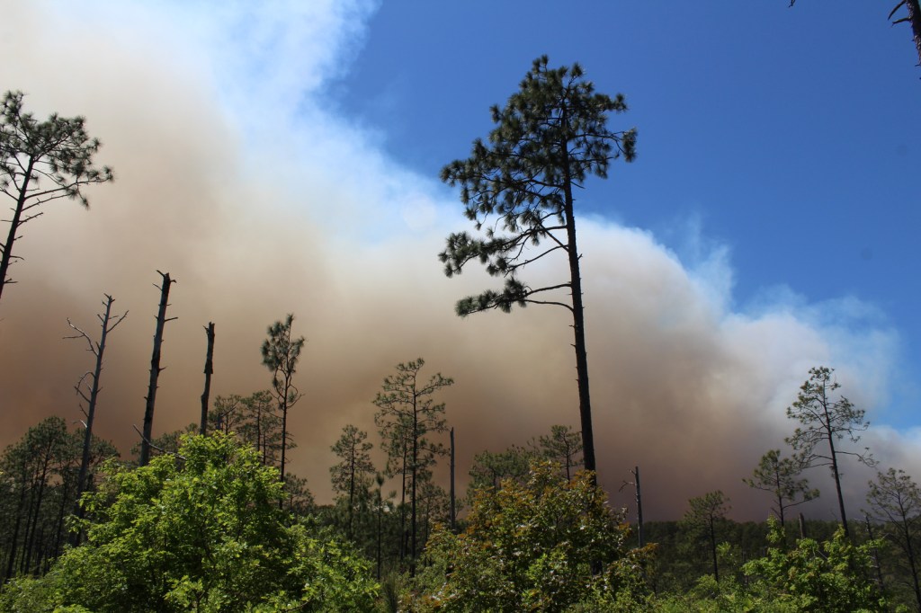
Louisiana is not known for its vertical topography, so it is worth stopping at Longleaf Vista Overlook for the panorama, though hopefully without the thick smoke we saw from a controlled burn.
Peak Season
Spring and fall
Fees
None
Road Conditions
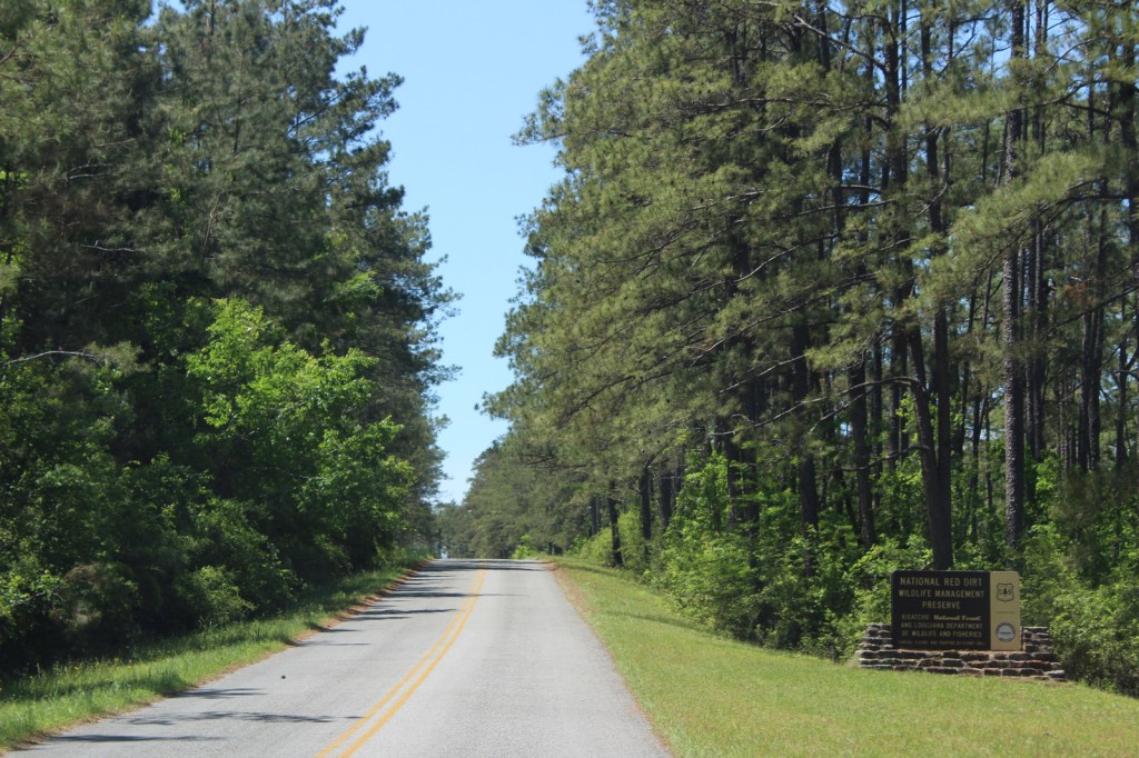
Longleaf Scenic Area is accessed by the paved 17-mile-long Longleaf Trail Scenic Byway, just off Interstate 49. To the west of Longleaf Scenic Area, a plethora of roads run through the Red Dirt National Wildlife Management Preserve, accessing Kisatchie Bayou Recreation Area and numerous campgrounds and trails. There are designated ATV trails in the Catahoula (at Stuart Lake) and Calcasieu Ranger Districts.
Camping
Official campgrounds are located throughout Kisatchie National Forest, including three at Kincaid Lake, two at Valentine Lake, three at Corney Lake, Stuart Lake Campground, Beaver Dam Campground on Upper Caney Lake, and Turtle Slide Campground on Lower Caney Lake. Specific campgrounds for equestrian use include Amus Melder Camp in Calcasieu Ranger District and Gum Springs Recreation Area in Winn Ranger District.
Longleaf Vista OverlookSmoke from controlled burnKincaid LakeKincaid LakeWild turkeyCampground closed for logging operationClear cut loggingCampground closed from hurricane damage
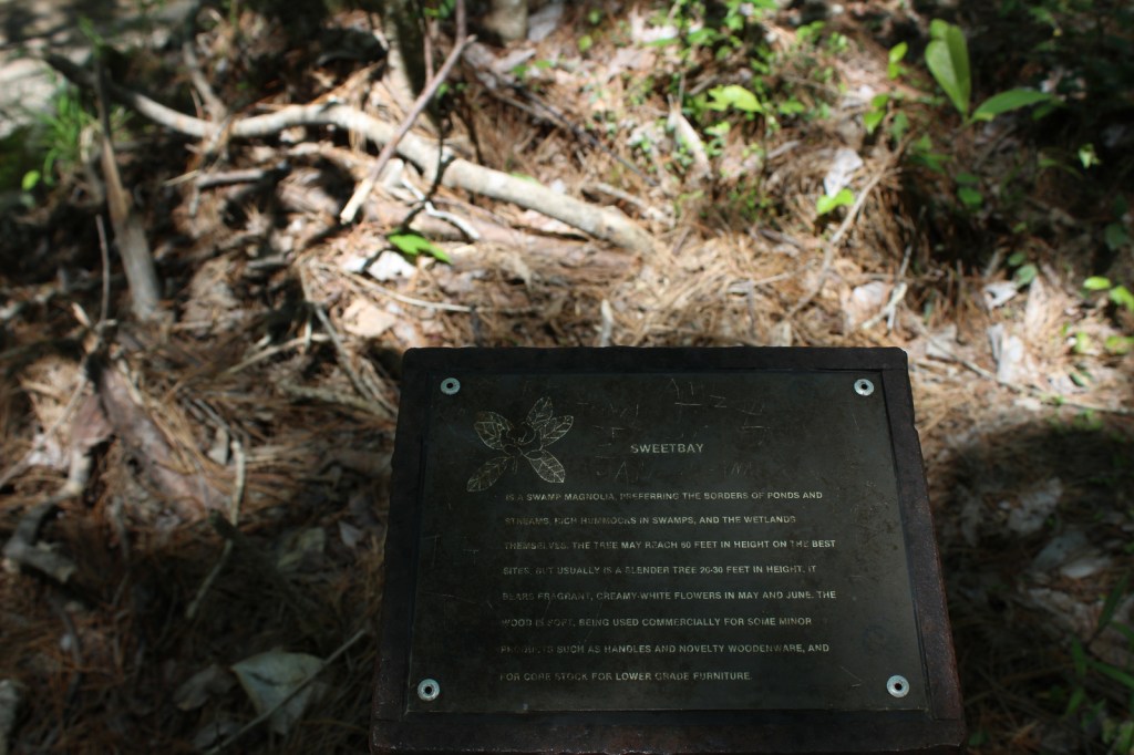
water tupelo, American beech, white oak, post oak, Shumard oak, white ash, mockernut hickory, nutmeg hickory, southern magnolia, flowering dogwood, redbud, red buckeye, red bay, fringe tree, chalk maple, wax myrtle, raisin tree, dahoon holly, yaupon holly, sweetbay magnolia, brookside alder
Explore More – How many acres of calcareous prairie remain in Louisiana, noting that Kisatchie National Forest’s historic Tancock Prairie (45 acres) and historic Bartram Prairie (1,190 acres) have been taken over by forests since the initial 1836 survey?
Learn more about this and the 154 other National Forests in our new guidebook Out in the Woods
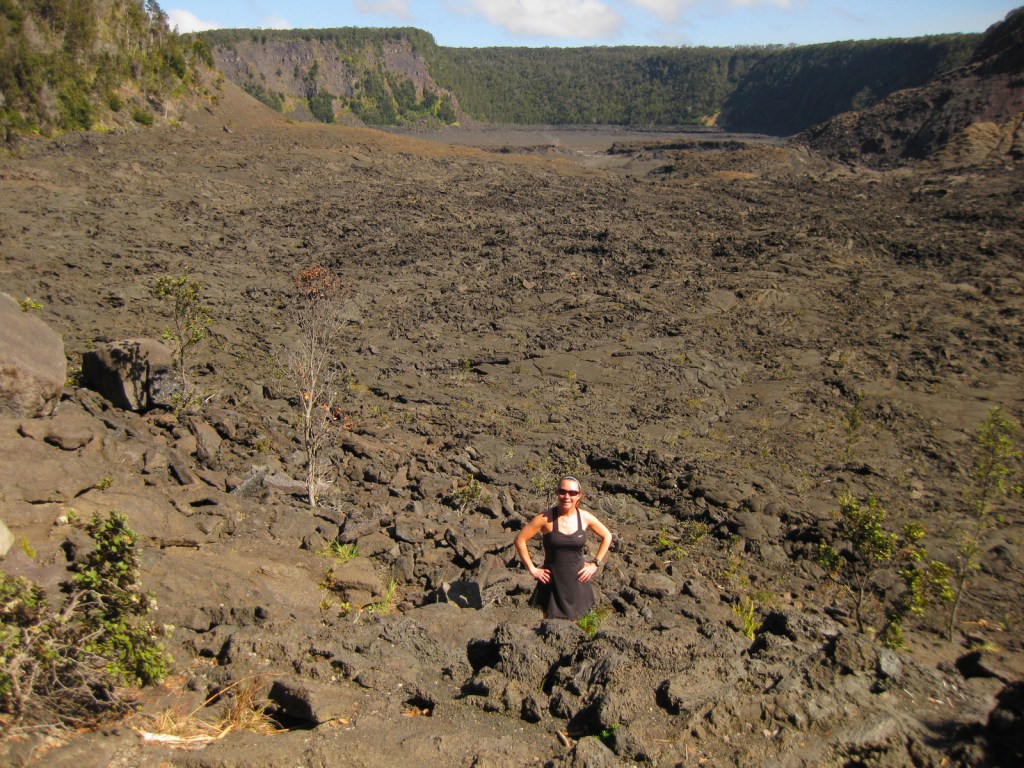
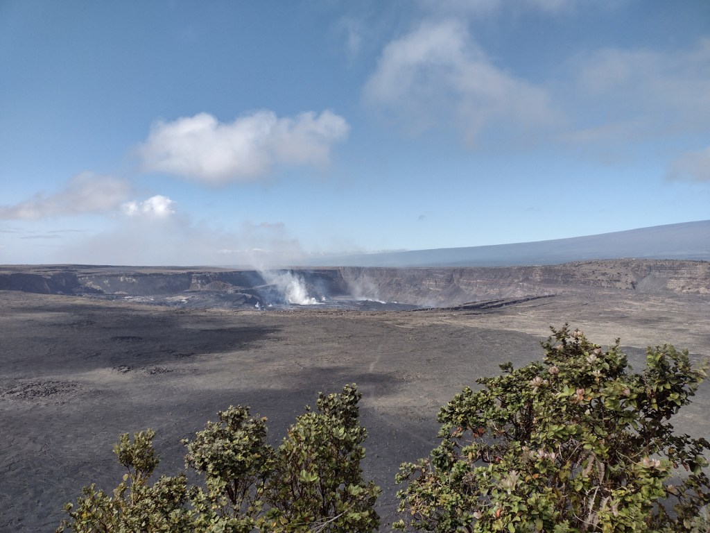
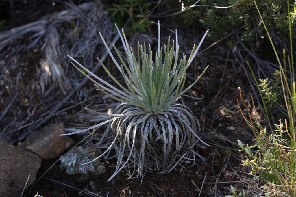
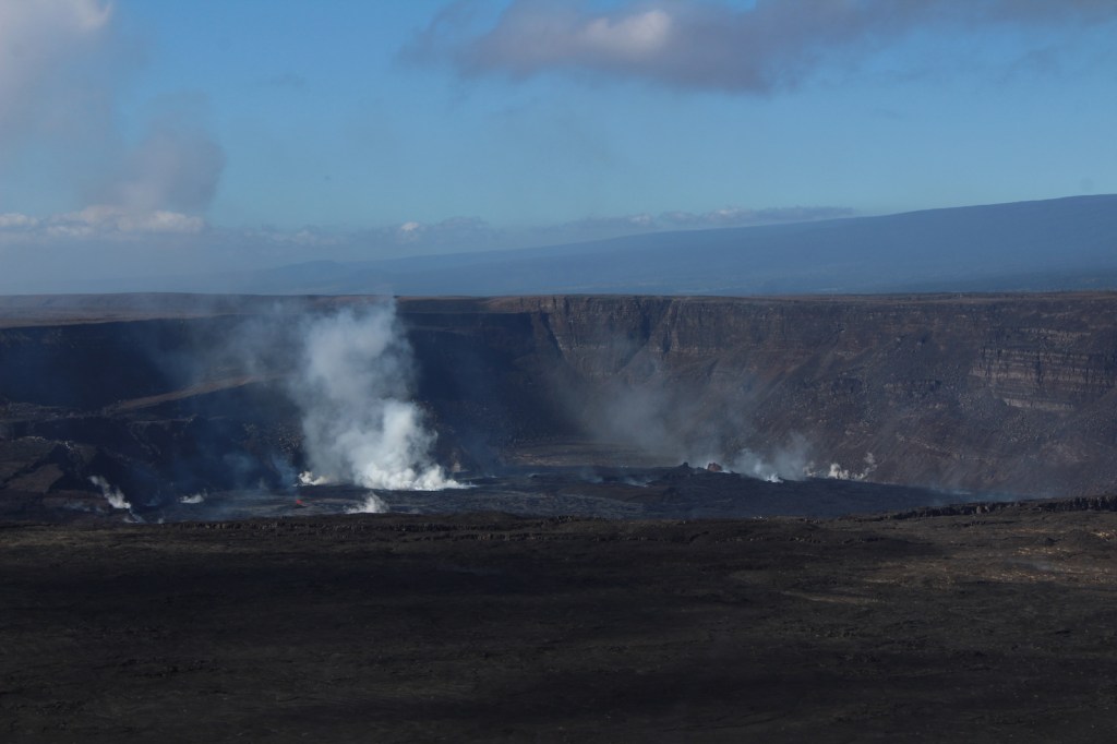
Hawai‘i National Park was created in 1916, before being split in 1961 into this park on the Big Island of Hawai‘i and Haleakala National Park on Maui. Encompassing two of the world’s most active volcanoes (Kīlauea and Mauna Loa), Hawaiʻi Volcanoes National Park is constantly changing. Indigenous people considered Kīlauea Caldera and its bubbling Halemaʻumaʻu Crater as the sacred home of Pele, goddess of the volcano. This area first became a tourist attraction in the 1840s when Volcano House was still a grass shack. A small, wooden hotel was built in 1877 that now serves as Volcano Art Center Gallery, before the larger lodge was finished in the 1940s on the edge of the caldera. A strenuous backpacking trail summits the world’s largest shield volcano, 13,677-foot Mauna Loa, which erupted in 1926, 1942, 1950, 1984, and 2022.
Volcano Art Center, Halemaʻumaʻu Crater, Chain of Craters Road, Kīlauea Iki Crater, Nāhuku (Thurston Lava Tube), Hōlei Sea Arch, Lava Tree Molds, Mauna Loa Overlook, Kīpukapuaulu Trail, Pu‘u Loa Petroglyphs Trail
Must-Do Activity
Arrive early or late at the visitor center to avoid tour bus crowds, then check with a ranger to find the best overlooks to view any volcanic activity in Halemaʻumaʻu Crater (depicted in our illustration below). Consider returning to view the molten lava after dark, although parking can be a challenge. The Chain of Craters Road leads 20 miles south from the forested caldera rim above 4,078 feet in elevation down to the sparsely vegetated seashore, descending through a wide range of environments before it dead ends into recent lava flows near the Hōlei Sea Arch and 1.5-mile Pu‘u Loa Petroglyphs Trail, where the crisp images chipped into the black lava have been spared from centuries of volcanic activity.
Best Trail
Kīlauea Iki Trail makes a four-mile loop descending 400 feet to the bottom of the crater that was a lake of lava in 1959. It is recommended to hike it in a counter-clockwise direction to avoid ascending the steepest sections.
Instagram-worthy Photo
Kīlauea erupted nonstop from 1983 through 2018, when lava poured in a near constant stream into the ocean, and it has been sporadically active since then. Lava made it into the #1 spot on our Top 10 Natural Phenomena to See in the U.S.
Chain of Craters Road is paved, but can be closed during volcanic eruptions, just as half of Crater Rim Drive has been closed since March 19, 2008. The side road to Hilina Pali Overlook is usually closed beyond Kulanaokuaiki Campground. The one-lane, potholed Mauna Loa Road is doable with a passenger vehicle if you take it slow, as is the unpaved road into the western Kahuku Unit.
Camping
The name of Kulanaokuaiki Campground translates as “shaking earth,” and this nine-site primitive camp has no drinking water, unlike the concessionaire-run Nāmakanipaio Campground and Cabins on Highway 11. Even though this is Hawai‘i, bring some warm clothes as it can be quite rainy and windy, especially when the volcano is erupting; the temperature around Halemaʻumaʻu Crater did not rise above 59°F all day during our 2023 visit.
Scott at the bottom of Kīlauea Iki CraterScott at steam vents on Crater Rim DriveTiff on Kīlauea Iki TrailChain of Craters RoadPu‘u Loa Petroglyphs TrailHōlei Sea ArchTiff at the entrance to Nāhuku (Thurston Lava Tube)Nāhuku (Thurston Lava Tube)Inside the visitor centerTiff in Kahuku UnitTiff hiking in Kahuku UnitMauna Loa RoadMauna Loa OverlookSilversword plant at Mauna Loa OverlookKīpukapuaulu TrailKīlauea Iki TrailScott at Kulanaokuaiki CampgroundScott at Volcano House Lodge
Explore More – When was the 115,788-acre Kahuku Unit added to the National Park?
This design we created to celebrate Hawai’i Volcanoes National Park is available on a variety of products at Cafe PressCafe PressWe designed this ‘ohi’a lehua logo for the park available on Amazon.com
We are a participant in the Amazon Services LLC Associates Program, an affiliate advertising program designed to provide a means for us to earn fees by linking to Amazon.com and affiliated sites.
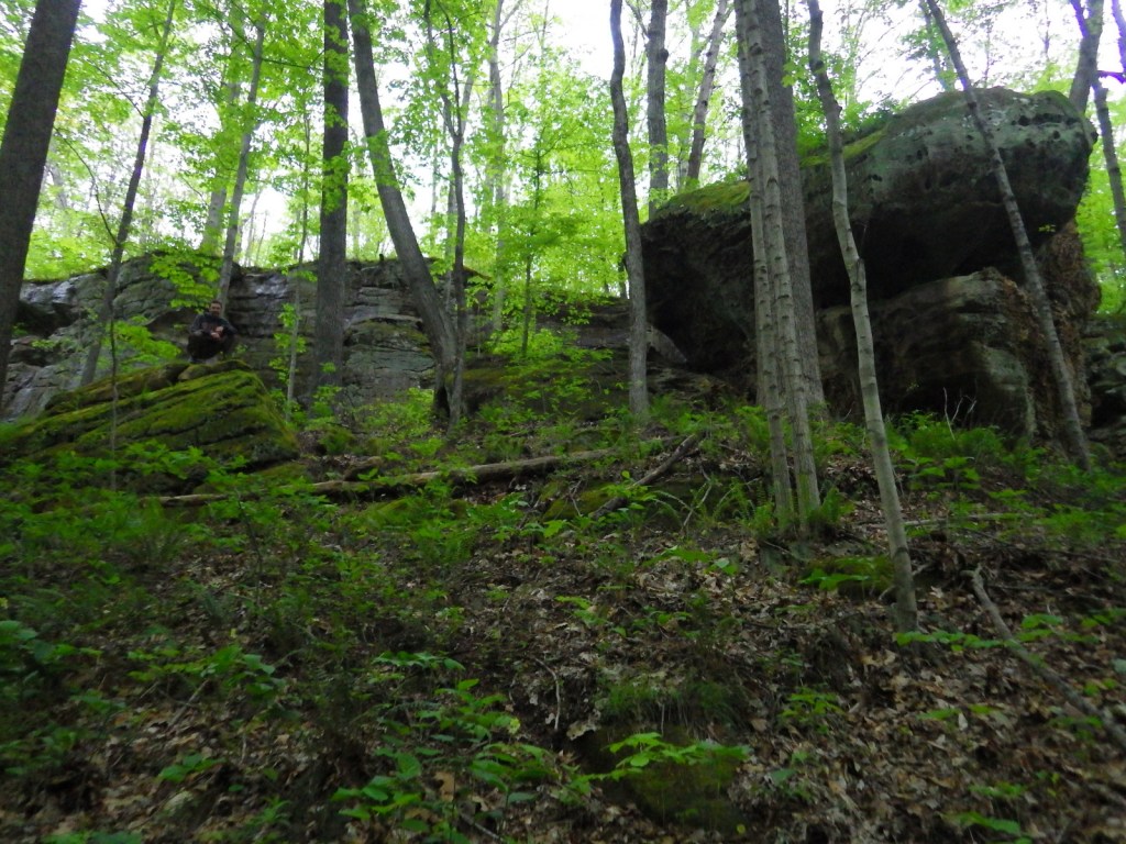
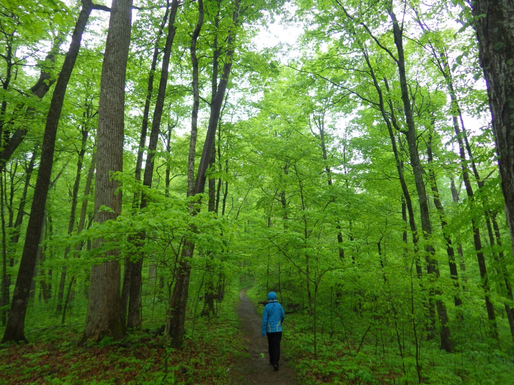
Southern Indiana’s Hoosier National Forest was created in 1935 from cutover and abandoned farm land. Six years later an additional 88 acres of old-growth forest was purchased that became Pioneer Mothers Memorial Forest, which has never been cut and is used to study natural succession. A 0.8-mile trail runs through the woods and accesses the Indiana Pioneer Mothers Memorial and Lick Creek Settlement Site. The latter was a community of free African-Americans led by the Quaker Jonathan Lindley from 1819 to 1865, and located nearby is an archaeological site where there was a stockaded village in the 1300s.
Highlights
Pioneer Mothers Memorial Forest, Monroe Lake, Hickory Ridge Lookout Tower, German Ridge Lake, Lick Creek Settlement Site, Sundance Lake, Potts Creek Rockshelter Archeological Site, Lake Tarzian, Rickenbaugh House, Tipsaw Lake, Buzzard Roost Overlook, Clover Lick Barrens, Hardin Ridge Recreation Area, Birdseye Trail, Hemlock Cliffs Trail
Must-Do Activity
There are 266 miles of trails in Hoosier National Forest, including the 36.3-mile Terrill Ridge Trail that enters the Charles C. Deam Wilderness (Indiana’s one and only) and the 24.1 miles of trails around German Ridge Lake. Horse camps provide access to miles of bridle trails, including the 48.7-mile Hickory Ridge Trail. Many of the National Forest’s trails are old roads (even in the Wilderness), so while hiking watch for evidence of house foundations, fences, domestic plants, and cemeteries.
Best Trail
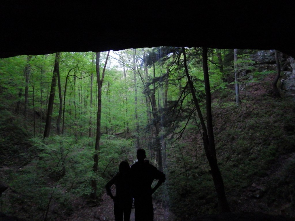
Hemlock Cliffs Trail is a 1.2-mile loop through a sandstone canyon that passes two unique waterfalls. Tall eastern hemlock trees surround both waterfalls that you can walk behind where the cliffs are undercut by erosion in this crumbly sedimentary rock. The falls only flow seasonally, but when they do the trail is often muddy and slippery, so take caution.
Watchable Wildlife
In 1972, wild turkeys were reintroduced to 6,000 acres around Clover Lick Barrens, an area of prairie vegetation. Other birds of interest include red-shouldered hawks, sharp-shinned hawks, scarlet tanagers, and pileated woodpeckers. Timber rattlesnakes and copperheads are two venomous snake species found here. Mammals include fox squirrels, raccoons, and white-tailed deer, which attract hunters in season.
Instagram-worthy Photo
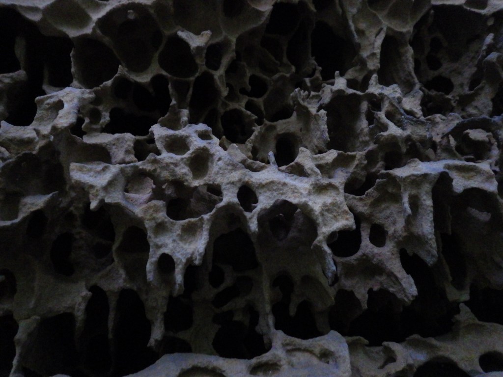
Southern Indiana is known for its Karst topography, which often forms limestone caves, as well as some beautiful Swiss-cheese formations that can be seen along the Hemlock Cliffs Trail.
Peak Season
Summer
Fees
None
Road Conditions
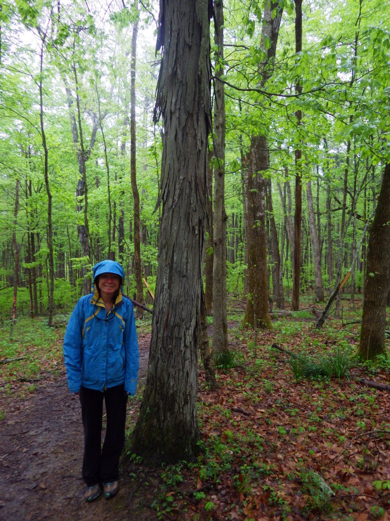
Road access is paved to the pullout for the Pioneer Mothers Memorial Forest, and the unpaved road to Hemlock Cliffs Trailhead was a good enough for our mini-van.
Camping
There are horse camps at Shirley Creek, Blackwell, Hickory Ridge, and Youngs Creek, in addition to other campgrounds dispersed throughout Hoosier National Forest.
American beech, tulip-poplar, basswood, Ohio buckeye, white ash, green ash, American elm, winged elm, black walnut, white oak, northern red oak, black oak, chinquapin oak, rock chestnut oak, post oak, blackjack oak, sugar maple, red maple, ironwood, sassafras, black cherry, black gum, black walnut, honeylocust, Kentucky coffeetree, flowering dogwood, redbud, basswood, sycamore, mockernut hickory, shagbark hickory, pawpaw, slippery elm, butternut, hophornbeam, sweetgum, mountain laurel
Explore More – Who was Charles C. Deam, the namesake for the only Wilderness in Indiana (designated in 1982)?
Learn more about this and the 154 other National Forests in our new guidebook Out in the Woods
Start your U.S. National Parks, National Forests, and National Monuments adventure here!