Tag Archives: skiing

Dixie National Forest

Dixie National Forest

Utah

Managed by U.S. Forest Service, Intermountain Region

1,967,165 acres (1,889,127 federal/ 78,038 other)

Website: https://www.fs.usda.gov/dixie

Overview

Dixie National Forest is spread across southwest Utah surrounding Cedar Breaks National Monument and near three National Parks: Bryce Canyon, Capitol Reef, and Zion.  The National Forest has a wide elevation range from 2,800 feet near St. George to 11,322 feet on Boulder Mountain.  The change in average temperature and precipitation leads to wide variety of ecosystems from a desert-like environment all the way up to subalpine conifer forests and tundra.  The warmth of southern Utah reminded some early emigrants of “Dixie,” the part of the U.S. south of the Mason-Dixon Line, but with growing public distaste for that name it may be changed in the future.

Highlights

Markagunt National Scenic Byway, Brian Head, Navajo Lake, Cascade Falls, Strawberry Point, Red Canyon Recreation Area, Honeycomb Rocks, Powell Point, Hell’s Backbone Bridge, Virgin River Rim Trail, Hancock Peak Trail, Whipple Trail, Casto Canyon Trail

Must-Do Activity

Highway 12 Scenic Byway winds through much of the National Forest, including Red Canyon Recreation Area where the popular Casto Canyon Trail is open to hikers, bicycles, horses, and ATVs.  The mountain ranges west of Interstate 15 are a less-visited section of the forest, with numerous trails traversing the Pine Valley Mountains Wilderness, including the 35-mile Summit Trail.

Best Trail

Leaving from a trailhead across Highway 143 from the road to the top of 11,312-foot-tall Brian Head, Rattlesnake Creek Trail skirts the edge of spectacular Cedar Breaks National Monument and enters the Ashdown Gorge Wilderness (established in 1984).  About one mile in, one of several side trails leads off to the left for an overlook of the Cedar Breaks, a red rock badlands full of hoodoos situated at the edge of the Markagunt Plateau.  Gnarled Great Basin bristlecone pine trees cling to the eroding edge of the natural amphitheater, making a great foreground for photographs with a beautiful backdrop.  The trail continues to drop more than 2,400 feet to the canyon bottom over four miles connecting with Ashdown Creek which eventually crosses Highway 14, but there is not an official trailhead there.

Watchable Wildlife

A variety of mammals call Dixie National Forest home: black bears, mountain lions, bobcats, coyotes, three species of foxes, minks, pine martens, porcupines, beavers, raccoons, skunks, badgers, snowshoe hares, pika, mountain goats, bighorn sheep, elk, mule deer, and pronghorns.  Large birds include bald eagles, golden eagles, California condors, turkey vultures, wild turkeys, and various species of woodpeckers.  There are many gamefish found in the streams and small lakes spread across the high-elevation Markagunt, Paunsaugunt, and Aquarius Plateaus.

Instagram-worthy Photo

South of Torrey, Highway 12 climbs into an aspen forest with incredible views of Capitol Reef National Park and Waterpocket Fold.

Peak Season

Late summer

Fees

None

Road Conditions

Highway 12 and Highway 143 are paved roads that access the high elevations of Dixie National Forest, but they may be closed seasonally due to snow.  There are numerous dirt roads that traverse the area, including the popular route to the top of 11,312-foot-tall Brian Head.

Camping

There are numerous campgrounds located throughout the National Forest, as well as dispersed camping opportunities on dirt roads west of Bryce Canyon National Park.

Wilderness Areas

Ashdown Gorge Wilderness

Box-Death Hollow Wilderness

Cottonwood Forest Wilderness

Pine Valley Mountains Wilderness

Related Sites

Cedar Breaks National Monument (Utah)

Grand Staircase-Escalante National Monument (Utah)

Capitol Reef National Park (Utah)

Nearest National Park

Bryce Canyon

Conifer Tree Species

Utah juniper, singleleaf pinyon pine, ponderosa pine, Douglas-fir, Engelmann spruce, subalpine fir, Great Basin bristlecone pine

Flowering Tree Species

quaking aspen, Bebb willow

Explore More – On the Markagunt Plateau, Navajo Lake drains out of two lava tubes that formed how many millions of years ago?

Learn more about this and the 154 other National Forests in our new guidebook Out in the Woods

We are a participant in the Amazon Services LLC Associates Program, an affiliate advertising program designed to provide a means for us to earn fees by linking to Amazon.com and affiliated sites.

Deschutes National Forest

Deschutes National Forest

Oregon

Managed by U.S. Forest Service, Pacific Northwest Region

1,853,929 acres (1,596,900 federal/ 257,029 other)

Website: https://www.fs.usda.gov/deschutes

Overview

Bend, Oregon is the gateway to Deschutes National Forest, with the beautiful Cascade Lakes Scenic Byway located west of town.  To the south, Newberry National Volcanic Monument is also managed by the U.S. Forest Service, which we will cover in our next blog post.  The Deschutes River was named La Rivière aux Chutes by French trappers because Celilo Falls was located near its confluence with the Columbia River.  Deschutes National Forest contains five Wilderness areas, six National Wild and Scenic Rivers, Metolius Conservation Area, and part of Oregon Cascade Recreation Area (mostly in Umpqua National Forest).

Highlights

Newberry National Volcanic Monument, Cascade Lakes Scenic Byway, Devils Lake, Mt. Bachelor, Sparks Lake, Broken Top, Three Sisters, McKenzie Pass-Santiam Pass Scenic Byway, Skeleton Cave, Pacific Crest National Scenic Trail

Must-Do Activity

The 66-mile-long (89-mile loop) Cascade Lakes Scenic Byway curves around the mountains west of Bend past numerous lakes reflecting multiple snow-capped peaks—a real photographers’ paradise.  To spend the golden hours up here, consider staying at campgrounds on the shores of Lava Lake or Sparks Lake with excellent views of Broken Top and South Sister Peak.  Like Mt. Hood to the north, 9,065-foot Mt. Bachelor is known for its ski resort.  A summer trip up Pine Marten Express Lift offers unsurpassed panoramas of the Cascades and Newberry National Volcanic Monument.

Best Trail

Sisters Mirror Lake is four miles and 650 feet up from a trailhead on the Cascade Lakes Scenic Byway and is located on the Pacific Crest National Scenic Trail.  Just as a warning, this entire trail was thick with aggressive mosquitoes on our hike in mid-July.

Watchable Wildlife

Elk, pronghorn, and mule deer are large ungulates found in Deschutes National Forest.  Carnivorous mammals include black bears, coyotes, mountain lions, and bobcats.  Large birds frequently seen are bald eagles, Canada geese, mallards, and whistling swans, and the northern spotted owl is a species of concern.  There are many lakes found throughout the National Forest that support a variety of gamefish, including bull trout (a threatened species).

Instagram-worthy Photo

Sparks Lake is a great place to watch the sun set behind the Cascades.

Peak Season

Summer

Fees

There is a day use fee for Newberry National Volcanic Monument.

Road Conditions

Cascade Lakes Scenic Byway is paved, as are the main roads into Newberry National Volcanic Monument, but there are many miles of logging roads to explore, too.

Camping

Campgrounds on the shores of Lava Lake or Sparks Lake provide views of Broken Top and South Sister Peak.  Walk-in campsites on crystal clear Devils Lake offer a bit more secluded experience.

Wilderness Areas

Diamond Peak Wilderness (also in Willamette National Forest)

Mt. Jefferson Wilderness (also in Mt. Hood and Willamette National Forests)

Mt. Thielsen Wilderness (also in Umpqua and Winema National Forests)

Mt. Washington Wilderness (also in Willamette National Forest)

Three Sisters Wilderness (also in Willamette National Forest)

Related Sites

Newberry National Volcanic Monument (Oregon)

Crooked River National Grassland (Oregon)

John Day Fossil Beds National Monument (Oregon)

Nearest National Park

Crater Lake

Conifer Tree Species

ponderosa pine, lodgepole pine, western white pine, sugar pine, western juniper, Douglas-fir, western redcedar, white fir, subalpine fir

Flowering Tree Species

quaking aspen, balsam poplar, Bebb willow

Explore More – The namesake of the Deschutes River (Celilo Falls) is now underwater behind what dam on the Columbia River?

Learn more about this and the 154 other National Forests in our new guidebook Out in the Woods
We are a participant in the Amazon Services LLC Associates Program, an affiliate advertising program designed to provide a means for us to earn fees by linking to Amazon.com and affiliated sites.

Coronado National Forest

Coronado National Forest

Arizona

Managed by U.S. Forest Service, Southwestern Region

1,859,807 acres (1,786,620 federal/ 73,187 other)

Website: https://www.fs.usda.gov/coronado

Overview

Coronado National Forest is sprinkled across the southeastern Arizona landscape, encompassing many forested “sky islands” that rise above the surrounding Sonoran Desert.  The isolation of these ranges has led to the evolution of some endemic species of plants and animals unique to this region.  That isolation also allows for clear night skies, so there are several peaks with astronomical observatories.  The most visited portion of the forest is the Santa Catalina Mountains, easily accessible along the paved 35-mile-long Catalina Highway east of Tucson, Arizona. 

Highlights

Catalina Highway, Sabino Canyon Recreation Area, Mt. Lemmon, Windy Point, Madera Canyon, Sky Island Scenic Byway, Mt. Graham, Onyx Cave, Madera Canyon, Mt. Hopkins Observatory, Pena Blanca Lake, Ramsey Canyon, Miller Peak, Cochise Stronghold

Must-Do Activity

The Santa Catalina Mountains offer many recreational opportunities, from road biking to downhill skiing at the top of 9,157-foot Mt. Lemmon (the southernmost ski area in the U.S.).   The scenic beauty and expansive vistas along the Catalina Highway are worth the many switchbacks, and you might drive past some of the most famous triathletes in the world who train here in the winter.  The drive ascends through multiple life zones from saguaro-dotted desert to ponderosa pine forest.  At the base of the Santa Catalina Mountains is the busy Sabino Canyon Recreation Area (fee).

Best Trail

Box Camp Trail is special to us as it was the site of our first date, marriage proposal, and wedding ceremony.  Over the course of 13 miles, Box Camp Trail drops 5,000 feet in elevation from ponderosa pine forest through pinyon-juniper woodland to the desert of Sabino Canyon dominated by saguaro cacti.  The rugged trail disappears in places, but offers incredible views along the way.  Route finding is required as the trail is somewhat overgrown (with downed trees from wildfires), plus the one-way hike requires two cars, one left at Sabino Canyon Recreation Area and one at the trailhead on the Catalina Highway. 

Watchable Wildlife

The Sonoran Desert is home to numerous unique wildlife species from roadrunners to Coues white-tailed deer.  Many of the animals are nocturnal to avoid the heat of the day, including ringtails (or ring-tailed cats), kangaroo rats, and javelinas (or collared peccaries).  The “sky islands” provide habitat for black bears, coyotes, skunks, mountain lions, bobcats, pronghorns, mule deer, and elk.  Sabino Canyon Recreation Area is known for its coatis, relatives of raccoons that typically travel in packs.

Instagram-worthy Photo

Windy Point is a spectacular overlook along the Catalina Highway in the pinyon-juniper woodland zone.  Not a bad spot for wedding photos, if we do say so ourselves.

Peak Season

Spring and fall

Fees

There is a fee to park at Sabino Canyon Recreation Area, plus a charge for the tram ride. Check the USFS website for details.

Road Conditions

The paved Catalina Highway is sometimes closed due to snow and ice in the winter.  There are some rough roads in this part of the Sonoran Desert, and especially be aware of the potential for flash flooding.

Camping

There are designated campgrounds along the Catalina Highway and throughout Coronado National Forest.  We dispersed camped near Dragoon Springs Station south of Interstate 10, but the access roads were in bad shape.

Wilderness Areas

Chiricahua Wilderness

Galiuro Wilderness

Miller Peak Wilderness

Mount Wrightson Wilderness

Pajarita Wilderness

Pusch Ridge Wilderness

Rincon Wilderness

Santa Teresa Wilderness

Related Sites

Coronado National Memorial (Arizona)

Tumacácori National Historical Park (Arizona)

Chiricahua National Monument (Arizona)

Nearest National Park

Saguaro

Conifer Tree Species

two-needle pinyon pine, alligator juniper, ponderosa pine, Chihuahua pine, Apache pine

Flowering Tree Species

Emory oak, Arizona oak, Mexican blue oak, Arizona rosewood, black alder, Arizona walnut, velvet ash, Arizona sycamore, quaking aspen

Explore More – Who was the famous ecologist that studied the similarity of increasing elevation to increasing latitude more than a century ago in the Santa Catalina Mountains?

Learn more about this and the 154 other National Forests in our new guidebook Out in the Woods
We are a participant in the Amazon Services LLC Associates Program, an affiliate advertising program designed to provide a means for us to earn fees by linking to Amazon.com and affiliated sites.

Coconino National Forest

Coconino National Forest

Arizona

Managed by U.S. Forest Service, Southwestern Region

2,013,804 acres (1,855,955 federal/ 157,849 other)

Website: https://www.fs.usda.gov/coconino/

Overview

Coconino National Forest has an elevation range of 10,000 feet from the Verde River up to 12,637-foot Mt. Humphreys, the highest point in Arizona.  It borders four other National Forests: Kaibab, Prescott, Sitgreaves, and Tonto.  The National Forest encompasses two busy recreational areas: the red rocks around Sedona and the San Francisco Peaks north of Flagstaff.  While in college for three years at Northern Arizona University, Scott probably hiked 100 different trails and more than 1,000 miles through Coconino National Forest.  He and his Siberian husky would often wake up early to get a hike in before class, including one moonlit summiting of Mt. Humphreys completed in time for an 8 a.m. lecture.

Highlights

Oak Creek Canyon, Bell Rock, Vultee Arch, Cathedral Rock, Sycamore Canyon, Honanki Ruins, Wet Beaver Creek, San Francisco Peaks, Mt. Humphreys, Lockett Meadow, Mt. Elden, West Clear Creek, Upper Lake Mary, West Fork Trail, Kachina Trail, Bear Jaw Canyon Trail

Must-Do Activity

North of Sedona is the deep, shady Oak Creek Canyon that houses a diversity of plant species, including riparian trees like sycamore and walnut.  The steep, forested walls make for beautiful scenery, but also create ideal conditions for crown fires as evidenced in 2006 and 2014.  The steep Wilson Mountain South Trail #10 provides extraordinary panoramas and the shady West Fork Trail #108 is perfect on hot summer days, though in the winter it is also beautiful covered in snow and ice.  The remains of the historic lodge and orchard at the latter site provide a glimpse into the past of a place immortalized in Zane Grey’s novel The Call of the Canyon.  Continue driving north up Highway 89A for unforgettable hairpin turns that lead to Oak Creek Vista and on to Flagstaff.

Best Trail

The San Francisco Peaks are the remains of an extinct volcano that forms the dramatic mountain skyline north of Flagstaff.  You cannot actually see the highest summit (12,637-foot Mt. Humphreys) from town, but you will if you drive Highway 180 toward Grand Canyon National Park.  The shortest route to the top leaves from 8,800 feet at Arizona Snowbowl Ski Resort and is nine miles roundtrip.  For the more adventurous: start on the Inner Basin Trail from Lockett Meadow, hike 19 miles roundtrip via the Weatherford Trail, or tack on seven miles to Snowbowl on the scenic Kachina Trail.  The San Francisco Peaks are beautiful (especially when aspen trees turn in the fall), but can be dangerous during thunderstorms that occur almost every afternoon during monsoon season.  

Watchable Wildlife

Elk are the most prevalent charismatic megafauna in Coconino National Forest, although mule deer and pronghorns are also common.  We have encountered black bears in the San Francisco Peaks and rattlesnakes in Sycamore Canyon.  Tassel-eared squirrels are the noisiest residents of the ponderosa pine forests, enough so that Bertie the talking squirrel became the main character in the children’s book Scott illustrated while working for the Ecological Restoration Institute at Northern Arizona University.

Instagram-worthy Photo

The cliff dwelling in Sedona’s Lost Canyon is in a beautiful spot overlooking a wide green valley that cuts between the red rock buttes and escarpments.  There is water in this narrow canyon, feeding the tall Arizona cypress trees below.  Just outside the cave, juniper trees offered firewood, pinyon pine produced edible nuts, and yucca plants provided thread for its former residents.  To the north numerous canyons drain the ponderosa pine forests where elk and mule deer reside in the summer.

Peak Season

Summer

Fees

A day-use fee applies at nearly every trailhead in Sedona, but an America the Beautiful pass can be substituted.

Road Conditions

Most of the dirt roads through Coconino National Forest are well maintained, especially around Sedona.  One exception to that is Woody Mountain Road that requires high-clearance once you get past the first 20 miles or so towards the Mogollon Rim above Sycamore Canyon.

Camping

Lockett Meadow Campground is special place that came in at #4 on our Top 10 Campgrounds in National Forests list.  The coveted campsites in Oak Creek Canyon on scenic Highway 89A are full throughout the summer and fall.

Wilderness Areas

Fossil Springs Wilderness

Kachina Peaks Wilderness

Kendrick Mountain Wilderness (also in Kaibab National Forest)

Mazatzal Wilderness (also in Tonto National Forest)

Munds Mountain Wilderness

Red Rock-Secret Mountain Wilderness

Strawberry Crater Wilderness

Sycamore Canyon Wilderness (also in Prescott and Kaibab National Forests)

West Clear Creek Wilderness

Wet Beaver Wilderness

Related Sites

Sunset Crater Volcano National Monument (Arizona)

Montezuma Castle National Monument (Arizona)

Walnut Canyon National Monument (Arizona)

Nearest National Park

Petrified Forest

Conifer Tree Species

ponderosa pine, limber pine, Rocky Mountain bristlecone pine, two-needle pinyon pine, Douglas-fir, subalpine fir, white fir, Engelmann spruce, alligator juniper, one-seed juniper, Utah juniper, Rocky Mountain juniper, Arizona cypress

Flowering Tree Species

Gambel oak, quaking aspen, New Mexico locust, boxelder, bigtooth maple, Arizona sycamore, Arizona walnut, Arizona alder, velvet ash

Explore More – What is largest natural lake in the state of Arizona, which is found atop Coconino National Forest’s Anderson Mesa (although it is often dried up in the summer)?

Learn more about this and the 154 other National Forests in our new guidebook Out in the Woods
We are a participant in the Amazon Services LLC Associates Program, an affiliate advertising program designed to provide a means for us to earn fees by linking to Amazon.com and affiliated sites.

Chippewa National Forest

Chippewa National Forest

Minnesota

Managed by U.S. Forest Service, Northeastern Region

1,599,664 acres (666,623 federal/ 933,041 other)

Website: https://www.fs.usda.gov/chippewa

Overview

Following passage of the Morris Act in 1902, the Minnesota Forest Reserve was created from 200,000 acres of unallotted lands on Ojibwe Indian reservations.  It was renamed Chippewa National Forest in 1928 and 44% of its acreage remains part of the Leech Lake Indian Reservation.  The forest includes 1,300 lakes and ponds, 925 miles of rivers, and 440,000 acres of wetlands, which represents 13% of all surface water within the entire National Forest system and provides habitat for a variety of wildlife.  Three of the ten largest lakes in Minnesota are located here: Lake Winnibigoshish, Cass Lake, and Leech Lake.

Highlights

Edge of the Wilderness Scenic Byway, Avenue of Pines Scenic Byway, Lady Slipper Scenic Byway, Woodtick Auto Trail, Cass Lake, Camp Rabideau, Lake Winnibigoshish, Benjamin Lake, Norway Beach Recreation Area, Leech Lake, Lost 40 Natural Area, Heartland Bike Trail, Simpson Creek Trail, Cut Foot Sioux National Recreation Trail, Big Pine Forest Trail, Chippewa Adventure Trail, North Country National Scenic Trail

Must-Do Activity

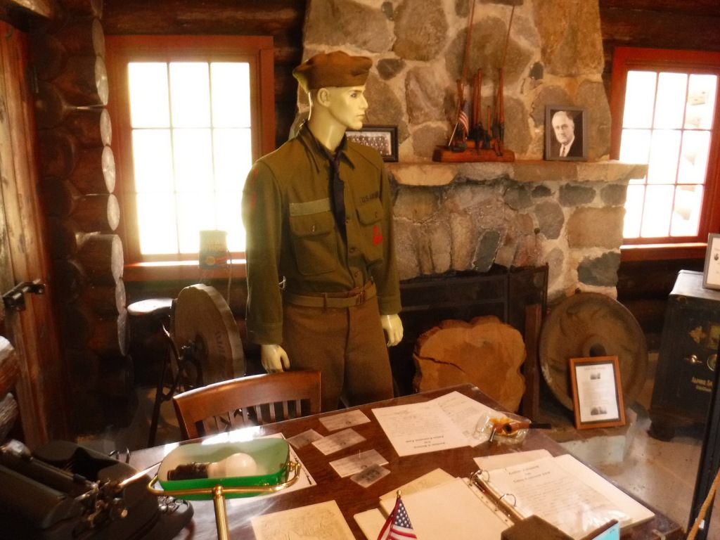
Other than getting out on the water, a great way to explore Chippewa National Forest is by driving one of five designated Scenic Byways: Lake Country, Edge of the Wilderness, Avenue of Pines, Lady Slipper, and the Great River Road.  Chippewa National Forest has more than 3,000 archeological and historic sites, including Camp Rabideau, perhaps the best preserved Civilian Conservation Corps (CCC) camp left from the 1930s.  Free guided tours of the camp are offered in summer, or you can take a self-guided tour around the well-signed buildings during daylight hours.

Best Trail

The Lost 40 is 144 acres of old-growth red and white pine forest that was never logged due to a surveying error that mapped the area as part of Coddington Lake in 1882.  The oldest tree here is more than 250 years old and can be seen on an easy one-mile loop trail with interpretive signs.  There is also an optional 0.2-mile one-way spur to an overlook of Moose Brook.  The trailhead is located east of Blackduck, Minnesota on well-signed back roads and is also popular for snowshoeing in the winter.

Watchable Wildlife

The most vocal and noticeable residents of Chippewa National Forest are its red squirrels, sandhill cranes, and common loons.  Its many rivers and lakes make ideal habitat for its 180 nesting pairs of bald eagles, one of the highest densities in the contiguous U.S.  Rarer wildlife sightings include Canadian lynx, black bears, moose, and trumpeter swans.  Important gamefish include lake trout, smallmouth bass, walleye, northern pike, and muskellunge (muskie). 

Instagram-worthy Photo

The largest red pine in the Lost 40 is 120 feet tall and three feet in diameter.

Peak Season

Summer

Fees

None

Road Conditions

The scenic byways seem to all be paved, but the roads accessing the Lost 40 and Camp Rabideau are unpaved, although well-signed and maintained.

Camping

The National Forest contains 21 developed campgrounds and 68 official dispersed camping locations. 

Wilderness Areas

None

Related Sites

Grand Portage National Monument (Minnesota)

Mississippi National River and Recreation Area (Minnesota)

Superior National Forest (Minnesota)

Nearest National Park

Voyageurs

Conifer Tree Species

northern white-cedar, tamarack, red pine, eastern white pine, jack pine, balsam fir, black spruce, white spruce

Flowering Tree Species

basswood, sugar maple, red maple, northern red oak, bur oak, basswood, American elm, slippery elm, bog birch, yellow birch, paper birch, bigtooth aspen, quaking aspen, balsam poplar

Explore More – The Lost 40 grows on an esker (or glacial ridge); how many years ago did the esker form?

Learn more about Chippewa and the 154 other National Forests in our new guidebook Out in the Woods
We are a participant in the Amazon Services LLC Associates Program, an affiliate advertising program designed to provide a means for us to earn fees by linking to Amazon.com and affiliated sites.