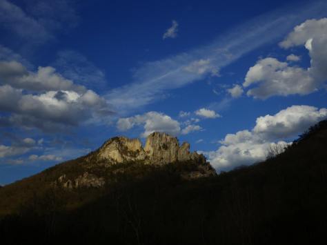
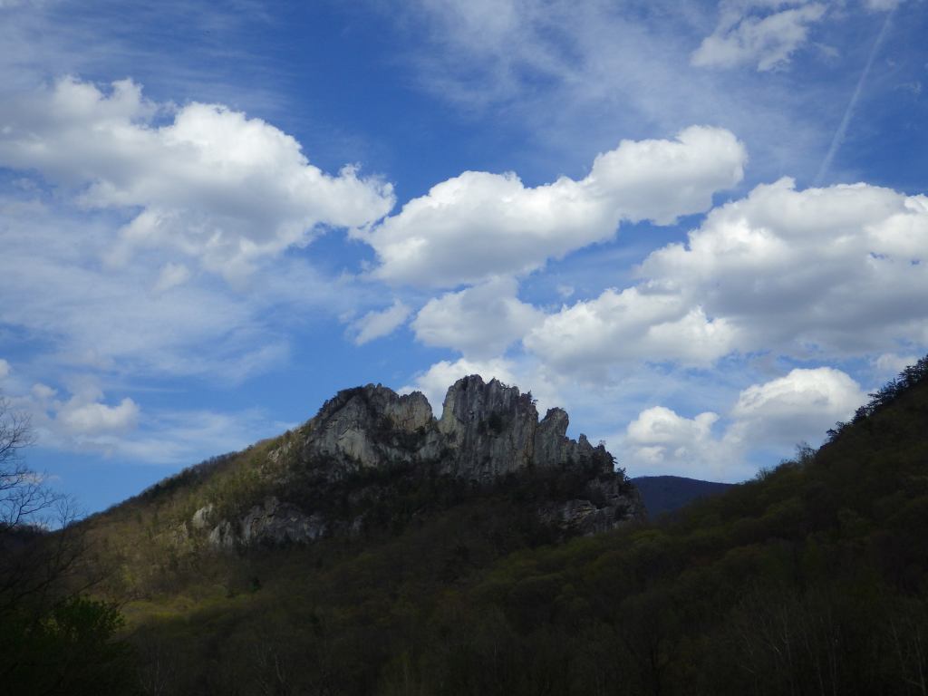
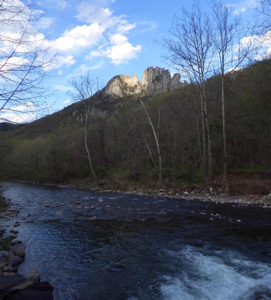
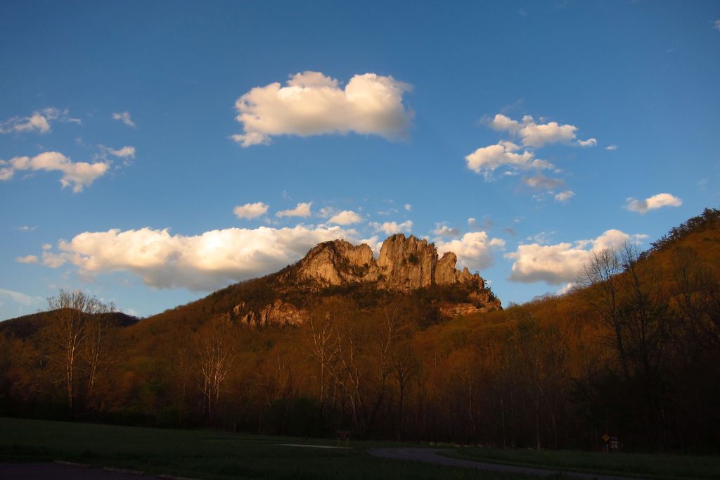
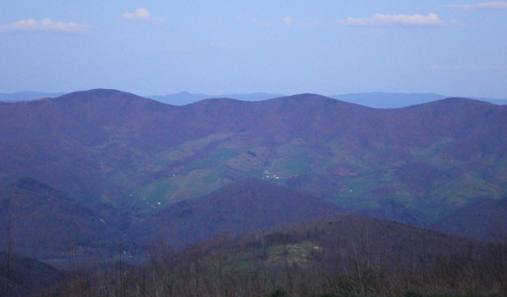
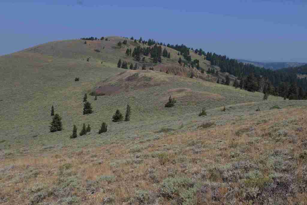
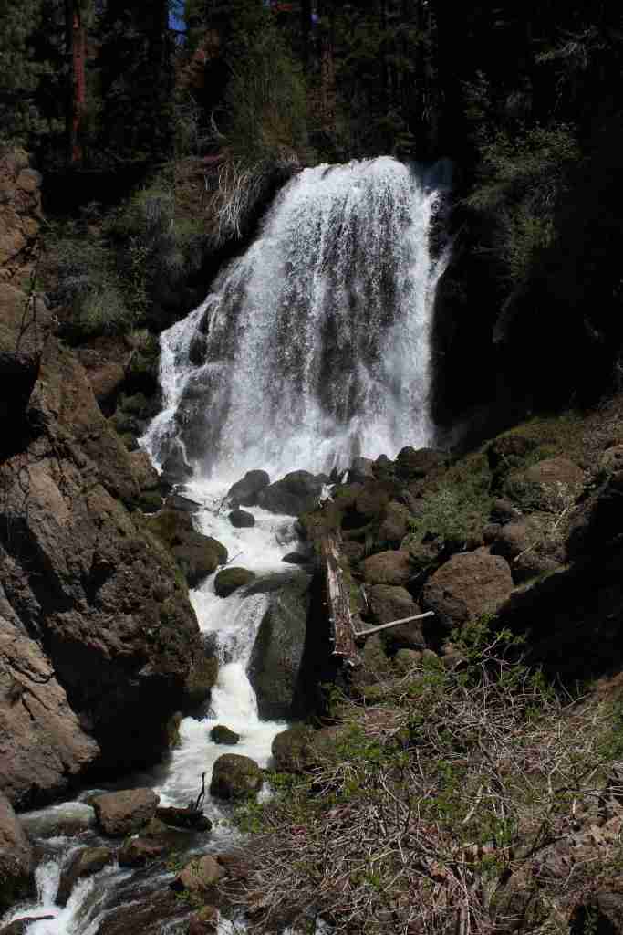
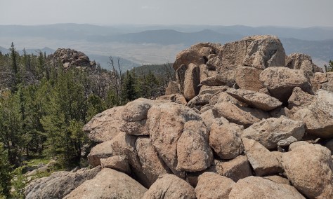
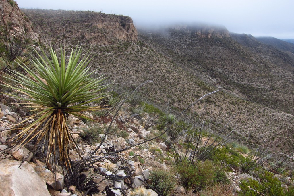
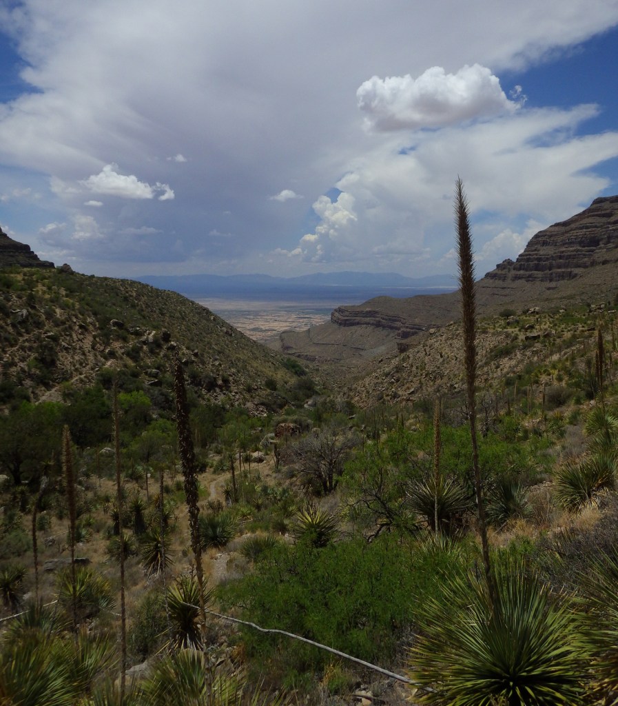
Monongahela National Forest contains the highest point in West Virginia, 4,863-foot-tall Spruce Knob with an observation tower for seeing over the trees at its summit. It is part of Spruce Knob-Seneca Rocks National Recreation Area (see our full blog post), which is very popular with rock climbers. The National Forest’s initial 7,200 acres were purchased by the federal government in 1915, and it the grew to 150,367 acres over the next decade. During World War II, the U.S. Army utilized the area as an artillery and mortar range, in addition to training soldiers in climbing techniques at Seneca, Nelson, and Champe Rocks. This area receives an average of 60 inches of annual precipitation on the west side of the Allegheny Front and only half that on the rain shadow side. It is the headwaters of six major rivers: the Monongahela, Potomac, Greenbrier, Elk, Tygart, and Gauley.
Know someone who loves the National Forests? Gift them our travel guidebook Out in the Woods so they can learn more about all 155 National Forests.
Highlights
Spruce Knob-Seneca Rocks National Recreation Area, Cranberry Glades Botanical Area, Highland Scenic Highway, Lake Sherwood Recreation Area, Gaudineer Knob Scenic Area, Cassell Cave, Sinks of Gandy, Stuart Memorial Drive, Champe Rocks, Dolly Sods Scenic Area
Must-Do Activity
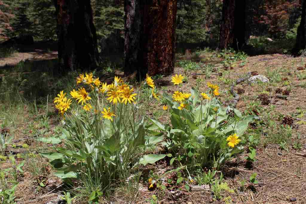
There are 94,991 acres in eight designated Wildernesses in Monongahela National Forest, more than half of which is in the Cranberry Wilderness. A boardwalk traverses the bogs at Cranberry Glades Botanical Area, which has a visitor center run by the Forest Service. Fishing is a popular pastime, especially at Lake Sherwood, Spruce Knob Lake, and Lake Buffalo. When winter conditions are right, there is a snowmobile area on Highland Scenic Highway. The forest is mostly second growth, but 318 acres of old-growth remains, which can be seen at Fanny Bennett Hemlock Grove, Gaudineer Scenic Area (for red spruce), Shavers Mountain Spruce-Hemlock Stand, North Fork Mountain Red Pine Botanical Area, North Spruce Mountain Old Growth Site, and Virgin White Pine Botanical Area.
Best Trail
There is great hiking in Spruce Knob-Seneca Rocks National Recreation Area, and other trails can be found at Lake Sherwood Recreation Area, Falls of Hill Creek Scenic Area, Mt. Porte Canyon, and Stuart Recreation Area. The 17,371-acreDolly Sods Wilderness encompasses much of the Red Creek drainage with high-elevation bogs and heaths like those found in southern Canada.
Watchable Wildlife
It is hard to believe given their abundant numbers today, but in the 1930s white-tailed deer had to be reintroduced from Michigan. In 1969, 23 fishers were reintroduced from New Hampshire. Other large mammals include black bear, red and gray fox, coyote, bobcat, snowshoe hare, beaver, river otter, raccoon, mink, skunk, and opossum. Of the 230 bird species identified, 159 are known to breed here. Approximately 90% of the trout waters in West Virginia are within the National Forest, and trout are stocked at Spruce Knob Lake and other locations.
Photographic Opportunity
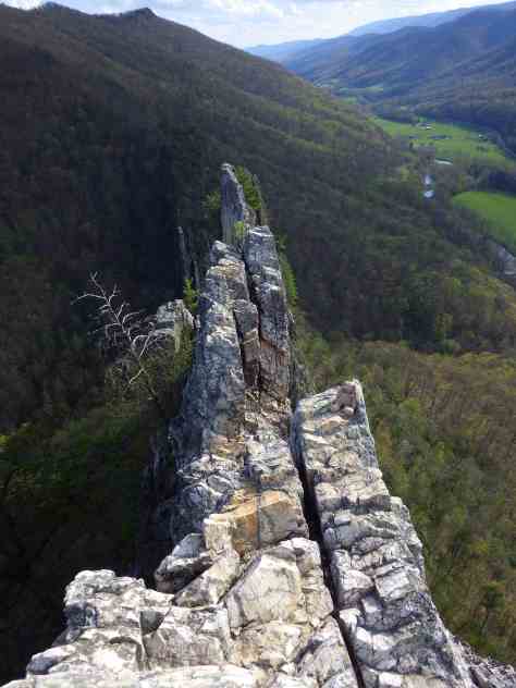
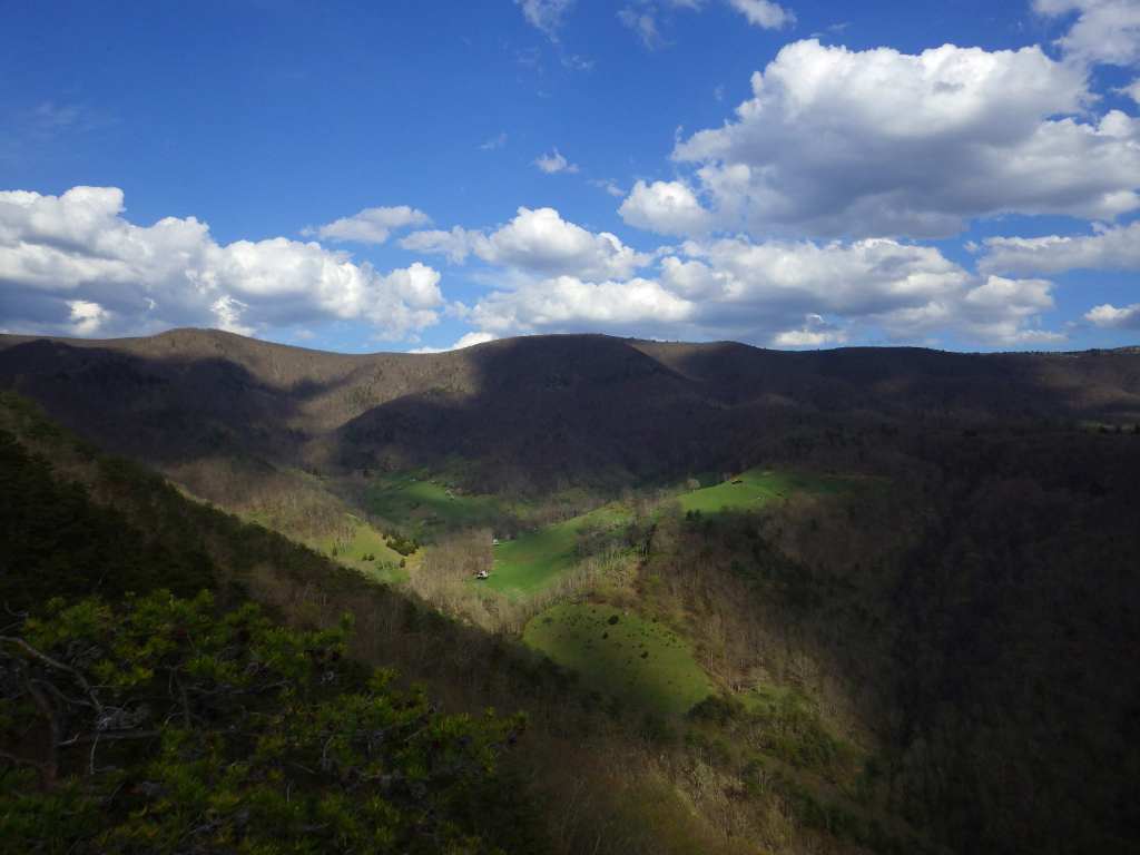
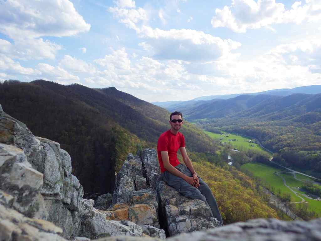
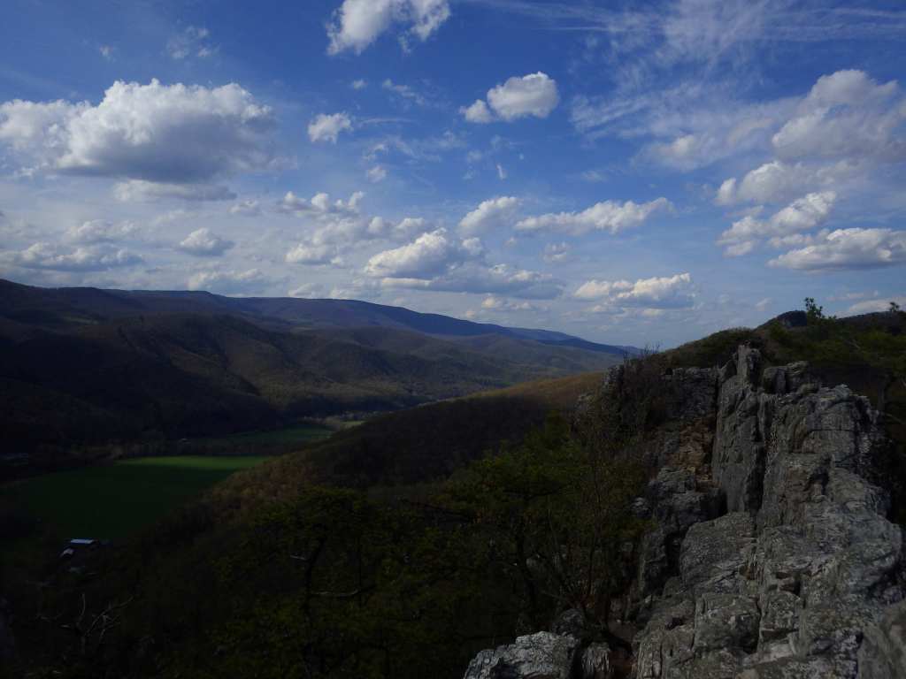
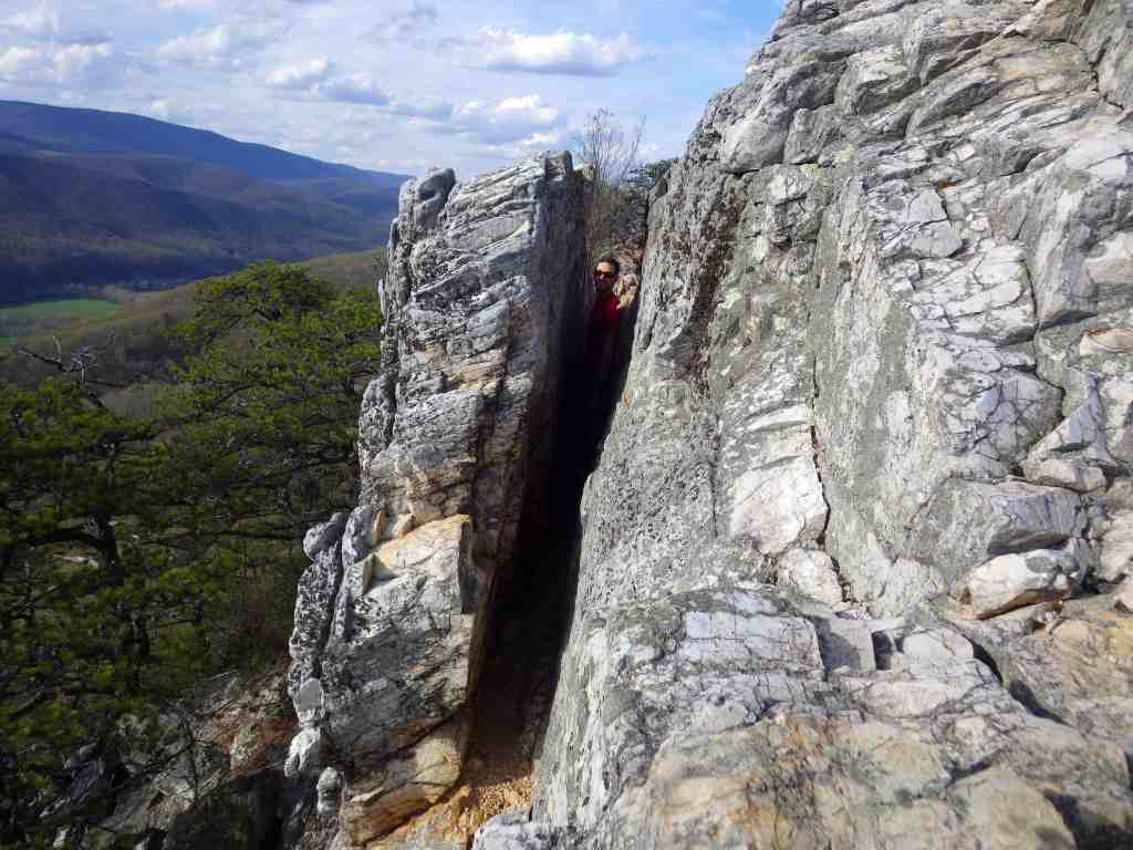
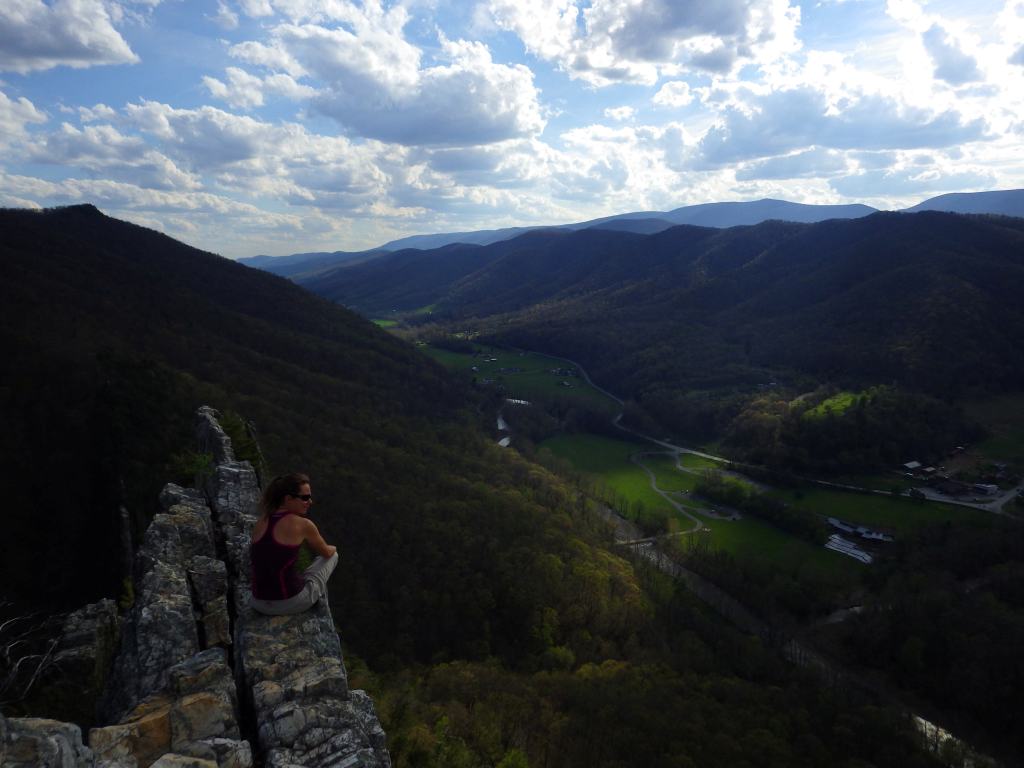
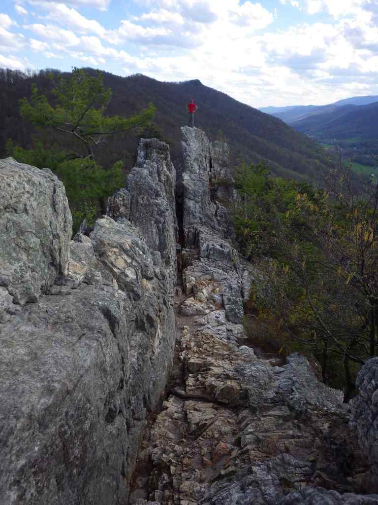
The iconic Seneca Rocks are a 900-foot-tall quartzite crag heavily used by rock climbers. On October 22, 1987, a prominent pinnacle dubbed “the Gendarme” fell to the ground.
Peak Season
Summer
Fees
A day use fee applies at Lake Sherwood Recreation Area.
Road Conditions
Most roads are open year-round, including the paved road to the top of Spruce Knob when it is snow-free.
black ash, mountain ash, black cherry, yellow birch, sugar maple, red maple, sweet birch, cucumber magnolia, American beech, basswood, speckled alder, mountain laurel, white rhododendron
Explore More – The Monongahela River gets its name from the Lenape language, and it translates as what in English?
Learn more about this and the 154 other National Forests in our new guidebook Out in the Woods
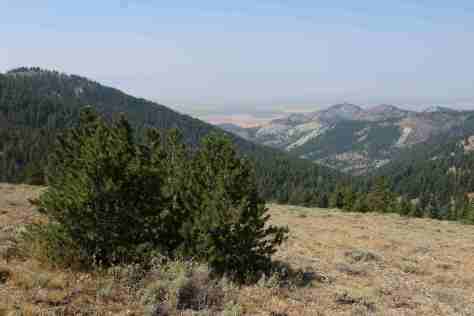
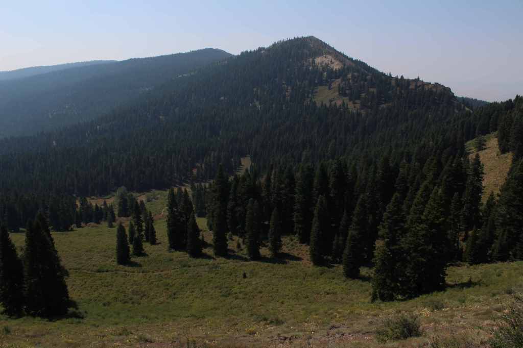
In the northeast corner of California, Modoc National Forest contains the largest shield volcano in North America: 7,921-foot Medicine Lake Volcano. This region has a long history of volcanism, as seen at Pumice Stone Mountain, Burnt Lava Flow, High Hole Crater, Hot Spot, and Glass Mountain (composed of rhyolite obsidian and glossy dacite). The basalt-topped plateau of Devil’s Garden is home to an 800-acre stand of western juniper. East of Goose Lake, the Warner Mountains rise from 4,300 feet to 9,892-foot Eagle Peak, and are covered by a mixed conifer forest of lodgepole pine, whitebark pine, ponderosa pine, incense-cedar, and red fir.
Know someone who loves the National Forests? Gift them our travel guidebook Out in the Woods so they can learn more about all 155 National Forests.
Highlights
Sáttítla Highlands National Monument, Volcanic Legacy Scenic Byway, Medicine Lake Recreation Area, Glass Mountain, Devil’s Garden Natural Area, Mill Creek Falls, Highgrade National Recreation Trail, Pine Creek Trail
Must-Do Activity
Medicine Lake offers boat ramps, trails, and campgrounds and nearby is Giant Crater, which has the longest known lava tube system in the world at 18 miles (although it is partially collapsed). Located up a dirt road often blocked by snowdrifts late into the summer, Glass Mountain has a crater full of sharp pieces of rhyolite obsidian and glossy dacite. This remote corner of California has some of the darkest skies in the continental U.S., so it is great for stargazing on moonless nights. In the winter, snowmobiling and cross-country skiing are popular activities on groomed trails. The South Warner Mountain Wilderness is traversed by the 21-mile Summit Trail that passes Eagle Peak, the Devil’s Knob, and The Slide. Mill Creek Falls is also in the Warner Mountains, accessed by a 3.4-mile out-and-back trail.
Best Trail
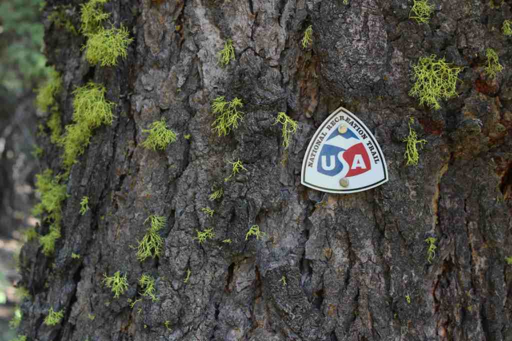
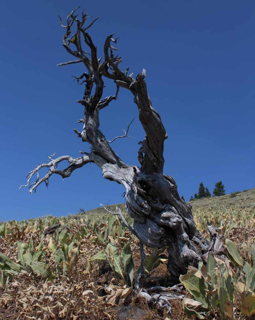
In the Warner Mountains near the border with Oregon’s Fremont National Forest, the 5.5-mile one-way Highgrade National Recreation Trail provides excellent views of Goose Lake. The trailhead is reached by taking paved County Road 9 five miles east from Highway 395 then turning north on the steep and unpaved Del Pratt Spring Road (Forest Road 47N72) for 6.3 miles. The trail quickly leaves the shade of the forest as it steadily climbs 800 feet through a slope covered in woolly mule’s ears flowers to a saddle west of 8,224-foot Mt. Vida. It is possible to summit Mt. Vida from this point, but the trail heads away toward Yellow Mountain following Forest Road 48N10.
Watchable Wildlife
Modoc National Forest borders Lower Klamath National Wildlife Refuge, in addition to Tule Lake, Clear Lake, and Modoc National Wildlife Refuges. These wetlands provide habitat crucial for bird nesting and migration on the Pacific Flyway. The many lava tubes provide habitat for numerous species of bats, in addition to violet-green swallows and bushy-tailed woodrats. Larger mammals include mule deer, pronghorn, badger, skunk, raccoon, pika, jackrabbit, yellow-bellied marmot, coyote, bobcat, and mountain lion. Large birds found here are great horned owl, short-eared owl, and bald eagle (winter resident). Reptiles are abundant, including the western fence lizard, northern sagebrush lizard, western skink, Rocky Mountain rubber boa, gopher snake, desert night, and western rattlesnake.
Photographic Opportunity
Not far up the steep Highgrade National Recreation Trail there are excellent views of Goose Lake to the west.
Peak Season
Summer
Fees
$5 per vehicle (or the America the Beautiful Pass) at Medicine Lake
Road Conditions
This area receives abundant winter snowfall, and roads can be blocked by snow into July, which we experienced trying to get to Glass Mountain. The road to Medicine Lake is paved, but almost every other road through the National Monument is unpaved, some requiring a high-clearance vehicle. Giant Crater is a Geologic Special Interest Area that can be accessed two miles off Medicine Lake Road on Forest Road 43N11.
Camping
There are multiple Forest Service campgrounds on Medicine Lake, plus two nearby at Blanche Lake and Bullseye Lake. Dirt roads in Modoc National Forest provide ample dispersed campsites.
After we published our guidebook 50 States of Great: Road Trip Guide to America in 2023, we decided to start a new type of blog post where we create a travel itinerary for all 50 states, in addition to our usual public land entries. After starting with Kansas, Georgia, Idaho, Rhode Island, Minnesota, Hawai’i, Arizona, Louisiana, South Dakota, and Indiana, we decided to head back west to Montana. There are so many great trails in the state’s National Forests that we had a difficult time narrowing it down. We made an ambitious seven-day plan starting in southeast Montana on Interstate 90, with enough options to easily extend the trip into three weeks or more.
The best time to visit the National Monument is around June 25, the anniversary of Custer’s Last Stand when a reenactment of the battle is held on private land bordering the National Park Service site.
Makoshika State Park
It is illegal to remove dinosaur fossils from these badlands, but there are many on display at the visitor center, in addition to nearby museums (plus reservations can be made to dig on private land). The few campsites are in high demand to spend the night in these colorful canyons where caprocks rise high above juniper trees.
Optional stop at Pompeys Pillar National Monument
A sandstone monolith on the Yellowstone River has been a place for humans to record their passing for 11,000 years. The most famous inscription was left by Captain William Clark on July 25, 1806, the sole on-site evidence of the Corps of Discovery’s three-year journey.
This underappreciated gem in the National Park Service system features gorgeous scenery and abundant wildlife, including bighorn sheep and wild horses. The highlight is across the state line in Wyoming where Devil Canyon Overlook sits atop cliffs that drop over 1,000 feet straight down to the level of the narrow reservoir.
Gallatin Petrified Forest is only accessible by trail, either from a short two-mile one-way jaunt or by backpacking the 27-mile Gallatin Divide-Devils Backbone Trail. Earthquake Lake Geologic Area stretches along Highway 287 to commemorate the events that occurred around midnight on August 17, 1959, when a deadly magnitude 7.5 earthquake hit West Yellowstone.
Some of the National Forest’s miles of hiking trails access the Crazy Mountains and Hellroaring Plateau. The two-mile Glacier Lake Trail steadily climbs 1,100 feet then drops into a bowl containing a stunning reservoir that straddles the Wyoming-Montana border.
Optional drive on Beartooth All-American Road
Custer National Forest is famous for its stretch of Highway 212 that climbs from the prairie around the town of Red Lodge up to 10,947 feet at Beartooth Pass across the Wyoming border in Shoshone National Forest. The road follows the southern border of the giant 943,626-acre Absaroka-Beartooth Wilderness, which contains the highest point in Montana.
Located mostly in Wyoming and partly in Montana and Idaho, you could easily spend an entire summer in the world’s first National Park and not see all the thermal features, lakes, waterfalls, wildlife, and hiking trails.
Day 3
Lewis & Clark Caverns State Park
Once a U.S. National Monument, the state now runs a campground here and offers guided tours through a limestone show cave where bats live in the summer.
The free Potosi Campground is situated near the trailhead for Upper Potosi Hot Springs where a 0.8-mile trail leads past the uphill side of a clear 100°F pool with room for about six adults.
Optional stop at Chico Hot Springs
If you leave Yellowstone National Park north through Gardiner on Highway 89, consider stopping at this developed hot springs (fee) that offers live music poolside on some nights (especially if the park’s Boiling River was closed). In business since 1897, even Teddy Roosevelt stopped to rest here.
Day 4
Bannack State Park
East of Lemhi Pass on the Idaho border (which is also the Continental Divide National Scenic Trail through there), Bannack State Park preserves more than 50 buildings from a gold rush town that was the territorial capital in 1864.
The site of a surprise attack by the U.S. Army on the morning of August 9, 1877, where Nez Perce warriors forced the troops to retreat, capturing a Howitzer cannon and allowing women and children to escape toward the newly created Yellowstone National Park. Part of the widespread Nez Perce National Historical Park, a small visitor center here overlooks the battlefield and a paved road accesses trails through it.
Blodgett Creek Trail leads 12.6 miles one-way to Blodgett Lake, but you do not have to go that far to appreciate its incredible beauty.
Optional stop at Elkhorn Hot Springs
In the Pioneer Mountains, about ten miles north of Highway 278 is the privately owned Elkhorn Hot Springs (fee), a great place to relax after hiking. There is free dispersed camping to the north in Beaverhead National Forest.
Day 5
Travelers’ Rest State Park
Follow in the footsteps of the Lewis and Clark expedition by driving the Lolo Trail (Highway 12), soaking at Lolo Hot Springs, or walking around Travelers’ Rest State Park (still a great place to camp).
Missoula
Do as the University of Montana students do and float tubes down the Clark Fork River through town. In the summer, look for webcam-famous Iris the Osprey in the parking lot near the football stadium. The Historical Museum at Fort Missoula preserves buildings dating back to 1877, including an Alien Detention Center used during World War II.
Outside Missoula, there are many trails in Rattlesnake National Recreation Area and Blue Mountain Recreation Area, plus the Aerial Fire Depot and Smokejumper Center, Ninemile Historic Remount Depot, and Savenac Historic Tree Nursery Area.
This working ranch commemorates the nineteenth-century lifestyle of cattle barons and cowboys. Free guided tours are offered inside the large ranch house, and a self-guided walking tour enters 15 buildings with displays on the history of barbwire, branding irons, and much more.
Day 6
National Bison Range
Established in 1908 under President Theodore Roosevelt and now run by the Confederated Salish and Kootenai Tribes. Start at the visitor center, then take the 19-mile Red Sleep Mountain Drive to see mule deer, white-tailed deer, elk, pronghorns, bighorn sheep, and the namesake bison.
Jewel Basin Hiking Area is famous among backpackers, and further south so is Holland Lake, which has several campgrounds. The steep Holland-Gordon Trail passes Holland Falls as it climbs 2,100 feet in 5.8 miles to Upper Holland Lake and continues into “the Bob” (Bob Marshall Wilderness). Flathead National Forest contains more than 2,800 miles of hiking trails, including 38 miles of the Pacific Northwest National Scenic Trail and a stretch of the Continental Divide National Scenic Trail.
Optional stop at Mission Mountains Wilderness
Located within Flathead National Forest, a popular trail accesses multiple mountain lakes; it is only 1.5 miles one-way to Glacier Lake, but we recommend continuing to Turquoise Lake. It borders the Mission Mountains Tribal Wilderness (permits required).
Waterton-Glacier International Peace Park’s renowned Going-to-the-Sun Road was built to cross the park from east to west in the 1920s (reservations are required to drive it between 7 a.m. and 3 p.m. in the summer). At its highest point at 6,646-foot Logan Pass, the road crosses the Continental Divide National Scenic Trail.
In the state’s northwest corner, incredible views await at Blue Mountain Trail, Skyline National Recreation Trail, Scenery Mountain Lookout Trail, Ross Creek Scenic Area of old-growth western redcedar trees, and Kootenai Falls (located in a county park on the side of Highway 2).
Meriwether Lewis named the Gates of the Mountains on July 19, 1805, and today a two-hour jet boat tour on the Missouri River provides history on the Corps of Discovery, American Indian pictographs, the Mann Gulch Fire, and the collapse of Hauser Dam. A trail through Refrigerator Canyon is less than ten feet wide at its narrowest point, where towering 200-foot limestone cliffs keep it cool and breezy throughout the summer.
Great Falls
North of Helena on Interstate 15 is the Lewis and Clark Interpretive Center (fee), which is managed by the U.S. Forest Service on the banks of the Missouri River.
This 375,000-acre National Monument preserves a stretch of the Missouri River that still looks much the way it did when Lewis and Clark explored it. Start your journey by paying for permits at the Bureau of Land Management interpretive center in historic Fort Benton, where you can launch your canoe or kayak to access 149 miles of the river. There are developed boat camps with vault toilets along the route, or you can pick your own spot near one of the Corps of Discovery campsite markers.
It includes portions of the Boulder Mountains, Flint Creek Range, and Elkhorn Mountains, as well as part of the Anaconda-Pintler Wilderness. Our favorite hike is Haystack Mountain National Recreation Trail off Interstate 15, where a climb of 2,000 feet ends at a mountaintop boulder field with panoramic views and the remnants of a fire lookout tower.
Backpacking is a major draw with trails in the Snowy Mountain Range and parts of the Scapegoat and Bob Marshall Wilderness areas, which provide crucial habitat for grizzly bears. It encompasses one of the most famous formations along the Continental Divide National Scenic Trail, the 15-mile long Chinese Wall (a 1,000-foot-tall cliff composed of five-million-year-old limestone).
Lincoln National Forest is best known as the birthplace of Smokey Bear, a black bear cub that survived a 1950 wildfire in the Capitan Mountains and became a national symbol. The nearby Smokey Bear Historical State Park is the final resting place for the famous bear that passed away at Washington D.C.’s National Zoo in 1976. Lincoln National Forest includes parts of the Guadalupe, Sacramento, Sierra Blanca/White Mountains, Capitan, and Gallinas ranges. There are several long trails through the National Forest, including the 20-mile Crest Trail in the White Mountain Wilderness and the 11-mile South Base Trail in the Capitan Wilderness. All but one mile of the 29-mile-long Rim Trail is open to OHVs.
Highlights
Sunspot Scenic Byway, Billy the Kid Scenic Byway, Trestle Recreation Area, Sitting Bull Falls, Sierra Blanca Peak, Rim Trail, Willie White Trail, Dog Canyon National Recreation Trail, Capitan Peak Trail
Must-Do Activity
Sunspot Scenic Byway (State Road 6563) provides great views and access to one of the world’s largest solar observatories that is open for tours on summer weekends. At its remote southern end, the National Forest borders both Carlsbad Caverns and Guadalupe Mountains National Parks. Roads only connect with the latter, where a short detour takes you to the half-mile trail for 150-foot-tall Sitting Bull Falls. In 1898, the Alamogordo and Sacramento Mountain Railway was constructed to access timberland 4,747 feet in the mountains above. One of its scenic remnants is the 320-foot trestle over Mexican Canyon near Cloudcroft. Lincoln National Forest has six fire lookouts listed on the National Register of Historic Places, including the stone Monjeau Lookout built by the Civilian Conservation Corps (CCC) that is accessible on a steep dirt road. Given its proximity to Carlsbad Caverns National Park, it is not surprising that there are hundreds of caves in the National Forest that require a permit to explore.
Best Trail
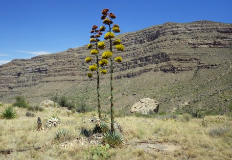
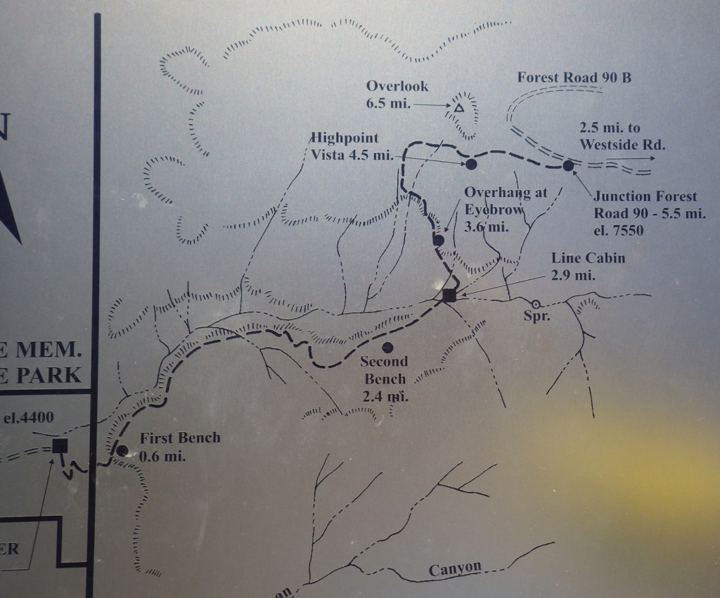
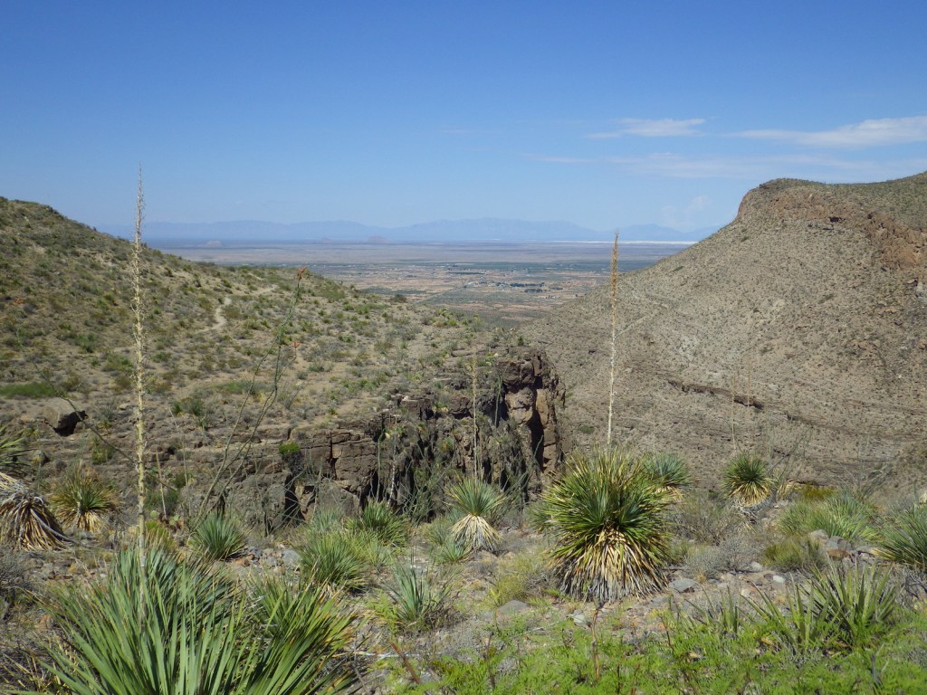
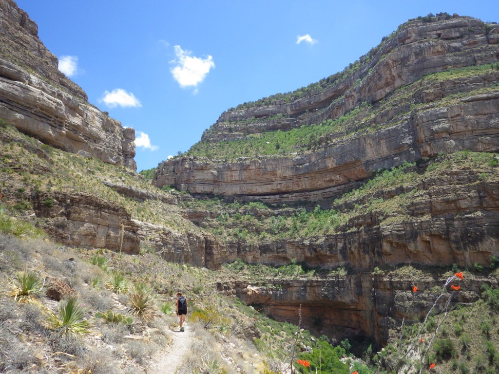
Dog Canyon National Recreation Trail follows a prehistoric travel route into the Sacramento Mountains east of White Sands National Park. The trailhead starts in Oliver Lee Memorial State Park, which has a nice campground and charges a day use fee (though we have seen cars avoid this by parking just outside its entrance). The 5.5-mile one-way trail climbs quickly above a beautiful canyon providing views of the Tularosa Basin before leveling out. Past the cabin ruins at the three-mile point, look for fossils along the trail as it again steeply rises into the agave and cacti-studded mountains. After gaining more than 3,000 feet in elevation, it dead ends at Forest Road 90B.
Watchable Wildlife
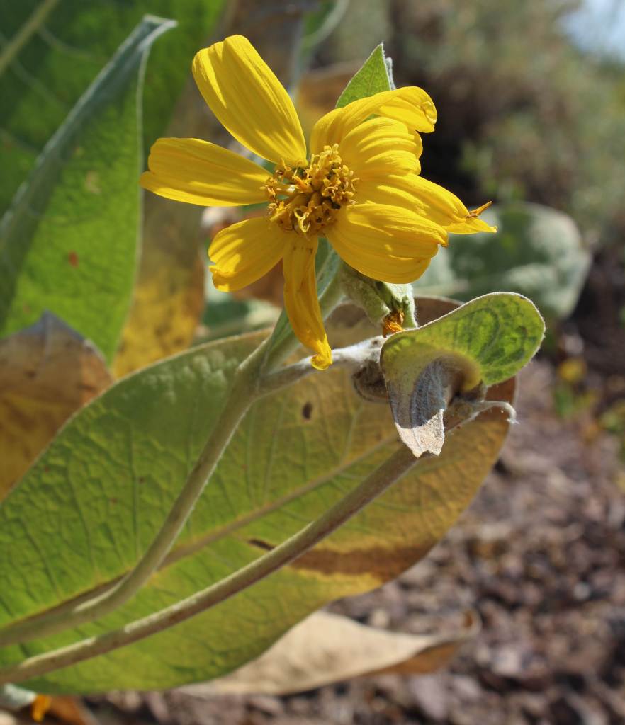
Ecosystems in the National Forest vary widely since it is spread across several mountain ranges and encompasses Chihuahuan Desert, pinyon-juniper woodlands, pine forests, and alpine meadows above 11,000 feet. Game species include elk, mule deer, black bear, mountain lion, and exotic Barbary sheep.
Photographic Opportunity
Look for fossils in the rocks along Dog Canyon National Recreation Trail.
Peak Season
Spring and fall
Fees
None
Road Conditions
The Sunspot Scenic Byway and the road into Oliver Lee Memorial State Park are both paved and maintained, although the paved access road (137) through Lincoln National Forest to the north part of Guadalupe Mountains National Park has many potholes in it. Be aware that there are also four-wheel-drive only roads to some trailheads.
Camping
There are a few developed campgrounds in the middle of the National Forest off Highway 82. Although not all areas are open to dispersed camping, popular spots include Upper Bonito Dispersed Camping Area northwest of Ruidoso and Lower Karr Canyon south of Cloudcroft.
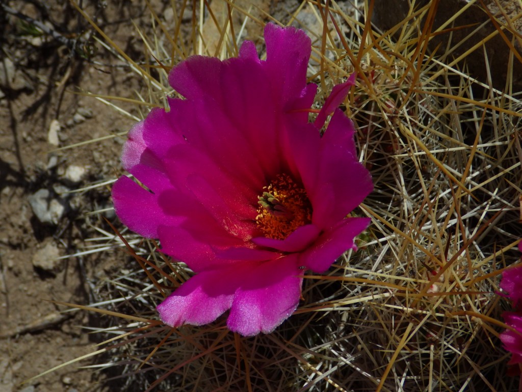
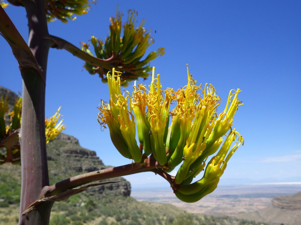
Baby barrel cactusMillipedeAgave bloomsCheckered whiptail lizardScott with a buckhorn chollaBeetleSpiny crevice lizardFossilsOcotillo bloomScott’s mother on Dog Canyon National Recreation Trail
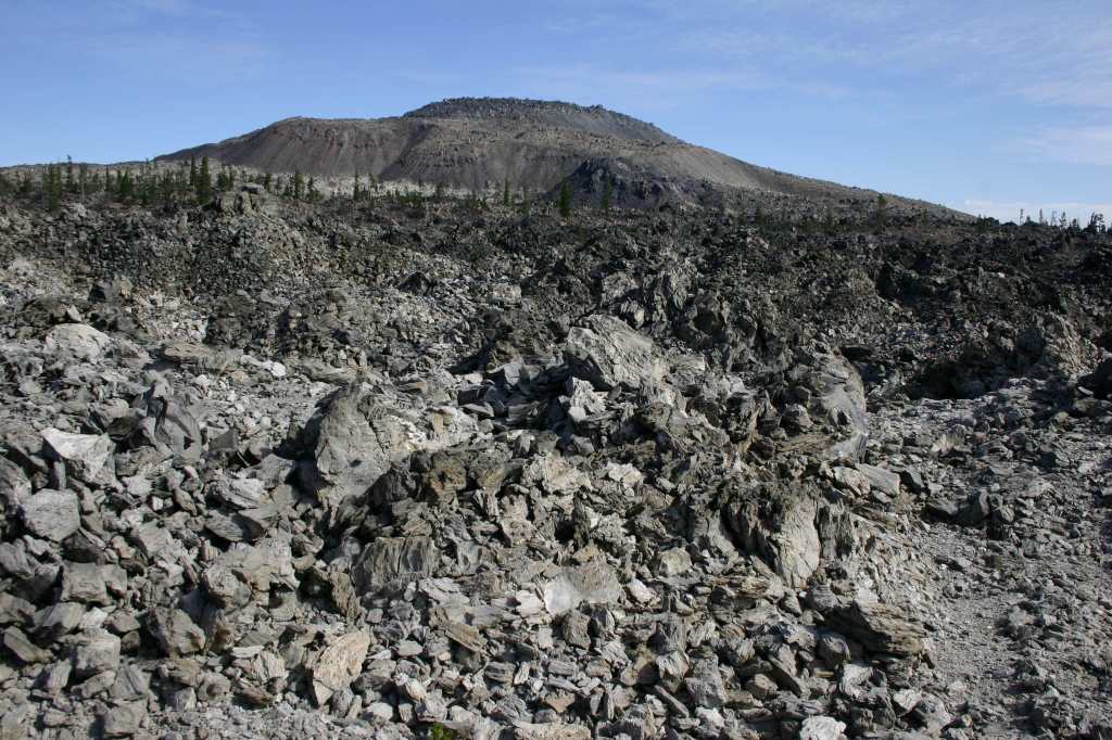
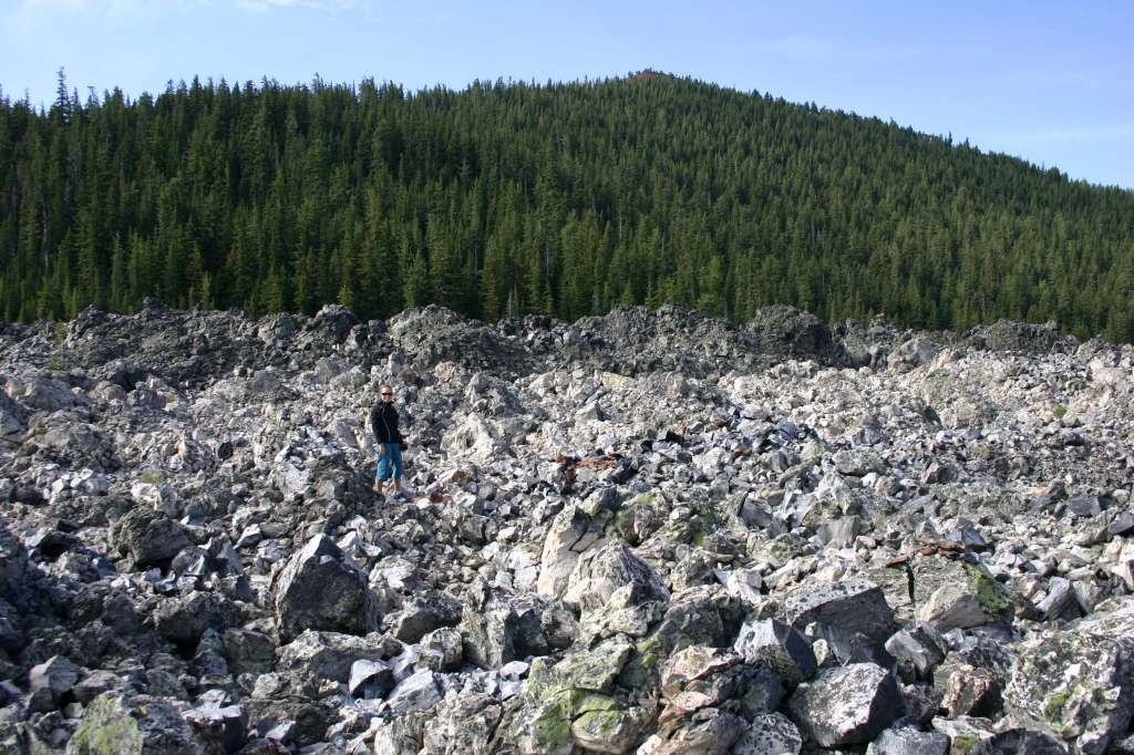
Lassen National Forest Reserve dates back to 1905, then a decade later when Lassen Peak explosively erupted (the first eruption to be photographed in the continental U.S.), 106,589-acre Lassen Volcanic National Park was carved out. The two federal areas are connected by the 187-mile-long Lassen Scenic Byway (Highways 44 and 89) that traces the volcanic legacy of the southern Cascade Range. The 41,100-acre Ishi Wilderness was named in 1984 to honor the last surviving member of the Yahi band of Southern Yanas, taken from his native home near Oroville in 1911 and employed as a janitor at the University of California’s Anthropology Museum in San Francisco until his death from tuberculosis five years later.
Highlights
Lassen Scenic Byway, Lake Almanor, Eagle Lake, Subway Cave, Hat Creek Recreational Area, Triangle Lake, Heart Lake National Recreation Trail, Bizz Johnson Trail, Spencer Meadows National Recreation Trail, Pacific Crest National Scenic Trail
Must-Do Activity
Lassen National Forest runs campgrounds and boat ramps on both Lake Almanor and Eagle Lake, although most of their shorelines are privately owned. Between the two lakes is the town of Susanville, where a railroad bed abandoned in 1978 was converted into the Bizz Johnson Trail that follows the Susan River for 26 miles. The trail features 12 river crossings and two tunnels with scenic mountain views. Camping is restricted to specific portions of the trail. The 20,546-acre Caribou Wilderness was one of America’s first Primitive Areas designated in 1932 and along with the 16,335-acre Thousand Lakes Wilderness was established immediately following passage of the 1964 Wilderness Act. In a proposed Wilderness area on the west side of Lassen Volcanic National Park, Heart Lake National Recreation Trail is a 2.4-mile one-way hike up to a glacial lake that connects to the longer Twin Meadows Trail.
Best Trail
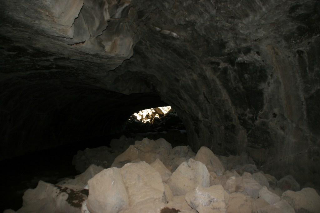
Subway Cave is only 1,300 feet long, but the lava tube is the main attraction in Lassen National Forest, with free guided tours offered on summer weekends. Lava flowed through here less than 2,000 years ago and interpretive signs along the 0.7-mile loop trail explain lavacicles and other geologic oddities. A flashlight is necessary to explore past the openings of the 46°F cave, which drops to four feet in some places with a maximum ceiling of 17 feet. One mile south on the Lassen Scenic Byway (Highway 44) is the 1.7-mile roundtrip Spatter Cone Trail (across from Hat Creek Campground). The trail passes a variety of volcanic formations in a forest of Jeffrey pine trees.
Watchable Wildlife
Lassen National Forest is home to black bears, pine martens, mountain lions, bobcats, red foxes, coyotes, and a few gray wolves that migrated south from Oregon. You are most likely to see mule deer or one of the variety of chipmunks or squirrels. Bird sightings include mountain chickadees, Steller’s jays, Clark’s nutcrackers (at high elevations), and eight species of woodpeckers such as pileated and white-headed.
Photographic Opportunity
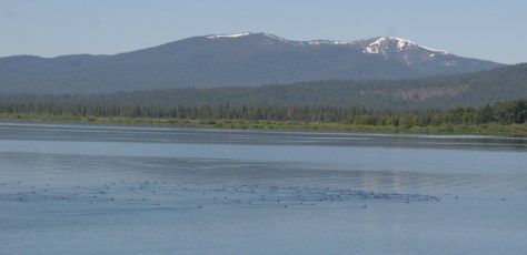
Sitting at 4,505 feet in elevation, Lake Almanor stretches for 13 miles near Chester, California and is a good place for summer boating and fishing.
Peak Season
Summer
Fees
None
Road Conditions
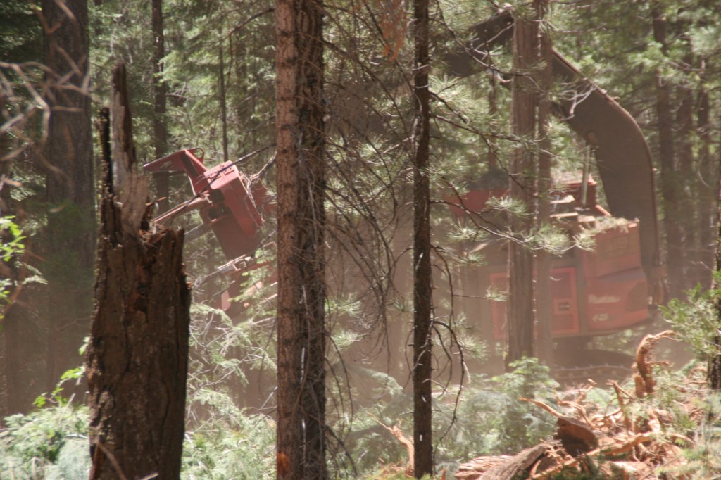
Subway Cave is located right off Lassen Scenic Byway (Highways 44 and 89) and most of the unpaved roads we have explored in the National Forest have been maintained, probably because of the continued harvesting activities that we witnessed on our field trip from Cal Poly University in 2010.
Camping
Lassen National Forest runs campgrounds on both Lake Almanor and Eagle Lake, plus Hat Creek Recreational Area has seven campgrounds. If you are looking to disperse camp outside Lassen Volcanic National Park, take the road west outside the southern entrance (but keep a clean campsite as we saw a black bear in the area).