30,030,893 acres
Statehood 1817 (20th)
Capital: Jackson
Population: 2,961,279 (34th)
High Point: Woodall Mountain (807 feet)
Best time of year: Spring
We recently published our guidebook 50 States of Great: Road Trip Guide to America, so we decided to start a new type of blog post where we create a travel itinerary for all 50 states, in addition to our usual National Forest and National Park entries. After starting with Kansas, Georgia, Idaho, Rhode Island, Minnesota, Hawai’i, Arizona, Louisiana, South Dakota, Indiana, and Montana, we decided to do another state in the deep south. We made an ambitious seven-day plan starting in the south on the Gulf Coast and then zigzagging across the state with plenty of options to extend the trip.
Day 1
Gulf Islands National Seashore (click here for our blog post)
You will have to take a ferry to enjoy the white sand beaches of West Ship Island, which are considered some of the best in the U.S. If you are stuck on the mainland, at least check out the visitor center and hiking trails just off Interstate 10.
Biloxi
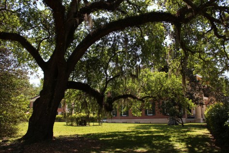
Biloxi has beaches, a lighthouse, casinos, and the Maritime and Seafood Industry Museum. I still want to see the Patriarch Oak, estimated to be more than 2,000 years old and located at Mary Mahoney’s Old French House seafood restaurant.
De Soto National Forest (click here for our blog post)
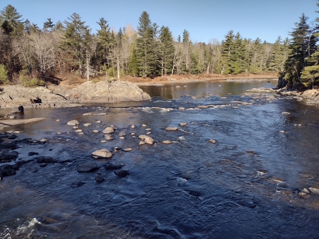
Tuxachanie National Recreation Trail runs 12 miles through De Soto National Forest with the path from its western trailhead following an old logging railroad right off Highway 49. Near the far eastern end of the trail is a lakeside World War II Prisoner of War camp with a pond.

Optional stop at Mississippi Sandhill Crane National Wildlife Refuge
Some sandhill cranes migrate to this forested spot for the winter, but a small population lives there year-round. There are trails, interpretive signs, and a visitor center.
Day 2
Natchez National Historical Park (click here for our blog post)
National Park Service (NPS) rangers or volunteers are on location at the William Johnson House, Melrose Estate, and the Forks of the Road where hundreds of thousands of slaves were sold in the 1800s. The William Johnson House tells the story of a slave freed at age 11 who apprenticed to a barber, and became a successful businessman before his murder.
Grand Village of the Natchez Indians State Historic Site
These historic mounds offer a free museum and film inside an air-conditioned building (which is important on a muggy summer day).
Optional stop at Homochitto National Forest (click here for our blog post)
There is a nice campground with showers on Clear Springs Lake, accessed by a paved road four miles south of Highway 84. A one-mile trail circles the lake, which has a picnic shelter built by the Civilian Conservation Corps (CCC) in 1935 that is listed on the National Register of Historic Places.

Day 3
Natchez Trace Parkway (click here for our blog post)
This paved road runs 444 miles from the Mississippi River to Nashville, Tennessee, including 309 miles in Mississippi. The trace (or trail) started as an American Indian footpath and was heavily used in the 1800s by “Kaintuck” flatboatmen returning from New Orleans who left the Mississippi River at Natchez and continued on foot north. At several roadside pullouts, you can still follow portions of the “sunken” trail worn down by travelers over the centuries. Popular stops along the way include the boardwalk at Cypress Swamp outside Jackson and its three free campgrounds.

Optional stop at Natchez Trace National Scenic Trail (click here for our blog post)
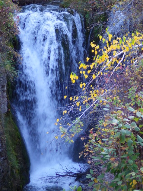
Paralleling the parkway, this trail exists in five segments totaling 67 miles in length. One of the longest sections is located north of Jackson (Miles 108-130). There are also eight miles of the original trace around the free Rocky Springs Campground (Mile 58) accessing Owens Creek Waterfall and a historic town site.
Day 4
Jackson
The capital city is home to the Mississippi Civil Rights Museum, Museum of Mississippi History, and Mississippi Agriculture and Forestry Museum. The Mississippi Museum of Natural Science is a 73,000-square-foot facility situated in a 300-acre forest with 2.5 miles of trails that also boasts a 200-seat theater and many aquariums, including “The Swamp” where alligators reside inside a large greenhouse.
Medgar and Myrlie Evers Home National Monument (click here for our blog post)
In Jackson, the National Park Service manages the former home of a prominent Civil Rights Leader who was assassinated in his driveway in 1963. Across the street, there is a sidewalk through Myrlie’s Garden, a community garden where interpretive signs on the wooden fence tell the story of the Evers family.
Optional stop at Bienville National Forest (click here for our blog post)
There are several lakes here open to the public, including 50-acre Marathon Lake (which got its name a lumber company that closed in 1929). The lake was built in the 1950s for recreation in a former logging camp and now has 34 campsites (with water and electric hook-ups), a boat ramp, a swimming area, and a 1.7-mile trail that circles it.

Day 5
Vicksburg National Military Park (click here for our blog post)
The numerous failed attempts to take Vicksburg by force are evidenced by the 17,000 soldiers buried in the National Cemetery here. Following a 46-day bombardment, the city finally surrendered on July 4, 1863. The best part of visiting the park is walking through the partially-reconstructed U.S.S. Cairo, an ironclad gunboat which was carefully salvaged from the Yazoo River during the 1960s.
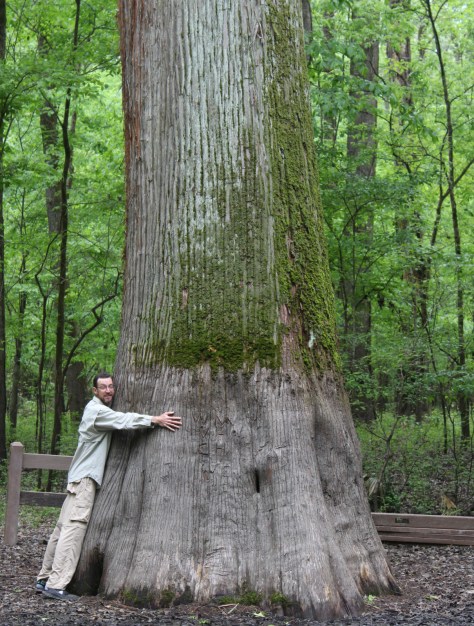
Optional stop at Delta National Forest (click here for our blog post)
Delta National Forest is seasonally flooded for wildlife, but it was dry enough to walk up to the Kay Cypress Tree even when other trails were underwater during our April visit. The tree is more than ten feet in diameter even above the widely fluted base common to baldcypress. It is located across from Blue Lake on unpaved Fire Tower Road.
Day 6
Emmett Till Historic Intrepid Center (ETHIC)
Located in a former cotton gin near the site of Emmett Till’s torture and murder on the farm of “J.W.” Milam in Glendora. Established in 2005, there is an atmosphere to the museum that bears the full weight of history, heightened by the short introductory video showing Emmett Till’s family members’ recollections of the events of 1955.
Emmett Till and Mamie Till-Mobley National Monument (click here for our blog post)
The National Park Service operates out of the Emmett Till Interpretive Center, located in a strip mall opposite the Tallahatchie County Second District Courthouse in Sumner. It has limited hours, but the courtroom where the September 1955 trial was held was unlocked when we visited on a Tuesday morning.
Optional stop at a Blues Museum
The Yazoo-Mississippi Delta (or simply “the Delta”) is a distinct section of western Mississippi renowned for its blues musicians. There is plenty to learn and listen to at the Delta Blues Museum in Clarksdale, GRAMMY Museum Mississippi in Cleveland, and B.B. King Museum and Delta Interpretive Center in Indianola. Spend the night in the area to go to a bar for live music in the evening.
Optional stop at Belzoni Catfish Museum and Welcome Center
At its peak in 1993, this region produced 461-million pounds of catfish annually (about 60% of U.S. production) and still hosts the World Catfish Festival every April. The best part is that Belzoni has catfish sculptures spread around town, painted to represent different occupations like a fireman and nurse.
Day 7
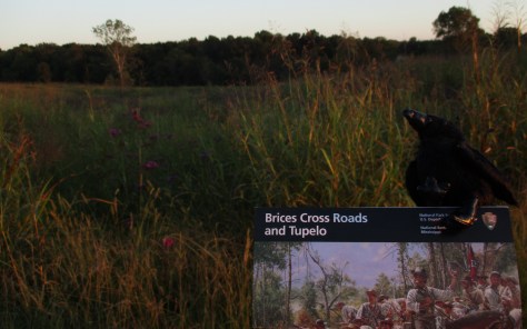
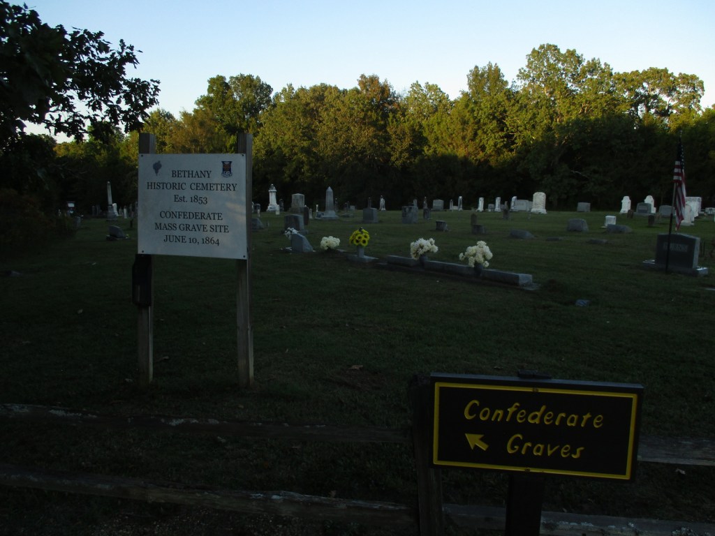
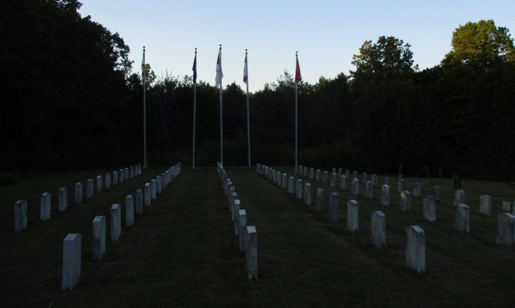
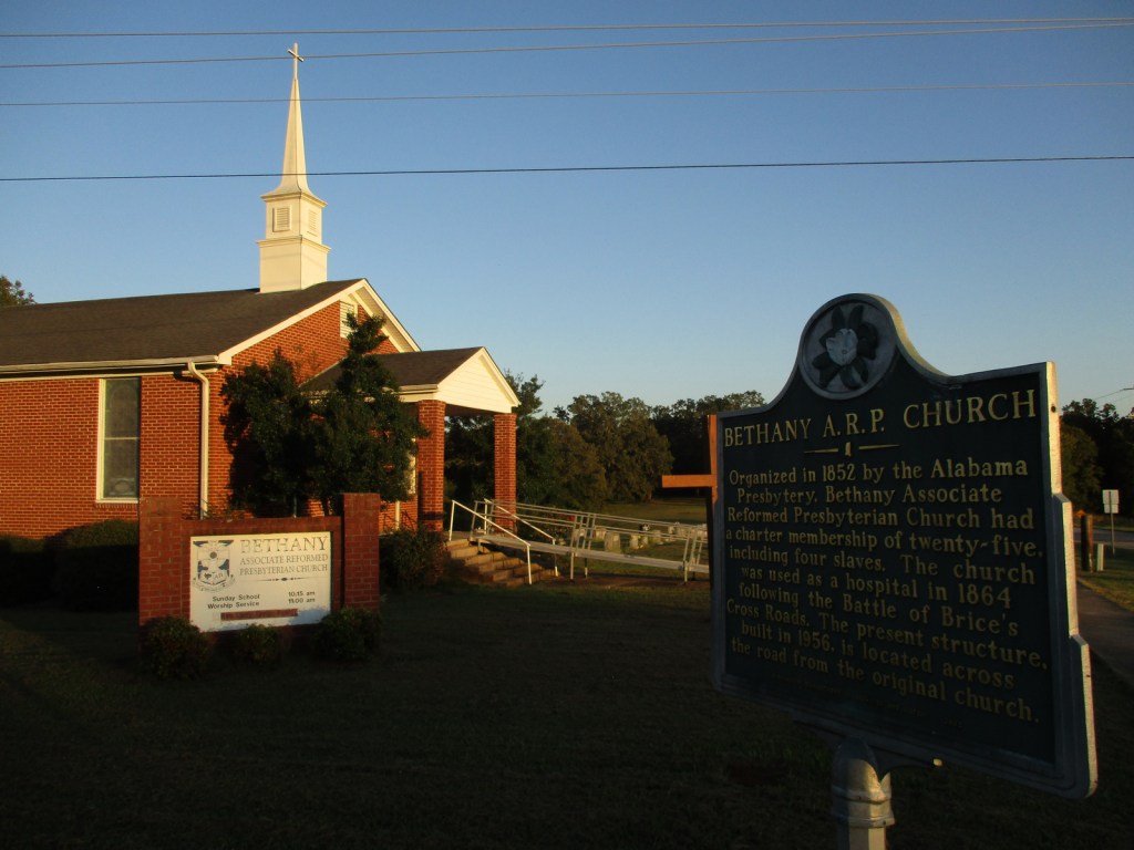
Brices Cross Roads National Battlefield Site (click here for our blog post)
The National Park Service site here is tiny with no facilities and only a couple interpretive signs, but a local battlefield commission owns 1,400 acres with walking trails. The nearby Mississippi Final Stands Interpretive Center is located five miles east of the battlefield in Baldwyn.

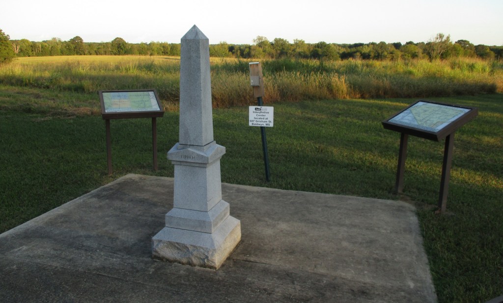
Tupelo National Battlefield (click here for our blog post)
Two cannons and a monument mark this one-acre National Park Service site surrounded by the city of Tupelo. Its visitor center is combined with the one for the Natchez Trace Parkway just outside Tupelo.
Optional stop at Elvis Pressley Birthplace and Museum
In Tupelo, the house where Elvis grew up is a main attraction. The grounds are open 24 hours and the museum is open seven days a week.
Optional stop at Tishomingo State Park
Tishomingo State Park is located just off the Natchez Trace Parkway (Milepost 304) northeast of Tupelo. The park’s sandstone and limestone rock formations represent the furthest southwest extent of the Appalachian Plateau. The park opened in 1939, after its infrastructure was built using local rock by the Civilian Conservation Corps (CCC). Several structures remain from that period, including a spectacular swinging bridge over Bear Creek.
Day 8+
Holly Springs National Forest (click here for our blog post)
Chewalla Lake Recreation Area is the most developed site offering a swimming beach and campground, plus fishing and boating opportunities. A 2.3-mile trail at the 260-acre lake passes an overlook and a reconstructed Choctaw burial mound. In the northeast corner off Highway 72, a short trail accesses Baker’s Pond, the source of the Wolf River. Further south, Lake Tillatoba is a fee-free primitive site managed by Tombigbee National Forest.

Shiloh National Military Park (click here for our blog post)
An important railroad crossroads in Corinth made it a strategic spot during the Civil War. In April 1862, two days of intense fighting across the border in Tennessee resulted in 23,746 soldiers killed, wounded, captured, or missing, and the Confederates abandoned the field and Corinth. There were an additional 7,000 casualties when they failed to recapture the town in October 1862, which is the focus of the museums in town.
Apron Museum
Iuka is home to the Apron Museum that has collected thousands of vintage aprons, plus it has a gift shop with quilts, crafts, and, of course, aprons for sale. Nearby, a restored wooden covered bridge is also worth a look-see and a drive across.

Learn more about Mississippi’s Most Scenic Drive, Wonderful Waterfall, Top State Park, and other categories in our travel guidebook 50 States of Great: Road Trip Guide to America.