World War I Memorial
District of Columbia
Managed by National Park Service
Established 2021
1.76 acres
Website: https://www.nps.gov/nama/planyourvisit/national-world-war-i-memorial.htm
Overview
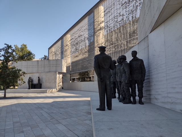
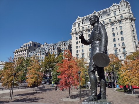
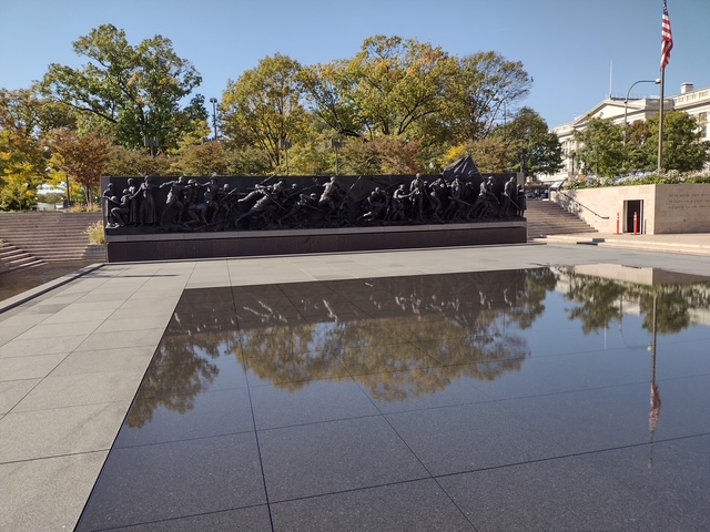
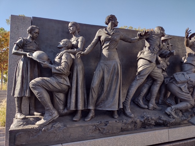
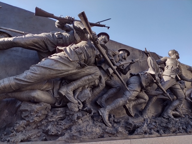
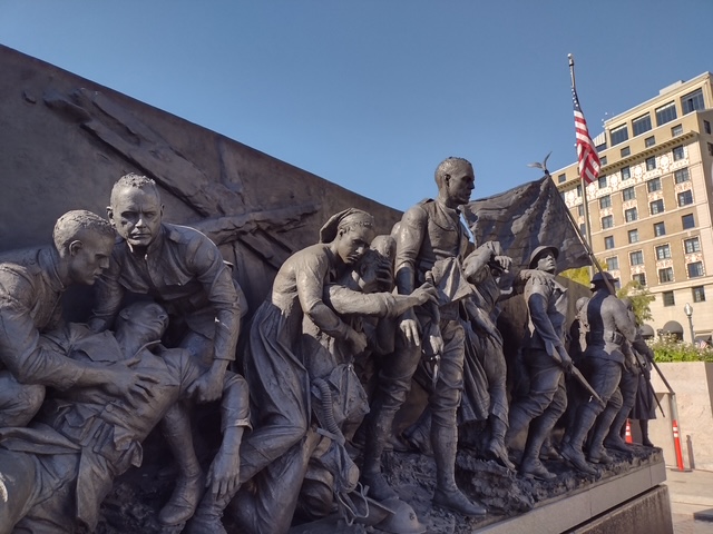
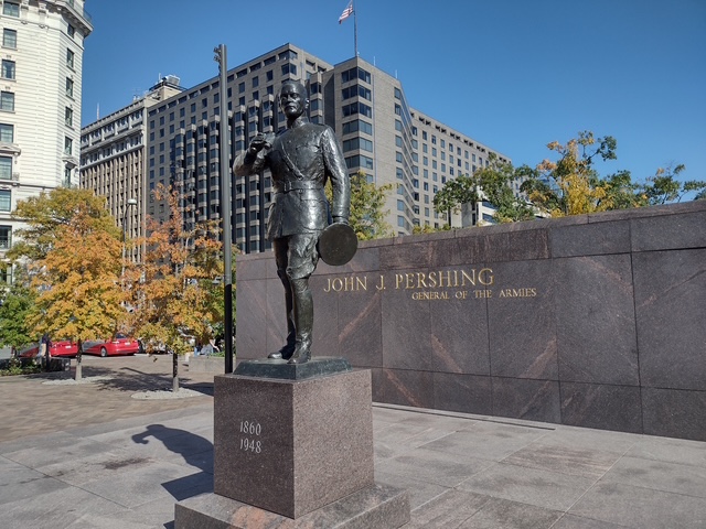
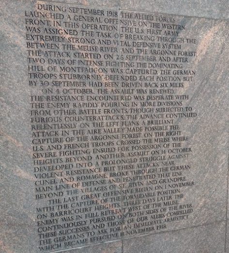
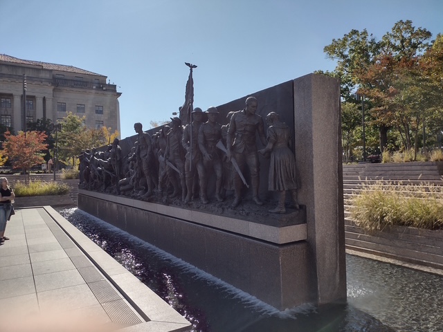
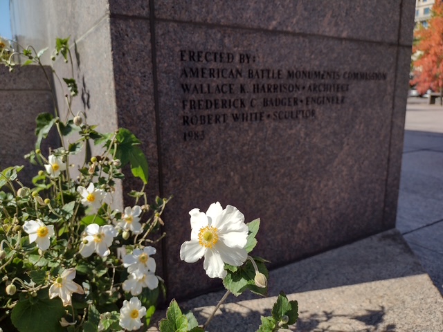
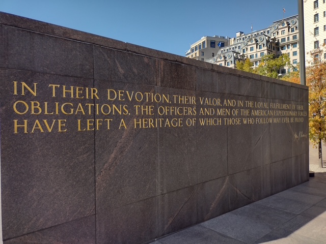
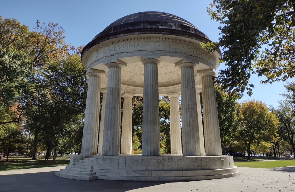
In 1931, the District of Columbia War Memorial was erected on the National Mall where the white rotunda still stands near the Washington Monument (see photos below). The World War I Memorial near the White House was first approved by Congress in 1957 to honor John J. Pershing, General of the Armies during World War I (a rank only George Washington shares). A scant 24 years later, Pershing Park on Pennsylvania Avenue NW was finally dedicated and a statue was added after another two years. On April 16, 2021, the World War I Memorial officially opened and three years later, the58-foot-long A Soldier’s Journey sculpture by Sabin Howard was installed. In Kansas City, Missouri, the National World War I Museum and Memorial opened in 1926 as the Liberty Memorial, and Congress designated it as the country’s official war memorial in 2014.
Highlights
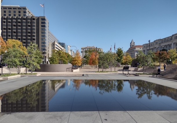
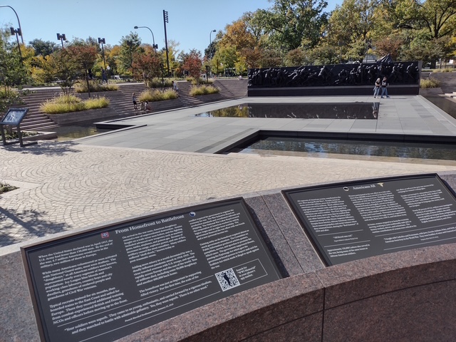
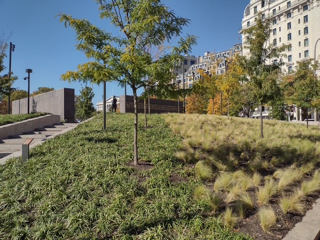
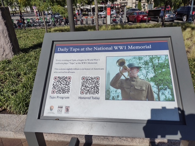
Reflecting pool, Pershing sculpture, A Soldier’s Journey sculpture, 5 p.m. “Taps”
Must-Do Activity
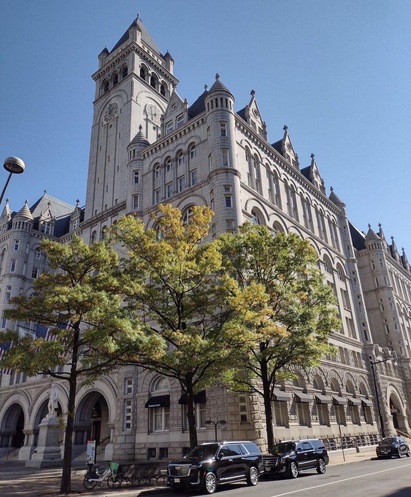
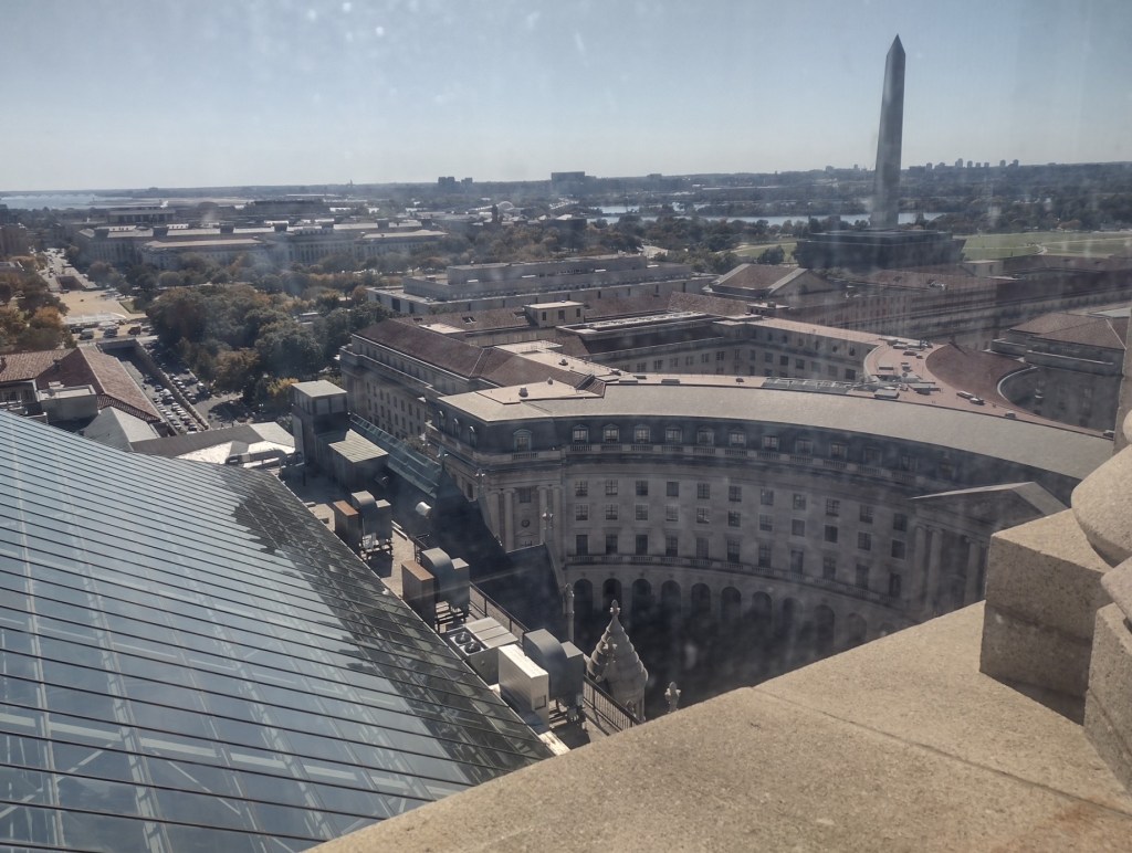
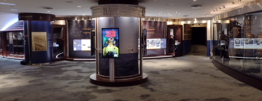
World War I Memorial is considered part of both Pennsylvania Avenue National Historic Site and the National Mall and Memorial Parks, as well as being listed as one of the 433 official National Park Service (NPS) sites. It does not take long to read the plaques and see the sculptures, so try to aim to be there for the 5 p.m. daily playing of “Taps” by a soldier in a World War I-era uniform. Nearby, the Old Post Office Tower on Pennsylvania Avenue NW was completed in 1899 and reaching the top requires two free elevator rides from NPS rangers. It provides a great view from the third highest point in the city (and hopefully it reopens soon after the new hotel owners closed it to the public on October 1, 2025). Further east down the road, the free U.S. Navy Memorial Visitor Center is also worth a visit.
Best Trail
There is no trail here, but there is always plenty of walking done when visiting the many memorials in Washington, D.C.
Photographic Opportunity
A Soldier’s Journey is the 25-ton bronze bas-relief that was officially unveiled during the “First Illumination” ceremony on September 13, 2024.

Peak Season
Spring and fall
Hours
Open 24 hours
Fees
None
Road Conditions
Traffic can be slow and parking expensive in Washington, D.C., so consider taking the Metro to Smithsonian Station on the National Mall or the Archives-Navy Memorial-Penn Quarter stop on Pennsylvania Avenue.
Camping
There are National Park Service campgrounds in Maryland’s Greenbelt Park and Virginia’s Prince William Forest Park.
Related Sites
Chickamauga and Chattanooga National Military Park (Tennessee-Georgia)
World War II Memorial (District of Columbia)
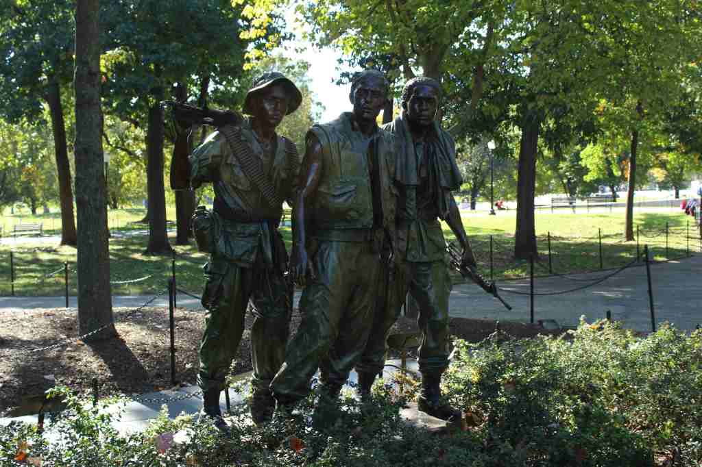
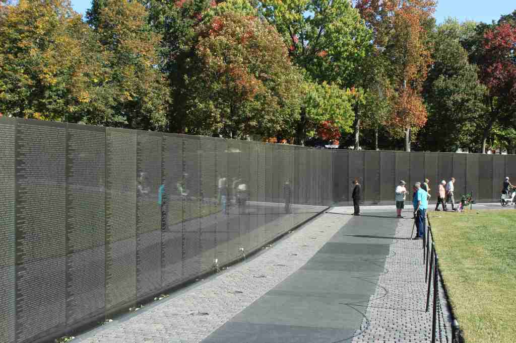
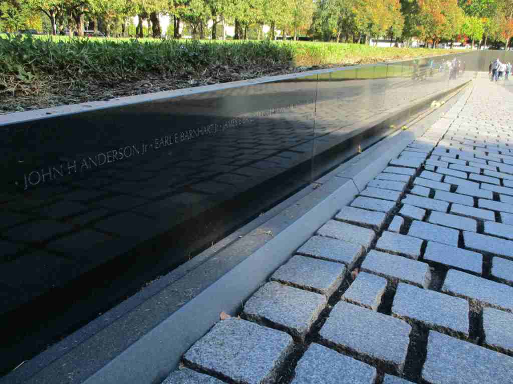
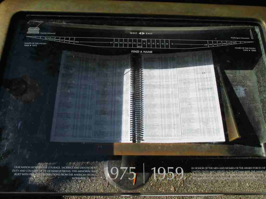
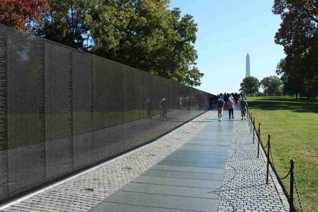
Vietnam Veterans Memorial (District of Columbia)
Nearest National Park

Explore More – Why did I include Civil War-era Chickamauga and Chattanooga National Military Park as a related site for the World War I Memorial?