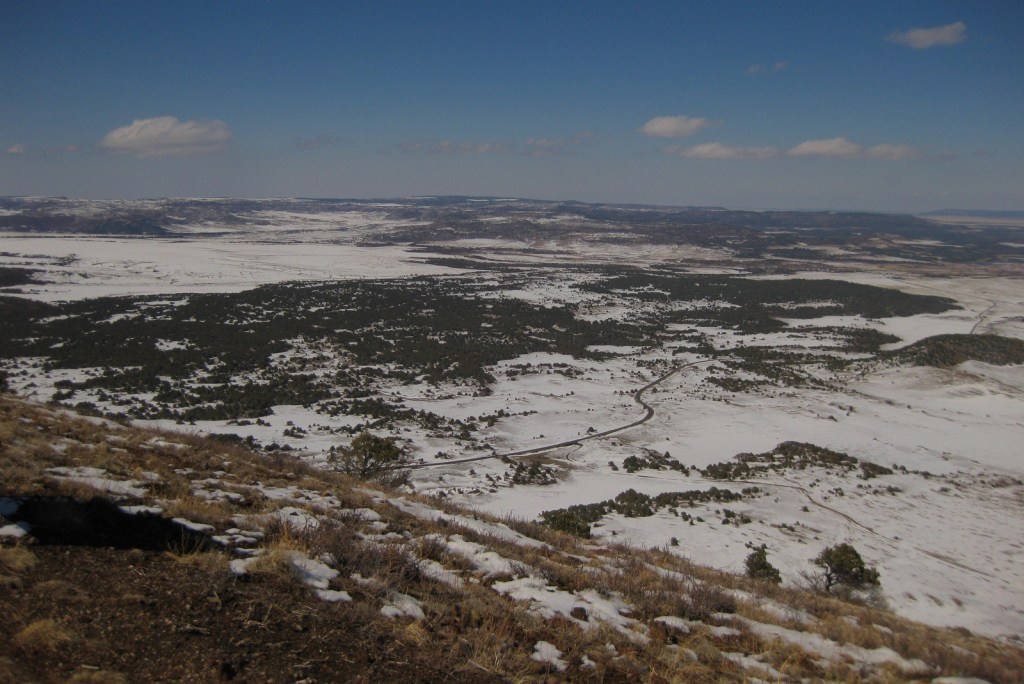
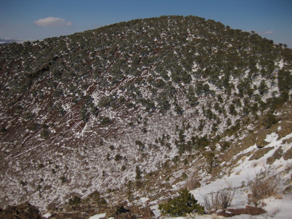
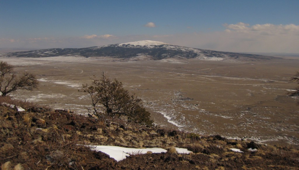
Kiowa National Grassland encompasses two discrete units in northeast New Mexico, the eastern one bordering Texas and Oklahoma’s Rita Blanca National Grassland. This patchwork of public and private lands is administered together with the larger Cibola National Forest and Black Kettle National Grassland. Elevations range from 4,500 up to 6,300 feet in the western unit where La Frontera del Llano Scenic Byway (NM 39) runs north to south. Shortgrass prairie is the dominant cover type, with sand sagebrush and pinyon-juniper woodland mostly found in the west. Ponderosa pines are dispersed on wetter hill faces and riparian areas support Fremont cottonwoods and willows.
Highlights
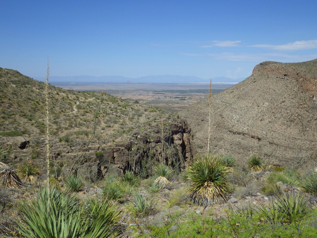
Mills Canyon, Santa Fe National Historic Trail
Must-Do Activity
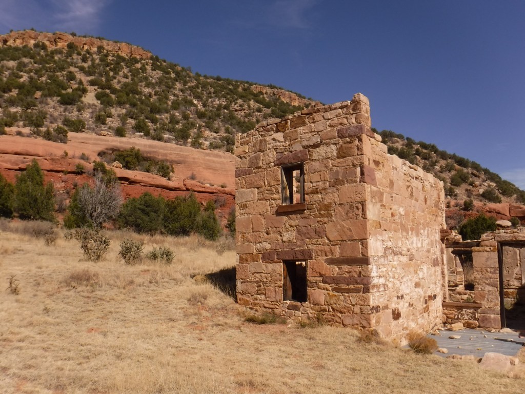
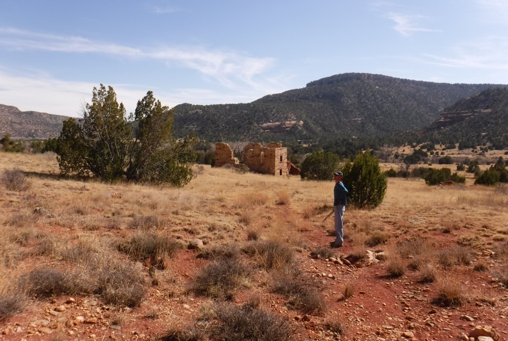
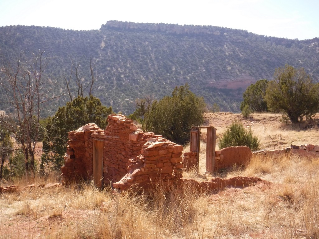
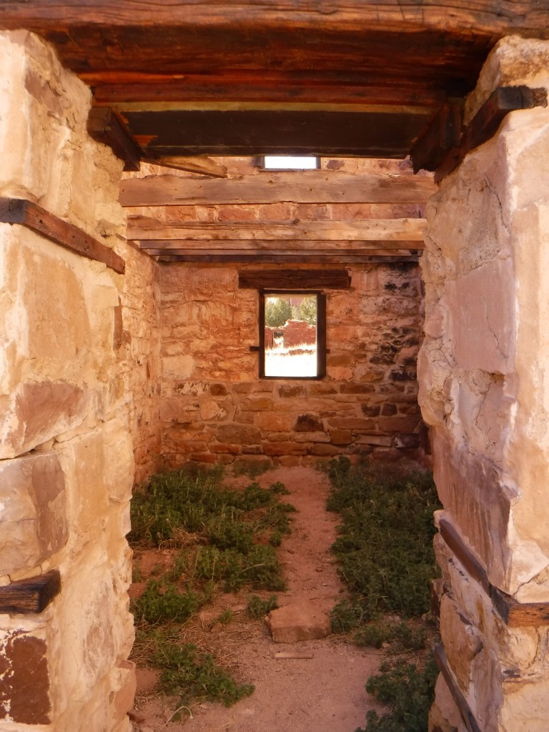
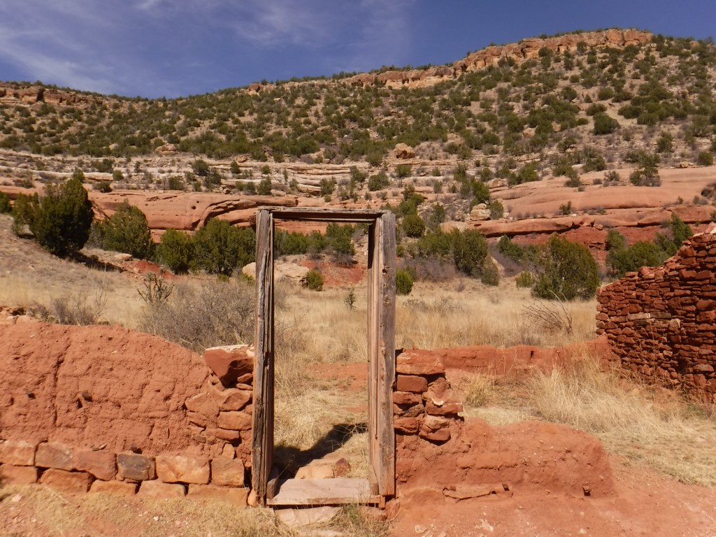
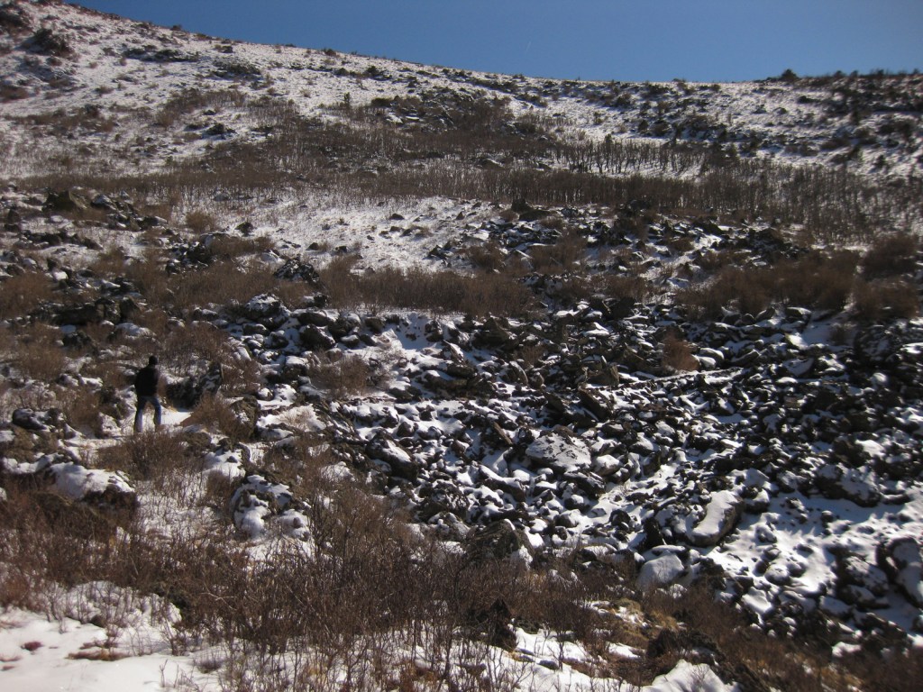
Melvin Mills (an attorney, territorial legislator, and entrepreneur) established the Mills Orchard and Ranch along the Canadian River in 1881. Flash flooding devastated the orchard in 1904, leading to the ranch’s abandonment a decade later. In 2005, the U.S. Forest Service and National Park Service collaborated to restore three ranch buildings, and for their efforts they won the Windows on the Past Award for historic preservation. There are also interpretive signs and a free campground at the bottom of Mills Canyon, located nine miles down unpaved Mills Canyon Road.
Best Trail
A three-mile stretch of the Santa Fe National Historic Trail’s Cimarron Route is marked by rock posts 17 miles north of Clayton, and it is open for walking and horseback riding. There are interpretive signs along the route and wagon ruts remain visible.
Watchable Wildlife
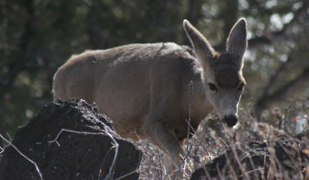
An introduced herd of Barbary sheep are thriving in the Mills Canyon area. The Canadian River supports largemouth bass and channel catfish. Nomadic Naturalists blog reported seeing swift foxes, spiny softshell turtles, black-chinned sparrows, and pinyon jays on their visit.
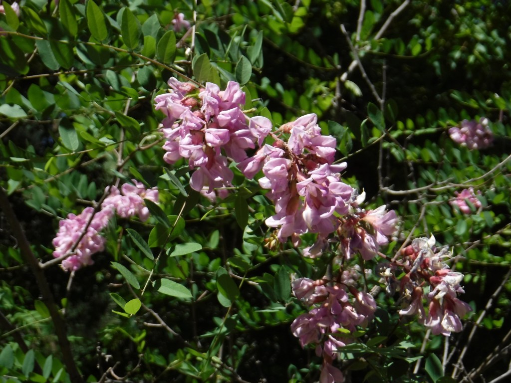
Photographic Opportunity
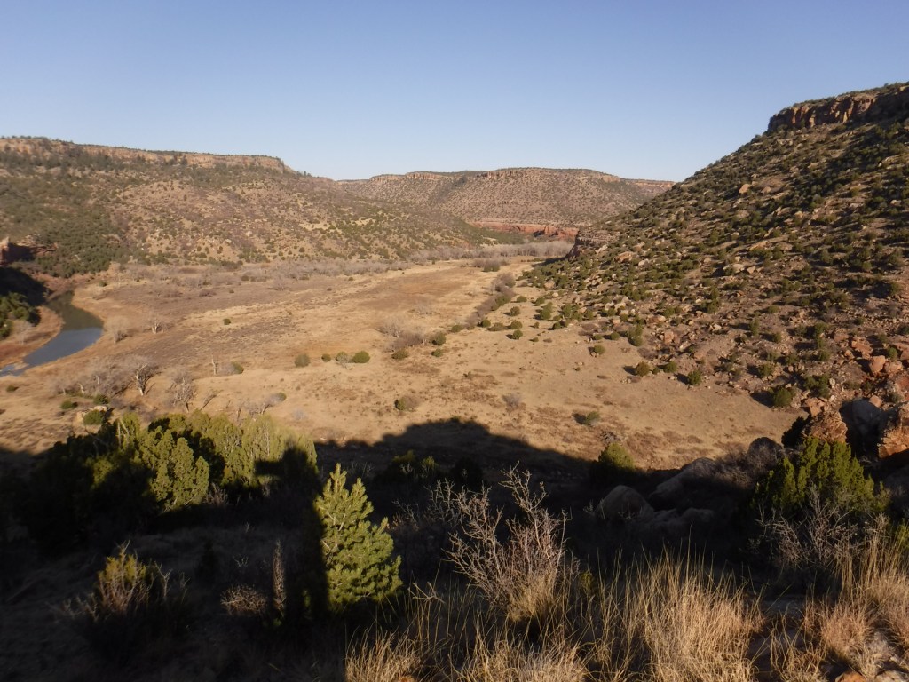
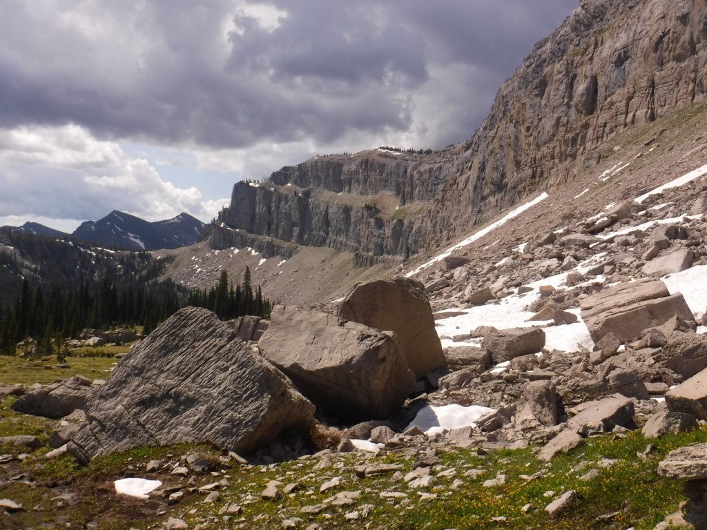
Mills Canyon was cut by the Canadian River through sedimentary rocks ranging in age from 200-million to 90-million years old.
Peak Season
Summer
Fees
None
Road Conditions
Past Mills Canyon Rim Campground, the unpaved Mills Canyon Road #600 is not recommended for trailers or passenger vehicles as it switchbacks down into Mills Canyon. A high-clearance vehicle is also recommended for the two-track paralleling the Santa Fe National Historic Trail’s Cimarron Route.
Camping
Both the Mills Canyon Rim Campground (6 campsites) and Mills Canyon Campground (12 sites) are free with vault toilets, but no water. Dispersed camping is allowed in the eastern unit around the Santa Fe National Historic Trail.
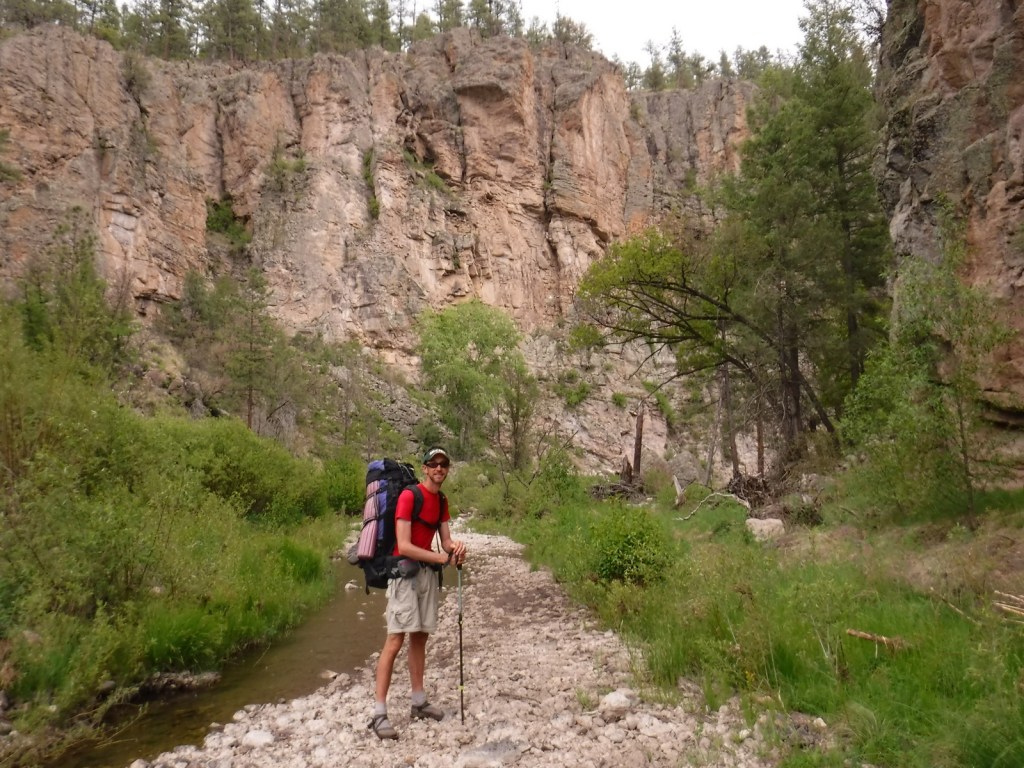
Scott exploring Mills CanyonTiff exploring the Canadian RiverHeading out of Mills Canyon
Explore More – As an attorney, Melvin Mills’ work often involved outlaws, American Indians, and politicians; who saved his life when he was nearly hanged by an angry mob?
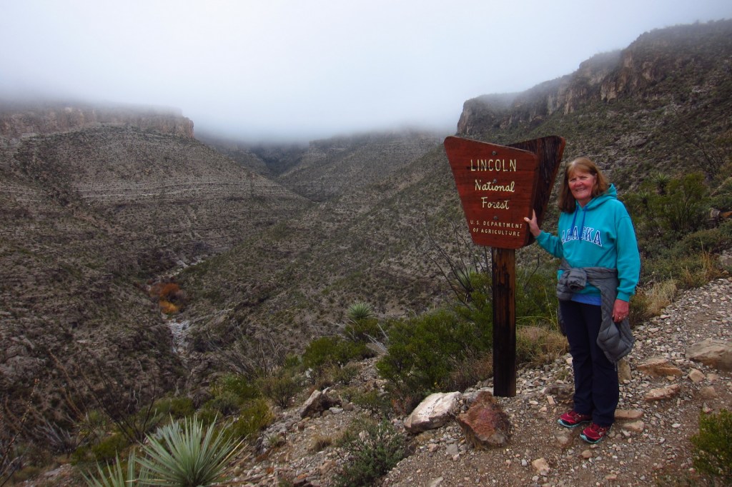
Lincoln National Forest is best known as the birthplace of Smokey Bear, a black bear cub that survived a 1950 wildfire in the Capitan Mountains and became a national symbol. The nearby Smokey Bear Historical State Park is the final resting place for the famous bear that passed away at Washington D.C.’s National Zoo in 1976. Lincoln National Forest includes parts of the Guadalupe, Sacramento, Sierra Blanca/White Mountains, Capitan, and Gallinas ranges. There are several long trails through the National Forest, including the 20-mile Crest Trail in the White Mountain Wilderness and the 11-mile South Base Trail in the Capitan Wilderness. All but one mile of the 29-mile-long Rim Trail is open to OHVs.
Highlights
Sunspot Scenic Byway, Billy the Kid Scenic Byway, Trestle Recreation Area, Sitting Bull Falls, Sierra Blanca Peak, Rim Trail, Willie White Trail, Dog Canyon National Recreation Trail, Capitan Peak Trail
Must-Do Activity
Sunspot Scenic Byway (State Road 6563) provides great views and access to one of the world’s largest solar observatories that is open for tours on summer weekends. At its remote southern end, the National Forest borders both Carlsbad Caverns and Guadalupe Mountains National Parks. Roads only connect with the latter, where a short detour takes you to the half-mile trail for 150-foot-tall Sitting Bull Falls. In 1898, the Alamogordo and Sacramento Mountain Railway was constructed to access timberland 4,747 feet in the mountains above. One of its scenic remnants is the 320-foot trestle over Mexican Canyon near Cloudcroft. Lincoln National Forest has six fire lookouts listed on the National Register of Historic Places, including the stone Monjeau Lookout built by the Civilian Conservation Corps (CCC) that is accessible on a steep dirt road. Given its proximity to Carlsbad Caverns National Park, it is not surprising that there are hundreds of caves in the National Forest that require a permit to explore.
Best Trail
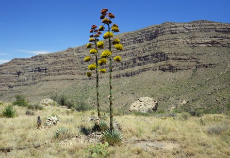
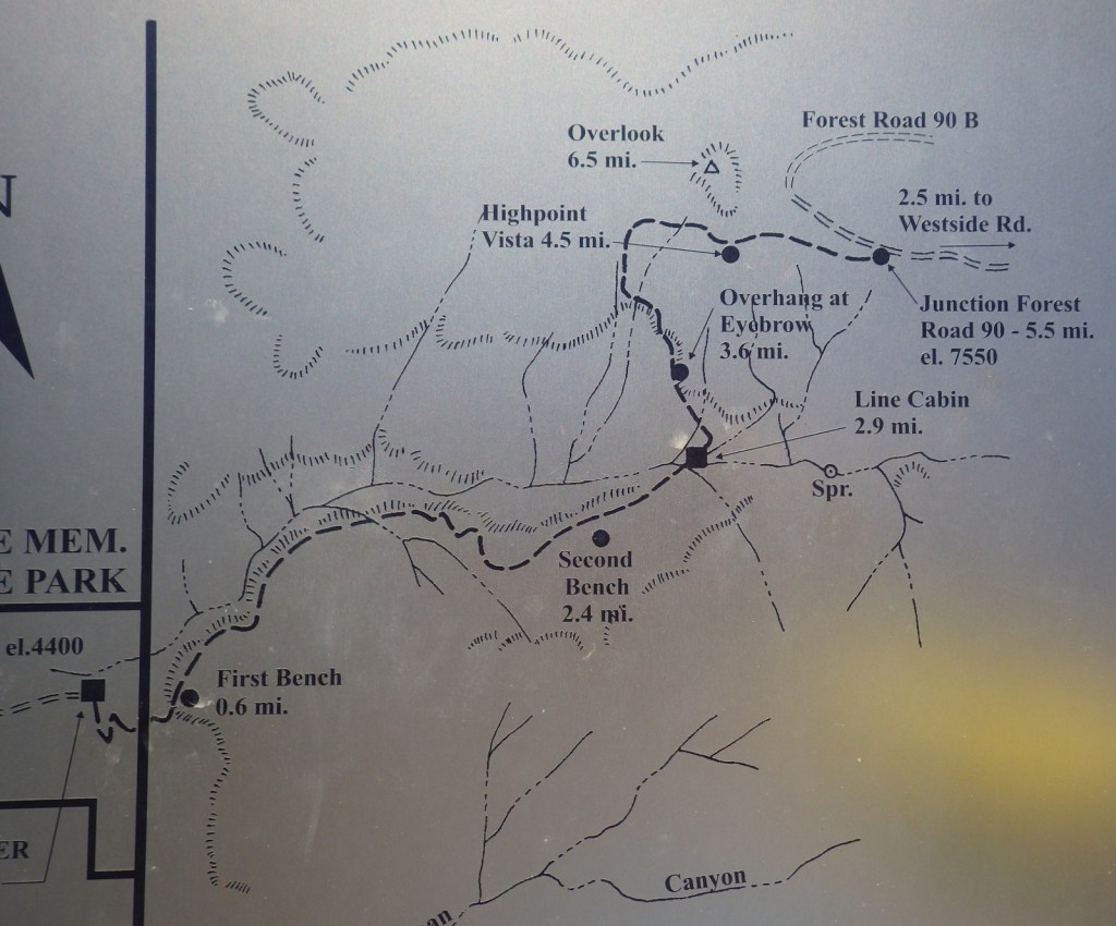
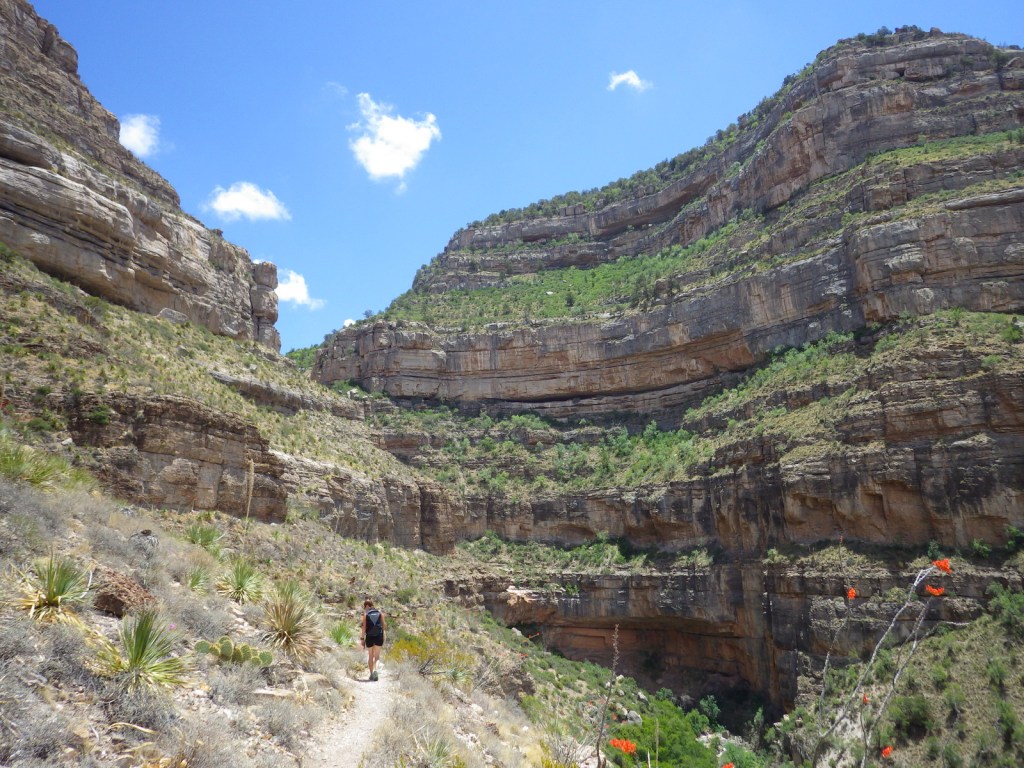
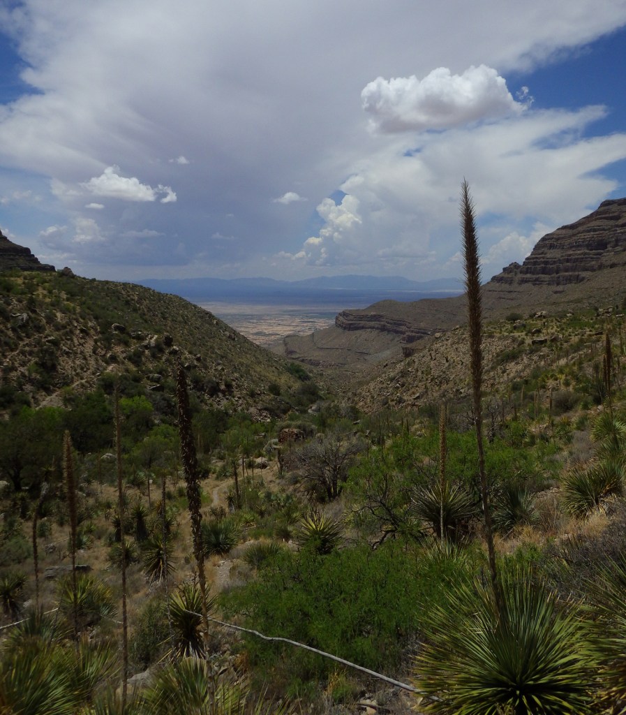
Dog Canyon National Recreation Trail follows a prehistoric travel route into the Sacramento Mountains east of White Sands National Park. The trailhead starts in Oliver Lee Memorial State Park, which has a nice campground and charges a day use fee (though we have seen cars avoid this by parking just outside its entrance). The 5.5-mile one-way trail climbs quickly above a beautiful canyon providing views of the Tularosa Basin before leveling out. Past the cabin ruins at the three-mile point, look for fossils along the trail as it again steeply rises into the agave and cacti-studded mountains. After gaining more than 3,000 feet in elevation, it dead ends at Forest Road 90B.
Watchable Wildlife
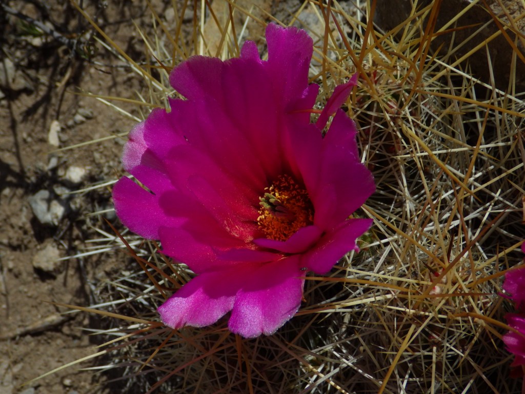
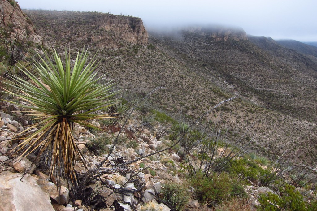
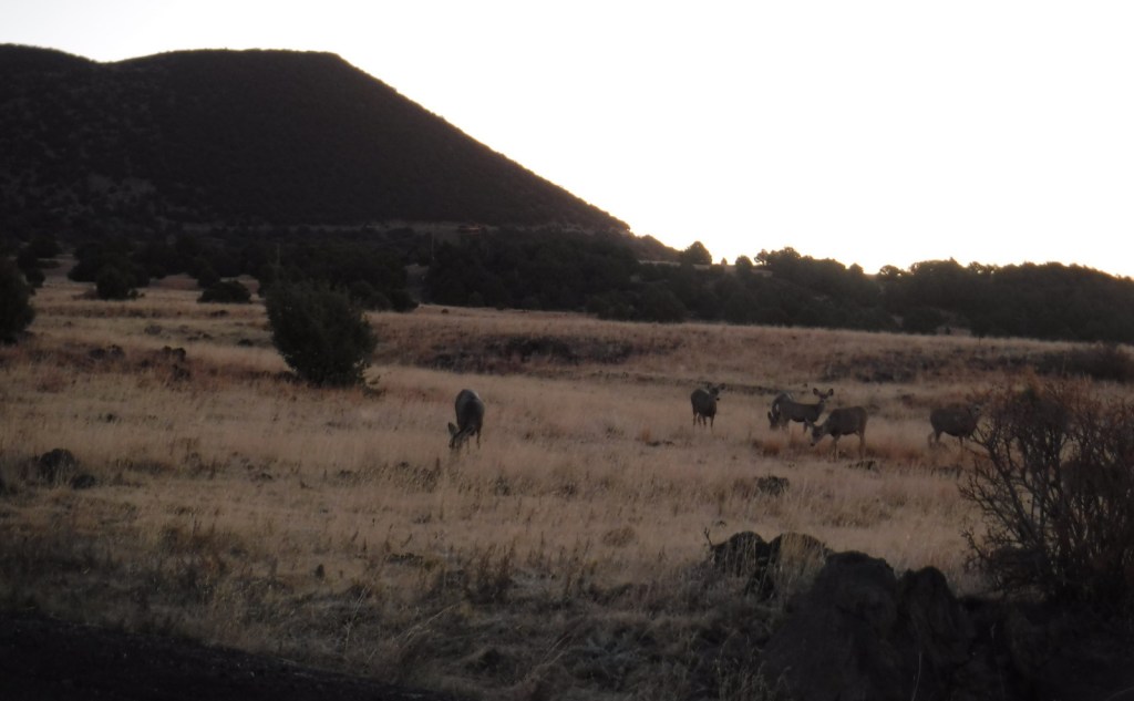
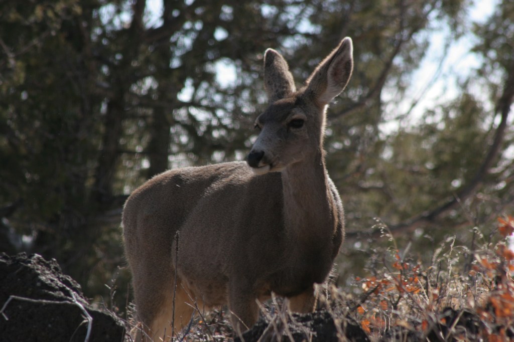
Ecosystems in the National Forest vary widely since it is spread across several mountain ranges and encompasses Chihuahuan Desert, pinyon-juniper woodlands, pine forests, and alpine meadows above 11,000 feet. Game species include elk, mule deer, black bear, mountain lion, and exotic Barbary sheep.
Photographic Opportunity
Look for fossils in the rocks along Dog Canyon National Recreation Trail.
Peak Season
Spring and fall
Fees
None
Road Conditions
The Sunspot Scenic Byway and the road into Oliver Lee Memorial State Park are both paved and maintained, although the paved access road (137) through Lincoln National Forest to the north part of Guadalupe Mountains National Park has many potholes in it. Be aware that there are also four-wheel-drive only roads to some trailheads.
Camping
There are a few developed campgrounds in the middle of the National Forest off Highway 82. Although not all areas are open to dispersed camping, popular spots include Upper Bonito Dispersed Camping Area northwest of Ruidoso and Lower Karr Canyon south of Cloudcroft.
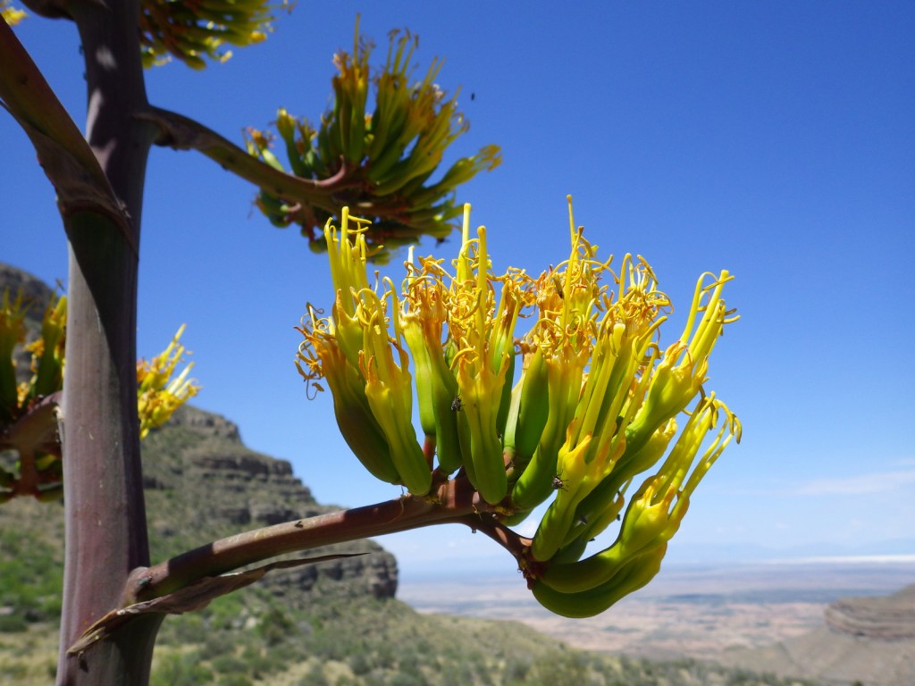
Baby barrel cactusMillipedeAgave bloomsCheckered whiptail lizardScott with a buckhorn chollaBeetleSpiny crevice lizardFossilsOcotillo bloomScott’s mother on Dog Canyon National Recreation Trail
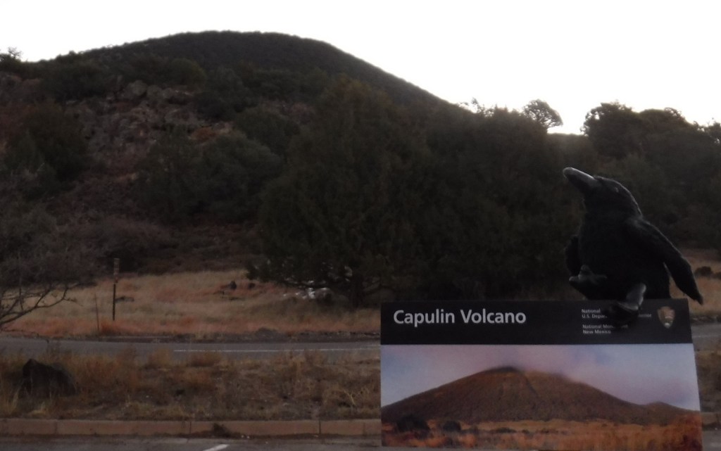
Capulin Volcano is a cinder cone that started to form 60,000 years ago in the Raton-Clayton Volcanic Field of northeast New Mexico. It would eventually erupt enough to rise 1,300 feet above the surrounding landscape and cover 16 square miles with lava. The volcanic field was last active about 10,000 years ago, so not nearly as recently as Arizona’s Sunset Crater Volcano National Monument. Capulin is the Spanish name for the native choke cherry tree (Prunus virginiana).
Start your visit at the National Park Service visitor center off Highway 325 where you can view the exhibits and watch the film. A two-mile drive leads from there to the rim of Capulin Volcano at 8,182 feet of elevation, where there are two hiking trails. At the top, watch the skies for golden eagles and the stems of trees and bushes for dense groupings of ladybugs.
Best Trail
There are two trails at the top of the cinder cone, one that drops to the bottom of the crater in 0.2 miles and another that circles the rim for one mile (going counterclockwise is recommended as less strenuous). There is also the one-mile Lava Flow Trail loop and a short paved Nature Walk at the visitor center, as well as the Boca Trail that loops 1.7 miles along the western base of Capulin Volcano where you might see mule deer.
Photographic Opportunity
The crater of the cinder cone is about 415 feet below the rim, which offers views into Colorado, Texas, and Oklahoma on a clear day.
The road is paved two miles from the visitor center to the parking lot at the top of Capulin Volcano, but gated off overnight even though the park is International Dark-Sky Association Gold Tier Certified.
Camping
There is not an NPS campground at the National Monument, but we have stayed at the nice campground at Sugarite State Park 33 miles west in Raton near Interstate 25. Kiowa National Grassland and Clayton Lake State Park also offer camping.
Nearly 25% of Gila National Forest is designated Wilderness, and the renowned Gila Wilderness became the world’s first such-titled area on June 3, 1924. There are multiple hot springs that attract backpackers to this area and 95% of thru-hikers on the Continental Divide National Scenic Trail (CDT) veer from the official route to enjoy its beauty. The nearby Aldo Leopold Wilderness is named for the Forest Service ranger that helped campaign for that designation and later became a famous ecologist and author of A Sand County Almanac (see our Top 10 Non-Fiction Books on Trees and Forests). In 2016, the Cosmic Campground became the first International Dark Sky Sanctuary in North America (and one of only 18 in the world), so it is a great spot for stargazing. Gila National Forest also manages the part of Arizona’s Apache National Forest that is in New Mexico, adding an additional 614,202 acres.
Highlights
Inner Loop Scenic Byway, Hulsey Lake, Cosmic Campground, Turkey Creek Hot Springs, Lake Roberts, Signal Peak, Quemado Lake, Chimney Rock Canyon, Jordan Hot Springs, Sawmill National Recreation Trail, Catwalk National Recreation Trail, Wood Haul Road National Recreation Trail, Continental Divide National Scenic Trail
Must-Do Activity
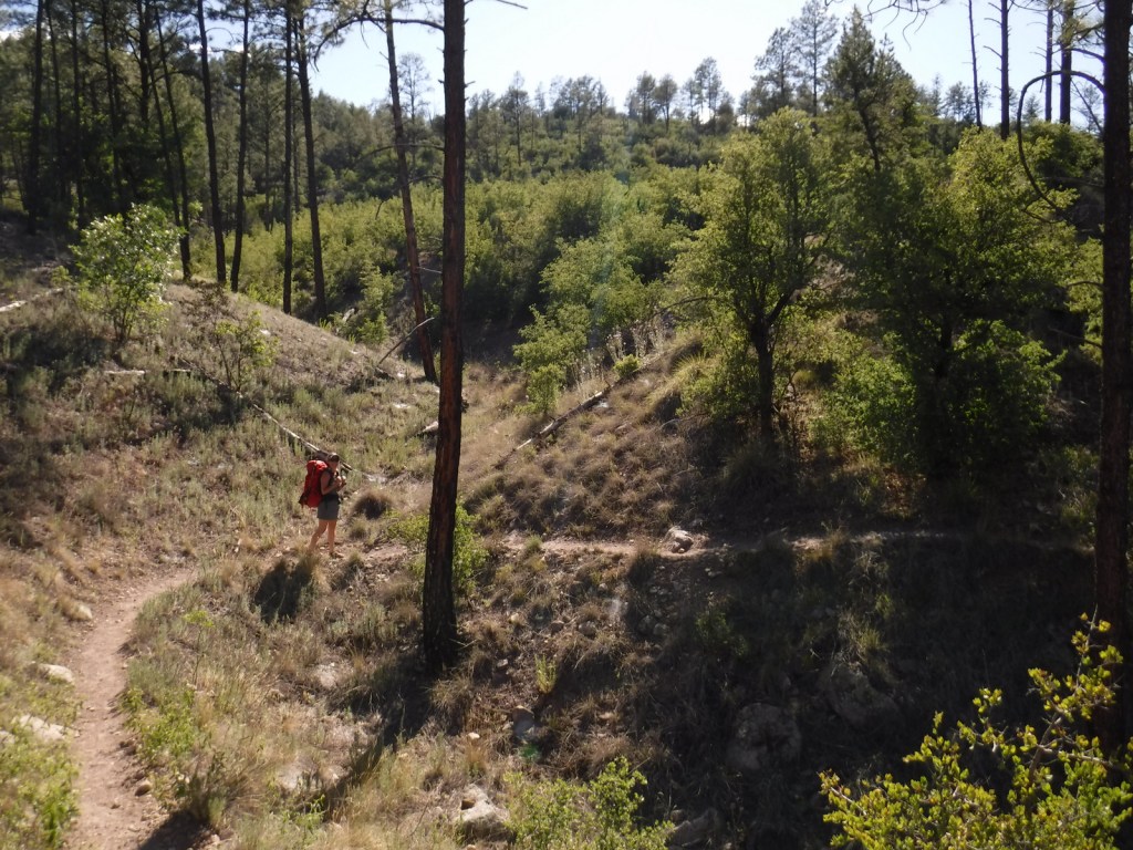
You do not have to journey far into the Gila Wilderness to reach Lightfeather Hot Springs on the Middle Fork Trail. Less than a mile down the trail a shallow pool is formed by stacked rocks where 150-degree hot springs water combines with the cool Middle Fork of the Gila River. It is a great place to watch and listen to wildlife. Seven miles further is Jordan Hot Springs, a very popular backpacking destination that requires countless stream crossings (it is best to wear fast-drying shoes and use trekking poles). The trailhead is located 43 miles north of Silver City on the Inner Loop Scenic Byway, not far from a visitor center co-managed by the Forest Service and National Park Service (that operates nearby Gila Cliff Dwellings National Monument). The Gila Wilderness is the reason this National Forest made it on our list of the Top 10 National Forests for Backpacking.
Best Trail
The most popular spot in Gila National Forest is the Catwalk National Recreation Trail, which requires driving through two stream crossings that are doable by a passenger car when the water is low. The one-mile trail is partially elevated above Whitewater Creek on wide, steel grates complete with handrails. The Catwalk started in 1893 as a way for miners to service a four-inch water pipe, then fell into disrepair before being upgraded by the Civilian Conservation Corps (CCC) in 1935. Today’s safer, tourist-friendly Catwalk was installed in 1961. This trail made our list of the Top 10 Day Hiking Trails in National Forests.
Watchable Wildlife
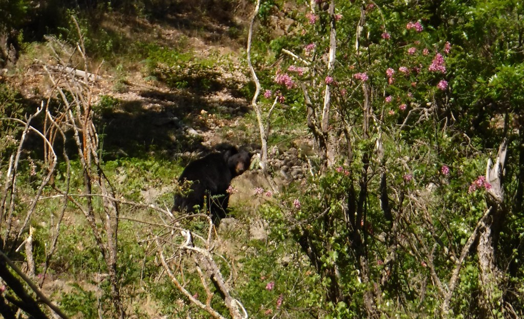
The Gila River gives its name to this National Forest, as well as animals like the venomous Gila monster, Gila woodpecker, and fish, including a trout, topminnow, and several species of chub. Mexican wolves have been reintroduced to this region, and other predators like mountain lions, bobcats, and black bears (we saw one and followed another’s wet footprints while backpacking near Gila Cliff Dwellings National Monument). Unique mammals include the javelina (collared peccary), gray fox, white-nosed coatimundi, and Coues white-tailed deer. Mule deer, elk, pronghorns, and bighorn sheep are additional ungulates found in Gila National Forest. Large birds include roadrunners, Mexican spotted owls, bald eagles, ospreys, peregrine falcons, and wild turkeys. Most of our wildlife encounters were with reptiles like horned lizards (a.k.a. frogs or toads), western fence lizards, and rattlesnakes.
Instagram-worthy Photo
In May 2020, we did a 72-mile backpacking loop connecting the West Fork of the Gila River with the Middle Fork, through gorgeous canyons and old-growth forests protected as the Gila Wilderness since 1924.
Peak Season
Summer
Fees
There is a parking fee at Catwalk National Recreation Trail (or you can display an America the Beautiful Pass), but some cars parked across the river to avoid paying.
Road Conditions
The eastern part of Inner Loop Scenic Byway is paved to the visitor center co-managed by the Forest Service and National Park Service, but the western portion is unpaved and has some steep grades not recommended for RVs. The unpaved road to Catwalk National Recreation Trail with its two stream crossings is doable with a passenger car when the water is low.
Camping
Cosmic Campground became the first International Dark Sky Sanctuary in North America (and one of only 14 in the world), so it is a great spot for stargazing. Pueblo Park Campground offers a trail through Chimney Rock Canyon and Upper End Campground is near 72-acre Lake Roberts. Cottonwood Campground is located near the Blue Range Wilderness on the Arizona border. In eastern Gila National Forest along Highway 152 are found both Upper Gallinas and Iron Creek Campgrounds. In the north, there are three campgrounds on 131-acre Quemado Lake and the Continental Divide National Scenic Trail cuts through primitive Apache Creek Campground.
Overlooking the Gila WildernessWestern fence lizardLightfeather Hot SpringsTiff on the Catwalk National Recreation TrailTiff on the Catwalk National Recreation TrailTiff backpacking in the Gila WildernessScott backpacking in the Gila WildernessRuins in the Gila WildernessTiff backpacking in the Gila WildernessBullfrogNew Mexico locust in bloomThis ponderosa pine was still alive despite its fire scarElkBlack bearRattlesnake
Explore More – Gila is a Spanish simplification of the Yuma word “hah-quah-sa-eel,” translated as what?
Learn more about this and the 154 other National Forests in our new guidebook Out in the Woods
We are a participant in the Amazon Services LLC Associates Program, an affiliate advertising program designed to provide a means for us to earn fees by linking to Amazon.com and affiliated sites.
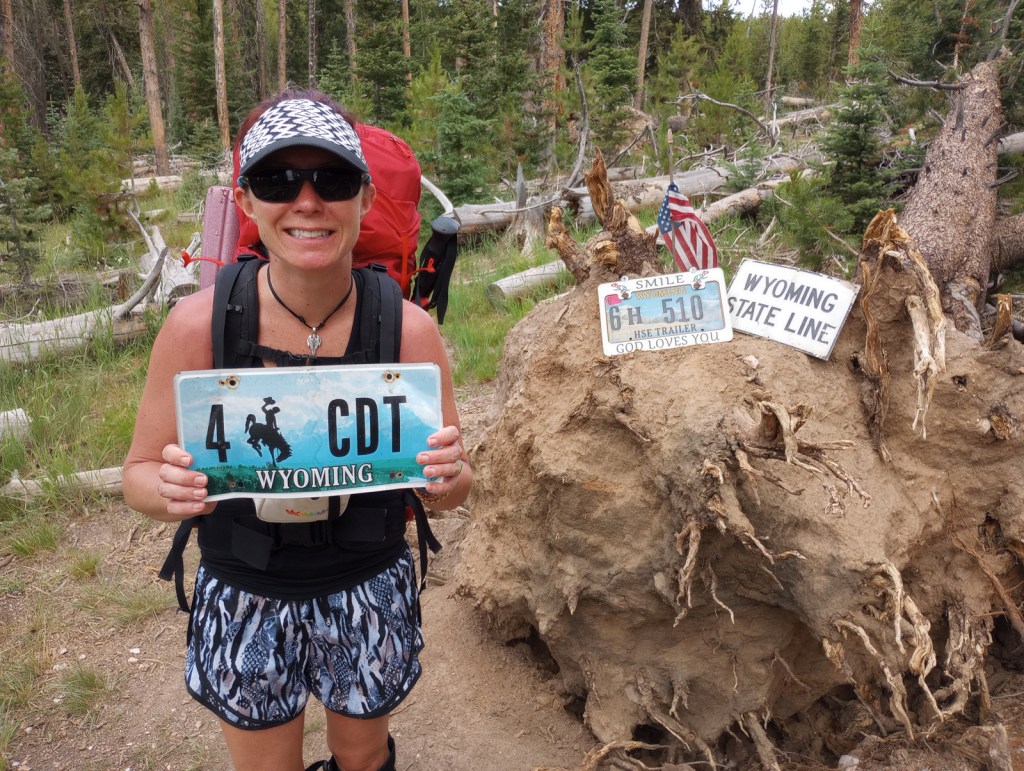
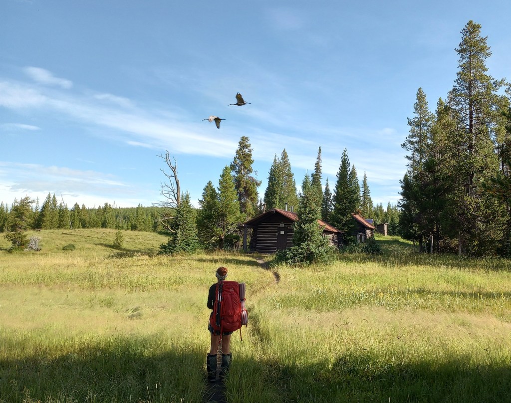
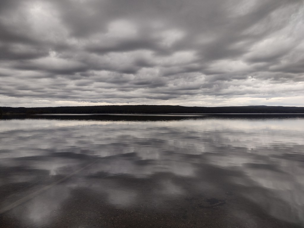
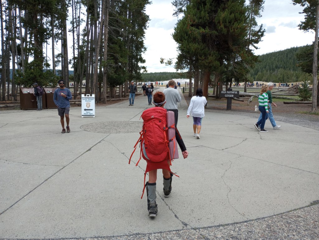
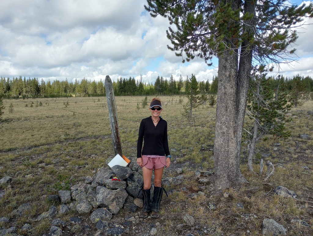
We decided to write about the Continental Divide National Scenic Trail (CDT) now, since Tiff recently finished backpacking the entire 512-mile Wyoming section of the route. The CDT stretches 3,028 miles from the Crazy Cook Monument on the border with Mexico north to Waterton-Glacier International Peace Park. The official trail is known as the “red route,” with popular alternatives called “blue routes” detouring through sections like New Mexico’s Gila Wilderness (which 95% of thru-hikers choose). Tiff was supported by Scott along portions of the trail and they both backpacked through Yellowstone National Park together. Tiff met dozens of thru-hikers doing the entire trail this year, many of whom were “flip-flopping” after getting stopped north bound (NOBO) by snowy Colorado mountains so switching to a south bound (SOBO) direction to finish.
It takes the average thru-hiker 147 days to complete the trek (including “zeros days”), but you can get a feel for the experience on shorter point-to-point or loop hikes. We have done the Rocky Mountain National Park section as a long day hike and Scott has backpacked the minimum 40 miles to see the famous Chinese Wall in Montana’s Lewis and Clark National Forest. We had all three of our backcountry campsites to ourselves along Yellowstone National Park’s 67-mile stretch of CDT and went a full day without seeing another person near the park’s Idaho border.
Best Trail
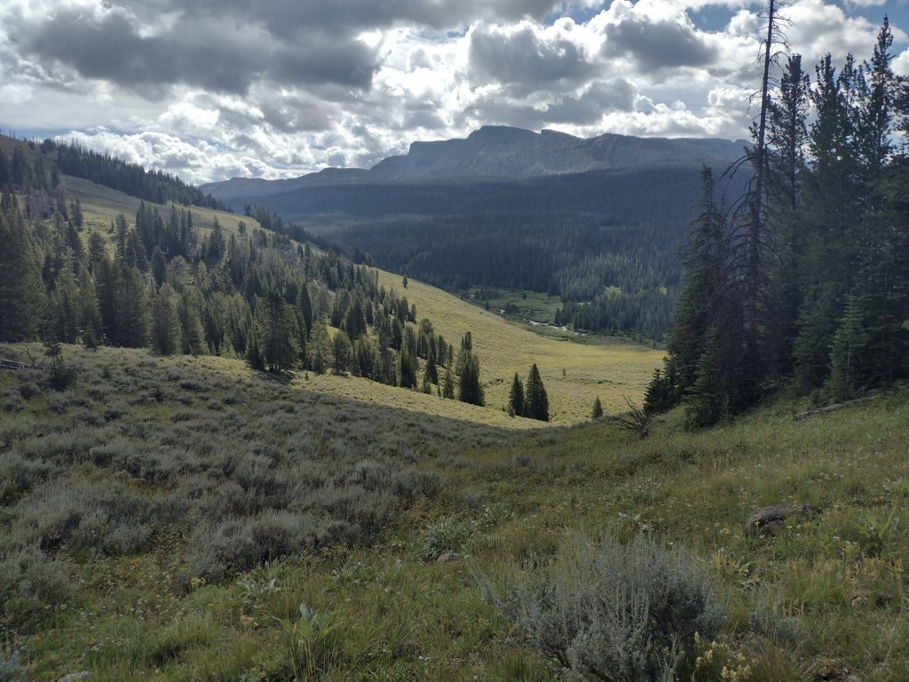
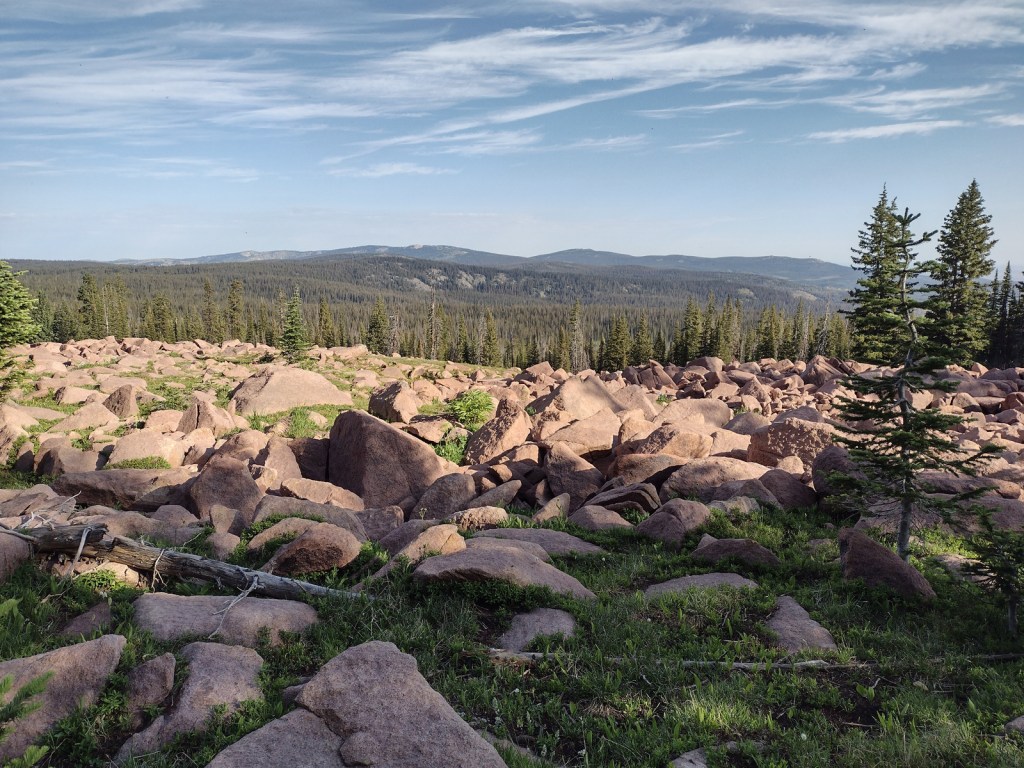
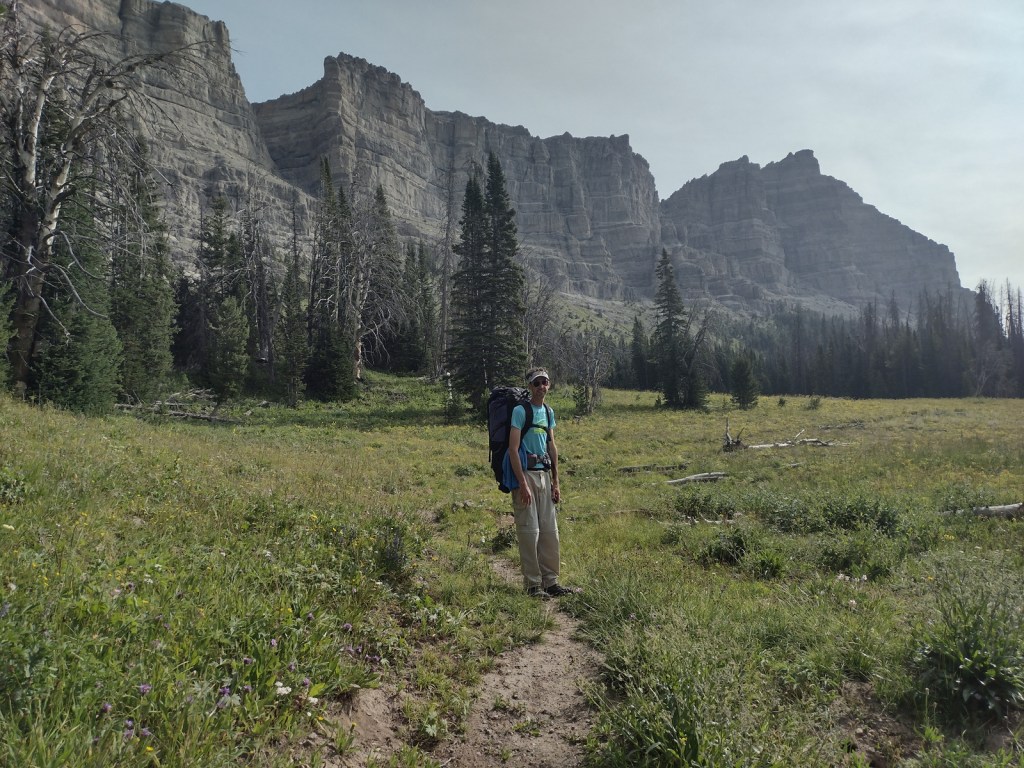
The Wind River Range in Wyoming’s Bridger National Forest is probably the most scenic stretch of mountains on the entire CDT. Many thru-hikers detour to a blue route to see beautiful, but overcrowded Titcomb Basin and the Cirque of the Towers (actually in neighboring Shoshone National Forest). Read more about our 2020 trip (mostly) following the CDT 120 miles through the range in our newspaper article.
Instagram-worthy Photo
The CDT goes right past crowded Old Faithful in Yellowstone National Park’s Lower Geyser Basin, although there are other areas of colorful hot springs like those near Heart Lake (pictured).
Peak Season
Summer
Fees
Fees apply if you camp inside or drive into Rocky Mountain, Yellowstone, and Glacier National Parks
Road Conditions
Much of the trail is actually walking dirt roads and some paved roads, especially in New Mexico. Access roads to certain trailheads can be very rough and require driving long unpaved sections, such as the 30 miles to busy Big Sandy Trailhead in Bridger National Forest.
Camping
Camping is dispersed except for designated sites (permit required) in Rocky Mountain, Yellowstone, and Glacier National Parks.
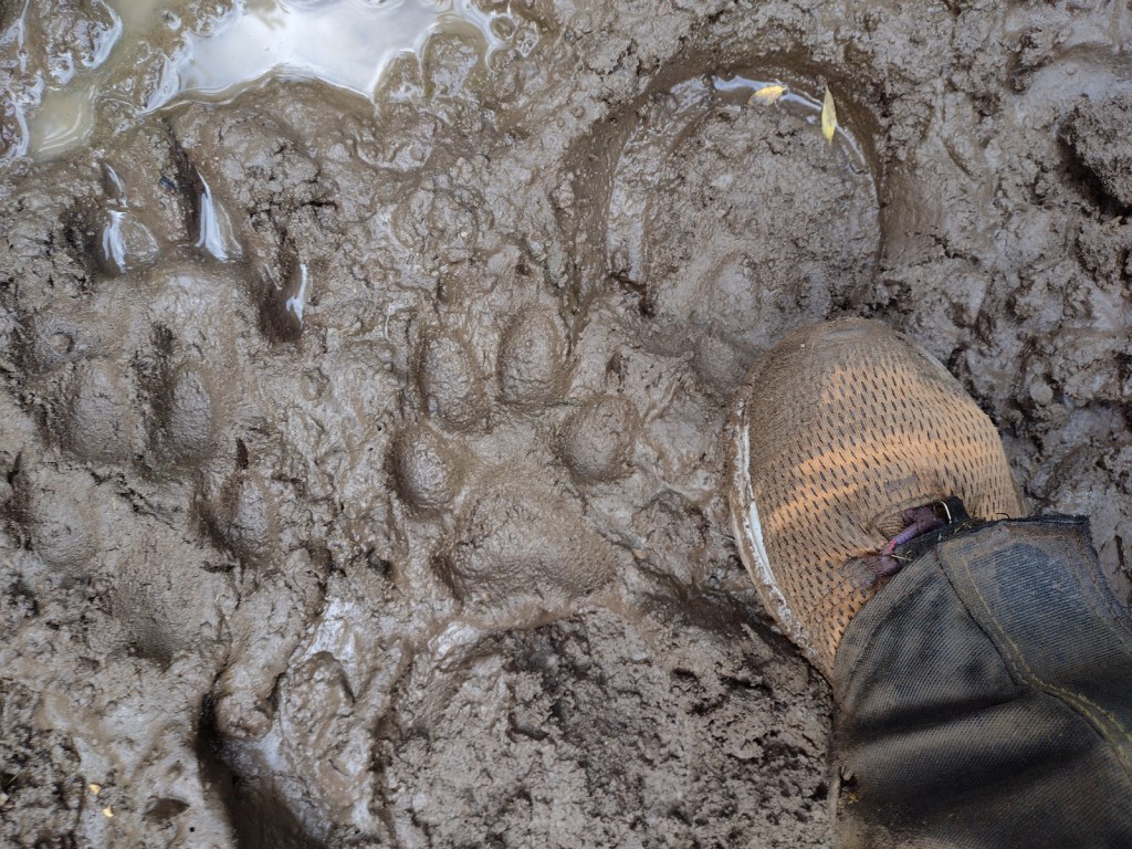
Tiff starting at the Colorado-Wyoming borderTiff in Wyoming’s South Pass City State Historic SiteEntering the Wind River RangeTiff in the Wind River RangeScott near Terrace MountainMule deerWolf tracks outside Tiff’s tent in the morningTiff at Heart Lake in Yellowstone National ParkSandhill cranes in Yellowstone National ParkShoshone Lake in Yellowstone National ParkScott crossing the Lewis River in Yellowstone National ParkGeysers in Yellowstone National ParkTiff at Old Faithful in Yellowstone National ParkYellowstone National ParkTiff finished at the Idaho border in Yellowstone National ParkBeargrass in Montana’s Lewis and Clark National ForestGrizzly bear in Lewis and Clark National ForestChinese WallLewis and Clark National Forest
Explore More – Which three oceans receive water from Triple Divide Pass in Montana?
Start your U.S. National Parks, National Forests, and National Monuments adventure here!