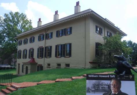
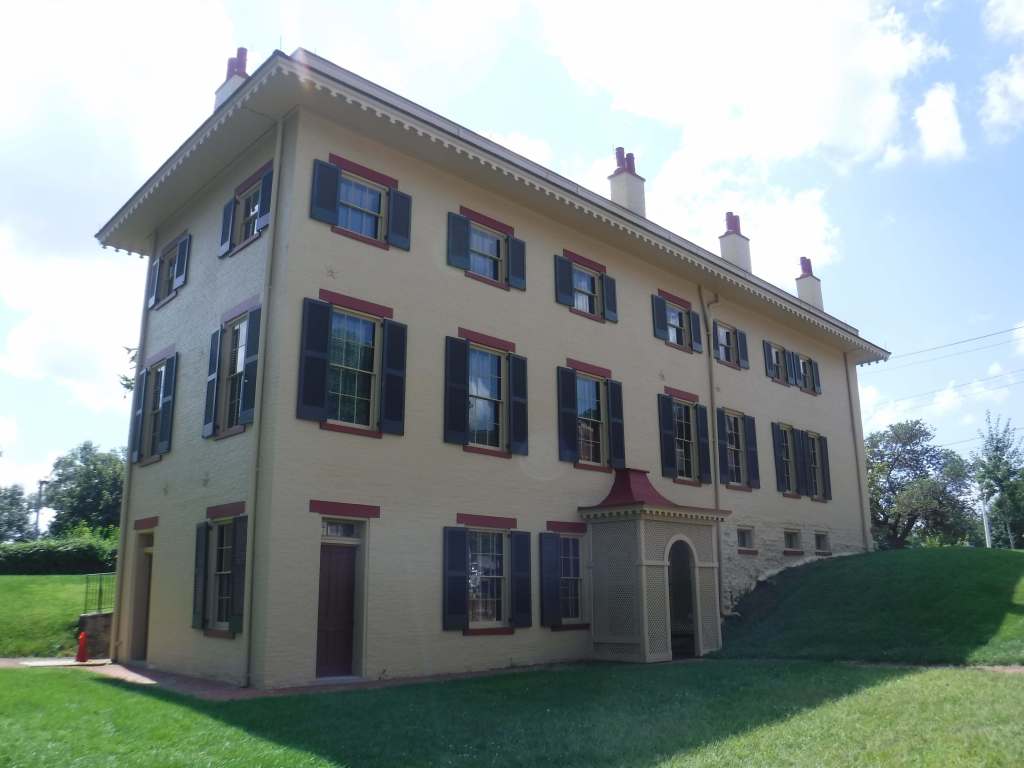
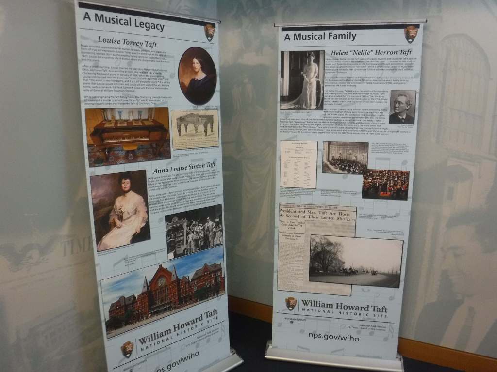
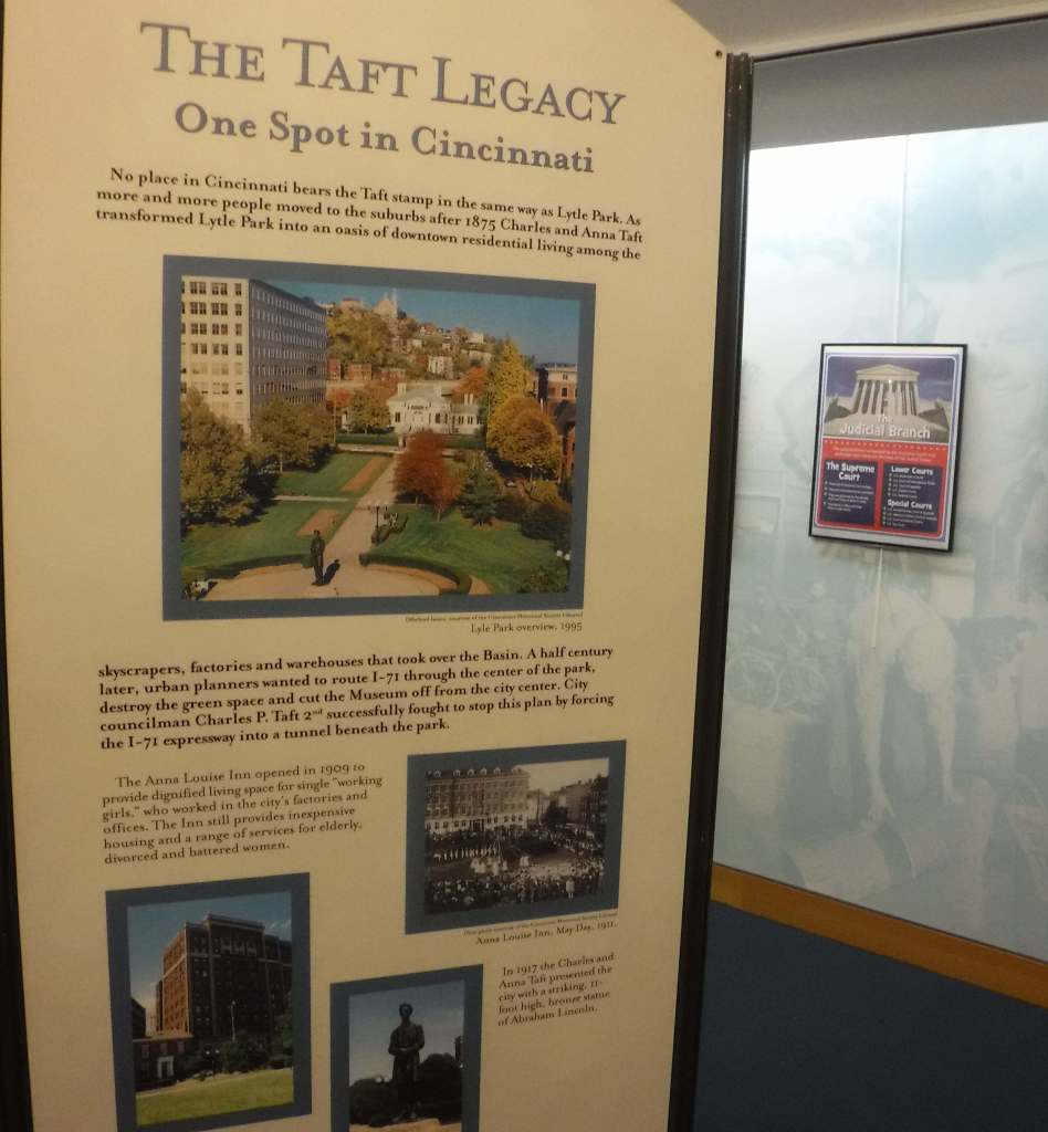
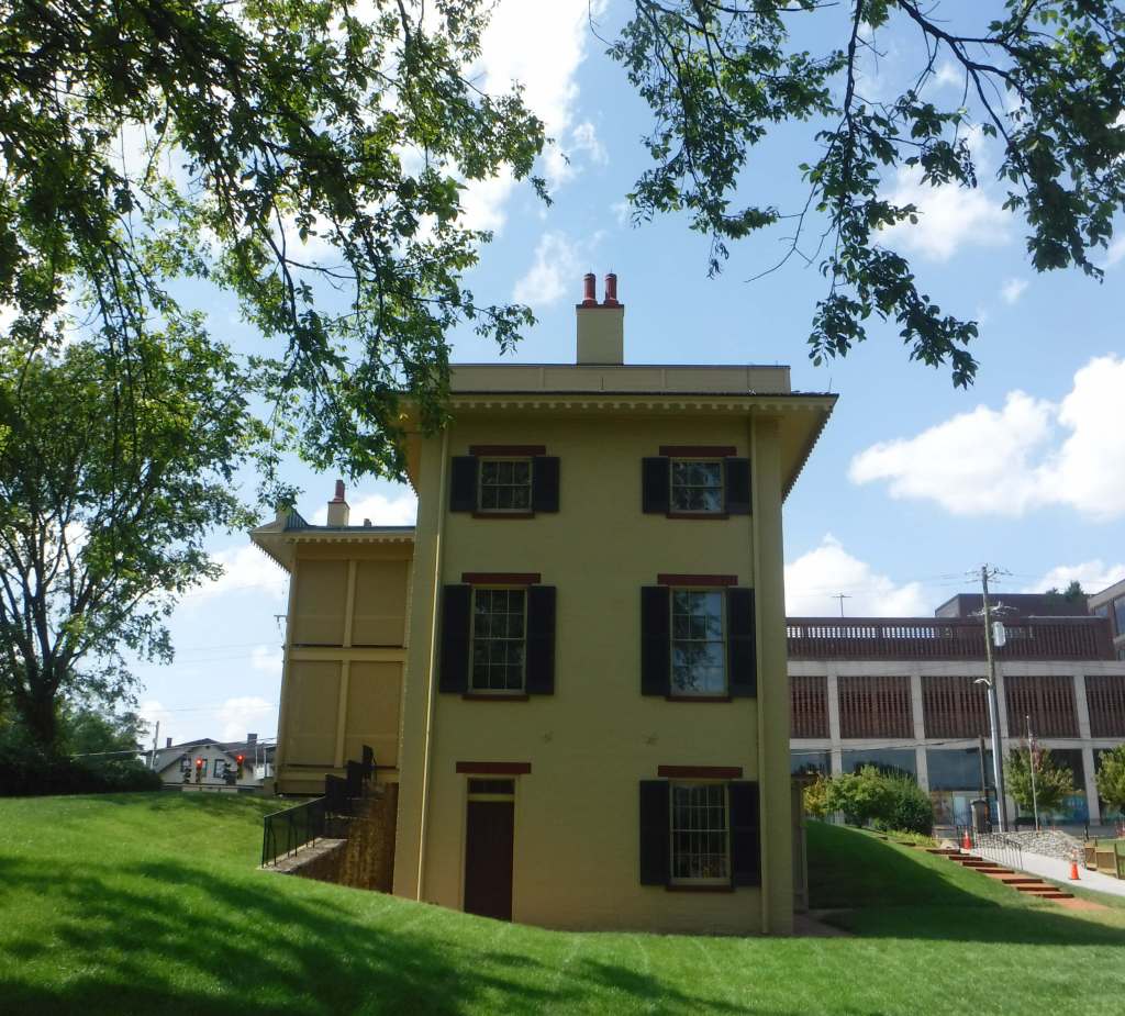
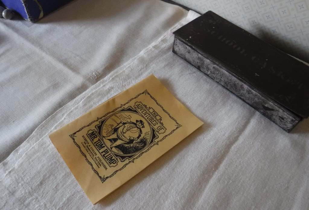
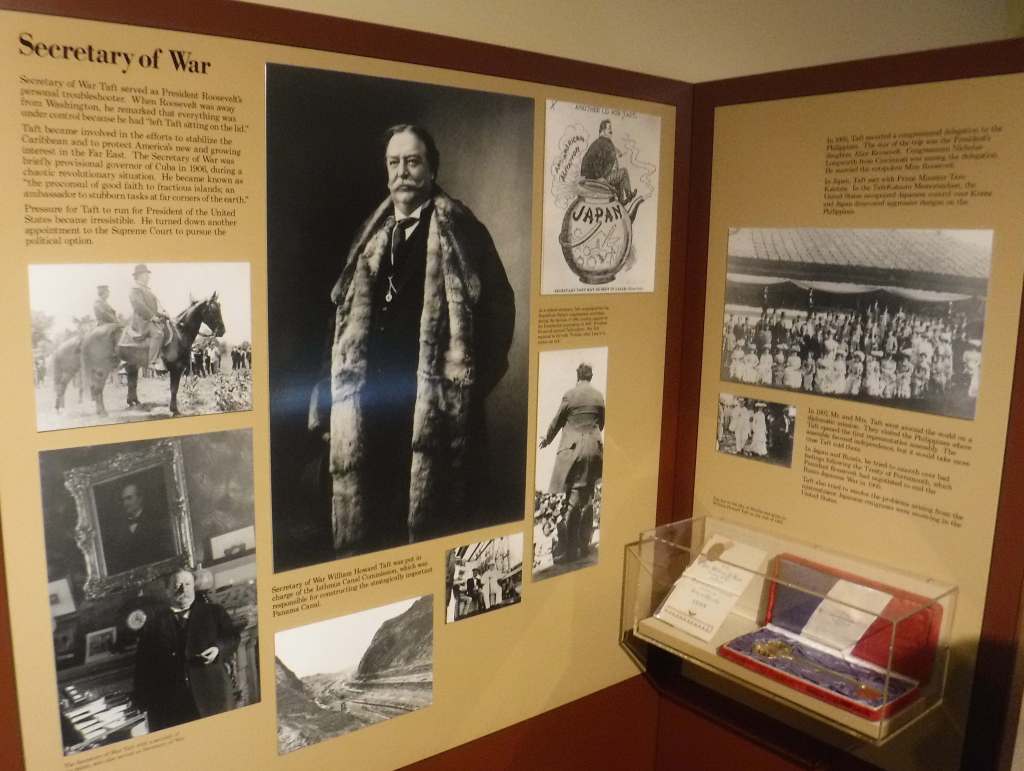
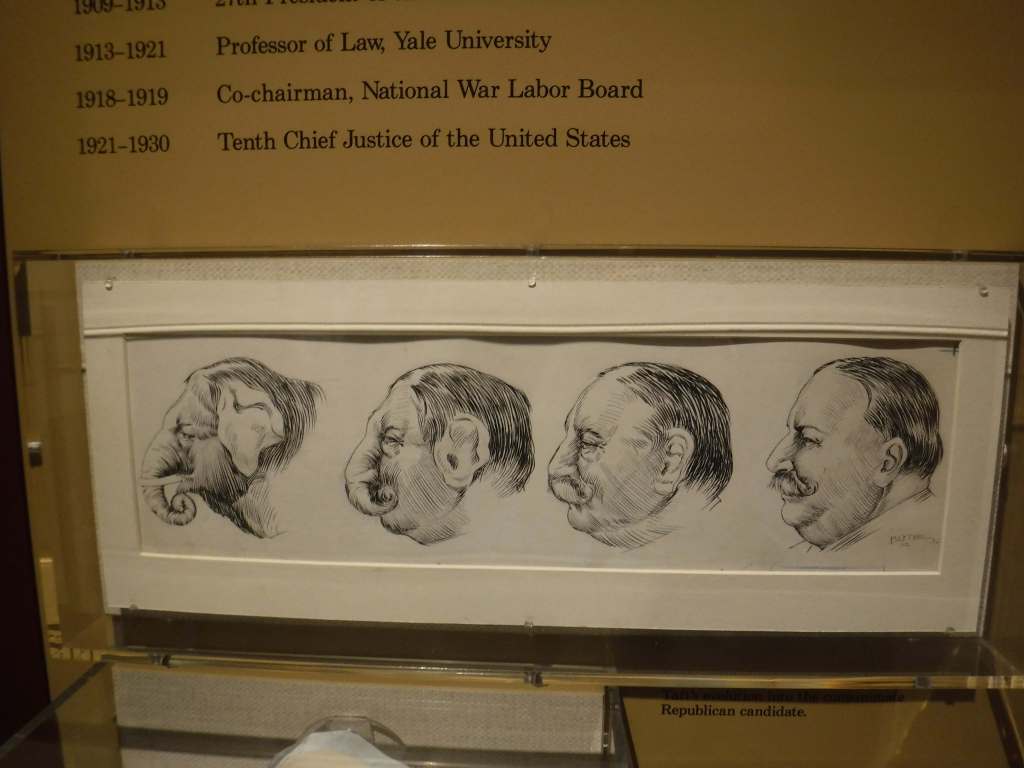
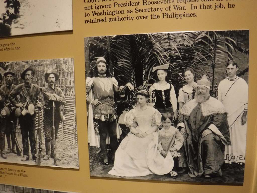
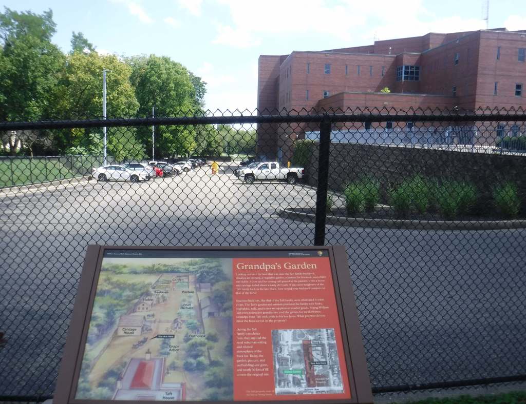
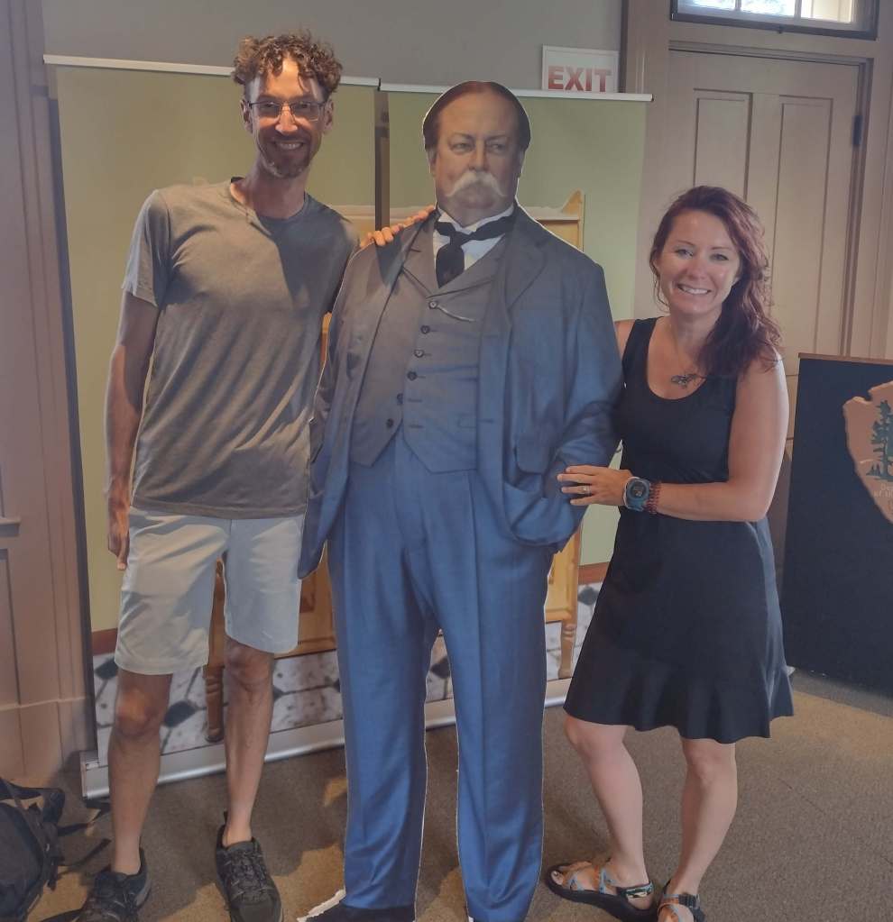
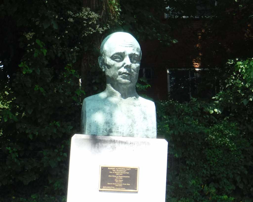
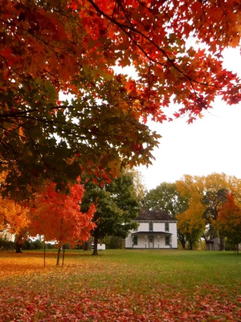
William Howard Taft was the nation’s 27th President and 10th Chief Justice of the U.S. Supreme Court, the only person to hold both positions in U.S. history. Taft was born on September 15, 1857, in this house in Cincinnati, the city where he attended law school after graduating from Yale (where he later served as a professor). Taft was promised a Supreme Court nomination by President William McKinley when he sailed for the Philippines in April 1900 where he would stay as Civil Governor until December 1903. After McKinley’s assassination, he would have to wait for his Supreme Court seat until 1921. His mother sold the Cincinnati house in 1899 and it was structurally altered and turned into apartments, so the National Park Service completed extensive restorations. Taft’s son Robert Alphonso Taft served as a U.S. Senator representing Ohio, and his father had been Secretary of War and U.S. Attorney General.
Highlights
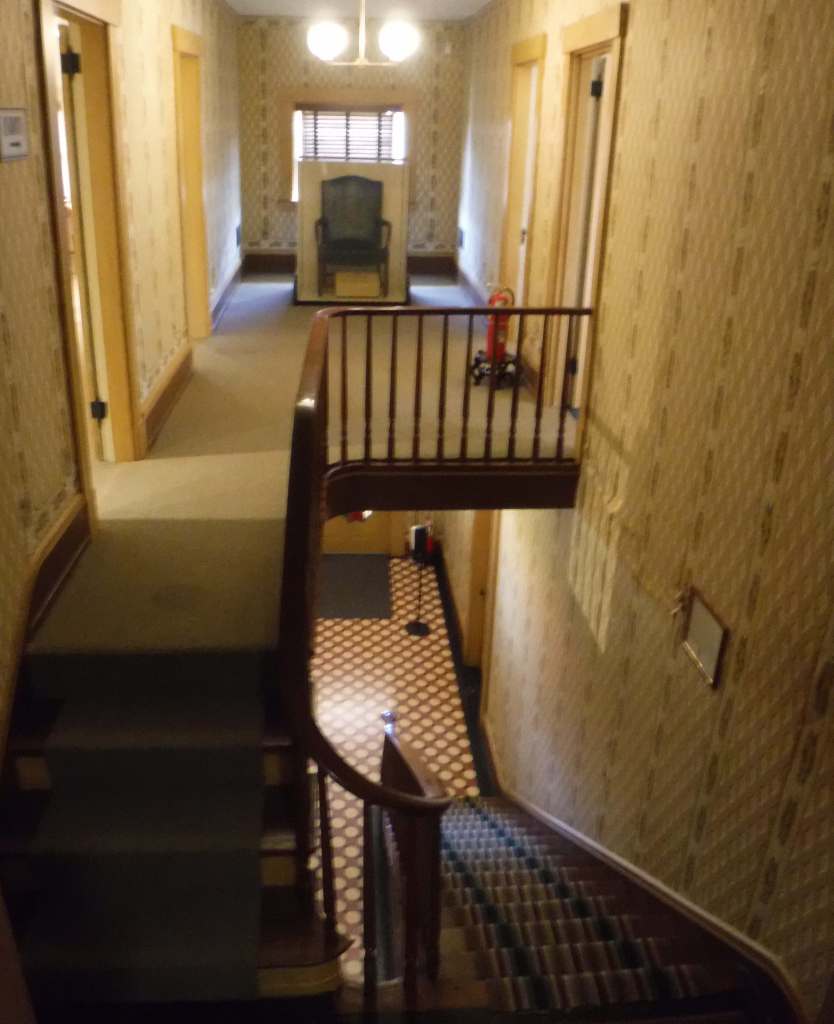
Guided tour of restored mansion, museum, film
Must-Do Activity
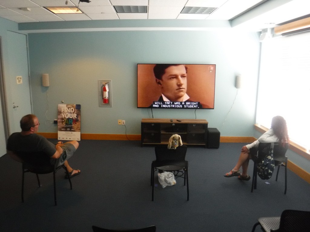
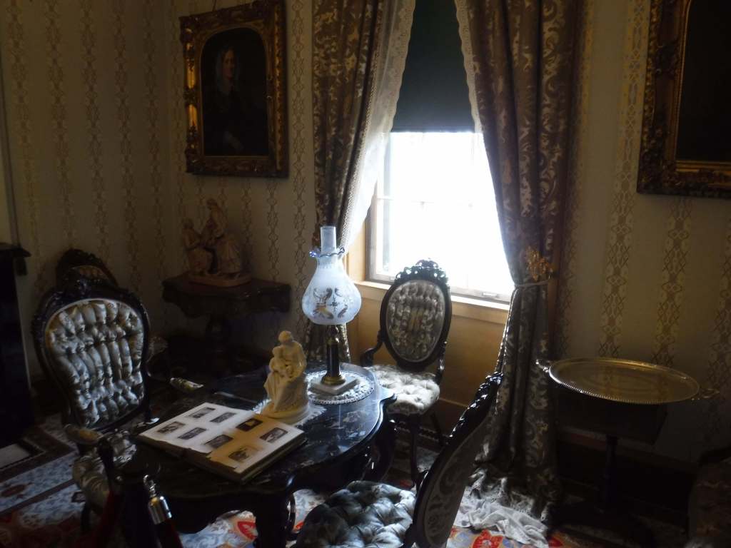
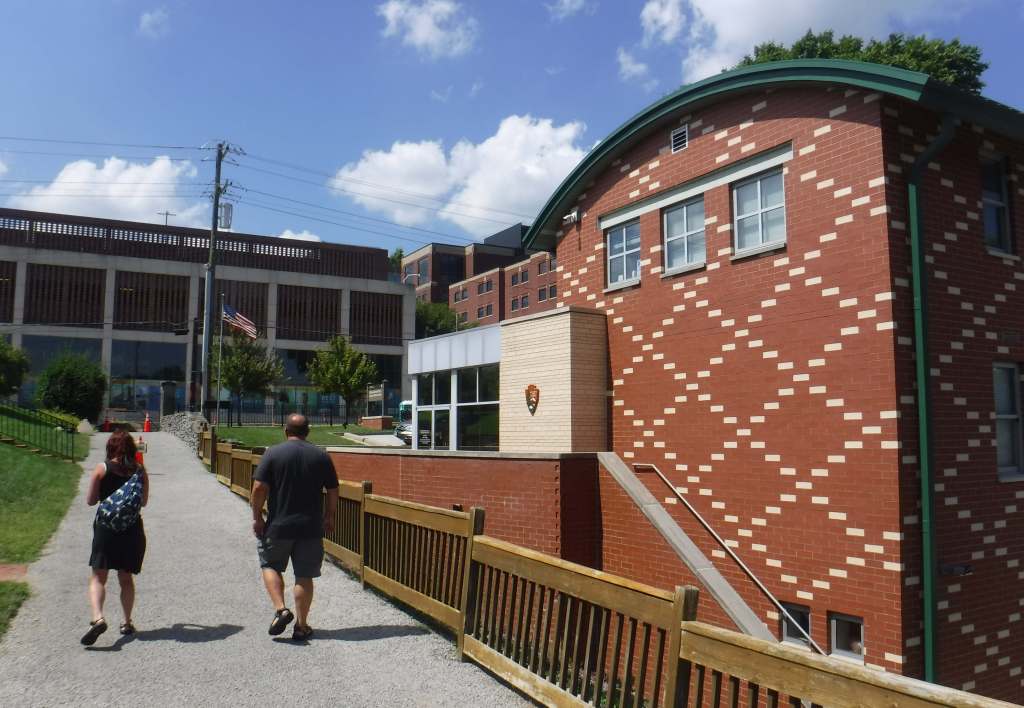
Visitors can park at the Taft Education Center next to the house where there are museum exhibits, a bookstore, and a film screening room. Guided tours that last 30 minutes are the only way inside the house, a Greek Revival design that is decorated with Victorian-era furnishings.
Best Trail
None
Photographic Opportunity
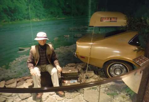
The museum has an audio-animatronic figure of Taft’s son Charles Phelps Taft II wearing fishing gear and telling stories about members of the Taft family.
Free paved parking is available at this site that is easily accessible from Interstate 71.
Camping
North of Cincinnati, Hueston Woods State Park offers 490 campsites, 59 cabins, and a lodge. The scenic Hocking Hills State Park has 172 campsites (reservations recommended) and is one of the most popular places to camp in Ohio.
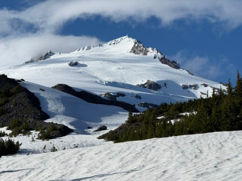
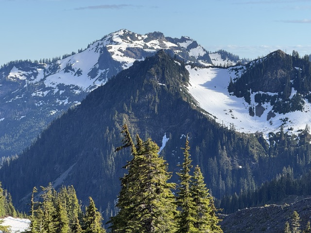
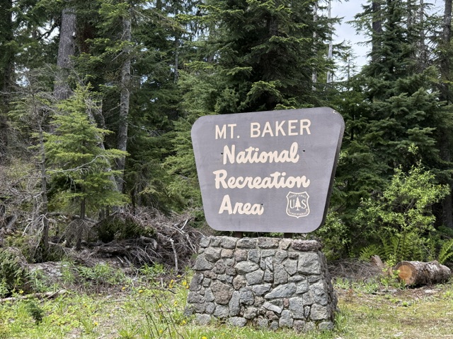
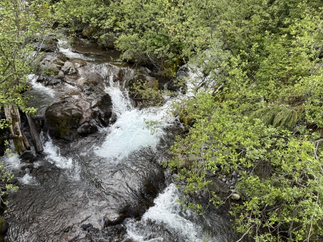
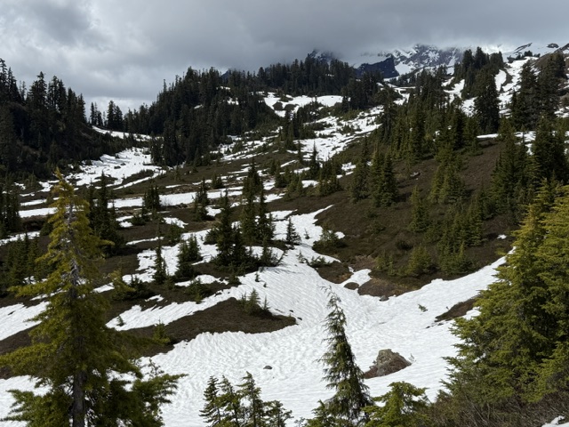
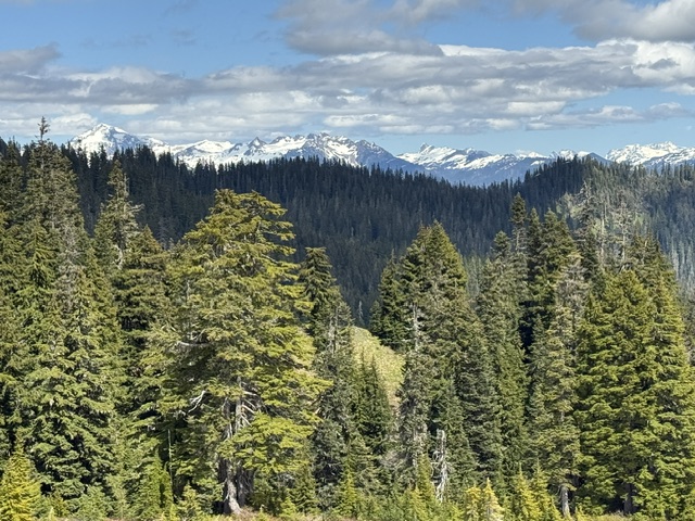
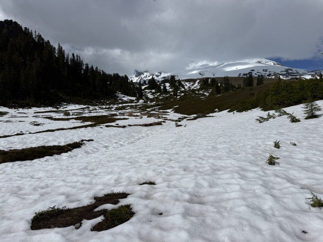
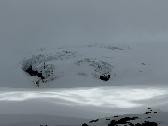
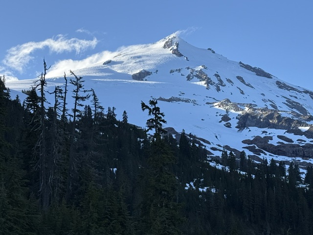
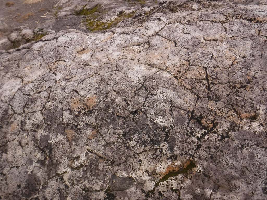
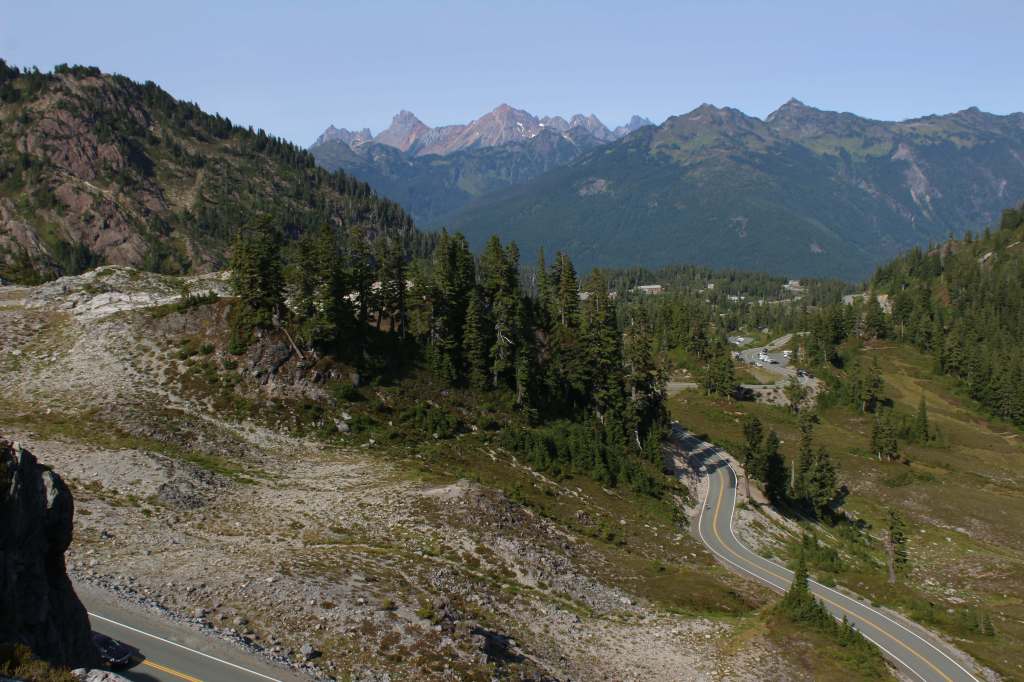
Part of Mt. Baker-Snoqualmie National Forest, Mt. Baker National Recreation Area was set aside to provide a place for snowmobile use on the 10,781-foot volcano’s south slope. Snowmobiling is restricted to certain areas outside the designated Wilderness and requires a minimum snow depth of two feet. Mt. Baker is an active stratovolcano that last had a major eruption 6,700 years ago, but experienced hydro-thermal explosions in 1840 and 1880 that led to dangerous lahars.
Highlights
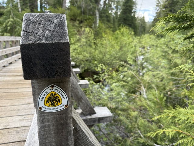
Park Butte Lookout, Railroad Grade Trail, Scott Paul Trail, Pacific Northwest National Scenic Trail
Must-Do Activity
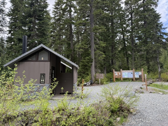
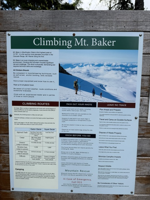
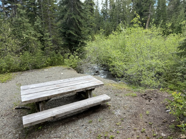
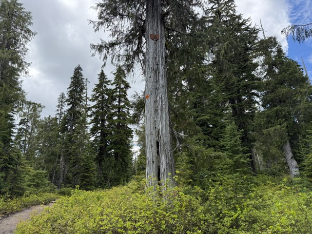
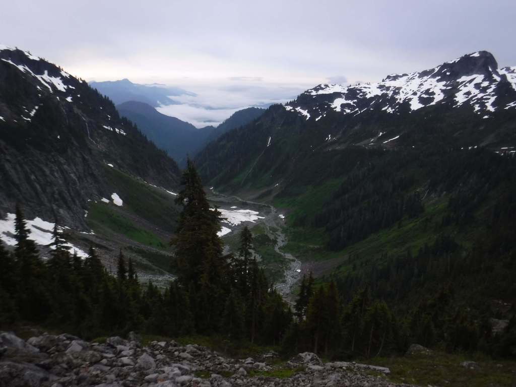
North of Baker Lake, Park Butte Trailhead is the main access point for Mt. Baker National Recreation Area and has a large parking lot with vault toilets and trash cans. Park Butte Trail immediately enters groves of large western hemlock and Alaska yellow-cedar trees. Taking the split to the right for the Scott Paul Trail creates a 7.5-mile loop, which remains heavily snow covered into mid-June. In addition to snowmobiling, other activities include snowshoeing, skiing, picking huckleberries, and climbing to the summit of Mt. Baker on the Coleman Glacier and Easton Glacier routes. Horseback riding is allowed on Bell Pass, Elbow Lake, Park Butte, and Ridley Creek Trails.
Best Trail
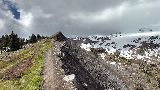
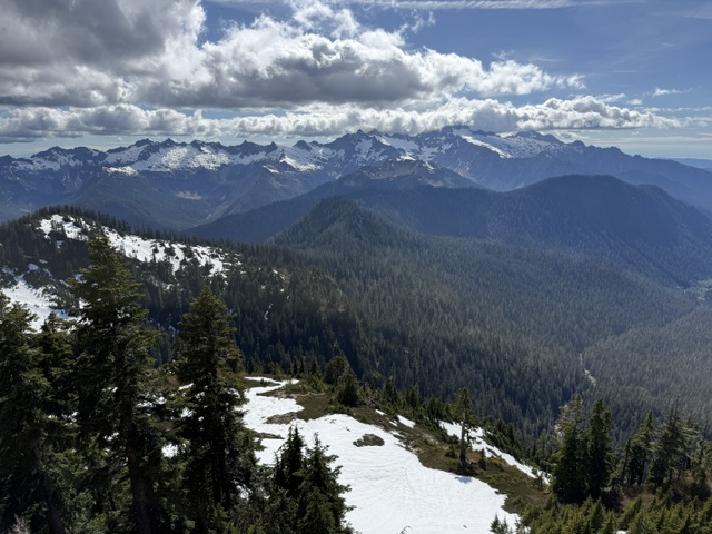
Railroad Grade Trail splits off Park Butte Trail and quickly climbs up to a lateral glacial moraine that offers incredible views of Mt. Baker on clear days. It is used by mountain climbers making their way to the summit of the volcano.
Photographic Opportunity
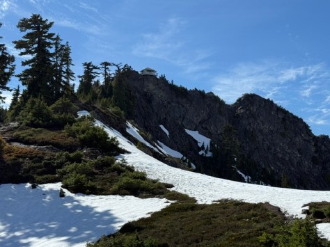
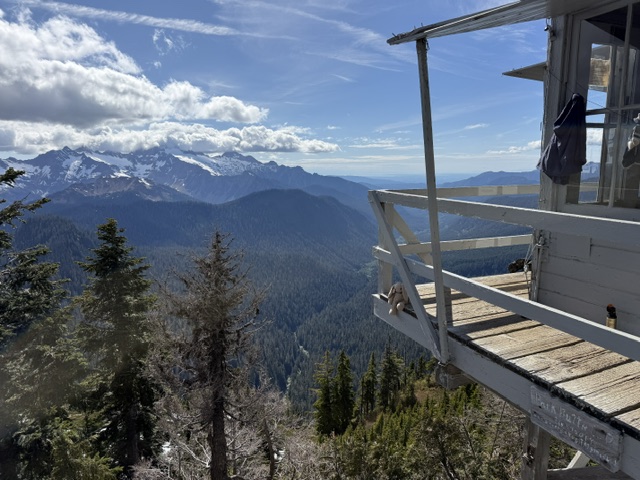
It is 7.9 miles out-and-back with 2,093 feet of cumulative elevation gain to the Park Butte Lookout, a historic structure built in 1932 that is maintained by Skagit Alpine Club volunteers. It is technically just inside the boundary for Mt. Baker Wilderness.
Peak Season
Summer
Fees
$5 day use (or America the Beautiful pass) at Park Butte Trailhead from May 1 through October 31, and a Washington State Sno-Park permit required the rest of the year.
Road Conditions
Park Butte Trailhead is accessed by taking the pothole-riddled Forest Service Roads 12 and 13 uphill for 8.9 miles. Access to Elbow Lake Trailhead and Ridley Creek Trailhead also require long dirt road drives.
Camping
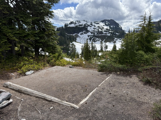
There are a couple designated free hiker campsites at Park Butte Trailhead with limited options for dispersed car camping situated along the road up to it. Backpacking is popular in this area, especially inside the historic 1932 Park Butte Lookout, which is available on a first-come, first-served basis. There are flat tent pads built at Cathedral Camp, High Camp, Railroad Camp, and Mazama Park Horse Camp in the backcountry.
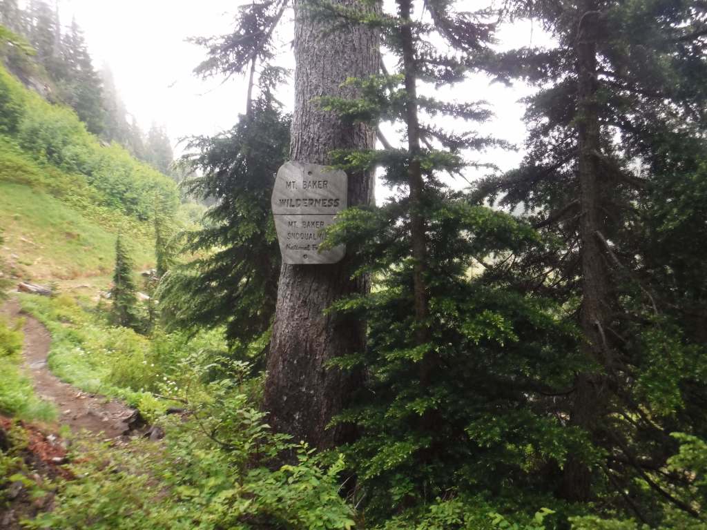
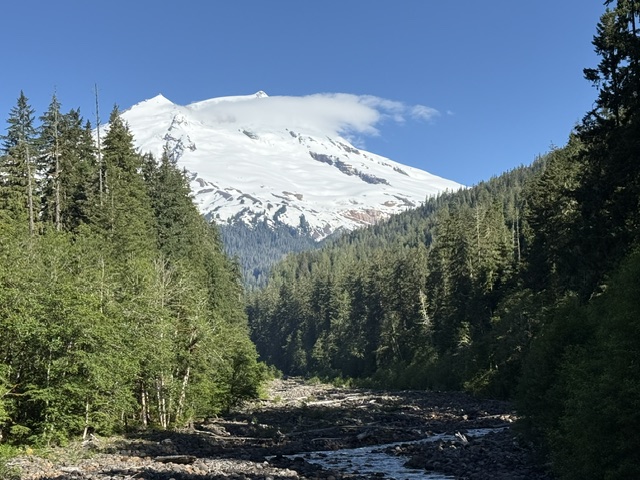
Mt. Baker National Forest’s namesake is the 10,781-foot glacier-covered stratovolcano that dominates the skyline of northwest Washington. It is surrounded by the 119,989-acre Mt. Baker Wilderness and the specially designated 8,473-acre Mt. Baker National Recreation Area that allows snowmobiling on the southern slope. About half of this National Forest is designated Wilderness, which also encompasses another active volcano within 566,057-acre Glacier Peak Wilderness. In 1968, part of Mt. Baker National Forest turned into North Cascades National Park and five years later its remaining acres were administratively merged with Snoqualmie National Forest.
Know someone who loves the National Forests? Gift them our travel guidebook Out in the Woods so they can learn more about all 155 National Forests.
Highlights
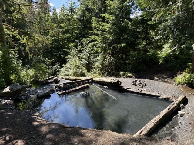
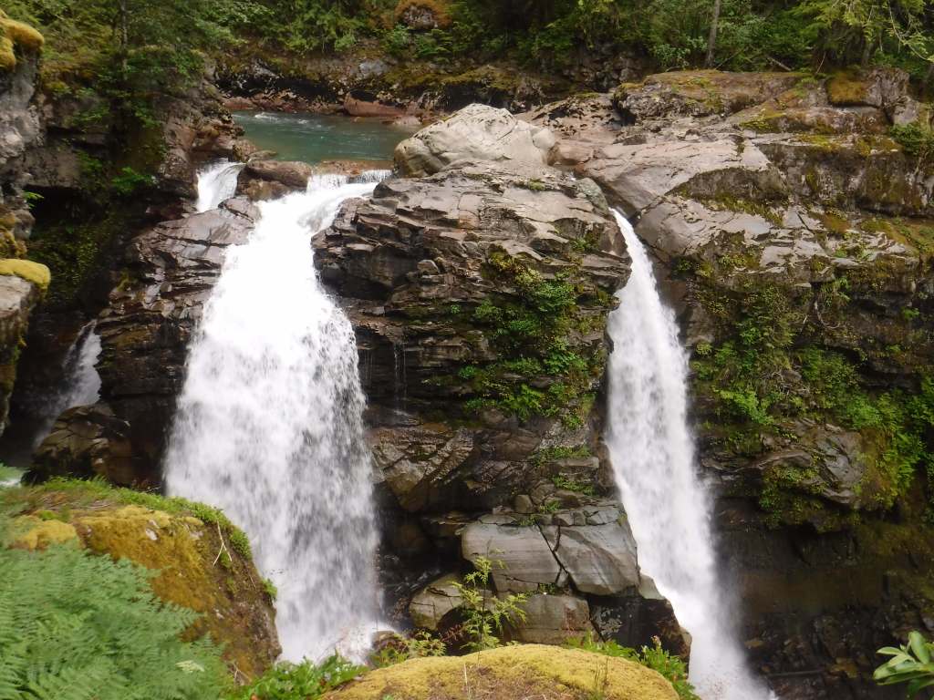
Mt. Baker National Recreation Area, Heather Meadows, Glacier Public Service Center, Nooksack Falls, Mountain Loop Scenic Byway, Baker Hot Springs, Boulder River Trail, Bagley Lakes Trails, Fire and Ice Trail, Baker Lake Trail, Pacific Northwest National Scenic Trail, Shadow of the Sentinels National Recreation Trail
Must-Do Activity
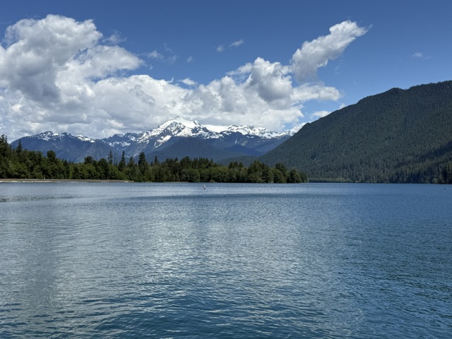
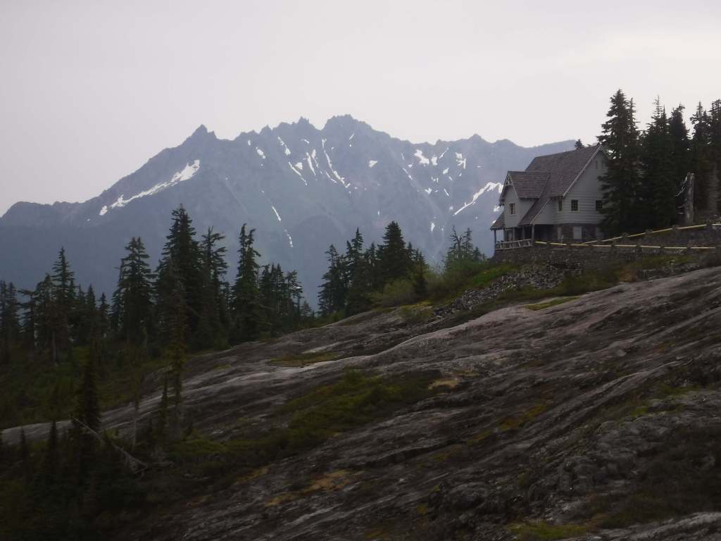
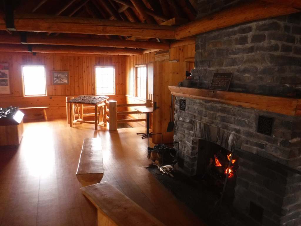
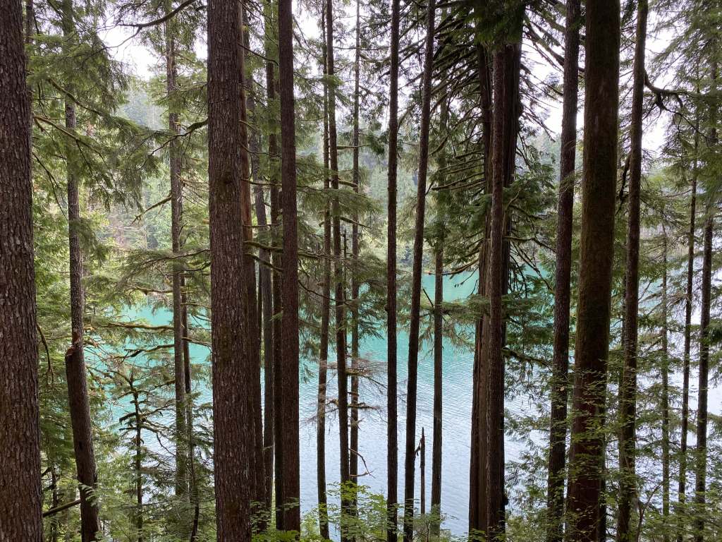
Mt. Baker Scenic Byway (Highway 542) passes Nooksack Falls as it heads east to Artist Point (open after snow melts). Be sure to stop at photogenic Picture Lake and the Heather Meadows Visitor Center, built in the 1930s by the Civilian Conservation Corps (CCC). A recreation pass is at most trailheads around nine-mile-long Baker Lake, a reservoir popular with campers and fishermen. On the lake’s east side, boat-in or hike-in Maple Grove Campground provides amazing views of Mt. Baker on a clear day.
Best Trail
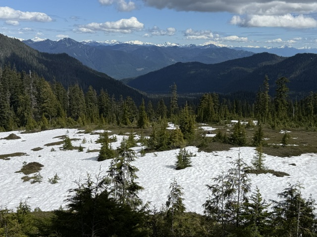
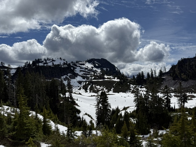
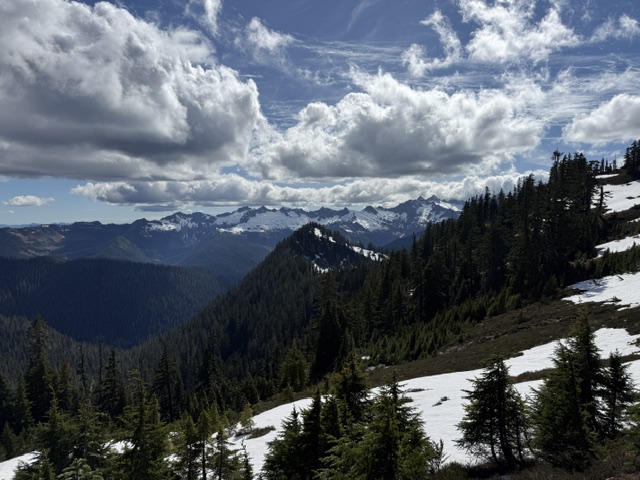
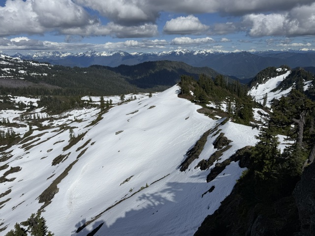
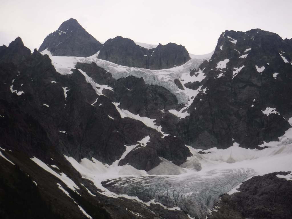
Mt. Baker Scenic Byway accesses several trailheads before dead ending in a huge parking lot at Artist Point, surrounded by snowy mountains. Snow often covers the 4.2-mile one-way trail to Lake Ann well into July. The first two miles share a path with the Pacific Northwest National Scenic Trail, dropping 800 feet to a junction with Swift Creek Trail. From there, a 700-foot climb begins to Lake Ann, a popular destination for backpackers within Mt. Baker Wilderness, which in addition to the normal restrictions prohibits campfires and requires all human waste to be packed out. On clear days, the payoff is unsurpassed views of Mt. Baker and Mt. Shuksan, a 9,131-foot peak in North Cascades National Park reached by continuing up the trail.
Watchable Wildlife
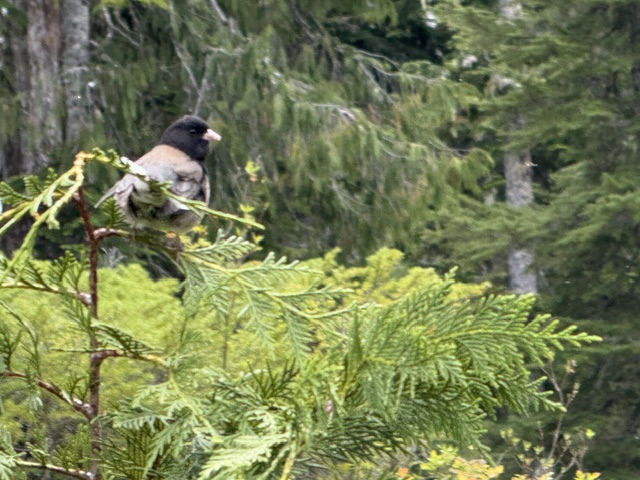
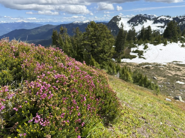
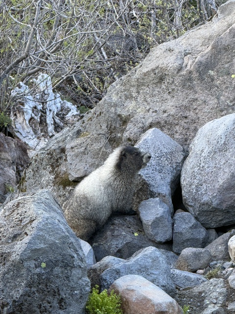
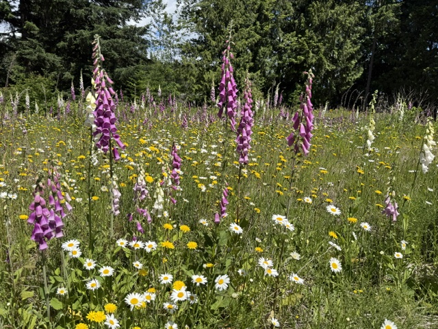
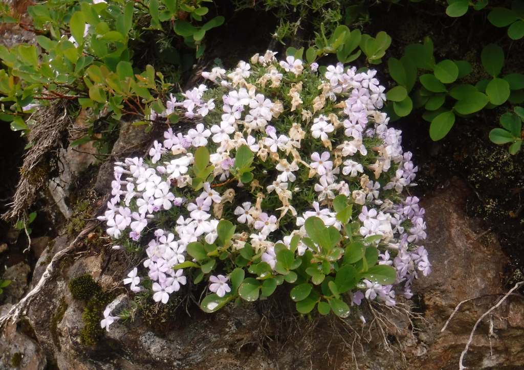
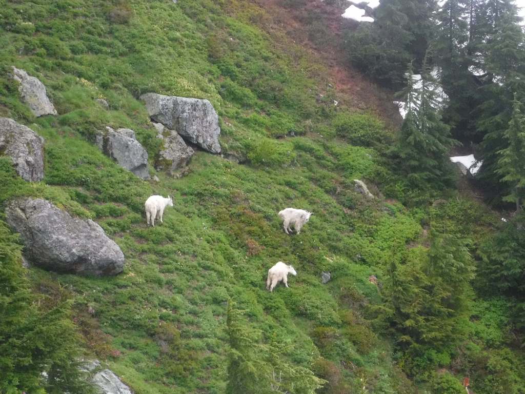
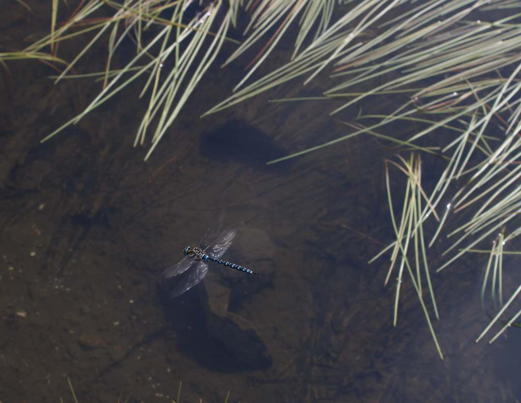
Mountain goats can be seen at high elevations, alongside marmot, pika, and snowshoe hare. Other large mammals include black bears, mountain lions, bobcats, Columbian black-tailed deer, and elk. In 1978, the Skagit Wild and Scenic River System was established along 125 miles of rivers, providing habitat for one of the nation’s largest winter populations of bald eagles. Two types of sea-run trout and five species of salmon are anadromous fish found in the lakes and streams.
Photographic Opportunity
Picture Lake near the Heather Meadows Visitor Center creates wonderful reflections of the surrounding snowy mountains. Plus, it is a good spot for huckleberries in September.
Peak Season
Summer
Fees
$5 Northwest Forest Pass (or America the Beautiful pass) required at the end of Mt. Baker Highway and at trailheads around Baker Lake; Washington State Sno-Park permit is required November 1 through April 30 at some sites
Road Conditions
Mt. Baker Highway (542) received the National Forest Scenic Byway designation in 1988. The 57-mile-long paved route from Interstate 5 is open most of the year between Bellingham and Mt. Baker Ski Area, but it is usually closed beyond that from October well into July because of heavy snowfall.
Camping
There are several campgrounds around Baker Lake, including the boat-in or hike-in Maple Grove Campground. Marble Creek and Mineral Park are two free campgrounds on the Cascade River Road. There are no campgrounds in the Heather Meadows area, but at lower elevations on the Mt. Baker Scenic Byway are Douglas-Fir and Silver Fir Campgrounds.
Wilderness Areas
Alpine Lakes Wilderness (also in Wenatchee National Forest)
Boulder River Wilderness
Clearwater Wilderness
Glacier Peak Wilderness (also in Wenatchee National Forest)
Henry M. Jackson Wilderness (also in Wenatchee National Forest)
Mt. Baker Wilderness
Noisy-Diobsud Wilderness
Norse Peak Wilderness
Pasayten Wilderness (also in Okanogan National Forest)
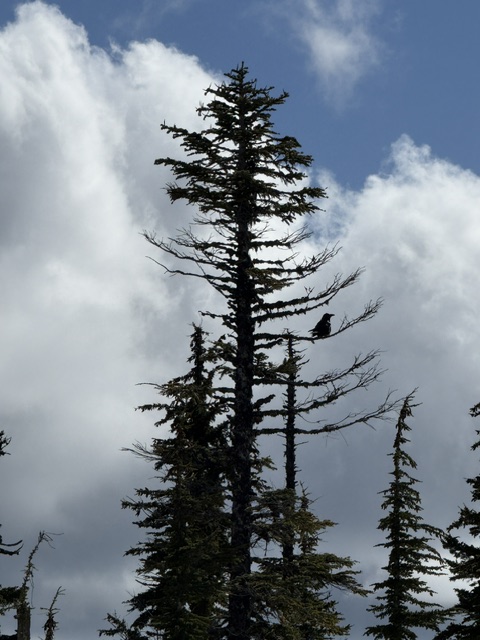
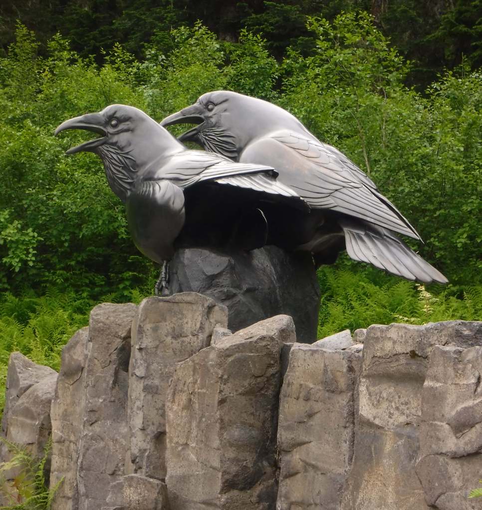
Baker LakeHeather Meadows Visitor CenterMountain goatsPicture LakeBanana slugBaker Lake at Maple Grove CampgroundBaker Hot SpringsNooksack FallsRavens about the forest
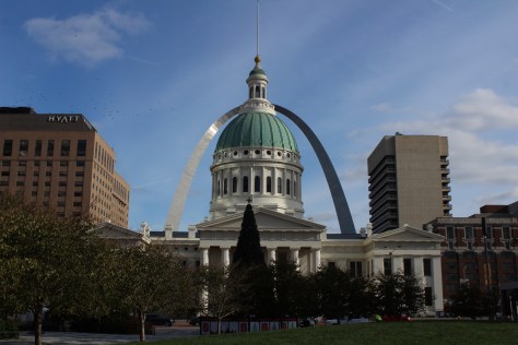
Formerly Jefferson National Expansion Memorial, in 2018, this 193-acre site was named the country’s 60th (and smallest) National Park. It has a new museum and theater, and the claustrophobia-inducing tram cars still take visitors to the top of the arch for excellent views of St. Louis and across the Mississippi River into Illinois. The city is also home to 1,371-acre Forest Park (site of the 1904 World’s Fair), with many attractions like a zoo, art museum, ice skating rink, outdoor musical theater, history museum, and science center.
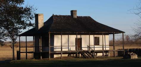
The antebellum plantation of White Haven is where the future General and President raised a family in the 1850s following his initial resignation from the U.S. Army. A thought-provoking museum is housed in the former horse stables, while access inside the house is only on a free ranger-guided tour. It is located next to Grant’s Farm that offers free Budweiser brewery tours and a chance to see the famous Clydesdale horses.
The celebrated author’s hometown of Hannibal on the Mississippi River is a pilgrimage site for a half-million visitors annually. The museum has eight buildings, including the house his father built in 1843. Across the street is the Becky Thatcher House, where Twain’s childhood sweetheart (Laura Hawkins) lived. Held every July, National Tom Sawyer Days features frog-jumping and fence-painting contests.
Named in honor of a U.S. Congressman, these 3,750 acres provide a variety of wetland habitats for migratory birds along the Mississippi River floodplain.
Day 3
Jefferson City
The capitol building is known for its stained glass, murals, carvings, and statuary, as well as being home to the Missouri State Museum. Nearby, Jefferson Landing State Historic Site preserves the Lohman Building and Union Hotel that were restored along the Missouri River.
Spread across nine separate units, this sprawling jurisdiction used to be two National Forests until 1976 when the more northerly Clark National Forest was administratively combined. Between Jefferson City and Columbia, Pine Ridge Recreation Area accesses Cedar Creek Trail, which has multiple trailheads and four loops totaling 36 miles.
Day 4
Kansas City
The city that crosses the western state border has more than 200 fountains, the most of anywhere outside Rome, Italy. Kansas City is best known for its barbecued meats slathered in thick, tangy sauce, a tradition dating back to 1908. The two oldest contenders for best barbecue in K.C. are Arthur Bryant’s Barbecue and Gates and Sons Bar-B-Q, but it is hard to find a bad restaurant due to the stiff competition.
The most photographed spot in the city might be the giant shuttlecock sculptures on the lawn of the free art museum (where there’s also a free mini-golf course). Near Union Station, the National World War I Museum at Liberty Memorial features a 217-foot-tall Art Deco tower with an Egyptian motif.
The visitor center in downtown Independence offers a film and a few artifacts, as well as first-come, first-served tickets for ranger-guided tours of the Truman Home. About a 30-minute drive from Independence, take a self-guided cell phone tour around the ten acres surrounding the 1894 Truman Farm Home, which once stood on a 600-acre farm that is now the suburb of Grandview.
If you make it to Independence, pay to visit this museum located where emigrants once departed to begin their long journeys on the Santa Fe, Oregon, and California National Historic Trails.
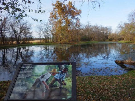
When Carver died in 1943, this site became the first National Park Service unit to honor an African-American. The scientist was born into slavery on this farm but went on to earn a master’s degree in botany from Iowa State University in 1896 and to work at Tuskegee Institute for 47 years where he popularized peanut, sweet potato, and soy agriculture. There is a museum with interactive exhibits and a self-guided one-mile loop trail with interpretive signs.
The original Bass Pro Shops in Springfield has almost 500,000 square-feet dedicated to outdoor recreation, including the Archery Hall of Fame and this impressive aquarium (fee).
Missouri stayed in the Union throughout the Civil War despite the $10-million in property damage caused by guerrilla fighters, making it the third most fought-over state. Start your visit by watching a short film, then peruse the excellent museum before taking the five-mile driving route that provides an overview of the battle at eight interpretive stops.
Day 6
Branson
The entertainment capital of the central U.S. has a main strip lit up like Las Vegas without the casinos. The main draw is the variety of live music and magic shows offered every day of the week in 37 theaters, but do not miss the historic downtown with the iconic Dick’s 5 & 10 Cent Store on Main Street. There are also mini-golf courses, a wax museum (topped by King Kong), an amusement park, a Ripley’s Believe It or Not! Odditorium, and a building shaped like the bow of the Titanic hitting a giant iceberg.
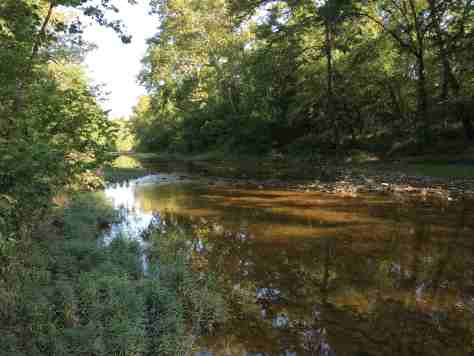
Spread throughout the Ozark Mountains, 1.5-million-acre Mark Twain National Forest is full of caves, sinkholes, springs, and streams. Greer Spring is the second largest in Missouri, with a daily flow of 222-million gallons as it drains 1.2 miles into the Eleven Point National Scenic River. Several long trails explore the National Forest’s seven designated Wilderness areas, including sections of the 350-mile Ozark Trail. Mark Twain National Forest also has three designated Scenic Byways: Blue Buck Knob, Sugar Camp, and Glade Top Trail.
Optional stop at the “Tri-Lakes”
The reservoirs of Table Rock, Taneycomo, and Bull Shoals offer opportunities for boating, fishing, and water sports. The U.S. Army Corps of Engineers runs a museum at 252-foot-tall Table Rock Dam on the White River.
The Jacks Fork and Current Rivers flow freely within Ozark National Scenic Riverways. The best way to explore the serpentine park boundaries is on the water, but roads access several swimming holes and the bright red Alley Mill. The dolomite and limestone karst underneath this park is riddled with caves and sinkholes, like Devils Well, Round Spring Cave (offering ranger-guided tours for a fee), and Jam Up Cave (only accessible from the Jacks Fork River).
After suffering catastrophic damage from a 2005 dam breach, this park has been redeveloped and still has the chutes and waterfalls that provided its name. Its campground is considered one of the nation’s best for RVs on public land.
Established in 2020 to protect the French colonial-era houses of Missouri’s first permanent settlement where residents still go all out to celebrate Bastille Day. The oldest standing structure is the Bolduc House that dates back to 1792, while the Old Brick House from 1804 is now a restaurant.
This geologic wonderland features a natural bridge, caves, sinkholes, limestone bluffs, and a large natural spring, but may be best known for the burned-out ruins of a mansion.
The M-K-T (Missouri-Kansas-Texas) Railroad has been converted into the 240-mile-long Katy Trail, running across the state from north of St. Louis to Clinton (75 miles southeast of Kansas City). Camping along the trail is an option, but it passes through many towns with hotels.
Accessed from the same trailhead as the state’s high point, Mina Sauk Falls is a 132-foot cascade accessed via a three-mile out-and-back hike that gains 430 feet in elevation. Missouri’s tallest waterfall typically flows best during the spring season; otherwise, it is reduced to a trickle.
The park’s billion-year-old granite rocks are broken into vertical cracks and eroded into huge “elephants” like 680-ton Dumbo (27 feet tall and 35 feet long). The park even has a one-mile paved path designed specifically for the visually impaired with signs in Braille.
In northwest Missouri, winter is the time to visit to see nearly one-million snow geese, plus trumpeter swans, bald eagles, and a variety of shorebirds and waterfowl.
Currently, I am working on finishing American History 101, a guidebook that tells the story of America by detailing 101 National Park Service sites across all 50 states. I recently climbed Mt. Hood with my cousin and hiked to the top of Boundary Peak in Nevada, my 39th state high point. In August, I have permits to summit Mt. Whitney in Sequoia National Park and continue north to complete the 214-mile John Muir Trail through California’s Sierra Nevada to Yosemite National Park. Over the next 100 blog posts, I plan to start writing about National Wildlife Refuges, which I have been visiting across the country over the years (including one in all 50 states).
I appreciate your time as readers and plan to continue producing quality blog posts and guidebooks to America’s public lands for you all in the coming years.