Tag Archives: road trip

Missouri Road Trip Itinerary

43,994,573 acres

Statehood 1821 (24th)

Capital: Jefferson City

Population: 6,154,913 (18th)

High Point: Taum Sauk Mountain (1,772 feet)

Best time of year: Spring and fall

After publishing the guidebook 50 States of Great: Road Trip Guide to America, I have been creating blog posts with a travel itinerary for every state.  After starting with KansasGeorgiaIdaho, Rhode Island, MinnesotaHawai‘iArizonaLouisianaSouth DakotaIndiana, Montana, Mississippi, and Wyoming, I decided to do a central state that borders the most other states (eight).  I made an ambitious seven-day plan starting in St. Louis, with plenty of options to extend the trip.

Day 1

Gateway Arch National Park (click here for our blog post)

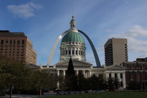
Formerly Jefferson National Expansion Memorial, in 2018, this 193-acre site was named the country’s 60th (and smallest) National Park.  It has a new museum and theater, and the claustrophobia-inducing tram cars still take visitors to the top of the arch for excellent views of St. Louis and across the Mississippi River into Illinois.  The city is also home to 1,371-acre Forest Park (site of the 1904 World’s Fair), with many attractions like a zoo, art museum, ice skating rink, outdoor musical theater, history museum, and science center.

Optional stop at Ulysses S. Grant National Historic Site (click here for our blog post)

The antebellum plantation of White Haven is where the future General and President raised a family in the 1850s following his initial resignation from the U.S. Army.  A thought-provoking museum is housed in the former horse stables, while access inside the house is only on a free ranger-guided tour.  It is located next to Grant’s Farm that offers free Budweiser brewery tours and a chance to see the famous Clydesdale horses.

Day 2

Mark Twain Boyhood Home and Museum

The celebrated author’s hometown of Hannibal on the Mississippi River is a pilgrimage site for a half-million visitors annually.  The museum has eight buildings, including the house his father built in 1843.  Across the street is the Becky Thatcher House, where Twain’s childhood sweetheart (Laura Hawkins) lived.  Held every July, National Tom Sawyer Days features frog-jumping and fence-painting contests. 

Optional stop at Clarence Cannon National Wildlife Refuge

Named in honor of a U.S. Congressman, these 3,750 acres provide a variety of wetland habitats for migratory birds along the Mississippi River floodplain.

Day 3

Jefferson City

The capitol building is known for its stained glass, murals, carvings, and statuary, as well as being home to the Missouri State Museum.  Nearby, Jefferson Landing State Historic Site preserves the Lohman Building and Union Hotel that were restored along the Missouri River. 

Optional stop at Mark Twain National Forest (click here for our blog post)

Spread across nine separate units, this sprawling jurisdiction used to be two National Forests until 1976 when the more northerly Clark National Forest was administratively combined.  Between Jefferson City and Columbia, Pine Ridge Recreation Area accesses Cedar Creek Trail, which has multiple trailheads and four loops totaling 36 miles.

Day 4

Kansas City

The city that crosses the western state border has more than 200 fountains, the most of anywhere outside Rome, Italy.  Kansas City is best known for its barbecued meats slathered in thick, tangy sauce, a tradition dating back to 1908.  The two oldest contenders for best barbecue in K.C. are Arthur Bryant’s Barbecue and Gates and Sons Bar-B-Q, but it is hard to find a bad restaurant due to the stiff competition. 

Nelson-Atkins Museum of Art

The most photographed spot in the city might be the giant shuttlecock sculptures on the lawn of the free art museum (where there’s also a free mini-golf course). Near Union Station, the National World War I Museum at Liberty Memorial features a 217-foot-tall Art Deco tower with an Egyptian motif.

Harry S Truman National Historic Site (click here for our blog post)

The visitor center in downtown Independence offers a film and a few artifacts, as well as first-come, first-served tickets for ranger-guided tours of the Truman Home.  About a 30-minute drive from Independence, take a self-guided cell phone tour around the ten acres surrounding the 1894 Truman Farm Home, which once stood on a 600-acre farm that is now the suburb of Grandview.

Optional stop at National Frontier Trails Museum

If you make it to Independence, pay to visit this museum located where emigrants once departed to begin their long journeys on the Santa Fe, Oregon, and California National Historic Trails. 

Day 5

George Washington Carver National Monument (click here for our blog post)

When Carver died in 1943, this site became the first National Park Service unit to honor an African-American.  The scientist was born into slavery on this farm but went on to earn a master’s degree in botany from Iowa State University in 1896 and to work at Tuskegee Institute for 47 years where he popularized peanut, sweet potato, and soy agriculture.  There is a museum with interactive exhibits and a self-guided one-mile loop trail with interpretive signs. 

Wonders of Wildlife National Museum & Aquarium

The original Bass Pro Shops in Springfield has almost 500,000 square-feet dedicated to outdoor recreation, including the Archery Hall of Fame and this impressive aquarium (fee). 

Optional stop at Wilson’s Creek National Battlefield (click here for our blog post)

Missouri stayed in the Union throughout the Civil War despite the $10-million in property damage caused by guerrilla fighters, making it the third most fought-over state.  Start your visit by watching a short film, then peruse the excellent museum before taking the five-mile driving route that provides an overview of the battle at eight interpretive stops.

Day 6

Branson

The entertainment capital of the central U.S. has a main strip lit up like Las Vegas without the casinos.  The main draw is the variety of live music and magic shows offered every day of the week in 37 theaters, but do not miss the historic downtown with the iconic Dick’s 5 & 10 Cent Store on Main Street.  There are also mini-golf courses, a wax museum (topped by King Kong), an amusement park, a Ripley’s Believe It or Not! Odditorium, and a building shaped like the bow of the Titanic hitting a giant iceberg. 

Mark Twain National Forest (click here for our blog post)

Spread throughout the Ozark Mountains, 1.5-million-acre Mark Twain National Forest is full of caves, sinkholes, springs, and streams.  Greer Spring is the second largest in Missouri, with a daily flow of 222-million gallons as it drains 1.2 miles into the Eleven Point National Scenic River.  Several long trails explore the National Forest’s seven designated Wilderness areas, including sections of the 350-mile Ozark Trail.  Mark Twain National Forest also has three designated Scenic Byways: Blue Buck Knob, Sugar Camp, and Glade Top Trail.

Optional stop at the “Tri-Lakes”

The reservoirs of Table Rock, Taneycomo, and Bull Shoals offer opportunities for boating, fishing, and water sports.  The U.S. Army Corps of Engineers runs a museum at 252-foot-tall Table Rock Dam on the White River.

Day 7

Ozark National Scenic Riverways (click here for our blog post)

The Jacks Fork and Current Rivers flow freely within Ozark National Scenic Riverways.  The best way to explore the serpentine park boundaries is on the water, but roads access several swimming holes and the bright red Alley Mill.  The dolomite and limestone karst underneath this park is riddled with caves and sinkholes, like Devils Well, Round Spring Cave (offering ranger-guided tours for a fee), and Jam Up Cave (only accessible from the Jacks Fork River). 

Optional stop at Johnson’s Shut-Ins State Park

After suffering catastrophic damage from a 2005 dam breach, this park has been redeveloped and still has the chutes and waterfalls that provided its name.  Its campground is considered one of the nation’s best for RVs on public land.

Day 8+

Ste. Genevieve National Historical Park (click here for our blog post)

Established in 2020 to protect the French colonial-era houses of Missouri’s first permanent settlement where residents still go all out to celebrate Bastille Day.  The oldest standing structure is the Bolduc House that dates back to 1792, while the Old Brick House from 1804 is now a restaurant.

Ha Ha Tonka State Park

This geologic wonderland features a natural bridge, caves, sinkholes, limestone bluffs, and a large natural spring, but may be best known for the burned-out ruins of a mansion.

Katy Trail

The M-K-T (Missouri-Kansas-Texas) Railroad has been converted into the 240-mile-long Katy Trail, running across the state from north of St. Louis to Clinton (75 miles southeast of Kansas City).  Camping along the trail is an option, but it passes through many towns with hotels. 

Taum Sauk Mountain State Park

Accessed from the same trailhead as the state’s high point, Mina Sauk Falls is a 132-foot cascade accessed via a three-mile out-and-back hike that gains 430 feet in elevation.  Missouri’s tallest waterfall typically flows best during the spring season; otherwise, it is reduced to a trickle. 

Elephant Rocks State Park

The park’s billion-year-old granite rocks are broken into vertical cracks and eroded into huge “elephants” like 680-ton Dumbo (27 feet tall and 35 feet long).  The park even has a one-mile paved path designed specifically for the visually impaired with signs in Braille. 

Loess Bluffs National Wildlife Refuge

In northwest Missouri, winter is the time to visit to see nearly one-million snow geese, plus trumpeter swans, bald eagles, and a variety of shorebirds and waterfowl.

Learn more about Missouri’s Most Scenic Drive, Wonderful Waterfall, Top State Park, and other categories in our new travel guidebook  50 States of Great: Road Trip Guide to America.

Wyoming Road Trip Itinerary

62,139,610 acres

Statehood 1890 (44th)

Capital: Cheyenne

Population: 576,851 (50th)

High Point: Gannett Peak (13,804 feet)

Best time of year: Summer, especially July

After publishing the guidebook 50 States of Great: Road Trip Guide to America, I have been creating blog posts with a travel itinerary for every state.  After starting with KansasGeorgiaIdaho, Rhode Island, MinnesotaHawai‘iArizonaLouisianaSouth DakotaIndiana, Montana, and Mississippi, I decided to cover Wyoming where I lived for nearly 13 years (longer than any other state).  I made an ambitious seven-day plan starting in the capital, with plenty of options to extend the trip.  It would be easy to spend a week in Yellowstone National Park alone, so make a longer visit or plan a return trip in the future.

Day 1

Cheyenne

Held the last full week of July, Cheyenne Frontier Days Rodeo is considered “The Daddy of ’em All” and has been held annually since 1897 in the state’s capital city.  It is easy to spend several days exploring local museums and attending the free air show put on by the U.S. Air Force Thunderbirds, four Western Heritage Parades, performances at Indian Village, and three free pancake breakfasts.  Daily gunfights are put on throughout the summer by the Cheyenne Gunslingers near the Railroad Depot Museum. 

Medicine Bow National Forest (click here for our blog post)

If you need a break from the rodeo and concert crowds, head 40 minutes west on Interstate 80 to hike at rocky Vedauwoo Recreation Area.  The National Forest also contains its namesake 12,013-foot mountain on the Colorado border.  The Snowy Range Scenic Byway cuts across this rugged landscape and is a great place for outdoor recreation.  If you pass through Saratoga on the west side of the peaks, soak at the free Hobo Pool, the town’s developed hot springs (with indoor showers).

Optional stop at Fort Laramie National Historic Site (click here for our blog post)

Originally founded in 1834 for its strategic location at the confluence of two rivers, the fort was purchased by the U.S. military in 1849.  In the summer, stop into the bar for a cold sarsaparilla or attend July 4th festivities. West of the fort, at Register Cliff and Oregon Trail Ruts State Historic Site pioneers left their marks along the North Platte River.

Optional stop at Quebec-01 Missile Alert Facility State Historic Site

The newest State Park in Wyoming preserves a nuclear missile command center manned nonstop for decades by the U.S. Air Force.  Underground tours are offered for a small fee.

Day 2

National Trails Interpretive Center

In Casper, this free museum is run by the Bureau of Land Management on a hill above where the Pony Express, Mormon Pioneer, Oregon, and California National Historic Trails all ran along the North Platte River in the 1800s.  Fort Caspar Museum also celebrates its trail town history.

Optional stop at Thunder Basin National Grassland (click here for our blog post)

Mostly undeveloped for tourists, Weston Recreation Area is located 30 miles north of Gillette off Highway 59 with at least 15 miles of Off-Highway Vehicle (OHV) trails.  Fishing for warm water species like smallmouth bass and bluegill is possible at several reservoirs.  On moonless nights, the stars in this part of the state are epic.

Optional stop at Devils Tower National Monument (click here for our blog post)

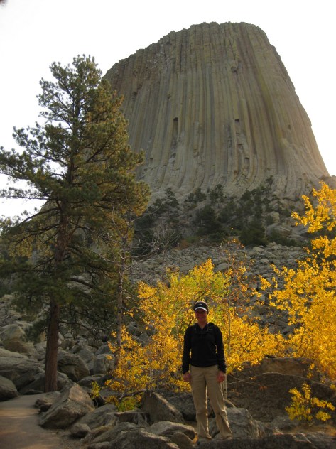
Devils Tower was named the nation’s first National Monument by President Teddy Roosevelt in 1906.  If you look closely, the vertical columns of the 867-foot-tall volcanic formation may hold a few rock climbers dwarfed by the scale.  It is often easier to reach this northeast corner of Wyoming while visiting the Black Hills of South Dakota.

Day 3

Bighorn National Forest (click here for our blog post)

The Bighorn Mountains are crossed by three scenic byways: Cloud Peak Skyway, Bighorn Scenic Byway, and Medicine Wheel Passage.  Located right off Bighorn Scenic Byway (Highway 14) is 120-foot-tall Shell Falls, while accessing the short trail to 600-foot Bucking Mule Falls involves driving about ten miles of dirt roads.

Optional stop at Sheridan

Sheridan sits at the base of the Bighorn Mountains, where Trail End State Historic Site, Fort Phil Kearny State Historic Site, and several museums celebrate its frontier history.

Optional stop at Bighorn Canyon National Recreation Area (click here for our blog post)

Devil Canyon Overlook and most of the 27 miles of hiking trails are in the Wyoming section of the park along with Pryor Mountain Wild Horse Range, Hillsboro Dude Ranch, and several tipi rings found along Bad Pass Trail, a route which has seen over 10,000 years of human use.

Day 4

Shoshone National Forest

Considered the first protected forest in American history dating to 1891, this National Forest encompasses incredible scenery, more than 1,300 miles of hiking trails, and tallest mountain in Wyoming.

Cody

Cody is the gateway to Yellowstone National Park’s eastern entrance and holds a nightly rodeo during the summer.  It is also home to an excellent and eclectic museum called the Buffalo Bill Center of the West.

Optional route on Beartooth Highway

U.S. Route 212 is an All-American Road that crosses a high-elevation plateau on the Montana border before entering the northeast corner of Yellowstone National Park.  Chief Joseph Scenic Byway (Highway 296) connects Cody with the Beartooth Highway.

Day 5

Yellowstone National Park (click here for our blog post)

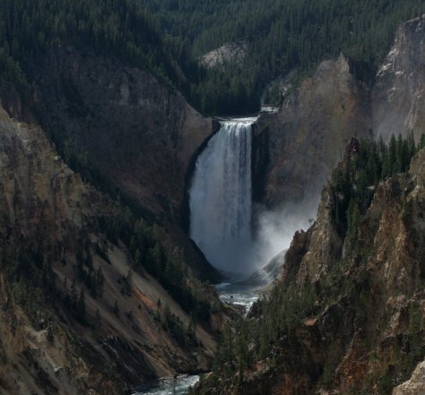
The world’s first National Park was created in 1872 and surrounds the giant 45-mile-wide caldera of a supervolcano.  This geologic wonderland contains more than 50% of the world’s geysers and is a haven for wildlife that is best seen in the Hayden and Lamar Valleys.  The park has countless waterfalls, including the 308-foot-tall Lower Falls that can be viewed from famous overlooks like Artist Point and Inspiration Point, or you can hike the steep, paved trail 600 feet down to the Brink of Lower Falls for unforgettable views of the canyon, especially on sunny days when a rainbow appears in its spray. 

Optional stop at Gallatin National Forest (click here for our blog post)

It can be hard to get a reservation to stay inside the park overnight, so many visitors cross the border into Montana to the towns of Gardiner or West Yellowstone.  Campgrounds, dispersed camping, and backpacking are also options in Montana’s Gallatin National Forest.

Day 6

Yellowstone National Park (click here for our blog post)

Wherever you spend the night, make sure to visit Lower Geyser Basin the next day.  This is where Old Faithful can shoot water up to 185 feet in the air.  Since the occurrence of several earthquakes, it is no longer as consistent as its name suggests, but its eruptions can be accurately predicted every 60 to 110 minutes throughout the day.  Nearby, Grand Prismatic Spring in Midway Geyser Basin is definitely worth a stop, especially from an overlook along Fairy Falls Trail.

Grand Teton National Park (click here for our blog post)

Jenny Lake sparkles below 12,325-foot Teewinot Peak and is the trailhead for popular Cascade Canyon Trail (you can take the shortcut aboard a shuttle boat for a fee).  There are plenty of activities other than hiking, which include wildlife watching, boating, horseback riding, mountain climbing, whitewater rafting, or cross-country skiing in the winter.

Jackson

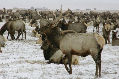
Crowded in the summer, Jackson is famous for its four arches in its town square that are built from shed elk antlers found in the National Elk Refuge.  Horse drawn carriage rides into the middle of the wintering elk herds are a popular winter attraction in the refuge.  Right in town in the summer, Bar T 5 offers wagon rides and chuckwagon dinners with live entertainment.

Optional stop at John D. Rockefeller Jr. Memorial Parkway (click here for our blog post)

This is the road connecting Yellowstone and Grand Teton National Parks, so visiting here is not really optional, but stopping to hike to Polecat Hot Springs for a soak is worth the time.

Day 7

Teton National Forest

South of Jackson, you can drive to pretty Granite Falls, a 50-foot-tall and 100-foot-wide cascade that was featured in the film A River Runs Through It (plus the falls has a hot springs across the river at its base).  There are many hiking and camping options available throughout Teton National Forest.

Optional stop at Fossil Butte National Monument (click here for our blog post)

The visitor center displays fossil fish, turtles, and other species, and on the deck outside there is an awesome timeline that traces CO2 levels and life on Earth throughout geologic time.  Take the steep steps up the Historic Quarry Trail to find fish fossils still in the rocks.  Several companies on private property in the area allow visitors to pay to quarry their own fish fossils to keep.

Day 8+

Bridger National Forest (click here for our blog post)

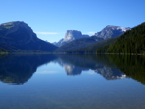
From Pinedale, a 50-mile (partially paved) drive leads to the campground at Green River Lakes, which opens up into a beautiful valley that frames photogenic Squaretop Mountain.  Starting from the lakeside campground, the Highline Trail is a 72-mile trek that traverses the Wind River Range, my favorite mountain range in the world.

South Pass City

South Pass City State Historic Site is a well-preserved ghost town with 30 structures where kids will appreciate the irony that the Sweetwater County Jail later served as a classroom.  The Continental Divide National Scenic Trail passes through the middle of the ghost town.  Lantern-guided tours inside the nearby Carissa Gold Mine and Mill are available by reservation. 

Wyoming Dinosaur Center

Some of the best dinosaur fossils in the world were found in Wyoming, and the little town of Thermopolis (home to the world’s largest mineral hot springs) has an excellent museum, plus visitors can schedule a trip to work alongside paleontologists at an active dig site in the summer.

Seedskadee National Wildlife Refuge

Along 36 miles of the Green River (Seedskadee means “river of the prairie hen”), 220 types of birds have been identified, and other species seen include pronghorn, mule deer, and moose.

Flaming Gorge National Recreation Area (click here for our blog post)

Flaming Gorge Reservoir on the Green River straddles the Wyoming-Utah border in the northern portion of Ashley National Forest offering 360 miles of shoreline, five full-service marinas, whitewater rafting, and numerous boat launches and campgrounds.

Killpecker Dunes

North of Rock Springs is North America’s largest active dune field in a remote area called the Red Desert, home to the nation’s only herd of desert-dwelling elk.  The Bureau of Land Management allows dispersed camping throughout the region, including near the dramatic Boars Tusk rock formation and further south around the badlands of Adobe Town.

Learn more about Wyoming’s Most Scenic Drive, Wonderful Waterfall, Top State Park, and other categories in our travel guidebook 50 States of Great: Road Trip Guide to America..

South Dakota Road Trip Itinerary

48,519,040 acres

Statehood 1889 (40th)

Capital: Pierre

Population:  886,667 (46th)

High Point: Black Elk Peak (7,242 feet)

Best time of year: Summer

Last year we published our guidebook 50 States of Great: Road Trip Guide to America, so we decided to start a new type of blog post where we create a travel itinerary for all 50 states, in addition to our usual National Forest and National Park entries.  After starting by jumping around to KansasGeorgia, Idaho, Rhode Island, Minnesota, Hawai’i, Arizona, and Louisiana, we chose one of our favorite states to visit.  Just in time for summer (and the Custer State Park chip flip), we made an ambitious seven-day plan starting in the east near Sioux Falls and following Interstate 90 west, with plenty of options to extend the trip. See for yourself why South Dakota made it on our Top 10 States for State Parks and Top 10 States for National Park Service Sites list.

Day 1

Palisades State Park

Start your trip near Sioux Falls, where pink formations of quartzite rock rise above muddy Split Rock Creek below.  It is a great spot for a picnic, and you might get to watch rock climbers across the creek repelling down the steep cliffs. 

Optional stop at Falls Park

Not only is Sioux Falls the largest city in the state, it is also home to Falls Park where the Big Sioux River tumbles down 100 feet of rosy quartzite in a series of photogenic cascades. 

Day 2

Corn Palace

Not far off Interstate 90 in Mitchell is a great wonder of human creativity dating back to 1892.  Each year a new theme is chosen by artists who design images to decorate the outside of the building completely with organic materials.  By the end of the summer, the face of this unique building is covered with 275,000 ears of corn in a variety of colors.  Be sure to go inside the building to see pictures of past palaces, turn a millstone to grind our own cornmeal, and learn fun facts. 

Dignity sculpture

Also on Interstate 90, there is a new 50-foot sculpture of a Native American woman wearing a traditional star quilt entitled Dignity of Earth and Sky.

State Capitol Building

Visit inside the capitol to learn why the tiny town of Pierre (pronounced “peer”) was chosen as the state’s capital city in 1889 and how the building was constructed starting in 1905.

Optional stop at Fort Pierre National Grassland (click here for our complete blog post)

Look online for the publication South Dakota Fishing Guide to the National Grasslands, which provides information on 41 fishing ponds in the National Grassland.  Originally built in 1934, Richland Dam was renovated in 2014 and now features handicapped-accessible fishing and a concrete boat ramp.  Fishing ponds are generally open December 1 to August 31 to avoid overlap with hunting season.

Day 3

Badlands National Park (click here for our complete blog post)

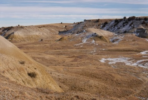
Beyond the geologic formations and hiking trails, this is a good place to camp at the developed Cedar Pass Campground, free Sage Creek Primitive Campground (which can be crowded in the summer), or backpacking out with the bison.  Bighorn sheep are also common, and porcupines, surprising for as treeless as it is.  Prairie dog towns make for an endless variety of entertainment and provide habitat for burrowing owls, prairie rattlesnakes, and endangered black-footed ferrets that have been reintroduced throughout South Dakota. 

Optional stop at Minuteman Missile National Historic Site (click here for our complete blog post)

Outside Badlands National Park on Interstate 90, a small museum and ranger-guided tours of the Delta-01 launch control facility.  Tours have very limited space and a nominal fee, but are no longer solely first-come-first served thanks to an online reservation system. 

Day 4

Wall Drug

Perhaps the greatest roadside attraction in the entire world, famous since 1936 for its “Free Ice Water” road signs.  Today Interstate 90 is inundated with Wall Drug billboards for miles in each direction.  Ice water is still free and the café still offers a cup of coffee for only five cents, as well as the best soft-serve ice cream we have ever tasted.  In the Wall Drug Backyard, you can even ride atop a ten-foot-tall jackalope; and do not leave without a free bumper sticker.

Optional stop at the National Grasslands Visitor Center

This serves as the main interpretive site for all 20 National Grasslands (plus Midewin National Tallgrass Prairie).  The exhibit hall is still under reconstruction following a flood that forced a relocation into a temporary trailer for years, but the theater is reopened showing a short film. 

Optional stop at the South Dakota Air & Space Museum

Admission is free to this museum (currently closed for construction) seven miles east of Rapid City on Interstate 90.  It sits next to Ellsworth Air Force Base, but you do not have to pass through military security to enter.  An impressive B-1B Lancer sits out front alongside other historic aircraft, with many more located inside the hangars.

Day 6

Mount Rushmore National Memorial (click here for our complete blog post)

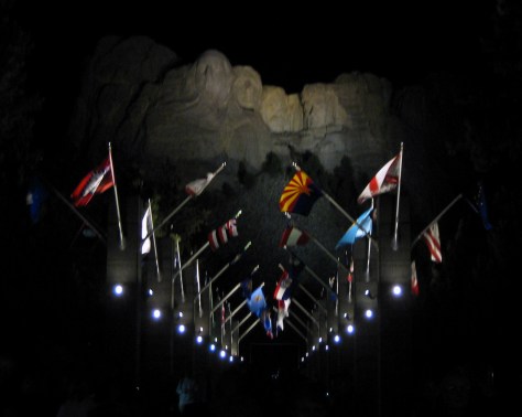
This icon of South Dakota is inspiring to see during the day, but for the full patriotic effect do not miss the night lighting ceremony offered May to September. 

Needles Highway

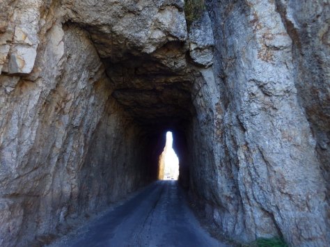
The 14-mile-long Needles Highway was completed in 1922 and is known for its narrow, one-lane tunnels that run straight through mountainsides and the natural arch aptly named the Needle’s Eye (Custer State Park admission required).  Trails leave from along its length to access the Cathedral Spires, Black Elk Peak, Sylvan Lake, and Little Devil’s Tower.  To the northeast, the Highway 16A section of the Peter Norbeck Scenic Highway utilizes more one-lane tunnels and fascinating corkscrew turns called “pigtail bridges” to connect Custer State Park with Mount Rushmore National Memorial (no admission fee required when simply driving through).

Optional stop at Crazy Horse Memorial

Under construction since 1948, this privately-funded monument continues to be carved and blasted to this day.  In addition to the 563-foot-tall memorial to the legendary fighter and leader of the Oglala Lakota, the site also has the Indian Museum of North America full of outstanding artwork and artifacts.  Special tours can be booked up to the 87-foot-tall head of Crazy Horse, plus, a laser-light show runs nightly in the summer.  There is a pretty good view from the highway if you do not want to pay the admission fee.

Day 5

Custer State Park

World famous for its Buffalo Roundup every September, this park has so much more than bison (see Needles Highway above).  Visitors can see bighorn sheep, mountain goats, pronghorn, elk, mule deer, white-tailed deer, coyotes, turkeys, golden eagles, and you might even get nose-to-nose with one of the feral burros that roam free and love handouts. You may find yourself stuck waiting out a “bison jam” as the large ungulates cross a road. 

Wind Cave National Park (click here for our complete blog post)

The interior of Wind Cave is a constant 53°F, so bring a jacket if you sign up for the Natural Entrance Tour, which involves entering a vapor lock revolving door and descending stairs.  On the Candlelight Tour you carry lightweight metal candle-lanterns, just like 19th-century tourists.  It is only offered in the summer and explores an unlit section of the cave.  There are several good trails that traverse the prairie and canyons and we enjoy backpacking (free permit required) on Highland Creek Trail where we always see bison.

Optional stop at Black Hills National Forest (click here for our complete blog post)

Surrounding Custer State Park and Mount Rushmore and spilling into the state of Wyoming, it is home to a fun hike to the state’s high point at 7,242-foot tall Black Elk (formerly Harney) Peak rising in the center of the beautiful Black Elk Wilderness.  We also recommend Old Baldy Trail and Buzzards Roost Trail.

Day 7

Jewel Cave National Monument (click here for our complete blog post)

Currently, Jewel Cave ranks third worldwide with over 160 miles in mapped passages, and based on air flow estimates the cave is less than 10% mapped.  The namesake jewels are actually boxy calcite formations, which crystalized out of water in a manner similar to the way a bathtub ring forms.  The Wild Caving Tour and Lantern Tour are our favorite ranger-guided tour options.

Optional stop at Buffalo Gap National Grassland (click here for our complete blog post)

The only developed site of this sprawling area is located at French Creek Agate Beds, where there is a campground and rockhounding is legal for Fairburn agate (the official State Gem of South Dakota), rose quartz, and banded jasper.

Day 8+

George S. Mickelson Trail

This flat trail runs 109 miles from Deadwood to Edgemont along the former Burlington Northern rail line, but you can choose to hike as far as you like (day-use fee).  Like many rails-to-trails projects, this route is wide enough to accommodate bikes and includes many bridges and tunnels, like those near the Mystic Trailhead.

Spearfish Canyon Nature Area

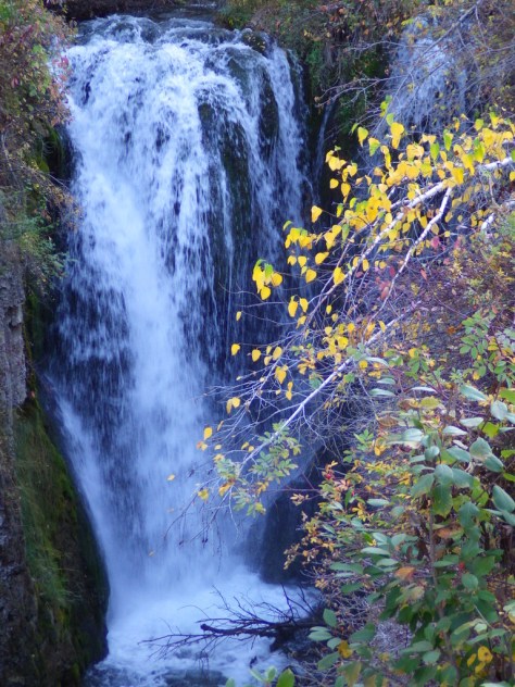
A scenic byway follows Highway 14A south of Interstate 90 past roadside Bridal Veil Falls and Spearfish Falls.  The limestone cliffs of the canyon are sprinkled with ponderosa pine trees and the creek is lined by deciduous trees that add to the beauty when changing colors in late-September (around Buffalo Roundup weekend).  It is free to park at 30-foot-tall Roughlock Falls (pictured below), but this small park can get congested. 

Geographic Center of the Nation

Belle Fourche is home to a 21-foot-wide monument with a visitor center and museum at the site designated by the National Geodetic Survey as the center of the 50 states after Alaska and Hawai‘i were added in 1959.

Petrified Wood Park in Lemmon

A free park filled with locally gathered petrified wood and other geological specimens. The “world’s largest collection” also has a free museum constructed out of petrified wood that is open from Memorial Day to Labor Day.

Missouri National Recreational River (click here for our complete blog post)

In southeast South Dakota, the river’s lower segment runs 59 miles from the Gavins Point Dam to Ponca State Park, plus a 39-mile stretch was added from the Fort Randall Dam to Niobrara State Park, and includes 20 miles of the Lower Niobrara River (which is itself designated a National Scenic River upstream in Nebraska). 

Learn more about South Dakota’s Most Scenic Drive, Top State Park, and other categories in our travel guidebook 50 States of Great: Road Trip Guide to America.

Arizona Road Trip Itinerary

72,700,211 acres

Statehood 1912 (48th)

Capital: Phoenix

Population: 7,151,502 (14th)

High Point: Mt. Humphreys (12,643 feet)

Best time of year: Winter and spring

Last year we published our guidebook 50 States of Great: Road Trip Guide to America, so we decided to start a new type of blog post where we create a travel itinerary for all 50 states, in addition to our usual National Forest and National Park entries.  After starting with KansasGeorgiaIdahoRhode Island, Minnesota, and Hawai‘i we decided to do a state in the southwest.  Arizona probably needs two separate itineraries, with the southern deserts being a great destination in the winter and the high-elevation northern part of the state better in the summer (see Day 8+).  We made an ambitious seven-day plan starting in the south, with plenty of options to extend the trip.  Scott grew up in Arizona, so he could have easily made this a four-week itinerary and still left out many good options. 

Day 1

Organ Pipe Cactus National Monument (click here for our blog post)

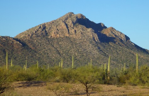
On the Mexican border sits 330,689 acres of undeveloped Sonoran Desert recognized as a UNESCO International Biosphere Reserve in 1976.  Its namesake cactus is more common further south and shares this landscape with 27 other species of cacti, including the famous saguaro.  The park’s jagged Ajo Mountains are mostly volcanic rhyolite and to see them at their best, we recommend driving the 21-mile dirt road loop in the evening before turning in for the night at the excellent Twin Peaks Campground, run by the National Park Service (NPS).

Optional stop at Casa Grande Ruins National Monument (click here for our blog post)

Arizona has 19 National Monuments (more than any other state), so if you flew into Sky Harbor Airport in Phoenix start with the one located right off Interstate 10.

Optional stop at Kofa National Wildlife Refuge

Desert bighorn sheep can be seen in this remote part of southwest Arizona south of Quartzsite.  Cibola and Imperial National Wildlife Refuges along the Colorado River are good spots for birding.

Day 2

Titan Missile Museum

Southwest of Tucson, Arizona in a nondescript stretch of desert are the remains of an underground Intercontinental Ballistic Missile (ICBM) silo built in 1963, during the height of the Cold War.  The nuclear warhead and rocket fuel was long ago removed from the site, but otherwise everything has been preserved.  A tour guide takes you below ground in the original elevator to explain the steps required to unleash this devastating weapon. 

Coronado National Forest (click here for our blog post)

The Catalina Highway ascends from Tucson through multiple life zones from saguaro-dotted desert to ponderosa pine forests at more than 9,000 feet in elevation.  The expansive vistas along the drive are worth the many switchbacks, with Windy Point Vista is an especially beautiful wayside in the pinyon-juniper woodland zone.  At the base of the Santa Catalina Mountains, also within Coronado National Forest, tram rides are available through beautiful Sabino Canyon Recreation Area.

Optional stop at Saguaro National Park (click here for our blog post)

If you didn’t get your fill of cacti the first day, you will at this park with separate sections east and west of Tucson.  If you only have time for one, we recommend the eastern Rincon Mountain District.

Optional stop at Tumacácori National Historical Park (click here for our blog post)

South of Tucson in Tubac, San Cayetano de Tumacácori is a Spanish mission founded in 1691 by Padre Kino and abandoned in 1848.  It became a National Monument in 1908 when it was restored to its ruined state based on photographs dating from 1868.

Day 3

Kartchner Caverns State Park

The highly decorated cave was not discovered until 1974, when its location was kept a tight secret while efforts were made to preserve it for future visitors.  There are two guided tours on paved trails offered, and if you space out your reservations far enough you can take a hike on the 2.4-mile Foothills Loop Trail in between.

Bisbee

The copper mining center of Bisbee was once the largest city between El Paso and San Francisco.  The well-maintained Victorian architecture and flights of steep staircases give this border town a unique atmosphere. 

Optional stop at Coronado National Memorial (click here for our blog post)

The park does not actually contain a statue or large memorial to Coronado.  It does have a steep three-quarter mile trail to a 600-foot long limestone cave bearing Coronado’s name, which visitors can explore on their own with flashlights.

Day 4

Chiricahua National Monument (click here for our blog post)

Tucked away in the southeastern corner of Arizona, millions of years of erosion left behind a spectacular collection of rhyolite rock formations that rise above surrounding evergreen trees.  All the trails are good, but we recommend an all-day hike through Echo Canyon to the Heart of Rocks Loop where you will find formations resembling camels, ducks, and anything else you can imagine. 

Salt River Canyon

Start driving north and be sure to stop for photos where U.S. Highway 60 drops steeply into this gorgeous canyon between Globe and Show Low.

Optional stop at Wilcox Playa Wildlife Area

In the winter, sandhill cranes stay in large numbers in the wetlands south of Wilcox and Interstate 10.

Optional stop at Fort Bowie National Historic Site (click here for our blog post)

To visit the NPS visitor center, the literal “must-do activity” is to hike 1.5 miles from the trailhead.  You do pass interpretive signs, a cemetery, and ruins along the way.

Day 5

Petrified Forest National Park (click here for our blog post)

A paved walkway behind the Rainbow Forest Museum is a great place to start, as NPS rangers give guided tours there throughout the day.  It is worth a hike to Agate House and a connection to the Giant Logs Trail to see more petrified wood, but be sure to bring water with you in the summer since there is no shade.

“Standin’ on the corner” statue in Winslow

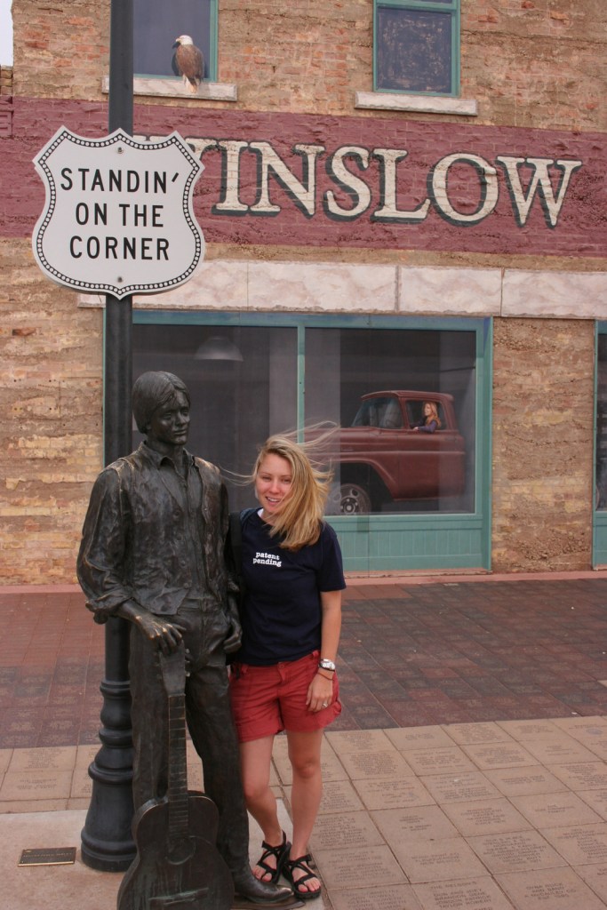
Jackson Browne and Glenn Frey probably could not have guessed when they penned the 1970s anthem “Take It Easy” that it would inspire a statue in an Arizona town on historic Route 66.  Perhaps even more fitting is the mural behind it that shows the reflection of a girl driving a flatbed truck.  Located off Interstate 40, Winslow is a great place “to loosen your load.”

Cameron Trading Post

As a kid, Scott’s family would always spend the night at the hotel here before taking friends and family to the Grand Canyon National Park.  Try the mutton stew or Indian taco in the restaurant at this historic spot.

Optional stop at Meteor Crater

There is a good museum at this big, round hole in the ground along Interstate 40.  It is definitely worth seeing once in your life.

Optional stops at Sunset Crater Volcano, Walnut Canyon, and Wupatki National Monuments (click here for our blog posts)

Heading north from Flagstaff, a 36-mile loop drive through Sunset Crater Volcano National Monument to adjacent Wupatki National Monument passes by the red-hued cinder cone through ponderosa pine forests and sunflower-filled meadows on its way to an arid, rocky high desert region that is dotted with Sinagua ruins from around AD 1100.  Nearby cliff dwellings were built in Walnut Canyon National Monument around the same time by another group of Sinagua.  To get up close with the cliff dwellings inside shallow limestone caves requires a hike down 200 stairs on the one-mile loop Island Trail. 

Day 6

Grand Canyon National Park (click here for our blog post)

Visit the South Rim of the park from the less busy eastern entrance and stop at the Watchtower and other scenic views along the way.  It is worth spending a few nights here and hiking (or riding a mule) to the bottom of the canyon, but that is not for everyone.  If you come in the summer, consider a trip to the North Rim or remote Toroweap (online permit required).

Optional stop at Little Colorado River Gorge Navajo Tribal Park

A nice overlook above a canyon along Highway 64 on the way into Grand Canyon National Park.

Day 7

Sedona

Famous for art galleries and New Age mysticism, the red rock city of Sedona offer plenty of stores and restaurants.  Be sure to leave some time to explore some unpaved roads and hiking trails in the surrounding area.

Coconino National Forest (click here for our blog post)

There are numerous trails in the National Forest around Sedona, where sandstone buttes (like Bell Rock and Cathedral Rock) dominate the landscape.  The shady West Fork Trail in Oak Creek Canyon is perfect on hot summer days, though in the winter it is also beautiful covered in snow and ice.

Optional stop at Sycamore Canyon Wilderness

This designated Wilderness (55,937 acres) is shared between three National Forests: Coconino, Kaibab, and Prescott.  The easiest way in is on the Parsons Trail located outside Clarkdale, west of Sedona.  The trailhead is accessed by driving the dirt Forest Road 131 for 10.5 miles from where it splits off near Tuzigoot National Monument.

Optional stop at Tuzigoot National Monument (click here for our blog post)

The Sinagua pueblo at Tuzigoot had about 110 rooms and is estimated to have housed 200 to 300 people.  You can walk inside portions of the ruin, including a section with a reconstructed roof.

Day 8+

Montezuma Castle National Monument (click here for our blog post)

If you are driving back south on Interstate 17 to Phoenix, this cliff dwelling makes a nice stop to break up the trip.

Tonto National Monument (click here for our blog post)

These cliff ruins east of Phoenix are worth the hike up to, as are many parts of Tonto National Forest, especially the Flat Iron, Hieroglyph Canyon, and Weaver’s Needle.

Hubbell Trading Post National Historic Site (click here for our blog post)

This is a unique NPS site with livestock (sheep, horses, turkeys) and a hands-on play area for children, as well as the original dusty store which allows visitors to travel back into the late-1800s.  There are frequent Navajo rug weaving demonstrations and tours inside the Hubbell Home are available for a fee. 

Canyon de Chelly National Monument (click here for our blog post)

In the heart of the Navajo Nation in northeast Arizona lies this picturesque National Monument.  Humans have inhabited this area for 4,500 years, leaving behind numerous pictographs and the dramatic ruins of Ancestral Puebloan cliff dwellings.

Navajo National Monument (click here for our blog post)

Visitors can reserve spots on the ranger-led day hike to Betatakin cliff dwelling or the 20-person backpacking trips to Keet Seel that are offered twice per month in the summer.  The latter is a strenuous trip covering 17 miles total with numerous stream crossings and all water must be carried in.  The hardest part is at the end, when a 1,000 foot climb awaits, but it is worth it to be one of the few who get to see Keet Seel, the 150-room ruin that is second in size only to Cliff Palace at Mesa Verde National Park.

Monument Valley Navajo Tribal Park

On the border of Arizona and Utah, entrance into Monument Valley Navajo Tribal Park allows you to see the iconic Mitten Buttes in person, which have served as a backdrop for countless films.  You can even pitch your tent at The View Campground overlooking the red rock formations. 

Havasupai Reservation

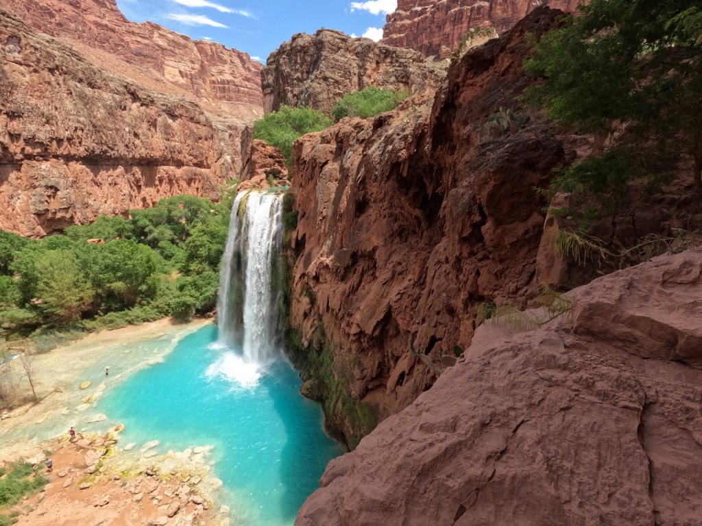
It is hard to argue against Mooney Falls and the other waterfalls in Havasu Canyon as being the most outstanding in the state, but it can be difficult (and expensive) to obtain one of the limited reservations available to visit the Havasupai Reservation that borders Grand Canyon National Park.

Baaj Nwaavjo I’tah Kukveni – Ancestral Footprints of the Grand Canyon National Monument (click here for our blog post)

The newest of Arizona’s 19 National Monuments includes the pictographs in Snake Gulch, part of Kaibab National Forest.

Pipe Spring National Monument (click here for our blog post)

Retention ponds keep this area green in the hot summer months where ducks paddle and dragonflies buzz through the humid air.  When a NPS ranger is present, you can walk around inside Winsor Castle, a Mormon fort that dates back to 1870. 

Antelope Canyon

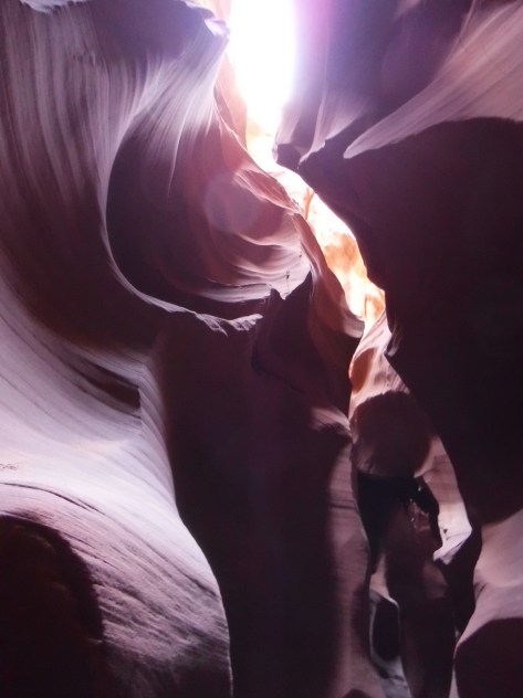
Guided tours are required to access these beautiful slot canyons located on private land on the Navajo Nation

Glen Canyon National Recreation Area (click here for our blog post)

You might want to bring your “selfie stick” to iconic Horseshoe Bend Overlook, a short 0.7-mile one-way hike from the parking area on Highway 89 outside Page.

Lake Mead National Recreation Area (click here for our blog post)

At Arizona Hot Springs, pools are formed by sandbags in a narrow canyon.  It is accessible from Liberty Bell Trailhead by a 6.5-mile out-and-back hike through a beautiful arroyo down to Black Canyon (now the upper reaches of Lake Mohave formed by a dam) on the Colorado River.  The trail is closed during the hot summer months, but you can still access it by boat from Willow Beach Marina or just downstream from the Hoover Dam (with a special permit).  Further south on Lake Mohave, stop at Emerald Cove for incredible photographs.

Learn more about Arizona’s Most Scenic Drive, Wonderful Waterfall, Top State Park, and other categories in our new travel guidebook 50 States of Great: Road Trip Guide to America.
Our 500th Blog Post!

A big thank you to our readers for continuing to support our website!  We recently reflected on our love of travel for the website All Fifty States Club and wanted to share that with you. And if you are around Wyoming, please check out our next 4 presentations at local libraries.

Our travel website Raven About The Parks is dedicated to providing information on recreating on U.S. public lands.  Our mission is to shine a light on the lesser-known National Forests and National Park Service sites in America, and eventually to expand into covering National Wildlife Refuges and State Parks.  We enjoy outdoor pursuits like backpacking, kayaking, camping, and snowshoeing, but we also love touring historic buildings, exploring museums, reading interpretive signs, and attending college football games.  We take joy in discovering new places, and it seems like every time we visit one new spot, we add two more to our list.  That is fine with us, since we believe travel is a never-ending quest to live life to its fullest.  We hope that sharing our travels helps inspire others to “Find what you love and do more of it.” 

In 2016, we took ten months off work in Wyoming to travel the world and we visited all 50 states between April and November.  We had already been to more than 40 states at that point, and Tiff’s final state was New Jersey, while Scott’s was Connecticut.  Our goal that year was in every state to stop into at least one State Park and a National Park Service site that we had never been to (some states like New Hampshire only have one).  We printed blank sheets for each state to record the dates we visited, wildlife spotted, favorite places and people, and our impressions of each state’s drivers, roads, and topography.  One of the best things we recorded was a list of places and events to return for, which has helped us plan some awesome trips in the subsequent years.

Between 2017 and 2023, we visited all 50 states once again (Delaware was the final one) while researching travel guidebooks we wrote on all 155 National Forests and road tripping in each state.  We also made sure by the end that we had spent the night in every state (with Rhode Island being our last).  The 50 States of Great guidebook is based on our experiences and thousands of hours of research; we picked our favorite National Park, State Park, National Forest (40 states have at least one), museum, roadside attraction, and eight other categories for all states.  We even included shorter chapters on American Samoa, D.C., Puerto Rico, and the U.S. Virgin Islands (and we hope to visit Guam and Saipan someday).  If you are interested, 50 States of Great: Road Trip Guide to America is available on Amazon.

We continue to travel across the U.S. seeking new adventures and returning to favorite places.  In 2022, we came upon the book The Happiness of Pursuit by Chris Guillebeau that explained the mental health benefits of working toward a greater life goal (like running a marathon in all 50 states or attending a baseball game at every MLB stadium).  We had been doing this all along, but since reading the book we have gone back to check in how many states we have bought a stuffed animal (45), hiked to a waterfall (38), crushed a penny (46), climbed to the highest point (29), visited the capital city (50 finished in Olympia, WA in 2023), showered at a Planet Fitness (29), and entered a museum (46).  Our current active pursuits include attending a college football game (39) and hiking in a National Wildlife Refuge (33) in every state.

Basically, we write about the places we have been to inspire others to “Find what you love and do more of it.”  We especially enjoy visiting new places, knowing that some of them will exceed our expectations and surprise us in ways we never could have anticipated.  We flip through travel magazines and scroll through Pinterest boards (check out ours here), but some of our more interesting finds have been inspired by obscure sources such as U.S. Mint quarters and U-Haul Super Graphics (we are mildly obsessed with these and have been known to burst into jubilation upon seeing a Saskatchewan moose on a dune).  We look forward to a future filled with travel across the U.S. and abroad.  To put our expertise on U.S. travel to good use, we have started posting one-week itineraries for all 50 states (starting with Kansas, Georgia, Idaho, and Rhode Island).

After reading an article on the website All Fifty States Club by Bob Rainville, we were inspired to determine how many state-to-state border crossings we had completed.  It took more than an hour of poring over maps and searching our memories, but we figured out there are 104 drivable border crossings and that we have made 96 of them already on our cross-country journeys.  Half of the eight remaining involve the corners of Missouri, which touches eight different states (the most of any state).

We appreciate your time and hope to produce another 500 quality posts for our audience in the coming years.  We have previously made Top 10 Lists of our favorite posts from each 100 post milestone, but this time we decided to create a different list highlighting the Top 10 Natural Phenomena to See in the U.S.  Watch for it soon!

Thank you for reading our blog! 

Scott and Tiff

Cheyenne, WY

Please check out our next 4 presentations at libraries in Wyoming!

“Find what you love and do more of it.” 

We recently published the expanded 2nd edition of our guidebook to the National Parks— A Park to Yourself: Finding Solitude in America’s 63 National Parks (available for sale on Amazon). The new edition is more than 60 pages longer with four-page chapters on Alaska’s wilderness National Parks that formerly had only a page. We also wrote a six-page chapter on the newest National Park— New River Gorge National Park and Preserve.

Our travel guidebook 50 States of Great: Road Trip Guide to America is also available for sale on Amazon