Tag Archives: itinerary

Missouri Road Trip Itinerary

43,994,573 acres

Statehood 1821 (24th)

Capital: Jefferson City

Population: 6,154,913 (18th)

High Point: Taum Sauk Mountain (1,772 feet)

Best time of year: Spring and fall

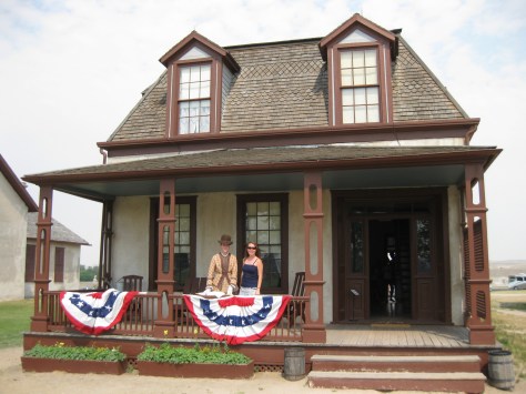
After publishing the guidebook 50 States of Great: Road Trip Guide to America, I have been creating blog posts with a travel itinerary for every state.  After starting with KansasGeorgiaIdaho, Rhode Island, MinnesotaHawai‘iArizonaLouisianaSouth DakotaIndiana, Montana, Mississippi, and Wyoming, I decided to do a central state that borders the most other states (eight).  I made an ambitious seven-day plan starting in St. Louis, with plenty of options to extend the trip.

Day 1

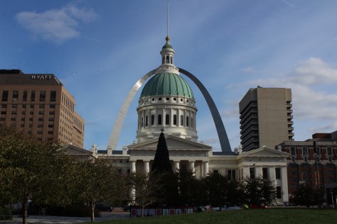
Gateway Arch National Park (click here for our blog post)

Formerly Jefferson National Expansion Memorial, in 2018, this 193-acre site was named the country’s 60th (and smallest) National Park.  It has a new museum and theater, and the claustrophobia-inducing tram cars still take visitors to the top of the arch for excellent views of St. Louis and across the Mississippi River into Illinois.  The city is also home to 1,371-acre Forest Park (site of the 1904 World’s Fair), with many attractions like a zoo, art museum, ice skating rink, outdoor musical theater, history museum, and science center.

Optional stop at Ulysses S. Grant National Historic Site (click here for our blog post)

The antebellum plantation of White Haven is where the future General and President raised a family in the 1850s following his initial resignation from the U.S. Army.  A thought-provoking museum is housed in the former horse stables, while access inside the house is only on a free ranger-guided tour.  It is located next to Grant’s Farm that offers free Budweiser brewery tours and a chance to see the famous Clydesdale horses.

Day 2

Mark Twain Boyhood Home and Museum

The celebrated author’s hometown of Hannibal on the Mississippi River is a pilgrimage site for a half-million visitors annually.  The museum has eight buildings, including the house his father built in 1843.  Across the street is the Becky Thatcher House, where Twain’s childhood sweetheart (Laura Hawkins) lived.  Held every July, National Tom Sawyer Days features frog-jumping and fence-painting contests. 

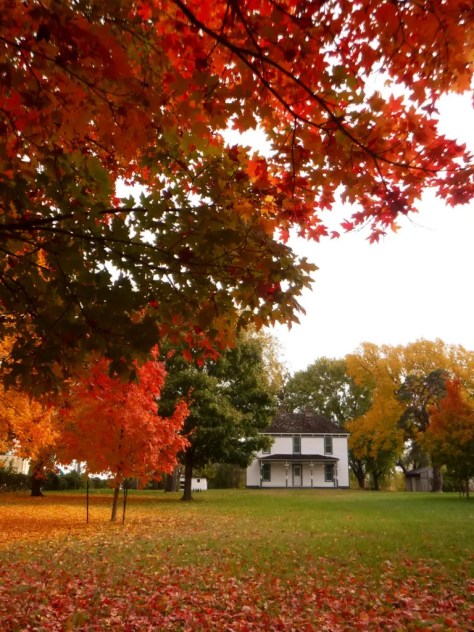
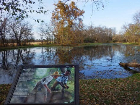
Optional stop at Clarence Cannon National Wildlife Refuge

Named in honor of a U.S. Congressman, these 3,750 acres provide a variety of wetland habitats for migratory birds along the Mississippi River floodplain.

Day 3

Jefferson City

The capitol building is known for its stained glass, murals, carvings, and statuary, as well as being home to the Missouri State Museum.  Nearby, Jefferson Landing State Historic Site preserves the Lohman Building and Union Hotel that were restored along the Missouri River. 

Optional stop at Mark Twain National Forest (click here for our blog post)

Spread across nine separate units, this sprawling jurisdiction used to be two National Forests until 1976 when the more northerly Clark National Forest was administratively combined.  Between Jefferson City and Columbia, Pine Ridge Recreation Area accesses Cedar Creek Trail, which has multiple trailheads and four loops totaling 36 miles.

Day 4

Kansas City

The city that crosses the western state border has more than 200 fountains, the most of anywhere outside Rome, Italy.  Kansas City is best known for its barbecued meats slathered in thick, tangy sauce, a tradition dating back to 1908.  The two oldest contenders for best barbecue in K.C. are Arthur Bryant’s Barbecue and Gates and Sons Bar-B-Q, but it is hard to find a bad restaurant due to the stiff competition. 

Nelson-Atkins Museum of Art

The most photographed spot in the city might be the giant shuttlecock sculptures on the lawn of the free art museum (where there’s also a free mini-golf course). Near Union Station, the National World War I Museum at Liberty Memorial features a 217-foot-tall Art Deco tower with an Egyptian motif.

Harry S Truman National Historic Site (click here for our blog post)

The visitor center in downtown Independence offers a film and a few artifacts, as well as first-come, first-served tickets for ranger-guided tours of the Truman Home.  About a 30-minute drive from Independence, take a self-guided cell phone tour around the ten acres surrounding the 1894 Truman Farm Home, which once stood on a 600-acre farm that is now the suburb of Grandview.

Optional stop at National Frontier Trails Museum

If you make it to Independence, pay to visit this museum located where emigrants once departed to begin their long journeys on the Santa Fe, Oregon, and California National Historic Trails. 

Day 5

George Washington Carver National Monument (click here for our blog post)

When Carver died in 1943, this site became the first National Park Service unit to honor an African-American.  The scientist was born into slavery on this farm but went on to earn a master’s degree in botany from Iowa State University in 1896 and to work at Tuskegee Institute for 47 years where he popularized peanut, sweet potato, and soy agriculture.  There is a museum with interactive exhibits and a self-guided one-mile loop trail with interpretive signs. 

Wonders of Wildlife National Museum & Aquarium

The original Bass Pro Shops in Springfield has almost 500,000 square-feet dedicated to outdoor recreation, including the Archery Hall of Fame and this impressive aquarium (fee). 

Optional stop at Wilson’s Creek National Battlefield (click here for our blog post)

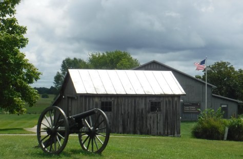
Missouri stayed in the Union throughout the Civil War despite the $10-million in property damage caused by guerrilla fighters, making it the third most fought-over state.  Start your visit by watching a short film, then peruse the excellent museum before taking the five-mile driving route that provides an overview of the battle at eight interpretive stops.

Day 6

Branson

The entertainment capital of the central U.S. has a main strip lit up like Las Vegas without the casinos.  The main draw is the variety of live music and magic shows offered every day of the week in 37 theaters, but do not miss the historic downtown with the iconic Dick’s 5 & 10 Cent Store on Main Street.  There are also mini-golf courses, a wax museum (topped by King Kong), an amusement park, a Ripley’s Believe It or Not! Odditorium, and a building shaped like the bow of the Titanic hitting a giant iceberg. 

Mark Twain National Forest (click here for our blog post)

Spread throughout the Ozark Mountains, 1.5-million-acre Mark Twain National Forest is full of caves, sinkholes, springs, and streams.  Greer Spring is the second largest in Missouri, with a daily flow of 222-million gallons as it drains 1.2 miles into the Eleven Point National Scenic River.  Several long trails explore the National Forest’s seven designated Wilderness areas, including sections of the 350-mile Ozark Trail.  Mark Twain National Forest also has three designated Scenic Byways: Blue Buck Knob, Sugar Camp, and Glade Top Trail.

Optional stop at the “Tri-Lakes”

The reservoirs of Table Rock, Taneycomo, and Bull Shoals offer opportunities for boating, fishing, and water sports.  The U.S. Army Corps of Engineers runs a museum at 252-foot-tall Table Rock Dam on the White River.

Day 7

Ozark National Scenic Riverways (click here for our blog post)

The Jacks Fork and Current Rivers flow freely within Ozark National Scenic Riverways.  The best way to explore the serpentine park boundaries is on the water, but roads access several swimming holes and the bright red Alley Mill.  The dolomite and limestone karst underneath this park is riddled with caves and sinkholes, like Devils Well, Round Spring Cave (offering ranger-guided tours for a fee), and Jam Up Cave (only accessible from the Jacks Fork River). 

Optional stop at Johnson’s Shut-Ins State Park

After suffering catastrophic damage from a 2005 dam breach, this park has been redeveloped and still has the chutes and waterfalls that provided its name.  Its campground is considered one of the nation’s best for RVs on public land.

Day 8+

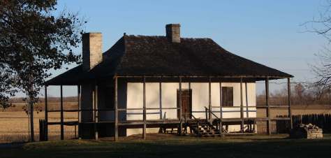
Ste. Genevieve National Historical Park (click here for our blog post)

Established in 2020 to protect the French colonial-era houses of Missouri’s first permanent settlement where residents still go all out to celebrate Bastille Day.  The oldest standing structure is the Bolduc House that dates back to 1792, while the Old Brick House from 1804 is now a restaurant.

Ha Ha Tonka State Park

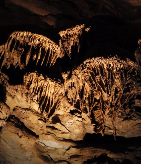
This geologic wonderland features a natural bridge, caves, sinkholes, limestone bluffs, and a large natural spring, but may be best known for the burned-out ruins of a mansion.

Katy Trail

The M-K-T (Missouri-Kansas-Texas) Railroad has been converted into the 240-mile-long Katy Trail, running across the state from north of St. Louis to Clinton (75 miles southeast of Kansas City).  Camping along the trail is an option, but it passes through many towns with hotels. 

Taum Sauk Mountain State Park

Accessed from the same trailhead as the state’s high point, Mina Sauk Falls is a 132-foot cascade accessed via a three-mile out-and-back hike that gains 430 feet in elevation.  Missouri’s tallest waterfall typically flows best during the spring season; otherwise, it is reduced to a trickle. 

Elephant Rocks State Park

The park’s billion-year-old granite rocks are broken into vertical cracks and eroded into huge “elephants” like 680-ton Dumbo (27 feet tall and 35 feet long).  The park even has a one-mile paved path designed specifically for the visually impaired with signs in Braille. 

Loess Bluffs National Wildlife Refuge

In northwest Missouri, winter is the time to visit to see nearly one-million snow geese, plus trumpeter swans, bald eagles, and a variety of shorebirds and waterfowl.

Learn more about Missouri’s Most Scenic Drive, Wonderful Waterfall, Top State Park, and other categories in our new travel guidebook  50 States of Great: Road Trip Guide to America.

Wyoming Road Trip Itinerary

62,139,610 acres

Statehood 1890 (44th)

Capital: Cheyenne

Population: 576,851 (50th)

High Point: Gannett Peak (13,804 feet)

Best time of year: Summer, especially July

After publishing the guidebook 50 States of Great: Road Trip Guide to America, I have been creating blog posts with a travel itinerary for every state.  After starting with KansasGeorgiaIdaho, Rhode Island, MinnesotaHawai‘iArizonaLouisianaSouth DakotaIndiana, Montana, and Mississippi, I decided to cover Wyoming where I lived for nearly 13 years (longer than any other state).  I made an ambitious seven-day plan starting in the capital, with plenty of options to extend the trip.  It would be easy to spend a week in Yellowstone National Park alone, so make a longer visit or plan a return trip in the future.

Day 1

Cheyenne

Held the last full week of July, Cheyenne Frontier Days Rodeo is considered “The Daddy of ’em All” and has been held annually since 1897 in the state’s capital city.  It is easy to spend several days exploring local museums and attending the free air show put on by the U.S. Air Force Thunderbirds, four Western Heritage Parades, performances at Indian Village, and three free pancake breakfasts.  Daily gunfights are put on throughout the summer by the Cheyenne Gunslingers near the Railroad Depot Museum. 

Medicine Bow National Forest (click here for our blog post)

If you need a break from the rodeo and concert crowds, head 40 minutes west on Interstate 80 to hike at rocky Vedauwoo Recreation Area.  The National Forest also contains its namesake 12,013-foot mountain on the Colorado border.  The Snowy Range Scenic Byway cuts across this rugged landscape and is a great place for outdoor recreation.  If you pass through Saratoga on the west side of the peaks, soak at the free Hobo Pool, the town’s developed hot springs (with indoor showers).

Optional stop at Fort Laramie National Historic Site (click here for our blog post)

Originally founded in 1834 for its strategic location at the confluence of two rivers, the fort was purchased by the U.S. military in 1849.  In the summer, stop into the bar for a cold sarsaparilla or attend July 4th festivities. West of the fort, at Register Cliff and Oregon Trail Ruts State Historic Site pioneers left their marks along the North Platte River.

Optional stop at Quebec-01 Missile Alert Facility State Historic Site

The newest State Park in Wyoming preserves a nuclear missile command center manned nonstop for decades by the U.S. Air Force.  Underground tours are offered for a small fee.

Day 2

National Trails Interpretive Center

In Casper, this free museum is run by the Bureau of Land Management on a hill above where the Pony Express, Mormon Pioneer, Oregon, and California National Historic Trails all ran along the North Platte River in the 1800s.  Fort Caspar Museum also celebrates its trail town history.

Optional stop at Thunder Basin National Grassland (click here for our blog post)

Mostly undeveloped for tourists, Weston Recreation Area is located 30 miles north of Gillette off Highway 59 with at least 15 miles of Off-Highway Vehicle (OHV) trails.  Fishing for warm water species like smallmouth bass and bluegill is possible at several reservoirs.  On moonless nights, the stars in this part of the state are epic.

Optional stop at Devils Tower National Monument (click here for our blog post)

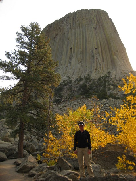
Devils Tower was named the nation’s first National Monument by President Teddy Roosevelt in 1906.  If you look closely, the vertical columns of the 867-foot-tall volcanic formation may hold a few rock climbers dwarfed by the scale.  It is often easier to reach this northeast corner of Wyoming while visiting the Black Hills of South Dakota.

Day 3

Bighorn National Forest (click here for our blog post)

The Bighorn Mountains are crossed by three scenic byways: Cloud Peak Skyway, Bighorn Scenic Byway, and Medicine Wheel Passage.  Located right off Bighorn Scenic Byway (Highway 14) is 120-foot-tall Shell Falls, while accessing the short trail to 600-foot Bucking Mule Falls involves driving about ten miles of dirt roads.

Optional stop at Sheridan

Sheridan sits at the base of the Bighorn Mountains, where Trail End State Historic Site, Fort Phil Kearny State Historic Site, and several museums celebrate its frontier history.

Optional stop at Bighorn Canyon National Recreation Area (click here for our blog post)

Devil Canyon Overlook and most of the 27 miles of hiking trails are in the Wyoming section of the park along with Pryor Mountain Wild Horse Range, Hillsboro Dude Ranch, and several tipi rings found along Bad Pass Trail, a route which has seen over 10,000 years of human use.

Day 4

Shoshone National Forest

Considered the first protected forest in American history dating to 1891, this National Forest encompasses incredible scenery, more than 1,300 miles of hiking trails, and tallest mountain in Wyoming.

Cody

Cody is the gateway to Yellowstone National Park’s eastern entrance and holds a nightly rodeo during the summer.  It is also home to an excellent and eclectic museum called the Buffalo Bill Center of the West.

Optional route on Beartooth Highway

U.S. Route 212 is an All-American Road that crosses a high-elevation plateau on the Montana border before entering the northeast corner of Yellowstone National Park.  Chief Joseph Scenic Byway (Highway 296) connects Cody with the Beartooth Highway.

Day 5

Yellowstone National Park (click here for our blog post)

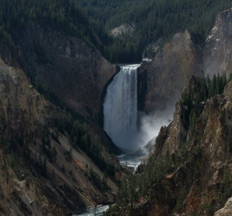
The world’s first National Park was created in 1872 and surrounds the giant 45-mile-wide caldera of a supervolcano.  This geologic wonderland contains more than 50% of the world’s geysers and is a haven for wildlife that is best seen in the Hayden and Lamar Valleys.  The park has countless waterfalls, including the 308-foot-tall Lower Falls that can be viewed from famous overlooks like Artist Point and Inspiration Point, or you can hike the steep, paved trail 600 feet down to the Brink of Lower Falls for unforgettable views of the canyon, especially on sunny days when a rainbow appears in its spray. 

Optional stop at Gallatin National Forest (click here for our blog post)

It can be hard to get a reservation to stay inside the park overnight, so many visitors cross the border into Montana to the towns of Gardiner or West Yellowstone.  Campgrounds, dispersed camping, and backpacking are also options in Montana’s Gallatin National Forest.

Day 6

Yellowstone National Park (click here for our blog post)

Wherever you spend the night, make sure to visit Lower Geyser Basin the next day.  This is where Old Faithful can shoot water up to 185 feet in the air.  Since the occurrence of several earthquakes, it is no longer as consistent as its name suggests, but its eruptions can be accurately predicted every 60 to 110 minutes throughout the day.  Nearby, Grand Prismatic Spring in Midway Geyser Basin is definitely worth a stop, especially from an overlook along Fairy Falls Trail.

Grand Teton National Park (click here for our blog post)

Jenny Lake sparkles below 12,325-foot Teewinot Peak and is the trailhead for popular Cascade Canyon Trail (you can take the shortcut aboard a shuttle boat for a fee).  There are plenty of activities other than hiking, which include wildlife watching, boating, horseback riding, mountain climbing, whitewater rafting, or cross-country skiing in the winter.

Jackson

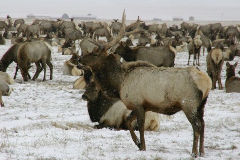
Crowded in the summer, Jackson is famous for its four arches in its town square that are built from shed elk antlers found in the National Elk Refuge.  Horse drawn carriage rides into the middle of the wintering elk herds are a popular winter attraction in the refuge.  Right in town in the summer, Bar T 5 offers wagon rides and chuckwagon dinners with live entertainment.

Optional stop at John D. Rockefeller Jr. Memorial Parkway (click here for our blog post)

This is the road connecting Yellowstone and Grand Teton National Parks, so visiting here is not really optional, but stopping to hike to Polecat Hot Springs for a soak is worth the time.

Day 7

Teton National Forest

South of Jackson, you can drive to pretty Granite Falls, a 50-foot-tall and 100-foot-wide cascade that was featured in the film A River Runs Through It (plus the falls has a hot springs across the river at its base).  There are many hiking and camping options available throughout Teton National Forest.

Optional stop at Fossil Butte National Monument (click here for our blog post)

The visitor center displays fossil fish, turtles, and other species, and on the deck outside there is an awesome timeline that traces CO2 levels and life on Earth throughout geologic time.  Take the steep steps up the Historic Quarry Trail to find fish fossils still in the rocks.  Several companies on private property in the area allow visitors to pay to quarry their own fish fossils to keep.

Day 8+

Bridger National Forest (click here for our blog post)

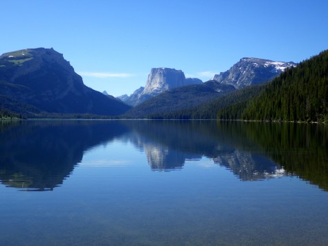
From Pinedale, a 50-mile (partially paved) drive leads to the campground at Green River Lakes, which opens up into a beautiful valley that frames photogenic Squaretop Mountain.  Starting from the lakeside campground, the Highline Trail is a 72-mile trek that traverses the Wind River Range, my favorite mountain range in the world.

South Pass City

South Pass City State Historic Site is a well-preserved ghost town with 30 structures where kids will appreciate the irony that the Sweetwater County Jail later served as a classroom.  The Continental Divide National Scenic Trail passes through the middle of the ghost town.  Lantern-guided tours inside the nearby Carissa Gold Mine and Mill are available by reservation. 

Wyoming Dinosaur Center

Some of the best dinosaur fossils in the world were found in Wyoming, and the little town of Thermopolis (home to the world’s largest mineral hot springs) has an excellent museum, plus visitors can schedule a trip to work alongside paleontologists at an active dig site in the summer.

Seedskadee National Wildlife Refuge

Along 36 miles of the Green River (Seedskadee means “river of the prairie hen”), 220 types of birds have been identified, and other species seen include pronghorn, mule deer, and moose.

Flaming Gorge National Recreation Area (click here for our blog post)

Flaming Gorge Reservoir on the Green River straddles the Wyoming-Utah border in the northern portion of Ashley National Forest offering 360 miles of shoreline, five full-service marinas, whitewater rafting, and numerous boat launches and campgrounds.

Killpecker Dunes

North of Rock Springs is North America’s largest active dune field in a remote area called the Red Desert, home to the nation’s only herd of desert-dwelling elk.  The Bureau of Land Management allows dispersed camping throughout the region, including near the dramatic Boars Tusk rock formation and further south around the badlands of Adobe Town.

Learn more about Wyoming’s Most Scenic Drive, Wonderful Waterfall, Top State Park, and other categories in our travel guidebook 50 States of Great: Road Trip Guide to America..

Mississippi Road Trip Itinerary

30,030,893 acres

Statehood 1817 (20th)

Capital: Jackson

Population: 2,961,279 (34th)

High Point: Woodall Mountain (807 feet)

Best time of year: Spring

We recently published our guidebook 50 States of Great: Road Trip Guide to America, so we decided to start a new type of blog post where we create a travel itinerary for all 50 states, in addition to our usual National Forest and National Park entries.  After starting with KansasGeorgia, Idaho, Rhode Island, Minnesota, Hawai’i, Arizona, LouisianaSouth Dakota, Indiana, and Montana, we decided to do another state in the deep south.  We made an ambitious seven-day plan starting in the south on the Gulf Coast and then zigzagging across the state with plenty of options to extend the trip.

Day 1

Gulf Islands National Seashore (click here for our blog post)

You will have to take a ferry to enjoy the white sand beaches of West Ship Island, which are considered some of the best in the U.S.  If you are stuck on the mainland, at least check out the visitor center and hiking trails just off Interstate 10. 

Biloxi

Biloxi has beaches, a lighthouse, casinos, and the Maritime and Seafood Industry Museum.  I still want to see the Patriarch Oak, estimated to be more than 2,000 years old and located at Mary Mahoney’s Old French House seafood restaurant.

De Soto National Forest (click here for our blog post)

Tuxachanie National Recreation Trail runs 12 miles through De Soto National Forest with the path from its western trailhead following an old logging railroad right off Highway 49.  Near the far eastern end of the trail is a lakeside World War II Prisoner of War camp with a pond.

Optional stop at Mississippi Sandhill Crane National Wildlife Refuge

Some sandhill cranes migrate to this forested spot for the winter, but a small population lives there year-round.  There are trails, interpretive signs, and a visitor center.

Day 2

Natchez National Historical Park (click here for our blog post)

National Park Service (NPS) rangers or volunteers are on location at the William Johnson House, Melrose Estate, and the Forks of the Road where hundreds of thousands of slaves were sold in the 1800s.  The William Johnson House tells the story of a slave freed at age 11 who apprenticed to a barber, and became a successful businessman before his murder.

Grand Village of the Natchez Indians State Historic Site

These historic mounds offer a free museum and film inside an air-conditioned building (which is important on a muggy summer day). 

Optional stop at Homochitto National Forest (click here for our blog post)

There is a nice campground with showers on Clear Springs Lake, accessed by a paved road four miles south of Highway 84.  A one-mile trail circles the lake, which has a picnic shelter built by the Civilian Conservation Corps (CCC) in 1935 that is listed on the National Register of Historic Places.

Day 3

Natchez Trace Parkway (click here for our blog post)

This paved road runs 444 miles from the Mississippi River to Nashville, Tennessee, including 309 miles in Mississippi.  The trace (or trail) started as an American Indian footpath and was heavily used in the 1800s by “Kaintuck” flatboatmen returning from New Orleans who left the Mississippi River at Natchez and continued on foot north.  At several roadside pullouts, you can still follow portions of the “sunken” trail worn down by travelers over the centuries.  Popular stops along the way include the boardwalk at Cypress Swamp outside Jackson and its three free campgrounds.

Optional stop at Natchez Trace National Scenic Trail (click here for our blog post)

Paralleling the parkway, this trail exists in five segments totaling 67 miles in length.  One of the longest sections is located north of Jackson (Miles 108-130).  There are also eight miles of the original trace around the free Rocky Springs Campground (Mile 58) accessing Owens Creek Waterfall and a historic town site.

Day 4

Jackson

The capital city is home to the Mississippi Civil Rights Museum, Museum of Mississippi History, and Mississippi Agriculture and Forestry Museum.  The Mississippi Museum of Natural Science is a 73,000-square-foot facility situated in a 300-acre forest with 2.5 miles of trails that also boasts a 200-seat theater and many aquariums, including “The Swamp” where alligators reside inside a large greenhouse. 

Medgar and Myrlie Evers Home National Monument (click here for our blog post)

In Jackson, the National Park Service manages the former home of a prominent Civil Rights Leader who was assassinated in his driveway in 1963.  Across the street, there is a sidewalk through Myrlie’s Garden, a community garden where interpretive signs on the wooden fence tell the story of the Evers family.

Optional stop at Bienville National Forest (click here for our blog post)

There are several lakes here open to the public, including 50-acre Marathon Lake (which got its name a lumber company that closed in 1929).  The lake was built in the 1950s for recreation in a former logging camp and now has 34 campsites (with water and electric hook-ups), a boat ramp, a swimming area, and a 1.7-mile trail that circles it. 

Day 5

Vicksburg National Military Park (click here for our blog post)

The numerous failed attempts to take Vicksburg by force are evidenced by the 17,000 soldiers buried in the National Cemetery here.  Following a 46-day bombardment, the city finally surrendered on July 4, 1863.  The best part of visiting the park is walking through the partially-reconstructed U.S.S. Cairo, an ironclad gunboat which was carefully salvaged from the Yazoo River during the 1960s.

Optional stop at Delta National Forest (click here for our blog post)

Delta National Forest is seasonally flooded for wildlife, but it was dry enough to walk up to the Kay Cypress Tree even when other trails were underwater during our April visit.  The tree is more than ten feet in diameter even above the widely fluted base common to baldcypress.  It is located across from Blue Lake on unpaved Fire Tower Road.

Day 6

Emmett Till Historic Intrepid Center (ETHIC)

Located in a former cotton gin near the site of Emmett Till’s torture and murder on the farm of “J.W.” Milam in Glendora.  Established in 2005, there is an atmosphere to the museum that bears the full weight of history, heightened by the short introductory video showing Emmett Till’s family members’ recollections of the events of 1955. 

Emmett Till and Mamie Till-Mobley National Monument (click here for our blog post)

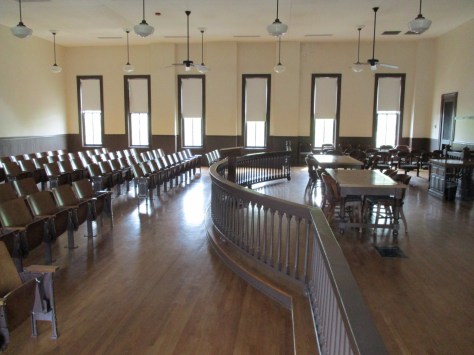
The National Park Service operates out of the Emmett Till Interpretive Center, located in a strip mall opposite the Tallahatchie County Second District Courthouse in Sumner.  It has limited hours, but the courtroom where the September 1955 trial was held was unlocked when we visited on a Tuesday morning.

Optional stop at a Blues Museum

The Yazoo-Mississippi Delta (or simply “the Delta”) is a distinct section of western Mississippi renowned for its blues musicians.  There is plenty to learn and listen to at the Delta Blues Museum in Clarksdale, GRAMMY Museum Mississippi in Cleveland, and B.B. King Museum and Delta Interpretive Center in Indianola.  Spend the night in the area to go to a bar for live music in the evening. 

Optional stop at Belzoni Catfish Museum and Welcome Center

At its peak in 1993, this region produced 461-million pounds of catfish annually (about 60% of U.S. production) and still hosts the World Catfish Festival every April.  The best part is that Belzoni has catfish sculptures spread around town, painted to represent different occupations like a fireman and nurse. 

Day 7

Brices Cross Roads National Battlefield Site (click here for our blog post)

The National Park Service site here is tiny with no facilities and only a couple interpretive signs, but a local battlefield commission owns 1,400 acres with walking trails.  The nearby Mississippi Final Stands Interpretive Center is located five miles east of the battlefield in Baldwyn. 

Tupelo National Battlefield (click here for our blog post)

Two cannons and a monument mark this one-acre National Park Service site surrounded by the city of Tupelo.  Its visitor center is combined with the one for the Natchez Trace Parkway just outside Tupelo.

Optional stop at Elvis Pressley Birthplace and Museum

In Tupelo, the house where Elvis grew up is a main attraction.  The grounds are open 24 hours and the museum is open seven days a week. 

Optional stop at Tishomingo State Park

Tishomingo State Park is located just off the Natchez Trace Parkway (Milepost 304) northeast of Tupelo.  The park’s sandstone and limestone rock formations represent the furthest southwest extent of the Appalachian Plateau.  The park opened in 1939, after its infrastructure was built using local rock by the Civilian Conservation Corps (CCC).  Several structures remain from that period, including a spectacular swinging bridge over Bear Creek.

Day 8+

Holly Springs National Forest (click here for our blog post)

Chewalla Lake Recreation Area is the most developed site offering a swimming beach and campground, plus fishing and boating opportunities.  A 2.3-mile trail at the 260-acre lake passes an overlook and a reconstructed Choctaw burial mound.  In the northeast corner off Highway 72, a short trail accesses Baker’s Pond, the source of the Wolf River.  Further south, Lake Tillatoba is a fee-free primitive site managed by Tombigbee National Forest.

Shiloh National Military Park (click here for our blog post)

An important railroad crossroads in Corinth made it a strategic spot during the Civil War.  In April 1862, two days of intense fighting across the border in Tennessee resulted in 23,746 soldiers killed, wounded, captured, or missing, and the Confederates abandoned the field and Corinth.  There were an additional 7,000 casualties when they failed to recapture the town in October 1862, which is the focus of the museums in town.

Apron Museum

Iuka is home to the Apron Museum that has collected thousands of vintage aprons, plus it has a gift shop with quilts, crafts, and, of course, aprons for sale.  Nearby, a restored wooden covered bridge is also worth a look-see and a drive across.

Learn more about Mississippi’s Most Scenic Drive, Wonderful Waterfall, Top State Park, and other categories in our travel guidebook 50 States of Great: Road Trip Guide to America.
Montana Road Trip Itinerary

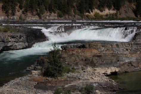
93,149,312 acres

Statehood 1889 (41st)

Capital: Helena

Population: 1,084,225 (43rd)

High Point: Granite Peak (12,807 feet)

Best time of year: Summer

After we published our guidebook 50 States of Great: Road Trip Guide to America in 2023, we decided to start a new type of blog post where we create a travel itinerary for all 50 states, in addition to our usual public land entries.  After starting with Kansas, Georgia, Idaho, Rhode Island, Minnesota, Hawai’i, Arizona, Louisiana, South Dakota, and Indiana, we decided to head back west to Montana.  There are so many great trails in the state’s National Forests that we had a difficult time narrowing it down.  We made an ambitious seven-day plan starting in southeast Montana on Interstate 90, with enough options to easily extend the trip into three weeks or more.

Day 1

Little Bighorn Battlefield National Monument (click here for our blog post)

The best time to visit the National Monument is around June 25, the anniversary of Custer’s Last Stand when a reenactment of the battle is held on private land bordering the National Park Service site.

Makoshika State Park

It is illegal to remove dinosaur fossils from these badlands, but there are many on display at the visitor center, in addition to nearby museums (plus reservations can be made to dig on private land).  The few campsites are in high demand to spend the night in these colorful canyons where caprocks rise high above juniper trees. 

Optional stop at Pompeys Pillar National Monument

A sandstone monolith on the Yellowstone River has been a place for humans to record their passing for 11,000 years.  The most famous inscription was left by Captain William Clark on July 25, 1806, the sole on-site evidence of the Corps of Discovery’s three-year journey.

Optional stop at Bighorn Canyon National Recreation Area (click here for our blog post)

This underappreciated gem in the National Park Service system features gorgeous scenery and abundant wildlife, including bighorn sheep and wild horses.  The highlight is across the state line in Wyoming where Devil Canyon Overlook sits atop cliffs that drop over 1,000 feet straight down to the level of the narrow reservoir. 

Day 2

Gallatin National Forest (click here for our blog post)

Gallatin Petrified Forest is only accessible by trail, either from a short two-mile one-way jaunt or by backpacking the 27-mile Gallatin Divide-Devils Backbone Trail.  Earthquake Lake Geologic Area stretches along Highway 287 to commemorate the events that occurred around midnight on August 17, 1959, when a deadly magnitude 7.5 earthquake hit West Yellowstone.

Custer National Forest (click here for our blog post)

Some of the National Forest’s miles of hiking trails access the Crazy Mountains and Hellroaring Plateau.  The two-mile Glacier Lake Trail steadily climbs 1,100 feet then drops into a bowl containing a stunning reservoir that straddles the Wyoming-Montana border.

Optional drive on Beartooth All-American Road

Custer National Forest is famous for its stretch of Highway 212 that climbs from the prairie around the town of Red Lodge up to 10,947 feet at Beartooth Pass across the Wyoming border in Shoshone National Forest.  The road follows the southern border of the giant 943,626-acre Absaroka-Beartooth Wilderness, which contains the highest point in Montana.

Optional stop at Yellowstone National Park (click here for our blog post)

Located mostly in Wyoming and partly in Montana and Idaho, you could easily spend an entire summer in the world’s first National Park and not see all the thermal features, lakes, waterfalls, wildlife, and hiking trails.

Day 3

Lewis & Clark Caverns State Park

Once a U.S. National Monument, the state now runs a campground here and offers guided tours through a limestone show cave where bats live in the summer.

Beaverhead National Forest (click here for our blog post)

The free Potosi Campground is situated near the trailhead for Upper Potosi Hot Springs where a 0.8-mile trail leads past the uphill side of a clear 100°F pool with room for about six adults.

Optional stop at Chico Hot Springs

If you leave Yellowstone National Park north through Gardiner on Highway 89, consider stopping at this developed hot springs (fee) that offers live music poolside on some nights (especially if the park’s Boiling River was closed).  In business since 1897, even Teddy Roosevelt stopped to rest here.

Day 4

Bannack State Park

East of Lemhi Pass on the Idaho border (which is also the Continental Divide National Scenic Trail through there), Bannack State Park preserves more than 50 buildings from a gold rush town that was the territorial capital in 1864. 

Big Hole National Battlefield (click here for our blog post)

The site of a surprise attack by the U.S. Army on the morning of August 9, 1877, where Nez Perce warriors forced the troops to retreat, capturing a Howitzer cannon and allowing women and children to escape toward the newly created Yellowstone National Park.  Part of the widespread Nez Perce National Historical Park, a small visitor center here overlooks the battlefield and a paved road accesses trails through it.

Bitterroot National Forest (click here for our blog post)

Blodgett Creek Trail leads 12.6 miles one-way to Blodgett Lake, but you do not have to go that far to appreciate its incredible beauty. 

Optional stop at Elkhorn Hot Springs

In the Pioneer Mountains, about ten miles north of Highway 278 is the privately owned Elkhorn Hot Springs (fee), a great place to relax after hiking.  There is free dispersed camping to the north in Beaverhead National Forest.

Day 5

Travelers’ Rest State Park

Follow in the footsteps of the Lewis and Clark expedition by driving the Lolo Trail (Highway 12), soaking at Lolo Hot Springs, or walking around Travelers’ Rest State Park (still a great place to camp). 

Missoula

Do as the University of Montana students do and float tubes down the Clark Fork River through town.  In the summer, look for webcam-famous Iris the Osprey in the parking lot near the football stadium.  The Historical Museum at Fort Missoula preserves buildings dating back to 1877, including an Alien Detention Center used during World War II.

Lolo National Forest (click here for our blog post)

Outside Missoula, there are many trails in Rattlesnake National Recreation Area and Blue Mountain Recreation Area, plus the Aerial Fire Depot and Smokejumper Center, Ninemile Historic Remount Depot, and Savenac Historic Tree Nursery Area.

Optional stop at Grant-Kohrs Ranch National Historic Site (click here for our blog post)

This working ranch commemorates the nineteenth-century lifestyle of cattle barons and cowboys.  Free guided tours are offered inside the large ranch house, and a self-guided walking tour enters 15 buildings with displays on the history of barbwire, branding irons, and much more. 

Day 6

National Bison Range

Established in 1908 under President Theodore Roosevelt and now run by the Confederated Salish and Kootenai Tribes.  Start at the visitor center, then take the 19-mile Red Sleep Mountain Drive to see mule deer, white-tailed deer, elk, pronghorns, bighorn sheep, and the namesake bison. 

Flathead National Forest (click here for our blog post)

Jewel Basin Hiking Area is famous among backpackers, and further south so is Holland Lake, which has several campgrounds.  The steep Holland-Gordon Trail passes Holland Falls as it climbs 2,100 feet in 5.8 miles to Upper Holland Lake and continues into “the Bob” (Bob Marshall Wilderness).  Flathead National Forest contains more than 2,800 miles of hiking trails, including 38 miles of the Pacific Northwest National Scenic Trail and a stretch of the Continental Divide National Scenic Trail.

Optional stop at Mission Mountains Wilderness

Located within Flathead National Forest, a popular trail accesses multiple mountain lakes; it is only 1.5 miles one-way to Glacier Lake, but we recommend continuing to Turquoise Lake.  It borders the Mission Mountains Tribal Wilderness (permits required). 

Day 7

Glacier National Park (click here for our blog post)

Waterton-Glacier International Peace Park’s renowned Going-to-the-Sun Road was built to cross the park from east to west in the 1920s (reservations are required to drive it between 7 a.m. and 3 p.m. in the summer).  At its highest point at 6,646-foot Logan Pass, the road crosses the Continental Divide National Scenic Trail.

Optional stop at Kootenai National Forest (click here for our blog post)

In the state’s northwest corner, incredible views await at Blue Mountain Trail, Skyline National Recreation Trail, Scenery Mountain Lookout Trail, Ross Creek Scenic Area of old-growth western redcedar trees, and Kootenai Falls (located in a county park on the side of Highway 2).

Day 8+

Helena National Forest (click here for our blog post)

Meriwether Lewis named the Gates of the Mountains on July 19, 1805, and today a two-hour jet boat tour on the Missouri River provides history on the Corps of Discovery, American Indian pictographs, the Mann Gulch Fire, and the collapse of Hauser Dam.  A trail through Refrigerator Canyon is less than ten feet wide at its narrowest point, where towering 200-foot limestone cliffs keep it cool and breezy throughout the summer. 

Great Falls

North of Helena on Interstate 15 is the Lewis and Clark Interpretive Center (fee), which is managed by the U.S. Forest Service on the banks of the Missouri River.

Upper Missouri River Breaks National Monument (click here for our blog post)

This 375,000-acre National Monument preserves a stretch of the Missouri River that still looks much the way it did when Lewis and Clark explored it.  Start your journey by paying for permits at the Bureau of Land Management interpretive center in historic Fort Benton, where you can launch your canoe or kayak to access 149 miles of the river.  There are developed boat camps with vault toilets along the route, or you can pick your own spot near one of the Corps of Discovery campsite markers.

Deerlodge National Forest (click here for our blog post)

It includes portions of the Boulder Mountains, Flint Creek Range, and Elkhorn Mountains, as well as part of the Anaconda-Pintler Wilderness.  Our favorite hike is Haystack Mountain National Recreation Trail off Interstate 15, where a climb of 2,000 feet ends at a mountaintop boulder field with panoramic views and the remnants of a fire lookout tower.

Lewis & Clark National Forest (click here for our blog post)

Backpacking is a major draw with trails in the Snowy Mountain Range and parts of the Scapegoat and Bob Marshall Wilderness areas, which provide crucial habitat for grizzly bears.  It encompasses one of the most famous formations along the Continental Divide National Scenic Trail, the 15-mile long Chinese Wall (a 1,000-foot-tall cliff composed of five-million-year-old limestone). 

Learn more about Montana’s Most Scenic Drive, Wonderful Waterfall, Top State Park, and other categories in our travel guidebook 50 States of Great: Road Trip Guide to America.

Indiana Road Trip Itinerary

22,928,710 acres

Statehood 1816 (19th)

Capital: Indianapolis

Population: 6,785,528 (17th)

High Point: Hoosier Hill (1,257 feet)

Best time of year: Summer

Last year we published our guidebook 50 States of Great: Road Trip Guide to America, so we decided to start a new type of blog post where we create a travel itinerary for all 50 states, in addition to our usual National Forest and National Park entries.  After starting by jumping around to KansasGeorgia, Idaho, Rhode Island, Minnesota, Hawai’i, Arizona, Louisiana, and South Dakota, we headed to the Midwest for our tenth state.  We start in the northwest corner of Indiana on the shores of Lake Michigan near Chicago, then all roads lead to Indianapolis, so we head south with plenty of options to extend the trip. See for yourself why Indiana made it on our Top 10 States for State Parks list.

Day 1

Indiana Dunes National Park (click here for our complete blog post)

Indiana Dunes National Lakeshore was originally created in 1966 as a compromise between industrialists seeking to build more steel mills and conservationists wanting to preserve biodiversity.  Though it is now one of the 63 National Parks, the quiet Dunewood Campground still provides hot showers in a wooded setting inland from the lakeshore.

Optional stop at Indiana Dunes State Park

Complete the 3 Dune Challenge by climbing the three tallest dunes in the State Park (separate entrance fee) to earn a prize at the visitor center shared with the National Park.

Day 2

Raclin Murphy Museum of Art

This museum on the University of Notre Dame campus in South Bend offers free admission and highlights Christian art from Europe.  Guided tours are offered of the famous football stadium year-round, and the Basilica of the Sacred Heart and adjacent Grotto of Our Lady of Lourdes spiritual shrine are always open.  On a college football gameday, do not miss the midnight drumming circle beneath the golden dome and other traditions throughout the day.

Optional stop at Studebaker National Museum

South Bend was once the headquarters for manufacturing Studebakers and the museum displays many made-in-Indiana automobiles.

Day 3

RV/MH Hall of Fame

Elkhart is recognized as “the RV Capital of the World” since so many Recreational Vehicles are built in local factories.  The Hall of Fame first opened in 1991 then moved to a larger building where it exhibits more than 50 historic vehicles dating back to the 1913 Earl Travel Trailer.  You can also take a free plant tour of Jayco, Inc. to see RVs being manufactured in nearby Middlebury.

Optional stop at Hall of Heroes Superhero Museum

Six miles down the road in Elkhart, the Hall of Heroes Superhero Museum has more than 50,000 comic books and countless toys and movie props on display.  All-you-can-play arcade games are included with your admission.

Optional stop at Turkey Run State Park

This popular state park is about an hour west of Indianapolis and offers camping, hiking, swimming, kayaking, and fishing.

Day 4

Indianapolis Motor Speedway

The first auto race took place here in 1909 and the first Indy 500 was held two years later.  The car that won that inaugural Indy 500 was the Marmon Wasp and it is held in the track’s Hall of Fame Museum, along with the Borg-Warner Trophy.  This is considered the world’s largest stadium (with a capacity of 257,325).  When cars are not running, you can take a bus tour around the oval (at significantly less than 200 miles-per-hour) and kiss the 36-inch strip of bricks at the finish line left unpaved. 

Optional stop at James A. Allison Exhibition Center

Down the road from the racetrack, the free James A. Allison Exhibition Center tells the story of a local auto parts builder who expanded his company (founded in 1915) into engines for military airplanes.

Optional stop at the Children’s Museum of Indianapolis

Hands-on exhibits abound in this renowned museum southeast of downtown.

Day 5

Spring Mill State Park

Today you can still buy cornmeal ground by the historic gristmill that runs for ten minutes every hour, part of Pioneer Village where costumed reenactors demonstrate chair caning, broom making, and fiddle making.  The park also contains trails, an elevated flume reconstructed by the Civilian Conservation Corps (CCC), Hamer Pioneer Gardens, guided boat trips that enter 500 feet into Twin Caves, and the Grissom Memorial Museum dedicated to the local hero who was the second American astronaut in space and died in a 1967 launchpad fire.

Optional stop at White River State Park

Located in downtown Indianapolis, this unique State Park surrounds the Indiana State Museum, Eiteljorg Museum of American Indian and Western Art, Indiana Zoo, and NCAA Hall of Champions featuring many interactive exhibits next door to the National Collegiate Athletics Association (NCAA) headquarters.

Day 6

Hoosier National Forest (click here for our complete blog post)

Created in 1935 from cutover and abandoned farmland, the National Forest’s best hike is Hemlock Cliffs Trail, a 1.2-mile loop through a canyon that passes two unique waterfalls.  A 0.8-mile trail runs through the 88 acres of old-growth forest of Pioneer Mothers Memorial Forest.  The tall trees here range in age from 150- to 600-years-old, and the black walnuts that grow in a moist cove known as Walnut Cathedral are considered the finest specimens in the country.

Optional stop at Muscatatuck National Wildlife Refuge

A visitor center and auto trail make this the most developed National Wildlife Refuge in Indiana for birding and fishing.  The nearby Big Oaks National Wildlife Refuge encompasses a former military property and requires special authorization to visit.

Day 7

Lanier Mansion State Historic Site

The beautiful Lanier Mansion was built for James Franklin Doughty Lanier, a prominent businessman in the state of Indiana around the mid-1800s. The Greek Revival-style house was completed in 1844 and is one of the finest buildings in Madison’s National Historic Landmark District on the Ohio River.  Well-preserved Madison was an important waystation on the Underground Railroad. 

Clifty Falls State Park

This park protects a deep, boulder-strewn canyon with several waterfalls, including one with a 60-foot drop.  It also has a campground and the blufftop Clifty Inn built in 1924 with views of the Ohio River.

Optional stop on the Indiana Cave Trail

A driving route connects several show caves in the southern part of the state where the brisk air is always a humid 57°F.  Highlights include Indiana Caverns, Wyandotte Caves State Recreation Area, Squire Boone Caverns, Marengo Cave, and Bluespring Caverns that offers a one-hour boat ride through America’s longest navigable underground river. 

Day 8+

George Rogers Clark National Historical Park (click here for our complete blog post)

A beautiful 80-foot-tall granite memorial was built on the site of Fort Sackville in the 1930s to commemorate the victory Clark led there on February 25, 1779.  After watching the 20-minute film in the visitor center in Vincennes, go inside the circular memorial with 16 columns in classic Greek style to see a bronze statue surrounded by seven murals.  You can then walk down the Wabash River to see the home of President William Henry Harrison and the old territorial capitol.

Holiday World

Located in the town of Santa Claus, this Christmas-themed amusement park has roller coasters, a water park, and many shops.

Lincoln Boyhood National Memorial (click here for our complete blog post)

Take a walk past the pioneer cemetery to the Cabin Site Memorial where a bronze casting of sill logs and the fireplace hearthstones are at the site of Abraham Lincoln’s family cabin from 1829.  The Living Historical Farm has costumed interpreters in the summer that depict homestead life at an authentic cabin and several outbuildings that were moved here from other parts of Indiana.
Angel Mounds State Historic Site

Near Evansville is a 430-acre site where there are 11 grass-covered Mississippian mounds built as early as 1,000 years ago, plus a replica village, simulated excavation site, and a visitor center full of artifacts. 

Milan ’54 Museum

Commemorates the town’s 1954 high school boys’ basketball team that defeated the mighty Muncie Central for the state championship, as immortalized in the 1986 film Hoosiers.

Indiana Basketball Hall of Fame

In a state obsessed with basketball, this museum was moved from the capital city to New Castle in 1990 so it could have more room for expansion. 

Learn more about Indiana’s Most Scenic Drive, Top Backpacking Destination, and other categories in our travel guidebook 50 States of Great: Road Trip Guide to America.