Tag Archives: canoeing

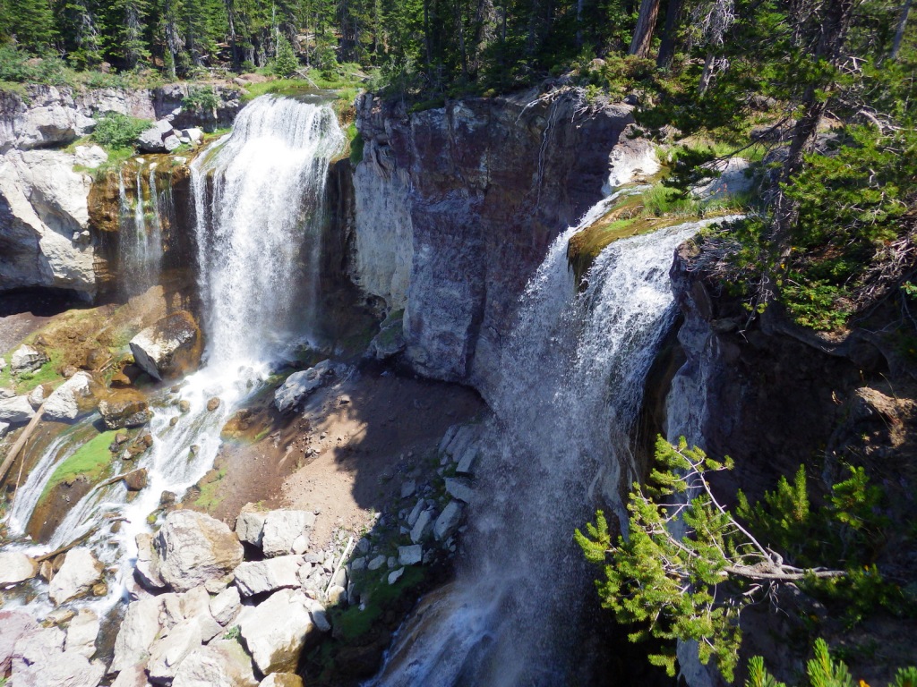
Deschutes National Forest

Deschutes National Forest

Oregon

Managed by U.S. Forest Service, Pacific Northwest Region

1,853,929 acres (1,596,900 federal/ 257,029 other)

Website: https://www.fs.usda.gov/deschutes

Overview

Bend, Oregon is the gateway to Deschutes National Forest, with the beautiful Cascade Lakes Scenic Byway located west of town.  To the south, Newberry National Volcanic Monument is also managed by the U.S. Forest Service, which we will cover in our next blog post.  The Deschutes River was named La Rivière aux Chutes by French trappers because Celilo Falls was located near its confluence with the Columbia River.  Deschutes National Forest contains five Wilderness areas, six National Wild and Scenic Rivers, Metolius Conservation Area, and part of Oregon Cascade Recreation Area (mostly in Umpqua National Forest).

Highlights

Newberry National Volcanic Monument, Cascade Lakes Scenic Byway, Devils Lake, Mt. Bachelor, Sparks Lake, Broken Top, Three Sisters, McKenzie Pass-Santiam Pass Scenic Byway, Skeleton Cave, Pacific Crest National Scenic Trail

Must-Do Activity

The 66-mile-long (89-mile loop) Cascade Lakes Scenic Byway curves around the mountains west of Bend past numerous lakes reflecting multiple snow-capped peaks—a real photographers’ paradise.  To spend the golden hours up here, consider staying at campgrounds on the shores of Lava Lake or Sparks Lake with excellent views of Broken Top and South Sister Peak.  Like Mt. Hood to the north, 9,065-foot Mt. Bachelor is known for its ski resort.  A summer trip up Pine Marten Express Lift offers unsurpassed panoramas of the Cascades and Newberry National Volcanic Monument.

Best Trail

Sisters Mirror Lake is four miles and 650 feet up from a trailhead on the Cascade Lakes Scenic Byway and is located on the Pacific Crest National Scenic Trail.  Just as a warning, this entire trail was thick with aggressive mosquitoes on our hike in mid-July.

Watchable Wildlife

Elk, pronghorn, and mule deer are large ungulates found in Deschutes National Forest.  Carnivorous mammals include black bears, coyotes, mountain lions, and bobcats.  Large birds frequently seen are bald eagles, Canada geese, mallards, and whistling swans, and the northern spotted owl is a species of concern.  There are many lakes found throughout the National Forest that support a variety of gamefish, including bull trout (a threatened species).

Instagram-worthy Photo

Sparks Lake is a great place to watch the sun set behind the Cascades.

Peak Season

Summer

Fees

There is a day use fee for Newberry National Volcanic Monument.

Road Conditions

Cascade Lakes Scenic Byway is paved, as are the main roads into Newberry National Volcanic Monument, but there are many miles of logging roads to explore, too.

Camping

Campgrounds on the shores of Lava Lake or Sparks Lake provide views of Broken Top and South Sister Peak.  Walk-in campsites on crystal clear Devils Lake offer a bit more secluded experience.

Wilderness Areas

Diamond Peak Wilderness (also in Willamette National Forest)

Mt. Jefferson Wilderness (also in Mt. Hood and Willamette National Forests)

Mt. Thielsen Wilderness (also in Umpqua and Winema National Forests)

Mt. Washington Wilderness (also in Willamette National Forest)

Three Sisters Wilderness (also in Willamette National Forest)

Related Sites

Newberry National Volcanic Monument (Oregon)

Crooked River National Grassland (Oregon)

John Day Fossil Beds National Monument (Oregon)

Nearest National Park
Crater Lake

Conifer Tree Species

ponderosa pine, lodgepole pine, western white pine, sugar pine, western juniper, Douglas-fir, western redcedar, white fir, subalpine fir

Flowering Tree Species

quaking aspen, balsam poplar, Bebb willow

Explore More – The namesake of the Deschutes River (Celilo Falls) is now underwater behind what dam on the Columbia River?

Learn more about this and the 154 other National Forests in our new guidebook Out in the Woods

We are a participant in the Amazon Services LLC Associates Program, an affiliate advertising program designed to provide a means for us to earn fees by linking to Amazon.com and affiliated sites.

Davy Crockett National Forest

Davy Crockett National Forest

Texas

Managed by U.S. Forest Service, Southern Region

394,200 acres (160,647 federal/ 233,553 other)

Website: https://www.fs.usda.gov/texas

Overview

The pine forests and blackland prairies of Davy Crockett National Forest are situated between Lufkin and Crockett, Texas.  The National Forest is located within the Trinity and Neches River basins, where the Big Slough Canoe Trail explores the swampy 3,639-acre Big Slough Wilderness.  David Crockett was a frontiersman, soldier, and Tennessee politician who died at the infamous Battle of the Alamo in 1836 and later became an almost-mythical American folk hero known as the “King of the Wild Frontier.”  This swampy stretch of eastern Texas is a fitting place to be his namesake.

Highlights

Ratcliff Lake Recreation Area, Holly Bluff Campground, Neches Bluff Overlook, Neches River, Big Slough Canoe Trail, Tall River Trail, Four C Trail

Must-Do Activity

Davy Crockett National Forest’s most developed site is Ratcliff Lake Recreation Area, where several trails run near the campsites that surround the 45-acre lake, including one end of the 20-mile-long Four C National Recreation Trail.  The site also has a bathhouse, picnicking and swimming areas, and boat ramps.

Best Trail

The 20-mile Four C National Recreation Trail connects Ratcliff Lake Recreation Area with Neches Bluff Overlook, although hurricane damage closed the northern portion of the trail in 2019.  The trail is named after the Central Coal and Coke Company, which had a sawmill at Ratcliff Lake.  Much of the well-marked route follows abandoned tramways built by the company to haul logs.  The two trailheads are easily accessible from highways, but no backpack camping is allowed during deer hunting season (November through January).

Watchable Wildlife

Fishing is a major draw to Ratcliff Lake, as is hunting for white-tailed deer, fox squirrels, northern bobwhite quail, doves, wild turkeys, and various waterfowl.  Beavers and American alligators are also found at Ratcliff Lake.  Longleaf pine forests are managed to provide habitat for red-cockaded woodpeckers, an endangered species.  We saw an armadillo while hiking a swampy section of the Four C National Recreation Trail along the Neches River.

Instagram-worthy Photo

There is not much vertical topography in eastern Texas, so Neches Bluff Overlook stands out and commands an expansive view, including Caddo Mounds State Historic Site.

Peak Season

Spring and fall

Fees

None

Road Conditions

Access to Neches Bluff Overlook is by a well-maintained unpaved road that would be drivable by an RV.

Camping

There is free primitive camping allowed at Neches Bluff Overlook, which is located just south of Highway 21 near Caddo Mounds State Historic Site.  No backpack camping is allowed on the Four C National Recreation Trail during deer hunting season (November through January), when dispersed camping is also restricted to 20 designated hunter camps.

Wilderness Areas

Big Slough Wilderness

Related Sites

Angelina National Forest (Texas)

Sabine National Forest (Texas)

Big Thicket National Preserve (Texas)

Nearest National Park
Hot Springs

Conifer Tree Species

baldcypress, loblolly pine, shortleaf pine, longleaf pine, eastern redcedar

Flowering Tree Species

blackjack oak, post oak, southern red oak, white oak, swamp chestnut oak, willow oak, sweetgum, red maple, swamp red maple, green ash, swamp cottonwood, black willow, water hickory, pignut hickory, hophornbeam, sassafras, slippery elm, water elm, winged elm, American holly, yaupon holly, red buckeye, redbud, rough-leaf dogwood, flowering dogwood

Explore More – When were the mounds created at nearby Caddo Mounds State Historic Site?

Learn more about this and the 154 other National Forests in our new guidebook Out in the Woods

We are a participant in the Amazon Services LLC Associates Program, an affiliate advertising program designed to provide a means for us to earn fees by linking to Amazon.com and affiliated sites.

Croatan National Forest

Croatan National Forest

North Carolina

Managed by U.S. Forest Service, Southern Region

308,234 acres (159,885 federal/ 148,349 other)

Website: https://www.fs.usda.gov/nfsnc

Overview

The sandy soil of North Carolina’s coastal plain is where you will find Croatan National Forest, the land of the longleaf pine (which is the official state tree).  Longleaf pines are adapted to frequent surface fires by going through a “grass stage” when young, so the Forest Service conducts controlled burns in some stands.  Much of the National Forest has standing water (in pocosins and Carolina bays), which is why there is not a single trail through its 31,000 acres of designated Wilderness areas.  Pocosins are raised bogs and home to 11 species of carnivorous plants, including the federally-protected Venus flytrap.  A Carolina bay is one of many oval-shaped depressions typically filled with water that are oriented in a northwest-southeast direction across the coastal plain.  They range in size from small ponds to two miles in diameter, but the exact cause of their formation is unknown.

Highlights

Cedar Point Tideland National Recreation Trail, Flanner Beach, Fishers Landing, Brice Creek canoe trail, Black Swamp OHV Trail, Island Creek Trail, Patsy Pond Nature Trail, Cedar Point Tideland National Recreation Trail, Neusiok Trail

Must-Do Activity

To find some of the 11 species of carnivorous plants in Croatan National Forest, you will have to work a little bit.  Pull off one of the highways that bisect the area and hike to the edge of a pocosin, where scrubby vegetation grows in highly-acidic black soil.  Pitcher plants, bladderworts, sundews, and Venus flytraps utilize different methods to capture insects and spiders in order to sap their nitrogen and other nutrients that are scarce in the water-logged soil.  To trigger a tiny Venus flytrap to close, an insect must touch one hair twice or multiple hairs within 20 seconds.  They are often found adjacent to larger pitcher plants, which lure insects inside by color or odor, then are too slick-walled to escape.  Sundews and the butterwort utilize a sticky substance to capture their prey.  The five species of bladderworts float in shallow water where they capture swimming prey that trigger a trap door.

Best Trail

The Cedar Point Tideland National Recreation Trail is a 1.4-mile loop located partially on a boardwalk near the mouth of the White Oak River.  There are also two long trails through the swamps and pine forests: Neusiok Trail (21 miles) and Weetock Trail (14 miles).  There are no designated trails through Croatan National Forest’s 31,000 acres of designated Wilderness areas. 

Watchable Wildlife

Black bears in this region can get very big since they generally do not hibernate in the winter.  Other large mammals found are bobcats, raccoons, river otters, and muskrats.  Great blue herons, snowy egrets, ospreys, bald eagles, peregrine falcons, wild turkeys, woodcocks, and northern bobwhite quail are major bird species.  There are a variety of reptiles and amphibians, including alligators, anoles, cottonmouths, copperheads, canebrake rattlesnakes, pigmy rattlesnakes, and eastern diamondback rattlesnakes.  The tannic-stained blackwater supports fish like warmouth, redfin pickerel, sunfish, bowfin, yellow bullhead catfish, and the rare swampfish (a species of cavefish). 

Instagram-worthy Photo

Carnivorous pitcher plants have large showy flowers that bloom in early May.

Peak Season

Spring and fall

Fees

None

Road Conditions

The major highways (17, 58, 70) that cross the National Forest are paved, and the sandy, unpaved roads are generally in good shape except when flooded.

Camping

There are Forest Service campgrounds at Flanner Beach on the Neuse River and Cedar Point along the White Oak River.

Wilderness Areas

Catfish Lake South Wilderness

Pocosin Wilderness

Pond Pine Wilderness

Sheep Ridge Wilderness

Related Sites

Cape Lookout National Seashore (North Carolina)

Fort Raleigh National Historic Site (North Carolina)

Moores Creek National Battlefield (North Carolina)

Nearest National Park
Congaree

Conifer Tree Species

baldcypress, longleaf pine, loblolly pine, shortleaf pine, pond pine, eastern redcedar, Atlantic white-cedar

Flowering Tree Species

black gum, umbrella magnolia, southern magnolia, northern red oak, southern red oak, white oak, water oak, chestnut oak, overcup oak, black cherry, sassafras, American holly, yaupon holly, Hercules’ club, sweetgum, red maple, sugar maple, white alder, witch hazel, American beech, black walnut, tulip-poplar, hophornbeam, musclewood, red mulberry, flowering dogwood, loblolly bay, red bay, sweet bay magnolia, titi

Explore More – What is the origin of the National Forest’s name and how does it relate to Fort Raleigh National Historic Site?

Learn more about this and the 154 other National Forests in our new guidebook Out in the Woods

We are a participant in the Amazon Services LLC Associates Program, an affiliate advertising program designed to provide a means for us to earn fees by linking to Amazon.com and affiliated sites.

St. Croix National Scenic Riverway

Overview

Since 1972, about 255 miles of the St. Croix and Namekagon Rivers have been protected along the Minnesota-Wisconsin border.  It is a popular route for paddlers and tube floaters, in addition to providing invaluable habitat for a variety of wildlife, including beavers, great blue herons, and 40 species of native mussels.  There are a few dams along the rivers and regulations vary by who manages different sections, so it is important to know the rules before you launch your boat.

Highlights

Trego Nature Trail, Sandrock Cliffs, Interstate State Parks

Must-Do Activity

There is a long scenic byway that follows the St. Croix River north from its confluence with the Mississippi River (south of Minneapolis) near the Great River Road Visitor Center in Prescott, Wisconsin.  The National Park Service (NPS) manages the seasonal Namekagon River Visitor Center on a stretch of water that is good for floating.  If you do not have a boat, just down the road try the 2.8-mile roundtrip Trego Nature Trail that follows the Namekagon River through a forest of white pine, bigtooth aspen, and paper birch trees.

Best Trail

Wisconsin Interstate State Park is located on the St. Croix River and is the western terminus for the partially completed 1,200-mile long Ice Age National Scenic Trail.

Instagram-worthy Photo

Both Minnesota and Wisconsin Interstate State Parks are great places to learn about potholes (up to 15-foot deep bowls carved into solid rock) formed by boulders caught in whirlpools during glacial melting.

Peak Season

Summer

Hours

https://www.nps.gov/sacn/planyourvisit/hours.htm

Fees

None

Road Conditions

All main roads are paved, but some (like the side road to Trego Nature Trail) are good gravel.

Camping

Developed campgrounds can be found in the numerous state parks and state forests along the rivers.  Only designated riverside campsites can be used by those paddling (except in the Stillwater Islands area), but no reservations are accepted.

Related Sites

Mississippi National River and Recreation Area (Minnesota)

Apostle Islands National Lakeshore (Wisconsin)

Voyageurs National Park (Minnesota)

Explore More – A major proponent of creating this park, Senator Gaylord Nelson was born in Clear Lake, Wisconsin and helped pass the Wild and Scenic Rivers Act, as well as founding what annual holiday in 1970?

Niobrara National Scenic River

Overview

When most folks think of Nebraska they imagine endless dusty prairie scenes of the Oregon Trail, yet between the wide Platte and Missouri Rivers also runs the 535-mile long Niobrara River.  The Niobrara cuts across the 100th Meridian of Longitude that roughly divides in half the continental U.S.  This special area is home to species representative of the eastern forests, Rocky Mountains, boreal forests, and prairies; consequently it has high biodiversity.  The motto on the National Park Service (NPS) signs is “Public Waters, Private Land.”

Highlights

Fort Niobrara National Wildlife Refuge, Fort Falls Trail, Smith Falls State Park, canoeing, tubing

Must-Do Activity

The 76-mile section of river designated the Niobrara National Scenic River in 1991 begins within Fort Niobrara National Wildlife Refuge where the first 4.8 miles are closed to the public.  The 22-mile section starting from Cornell Bridge is the most popular portion for canoers, tubers, and people who float downstream in round metal cattle troughs.  The Niobrara River has a few big Class IV rapids, but nothing more than Class II through the first 27 miles.  We floated to the portage at dangerous Rocky Ford Rapid at high water in May and encountered only Class I rapids and a few strainers along the shorelines.

Best Trail

Pull off the river around Mile 15 in Smith Falls State Park to take the short boardwalk to a 63-foot tall waterfall.  The waterfalls along these cliffs are interesting because instead of pouring off a cut bank they develop a prominent ledge that grows as the limestone is dissolved and redeposited (like a cave formation).  You can also drive to the state park and walk over the Niobrara River on the Verdigre Bridge, originally built in 1910 and relocated here in 1996.

Instagram-worthy Photo

Do not miss the opportunity to drive the dirt road through Fort Niobrara National Wildlife Refuge to see the bison herd, especially in May when the bison calves are born.  The refuge also contains the short Fort Falls Trail, which forms a loop with views of a 45-foot tall waterfall.

Peak Season

Summer, though water levels drop after June.

Hours

https://www.nps.gov/niob/planyourvisit/hours.htm

Fees

None for the river, but there is a $1 per person launch fee in Fort Niobrara National Wildlife Refuge and entry/camping fees at Smith Falls State Park.

Road Conditions

The dirt roads in Fort Niobrara National Wildlife Refuge and Smith Falls State Park are well-maintained and passable to all vehicles.

Camping

Camping options are limited since most of the river banks are privately owned, though Smith Falls State Park offers a campground ($6/person/night) and other private campsites are marked on river maps.

Related Sites

Missouri National Recreation River (Nebraska-South Dakota)

Agate Fossil Beds National Monument (Nebraska)

Scotts Bluff National Monument (Nebraska)

Explore More – Named for a town in Nebraska, the Valentine Formation holds what types of fossils?