Tag Archives: Utah

Fishlake National Forest     

Fishlake National Forest           

Utah

Managed by U.S. Forest Service, Intermountain Region

1,539,737 acres (1,461,226 federal/ 78,511 other)

Website: https://www.fs.usda.gov/fishlake

Overview

Much of Fishlake National Forest is at high elevation in central Utah, which is also true of its namesake Fish Lake that sits at 8,800 feet.  Fish Lake is the largest natural mountain lake in Utah and lent its name to the Fish Lake Cutoff on the Old Spanish Trail, which ran from Santa Fe to Los Angeles.  There are hundreds of miles of trails open to ATVs in the National Forest, including the 238-mile Paiute ATV Trail and the Gooseberry ATV Trails accessible from Interstate 70.  There are also plenty of trails for hikers, backpackers, mountain bikers, and equestrians, including the trail that crosses the South Fork of North Creek Trail 60 times as it covers ten miles leaving from beautiful Blue Lake at the base of Mt. Baldy.

Highlights

Beaver Canyon Scenic Byway, Wildcat Guard Station, Tushar Mountains, Delano Peak, Bullion Falls, Pistol Rock, Koosharem Canyon, Fishlake Scenic Byway, Fool Creek Canyon petroglyphs, Blue Lake, Bullion Canyon Trail System, Skyline National Recreation Trail, Lakeshore Trail, Old Spanish National Historic Trail

Must-Do Activity

Fish Lake’s most famous resident is the aspen clone dubbed Pando (meaning “I spread” in Latin).  Connected by a single root system, stems of Pando cover 106 acres and it is estimated to have started growing 80,000 years ago, arguably making it the oldest and heaviest living organism on the planet.  Campers enjoy the popular Lakeshore Trail that is in four discontinuous sections adding up to about 15 miles.  We found the road to Pelican Promontory on the north side of the lake too rough for our passenger vehicle and the five-mile Pelican Canyon Trail too overgrown to follow after a mile, although we did see (and hear) a northern goshawk on nest. 

Best Trail

In the Tushar Mountains, Beaver Canyon Scenic Byway (Highway 153) switchbacks its way up to several trailheads for the 8.3-mile-long Skyline National Recreation Trail.  We attempted to access Lake Stream Trailhead in the middle, but found the road at Puffer Lake required high-clearance.  Instead, we drove the rough quarter-mile spur road to Big Flat Trailhead (at 10,220 feet in elevation) and hiked two miles to a rocky outcrop with good views.  We did not attempt to drive to the trail’s western terminus at Big John Flat Trailhead that sits beneath 12,173-foot Delano Peak.

Watchable Wildlife

We first heard and then saw a northern goshawk on a nest (see photos) as we struggled to follow the overgrown Pelican Canyon Trail at Fish Lake.  Additional birds of note are bald eagles, kestrels, several species of owls, turkey vultures, Canada geese, white pelicans, and wild turkeys.  Ungulates found here are elk, mule deer, pronghorns, bighorn sheep, mountain goats, and even some moose.  Other large mammals include black bears, bobcats, mountain lions, red foxes, coyotes, pine martens, minks, badgers, porcupines, beavers, snowshoe hares, and pika.  As you might expect from a National Forest named Fishlake, fishing is a popular activity in the lakes and streams for rainbow trout, lake trout, splake, and other species, even in the winter.

Instagram-worthy Photo

Stop at the informational pullout on the Fishlake Scenic Byway to read about the Fish Lake Cutoff of the Old Spanish Trail, then get your photo with the metal cutouts of a pack train in the sagebrush flats near Zedd’s Meadow.

Peak Season

Summer

Fees

$5 day use fee at Ponderosa Picnic Area or America the Beautiful pass

Road Conditions

There are some rough roads in this area that require high-clearance vehicles, including the ones to Pelican Promontory and Puffer Lake.  Fishlake Scenic Byway and Beaver Canyon Scenic Byway are paved, but connecting between the two required driving some good gravel roads that were already snow free during our mid-June visit.

Camping

The Aquarius Ranger Station is available for rental from May through October, as are the historic cabins at the Gooseberry Administrative Site.  There are several campgrounds at Fish Lake and others located throughout the National Forest, in addition to one scenic spot on a ridge adjacent to the Second Crossing of Salina Creek in the White Mountains.

Wilderness Areas

None

Related Sites

Dixie National Forest (Utah)

Bryce Canyon National Park (Utah)

Cedar Breaks National Monument (Utah)

Nearest National Park

Capitol Reef

Conifer Tree Species

subalpine fir, white fir, Engelmann spruce, Douglas-fir, ponderosa pine, singleleaf pinyon pine, Utah juniper

Flowering Tree Species

quaking aspen, Gambel oak, bigtooth maple, Fremont cottonwood, sagebrush

Explore More – Which famous American explorer named the Old Spanish Trail in the 1840s (hint: he has a National Forest named after him, but maybe not the one you first think)?

Learn more about this and the 154 other National Forests in our new guidebook Out in the Woods

We are a participant in the Amazon Services LLC Associates Program, an affiliate advertising program designed to provide a means for us to earn fees by linking to Amazon.com and affiliated sites.

Dixie National Forest

Dixie National Forest

Utah

Managed by U.S. Forest Service, Intermountain Region

1,967,165 acres (1,889,127 federal/ 78,038 other)

Website: https://www.fs.usda.gov/dixie

Overview

Dixie National Forest is spread across southwest Utah surrounding Cedar Breaks National Monument and near three National Parks: Bryce Canyon, Capitol Reef, and Zion.  The National Forest has a wide elevation range from 2,800 feet near St. George to 11,322 feet on Boulder Mountain.  The change in average temperature and precipitation leads to wide variety of ecosystems from a desert-like environment all the way up to subalpine conifer forests and tundra.  The warmth of southern Utah reminded some early emigrants of “Dixie,” the part of the U.S. south of the Mason-Dixon Line, but with growing public distaste for that name it may be changed in the future.

Highlights

Markagunt National Scenic Byway, Brian Head, Navajo Lake, Cascade Falls, Strawberry Point, Red Canyon Recreation Area, Honeycomb Rocks, Powell Point, Hell’s Backbone Bridge, Virgin River Rim Trail, Hancock Peak Trail, Whipple Trail, Casto Canyon Trail

Must-Do Activity

Highway 12 Scenic Byway winds through much of the National Forest, including Red Canyon Recreation Area where the popular Casto Canyon Trail is open to hikers, bicycles, horses, and ATVs.  The mountain ranges west of Interstate 15 are a less-visited section of the forest, with numerous trails traversing the Pine Valley Mountains Wilderness, including the 35-mile Summit Trail.

Best Trail

Leaving from a trailhead across Highway 143 from the road to the top of 11,312-foot-tall Brian Head, Rattlesnake Creek Trail skirts the edge of spectacular Cedar Breaks National Monument and enters the Ashdown Gorge Wilderness (established in 1984).  About one mile in, one of several side trails leads off to the left for an overlook of the Cedar Breaks, a red rock badlands full of hoodoos situated at the edge of the Markagunt Plateau.  Gnarled Great Basin bristlecone pine trees cling to the eroding edge of the natural amphitheater, making a great foreground for photographs with a beautiful backdrop.  The trail continues to drop more than 2,400 feet to the canyon bottom over four miles connecting with Ashdown Creek which eventually crosses Highway 14, but there is not an official trailhead there.

Watchable Wildlife

A variety of mammals call Dixie National Forest home: black bears, mountain lions, bobcats, coyotes, three species of foxes, minks, pine martens, porcupines, beavers, raccoons, skunks, badgers, snowshoe hares, pika, mountain goats, bighorn sheep, elk, mule deer, and pronghorns.  Large birds include bald eagles, golden eagles, California condors, turkey vultures, wild turkeys, and various species of woodpeckers.  There are many gamefish found in the streams and small lakes spread across the high-elevation Markagunt, Paunsaugunt, and Aquarius Plateaus.

Instagram-worthy Photo

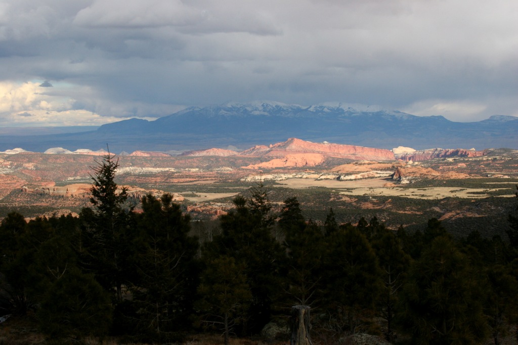
South of Torrey, Highway 12 climbs into an aspen forest with incredible views of Capitol Reef National Park and Waterpocket Fold.

Peak Season

Late summer

Fees

None

Road Conditions

Highway 12 and Highway 143 are paved roads that access the high elevations of Dixie National Forest, but they may be closed seasonally due to snow.  There are numerous dirt roads that traverse the area, including the popular route to the top of 11,312-foot-tall Brian Head.

Camping

There are numerous campgrounds located throughout the National Forest, as well as dispersed camping opportunities on dirt roads west of Bryce Canyon National Park.

Wilderness Areas

Ashdown Gorge Wilderness

Box-Death Hollow Wilderness

Cottonwood Forest Wilderness

Pine Valley Mountains Wilderness

Related Sites

Cedar Breaks National Monument (Utah)

Grand Staircase-Escalante National Monument (Utah)

Capitol Reef National Park (Utah)

Nearest National Park

Bryce Canyon

Conifer Tree Species

Utah juniper, singleleaf pinyon pine, ponderosa pine, Douglas-fir, Engelmann spruce, subalpine fir, Great Basin bristlecone pine

Flowering Tree Species

quaking aspen, Bebb willow

Explore More – On the Markagunt Plateau, Navajo Lake drains out of two lava tubes that formed how many millions of years ago?

Learn more about this and the 154 other National Forests in our new guidebook Out in the Woods

We are a participant in the Amazon Services LLC Associates Program, an affiliate advertising program designed to provide a means for us to earn fees by linking to Amazon.com and affiliated sites.

Zion National Park

Zion National Park

Utah

Managed by National Park Service

Established 1909 National Monument, 1919 National Park

146,598 acres

Website: nps.gov/zion

Overview

Zion National Park protects an outstanding canyon where steep sandstone walls up to 3,000 feet high appear to glow at sunrise and sunset.  Views are great from the road along the North Fork of the Virgin River, but to really get a sense of scale here you have to hike uphill on one of many trails.  Check out a new film on the park here: https://zionpark.org/wethekeepers/

Learn more in our guidebook to the National Parks, A Park to Yourself: Finding Adventure in America’s National Parks (available on Amazon).

Highlights

Kolob Canyons, The Narrows, Emerald Pools, Weeping Rock, Observation Point, The Subway, Angels Landing, Canyon Overlook Trail

Must-Do Activity

Kolob Canyons is in the northern section of the park located just off Interstate 15, where a short drive leaves the road noise behind and opens up a world of red rock beauty.  There are no campgrounds in this area of the park, so we picked up a backpacking permit at the visitor center to spend the night near Timber Creek.  The flowing water meant croaking frogs and toads provided a chorus throughout the night.  This site provided a good jumping off point for the La Verkin Creek Trail which travels 7.5 miles one-way to Kolob Arch.  At 310 feet across, this arch is one of the biggest in the world, but you cannot get nearly as close to it as you can to those at Arches National Park.  Hiking anywhere in Kolob Canyons is much less busy than other parts of Zion National Park, but the trails can be snow covered in the winter (when the access road sometimes closes).

Best Trail

The Narrows, Angels Landing, and The Subway are hiking destinations known around the world, and their popularity means they each require a reservation.  Wading upriver through the frigid water of the Narrows, where the canyon pinches to only 18 feet wide in places, is an essential experience open to all visitors for the first five miles to Big Spring.  The busy 5.4-mile out-and-back trail to Angels Landing is not for the faint of heart as it follows a knife-edge route with chains mounted in places.  But it is worth the effort, even if you just make it to the saddle at the end of Walter’s Wiggles, perhaps the world’s most famous trail switchbacks.

Instagram-worthy Photo

We watched a huge California condor flying over Zion Canyon from Observation Point, a popular eight-mile out-and-back hike that leaves from the same trailhead as Weeping Rock.

Peak Season

Spring and fall

Hours

https://nps.gov/zion/planyourvisit/hours.htm

Fees

$35 per vehicle or America the Beautiful pass

Road Conditions

The main roads into Kolob Canyons and Zion Canyon are paved, but a free shuttle bus is required to enter the dead end Zion Canyon Scenic Drive from 7 a.m. to 7 p.m. daily from March to November (click here for more shuttle information).  There is an extra fee for large RVs to use the Zion-Mount Carmel Tunnel, since they require a pilot car and the road must be shut down to one-way traffic only.

Camping

There is not a campground in Kolob Canyons, but in Zion Canyon you can wake up to an awesome morning view in sprawling Watchman or South Campgrounds.  Lava Point Campground is located down the long, unpaved Kolob Terrace Road and is closed in the winter.  Dispersed camping is allowed by the Bureau of Land Management outside park boundaries, but it can be hard to find an open spot.

Related Sites

Bryce Canyon National Park (Utah)

Cedar Breaks National Monument (Utah)

Dixie National Forest (Utah)

Explore More – Walter’s Wiggles may be the world’s most famous trail switchbacks, so who are they named after?

This design we created to celebrate Zion National Park is available on a variety of products at Cafe Press and Amazon.

Explore More – Walter’s Wiggles may be the world’s most famous trail switchbacks, so who are they named after?

We are a participant in the Amazon Services LLC Associates Program, an affiliate advertising program designed to provide a means for us to earn fees by linking to Amazon.com and affiliated sites.

Caribou National Forest

Caribou National Forest

Idaho, Utah, Wyoming

Managed by U.S. Forest Service, Intermountain Region

1,085,966 acres (987,216 federal/ 98,750 other)

Website: https://www.fs.usda.gov/ctnf

Overview

Co-managed as Caribou-Targhee National Forest since 2000, Caribou National Forest is located in the southeastern corner of Idaho.  To add to the jurisdictional muddle, Caribou National Forest has also administered the 263,940-acre Idaho portion of Wasatch-Cache National Forest since 1973 (see previous blog post).  However, nearly 50 years later all of the wooden signs in this area still read Cache National Forest.  Despite the signage, U.S. Forest Service publications and topographic maps identify Minnetonka Cave and Paris Ice Cave as being in Caribou-Targhee National Forest, so we went with that.  Confused?  So are we, so much so that we made a phone call to a Forest Service employee in this ranger district that still did not clear up the bureaucratic mess.

Highlights

Pioneer Historic Scenic Byway, Minnetonka Cave, Paris Ice Cave, Caribou City ghost town, Malad Range, Tincup Mountain, Oregon Trail-Bear Lake Scenic Byway, Lander Cutoff, Oneida Salt Works, Cherry Springs Nature Area, Montpelier Canyon, Bloomington Lake, Scout Mountain Nature Trail

Must-Do Activity

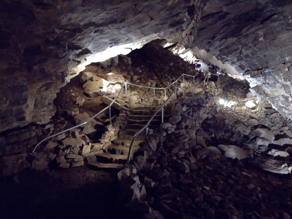
In Montpelier, Idaho, the National Oregon/California Trail Center is managed by the U.S. Forest Service on the Pioneer Historic Scenic Byway.  To the southwest, Minnetonka Cave is one of the few developed cave tours offered by (a concessionaire for) the Forest Service.  The natural entrance to Minnetonka Cave was widened and the route lighted by the Works Progress Administration in the 1930s when 444 stairs were installed to allow large groups to visit.  The tour goes out and back on the same route so the steep downward sections become climbs on the return trip, but guides make multiple stops in both directions to allow you to catch your breath at this high elevation.

Best Trail

Further north than Minnetonka Cave, a 9.5-mile long dirt road drive up to 7,800 feet in elevation leads to the short boardwalk through the Paris Ice Cave.  This photogenic natural tunnel is open at both ends so it does not require a flashlight, but does retain snowpack deep into the summer months.  Signs at both caves still say Cache National Forest even though this district has not been managed by them since 1973.

Watchable Wildlife

This is a fairly arid portion of the west, so you are more likely to see a ground squirrel, coyote, or mule deer than any other wildlife.  In Minnetonka Cave, our tour guide pointed out a couple Townsend’s big-eared bats, which is why they screen all visitors for white-nosed bat syndrome.  We disturbed a nesting robin when exiting the Paris Ice Cave.

Instagram-worthy Photo

On the Idaho-Utah border, the 109-square-mile Bear Lake has been called the “Caribbean of the Rockies” because of its water’s intense turquoise color, due to suspended limestone sediment.  The naturally-formed lake sits at 5,924 feet in elevation and its maximum depth is 208 feet.  Both states have their own Bear Lake State Park with boat ramps and beaches for swimming. 

Peak Season

Summer

Fees

It costs $12 per person for the 80-minute Minnetonka Cave Tour that you must pay before driving up to the actual cave, but we did not come across any other fees.

Road Conditions

Access to Minnetonka Cave is paved and the 9.5-mile long dirt road drive up to Paris Ice Cave was good enough for our passenger vehicle to handle.

Camping

There are numerous campgrounds on the way to Minnetonka Cave and we found a large, flat dispersed camp along the road to Paris Ice Cave.

Wilderness Areas

None

Related Sites

Targhee National Forest (Idaho-Wyoming)

Fossil Butte National Monument (Wyoming)

Timpanogos Cave National Monument (Utah)

Nearest National Park

Grand Teton (Wyoming)

Conifer Tree Species

Rocky Mountain juniper, Utah juniper, limber pine, whitebark pine, ponderosa pine, lodgepole pine, Engelmann spruce, subalpine fir, white fir, Douglas-fir

Flowering Tree Species

quaking aspen, river birch, boxelder, Rocky Mountain maple, Bebb willow, blue elderberry, red osier dogwood, chokecherry, curlleaf mountain-mahogany, sagebrush

Explore More – The Caribou Mountains were named for a gold miner nicknamed “Cariboo Jack,” but what was his real name?

Learn more about Caribou and the 154 other National Forests in our new guidebook Out in the Woods

We are a participant in the Amazon Services LLC Associates Program, an affiliate advertising program designed to provide a means for us to earn fees by linking to Amazon.com and affiliated sites.

Cache National Forest

Cache National Forest

Utah, Idaho

Managed by U.S. Forest Service, Intermountain Region

1,216,778 acres (701,652 federal/ 515,126 other)

Website: https://www.fs.usda.gov/uwcnf

Overview

Cache National Forest surrounds Logan, Utah on three sides covering the Bear River Range and Wellsville Mountains, which are considered to have the steepest grade in the entire nation.  Since August 2007, Cache National Forest is officially part of the massive Uinta-Wasatch-Cache National Forest that sprawls across northeastern Utah.  To add to the bureaucratic confusion, the 263,940 acres of Cache National Forest in Idaho have been administered since 1973 by Caribou National Forest (see our next blog post).  When you subtract that land area, it only includes 437,712 acres of federal land, making it one of the smallest National Forests in the western U.S.

Highlights

Logan Canyon Scenic Byway, Wind Cave, Jardine Juniper, Tea Pot Rock, Old Limber Pine Nature Trail, Ogden River Scenic Byway, Pineview Reservoir, Tony Grove Lake Campground, Causey Reservoir, Wellsville Mountains, Naomi Peak National Recreation Trail

Must-Do Activity

Logan Canyon Scenic Byway follows Highway 89 and the beautiful Logan River up to a pass with views of Bear Lake, a naturally-formed body of water that gets its turquoise color from suspended limestone sediment (earning it’s the nickname “Caribbean of the Rockies”).  Logan Canyon is especially busy in the fall when the leaves change on quaking aspens and three species of maples: boxelder, canyon/bigtooth maple, and Rocky Mountain maple. 

Best Trail

Logan Canyon has two popular, but steep trails that lead to Wind Cave and the Old Jardine Juniper, the world’s largest Rocky Mountain juniper estimated to be at least 3,000 years old.  The 3.6-mile out-and-back trail to Wind Cave starts from a roadside pullout across from Guinavah-Malibu Campground and gains more than 900 feet in elevation.  Hiking to the Old Jardine Juniper requires a climb of over 2,100 feet along the five-mile one-way trail, which continues further into the Mt. Naomi Wilderness.

Watchable Wildlife

Trout fishing is a popular activity due to all of the rivers and streams in Cache National Forest.  Large mammalian species include elk, mule deer, pronghorns, and black bears.  Watch the skies above Logan Canyon for ravens and a variety of birds of prey.

Instagram-worthy Photo

The limestone arches of Wind Cave originally formed underground then were exposed when the Logan River cut its steep canyon.

Peak Season

Summer

Fees

None

Road Conditions

Logan Canyon (Highway 89) and Ogden River (Highway 39) Scenic Byways are both paved.  We did not drive any unpaved roads, but we did notice that the dirt roads around Bear Lake Summit (on Highway 89) looked very rutted and four-wheel-drive only.

Camping

There are numerous campgrounds along both the Logan Canyon and Ogden River Scenic Byways.  We did not notice any dispersed campsites in these areas, although there probably are some options in more remote portions of the National Forest.

Wilderness Areas

Mt. Naomi Wilderness

Wellsville Mountain Wilderness

Related Sites

Golden Spike National Historical Park (Utah)

Timpanogos Cave National Monument (Utah)

Wasatch National Forest (Utah-Wyoming)

Nearest National Park

Grand Teton (Wyoming)

Conifer Tree Species

Rocky Mountain juniper, Utah juniper, limber pine, whitebark pine, ponderosa pine, lodgepole pine, Engelmann spruce, subalpine fir, white fir, Douglas-fir

Flowering Tree Species

quaking aspen, river birch, boxelder, canyon/bigtooth maple, Rocky Mountain maple, Bebb willow, blue elderberry, chokecherry, curlleaf mountain-mahogany, sagebrush

Explore More – In what year did the Cache Valley host the second-ever rendezvous of fur-trapping mountain men?

Learn more about Cache and the 154 other National Forests in our new guidebook Out in the Woods

We are a participant in the Amazon Services LLC Associates Program, an affiliate advertising program designed to provide a means for us to earn fees by linking to Amazon.com and affiliated sites.