Tag Archives: State Park

Missouri Road Trip Itinerary

43,994,573 acres

Statehood 1821 (24th)

Capital: Jefferson City

Population: 6,154,913 (18th)

High Point: Taum Sauk Mountain (1,772 feet)

Best time of year: Spring and fall

After publishing the guidebook 50 States of Great: Road Trip Guide to America, I have been creating blog posts with a travel itinerary for every state.  After starting with KansasGeorgiaIdaho, Rhode Island, MinnesotaHawai‘iArizonaLouisianaSouth DakotaIndiana, Montana, Mississippi, and Wyoming, I decided to do a central state that borders the most other states (eight).  I made an ambitious seven-day plan starting in St. Louis, with plenty of options to extend the trip.

Day 1

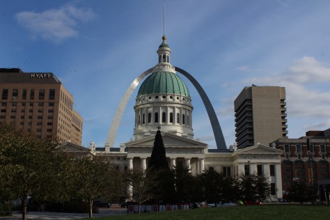
Gateway Arch National Park (click here for our blog post)

Formerly Jefferson National Expansion Memorial, in 2018, this 193-acre site was named the country’s 60th (and smallest) National Park.  It has a new museum and theater, and the claustrophobia-inducing tram cars still take visitors to the top of the arch for excellent views of St. Louis and across the Mississippi River into Illinois.  The city is also home to 1,371-acre Forest Park (site of the 1904 World’s Fair), with many attractions like a zoo, art museum, ice skating rink, outdoor musical theater, history museum, and science center.

Optional stop at Ulysses S. Grant National Historic Site (click here for our blog post)

The antebellum plantation of White Haven is where the future General and President raised a family in the 1850s following his initial resignation from the U.S. Army.  A thought-provoking museum is housed in the former horse stables, while access inside the house is only on a free ranger-guided tour.  It is located next to Grant’s Farm that offers free Budweiser brewery tours and a chance to see the famous Clydesdale horses.

Day 2

Mark Twain Boyhood Home and Museum

The celebrated author’s hometown of Hannibal on the Mississippi River is a pilgrimage site for a half-million visitors annually.  The museum has eight buildings, including the house his father built in 1843.  Across the street is the Becky Thatcher House, where Twain’s childhood sweetheart (Laura Hawkins) lived.  Held every July, National Tom Sawyer Days features frog-jumping and fence-painting contests. 

Optional stop at Clarence Cannon National Wildlife Refuge

Named in honor of a U.S. Congressman, these 3,750 acres provide a variety of wetland habitats for migratory birds along the Mississippi River floodplain.

Day 3

Jefferson City

The capitol building is known for its stained glass, murals, carvings, and statuary, as well as being home to the Missouri State Museum.  Nearby, Jefferson Landing State Historic Site preserves the Lohman Building and Union Hotel that were restored along the Missouri River. 

Optional stop at Mark Twain National Forest (click here for our blog post)

Spread across nine separate units, this sprawling jurisdiction used to be two National Forests until 1976 when the more northerly Clark National Forest was administratively combined.  Between Jefferson City and Columbia, Pine Ridge Recreation Area accesses Cedar Creek Trail, which has multiple trailheads and four loops totaling 36 miles.

Day 4

Kansas City

The city that crosses the western state border has more than 200 fountains, the most of anywhere outside Rome, Italy.  Kansas City is best known for its barbecued meats slathered in thick, tangy sauce, a tradition dating back to 1908.  The two oldest contenders for best barbecue in K.C. are Arthur Bryant’s Barbecue and Gates and Sons Bar-B-Q, but it is hard to find a bad restaurant due to the stiff competition. 

Nelson-Atkins Museum of Art

The most photographed spot in the city might be the giant shuttlecock sculptures on the lawn of the free art museum (where there’s also a free mini-golf course). Near Union Station, the National World War I Museum at Liberty Memorial features a 217-foot-tall Art Deco tower with an Egyptian motif.

Harry S Truman National Historic Site (click here for our blog post)

The visitor center in downtown Independence offers a film and a few artifacts, as well as first-come, first-served tickets for ranger-guided tours of the Truman Home.  About a 30-minute drive from Independence, take a self-guided cell phone tour around the ten acres surrounding the 1894 Truman Farm Home, which once stood on a 600-acre farm that is now the suburb of Grandview.

Optional stop at National Frontier Trails Museum

If you make it to Independence, pay to visit this museum located where emigrants once departed to begin their long journeys on the Santa Fe, Oregon, and California National Historic Trails. 

Day 5

George Washington Carver National Monument (click here for our blog post)

When Carver died in 1943, this site became the first National Park Service unit to honor an African-American.  The scientist was born into slavery on this farm but went on to earn a master’s degree in botany from Iowa State University in 1896 and to work at Tuskegee Institute for 47 years where he popularized peanut, sweet potato, and soy agriculture.  There is a museum with interactive exhibits and a self-guided one-mile loop trail with interpretive signs. 

Wonders of Wildlife National Museum & Aquarium

The original Bass Pro Shops in Springfield has almost 500,000 square-feet dedicated to outdoor recreation, including the Archery Hall of Fame and this impressive aquarium (fee). 

Optional stop at Wilson’s Creek National Battlefield (click here for our blog post)

Missouri stayed in the Union throughout the Civil War despite the $10-million in property damage caused by guerrilla fighters, making it the third most fought-over state.  Start your visit by watching a short film, then peruse the excellent museum before taking the five-mile driving route that provides an overview of the battle at eight interpretive stops.

Day 6

Branson

The entertainment capital of the central U.S. has a main strip lit up like Las Vegas without the casinos.  The main draw is the variety of live music and magic shows offered every day of the week in 37 theaters, but do not miss the historic downtown with the iconic Dick’s 5 & 10 Cent Store on Main Street.  There are also mini-golf courses, a wax museum (topped by King Kong), an amusement park, a Ripley’s Believe It or Not! Odditorium, and a building shaped like the bow of the Titanic hitting a giant iceberg. 

Mark Twain National Forest (click here for our blog post)

Spread throughout the Ozark Mountains, 1.5-million-acre Mark Twain National Forest is full of caves, sinkholes, springs, and streams.  Greer Spring is the second largest in Missouri, with a daily flow of 222-million gallons as it drains 1.2 miles into the Eleven Point National Scenic River.  Several long trails explore the National Forest’s seven designated Wilderness areas, including sections of the 350-mile Ozark Trail.  Mark Twain National Forest also has three designated Scenic Byways: Blue Buck Knob, Sugar Camp, and Glade Top Trail.

Optional stop at the “Tri-Lakes”

The reservoirs of Table Rock, Taneycomo, and Bull Shoals offer opportunities for boating, fishing, and water sports.  The U.S. Army Corps of Engineers runs a museum at 252-foot-tall Table Rock Dam on the White River.

Day 7

Ozark National Scenic Riverways (click here for our blog post)

The Jacks Fork and Current Rivers flow freely within Ozark National Scenic Riverways.  The best way to explore the serpentine park boundaries is on the water, but roads access several swimming holes and the bright red Alley Mill.  The dolomite and limestone karst underneath this park is riddled with caves and sinkholes, like Devils Well, Round Spring Cave (offering ranger-guided tours for a fee), and Jam Up Cave (only accessible from the Jacks Fork River). 

Optional stop at Johnson’s Shut-Ins State Park

After suffering catastrophic damage from a 2005 dam breach, this park has been redeveloped and still has the chutes and waterfalls that provided its name.  Its campground is considered one of the nation’s best for RVs on public land.

Day 8+

Ste. Genevieve National Historical Park (click here for our blog post)

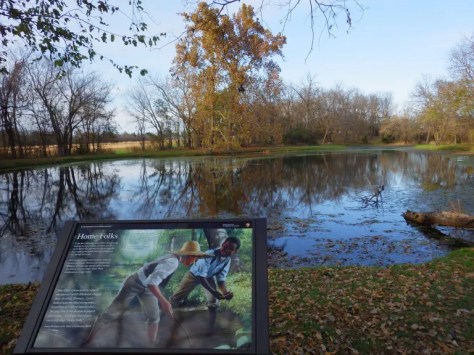
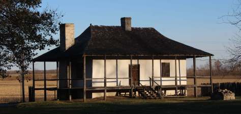
Established in 2020 to protect the French colonial-era houses of Missouri’s first permanent settlement where residents still go all out to celebrate Bastille Day.  The oldest standing structure is the Bolduc House that dates back to 1792, while the Old Brick House from 1804 is now a restaurant.

Ha Ha Tonka State Park

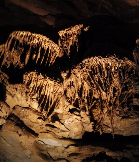
This geologic wonderland features a natural bridge, caves, sinkholes, limestone bluffs, and a large natural spring, but may be best known for the burned-out ruins of a mansion.

Katy Trail

The M-K-T (Missouri-Kansas-Texas) Railroad has been converted into the 240-mile-long Katy Trail, running across the state from north of St. Louis to Clinton (75 miles southeast of Kansas City).  Camping along the trail is an option, but it passes through many towns with hotels. 

Taum Sauk Mountain State Park

Accessed from the same trailhead as the state’s high point, Mina Sauk Falls is a 132-foot cascade accessed via a three-mile out-and-back hike that gains 430 feet in elevation.  Missouri’s tallest waterfall typically flows best during the spring season; otherwise, it is reduced to a trickle. 

Elephant Rocks State Park

The park’s billion-year-old granite rocks are broken into vertical cracks and eroded into huge “elephants” like 680-ton Dumbo (27 feet tall and 35 feet long).  The park even has a one-mile paved path designed specifically for the visually impaired with signs in Braille. 

Loess Bluffs National Wildlife Refuge

In northwest Missouri, winter is the time to visit to see nearly one-million snow geese, plus trumpeter swans, bald eagles, and a variety of shorebirds and waterfowl.

Learn more about Missouri’s Most Scenic Drive, Wonderful Waterfall, Top State Park, and other categories in our new travel guidebook  50 States of Great: Road Trip Guide to America.

Natchez Trace Parkway

Natchez Trace Parkway

Mississippi-Alabama-Tennessee

Managed by National Park Service

Established 1938

52,302 acres

Website: nps.gov/natr

Overview

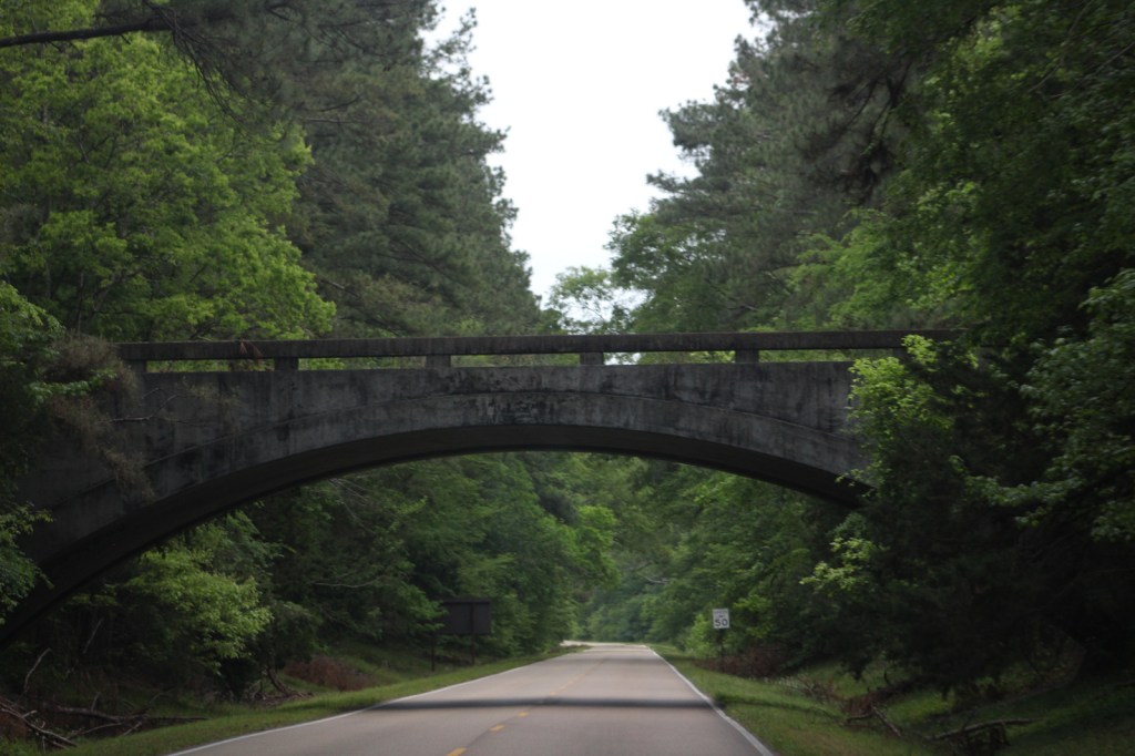
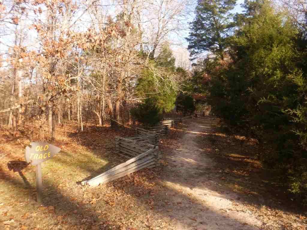
The National Park Service (NPS) administers the Natchez Trace Parkway, a two-lane All-American Road that extends 444 miles from Natchez, Mississippi to Nashville, Tennessee.  The trace started as a game trail that was utilized as an American Indian footpath.  Some of the mound builder sites protected here were inhabited when Hernando de Soto led the first Europeans into this area in 1540.  The Natchez Trace was heavily used in the 1800s by “Kaintuck” flatboatmen returning from New Orleans who left the Mississippi River from Natchez, Mississippi and continued on foot north to Kentucky and beyond.  Today you can still follow portions of the sunken trail worn down by travelers for centuries.  The parkway began as a Civilian Conservation Corps (CCC) project during the Great Depression and the final two segments were completed in 2005.

Highlights

Rocky Springs, Owens Creek Waterfall, Emerald Mound, Mount Locust, Chickasaw Village, Meriwether Lewis Monument and Gravesite, Cypress Swamp Walk, Witch Dance Horse Trail, Natchez Trace National Scenic Trail

Must-Do Activity

Near Tupelo, the Parkway Visitor Center at Milepost 266 is a must-do stop to learn the history of the trace, and it also serves as the NPS contact station for tiny Brices Cross Roads National Battlefield Site and Tupelo National Battlefield.  There are numerous roadside informational pullouts and trailheads along the route, so use the NPS app or pick up an official “unigrid” map.  You can easily spend days exploring, but at a minimum we recommend you check out Emerald Mound, Mount Locust, Cypress Swamp, and Meriwether Lewis Monument and Grave Site.

Best Trail

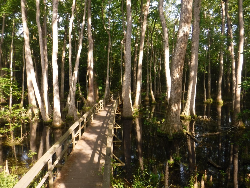
Our favorite trail is the Cypress Swamp Walk at Milepost 122, where a boardwalk crosses a scenic tupelo-baldcypress swamp.  The Natchez Trace National Scenic Trail (click here for our blog post) does not follow the entire 444-mile parkway, but exists in five segments totaling 67 miles in length.  There are also 15 miles of equestrian trails at Witch Dance (Milepost 233.2) in Tombigbee National Forest.

Photographic Opportunity

Not far from Natchez National Historical Park, Emerald Mound (a short detour at Milepost 10.3) is the second-largest American Indian ceremonial mound in the U.S.  It stands 35 feet tall and 770 by 435 feet at its base. 

Peak Season

Spring and fall

Hours

https://nps.gov/natr/planyourvisit/hours.htm

Fees

None

Road Conditions

The entire 444-mile Natchez Trace Parkway is paved from Natchez, Mississippi to Nashville, Tennessee with commercial traffic prohibited and a maximum speed limit of 50 miles per hour.  There is a detour from Milepost 181 to 204 due to ongoing construction.  Watch for bicycles and white-tailed deer on the road.

Camping

There are three free NPS campgrounds (at Milepost 54, 193.1, and 385.9) along the route, as well as those in sites like Mississippi’s Tishomingo State Park.  The three NPS campgrounds have water and bathrooms (but no RV hookups), plus there are also five bike-only campsites along the route.  Jeff Busby Campground closed in June 2025 for repairs.

Related Sites

Natchez National Historical Park (Mississippi)

Tupelo National Battlefield (Mississippi)

Brices Cross Roads National Battlefield Site (Mississippi)

Vicksburg National Military Park (Mississippi)

Nearest National Park

Hot Springs

Explore More – When were Ackia Battleground National Monument and Meriwether Lewis National Monument disbanded and added to the Natchez Trace Parkway?

Katahdin Woods and Waters National Monument

Katahdin Woods and Waters National Monument

Managed by National Park Service

Established 2016

87,564 acres

Website: nps.gov/kaww

Overview

Central Maine is an ecological transition zone between boreal and broadleaf deciduous forests that provides habitat for Canada lynx, black bear, moose, and beaver.  The waters are home to brook trout and Atlantic salmon, which are being reestablished with cooperation between government agencies and the Penobscot and other Wabanaki Nations.  The official northern terminus of the Appalachian National Scenic Trail, Katahdin means “greatest mountain” in the Penobscot language and is the name of the 5,269-foot peak outside National Monument boundaries in neighboring Baxter State Park.  This undeveloped landscape was purchased by the businesswoman Roxanne Quimby beginning in 2001 with the plan to turn it into a National Park.  It was donated to the National Park Service to mark the centennial of its creation and, despite some controversy, was established by President Barack Obama. 

Learn more about the other 137 National Monuments in our book Monumental America: Your Guide to All 138 National Monuments. It is now available for sale on Amazon.com.

Highlights

Tekαkαpimək Contact Station, Patten Lumbermen’s Museum, Katahdin Loop Road, Barnard Mountain, Stair Falls

Must-Do Activity

Opened in 2025 near the south entrance, the Tekαkαpimək Contact Station is seasonally open Friday through Sunday in a building inspired by Wabanaki culture.  The National Park Service no longer works out of the Patten Lumbermen’s Museum (but it is still worth a visit).  The 17-mile-long Katahdin Loop Road in the southern section of the National Monument is the most developed with picnic areas, vault toilets, and overlooks.  The unpaved loop road is accessed from the east by miles of unpaved road and has no access to Baxter State Park.  About 30 miles of the International Appalachian Trail runs through Katahdin Woods and Waters National Monument with lean-tos dispersed along the route.  Other than hiking, visitors enjoy stargazing, birding, leaf peeping in the fall, canoeing the East Branch of the Penobscot River with portages around its many waterfalls.  In the winter, there are opportunities for cross-country skiing, snowshoeing, and snowmobiling. 

Best Trail

From the Haskell Gate at the end of New River Road, it is 3.5 miles out-and-back to Stair Falls on the East Branch of the Penobscot River.  The first part follows an old road and the International Appalachian Trail before branching north at a signed junction to access the water and is also open to bicycles.  The only trailhead accessed from a paved road is the 13.6-mile Seboeis Riverside Trail that starts outside the National Monument off Grand Lake Road.     

Photographic Opportunity

One of the best views of Katahdin is from the top of Barnard Mountain, accessed by a two-mile one-way hike with 725 feet of elevation gain. 

Peak Season

Summer

Hours

https://www.nps.gov/kaww/planyourvisit/basicinfo.htm

Fees

None

Road Conditions

Every road within the National Monument is unpaved, so watch for potholes and logging trucks.  The north and south entrances have gates that close seasonally.

Camping

Reservations are required to car camp at designated sites within Katahdin Woods and Waters National Monument and can be made online at Recreation.gov

Related Sites

Appalachian National Scenic Trail (Maine to Georgia)

Saint Croix Island International Historic Site (Maine)

White Mountain National Forest (New Hampshire, Maine)

Nearest National Park

Acadia

Explore More – When did Katahdin Woods and Waters National Monument receive official recognition as a Dark Sky Sanctuary?

Learn more about the other 137 National Monuments in our book Monumental America: Your Guide to All 138 National Monuments

Minnesota Road Trip Itinerary

50,961,114 acres

Statehood 1858 (32nd)

Capital: St. Paul

Population: 5,706,494 (22nd)

High Point: Eagle Mountain (2,302 feet)

Best time of year: Summer for the state fair and access to the northern lakes

We recently published our guidebook 50 States of Great: Road Trip Guide to America, so we decided to start a new type of blog post where we create a travel itinerary for all 50 states, in addition to our usual National Forest and National Park entries.  After starting with KansasGeorgia, Idaho, and Rhode Island, we decided to do a state that is part Midwest and part North Woods.  We made an ambitious seven-day plan starting in the southern Minnesota, with plenty of options to extend the trip.

Day 1

SPAM Museum

Located in the small town of Austin, this free museum is full of interactive exhibits and photo opportunities, but the best part is that it does not take itself too seriously.  Even if you do not like to eat the canned “spiced ham” product, you will come to appreciate its significance to World War II history and pop culture, as well as its amazing gift shop with more branded products than you can imagine.

Niagara Cave or Mystery Cave

Niagara Cave is a privately-owned show cave named for its 60-foot-tall underground waterfall that is only viewable on guided tours.  Not far away, Forestville/Mystery Cave State Park contains the state’s longest cave (47 degrees year round) which also offers guided tours.

Optional stop at Pipestone National Monument (click here for our blog post)

If you come into the state from the southwest corner, consider a stop at a spot that people have come for 2,000 years to mine the red quartzite rock (also known as catlinite).  The soft sedimentary stone is relatively easy to carve into smoking pipes and effigies.  April through October, you can watch American Indian carvers at the National Park Service (NPS) museum demonstrate how to sculpt this soft yet durable stone into hollow pipes and other beautiful ornaments, some of which you can buy in the gift shop.

Optional stop at Laura Ingalls Wilder Museum

Fans of the author’s “Little House” series of books will want to see a replica of the Ingalls’ home in Walnut Grove and some of the family’s historic heirlooms.

Day 2

Mall of America

Indoor shopping malls are still thriving in the Twin Cities (Minneapolis-St. Paul) metropolitan area, perhaps due to the cold and snowy winter weather.  The most famous is the Mall of America with its indoor amusement park and 520 stores, making it the largest mall in the western hemisphere (and eleventh largest in the world).

Mississippi National River and Recreation Area (click here for our blog post)

This park follows 72 miles of the great river’s course through Minnesota, from busy metropolitan sections in the Twin Cities to secluded stretches of water where it reaches its confluence with the Saint Croix National Scenic Riverway.  In downtown Minneapolis, Minnehaha Regional Park contains its namesake falls celebrated in Henry Wadsworth Longfellow’s Song of Hiawatha.  Nearby, St. Anthony Falls is the only true waterfall along the entire length of the Mississippi River, now controlled by a lock and dam.  

Optional stop at University of Minnesota Golden Gophers’ football game

We saw wild turkeys wandering around this beautiful campus that sits on a bluff east of the Mississippi River.  Nobody seems to be exactly sure what a golden gopher is (possibly a thirteen-lined ground squirrel), but their mascot Goldie is the cutest in all of college football.  Huntington Bank Stadium has one of the best pregame areas with plenty of photo ops and a pep rally held outside the hockey arena, plus we got free Culver’s custard, a clear bag giveaway, and Mystic Lake casino provided free towels and “spinny video thing.”  The football team typically schedules their home opener on the Thursday before Labor Day during the Minnesota State Fair.

Day 3

Minnesota State Fair

You will need all day to visit America’s best state fair that is held annually the 12 days before Labor Day, welcoming more than two-million visitors annually.  The fair has the standard carnival rides, butter sculptures, farm animals, and artwork, as well as stages where musicians, comedians, and magicians perform throughout the day.  Some of the unique food offerings include hotdish-on-a-stick, poutine, fried cheese curds, pronto pup, fried pickles, pork chop-on-a-stick, and fried buckeyes (chocolate and peanut butter candy).  Since it started in 1979, Sweet Martha’s Cookie Jar has been overfilling buckets of fresh-baked chocolate chip cookies for customers, making up to 200,000 cookies an hour.  To wash all that down, you might want to visit one of the stands offering all-you-can-drink milk.

Optional stop at Hell’s Kitchen restaurant

If you are still hungry after the Minnesota State Fair then you probably didn’t do it right, but we will make one of our rare restaurant recommendations for this unique spot in downtown Minneapolis with interesting décor and really good food (try the poutine or walleye bites).

Day 4

Paul Bunyan Expressway

The legendary giant lumberjack Paul Bunyan is a big deal in Minnesota and he has statues honoring him in many towns along the Paul Bunyan Expressway.  The 18-foot-tall statues in Bemidji were originally built in 1937 to honor these larger-than-life heroes and continue to be an essential roadside attraction.  In Brainerd, Paul Bunyan Land is an entire amusement park built around a 26-foot-tall talking statue of Paul and 19-foot Babe, the latter refurbished after it blew over in a 2006 windstorm.

Chippewa National Forest (click here for our blog post)

The Lost 40 is 144 acres of old-growth red and white pine forest that was never logged due to a surveying error that mapped the area as part of Coddington Lake in 1882.  The oldest tree here is more than 250 years old and can be seen on an easy one-mile loop trail with interpretive signs.  The trailhead is located east of Blackduck on well-signed back roads that are also popular for snowshoeing in the winter.  Nearby, Camp Rabideau is perhaps the best preserved Civilian Conservation Corps (CCC) camp left from the 1930s, with free guided tours in the summer.

Optional stop at Itasca State Park

Lake Itasca is considered the headwaters of the Mississippi River and is located just west of Highway 71 at the beginning of the 2,069-mile-long Great River Road that goes all the way to Louisiana.

Day 5

Roadside Sculptures

Driving north on Highway 71, there is seemingly another great roadside attraction located every few miles.  We saw the statues of Uncle Dan Campbell in Big Falls, Jack Pine Savage in Littlefork, the world’s largest crow in Belgrade, and a giant black duck in the town of Blackduck.  Right outside Voyageurs National Park, which surrounds Lake Kabetogama, was our favorite—a giant walleye with a saddle for riding.  If Kabetogama seems like a mouthful, rest assured that everyone, including park rangers, simply calls it “Lake Kab.”

Voyageurs National Park (click here for our blog post)

The park is famous for its manmade destinations, including Kettle Falls Hotel, Hoist Bay Resort, and the unique sculptures at Ellsworth Rock Gardens.  Try to get out on one of Minnesota’s 10,000 lakes via a ranger-led tour or take your own boat to one of the shoreline campsites inaccessible by car (permit required).  Reservations can be made for the ranger-guided North Canoe Voyage that lets passengers paddle a 26-foot canoe, just like the French-Canadian “voyageurs” of old. 

Day 6

Kawishiwi Falls in Ely

The little town of Ely is the gateway to the Boundary Waters Canoe Area Wilderness (see below), but even if you are just passing through be sure to make the short hike to Kawishiwi Falls below the dam on Garden Lake.

International Wolf Center in Ely

Gray wolves (called timber wolves regionally) reside in the North Woods and while a few lucky travelers might hear them howling, your best bet to see one is at the Wolf Center.  It also has a section dedicated to Sigurd Olson, a talented local author and naturalist.

Optional stop at United States Hockey Hall of Fame in Eveleth

As seen on the side of U-Haul trailers, Eveleth is home to this museum and shrine to American ice hockey players.

Day 7

North Shore Scenic Drive

The northwest shore of Lake Superior is a beautiful stretch of cliffs and waterfalls.  This 148-mile drive starts at the Canadian border near Grand Portage National Monument and passes on its way to Duluth several nice State Parks, including Grand Portage, Gooseberry Falls, Split Rock Lighthouse, Tettegouche, Temperance River, Cascade River, and Judge C. R. Magney State Parks

Grand Portage National Monument (click here for our blog post)

French-Canadian voyageurs had to walk their canoes and goods along an eight-mile-long portage to bypass the rapids on the Pigeon River.  In 1784, the end of the trail on the edge of Lake Superior became the site of the North West Company headquarters where they held an annual rendezvous, where today visitors can walk around the reconstructed buildings and talk with the costumed reenactors during the summer.

Optional stop at Two Harbors

North of Duluth, the North Shore Scenic Drive passes through the town of Two Harbors where there is a giant rooster at Weldon’s Gifts and a huge statue of Pierre the Voyageur outside the Earthwood Inn.  If you press the speaker button at the statue’s base, Pierre will tell you all about the history of the region, but he never explains why he is not wearing any pants. 

Day 8+

Superior National Forest

In addition to encompassing the state’s highest mountain, Superior National Forest also offers scenic drives on the Gunflint Trail (County Road 12), Fernberg Road (State Route 169), and Echo Trail (County Road 116).  Vermilion Gorge Trail is an easy 1.5-mile one-way hike to a narrow canyon cut through Canadian Shield rock in the small community of Crane Lake (on the east side of Voyageurs National Park).  Not far away down a dirt road, a short trail leads to Vermilion Falls where the same river cuts a narrow channel through the rock. 

Boundary Waters Canoe Area Wilderness

Permits for the peak season can be hard to come by for the world’s premiere destination for backcountry canoeing, so plan ahead.  This one-million-acre preserve has more than 1,000 lakes with over 1,500 miles of canoe routes and 2,200 designated backcountry campsites.  In addition to its famous water routes with numerous portages, a few overland trails exist like the 12-mile Angleworm Trail and the 39-mile Kekekebic Trail, an official part of the North Country National Scenic Trail.

Learn more about Minnesota’s Most Scenic Drive, Wonderful Waterfall, Top State Park, and other categories in our new travel guidebook 50 States of Great: Road Trip Guide to America.
Rhode Island Road Trip Itinerary

Rhode Island Road Trip Itinerary

Rhode Island

661,638 acres (0.03% of U.S.)

Statehood 1790 (13th of 50)

Capital: Providence

Population:  1,097,379 (44th of 50)

High Point: Jerimoth Hill (811 feet)

Best time of year: Summer for beaches, music festivals, and WaterFire in Providence

We recently published our guidebook 50 States of Great: Road Trip Guide to America, so we decided to start a new type of blog post where we create a travel itinerary for all 50 states, in addition to our usual National Forest and National Park entries.  After starting with Kansas, Georgia, and Idaho, we decided to do a New England state.  Despite it being the smallest of all 50 states, we were able to make a five-day plan starting in northern Rhode Island, with some options to extend the trip.
Day 1

Providence

Until 2020, the state’s full legal name was Rhode Island and Providence Plantations, but the legislature felt that had slavery connotations so they shortened it to Rhode Island.  At the head of Narragansett Bay, the capital city of Providence holds a summerlong event called WaterFire, where on weekend nights 86 wood-filled braziers blaze around the confluence of the Woonasquatucket and Moshassuck Rivers.

Roger Williams National Memorial (click here for our blog post)

Dedicated to the man who left the Puritan-led Massachusetts Bay Colony in 1636 to found a city based on religious freedom, this 4.5-acre park in downtown Providence houses a small National Park Service (NPS) visitor center.  A short, but steep walk takes you to a large statue of Roger Williams that offers a great overlook of the city. 

Optional stop at Roger Williams Park

Not to be confused with Roger Williams National Memorial, this large park is home to a zoo.  Providence also has two famous historic homes: the Sullivan-Dorr House and John Brown House.

Day 2

Blackstone River State Park

A scenic drive follows Highway 122 to this park, which has a free museum inside the historic Kelly House and a section of the canal that once followed the river.  It also has 3.5 miles of the 24-mile (of a planned 48) paved bikeway along the canal towpath.

Blackstone River Valley National Historical Park (click here for our blog post)

Blackstone River State Park is part of this park, which commemorates the industrial revolution that changed the landscape of America during the 1800s, as well as the immigration of factory workers that changed its face.  The NPS works with a partnership of government agencies, non-profits, and businesses in Massachusetts and Rhode Island.  The National Historical Park’s centerpiece is the nation’s first successful water-powered cotton-spinning factory:

Old Slater Mill National Historical Landmark

Located at a short, 180-foot-long dam on the Blackstone River in Pawtucket, free NPS ranger-guided tours are offered at this site.  Check out the bus station across the street for more interpretive displays and information.  By 1880, this “hardest working river” was one of the most polluted in the country, but it has recovered so that canoeists can now safely float portions of its 46-mile length.

Optional stop at Jerimoth Hill

It is a short, flat walk from a pullout on Highway 101 to the highest point in the state near the border with Connecticut.

Day 3

Shannock

This small village is situated on the Pawcatuck River, which has fueled grist mills, sawmills, woolen mills, cotton mills, and silk mills throughout its history.  Today, the curved shape of ten-foot-tall Horseshoe Falls Dam and fishway makes it unique and very picturesque. 

Fort Adams State Park

One of many red-brick coastal fortifications built in the U.S. after the War of 1812, visitors must purchase a ticket for a guided tour to explore inside the fort.  It hosts the famous Newport Folk Festival and Newport Jazz Festival on successive summer weekends in August, as well as the Great Chowder Cook-Off and Classic Yacht Regatta every Labor Day weekend.  During the Newport Winter Festival, ice carving and sand sculpture competitions are held here.

Optional stop at Seabee Museum and Memorial Park

In North Kingston, the A-shaped Chapel in the Pines and a three-dimensional statue of the Seabee logo are photogenic spots at this collection of Quonset Huts that honors the military engineers of World War II.

Day 4

Newport

Primarily built during the Gilded Age of the late 1800s, there are 11 houses open for tours that were the summer “cottages” of affluent families with recognizable last names like Carnegie, Vanderbilt, Morgan, Astor, and Rockefeller. 

Cliff Walk National Recreation Trail

Only 3.5 miles long, there are multiple public access points to this pathway that follows the shoreline through the backyards of some of the most expensive houses in Newport.  If you can only do part of the trail, make sure it includes the scenic area around the 40 Steps, a granite staircase located at the end of Narragansett Avenue.

Touro Synagogue National Historic Site

The nation’s oldest standing synagogue was originally built in 1763, although its congregation dates back to a century earlier when they came to Newport seeking religious freedom.  There is an admission fee for the 30-minute tour to see the ornate interior of the synagogue, and, next door, the Loeb Visitor Center opened in 2009 with an excellent museum upstairs. 

Newport Tower/Old Stone Mill

A 28-foot-tall tower in Touro Park has been variously attributed to the Vikings, the Knights Templar, Chinese sailors, Portuguese explorers, or the English astronomer John Dee.  We first learned about it from reading the side of a U-Haul trailer.  Although there is no information about it at the site, the nearby Newport Tower Museum provides plenty of speculation on its mysterious origins.  The most likely explanation is that it was built by Rhode Island’s first Governor, Benedict Arnold (great-grandfather of the infamous Revolutionary War General), as the base for a windmill. 

Optional stop at Green Animals Topiary Garden

Located ten miles outside Newport, this stop is more popular with children than the tedious, “do-not-touch” mansion tours. 

Day 5

Save the Bay Seal Watch Cruise

The Ocean State has 384 miles of Atlantic shoreline, much of it in Narragansett Bay, where harbor seals, hooded seals, gray seals, and harp seals can be seen on a guided cruise.

Ninigret National Wildlife Refuge

Walk the beach of a barrier island in Ninigret Conservation Area, or park inland at the Kettle Pond Visitor Center to hike trails through the woods on these 900 acres set aside in 1970 as a National Wildlife Refuge.

Beavertail State Park

Sitting on 153 acres at the southern tip of Conanicut Island, this park at the entrance to Narragansett Bay is famous for its 1856 lighthouse, but even more so for its sunsets.  The assistant keeper’s house now contains the Beavertail Lighthouse Museum where you will learn about the construction of Beaver Tail Fort during the American Revolution and Fort Burnside during World War II. 

Fishermen’s Memorial Campground

Located not on the beach but inland in the town of Narragansett, this campground is near Roger Wheeler State Beach, Salty Brine State Beach, and Scarborough State Beach, as well as the Block Island Ferry Dock at Point Judith.  It is extremely popular in the summer, so reservations are recommended.

Optional stop at Fantastic Umbrella Factory

This commune on the coast in Charleston has a small store selling handmade artwork and decorations, mostly with a beach theme.

Day 6+ optional ferry to Block Island

Pick up a ferry in Newport or Point Judith to spend a few nights on scenic Block Island (where we hope to visit someday).  There are few cars allowed on the island, so everyone is encouraged to bicycle or walk its 28 miles of nature trails.  More than 47% of the island is preserved from development, including Rodman’s Hollow and Mohegan Bluffs Scenic Natural Areas.

Block Island National Wildlife Refuge

Located at the northern end of the 6,000-acre island situated 12 miles off mainland Rhode Island, the refuge is an important stop for migratory birds since its many ponds contain significant sources of freshwater.  Block Island and its 17 miles of sandy beaches have been attracting summer vacationers for decades, but the National Wildlife Refuge was not established until 1973.

Learn more about Rhode Island’s Most Scenic Drive, Wonderful Waterfall, Top State Park, and other categories in our new travel guidebook 50 States of Great: Road Trip Guide to America.