Tag Archives: geology

Upper Missouri River Breaks National Monument

Upper Missouri River Breaks National Monument

Managed by Bureau of Land Management

Established 2001

377,346 acres

Website: https://www.blm.gov/programs/national-conservation-lands/montana-dakotas/upper-missouri-river-breaks

Overview

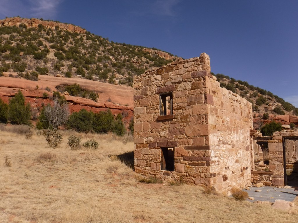
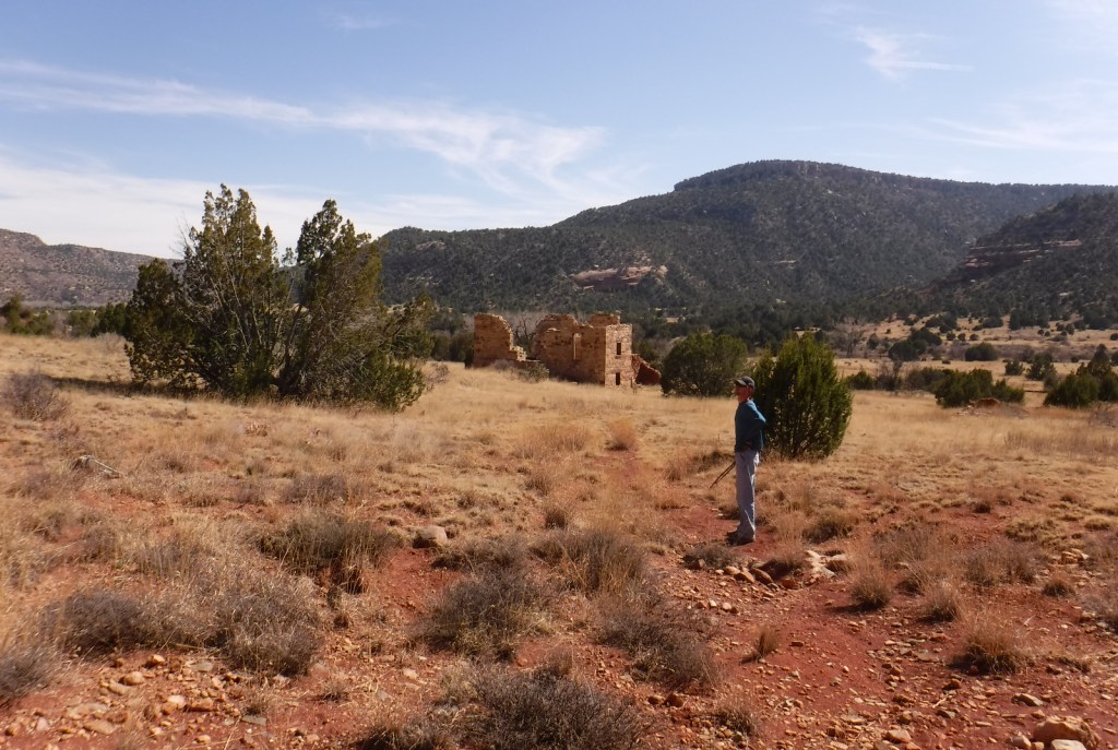
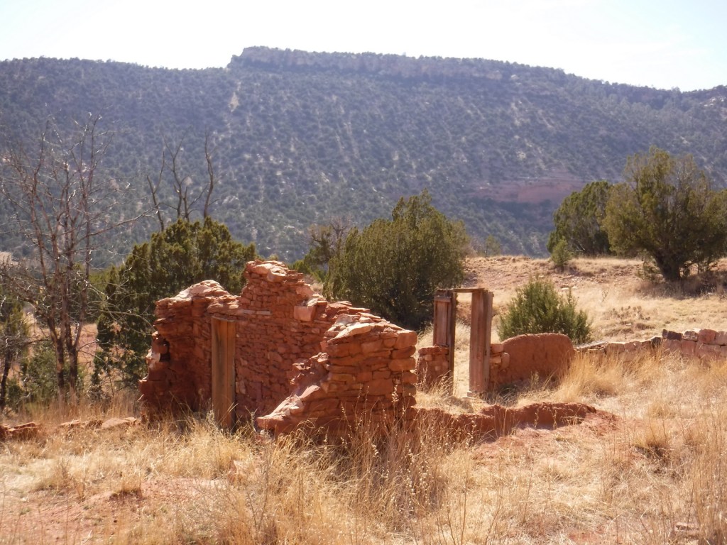
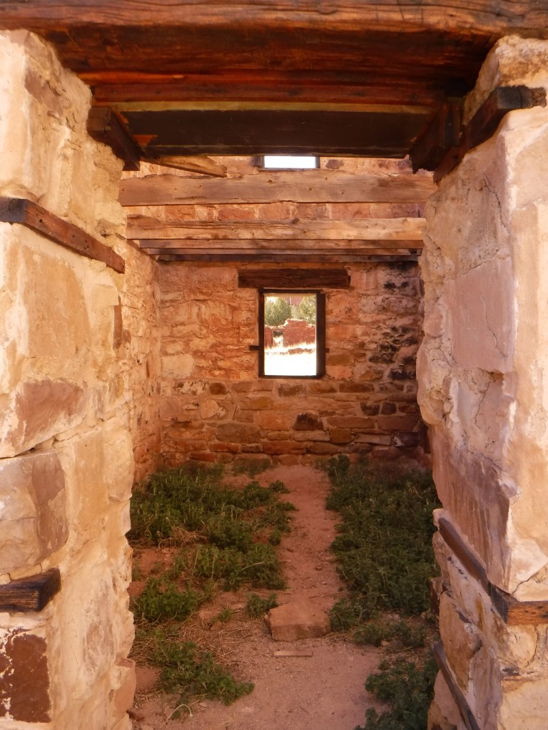
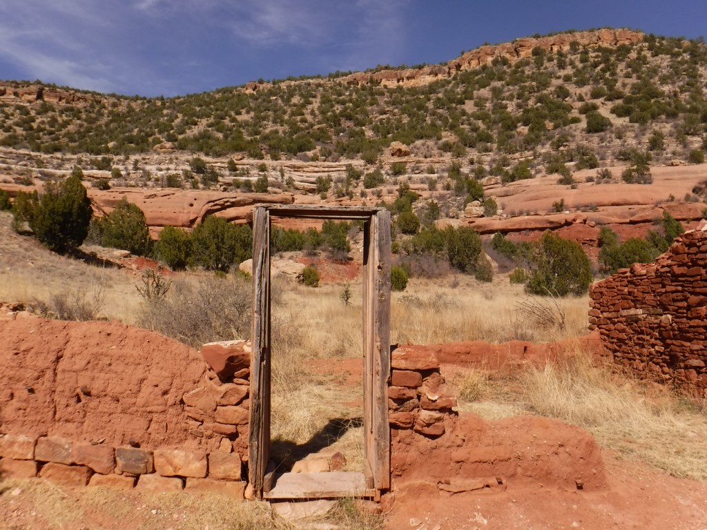
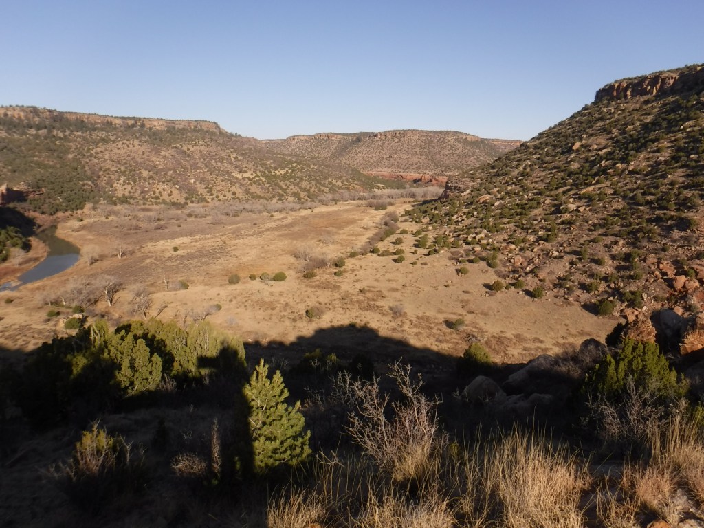
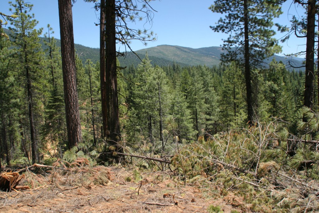
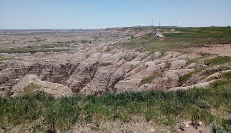
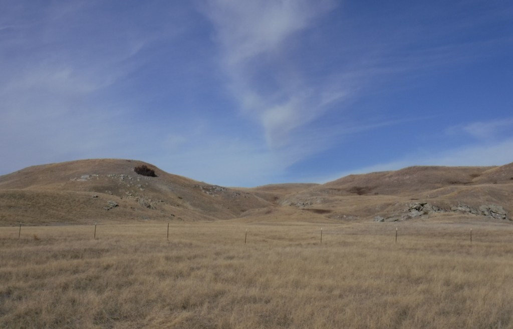
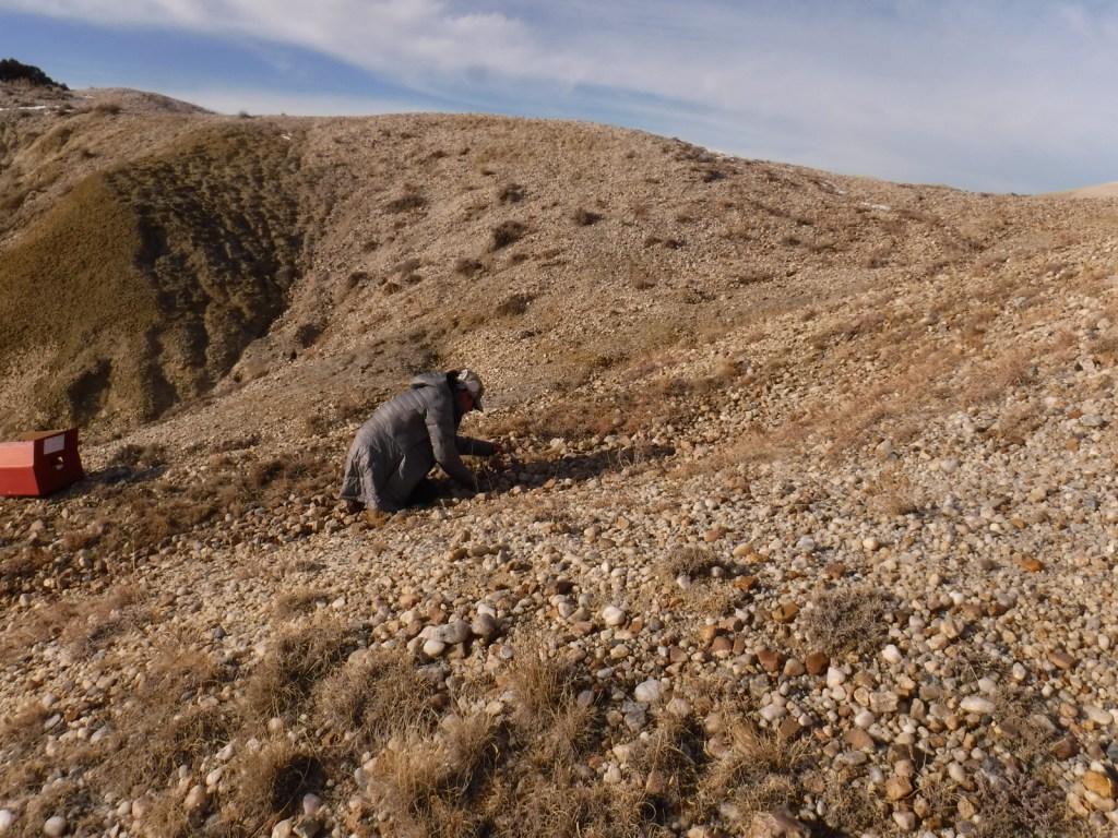
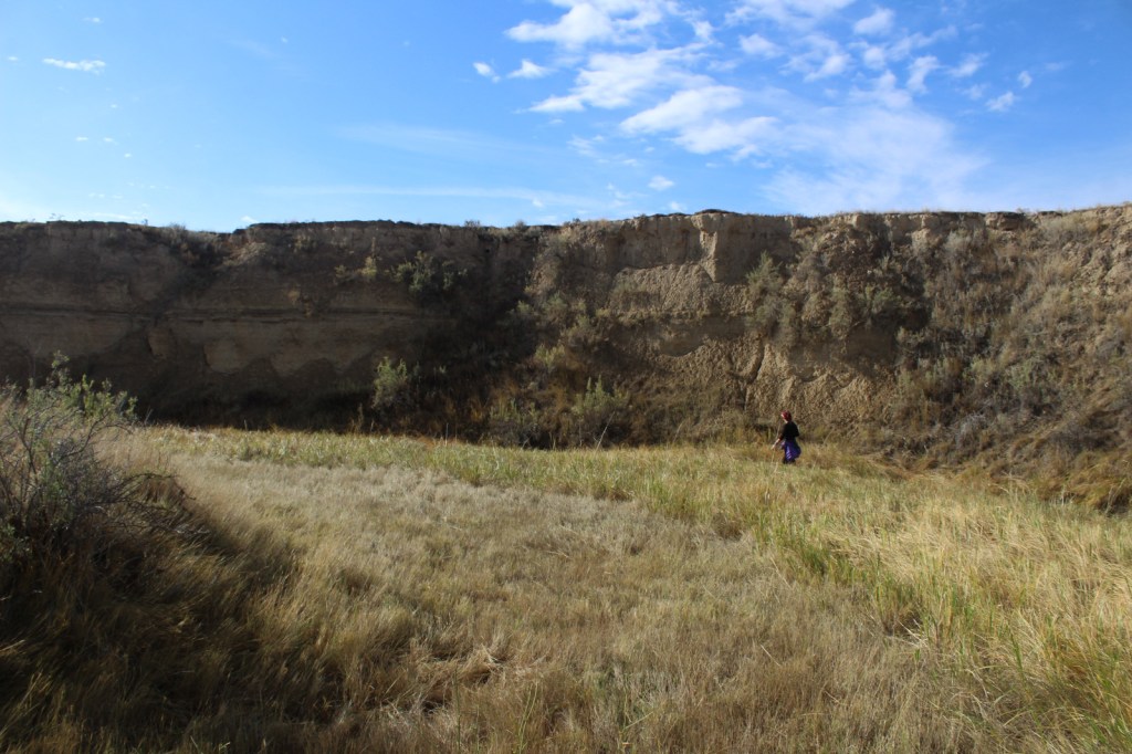
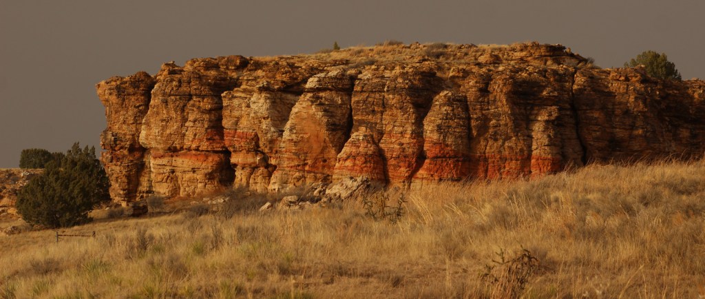
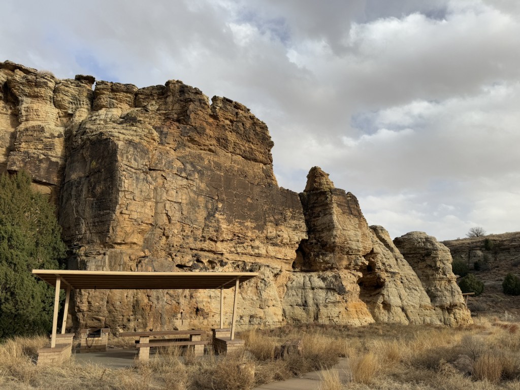
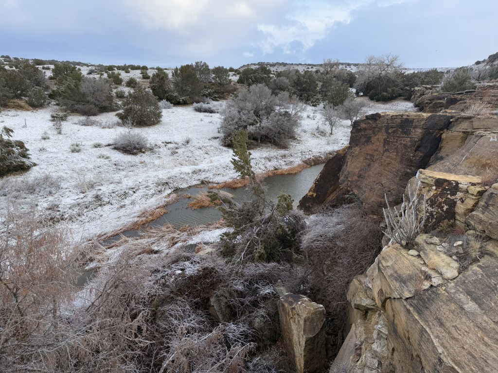
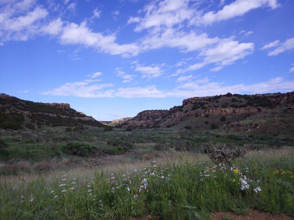
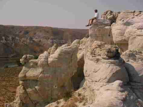
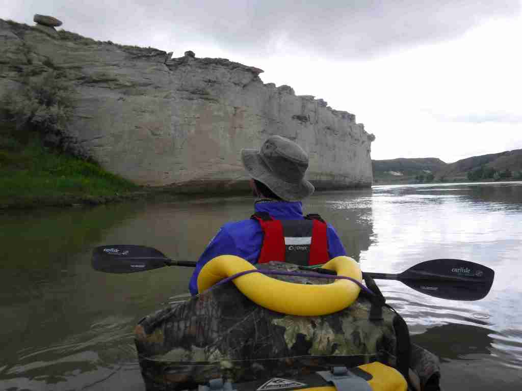
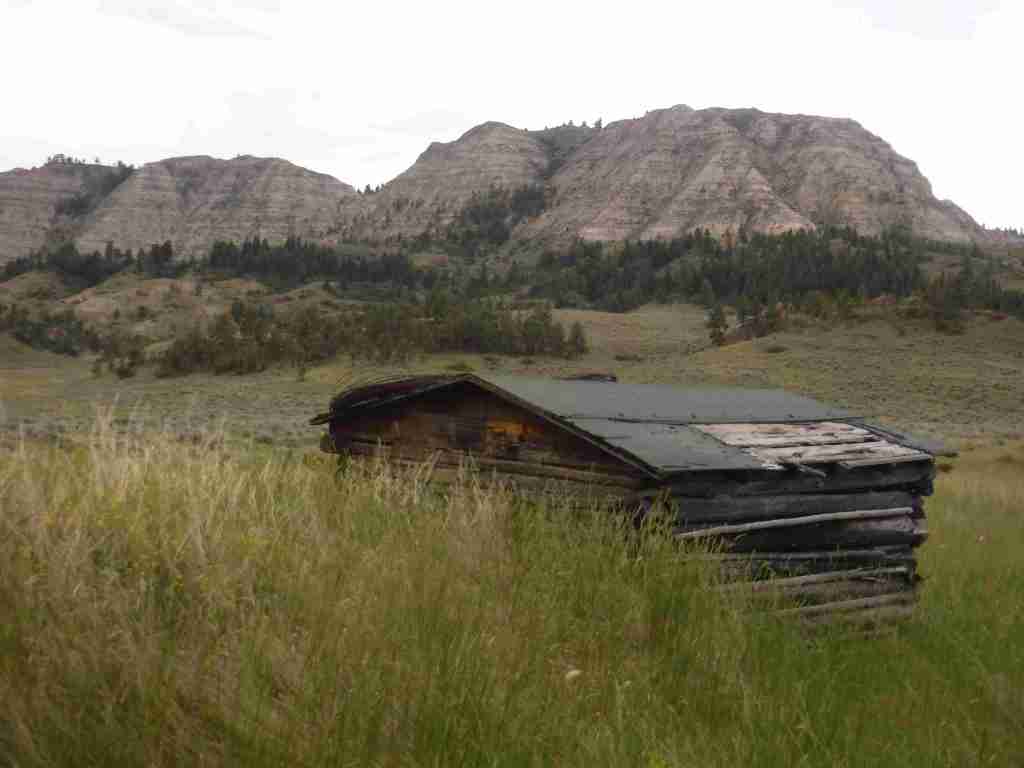
In central Montana, 149 miles of the Upper Missouri River were designated as a National Wild and Scenic River in 1976, upstream from the reservoir in Charles M. Russell National Wildlife Refuge.  This stretch of the river still looks much the way it did when the Lewis and Clark expedition first explored it in 1805 and their former campsites are marked by posts.  The breaks are a topographic area where the Missouri River eroded sedimentary rock that formed as horizontal layers laid down at the bottom of an ancient sea.  The National Monument comprises public land in a matrix with private ranches, with cattle making the water unfit for filtering.  There are a couple places to drive to along the river, but the best way to experience it is by floating a canoe or kayak down the non-motorized sections

Learn more about the other 137 National Monuments in our book Monumental America: Your Guide to All 138 National Monuments. It is now available for sale on Amazon.com.

Highlights

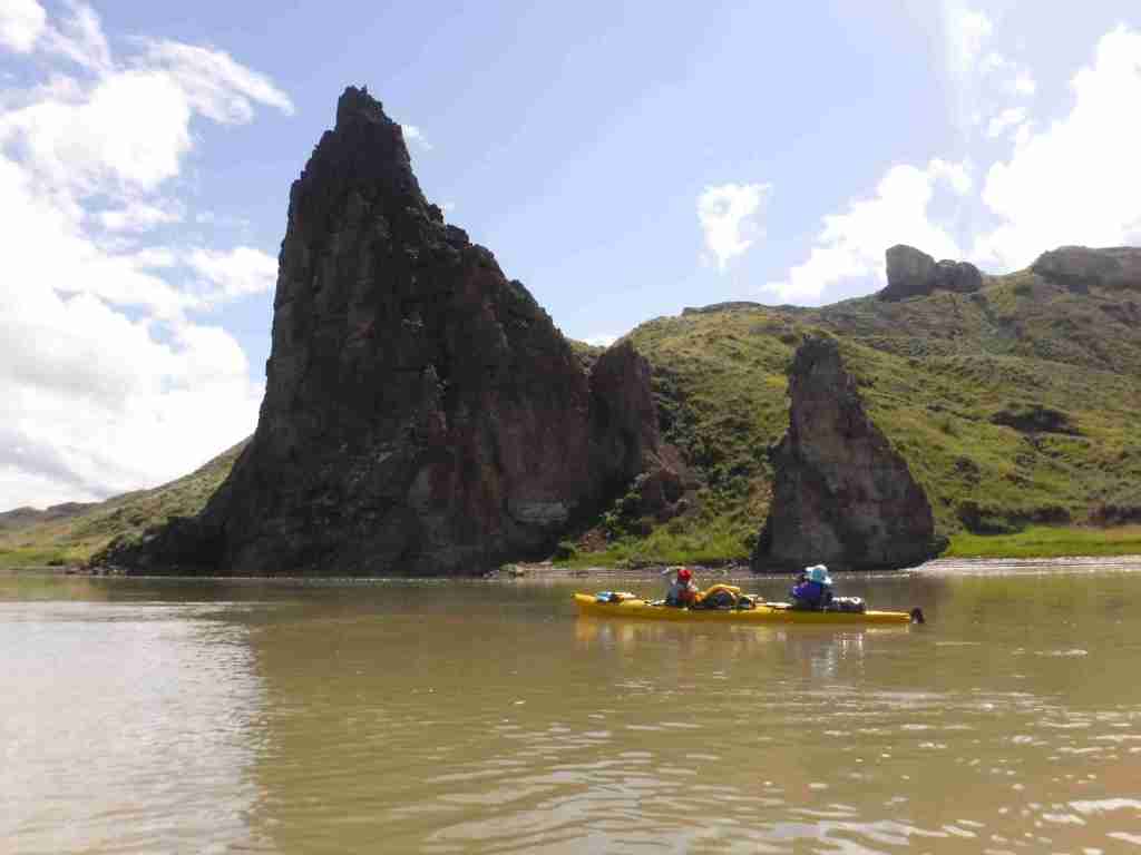
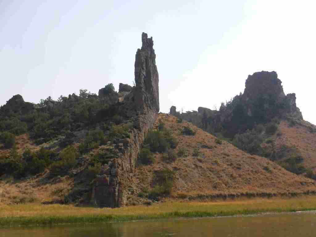
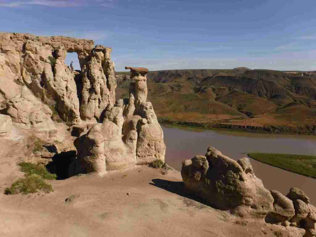
Fort Benton, Decision Point, Neat Coulee, Citadel Rock, Hole-in-the-Wall, Lewis and Clark National Historic Trail

Must-Do Activity

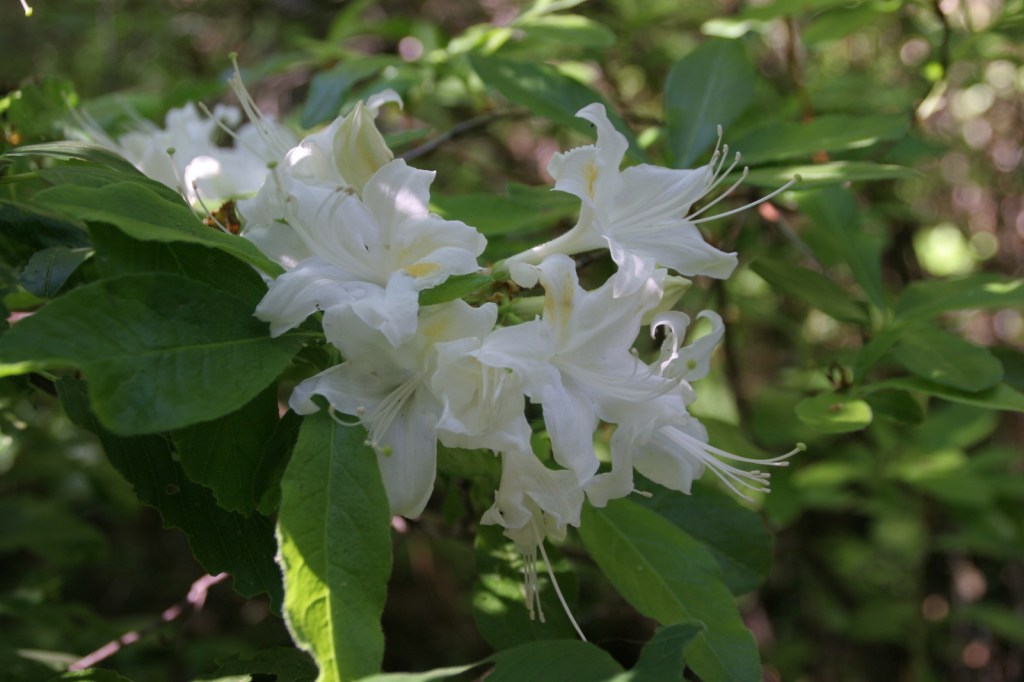
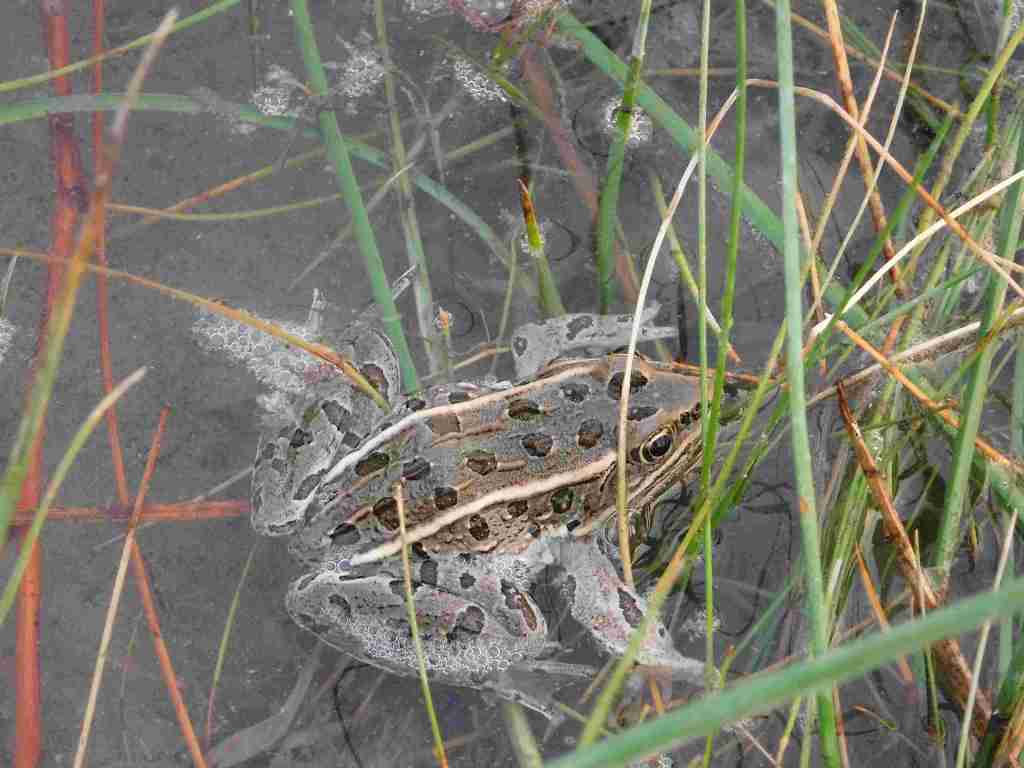
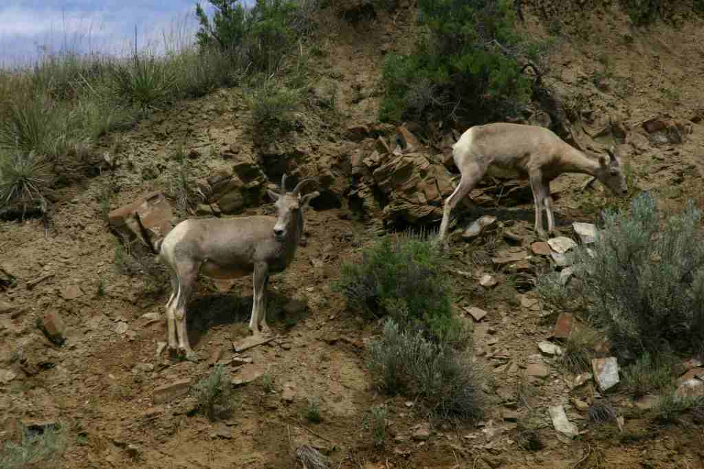
In Fort Benton, start your visit at the free interpretive center run by the Bureau of Land Management (BLM), then head downtown to learn more history by walking the riverfront of Fort Benton National Historic Landmark, including its many museums (admission fees charged) and sculptures of Lewis, Clark, Sacagawea and her son Pompey, and Shep (a local dog famous for his faithfulness).  To find out more about the Corps of Discovery, check out the Lewis and Clark Interpretive Center upstream in Great Falls.  The most scenic stretch to float lies in the 44 miles between Coal Banks Landing and Judith Landing where there are no rapids and the river current is so strong that paddling is mostly reserved for steering.  A permit (fee) is required from the BLM, and we recommend you purchase a Boaters’ Guide and W.A.G. bags.  Wildlife we spotted along the river included bighorn sheep, bald eagles, white pelicans, great blue herons, and beavers. 

Best Trail

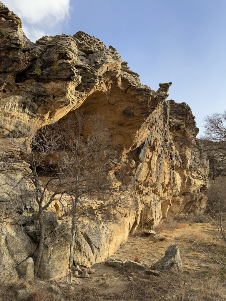
Only accessible by boat, the hike up the slot canyon at Neat Coulee from the Eagle Creek Developed Boat Camp is worth a stop.  It is also possible to scramble up to the eight-foot-tall Hole-in-the-Wall arch that comes into view on the south side of the river just past Citadel Rock.

Photographic Opportunity

One of the few places with road access in Upper Missouri River Breaks National Monument, at Decision Point, Captains Lewis and Clark were not sure which was the main route: the Marias or Missouri River.

Peak Season

Summer

Fees

There is a small fee charged per person per day to be on the river, which helps pay for the maintenance of vault toilets along the route (other waste must be packed out in W.A.G. bags).  An America the Beautiful pass covers the admission fee for the small museum at the BLM visitor center in Ft. Benton.

Road Conditions

Dirt roads doable by passenger vehicles lead to Coal Banks Landing and Judith Landing, while paved roads lead to put-ins at Chouteau County Fairgrounds in Ft. Benton and Kipp Recreation Area at the western edge of Charles M. Russell National Wildlife Refuge.

Camping

There are campgrounds at Chouteau County Fairgrounds, Coal Banks Landing, and Kipp Recreation Area.  Throughout the National Monument developed riverside campgrounds can be accessed by boat, with dispersed camping allowed anywhere on public land (a good map is essential to avoid private land). 

Related Sites

Custer National Forest (Montana)

Pompeys Pillar National Monument (Montana)

Lewis and Clark National Forest (Montana)

Nearest National Park

Glacier

Explore More – Who was Charles M. Russell and why did he get a National Wildlife Refuge named after him?

Learn more about the other 137 National Monuments in our book Monumental America: Your Guide to All 138 National Monuments

Kiowa National Grassland

Kiowa National Grassland

New Mexico

Managed by U.S. Forest Service, Southwestern Region

137,131 acres

Website: https://www.fs.usda.gov/r03/cibola/recreation/kiowa-national-grasslands-0

Overview

Kiowa National Grassland encompasses two discrete units in northeast New Mexico, the eastern one bordering Texas and Oklahoma’s Rita Blanca National Grassland.  This patchwork of public and private lands is administered together with the larger Cibola National Forest and Black Kettle National Grassland.  Elevations range from 4,500 up to 6,300 feet in the western unit where La Frontera del Llano Scenic Byway (NM 39) runs north to south.  Shortgrass prairie is the dominant cover type, with sand sagebrush and pinyon-juniper woodland mostly found in the west.  Ponderosa pines are dispersed on wetter hill faces and riparian areas support Fremont cottonwoods and willows. 

Highlights

Mills Canyon, Santa Fe National Historic Trail

Must-Do Activity

Melvin Mills (an attorney, territorial legislator, and entrepreneur) established the Mills Orchard and Ranch along the Canadian River in 1881.  Flash flooding devastated the orchard in 1904, leading to the ranch’s abandonment a decade later.  In 2005, the U.S. Forest Service and National Park Service collaborated to restore three ranch buildings, and for their efforts they won the Windows on the Past Award for historic preservation.  There are also interpretive signs and a free campground at the bottom of Mills Canyon, located nine miles down unpaved Mills Canyon Road.

Best Trail

A three-mile stretch of the Santa Fe National Historic Trail’s Cimarron Route is marked by rock posts 17 miles north of Clayton, and it is open for walking and horseback riding.  There are interpretive signs along the route and wagon ruts remain visible. 

Watchable Wildlife

An introduced herd of Barbary sheep are thriving in the Mills Canyon area.  The Canadian River supports largemouth bass and channel catfish.  Nomadic Naturalists blog reported seeing swift foxes, spiny softshell turtles, black-chinned sparrows, and pinyon jays on their visit.

Photographic Opportunity

Mills Canyon was cut by the Canadian River through sedimentary rocks ranging in age from 200-million to 90-million years old. 

Peak Season

Summer

Fees

None

Road Conditions

Past Mills Canyon Rim Campground, the unpaved Mills Canyon Road #600 is not recommended for trailers or passenger vehicles as it switchbacks down into Mills Canyon.  A high-clearance vehicle is also recommended for the two-track paralleling the Santa Fe National Historic Trail’s Cimarron Route.

Camping

Both the Mills Canyon Rim Campground (6 campsites) and Mills Canyon Campground (12 sites) are free with vault toilets, but no water.  Dispersed camping is allowed in the eastern unit around the Santa Fe National Historic Trail.

Related Sites

Cimarron National Grassland (Kansas)

Bent’s Old Fort National Historic Site (Colorado)

Comanche National Grassland (Colorado)

Fort Union National Monument (New Mexico)

Nearest National Park

Great Sand Dunes

Explore More – As an attorney, Melvin Mills’ work often involved outlaws, American Indians, and politicians; who saved his life when he was nearly hanged by an angry mob?

Lassen National Forest

Lassen National Forest

California

Managed by U.S. Forest Service, Pacific Southwest Region

1,375,593 acres (1,070,992 federal/ 304,601 other)

Website: https://www.fs.usda.gov/r05/lassen

Overview

Lassen National Forest Reserve dates back to 1905, then a decade later when Lassen Peak explosively erupted (the first eruption to be photographed in the continental U.S.), 106,589-acre Lassen Volcanic National Park was carved out.  The two federal areas are connected by the 187-mile-long Lassen Scenic Byway (Highways 44 and 89) that traces the volcanic legacy of the southern Cascade Range.  The 41,100-acre Ishi Wilderness was named in 1984 to honor the last surviving member of the Yahi band of Southern Yanas, taken from his native home near Oroville in 1911 and employed as a janitor at the University of California’s Anthropology Museum in San Francisco until his death from tuberculosis five years later.

Highlights

Lassen Scenic Byway, Lake Almanor, Eagle Lake, Subway Cave, Hat Creek Recreational Area, Triangle Lake, Heart Lake National Recreation Trail, Bizz Johnson Trail, Spencer Meadows National Recreation Trail, Pacific Crest National Scenic Trail

Must-Do Activity

Lassen National Forest runs campgrounds and boat ramps on both Lake Almanor and Eagle Lake, although most of their shorelines are privately owned.  Between the two lakes is the town of Susanville, where a railroad bed abandoned in 1978 was converted into the Bizz Johnson Trail that follows the Susan River for 26 miles. The trail features 12 river crossings and two tunnels with scenic mountain views.  Camping is restricted to specific portions of the trail. The 20,546-acre Caribou Wilderness was one of America’s first Primitive Areas designated in 1932 and along with the 16,335-acre Thousand Lakes Wilderness was established immediately following passage of the 1964 Wilderness Act.  In a proposed Wilderness area on the west side of Lassen Volcanic National Park, Heart Lake National Recreation Trail is a 2.4-mile one-way hike up to a glacial lake that connects to the longer Twin Meadows Trail.

Best Trail

Subway Cave is only 1,300 feet long, but the lava tube is the main attraction in Lassen National Forest, with free guided tours offered on summer weekends.  Lava flowed through here less than 2,000 years ago and interpretive signs along the 0.7-mile loop trail explain lavacicles and other geologic oddities.  A flashlight is necessary to explore past the openings of the 46°F cave, which drops to four feet in some places with a maximum ceiling of 17 feet.  One mile south on the Lassen Scenic Byway (Highway 44) is the 1.7-mile roundtrip Spatter Cone Trail (across from Hat Creek Campground).  The trail passes a variety of volcanic formations in a forest of Jeffrey pine trees.

Watchable Wildlife

Lassen National Forest is home to black bears, pine martens, mountain lions, bobcats, red foxes, coyotes, and a few gray wolves that migrated south from Oregon.  You are most likely to see mule deer or one of the variety of chipmunks or squirrels.  Bird sightings include mountain chickadees, Steller’s jays, Clark’s nutcrackers (at high elevations), and eight species of woodpeckers such as pileated and white-headed.

Photographic Opportunity

Sitting at 4,505 feet in elevation, Lake Almanor stretches for 13 miles near Chester, California and is a good place for summer boating and fishing.

Peak Season

Summer

Fees

None

Road Conditions

Subway Cave is located right off Lassen Scenic Byway (Highways 44 and 89) and most of the unpaved roads we have explored in the National Forest have been maintained, probably because of the continued harvesting activities that we witnessed on our field trip from Cal Poly University in 2010.

Camping

Lassen National Forest runs campgrounds on both Lake Almanor and Eagle Lake, plus Hat Creek Recreational Area has seven campgrounds.  If you are looking to disperse camp outside Lassen Volcanic National Park, take the road west outside the southern entrance (but keep a clean campsite as we saw a black bear in the area).

Wilderness Areas

Caribou Wilderness

Ishi Wilderness (also managed by BLM)

Thousand Lakes Wilderness

Related Sites

Lava Beds National Monument (California)

Devils Postpile National Monument (California)

Whiskeytown-Shasta-Trinity National Recreation Area (California)

Nearest National Park

Lassen Volcanic

Conifer Tree Species

red fir, white fir, western hemlock, Jeffrey pine, ponderosa pine, lodgepole pine, western white pine, California juniper, incense-cedar

Flowering Tree Species

quaking aspen, Fremont cottonwood, ceanothus, manzanita

Explore More – Other than the namesake for Lassen Peak, who was Peter Lassen?

Learn more about this and the 154 other National Forests in our guidebook Out in the Woods

Buffalo Gap National Grassland

Buffalo Gap National Grassland

South Dakota

Managed by U.S. Forest Service, Rocky Mountain Region

Established 1960

679,805 acres (595,715 federal/ 84,090 other)

Website: https://www.fs.usda.gov/r02/nebraska/recreation/buffalo-gap-national-grassland

Overview

Buffalo Gap is the second-largest National Grassland and it surrounds Badlands National Park and Minuteman Missile National Historic Site east of Black Hills National Forest.  The town of Wall, South Dakota is home to the National Grasslands Visitor Center, which serves as the main interpretive site for all 20 National Grasslands (plus Midewin National Tallgrass Prairie).  The exhibit hall is still under reconstruction following a flood that forced a relocation into a temporary trailer for years, but the theater is reopened showing a short film.  This is a good spot to pick up a map and buy some hard-to-find National Grassland merchandise. 

Highlights

National Grasslands Visitor Center, French Creek Agate Beds

Must-Do Activity

After starting your visit at the National Grasslands Visitor Center in Wall (and making a required visit to Wall Drug—America’s best roadside attraction), head south through Buffalo Gap National Grassland towards the entrance booth for Badlands National Park (see Photographic Opportunity).  The only developed site is much further west at French Creek Agate Beds, where there is a campground and rockhounding is legal for Fairburn agate (the official State Gem of South Dakota), rose quartz, and banded jasper.  The collection and duplication of vertebrate fossils requires a permit and no commercial gathering of fossils is allowed, except for petrified wood. 

Best Trail

Right to the southeast of the Wyoming border on Highway 18 is a section of Buffalo Gap National Grassland where we did some off-trail hiking along a waterway.  Conata Basin south of Badlands National Park is also a good option for prairie exploration.

Watchable Wildlife

Buffalo Gap National Grassland contains grazing allotments for cattle and domesticated bison herds, as well as wild herds of white-tailed deer and pronghorn.  In 2003, 151 black-footed ferret kits were reintroduced and placed in coyote-free areas, but these nocturnal predators only spend a few minutes above ground each day.  Swift fox and bighorn sheep have also been reintroduced in neighboring Badlands National Park.  Watch in prairie dog towns for burrowing owls and prairie rattlesnakes, as well as northern harriers, prairie falcons, golden eagles, and other raptors. 

Photographic Opportunity

There are free designated campsites along the popular Nomad Vw S Road just north of the Pinnacles Entrance to Badlands National Park, which offer great views from the cliffs above the striped geologic formations.

Peak Season

Summer

Fees

None

Road Conditions

The bentonite clay soils can make the unpaved roads impassable to passenger vehicles when muddy.  There is also a deep stream crossing to access the French Creek Agate Beds that would require high clearance when there is water present. 

Camping

Unlike most National Grasslands, this one has a developed campground at French Creek (fee required) with vault toilets, fire grates, and picnic tables, but no potable water.  It is free to camp in designated sites along the busy Nomad Vw S Road just north of the Pinnacles Entrance to Badlands National Park.

Related Sites

Fort Pierre National Grassland (South Dakota)

Jewel Cave National Monument (South Dakota)

Wind Cave National Park (South Dakota)

Nearest National Park

Badlands

Explore More – What is the status of 48,000 acres of the National Grassland set to be designated as Wilderness in a 2010 bill sponsored by South Dakota Senator Tim Johnson?

Comanche National Grassland

Comanche National Grassland

Colorado

Managed by U.S. Forest Service, Rocky Mountain Region

Established 1960

467,373 acres (443,081 federal/ 24,292 other)

Website: https://www.fs.usda.gov/psicc

Overview

Near the Oklahoma border in southeast Colorado, Comanche National Grassland is comprised of two areas of shortgrass prairie co-managed with Pike and San Isabel National Forests and Cimarron National Grassland (in nearby Kansas).  The Timpas Unit is in the watershed of the Purgatoire (or Picket Wire) River, while the more southern Carrizo Unit is mostly centered around Carrizo Creek, a tributary of the Cimarron River.  There is a long history of human use of the canyons here, with petroglyphs dating back as far back as 8,000 years.  Before giving the National Grassland its name, the Comanche pushed the Apache out of this area in the 1700s and their circular tipi rings can still be found.  A branch of the Santa Fe National Historic Trail runs through the northern Timpas Unit with interpretive sites at Sierra Vista Overlook and Timpas Picnic Area (including a three-mile trail following the wagon tracks between the two). 

Highlights

Picture Canyon, Crack Cave, Picket Wire Canyon, Dolores Mission, Rourke Ranch, Carrizo Canyon, Vogel Canyon, Santa Fe National Historic Trail

Must-Do Activity

Petroglyphs can be seen on trails near Vogel Canyon and Carrizo Canyon Picnic Areas, with the most famous found in Picture Canyon.  It is about 16 miles of unpaved roads to access Picture Canyon from Highway 287, and there are vault toilets and picnic tables at the site.  From there, the U.S. Forest Service traditionally leads a hike on Arch Rock Trail to Crack Cave on both the spring and fall equinox, when at dawn the sun’s rays illuminate a specific petroglyph that is usually behind a locked gate that blocks a narrow opening in the sandstone.  A similar petroglyph with deeply-carved lines can be seen in an opening above a blue-tinted pictograph about a quarter-mile down the trail.  Rock climbing is also a draw here, with a few permanent anchors in the sandstone behind the picnic tables. 

Best Trail

It is a 17-mile drive down unpaved roads to Picket Wire Canyon, where a long trail leads to dinosaur tracks (19 miles out-and-back) and Rourke Ranch National Historic District (25 miles) that dates back to 1871.  There are approximately 1,900 tracks left by Apatosaurs and Allosaurs over 150-million years ago.  Along the way, look for petroglyphs, a model of a dinosaur fossil, and the ruins of Dolores Mission (see Photographic Opportunity). 

Watchable Wildlife

Elevations range from 3,900 to 6,200 feet atop Fallas Mesa with ponderosa pine, pinyon pine, juniper, Gambel oak, and cottonwoods trees found in moister areas.  Yucca and cacti are common in the prairie, as are desert-dwelling creatures like roadrunners and tarantulas (we saw one crossing the road).  Hunters come here for mule deer, elk, pronghorn, and wild turkey in season.  The National Grassland contains a lek for lesser prairie chickens, but it is typically closed during mating season due to their endangered status.  About 328 bird species have been identified here, including many eastern birds at the extent of their range. 

Photographic Opportunity

On the way to the dinosaur track site in Picket Wire Canyon, hikers pass Dolores Mission with a cemetery and the ruins of a small Catholic church dating back to 1898.

Peak Season

Spring and fall

Fees

None

Road Conditions

We have almost gotten stuck twice on the long dirt roads in Comanche National Grassland, once in deep mud following a spring thunderstorm and another time on thick ice following a spring blizzard. 

Camping

It is free to disperse camp almost anywhere not on private lands in Comanche National Grassland, with the exception of the parking lots at the following canyons: Picture, Carrizo, Vogel, and Picket Wire.

Related Sites

Cimarron National Grassland (Kansas)

Bent’s Old Fort National Historic Site (Colorado)

Sand Creek Massacre National Historic Site (Colorado)

Nearest National Park

Great Sand Dunes

Explore More – The markings in Crack Cave are theorized by some people to spell out what word in Ogam (an ancient Celtic alphabet)?