
Custer National Forest
Montana, South Dakota
Managed by U.S. Forest Service, Northern Region
1,278,749 acres (1,188,130 federal/ 90,619 other)
Website: https://www.fs.usda.gov/custergallatin
Overview
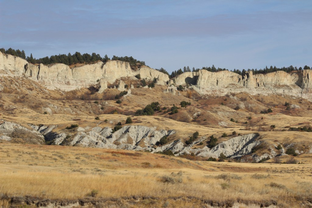
Custer National Forest is split across multiple units from the Absaroka Mountains in southern Montana east to five isolated patches in the northwest corner of South Dakota. It ranges in elevation from dry prairies to glaciated summits, including the highest point in Montana (12,807-foot Granite Peak). In eastern Montana, Capitol Rock is a sandstone and white clay formation that looks like a capitol dome from the east. In South Dakota, the National Forest also encompasses The Castles National Natural Landmark. Since 2014, Custer and Gallatin National Forests have been managed together as Custer-Gallatin National Forest.

Highlights
Beartooth All-American Road, Rock Creek Vista, Hellroaring Plateau, Granite Peak, East Rosebud Lake, Impasse Falls, Crooked Creek Canyon, Big Ice Cave, Pryor Mountains Wild Horse Range, Lost Water Canyon, Cook Mountains, Tongue River Breaks, Poker Jim Lookout, Chalk Buttes, Capitol Rock, Slim Buttes, The Castles, Glacier Lake, Basin Creek National Recreation Trail, Basin Lakes Trail
Must-Do Activity
Custer National Forest is most famous for its stretch of Highway 212 (Beartooth All-American Road) that climbs switchbacks from the prairie around Red Lodge, Montana up to 10,947 feet at Beartooth Pass across the Wyoming border in Shoshone National Forest. These two National Forests also share with Gallatin National Forest the giant 943,626-acre Absaroka-Beartooth Wilderness, which contains 12,807-foot Granite Peak. Backpackers come from around the world to this Wilderness in the summer because its trailheads start at such high elevations that it does not require much climbing to reach scenic alpine lakes.
Best Trail
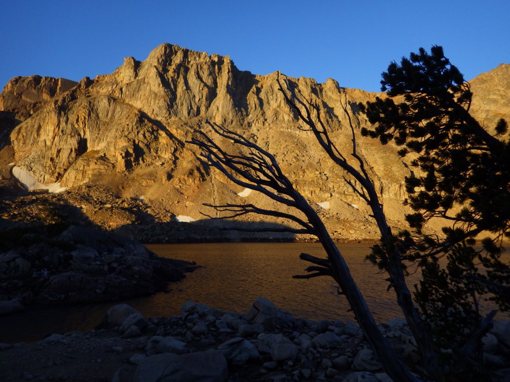
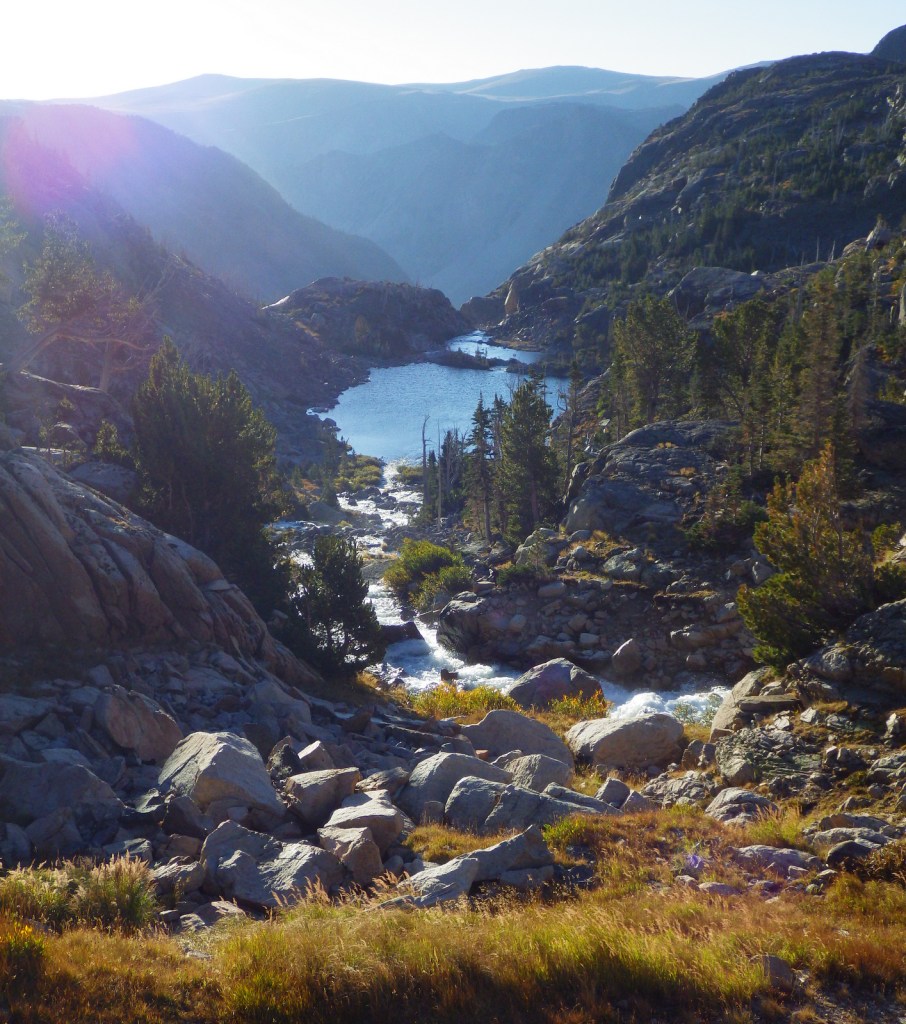
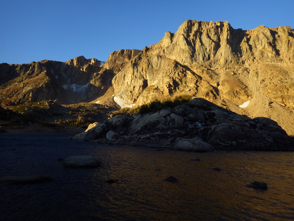
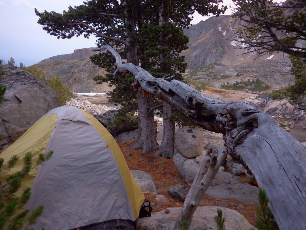
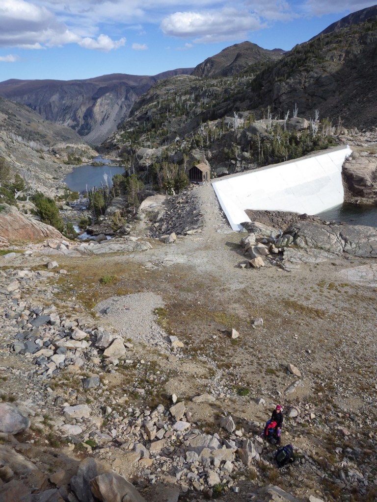
There are more than 1,500 miles of hiking trails in Custer National Forest, mostly concentrated in the western mountains. From the Glacier Lake Trailhead (high-clearance vehicle required), the two-mile Glacier Lake Trail steadily climbs 1,100 feet then drops into a bowl containing a stunning reservoir that straddles the Wyoming-Montana state border. You can turn around here at 9,691 feet in elevation or continue around the north side of the lake up to Goat and Sheep Lakes. We backpack camped at Glacier Lake for one night during Labor Day weekend and had the place to ourselves.
Watchable Wildlife
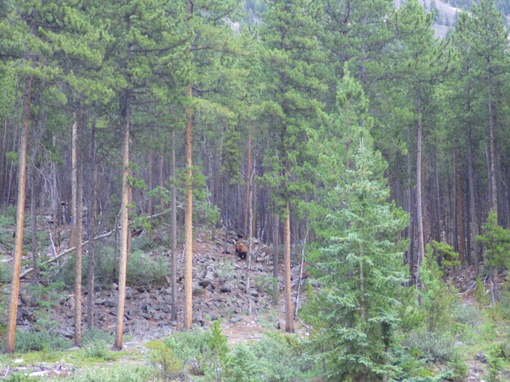
In addition to the raptors typical of western National Forests, merlins (a type of small falcon) are more common here than anywhere else in the country. Mammalian predators include grizzly bears, black bears, gray wolves, coyotes, red foxes, pine martens, mountain lions, and bobcats. Ungulates found here are pronghorns, moose, mountain goats, bighorn sheep, mule deer, elk, and bison (on private ranches).
Instagram-worthy Photo
During our backpacking trip, the Glacier Lake reservoir was especially scenic during the jaw-dropping twilight hours when the mountains were drenched in alpenglow.
Peak Season
Summer
Fees
None
Road Conditions
The paved Beartooth All-American Road (Highway 212) is typically open only June to October due to snow. At the bottom of the “Beartooth Switchbacks” on Highway 212 in southern Montana is Main Fork Rock Creek Road, a rough dirt road that follows the shallow creek past campgrounds and dispersed campsites back to Glacier Lake Trailhead. A high-clearance vehicle or an ATV is required if you want to drive the entire eight miles. Many recreationists bring the latter to tackle the nearby road that steeply ascends to the top of 11,000-foot-high Hellroaring Plateau.
Camping
There are more than 30 campgrounds in Custer National Forest, as well as numerous dispersed camping options (especially on roads west of Red Lodge, Montana).
Wilderness Areas
Absaroka-Beartooth Wilderness (also in Gallatin and Shoshone National Forests)
Related Sites
Bighorn Canyon National Recreation Area (Montana-Wyoming)
Little Bighorn Battlefield National Monument (Montana)
Beaverhead National Forest (Montana)
Nearest National Park
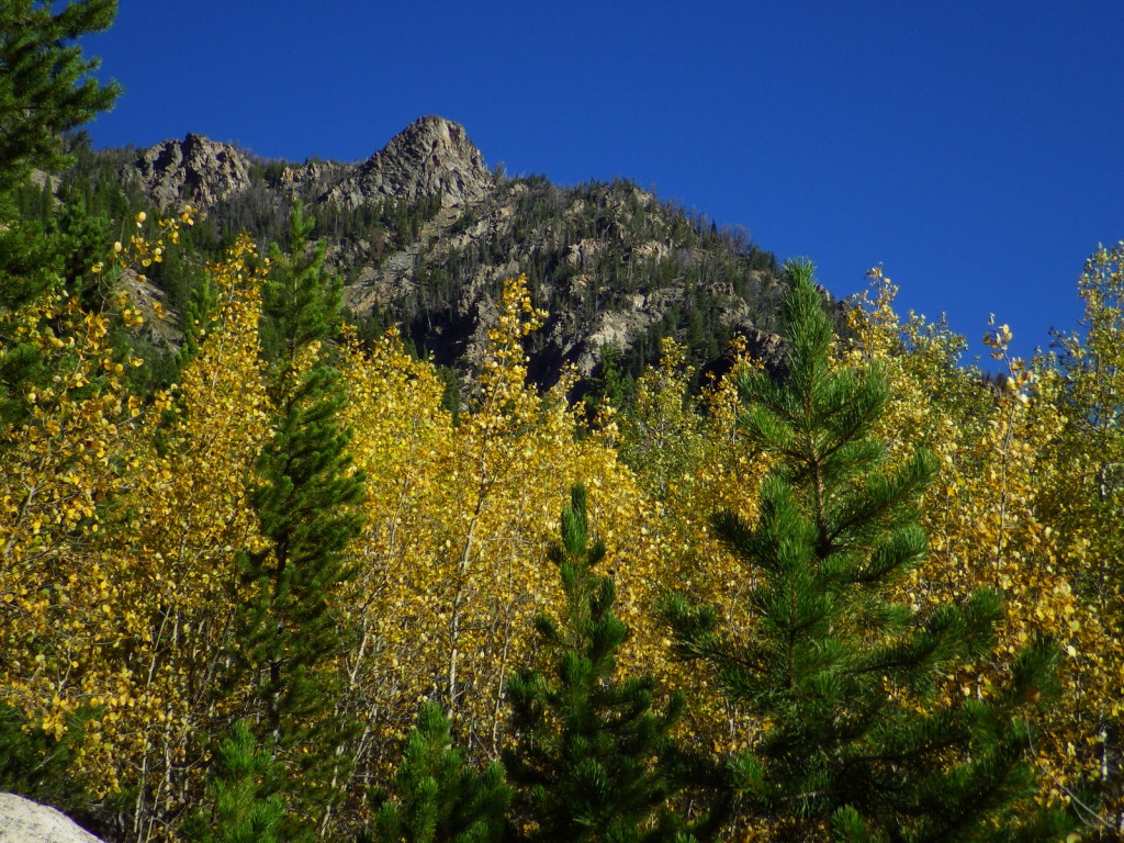


Douglas-fir, ponderosa pine, lodgepole pine, limber pine, whitebark pine, Engelmann spruce, subalpine fir, Rocky Mountain juniper
eastern cottonwood, quaking aspen, water birch, Rocky Mountain maple, boxelder, Bebb willow, blue elderberry, choke cherry, white alder, curlleaf mountain-mahogany, sagebrush
Explore More – Found on the side of Granite Peak, how did Grasshopper Glacier get its name?

Learn more about this and the 154 other National Forests in our new guidebook Out in the Woods
We are a participant in the Amazon Services LLC Associates Program, an affiliate advertising program designed to provide a means for us to earn fees by linking to Amazon.com and affiliated sites.

I grew up with this forest practically in my backyard, so I’m embarrassed to admit that I didn’t know the Custer part of the name hailed from South Dakota. That seems like a strange administrative combination. Either way, awesome pictures from the Beartooth Highway! I’ve never backpacked there but I can imagine it would be amazing
LikeLiked by 1 person
Glad you learned something new and we hope you get a chance to explore the Beartooth Wilderness and Hellroaring Plateau someday.
LikeLiked by 1 person