River Raisin National Battlefield Park

River Raisin National Battlefield Park

Michigan

Managed by National Park Service

Established 2009

42 acres

Website: nps.gov/rira

Overview

River Raisin National Battlefield Park is located in Monroe, Michigan near where the mouth of the river empties into Lake Erie.  During the War of 1812, the U.S. had a plan to invade Canada which fell through after the surrender of Detroit.  Five months later in January 1813, U.S. troops were heading towards Detroit when they made a detour to Frenchtown to drive off a small detachment of Canadians.  Following an initial victory, a few mornings later a British surprise attack captured or killed all but 33 of nearly 1,000 troops.  When Indian allies of the British returned to scalp six (according to the British) or 42 (according to the Americans) injured prisoners the devastating defeat became immortalized in the rallying cry “Remember the Raisin!”

Highlights

Museum, film, River Raisin Heritage Trail

Must-Do Activity

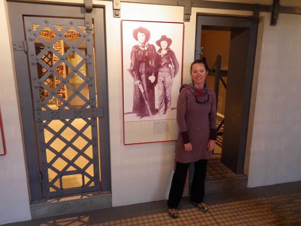
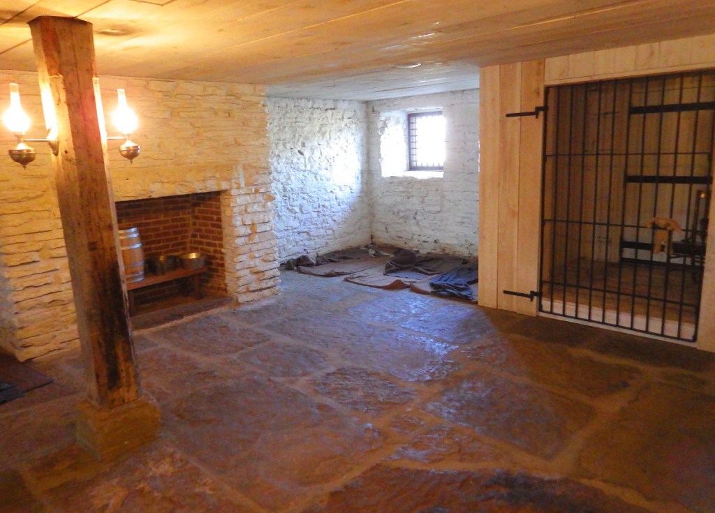
River Raisin National Battlefield Park was not authorized until 2009, so it has a nice new visitor center opened in 2011.  The National Park Service (NPS) has even attempted to make it kid-friendly by creating a stuffed animal of Major Muskrat with multiple costume options available in the gift shop.  It is not often that an NPS site commemorates an American defeat in battle.  In 1813, the U.S. went onto victory at the Battle of Lake Erie and the Battle of Thames in southern Ontario.  The Canadians do not have their own National Battlefield Parks dedicated to those defeats.

Best Trail

The 42-acre park is mostly a lawn with a paved path dotted by interpretive signs.  You can also hook into the River Raisin Heritage Trail, which takes you to Sterling State Park on Lake Erie.

Instagram-worthy Photo

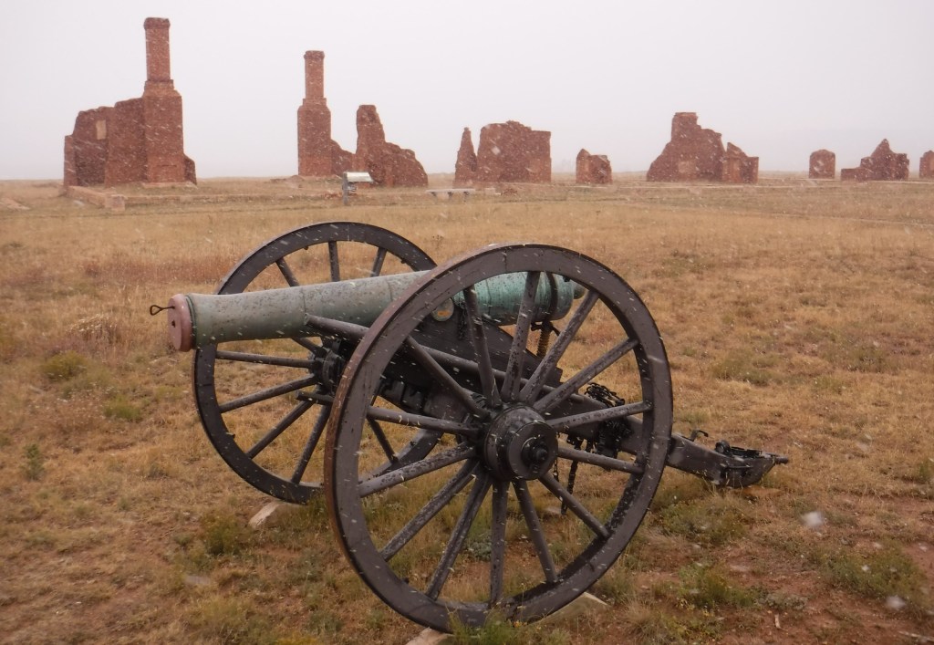
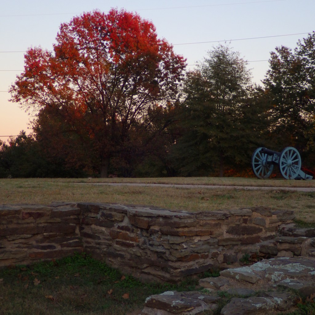
A replica of a cannon used at the January battle is on sled runners; pretty unique!

Peak Season

Summer

Hours

https://www.nps.gov/rira/planyourvisit/hours.htm

Fees

None

Road Conditions

All roads paved

Camping

Sterling State Park offers a 256-site campground on Lake Erie.

Related Sites

Perry’s Victory and International Peace Memorial (Ohio)

Horseshoe Bend National Military Park (Alabama)

Sleeping Bear Dunes National Lakeshore (Michigan)

Explore More – Native Americans were left out of the Treaty of Ghent that ended the War of 1812, so when did the U.S. sign the Treaty of Springwells officially ending hostilities?

Montezuma Castle National Monument

Overview

Central Arizona’s Montezuma Castle was one of the first four National Monuments established by President Theodore Roosevelt in 1906.  Conveniently accessible just off Interstate 17 on the way to Sedona or the Grand Canyon, it is a great place to stretch your legs after the 90-minute car ride from Phoenix.  Located in the scenic Verde River Valley, it is one of several sites related to the Sinagua people managed by the National Park Service (also see Walnut Canyon, Tuzigoot, and Wupatki).

Highlights

Cliff dwelling, Montezuma Well

Must-Do Activity

Protected in a cliff recess above Beaver Creek, the five-story tall ruin is not accessible to tourists and can only be viewed from below.  Its name “Montezuma” refers to the mistaken belief that it was somehow connected to the Aztec Empire of Mexico, but its inhabitants had more in common with the Sinagua people living in around Arizona in the 1400s.  Continue on the paved walkway to the ground-level ruins of Castle A and views of Beaver Creek.

Best Trail

To investigate a separate unit of Montezuma Castle National Monument, drive 11 miles north to Montezuma Well, a limestone sinkhole filled by a natural spring that produces 1.5-millions gallons of 74°F water daily.  The trail is only a half-mile long loop, but it is worth the trip to see the historic irrigation ditches and the 55-foot deep sinkhole.

Instagram-worthy Photo

It is unclear why the Sinagua people abandoned the cliff dwelling around 1425, but it may have been due to disease, drought, or climate change.  There were 35 to 50 inhabitants of Montezuma Castle and even more at Castle A, which had approximately 50 rooms.

Peak Season

Summer

Hours

https://www.nps.gov/moca/planyourvisit/hours.htm

Fees

$10 per person or America the Beautiful pass; Montezuma Well is free

Road Conditions

Access roads are paved.

Camping

There is no campground at the National Monument, but many located within massive Coconino National Forest, which also allows dispersed camping.

Related Sites

Tuzigoot National Monument (Arizona)

Tonto National Monument (Arizona)

Sunset Crater Volcano National Monument (Arizona)

Explore More – In what year did the National Park Service stop allowing visitors to climb ladders to walk inside Montezuma Castle?

Yucca House National Monument

Overview

Yucca House National Monument was established in 1919 outside Cortez, Colorado.  It is not far from Mesa Verde National Park, which has information about the National Monument at its visitor center on Highway 160.  The 34-acre site protects an unexcavated pueblo abandoned around 1300, so there is very little to see above ground.  The fact that there is public access at all is thanks to the ranching family that allows visitors to park in what is basically their driveway.

Highlights

Unexcavated pueblo, Canyons of the Ancients National Monument visitor center

Must-Do Activity

Unless you aim to visit every unit in the National Park Service (NPS) system, you are better off spending your time taking an extra tour or hike at Mesa Verde National Park.  There are no facilities and there is not much to see at Yucca House, but there are many interesting Ancestral Puebloan ruins within nearby Canyons of the Ancients National Monument, which is run by the Bureau of Land Management (BLM).  They have a large visitor center in Dolores, Colorado where you can get directions to archaeological sites, such as Painted Hand Pueblo.

Best Trail

Sand Canyon Trail lies within Canyons of the Ancients National Monument and its southern trailhead is located just off paved County Road G.  The trail provides access to numerous archaeological sites; just remember to leave everything where you found it.

Instagram-worthy Photo

The most interesting unexcavated pueblo we have visited is Posi-Ouinge, which is accessible by a short trail from Ojo Caliente Hot Springs Resort in New Mexico.  The ground there is littered with thousands of pot shards, many with painted designs still visible.
Peak Season

Summer

Hours

https://www.nps.gov/yuho/planyourvisit/hours.htm

Fees

None

Road Conditions

The access road is well-maintained dirt.

Camping

Dispersed camping is allowed in parts of nearby Canyons of the Ancients National Monument, which is run by the BLM.

Related Sites

Mesa Verde National Park (Colorado)

Hovenweap National Monument (Utah-Colorado)

Chaco Culture National Historical Park (New Mexico)

Explore More – Why did the Bureau of Land Management change the name of their visitor center in Dolores, Colorado from Anasazi Heritage Center?

Point Reyes National Seashore

Overview

North of San Francisco, California, Point Reyes National Seashore is the only park so designated on the Pacific Coast of the U.S.  Be prepared to get wet as this piece of land located on the San Andreas Fault is frequently enveloped by a fog belt year round.  It might not be the best spot to sunbathe on the beach, but this unique seashore is a great place to watch wildlife.

Highlights

Point Reyes Lighthouse, beaches, Arch Rock, Historic Pierce Point Ranch, Tomales Bay

Must-Do Activity

The main attraction is the Point Reyes Lighthouse, where you can try to spot sea lions and gray whales on their winter migration.  It is 300 steps down to the historic lighthouse, then you have to turn around and climb back up.  Nearby Drakes Beach is off limits in the winter months when elephant seals gather there and you can watch (and listen to) them from an overlook.  The park is popular with road and mountain bikers, and well-protected Tomales Bay attracts kayakers.

Best Trail

An extensive trail system with backcountry campsites (including two near the beach) is best accessed from the Bear Valley Visitor Center.  Plus, you can always walk the 11-mile long Point Reyes Beach.

Instagram-worthy Photo

The park has a reintroduced herd of Tule elk near the Historic Pierce Point Ranch on Tomales Point.  If you visit in January, you might find a bull was waiting for his other antler to drop.

Peak Season

Summer, though the weather is pretty much the same year round.

Hours

https://www.nps.gov/pore/planyourvisit/hours.htm

Fees

None

Road Conditions

All roads paved, except a few short ones that access trailheads.

Camping

There is no campground in Point Reyes National Seashore, but there are backcountry campsites that area available with a permit (reservations available).

Related Sites

Cabrillo National Monument (California)

Golden Gate National Recreation Area (California)

Olympic National Park (Washington)

Explore More – How far did the entire Point Reyes Peninsula permanently shift during the 1906 San Francisco Earthquake?

Top 10 National Park Service Sites for Kayaking

We own a 17-foot long tandem kayak that we have taken all over the United States, including some rivers where it may have been preferable to canoe.  Some of our most memorable National Park experiences have happened while seated in our kayak.  This does not include two amazing trips through Upper Missouri River Breaks National Monument in Montana, which you can read about on our other travel blog since it is not managed by the National Park Service.  Please check out all of our Top 10 lists for more adventure ideas and book recommendations!

10. Virgin Islands Coral Reef National Monument (U.S. Virgin Islands)

There is no dry land in this Caribbean monument that borders Virgin Islands National Park.

9. Ozark National Scenic Riverways (Missouri)

Canoes are also commonly used to explore the Jack’s Fork and Current Rivers.

8. Biscayne National Park (Florida)

A kayak can get close to the mangroves since most of this park covers ocean south of Miami.

7. Voyageurs National Park (Minnesota)

Find a free lakeside campsite and fall asleep listening to loons call.

6. Congaree National Park (South Carolina)

Get up close to wildlife and baldcypress knees on Cedar Creek.

5. Lake Mead National Recreation Area (Nevada-Arizona)

Stop at Emerald Cove for photos on the way to or from Arizona Hot Springs.

4. Pictured Rocks National Lakeshore (Michigan)

The only way to see Petit Portal is from the water and a kayak is necessary to go through it.

3. Buffalo National River (Arkansas)

Canoes may be preferable to run through the Ponca Wilderness during spring runoff.

2. Everglades National Park (Florida)

The best way to see this park is from a small boat, plus by staying overnight on a chickee.

…and finally our #1 National Park for kayaking!

1. Apostle Islands National Lakeshore (Wisconsin)

Sea caves carved by the waves of Lake Superior require a small craft to explore.

Honorable Mentions

Point Reyes National Seashore (California)

Located on the San Andreas Fault, Tomales Bay is a protected spot to explore north of San Francisco.

Glacier Bay National Park and Preserve (Alaska)

We have heard the best way to see this park is by kayak, but it sounds really cold.

Channel Islands National Park (California)

We hope someday to take a guided kayaking trip to the sea caves on Santa Cruz Island.

Big Thicket National Preserve (Texas)

Spanish moss-draped baldcypress trees line these picturesque bayous.