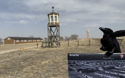
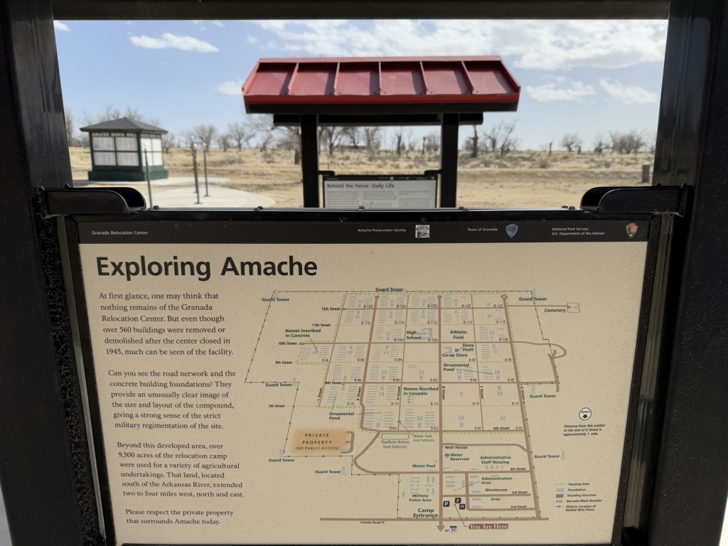
Added to the National Park Service (NPS) system on February 15, 2024, Amache National Historic Site is the fifth unit dedicated to remembering the sad story of the forced internment of 110,000 Japanese-Americans during World War II. Operated between 1942 and 1945, at its peak the Granada Relocation Center in southeast Colorado housed 7,310 incarcerees making it the state’s tenth largest city at the time. Although it does not have a visitor center, the site of the internment camp is more developed than other new NPS sites since it was previously added to the National Register of Historic Places in 1994 and then designated a National Historic Landmark in 2006. Learn more about the history of these camps by checking out the Related Sites below and watching some of our Top 10 World War II Films or reading one of the Top 10 World War Novels.
Highlights
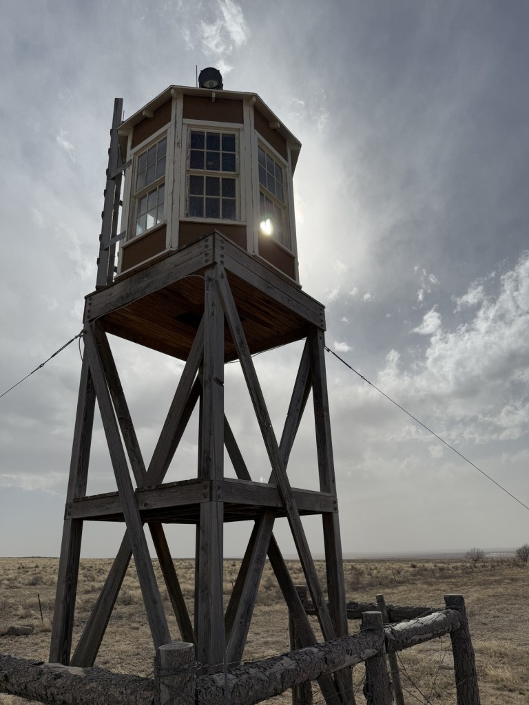
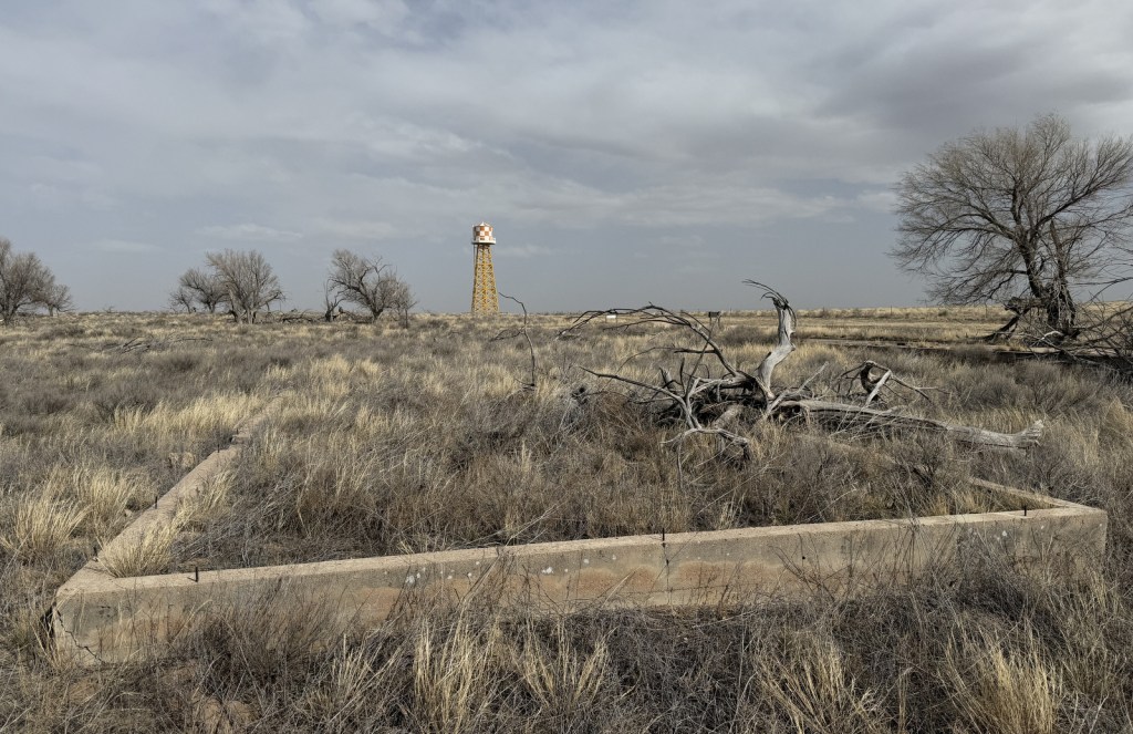
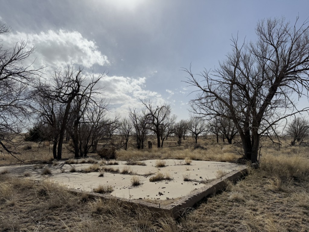
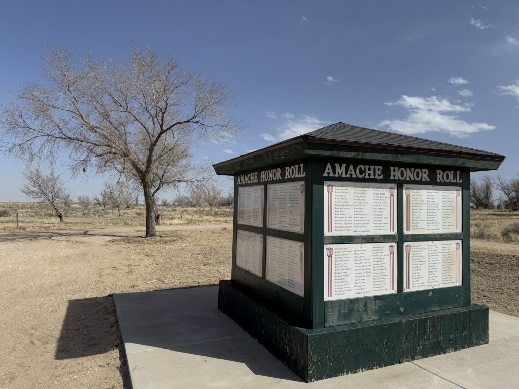
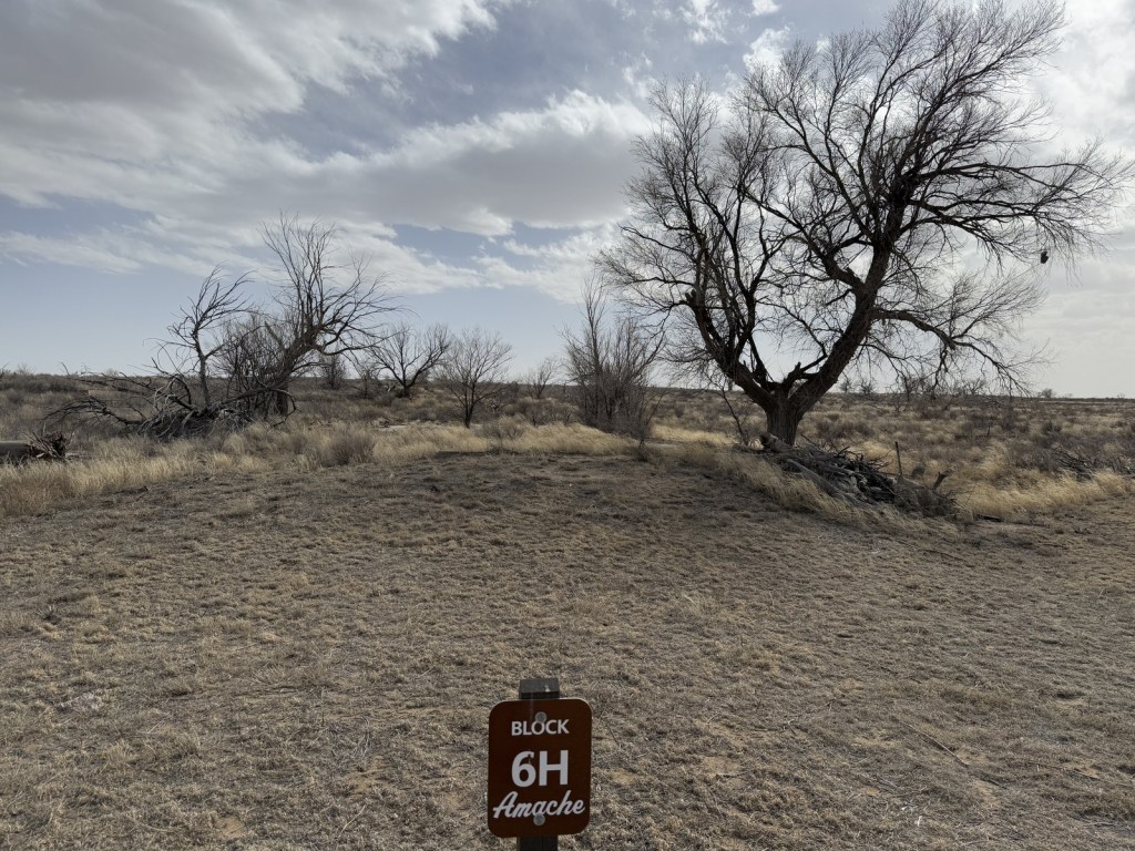
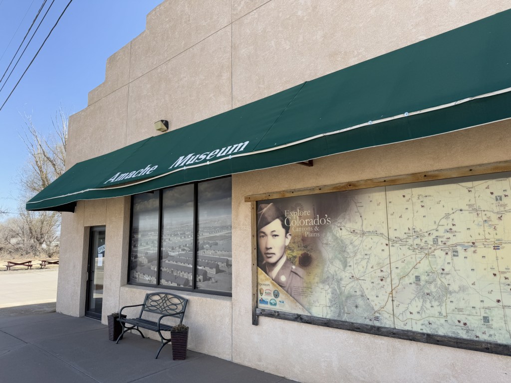
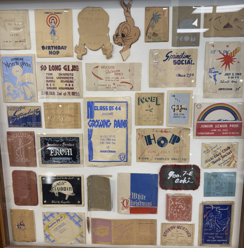
Amache Museum, water tower, barracks, guard tower, cemetery, Recreation Hall
Must-Do Activity
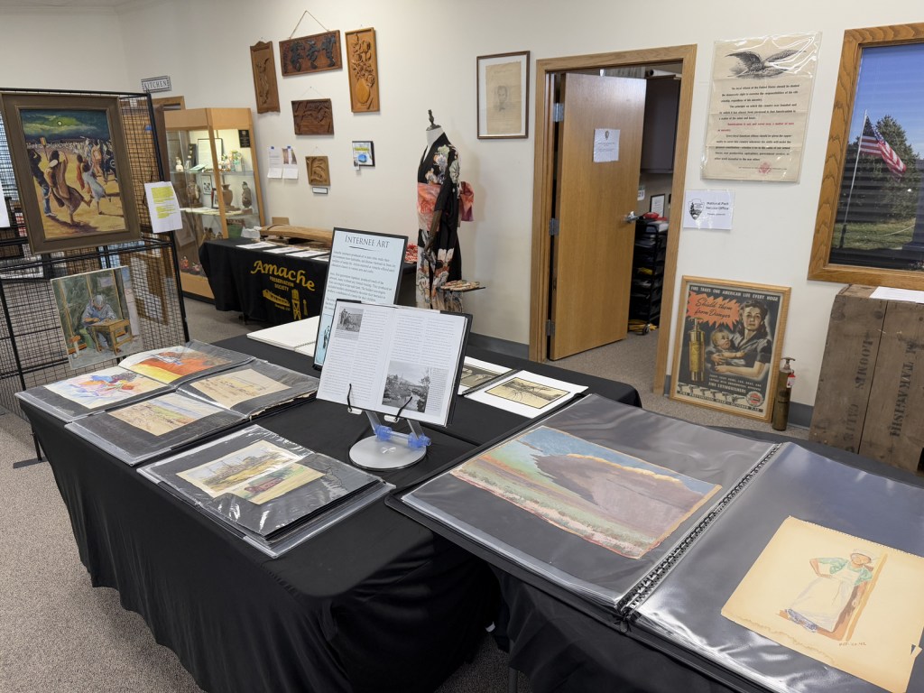
Start at the excellent Amache Museum in Granada, which is run by local high school students and has free admission (donations accepted). Be sure to pick up a map of the driving tour or visit the website (https://amache.org/driving-tour-map-podcasts) to listen to the audio recordings at each stop (there is smartphone coverage on site). Drive the route in order or skip around, but make it a point to see Stop 4 (guard tower and barracks), Stop 8 (cemetery), and the Rec Hall. Starting in June 2025, ranger-led tours will be offered at 10 a.m. on the first and third Friday of the summer months.
Best Trail
There is a short loop trail with many interpretive signs at the picnic area when you first arrive at the site by the Honor Roll square structure. There is also an off-trail walk to the old koi pond at Stop 2 that you can navigate if you listen to the directions on the audio recordings.
Photographic Opportunity
The reconstructed barracks and guard tower at the south end of the site are two of the only structures standing above the open prairie. They are near the water tower, which is worth a short detour to see.
Explore More – Most of the 10,000 acres dedicated to Granada Relocation Center was for agriculture, so how many acres were used for residential and administrative buildings?
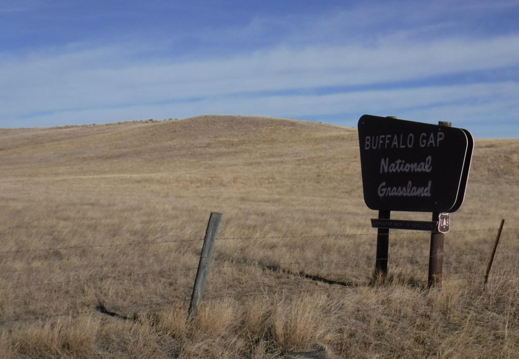
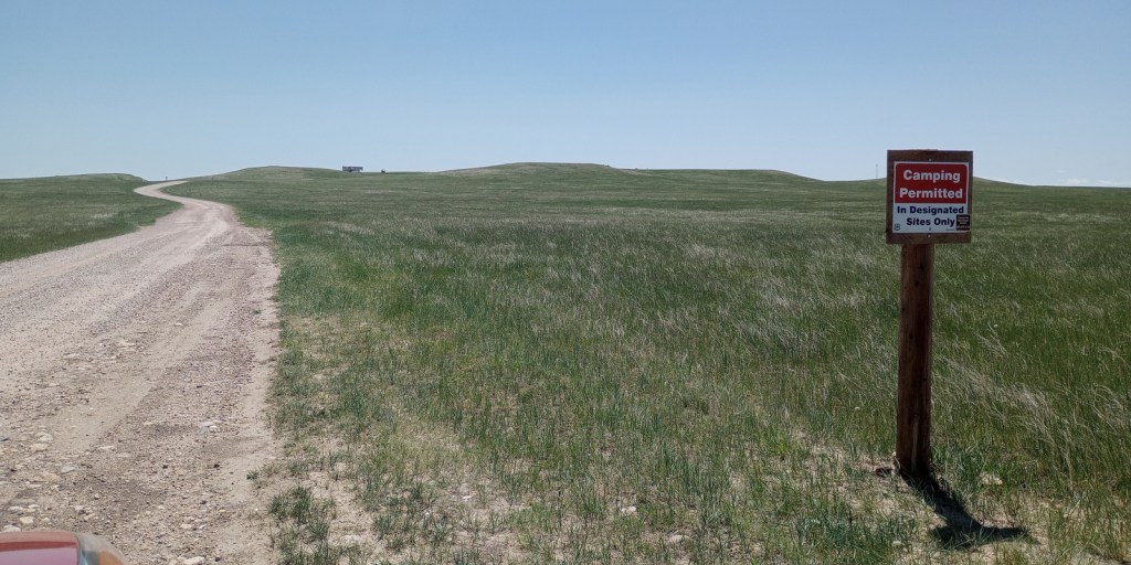
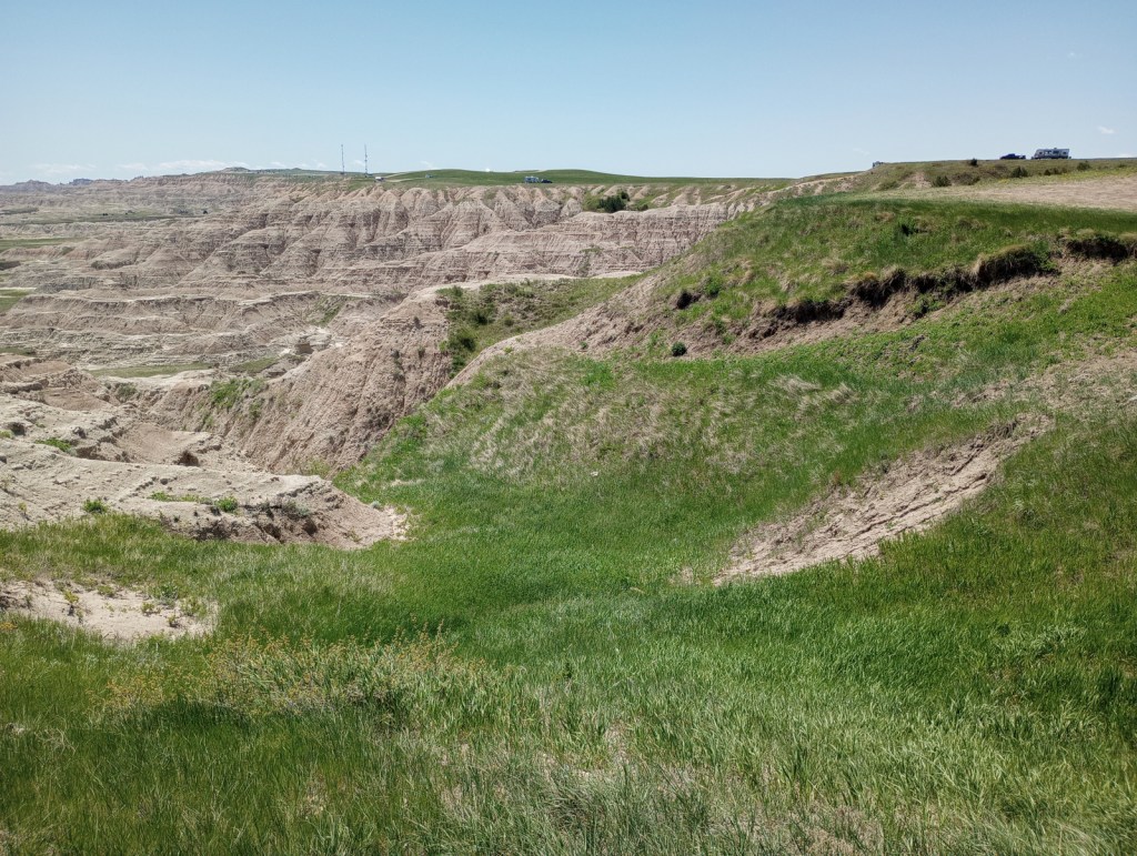
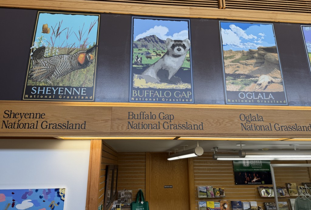
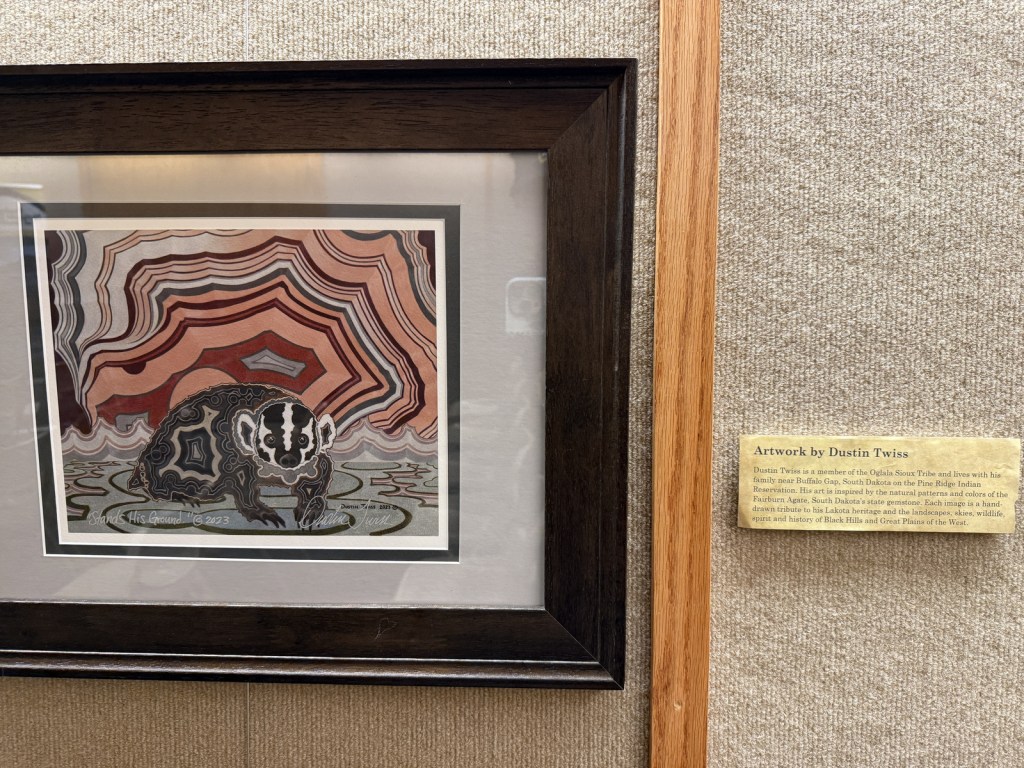
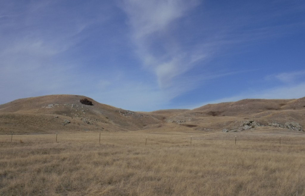
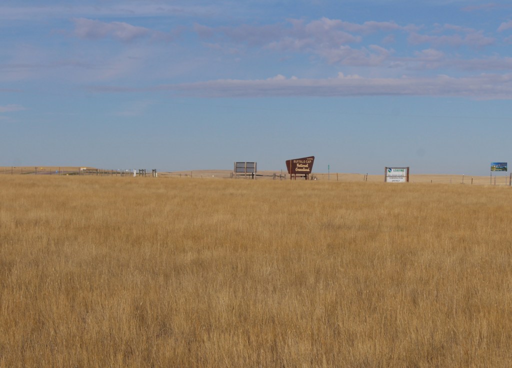
Buffalo Gap is the second-largest National Grassland and it surrounds Badlands National Park and Minuteman Missile National Historic Site east of Black Hills National Forest. The town of Wall, South Dakota is home to the National Grasslands Visitor Center, which serves as the main interpretive site for all 20 National Grasslands (plus Midewin National Tallgrass Prairie). The exhibit hall is still under reconstruction following a flood that forced a relocation into a temporary trailer for years, but the theater is reopened showing a short film. This is a good spot to pick up a map and buy some hard-to-find National Grassland merchandise.
Highlights
National Grasslands Visitor Center, French Creek Agate Beds
Must-Do Activity
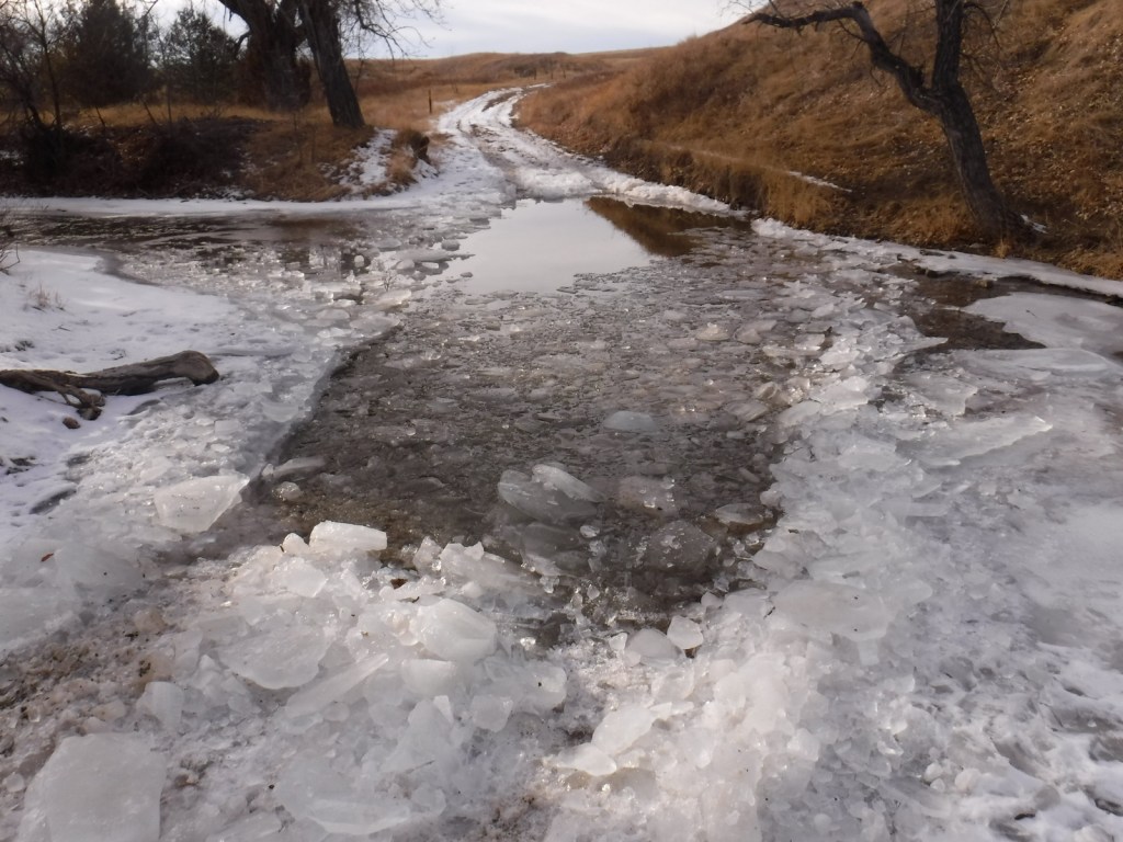
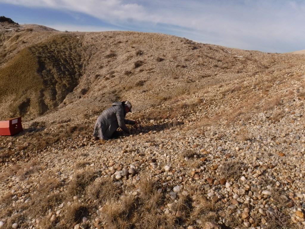
After starting your visit at the National Grasslands Visitor Center in Wall (and making a required visit to Wall Drug—America’s best roadside attraction), head south through Buffalo Gap National Grassland towards the entrance booth for Badlands National Park (see Photographic Opportunity). The only developed site is much further west at French Creek Agate Beds, where there is a campground and rockhounding is legal for Fairburn agate (the official State Gem of South Dakota), rose quartz, and banded jasper. The collection and duplication of vertebrate fossils requires a permit and no commercial gathering of fossils is allowed, except for petrified wood.
Best Trail
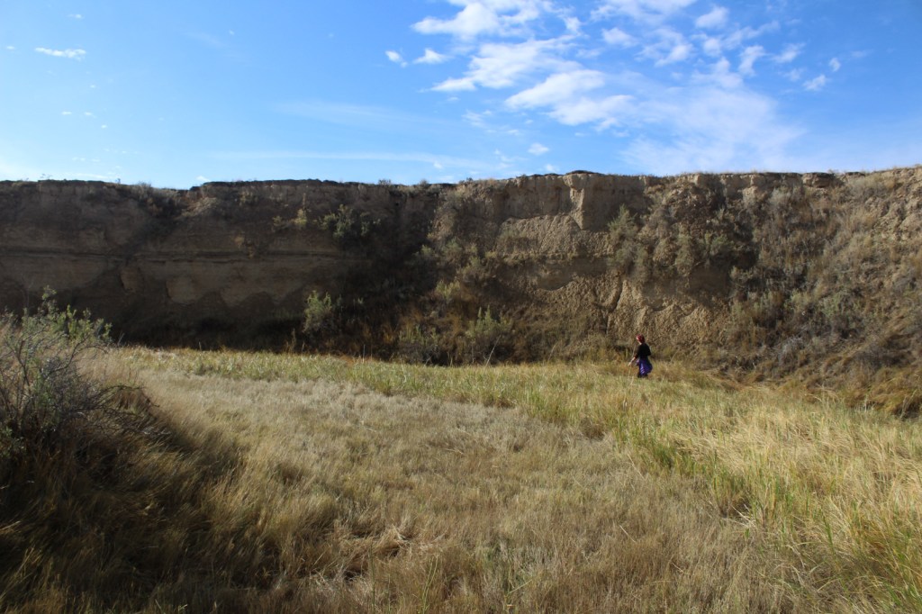
Right to the southeast of the Wyoming border on Highway 18 is a section of Buffalo Gap National Grassland where we did some off-trail hiking along a waterway. Conata Basin south of Badlands National Park is also a good option for prairie exploration.
Watchable Wildlife
Buffalo Gap National Grassland contains grazing allotments for cattle and domesticated bison herds, as well as wild herds of white-tailed deer and pronghorn. In 2003, 151 black-footed ferret kits were reintroduced and placed in coyote-free areas, but these nocturnal predators only spend a few minutes above ground each day. Swift fox and bighorn sheep have also been reintroduced in neighboring Badlands National Park. Watch in prairie dog towns for burrowing owls and prairie rattlesnakes, as well as northern harriers, prairie falcons, golden eagles, and other raptors.
Photographic Opportunity
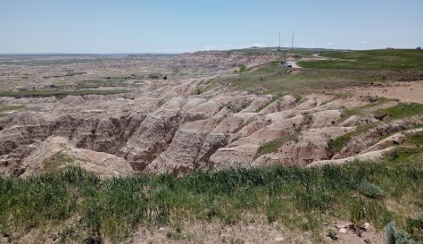
There are free designated campsites along the popular Nomad Vw S Road just north of the Pinnacles Entrance to Badlands National Park, which offer great views from the cliffs above the striped geologic formations.
Peak Season
Summer
Fees
None
Road Conditions
The bentonite clay soils can make the unpaved roads impassable to passenger vehicles when muddy. There is also a deep stream crossing to access the French Creek Agate Beds that would require high clearance when there is water present.
Camping
Unlike most National Grasslands, this one has a developed campground at French Creek (fee required) with vault toilets, fire grates, and picnic tables, but no potable water. It is free to camp in designated sites along the busy Nomad Vw S Road just north of the Pinnacles Entrance to Badlands National Park.
River crossing at French Creek Agate BedsScott making the river crossing at French Creek Agate BedsTiff rock hounding at French Creek Agate BedsWyoming border and National Grassland border
Explore More – What is the status of 48,000 acres of the National Grassland set to be designated as Wilderness in a 2010 bill sponsored by South Dakota Senator Tim Johnson?
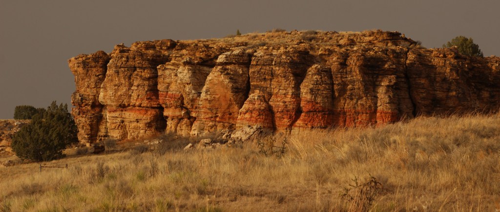
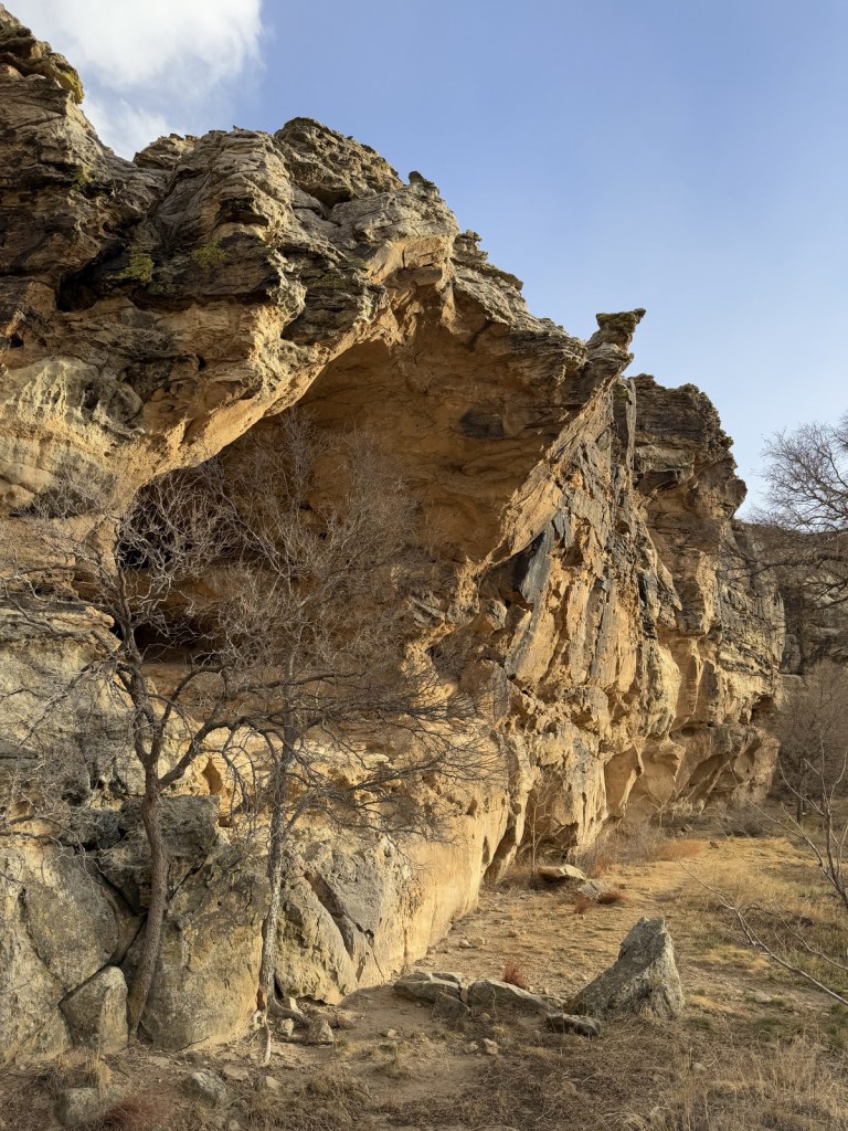
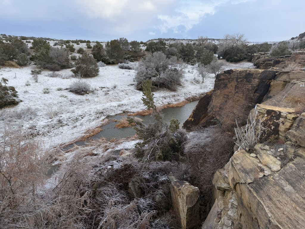
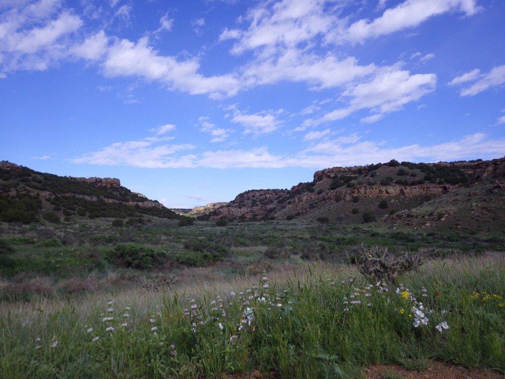
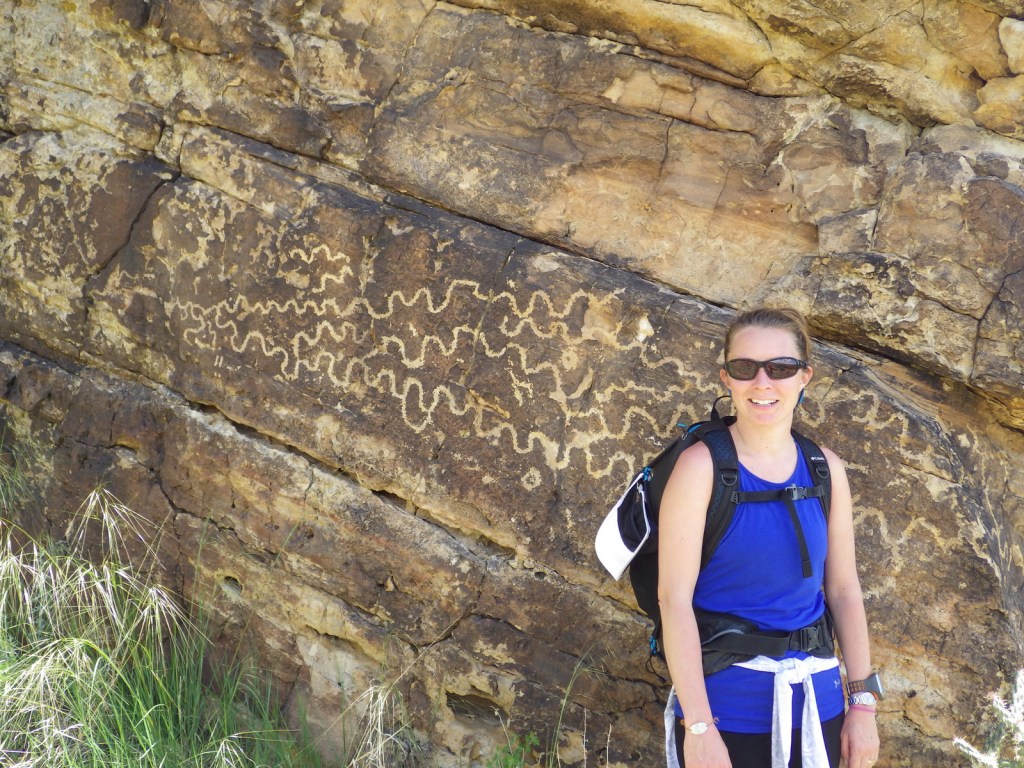
Near the Oklahoma border in southeast Colorado, Comanche National Grassland is comprised of two areas of shortgrass prairie co-managed with Pike and San Isabel National Forests and Cimarron National Grassland (in nearby Kansas). The Timpas Unit is in the watershed of the Purgatoire (or Picket Wire) River, while the more southern Carrizo Unit is mostly centered around Carrizo Creek, a tributary of the Cimarron River. There is a long history of human use of the canyons here, with petroglyphs dating back as far back as 8,000 years. Before giving the National Grassland its name, the Comanche pushed the Apache out of this area in the 1700s and their circular tipi rings can still be found. A branch of the Santa Fe National Historic Trail runs through the northern Timpas Unit with interpretive sites at Sierra Vista Overlook and Timpas Picnic Area (including a three-mile trail following the wagon tracks between the two).
Highlights
Picture Canyon, Crack Cave, Picket Wire Canyon, Dolores Mission, Rourke Ranch, Carrizo Canyon, Vogel Canyon, Santa Fe National Historic Trail
Must-Do Activity
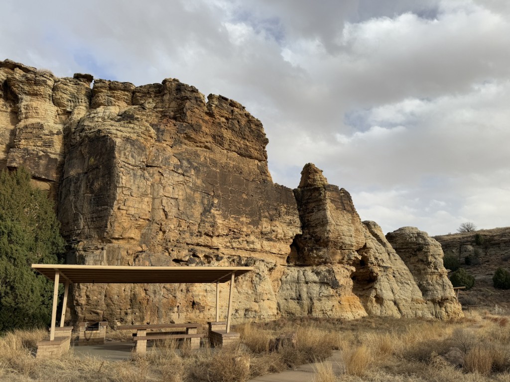
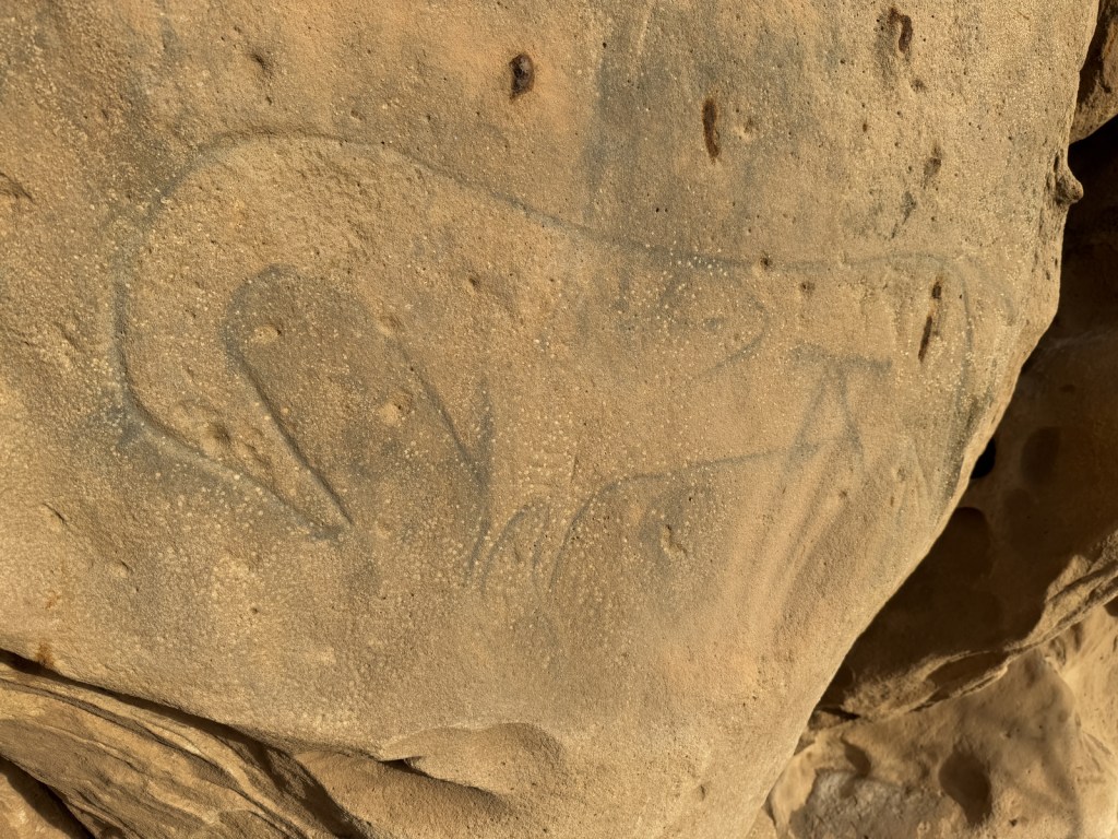
Petroglyphs can be seen on trails near Vogel Canyon and Carrizo Canyon Picnic Areas, with the most famous found in Picture Canyon. It is about 16 miles of unpaved roads to access Picture Canyon from Highway 287, and there are vault toilets and picnic tables at the site. From there, the U.S. Forest Service traditionally leads a hike on Arch Rock Trail to Crack Cave on both the spring and fall equinox, when at dawn the sun’s rays illuminate a specific petroglyph that is usually behind a locked gate that blocks a narrow opening in the sandstone. A similar petroglyph with deeply-carved lines can be seen in an opening above a blue-tinted pictograph about a quarter-mile down the trail. Rock climbing is also a draw here, with a few permanent anchors in the sandstone behind the picnic tables.
Best Trail
It is a 17-mile drive down unpaved roads to Picket Wire Canyon, where a long trail leads to dinosaur tracks (19 miles out-and-back) and Rourke Ranch National Historic District (25 miles) that dates back to 1871. There are approximately 1,900 tracks left by Apatosaurs and Allosaurs over 150-million years ago. Along the way, look for petroglyphs, a model of a dinosaur fossil, and the ruins of Dolores Mission (see Photographic Opportunity).
Watchable Wildlife
Elevations range from 3,900 to 6,200 feet atop Fallas Mesa with ponderosa pine, pinyon pine, juniper, Gambel oak, and cottonwoods trees found in moister areas. Yucca and cacti are common in the prairie, as are desert-dwelling creatures like roadrunners and tarantulas (we saw one crossing the road). Hunters come here for mule deer, elk, pronghorn, and wild turkey in season. The National Grassland contains a lek for lesser prairie chickens, but it is typically closed during mating season due to their endangered status. About 328 bird species have been identified here, including many eastern birds at the extent of their range.
Photographic Opportunity
On the way to the dinosaur track site in Picket Wire Canyon, hikers pass Dolores Mission with a cemetery and the ruins of a small Catholic church dating back to 1898.
Peak Season
Spring and fall
Fees
None
Road Conditions
We have almost gotten stuck twice on the long dirt roads in Comanche National Grassland, once in deep mud following a spring thunderstorm and another time on thick ice following a spring blizzard.
Camping
It is free to disperse camp almost anywhere not on private lands in Comanche National Grassland, with the exception of the parking lots at the following canyons: Picture, Carrizo, Vogel, and Picket Wire.
Picture Canyon Picnic AreaArch Rock TrailSurprise overnight blizzardCarrizo CreekTiff and a tarantulaTarantulaTiff in Picket Wire CanyonSunflower and ladybugTiff with petroglyphsA shoulder blade (replica) from an ApatosaurusScott with dinosaur tracksBobcat on the trailTiff getting some lunch by the Picket Wire RiverAn old cemetery at Dolores MissionPetroglyphsA storm rolling inRaven about the grassland
Explore More – The markings in Crack Cave are theorized by some people to spell out what word in Ogam (an ancient Celtic alphabet)?
Last year we published our guidebook 50 States of Great: Road Trip Guide to America, so we decided to start a new type of blog post where we create a travel itinerary for all 50 states, in addition to our usual National Forest and National Park entries. After starting by jumping around to Kansas, Georgia, Idaho, Rhode Island, Minnesota, Hawai’i, and Arizona, we headed back to the south for Louisiana. Just in time for Mardi Gras, we made an ambitious seven-day plan starting in New Orleans, with plenty of options to extend the trip.
Eating beignets is a great way to start your trip to Louisiana, and this is the most touristy place to get them, located on the Riverwalk in New Orleans.
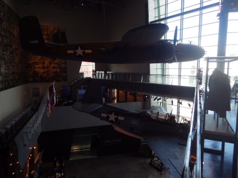
It is easy to spend an entire day here (fee) because of all the interactive exhibits and informational touchscreen kiosks. You do not even have to leave for lunch, since the Soda Shop and American Sector Restaurant & Bar are on site. We recommend you purchase a ticket including the 4-D film Beyond All Boundaries and the submarine experience based on the final mission of the USS Tang. This is our vote for #1 museum in the entire U.S.
French Quarter
Every American needs to visit the French Quarter at least once in their life (although whether that’s during the wildness of Mardi Gras is up to you), and it is walkable from the National WWII Museum. Consider stopping by iconic Lafayette Square, Old Ursuline Convent Museum, or the New Orleans Pharmacy Museum.
Ghost Tour
We have heard rave reviews about the ghost tours offered in New Orleans, and hope to attend one someday to compare it to the others we have done.
We camped here and it felt like we were off in the wild while still within the city’s suburbs.
Day 2
New Orleans Jazz National Historical Park
The New Orleans Jazz Museum (fee) is located in the old U.S. mint building right in the heart of the historic French Quarter. Check the online schedule for musical performances put on by the National Park Service (NPS) and enter the free visitor center shared with Jean Lafitte National Historical Park and Preserve.
Go out to lunch in New Orleans
Louisiana is famous for its Cajun food, including gumbo, étouffée, jambalaya, po’boys, and red beans and rice.
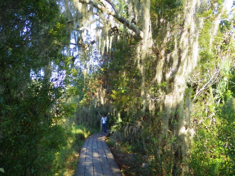
Make sure you visit the 24,000-acre Barataria Preserve to experience the bayous of Louisiana, whether you hike or take a boat tour (fee). South of downtown New Orleans off Highway 45, keep your feet dry by hiking the boardwalks on the Bayou Coquille Trail. In addition, this park includes three Acadian Cultural Centers spread throughout southwestern Louisiana.
Optional stop at Chalmette Battlefield
Another part of Jean Lafitte National Historical Park and Preserve encompasses the land where Andrew Jackson led the defeat of the British to retain New Orleans for the U.S. after the end of the War of 1812.
Day 3
Baton Rouge
Check out the art-deco capitol building where you might see white pelicans floating on the lake next door. We read that the pelican on the state flag is supposed to be a brown pelican (the official state bird) even though the artist made it white so it stood out against the blue background. Also consider visiting the Old State Capitol, Old Governor’s Mansion, or USS Kidd destroyer ship.
Optional drive along the Lake Ponchartrain Causeway
Not the most direct route between New Orleans and the capital city, this 23.8-mile causeway is considered the longest continuous bridge over water in the world. It is free to drive northbound, but don’t attempt it when it’s smoky or foggy, as it becomes very dangerous to drive.
Optional stop at LSU Tigers game
Louisiana State University is located in Baton Rouge and they are famous for their tailgating scene and raucous fans who support their perennially excellent football, women’s basketball, and gymnastics teams.
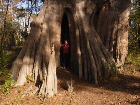
Northwest of Baton Rouge, the largest of all baldcypress trees in the U.S. is found at the end of a flat, half-mile trail, where there is a new boardwalk built around the tree to protect its roots. This area is located down six miles of dirt road full of potholes (and is sometimes flooded).
Louisiana is home to 24 National Wildlife Refuges, many found in its southern half where bayous are full of alligators and mostly uninhabited by humans, like this one west of Baton Rouge.
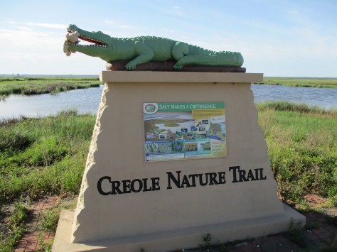
In southwest Louisiana, this route traverses 180 miles of pavement around Calcasieu Lake and the Gulf of Mexico coastline. Much of the state’s oceanfront is inaccessible swamp, but in this corner of the state there are 26 miles of beautiful sandy beaches where ocean waves and seashells await. Consider spending the night in Holly Beach.
Further inland, there are 700,000 acres of wetlands that attract waterfowl to Sabine National Wildlife Refuge, while the surrounding area is used by farmers to grow rice and raise crawfish.
There are eight parcels that constitute the sprawling 603,360-acre Kisatchie National Forest, which has over 40 developed recreation sites and 100 miles of trails. It encompasses lakes for boating and swimming, plus baldcypress-lined bayous for canoeing and fishing. Old-growth longleaf pine forests can be accessed by the paved Longleaf Trail Scenic Byway, just off Interstate 49. A 1.5-mile interpretive loop at Longleaf Vista is a good place to start.
Red Dirt National Wildlife Management Preserve
Camping is allowed in this area next to the 8,700-acre Kisatchie Hills Wilderness where you can backpack along trails. Kisatchie National Forest also offers several lakefront camping areas elsewhere. Lake Fausse Pointe, Lake Bistineau, and Chicot State Parks all have campgrounds with lake access, as well cabins available for rent.
The Creole Nature Trail Adventure Point is a self-guided audio tour and starts off Interstate 10 in Sulphur, where a museum has hands-on displays that introduce visitors to local wildlife and Cajun culture.
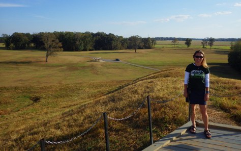
Settled 3,700 years ago by hunter-gatherers, this ancient city with a population estimated at 1,500 was situated along Bayou Macon in northeast Louisiana. The inhabitants constructed several mounds, the most impressive is 72-feet-tall in the shape of a bird, which required approximately 15-million basket-loads of soil to complete.
Oakland Plantation survived the Civil War intact, but in the wake of Reconstruction tenant farming created a new form of indentured servitude. Self-guided tours of the site take you through the mule barn, several cottages, and an old general store that still looks open for business along Highway 494. Slave/tenant quarters are also preserved at Magnolia Plantation downstream, but the main house is closed to the public.
Festivals dedicated to celebrating and eating frogs and crawfish; it does not get any more Louisiana than that! Also, consider arriving during one of the many music festivals dedicated to jazz, zydeco, or other regional musical styles.
An annual battle reenactment takes place at the site of a siege during the Civil War; further north, another Civil War reenactment is held at Pleasant Hill.
This forested Wildlife Management Area is located between Monroe and Alexandria in central Louisiana. It includes Rock Falls, which at 17 feet in height is the tallest waterfall in the state, accessible on a seven-mile trail.
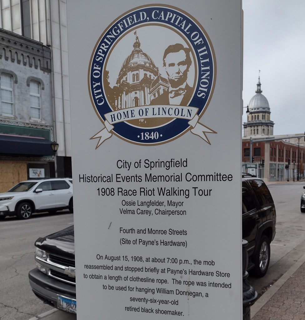
In 1908, African Americans made up only 5.5% of Springfield’s population of 47,000. However, racial tensions ran high across the nation, and, on August 14, a mob formed outside the jail where two African-American men were accused of separate incidents of sexual assault and murder. When the crowd found out the prisoners had been secretly moved 60 miles away, a full riot broke out. They destroyed buildings, looted, and lynched two prominent members of the African-American community—a barber named Scott Burton and the wealthy William Donnegan. By the time the National Guard arrived to restore order, seven people were dead and the mob had already burned the African-American neighborhood known as the “Badlands” to the ground. Eventually, the trials of the 80 riot suspects at the Old Court House led to only one conviction for petty larceny. While the rape suspect, George Richardson, was released when his accuser admitted fabricating the story, Joe James was convicted of murder and executed on October 23, 1908 despite being legally exempt from the death penalty as a minor. These events catalyzed the formation of the National Association for the Advancement of Colored People (NAACP) a few months later in New York City.
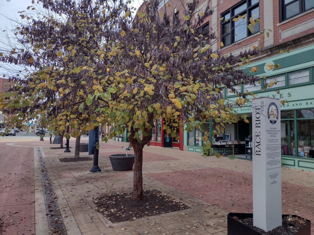
Walking tour, Acts of Intolerance sculpture, mural, Old Court House, Springfield and Central Illinois African American History Museum, Oak Ridge Cemetery, Mechanicsburg Cemetery
Must-Do Activity
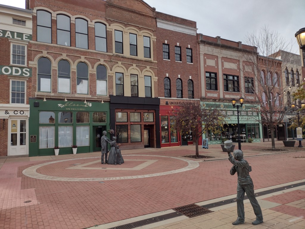
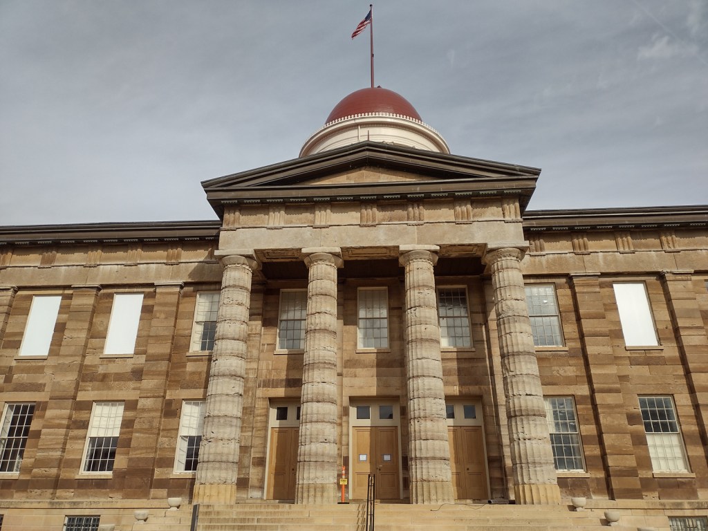
Before the National Monument was designated in 2024, the city of Springfield had already created a walking tour highlighting the events of the 1908 race riot marked by seven silver pillars. After starting at the former site of the jail, the tour moves to where Loper’s Restaurant once stood; its white owner having assisted in moving the prisoners, his restaurant and his car were destroyed. During the frenzy, a restaurant patron named Louis Johnson was shot and killed. There are five other stops detailing the events chronologically, but they do not include the mural inside HSHS St. John’s Hospital Women & Children’s Clinic, which is next to the officially designated National Monument boundaries where the foundations of five homes burned in the “Badlands” remain fenced off. Upon our visit less than three months after its creation, the National Park Service visitor center for Lincoln Home National Historic Site did not have any information on the new National Monument, but they already had a passport stamp.
Best Trail
When followed in chronological order, the walking tour bounces back and forth across the city, so you will get your steps in that day. In the summer, guided tours are offered from the Springfield Convention and Visitors Bureau. Alternatively, you can drive the route and read the descriptions in the publication available online and from the visitors bureau.
Photographic Opportunity
After the burning of the “Badlands” neighborhood, two chimneys were about the only structures left standing. The sculptor Preston Jackson utilized this imagery in his work Acts of Intolerance that depicts scenes of the race riot in bas relief. Dedicated in 2009, it stands across the street from the Abraham Lincoln Presidential Library in Union Square Park.
There is no free parking in downtown Springfield, so you can use a parking meter or the NPS pay lot at Lincoln Home National Historic Site.
Camping
Lincoln’s New Salem State Historic Site is 20 miles northwest of Springfield and its campground has running water. Further north, Starved Rock State Park is a beautiful spot for camping, and it also offers a historic lodge.
Related Sites
New Philadelphia National Historic Site (Illinois)