In northwest Montana, Kootenai National Forest includes parts of the Cabinet, Purcell, Salish, Selkirk, and Whitefish Mountains on the border of Canada. In 1975, the 422-foot-tall Libby Dam on the Kootenai River created 90-mile-long international Lake Koocanusa (a contraction of Kootenai-Canada-U.S.A.). Elevations in Kootenai National Forest range from 1,832 feet up to 8,738-foot Snowshoe Peak in the Cabinet Mountains Wilderness, encompassing a variety of habitats from subalpine meadows to arid plains with cacti.
Highlights
Lake Koocanusa Scenic Byway, Northwest Peak Scenic Area, McGregor Lake, Yaak Falls, Ten Lakes Scenic Area, Ross Creek Cedar Grove Scenic Area, Loon Lake, Tenmile Falls, Bluebird Basin Trail, Vinal McHenry Boulder National Recreation Trail, Pacific Northwest National Scenic Trail
Must-Do Activity
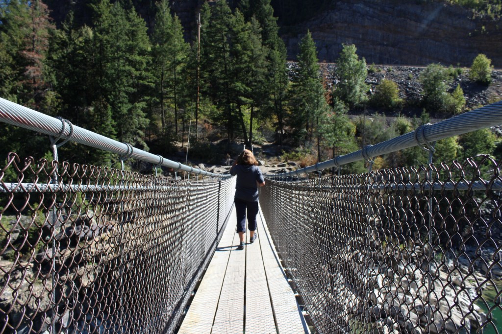
There are more than 1,200 miles of trails in Kootenai National Forest, including 90 miles of the Pacific Northwest National Scenic Trail. Two of the best places to hike are the Northwest Peak and Ten Lakes Scenic Areas, in the remote upper corners of the National Forest. Outside of Libby, Montana, Blue Mountain Trail (1.5 miles one-way), Skyline National Recreation Trail (22 miles), and Scenery Mountain Lookout Trail (2.5 miles) all climb to incredible overlooks. At Kootenai Falls (see Photographic Opportunity), a new suspension bridge crosses the Kootenai River to Forest Service land on the north shore. From there, Koot Creek Canyon Trail travels another three miles to a dirt road in Kootenai National Forest.
Best Trail
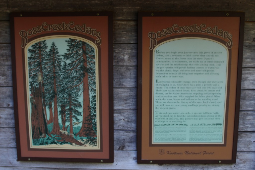
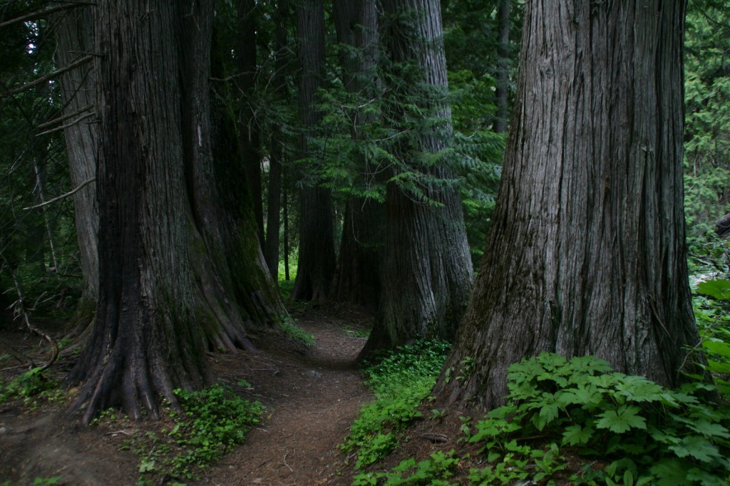
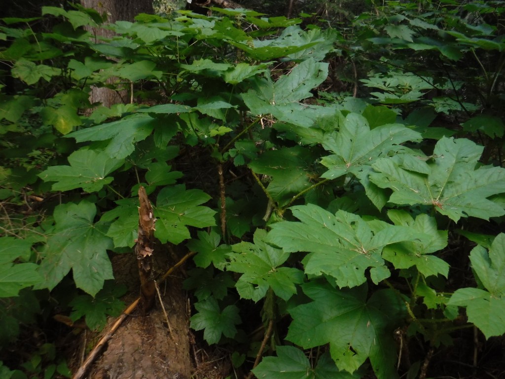
In 1959, Ross Creek Cedar Grove Scenic Area preserved 101 acres of western redcedar trees up to eight feet in diameter. A one-lane paved road with pullouts leads 4.3 miles from Highway 56 to a large parking area with a day-use fee. The main trail is a less than one-mile loop with interpretive signs, but continues five miles to the North Fork of Ross Creek. The old-growth forest is also home to large Douglas-fir, Engelmann spruce, grand fir, and western hemlock trees growing above a lush green understory of ferns and Devil’s-club.
Watchable Wildlife
The mountains provide habitat for grizzly bears, black bears, Canada lynxes, bobcats, mountain lions, wolverines, mink, pine martens, long-tailed weasels, porcupines, snowshoe hares, pika, moose, bighorn sheep, and mountain goats. Hoskins Lake is a wintering range for mule deer and white-tailed deer, as well as an osprey nesting area in the summer. The National Forest’s numerous rivers and more than 100 lakes support gamefish like cutthroat, rainbow, brown, and endangered bull trout. The endangered white sturgeon is also found in this area.
Photographic Opportunity
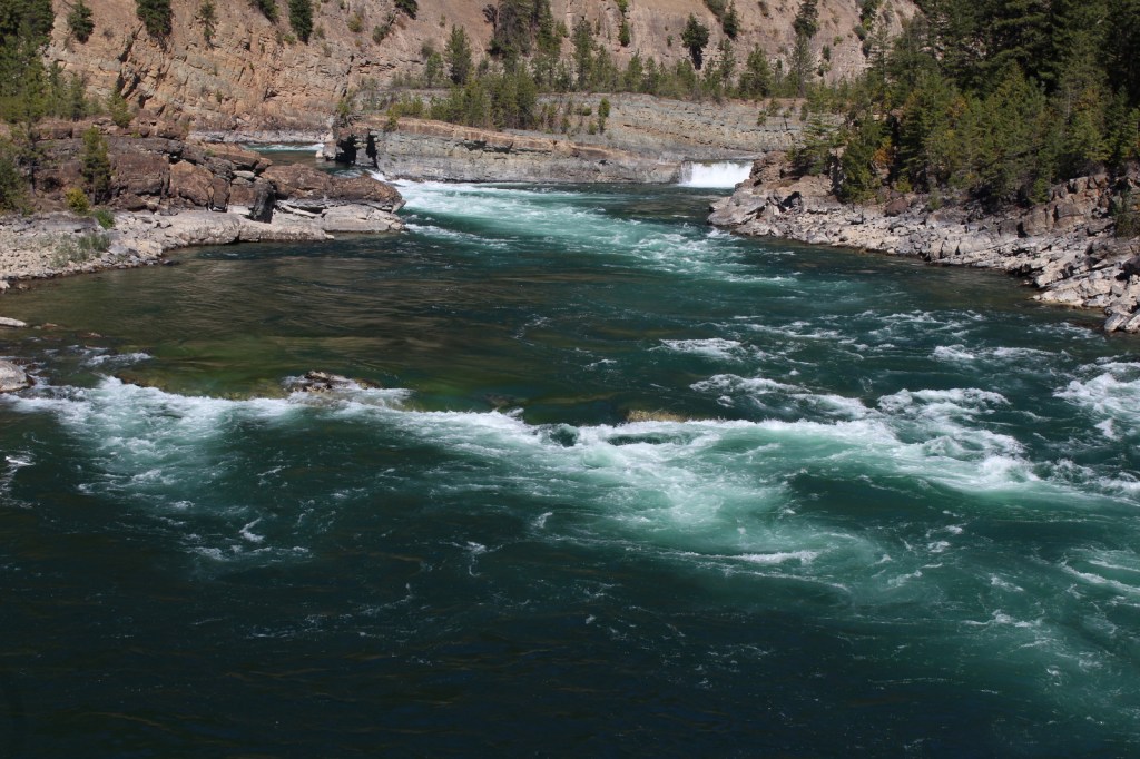
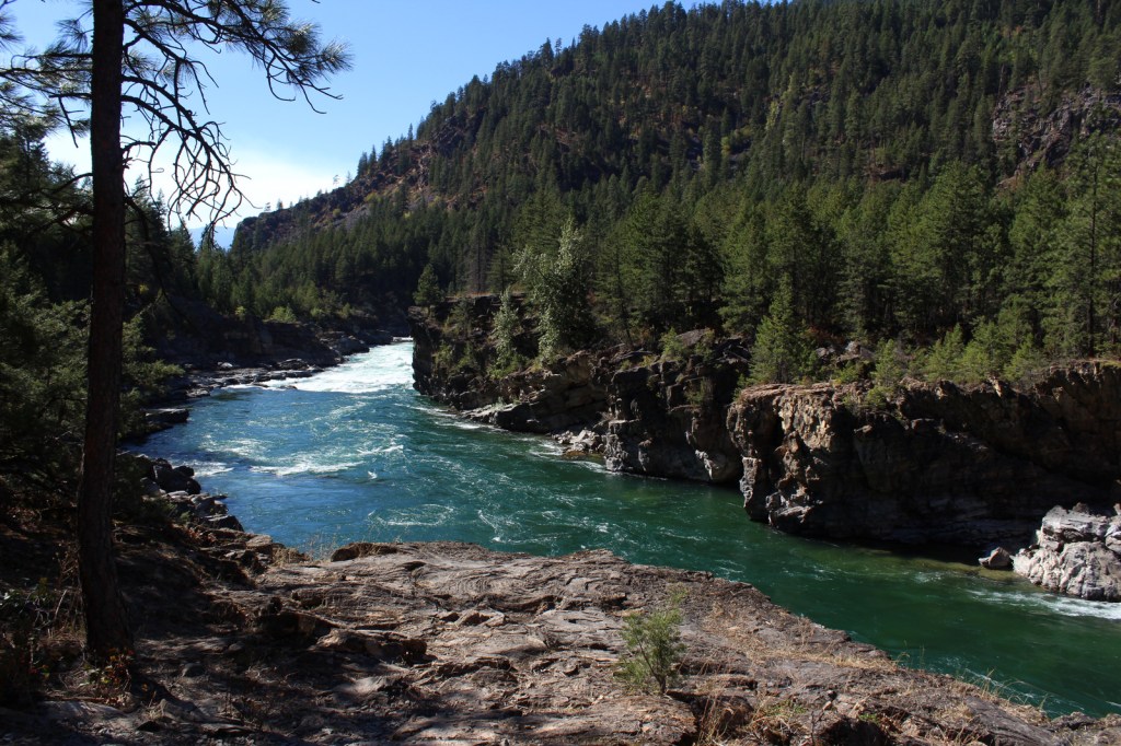
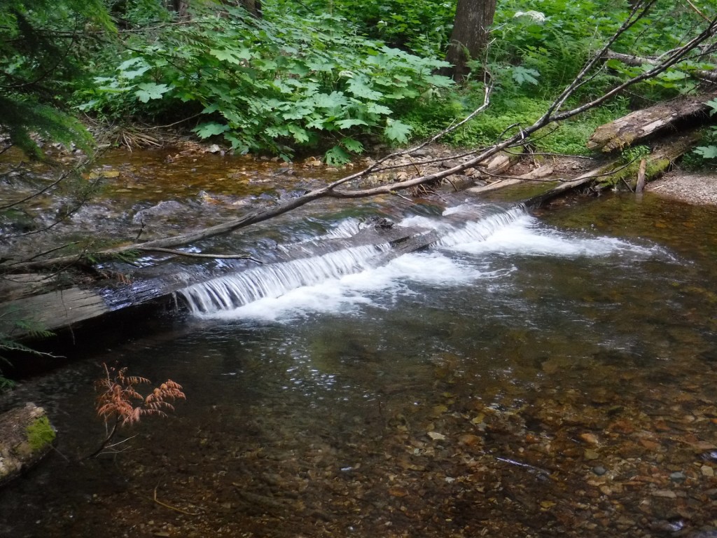
Located in a county park on the side of Highway 2, Kootenai Falls is only about 20 feet tall, but it is impressively wide and beautiful. An overlook is located one-tenth of a mile from the parking lot, but there is also a walking bridge that crosses over the railroad tracks to a viewpoint at the edge of the falls, and a suspension bridge only a quarter-mile further downstream.
Peak Season
Summer
Fees
Ross Creek Cedar Grove Scenic Area has a day-use fee (or the America the Beautiful pass is also accepted).
Road Conditions
Paved roads like the Lake Koocanusa Scenic Byway, U.S. Highway 2, and State Highway 56 make it easy to explore Kootenai National Forest. To access Ross Creek Cedar Grove Scenic Area, a one-lane paved road with pullouts leads 4.3 miles from Highway 56. A nice drive through the Purcell Mountains can be made by looping State Route 508 and Forest Road 68.
Camping
There are Forest Service campgrounds at Kilbrennan Lake, Loon Lake, Rexford Branch, Caribou, Red Top, Whitetail, Pete Creek, Howard Lake, and elsewhere. Big Creek Baldy Mountain lookout cabin can be rented, too.
Kootenai FallsSuspension bridge at Kootenai FallsSuspension bridge at Kootenai FallsKootenai RiverKootenai FallsScott’s mother in Ross Creek Cedar Grove Scenic AreaScott in Ross Creek Cedar Grove Scenic AreaScott’s mother in Ross Creek Cedar Grove Scenic Area
lodgepole pine, whitebark pine, ponderosa pine, Douglas-fir, western hemlock, western redcedar, , western larch, alpine larch, Engelmann spruce, subalpine fir, grand fir
Rocky Mountain maple, boxelder, quaking aspen, balsam poplar, dwarf birch, paper birch, Piper’s hawthorn, Bebb willow, western mountain-ash, choke cherry, western serviceberry
Explore More – The Kootenai (or Kootenay in Canada) River is named after the local Ktunaxa Indians, which translates as what in the Algonquian language?
Learn more about this and the 154 other National Forests in our new guidebook Out in the Woods
We are a participant in the Amazon Services LLC Associates Program, an affiliate advertising program designed to provide a means for us to earn fees by linking to Amazon.com and affiliated sites.
In the mountainous tip of the Idaho pandhandle bordering Canada, Kaniksu National Forest stretches into three states. Recreational opportunities surround three major rivers and two large natural bodies of water: Lake Pend Oreille and Priest Lake. As you might imagine in a place this wet, waterfalls abound (see Must-Do Activity). Coeur d’Alene National Forest is located on both sides of Interstate 90, east of the city of Coeur d’Alene, which was the French name given to the indigenous people. In 1973, Kaniksu National Forest was joined with Coeur d’Alene and St. Joe National Forests to form Idaho Panhandle National Forests.
Highlights
Priest Lake, Northeast Peak Scenic Area, Lake Pend Oreille, Bottle Lake, Snow Creek Falls, Chimney Rock, Huff Lake, Canyon Creek Natural Area, Copper Falls, Gunsight Peak, Hahn Lake, Hanna Flats Nature Trail, Gold Hill Trail
Must-Do Activity
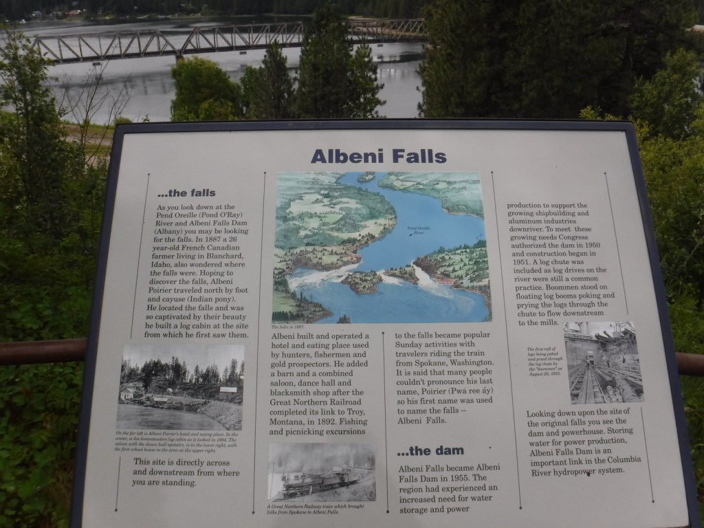
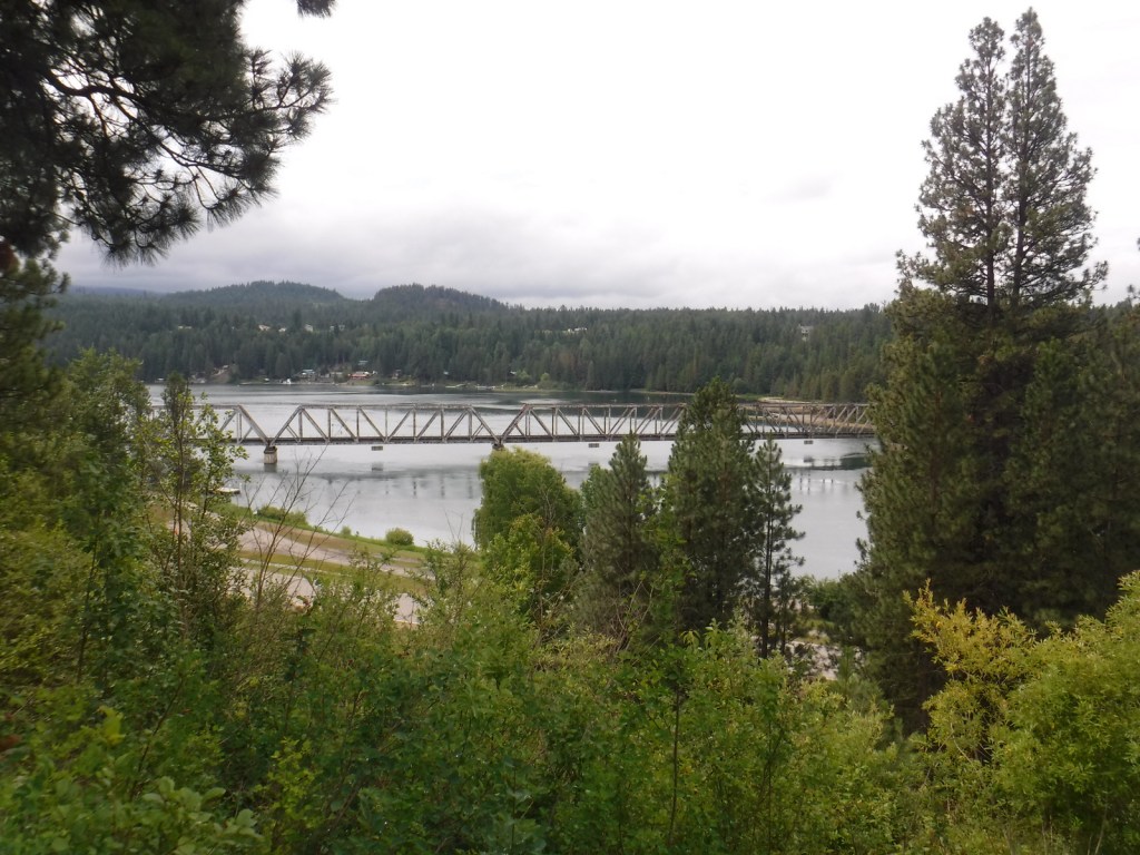
As you might imagine in a place this wet, waterfalls abound, including 160-foot Copper Falls, 150-foot Jeru Creek Falls, 75-foot Wellington Creek Falls, and 75-foot Char Falls. South of Bonners Ferry, a forest road leads to Snow Creek Falls with an upper drop of 125 feet and a lower plunge of 75 feet. Rapid Lightning Falls, Grouse Creek Falls, and Torelle Falls are also in Kaniksu National Forest. If you want to see more waterfalls, Moyie Falls drops 140 feet in a series of cascades located just outside the National Forest and there is a roadside pullout at Albani Falls Dam on the Pend Oreille River. A paved scenic byway follows the north shore of Lake Pend Oreille and the Clarks Fork River into Montana.
Best Trail
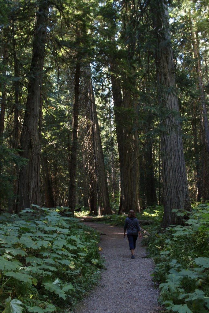
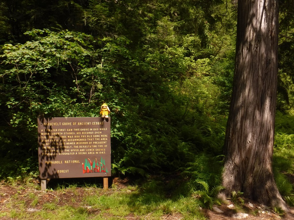
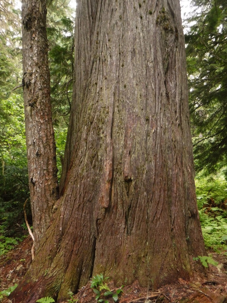
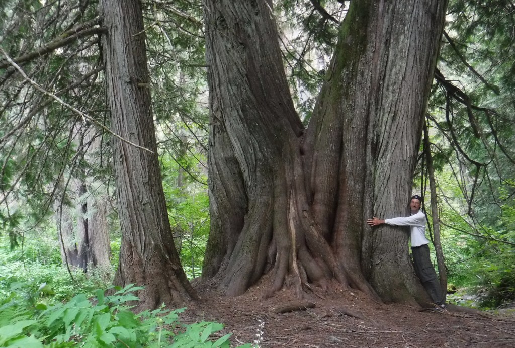
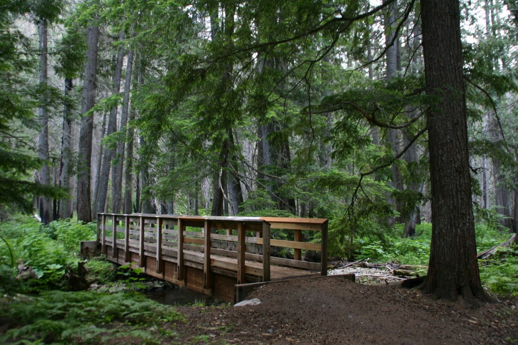
First discovered by a forester in 1919, the Roosevelt Grove of Ancient Cedars Scenic Area in Washington was named in honor of Theodore Roosevelt. A 1926 fire killed three-quarters of the trees, leaving two smaller remnant patches. Most of the western redcedars are around 800 years old, but some of them are estimated to be more than 2,000 years old. Of course, since this is Kaniksu National Forest there is also a trail here to a waterfall, with a one-mile loop climbing 200 feet to an overlook. From that point it is only a half-mile walk to the 20-acre Upper Grove. The trail leaves from the colorfully-named Stagger Inn Trailhead, which gets its moniker from a 1926 fire camp located an exhausting 14-mile hike from the nearest road.
Watchable Wildlife
Kaniksu National Forest is home to mule deer, elk, moose, black bears, bobcats, coyotes, and mountain lions. This close to Canada, it is also possible to find grizzly bears and gray wolves. The Selkirk Mountains represent the sole place in the contiguous U.S. where you might see mountain caribou. Common large birds include ospreys, golden eagles, bald eagles, wild turkeys, and ravens. The National Forest borders Lake Pend Oreille and Priest Lake, plus it contains many of the rivers and creeks that feed them, which provide incredible fishing opportunities.
Photographic Opportunity
At the Roosevelt Grove of Ancient Cedars Scenic Area, a one-mile loop trail climbs to a vista above Lower Granite Falls where Upper Granite Falls may be viewed.
Peak Season
Summer
Fees
None
Road Conditions
A long dirt road (FR 302) leads to the Roosevelt Grove of Ancient Cedars Scenic Area in Washington (and continues west into neighboring Colville National Forest), but it is maintained in good condition for passenger vehicles, although not all forest roads are.
Camping
There are numerous campgrounds on the west side of Priest Lake and around Lake Pend Oreille, plus dispersed campsites along the dirt roads near the Roosevelt Grove of Ancient Cedars Scenic Area.
Wilderness Areas
Cabinet Mountains Wilderness (also in Kootenai National Forest)
Selkirk MountainsSelkirk MountainsRoosevelt GroveRoosevelt Grove of Ancient Cedars Scenic AreaScott in the Roosevelt Grove of Ancient Cedars Scenic AreaLower Granite FallsUpper Granite FallsAlbeni Falls
western redcedar, ponderosa pine, lodgepole pine, western white pine, whitebark pine, Douglas-fir, grand fir, subalpine fir, Engelmann spruce, western hemlock, mountain hemlock, western larch
Rocky Mountain maple, quaking aspen, Pacific dogwood, balsam poplar, dwarf birch, paper birch, Piper’s hawthorn, boxelder, Bebb willow, western mountain-ash, choke cherry, western serviceberry, red alder, mountain alder
Explore More – Kaniksu is derived from a Kalispel Indian word meaning what?
Learn more about this and the 154 other National Forests in our new guidebook Out in the Woods
We are a participant in the Amazon Services LLC Associates Program, an affiliate advertising program designed to provide a means for us to earn fees by linking to Amazon.com and affiliated sites.
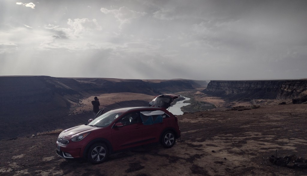
Best time of year: Summer for mountain access and whitewater rafting
We recently published our guidebook 50 States of Great: Road Trip Guide to America, so we decided to start a new type of blog post where we create a travel itinerary for all 50 states, in addition to our usual National Forest and National Park entries. After starting with Kansas and Georgia, we decided to do a western state. We made an ambitious seven-day plan starting in the northern panhandle of Idaho, with plenty of options to extend the trip.
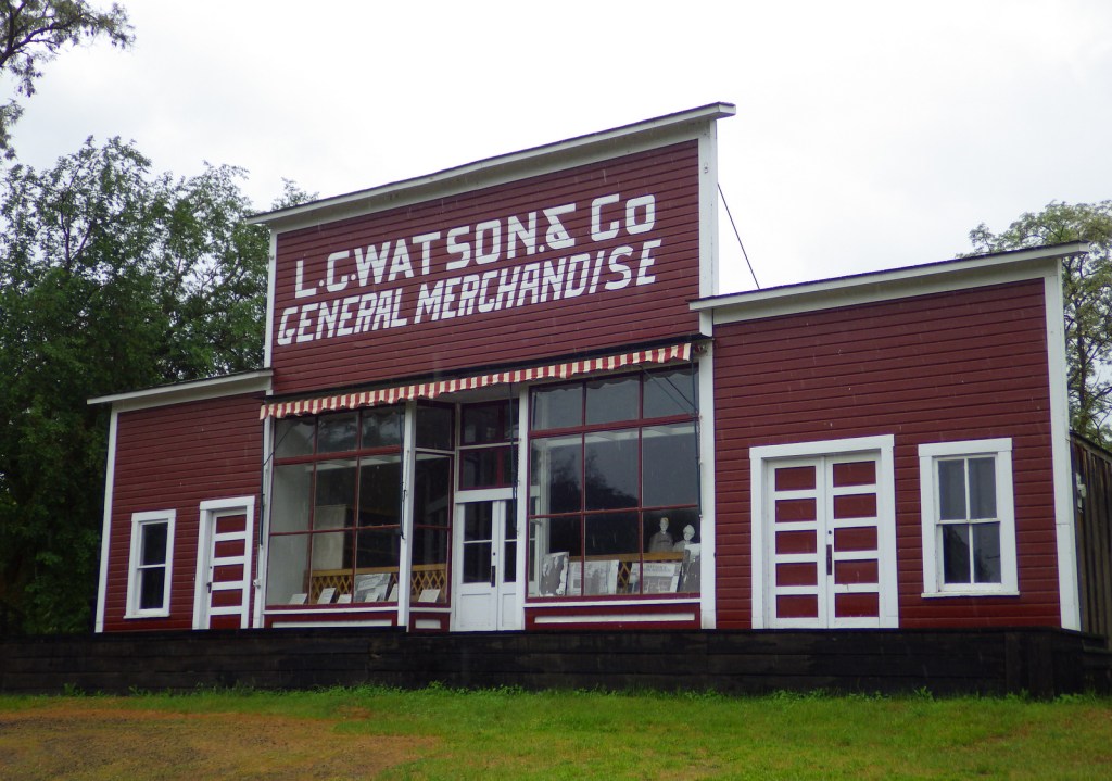
Located right off Interstate 90, this white-painted, timber-frame church dates back to 1850 (making it the oldest building standing in the state). It was constructed by Coeur d’Alene Indians and Catholic missionaries without using nails and visitors can admire the wooden pegs used instead. There is a parking fee, plus separate admission to the museum.
St. Joe National Forest
Part of the larger Idaho Panhandle National Forest, this area encompasses the famous Route of the Hiawatha bicycling trail that follows the former Milwaukee Railroad grade, dropping 1,000 feet in 13 miles. Due to its 200-foot-tall trestles and a 1.6-mile-long unlit tunnel, a flashlight and helmet are required, as are permits available only at Lookout Pass Ski Area, which also offers equipment rentals and shuttles.
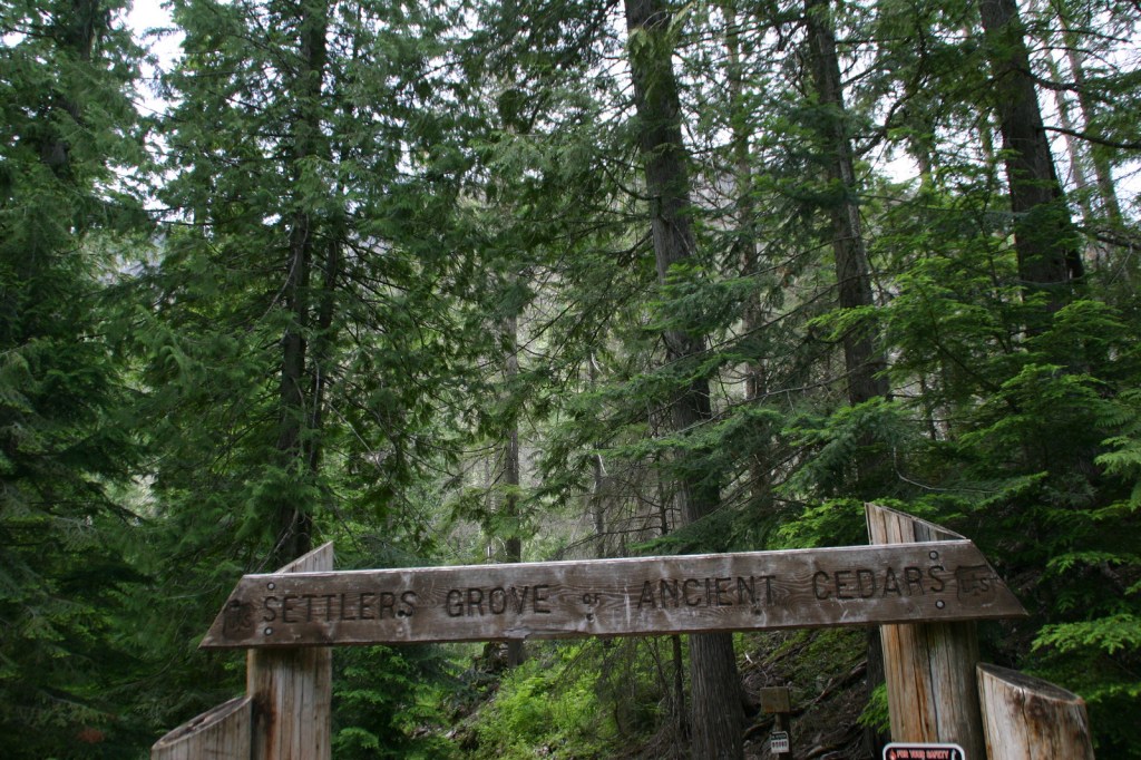
Home to the 173-acre Settler’s Grove of Ancient Cedars, it is part of Idaho Panhandle National Forest that also contains 240-acre Hobo Cedar Grove Botanical Area and 20-acre Roosevelt Grove of Ancient Cedars (technically in neighboring Washington).
An excellent film is shown at the main National Park Service visitor center in Spalding on the Nez Perce Indian Reservation. Nearby, check out interpretive signs at Heart of the Monster and historic buildings of Spalding.
Highway 12 follows the beautiful Clearwater River providing access points for the dusty Lolo Motorway (a section of the Nez Perce National Historical Trail) and its many scenic overlooks. It is worth the short, flat hike to soak in Jerry Johnson Hot Springs.
Day 3
Hells Canyon National Recreation Area
Hells Canyon is considered the deepest in the nation when measured nearly 8,000 feet from river level to the top of 9,383-foot He Devil Mountain. We did a daytrip combination whitewater rafting and jet boat tour that was a blast with stops to see petroglyphs, McGafee Cabin, and Kirkwood Ranch, which can also be accessed via the Snake River National Recreation Trail in Payette National Forest.
Optional stop at Payette National Forest
Fast-flowing Goose Creek Falls is accessed on an incredibly steep 3.3-mile, out-and-back trail. Dispersed camping is allowed nearby on the shores of Brundage Reservoir, which has views to the north of the 8,292-foot-tall Black Tip. The picturesque town of McCall on Payette Lake is home to a Forest Service smokejumper base where tours are available by reservation.
The headquarters of the Peregrine Fund is home to a California condor, red-tailed hawk, American kestrel, Swainson’s hawk, turkey vulture, western screech owl, and Harris’ hawk, in addition to exotic species like the harpy eagle and ornate hawk-eagle.
A different kind of “bird of prey” is on display in this hangar next to the small Nampa Airport, with military artifacts and aircraft, some of which still fly on special occasions.
South of Boise, this 484,873-acre area was established in 1993 because of its dense population of nesting raptors due to huge numbers of ground squirrels and other small burrowing mammals. It is run by the Bureau of Land Management, so dispersed camping is allowed.
South of Interstate 84, this is a fun spot for kids with sandcastle building, swimming, camping, sandboarding (rentals available), and stargazing at night around the park’s observatory.
Day 5
Idaho City
This gold rush town was briefly the largest settlement in the Pacific Northwest with a population of 7,000. It subsequently burned down and was rebuilt four times in 1865, 1867, 1868, and 1871. Today it retains its Wild West charm with saloons, antique shops, and a couple of parlors where you can try delicious huckleberry ice cream.
Follow the Ponderosa Pine Scenic Byway (Highway 21) 131 miles northeast through Idaho City and Lowman, where the road follows the South Fork of the Payette River past the campgrounds at Kirkham and Bonneville Hot Springs (reservations recommended) and up to 7,056-foot Banner Summit at the boundary with Challis National Forest (click here for our blog post).
The jagged Sawtooth Mountains live up to their name, rising majestically above the Salmon River Valley. There are numerous campgrounds, including several on Redfish Lake, which is a gateway for backpackers into the beautiful Sawtooth Wilderness. The Sawtooth Scenic Byway runs 116 miles from Stanley south to Shoshone, through Galena Pass and the ski resort towns of Ketchum and Sun Valley.
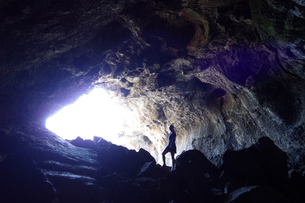
In the 1800s, this massive lava flow proved a major obstacle to avoid for immigrants on the Oregon Trail. Most of today’s highways follow in their tracks, going around and not through the 62-mile-long Great Rift. In 1969, the National Monument truly earned its lunar moniker by serving as a field school on volcanic geology for NASA Apollo astronauts. There are several short lava tubes found here, including Boy Scout Cave that retains ice well into the blazing hot summer months.
Day 6
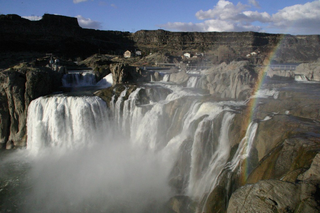
Shoshone Falls
Twin Falls is home to this impressive cascade that drops 212 feet down the Snake River canyon. Its mist can form a brilliant rainbow, especially when the river is flowing strong in the spring before much of its water is diverted for agriculture.
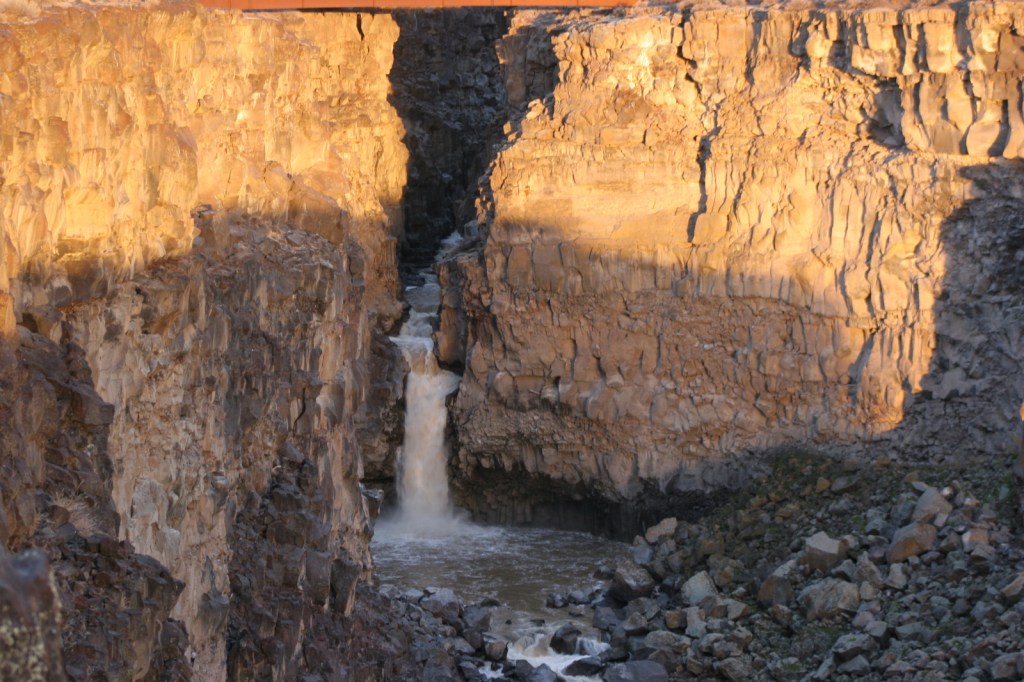
Situated directly beneath a bridge on Interstate 84, this is one of seven units in Thousand Springs State Park. Malad Gorge contains an awesome waterfall known as the Devil’s Washbowl and a beautiful volcanic rock canyon lined with natural springs.
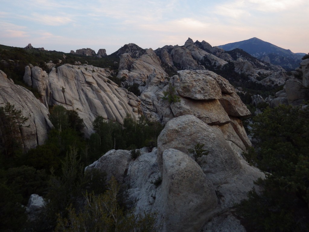
This collection of granite spires served as a rest stop along the California National Historic Trail. At the height of the gold rush in 1852, some 50,000 emigrants passed this site in a single year, many leaving their names painted in axle grease (still legible on Camp Rock and Register Rock). Today the National Reserve is a popular destination for rock climbers, and it also has 78 primitive campsites and 30 miles of hiking and equestrian trails.
Numerous mammal fossils from the Pliocene Epoch are on display at the National Park Service visitor center located on the main drag in the small town of Hagerman. Scenic overlooks of the Snake River and Oregon Trail are located further south, but there is no public access to the fossil beds.
Most of the 13,000 Japanese-Americans imprisoned in central Idaho were from Oregon, Alaska, and Washington (specifically Bainbridge Island where a memorial stands today). There is a new visitor center completed in 2020 with a large museum space and a small theater that shows an excellent film. A 1.6-mile interpretive trail loops past historic structures, including the Hermann House, root cellar, baseball field, barracks, and mess hall.
Located in a six-story building in downtown Pocatello, the museum offers more than one mile of displays, many of them light-hearted and downright hilarious (especially if you like puns). It was established by Don Aslett who started a janitorial services company while studying at nearby Idaho State University. The museum has a reasonable admission fee, and it is easy to spend two hours or more perusing the 10,000 artifacts and pieces of artwork inside.
A 15-foot-long model spud sits out front, providing an excellent photo opportunity. The museum has a collection of exhibits on cultivating the state’s principal crop and also boasts the world’s largest potato chip.
Even though the signs still read Cache National Forest, Minnetonka Cave offers one of the few developed cave tours offered by the U.S. Forest Service. In the 1930s, 444 stairs were installed to allow large groups to visit, and guides make multiple stops on this steep, out-and-back tour to allow you to catch your breath at this high elevation.
Day 8+ optional swing through eastern Idaho
Targhee National Forest
Mesa Falls Scenic Byway provides overlooks of both the 114-foot Upper Falls and 65-foot Lower Falls on the Henrys Fork of the Snake River. Palisades National Recreation Trail may be the most popular trail in Idaho as it leads to two beautiful mountain lakes located at 5,700 and 6,750 feet in elevation.
Salmon National Forest
Salmon National Forest includes a significant section of the 2.4-million-acre Frank Church-River of No Return Wilderness (the second largest Wilderness in the contiguous U.S.). Many multi-night rafting trips on the Salmon National Wild and Scenic River begin around the small town of North Fork. This upper 46-mile segment of the river is designated Recreational, so it only requires a self-issued permit. Those wishing to raft the 79-mile section west of Corn Creek Campground must enter a lottery, but out-of-state travelers typically go with a guide.
An Interpretive Center in Challis celebrates the mining history of this region with audiovisual programs and gold panning stations making this a great place to bring children. The State Park also includes the Challis Bison Kill Site where animals were stampeded off a cliff by American Indians.
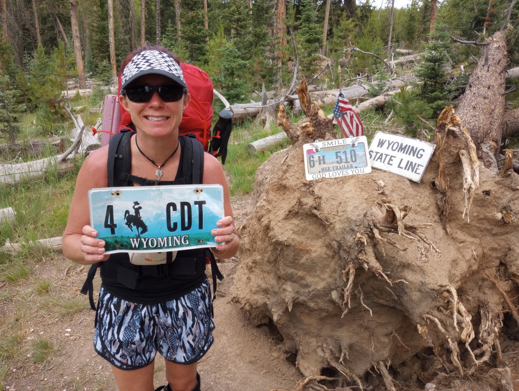
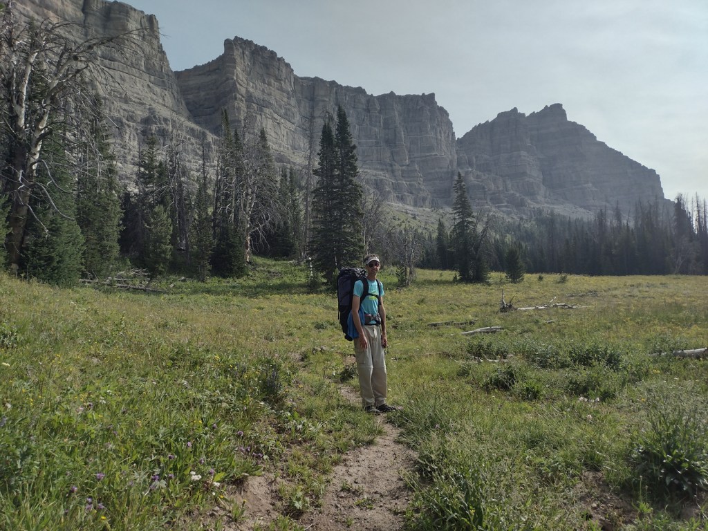
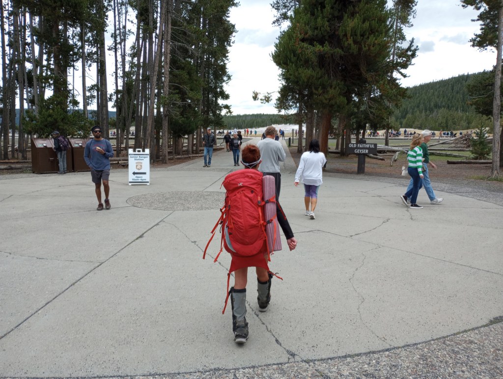
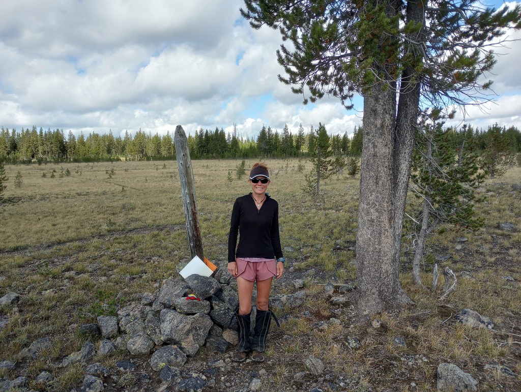
We decided to write about the Continental Divide National Scenic Trail (CDT) now, since Tiff recently finished backpacking the entire 512-mile Wyoming section of the route. The CDT stretches 3,028 miles from the Crazy Cook Monument on the border with Mexico north to Waterton-Glacier International Peace Park. The official trail is known as the “red route,” with popular alternatives called “blue routes” detouring through sections like New Mexico’s Gila Wilderness (which 95% of thru-hikers choose). Tiff was supported by Scott along portions of the trail and they both backpacked through Yellowstone National Park together. Tiff met dozens of thru-hikers doing the entire trail this year, many of whom were “flip-flopping” after getting stopped north bound (NOBO) by snowy Colorado mountains so switching to a south bound (SOBO) direction to finish.
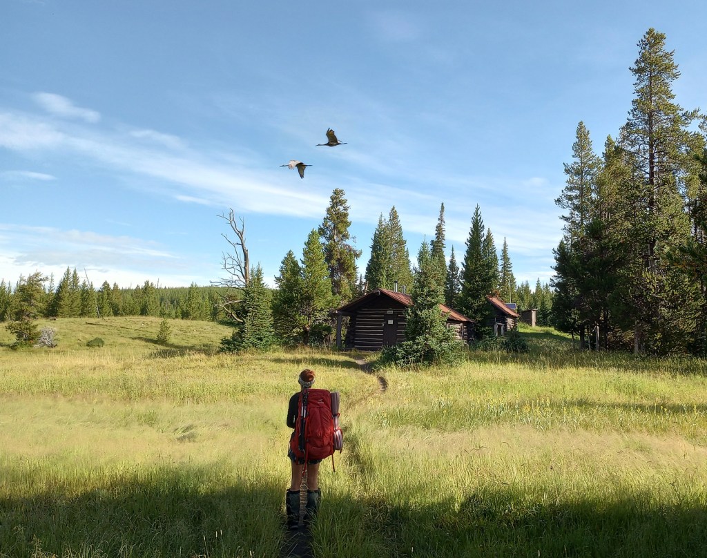
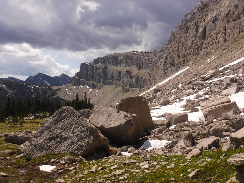
It takes the average thru-hiker 147 days to complete the trek (including “zeros days”), but you can get a feel for the experience on shorter point-to-point or loop hikes. We have done the Rocky Mountain National Park section as a long day hike and Scott has backpacked the minimum 40 miles to see the famous Chinese Wall in Montana’s Lewis and Clark National Forest. We had all three of our backcountry campsites to ourselves along Yellowstone National Park’s 67-mile stretch of CDT and went a full day without seeing another person near the park’s Idaho border.
Best Trail
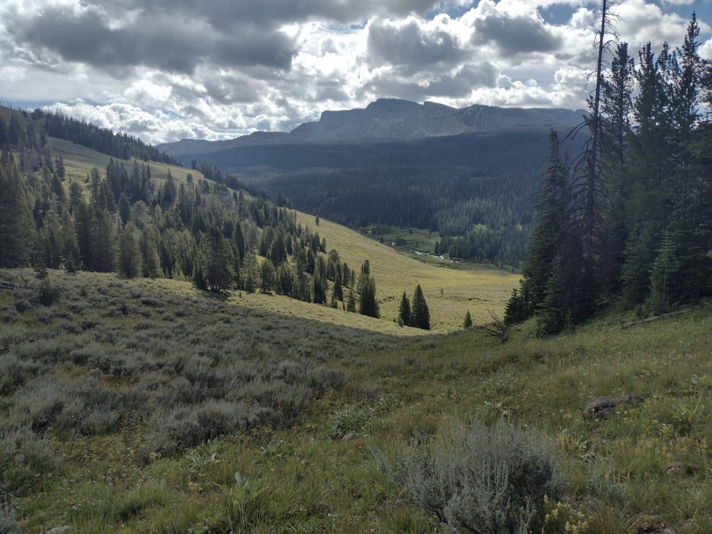
The Wind River Range in Wyoming’s Bridger National Forest is probably the most scenic stretch of mountains on the entire CDT. Many thru-hikers detour to a blue route to see beautiful, but overcrowded Titcomb Basin and the Cirque of the Towers (actually in neighboring Shoshone National Forest). Read more about our 2020 trip (mostly) following the CDT 120 miles through the range in our newspaper article.
Instagram-worthy Photo
The CDT goes right past crowded Old Faithful in Yellowstone National Park’s Lower Geyser Basin, although there are other areas of colorful hot springs like those near Heart Lake (pictured).
Peak Season
Summer
Fees
Fees apply if you camp inside or drive into Rocky Mountain, Yellowstone, and Glacier National Parks
Road Conditions
Much of the trail is actually walking dirt roads and some paved roads, especially in New Mexico. Access roads to certain trailheads can be very rough and require driving long unpaved sections, such as the 30 miles to busy Big Sandy Trailhead in Bridger National Forest.
Camping
Camping is dispersed except for designated sites (permit required) in Rocky Mountain, Yellowstone, and Glacier National Parks.
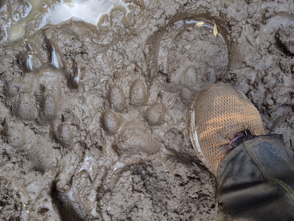
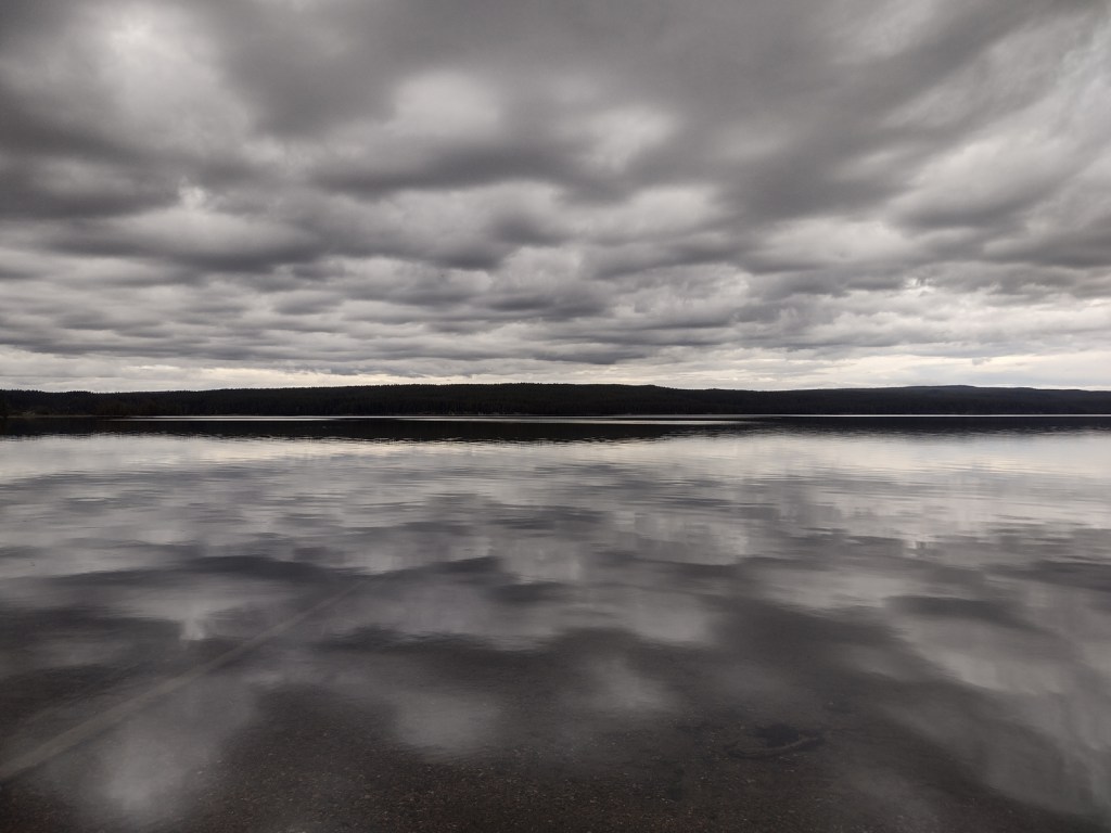
Tiff starting at the Colorado-Wyoming borderTiff in Wyoming’s South Pass City State Historic SiteEntering the Wind River RangeTiff in the Wind River RangeScott near Terrace MountainMule deerWolf tracks outside Tiff’s tent in the morningTiff at Heart Lake in Yellowstone National ParkSandhill cranes in Yellowstone National ParkShoshone Lake in Yellowstone National ParkScott crossing the Lewis River in Yellowstone National ParkGeysers in Yellowstone National ParkTiff at Old Faithful in Yellowstone National ParkYellowstone National ParkTiff finished at the Idaho border in Yellowstone National ParkBeargrass in Montana’s Lewis and Clark National ForestGrizzly bear in Lewis and Clark National ForestChinese WallLewis and Clark National Forest
Explore More – Which three oceans receive water from Triple Divide Pass in Montana?
Coeur d’Alene National Forest is located on both sides of Interstate 90, east of the city of Coeur d’Alene, which was the French name given to the indigenous people. In 1973, it was joined with Kaniksu and St. Joe National Forests to form Idaho Panhandle National Forests. A good base for exploration, Wallace is a silver mining boomtown that refused to die despite its close call during the infamous Big Burn of 1910 (read more about it and the Pulaski Tunnel in Timothy Egan’s book). On the Montana border, Lookout Pass Ski Area provides permits, equipment rentals, and shuttles for the famous Route of the Hiawatha bicycling trail (that is technically in St. Joe National Forest).
Highlights
Lake Hayden, Lookout Pass, Prichard Bridge, Stevens Lake, Willow Creek Falls, Steamboat Rock, Grassy Mountain Lookout, Lake Hayden, Settler’s Grove of Ancient Cedars, Pulaski Tunnel Trail
Must-Do Activity
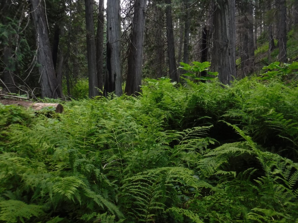
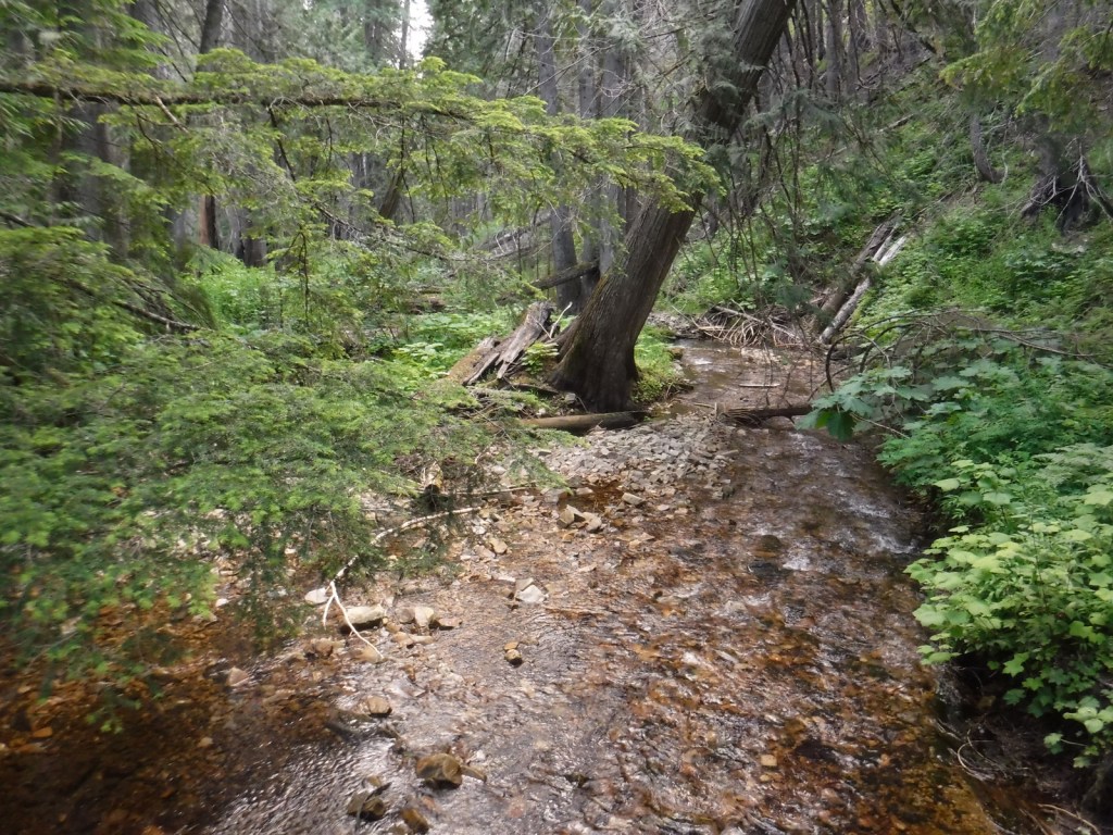
North of Wallace, a good dirt road follows the West Fork of Eagle Creek to the Settler’s Grove of Ancient Cedars. This 173-acre stand contains western redcedar trees up to seven feet in diameter, as well as large western hemlocks. Fire has burned through the understory of this grove freeing nutrients for a lush growth of ferns and devil’s-club. Look for a geocache near the sign that reads “end of Cedar Grove Trail” and points uphill to Trail No. 162, which continues another three miles.
Best Trail
The Idaho Centennial Trail follows the mountainous Idaho-Montana border on the eastern side of Coeur d’Alene National Forest, although it does dip west to cross Interstate 90 near the town of Mullan. The old Mullan Road was cut through this rugged area in 1859-61; the terrain was so steep that workers had to construct 47 bridges to cover a distance of only 28 miles.
Watchable Wildlife
Coeur d’Alene National Forest is home to mule deer, elk, moose, black bears, bobcats, coyotes, and mountain lions. This close to Canada, it is also possible to find grizzly bears and gray wolves. Common large birds include ospreys, golden eagles, bald eagles, wild turkeys, and ravens. Although the National Forest does not encompass Lake Coeur d’Alene, it does contain many of the rivers and creeks that feed it, which provide incredible fishing opportunities.
Instagram-worthy Photo
There are some impressive western redcedar trees growing in the Settler’s Grove of Ancient Cedars.
Peak Season
Summer
Fees
None
Road Conditions
Even the paved roads we drove north of Wallace were slow going—very steep with hairpin switchbacks. Once we got on the unpaved road following the West Fork of Eagle Creek, it was wide and flat. We drove through Coeur d’Alene National Forest to access Bullion Pass on a four-wheel-drive-only road up a steep three-mile-long grade about a mile west (on a paved frontage road) from the Dena Mosa-Lookout Pass Rest Area on eastbound Interstate 90.
Camping
There are campgrounds located throughout the National Forest, including Mokins Bay Campground on Hayden Lake and Bell Bay Campground on Lake Coeur d’Alene. We found a good dispersed campsite along the West Fork of Eagle Creek on the road to the Settler’s Grove of Ancient Cedars.
western redcedar, Engelmann spruce, lodgepole pine, western white pine, Douglas-fir, western hemlock, grand fir, subalpine fir, Pacific yew, western larch
Learn more about this and the 154 other National Forests in our new guidebook Out in the Woods
We are a participant in the Amazon Services LLC Associates Program, an affiliate advertising program designed to provide a means for us to earn fees by linking to Amazon.com and affiliated sites.
Start your U.S. National Parks, National Forests, and National Monuments adventure here!