The National Park Service (NPS) administers the Natchez Trace Parkway, a two-lane All-American Road that extends 444 miles from Natchez, Mississippi to Nashville, Tennessee. The trace started as a game trail that was utilized as an American Indian footpath. Some of the mound builder sites protected here were inhabited when Hernando de Soto led the first Europeans into this area in 1540. The Natchez Trace was heavily used in the 1800s by “Kaintuck” flatboatmen returning from New Orleans who left the Mississippi River from Natchez, Mississippi and continued on foot north to Kentucky and beyond. Today you can still follow portions of the sunken trail worn down by travelers for centuries. The parkway began as a Civilian Conservation Corps (CCC) project during the Great Depression and the final two segments were completed in 2005.
Highlights
Rocky Springs, Owens Creek Waterfall, Emerald Mound, Mount Locust, Chickasaw Village, Meriwether Lewis Monument and Gravesite, Cypress Swamp Walk, Witch Dance Horse Trail, Natchez Trace National Scenic Trail
Must-Do Activity
Near Tupelo, the Parkway Visitor Center at Milepost 266 is a must-do stop to learn the history of the trace, and it also serves as the NPS contact station for tiny Brices Cross Roads National Battlefield Site and Tupelo National Battlefield. There are numerous roadside informational pullouts and trailheads along the route, so use the NPS app or pick up an official “unigrid” map. You can easily spend days exploring, but at a minimum we recommend you check out Emerald Mound, Mount Locust, Cypress Swamp, and Meriwether Lewis Monument and Grave Site.
Best Trail
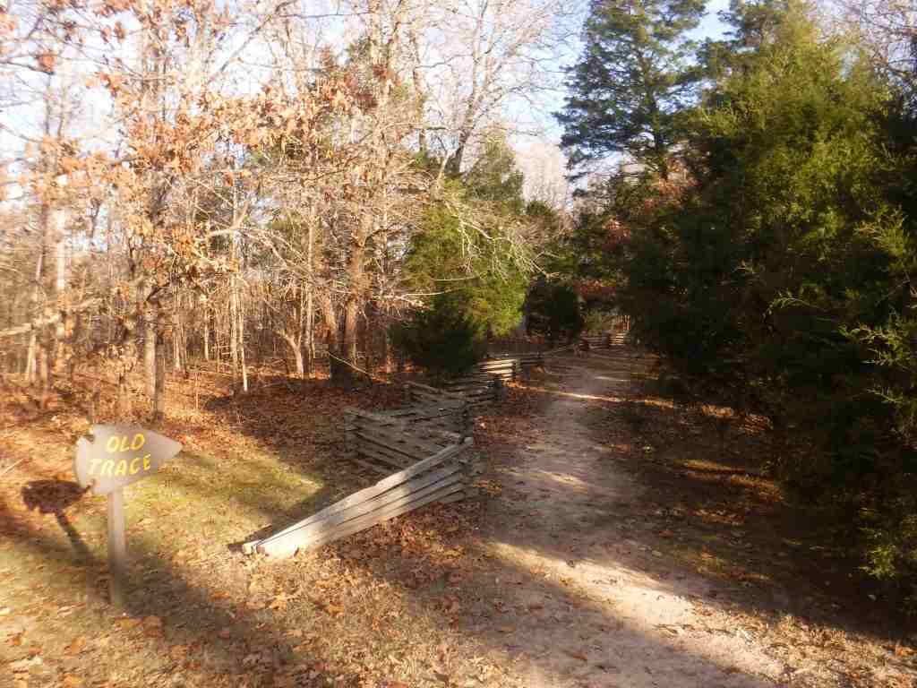
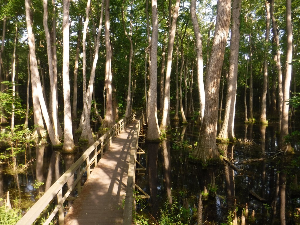
Our favorite trail is the Cypress Swamp Walk at Milepost 122, where a boardwalk crosses a scenic tupelo-baldcypress swamp. The Natchez Trace National Scenic Trail (click here for our blog post) does not follow the entire 444-mile parkway, but exists in five segments totaling 67 miles in length. There are also 15 miles of equestrian trails at Witch Dance (Milepost 233.2) in Tombigbee National Forest.
Photographic Opportunity
Not far from Natchez National Historical Park, Emerald Mound (a short detour at Milepost 10.3) is the second-largest American Indian ceremonial mound in the U.S. It stands 35 feet tall and 770 by 435 feet at its base.
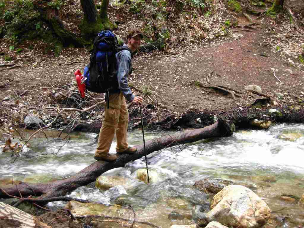
The entire 444-mile Natchez Trace Parkway is paved from Natchez, Mississippi to Nashville, Tennessee with commercial traffic prohibited and a maximum speed limit of 50 miles per hour. There is a detour from Milepost 181 to 204 due to ongoing construction. Watch for bicycles and white-tailed deer on the road.
Camping
There are three free NPS campgrounds (at Milepost 54, 193.1, and 385.9) along the route, as well as those in sites like Mississippi’s Tishomingo State Park. The three NPS campgrounds have water and bathrooms (but no RV hookups), plus there are also five bike-only campsites along the route. Jeff Busby Campground closed in June 2025 for repairs.
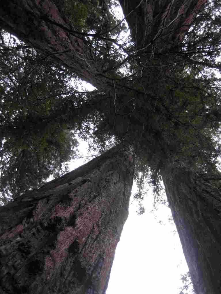
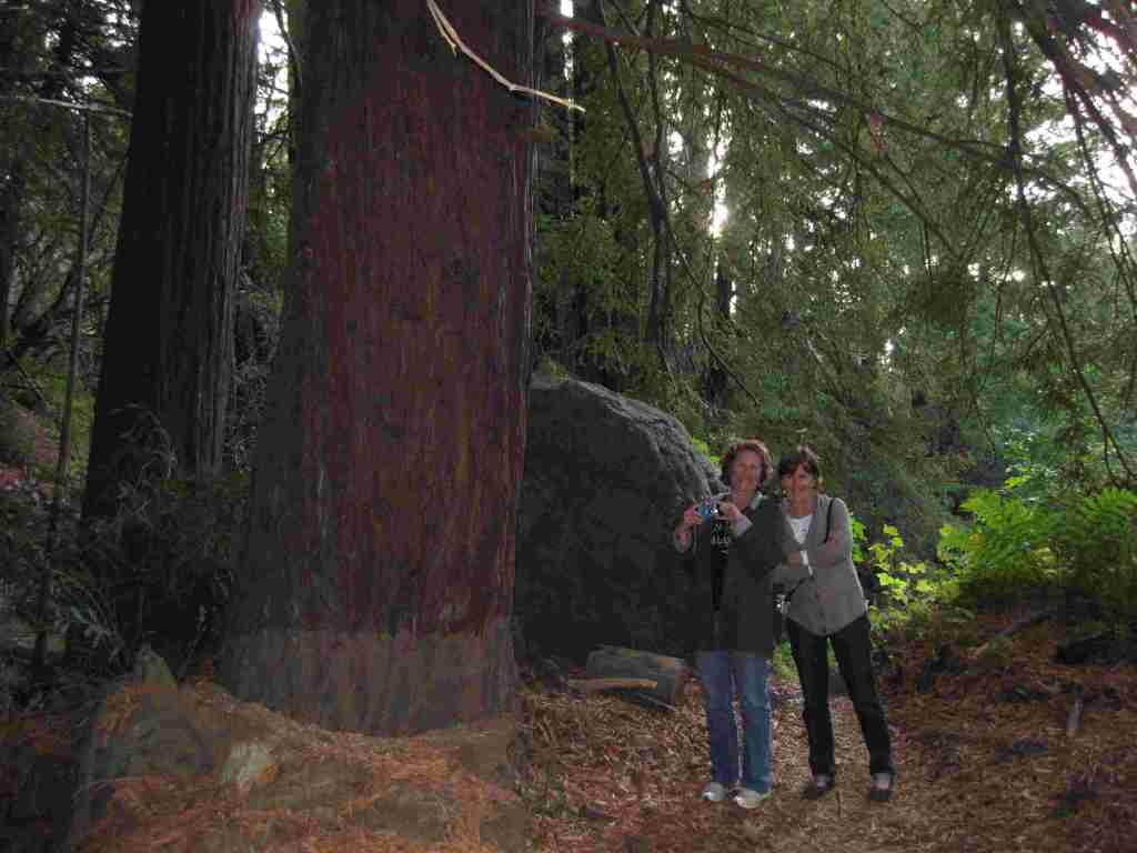
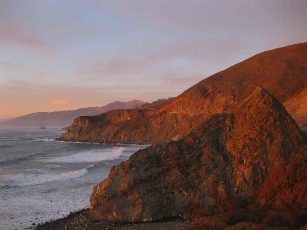
Los Padres National Forest stretches more than 200 miles from Monterrey south beyond Santa Barbara. It contains most of Big Sur, a name that conjures images of craggy cliffs dropping precipitously into white-capped ocean waves. This sparsely inhabited stretch of coastline is known as much for its historic bohemians as its coast redwood trees. It is home to multiple rare tree species with limited native ranges, especially those that can tolerate serpentine soils. As the only National Forest in California that touches the Pacific Ocean, a road trip down scenic Highway 1 should be on everyone’s bucket list, including stops at Julia Pfeiffer Burns State Park, Bixby Creek Bridge, Hearst Castle State Park, and the elephant seal rookery at Piedras Blancas. We have hiked many trails here since Scott taught for three years at Cal Poly State University in San Luis Obispo.
Know someone who loves the National Forests? Gift them our travel guidebook Out in the Woods so they can learn more about this and the 154 other National Forests.
Highlights
Big Sur, Sykes Hot Springs, Salmon Creek Falls, Jade Cove, Cuesta Ridge Botanical Area, Figueroa Mountain, Mt. Pinos, Knapp’s Castle, Seven Falls, Sespe Hot Springs
Must-Do Activity
Los Padres National Forest is 48% designated Wilderness, so the recommended activity is to hike into those natural areas. The Matilija Wilderness is in the Santa Ynez Mountains that loom above the coastal city of Santa Barbara, home to a university, art museum, and historic Presidio built in 1782. If you go to hike to the ruins of Knapp’s Castle in the National Forest, also make a quick stop at Chumash Painted Cave State Historic Park, which contains colorful pictographs dating back to the 1600s. Another popular U.S. Forest Service trailhead located closer to town goes either to Inspiration Point or Seven Falls, the latter a better choice on foggy days, which are common on the coast.
Best Trail
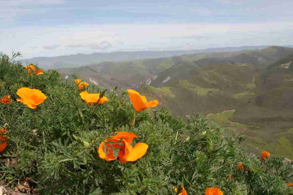
There are 323 miles of incredible hiking trails throughout Los Padres National Forest, including a few that access hot springs. Our favorite trails are in the Santa Lucia Mountains that tower above Big Sur. One pinnacle accessible by trail is Cone Peak at 5,155 feet in elevation. The access road is typically closed in the winter, but when it is open the trail is only 2.3 miles to the summit with a vertical gain of 1,400 feet. Do not expect any shade since multiple fires have burned most of the mountain, although there are still a few surviving examples of the rare Santa Lucia fir tree. Although some areas are no longer vegetated, the plentiful sunshine above the fog belt means there are often incredible displays of wildflowers along the trail early in summer, including lupine, sticky monkeyflower, and yucca.
Watchable Wildlife
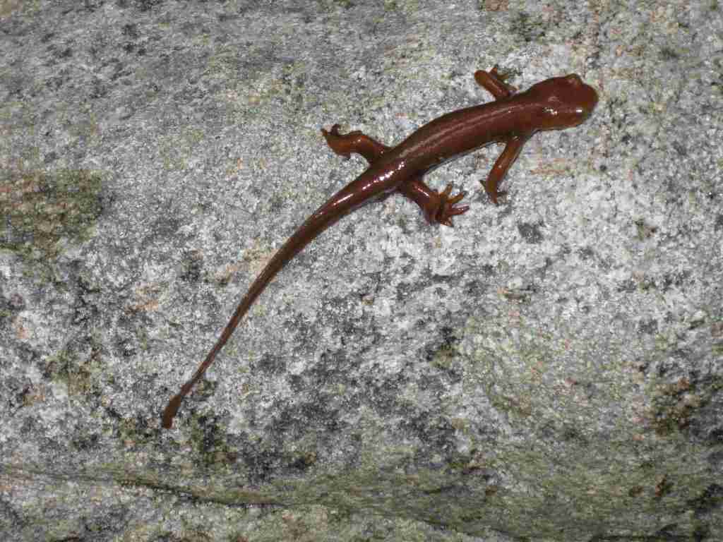
There is a wide range of wildlife found here from sea level up to 8,847 feet in elevation, and the most famous is the reintroduced California condor that nests in the Sespe Condor Sanctuary. Other birds include barn owls, great horned owls, red-tailed hawks, bald eagles, California quail, and California scrub jays. Coyotes, black bears, bobcats, mountain lions, black-tailed deer, bighorn sheep, and raccoons are common large mammals. Species of concern include the foothill yellow-legged frog and California mountain kingsnake. Look for California newts and banana slugs in the moist understory of coast redwood forests.
Photographic Opportunity
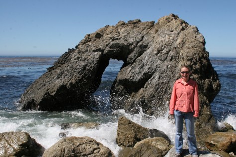
Even if you are not spending the night at Kirk Creek Campground, you can park and walk down the trail to the south that goes past redwood trees to the beach where there is a sea arch and tidepools.
Peak Season
Fall and winter
Fees
$5 per vehicle Adventure Pass (or America the Beautiful pass) required at most trailheads
Road Conditions
There are some steep unpaved roads in Los Padres National Forest, which can be impassable in wet or snowy conditions. Portions of the unpaved Tassajara Road to Chews Ridge are narrow and steep, requiring a four-wheel-drive vehicle to reach Tassajara Hot Springs.
Camping
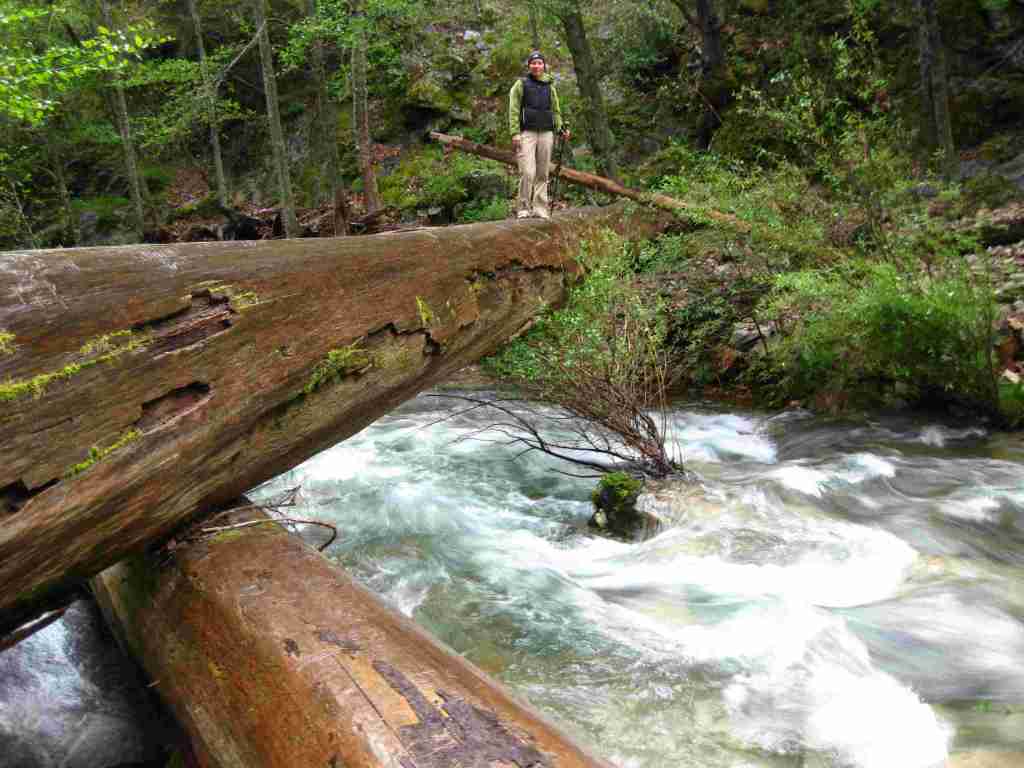
A night spent listening to the ocean waves breaking far below the U.S. Forest Service’s clifftop Kirk Creek Campground is enchanting, which is why it made it on our list of Top 10 Campgrounds in National Forests. There are 11 campgrounds in total, and a free campfire permit is required if you use a camp stove (which can be obtained online). Sespe Hot Springs is a popular ten-mile one-way backpacking destination.
Scott’s mother and aunt in the redwood forestTiff hiking to Sespe Hot SpringsSespe Hot SpringsSticky monkeyflowerScott backpacking to Sespe Hot SpringsHighway 1Scott with a Santa Lucia firScott with a coast redwood treeBanana slugCalifornia newtMt. PinosKirk Creek Campground in Big Sur
coast live oak, California black oak, tanoak, western redbud, Pacific madrone, manzanita
Explore More – What is the name of the nomadic group that lived in Big Sur dating back 5,500 years ago?
Know someone who loves the National Forests? Gift them our travel guidebook Out in the Woods so they can learn more about this and the 154 other National Forests.
Kiowa National Grassland encompasses two discrete units in northeast New Mexico, the eastern one bordering Texas and Oklahoma’s Rita Blanca National Grassland. This patchwork of public and private lands is administered together with the larger Cibola National Forest and Black Kettle National Grassland. Elevations range from 4,500 up to 6,300 feet in the western unit where La Frontera del Llano Scenic Byway (NM 39) runs north to south. Shortgrass prairie is the dominant cover type, with sand sagebrush and pinyon-juniper woodland mostly found in the west. Ponderosa pines are dispersed on wetter hill faces and riparian areas support Fremont cottonwoods and willows.
Highlights
Mills Canyon, Santa Fe National Historic Trail
Must-Do Activity
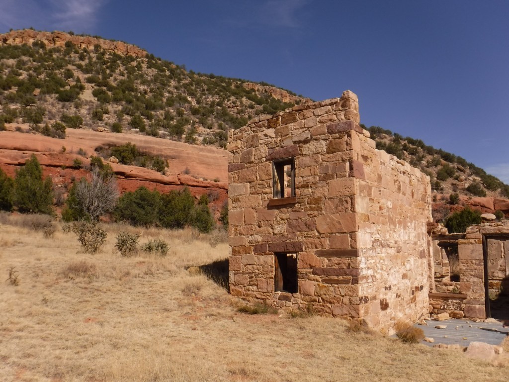
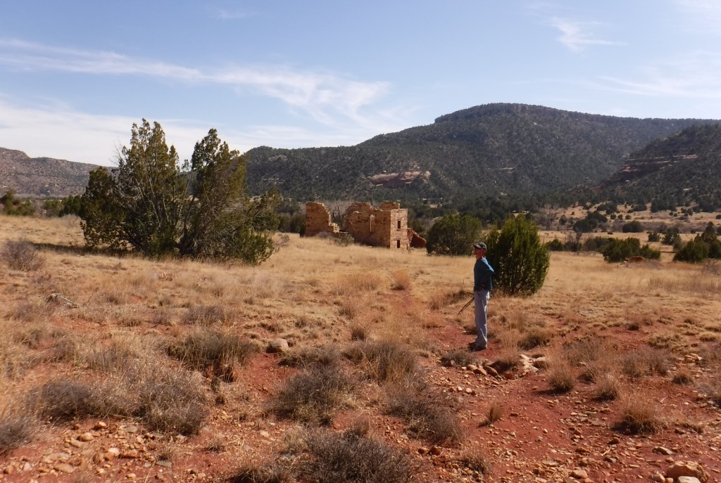
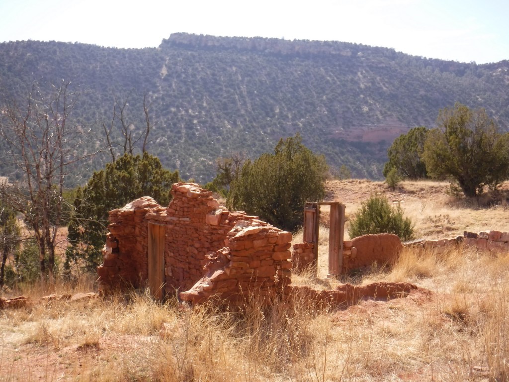
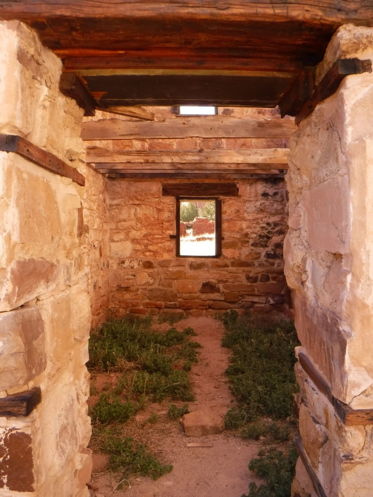
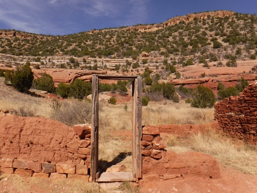
Melvin Mills (an attorney, territorial legislator, and entrepreneur) established the Mills Orchard and Ranch along the Canadian River in 1881. Flash flooding devastated the orchard in 1904, leading to the ranch’s abandonment a decade later. In 2005, the U.S. Forest Service and National Park Service collaborated to restore three ranch buildings, and for their efforts they won the Windows on the Past Award for historic preservation. There are also interpretive signs and a free campground at the bottom of Mills Canyon, located nine miles down unpaved Mills Canyon Road.
Best Trail
A three-mile stretch of the Santa Fe National Historic Trail’s Cimarron Route is marked by rock posts 17 miles north of Clayton, and it is open for walking and horseback riding. There are interpretive signs along the route and wagon ruts remain visible.
Watchable Wildlife
An introduced herd of Barbary sheep are thriving in the Mills Canyon area. The Canadian River supports largemouth bass and channel catfish. Nomadic Naturalists blog reported seeing swift foxes, spiny softshell turtles, black-chinned sparrows, and pinyon jays on their visit.
Photographic Opportunity
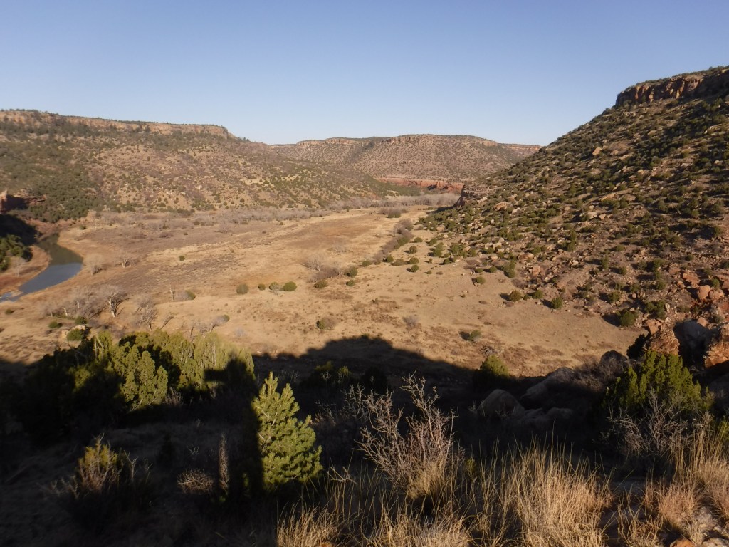
Mills Canyon was cut by the Canadian River through sedimentary rocks ranging in age from 200-million to 90-million years old.
Peak Season
Summer
Fees
None
Road Conditions
Past Mills Canyon Rim Campground, the unpaved Mills Canyon Road #600 is not recommended for trailers or passenger vehicles as it switchbacks down into Mills Canyon. A high-clearance vehicle is also recommended for the two-track paralleling the Santa Fe National Historic Trail’s Cimarron Route.
Camping
Both the Mills Canyon Rim Campground (6 campsites) and Mills Canyon Campground (12 sites) are free with vault toilets, but no water. Dispersed camping is allowed in the eastern unit around the Santa Fe National Historic Trail.
Scott exploring Mills CanyonTiff exploring the Canadian RiverHeading out of Mills Canyon
Explore More – As an attorney, Melvin Mills’ work often involved outlaws, American Indians, and politicians; who saved his life when he was nearly hanged by an angry mob?
After we published our guidebook 50 States of Great: Road Trip Guide to America in 2023, we decided to start a new type of blog post where we create a travel itinerary for all 50 states, in addition to our usual public land entries. After starting with Kansas, Georgia, Idaho, Rhode Island, Minnesota, Hawai’i, Arizona, Louisiana, South Dakota, and Indiana, we decided to head back west to Montana. There are so many great trails in the state’s National Forests that we had a difficult time narrowing it down. We made an ambitious seven-day plan starting in southeast Montana on Interstate 90, with enough options to easily extend the trip into three weeks or more.
The best time to visit the National Monument is around June 25, the anniversary of Custer’s Last Stand when a reenactment of the battle is held on private land bordering the National Park Service site.
Makoshika State Park
It is illegal to remove dinosaur fossils from these badlands, but there are many on display at the visitor center, in addition to nearby museums (plus reservations can be made to dig on private land). The few campsites are in high demand to spend the night in these colorful canyons where caprocks rise high above juniper trees.
Optional stop at Pompeys Pillar National Monument
A sandstone monolith on the Yellowstone River has been a place for humans to record their passing for 11,000 years. The most famous inscription was left by Captain William Clark on July 25, 1806, the sole on-site evidence of the Corps of Discovery’s three-year journey.
This underappreciated gem in the National Park Service system features gorgeous scenery and abundant wildlife, including bighorn sheep and wild horses. The highlight is across the state line in Wyoming where Devil Canyon Overlook sits atop cliffs that drop over 1,000 feet straight down to the level of the narrow reservoir.
Gallatin Petrified Forest is only accessible by trail, either from a short two-mile one-way jaunt or by backpacking the 27-mile Gallatin Divide-Devils Backbone Trail. Earthquake Lake Geologic Area stretches along Highway 287 to commemorate the events that occurred around midnight on August 17, 1959, when a deadly magnitude 7.5 earthquake hit West Yellowstone.
Some of the National Forest’s miles of hiking trails access the Crazy Mountains and Hellroaring Plateau. The two-mile Glacier Lake Trail steadily climbs 1,100 feet then drops into a bowl containing a stunning reservoir that straddles the Wyoming-Montana border.
Optional drive on Beartooth All-American Road
Custer National Forest is famous for its stretch of Highway 212 that climbs from the prairie around the town of Red Lodge up to 10,947 feet at Beartooth Pass across the Wyoming border in Shoshone National Forest. The road follows the southern border of the giant 943,626-acre Absaroka-Beartooth Wilderness, which contains the highest point in Montana.
Located mostly in Wyoming and partly in Montana and Idaho, you could easily spend an entire summer in the world’s first National Park and not see all the thermal features, lakes, waterfalls, wildlife, and hiking trails.
Day 3
Lewis & Clark Caverns State Park
Once a U.S. National Monument, the state now runs a campground here and offers guided tours through a limestone show cave where bats live in the summer.
The free Potosi Campground is situated near the trailhead for Upper Potosi Hot Springs where a 0.8-mile trail leads past the uphill side of a clear 100°F pool with room for about six adults.
Optional stop at Chico Hot Springs
If you leave Yellowstone National Park north through Gardiner on Highway 89, consider stopping at this developed hot springs (fee) that offers live music poolside on some nights (especially if the park’s Boiling River was closed). In business since 1897, even Teddy Roosevelt stopped to rest here.
Day 4
Bannack State Park
East of Lemhi Pass on the Idaho border (which is also the Continental Divide National Scenic Trail through there), Bannack State Park preserves more than 50 buildings from a gold rush town that was the territorial capital in 1864.
The site of a surprise attack by the U.S. Army on the morning of August 9, 1877, where Nez Perce warriors forced the troops to retreat, capturing a Howitzer cannon and allowing women and children to escape toward the newly created Yellowstone National Park. Part of the widespread Nez Perce National Historical Park, a small visitor center here overlooks the battlefield and a paved road accesses trails through it.
Blodgett Creek Trail leads 12.6 miles one-way to Blodgett Lake, but you do not have to go that far to appreciate its incredible beauty.
Optional stop at Elkhorn Hot Springs
In the Pioneer Mountains, about ten miles north of Highway 278 is the privately owned Elkhorn Hot Springs (fee), a great place to relax after hiking. There is free dispersed camping to the north in Beaverhead National Forest.
Day 5
Travelers’ Rest State Park
Follow in the footsteps of the Lewis and Clark expedition by driving the Lolo Trail (Highway 12), soaking at Lolo Hot Springs, or walking around Travelers’ Rest State Park (still a great place to camp).
Missoula
Do as the University of Montana students do and float tubes down the Clark Fork River through town. In the summer, look for webcam-famous Iris the Osprey in the parking lot near the football stadium. The Historical Museum at Fort Missoula preserves buildings dating back to 1877, including an Alien Detention Center used during World War II.
Outside Missoula, there are many trails in Rattlesnake National Recreation Area and Blue Mountain Recreation Area, plus the Aerial Fire Depot and Smokejumper Center, Ninemile Historic Remount Depot, and Savenac Historic Tree Nursery Area.
This working ranch commemorates the nineteenth-century lifestyle of cattle barons and cowboys. Free guided tours are offered inside the large ranch house, and a self-guided walking tour enters 15 buildings with displays on the history of barbwire, branding irons, and much more.
Day 6
National Bison Range
Established in 1908 under President Theodore Roosevelt and now run by the Confederated Salish and Kootenai Tribes. Start at the visitor center, then take the 19-mile Red Sleep Mountain Drive to see mule deer, white-tailed deer, elk, pronghorns, bighorn sheep, and the namesake bison.
Jewel Basin Hiking Area is famous among backpackers, and further south so is Holland Lake, which has several campgrounds. The steep Holland-Gordon Trail passes Holland Falls as it climbs 2,100 feet in 5.8 miles to Upper Holland Lake and continues into “the Bob” (Bob Marshall Wilderness). Flathead National Forest contains more than 2,800 miles of hiking trails, including 38 miles of the Pacific Northwest National Scenic Trail and a stretch of the Continental Divide National Scenic Trail.
Optional stop at Mission Mountains Wilderness
Located within Flathead National Forest, a popular trail accesses multiple mountain lakes; it is only 1.5 miles one-way to Glacier Lake, but we recommend continuing to Turquoise Lake. It borders the Mission Mountains Tribal Wilderness (permits required).
Waterton-Glacier International Peace Park’s renowned Going-to-the-Sun Road was built to cross the park from east to west in the 1920s (reservations are required to drive it between 7 a.m. and 3 p.m. in the summer). At its highest point at 6,646-foot Logan Pass, the road crosses the Continental Divide National Scenic Trail.
In the state’s northwest corner, incredible views await at Blue Mountain Trail, Skyline National Recreation Trail, Scenery Mountain Lookout Trail, Ross Creek Scenic Area of old-growth western redcedar trees, and Kootenai Falls (located in a county park on the side of Highway 2).
Meriwether Lewis named the Gates of the Mountains on July 19, 1805, and today a two-hour jet boat tour on the Missouri River provides history on the Corps of Discovery, American Indian pictographs, the Mann Gulch Fire, and the collapse of Hauser Dam. A trail through Refrigerator Canyon is less than ten feet wide at its narrowest point, where towering 200-foot limestone cliffs keep it cool and breezy throughout the summer.
Great Falls
North of Helena on Interstate 15 is the Lewis and Clark Interpretive Center (fee), which is managed by the U.S. Forest Service on the banks of the Missouri River.
This 375,000-acre National Monument preserves a stretch of the Missouri River that still looks much the way it did when Lewis and Clark explored it. Start your journey by paying for permits at the Bureau of Land Management interpretive center in historic Fort Benton, where you can launch your canoe or kayak to access 149 miles of the river. There are developed boat camps with vault toilets along the route, or you can pick your own spot near one of the Corps of Discovery campsite markers.
It includes portions of the Boulder Mountains, Flint Creek Range, and Elkhorn Mountains, as well as part of the Anaconda-Pintler Wilderness. Our favorite hike is Haystack Mountain National Recreation Trail off Interstate 15, where a climb of 2,000 feet ends at a mountaintop boulder field with panoramic views and the remnants of a fire lookout tower.
Backpacking is a major draw with trails in the Snowy Mountain Range and parts of the Scapegoat and Bob Marshall Wilderness areas, which provide crucial habitat for grizzly bears. It encompasses one of the most famous formations along the Continental Divide National Scenic Trail, the 15-mile long Chinese Wall (a 1,000-foot-tall cliff composed of five-million-year-old limestone).
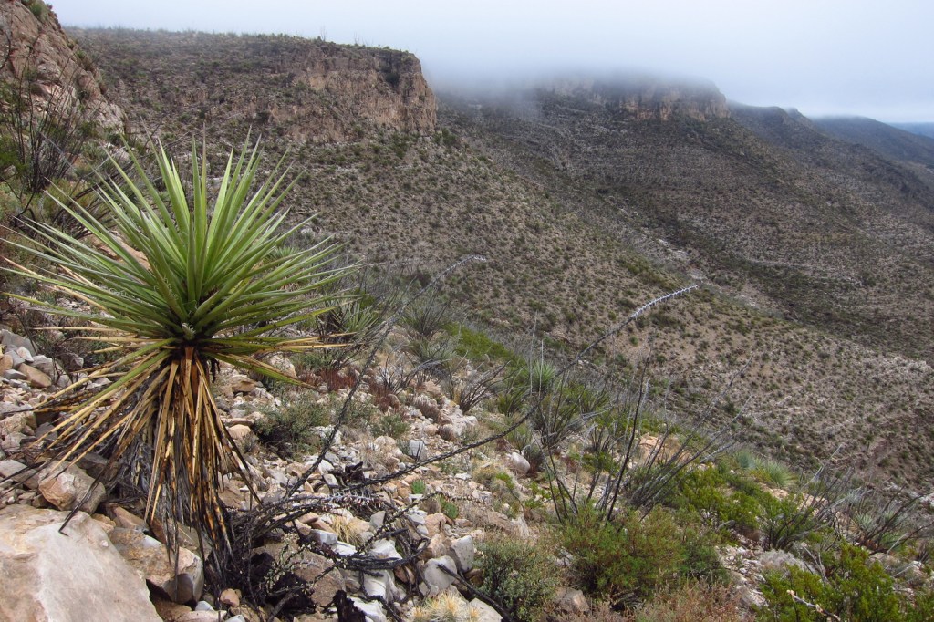
Lincoln National Forest is best known as the birthplace of Smokey Bear, a black bear cub that survived a 1950 wildfire in the Capitan Mountains and became a national symbol. The nearby Smokey Bear Historical State Park is the final resting place for the famous bear that passed away at Washington D.C.’s National Zoo in 1976. Lincoln National Forest includes parts of the Guadalupe, Sacramento, Sierra Blanca/White Mountains, Capitan, and Gallinas ranges. There are several long trails through the National Forest, including the 20-mile Crest Trail in the White Mountain Wilderness and the 11-mile South Base Trail in the Capitan Wilderness. All but one mile of the 29-mile-long Rim Trail is open to OHVs.
Highlights
Sunspot Scenic Byway, Billy the Kid Scenic Byway, Trestle Recreation Area, Sitting Bull Falls, Sierra Blanca Peak, Rim Trail, Willie White Trail, Dog Canyon National Recreation Trail, Capitan Peak Trail
Must-Do Activity
Sunspot Scenic Byway (State Road 6563) provides great views and access to one of the world’s largest solar observatories that is open for tours on summer weekends. At its remote southern end, the National Forest borders both Carlsbad Caverns and Guadalupe Mountains National Parks. Roads only connect with the latter, where a short detour takes you to the half-mile trail for 150-foot-tall Sitting Bull Falls. In 1898, the Alamogordo and Sacramento Mountain Railway was constructed to access timberland 4,747 feet in the mountains above. One of its scenic remnants is the 320-foot trestle over Mexican Canyon near Cloudcroft. Lincoln National Forest has six fire lookouts listed on the National Register of Historic Places, including the stone Monjeau Lookout built by the Civilian Conservation Corps (CCC) that is accessible on a steep dirt road. Given its proximity to Carlsbad Caverns National Park, it is not surprising that there are hundreds of caves in the National Forest that require a permit to explore.
Best Trail
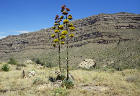
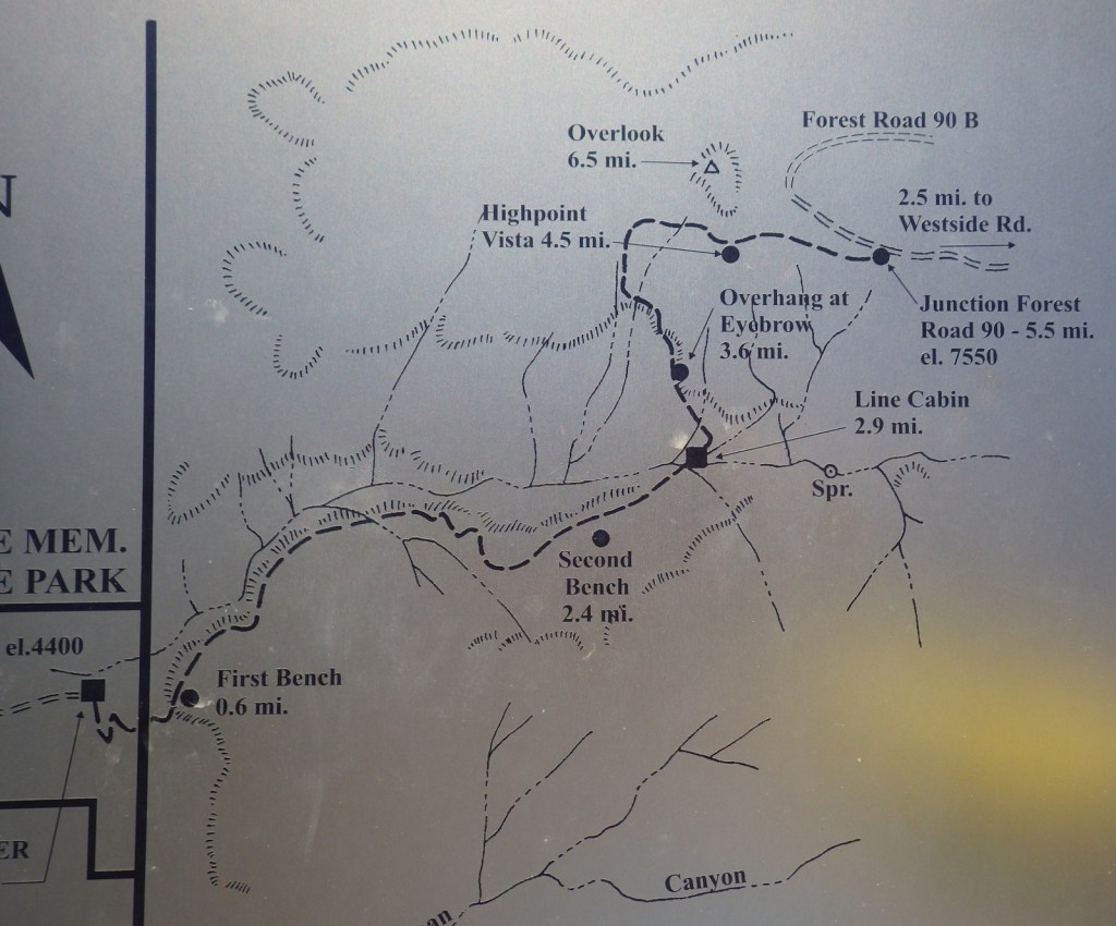
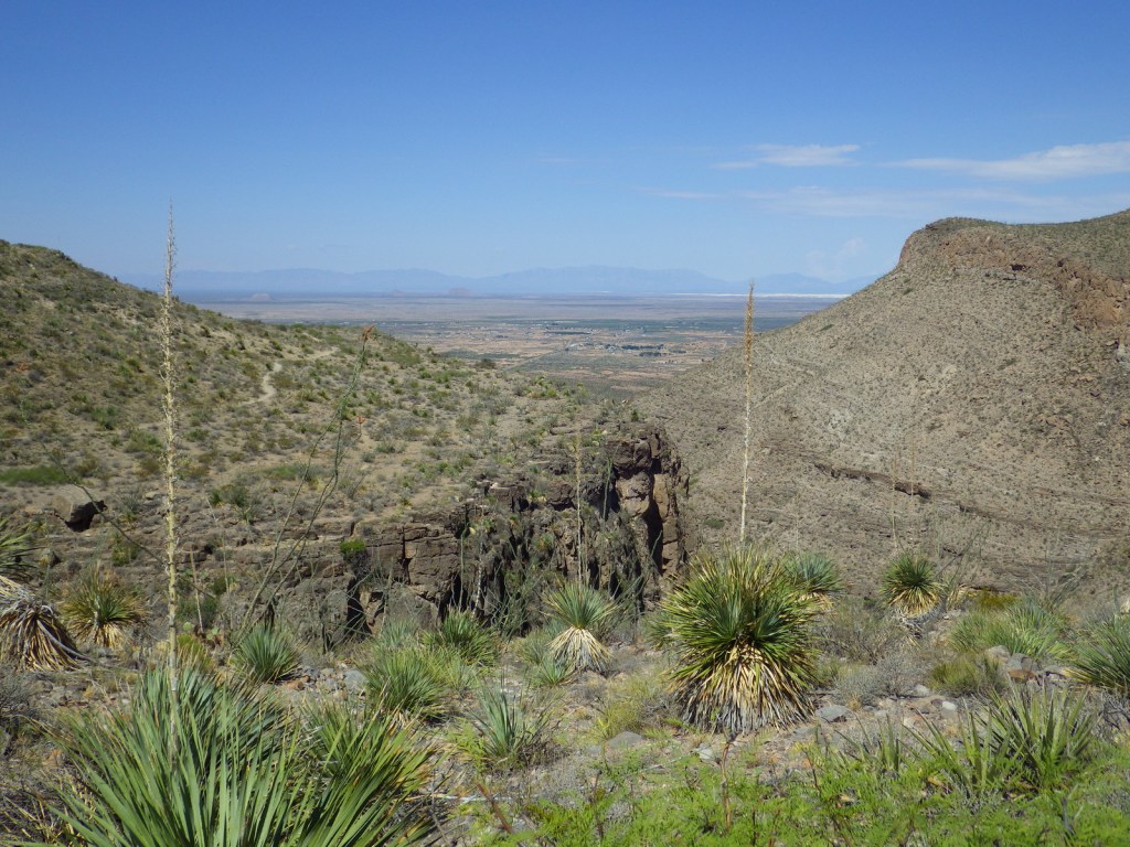
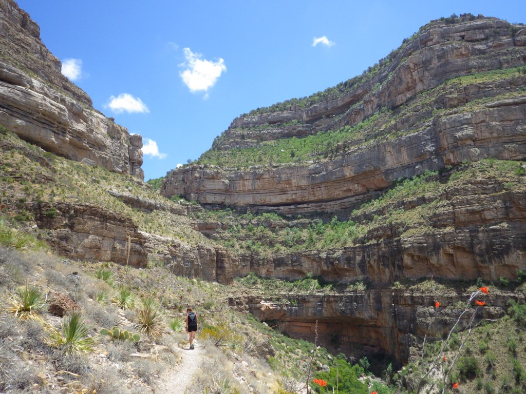
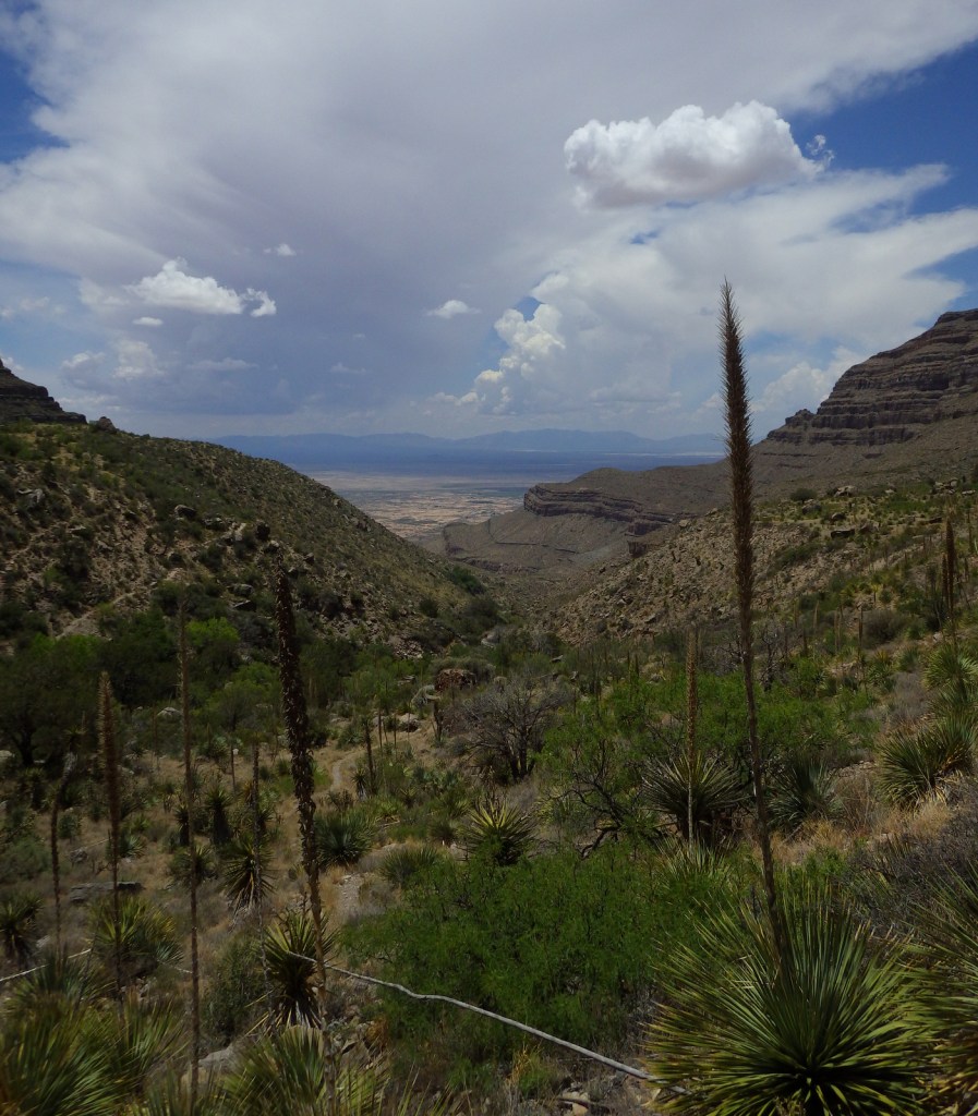
Dog Canyon National Recreation Trail follows a prehistoric travel route into the Sacramento Mountains east of White Sands National Park. The trailhead starts in Oliver Lee Memorial State Park, which has a nice campground and charges a day use fee (though we have seen cars avoid this by parking just outside its entrance). The 5.5-mile one-way trail climbs quickly above a beautiful canyon providing views of the Tularosa Basin before leveling out. Past the cabin ruins at the three-mile point, look for fossils along the trail as it again steeply rises into the agave and cacti-studded mountains. After gaining more than 3,000 feet in elevation, it dead ends at Forest Road 90B.
Watchable Wildlife
Ecosystems in the National Forest vary widely since it is spread across several mountain ranges and encompasses Chihuahuan Desert, pinyon-juniper woodlands, pine forests, and alpine meadows above 11,000 feet. Game species include elk, mule deer, black bear, mountain lion, and exotic Barbary sheep.
Photographic Opportunity
Look for fossils in the rocks along Dog Canyon National Recreation Trail.
Peak Season
Spring and fall
Fees
None
Road Conditions
The Sunspot Scenic Byway and the road into Oliver Lee Memorial State Park are both paved and maintained, although the paved access road (137) through Lincoln National Forest to the north part of Guadalupe Mountains National Park has many potholes in it. Be aware that there are also four-wheel-drive only roads to some trailheads.
Camping
There are a few developed campgrounds in the middle of the National Forest off Highway 82. Although not all areas are open to dispersed camping, popular spots include Upper Bonito Dispersed Camping Area northwest of Ruidoso and Lower Karr Canyon south of Cloudcroft.
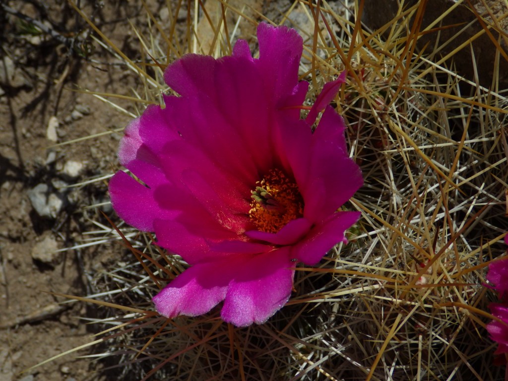
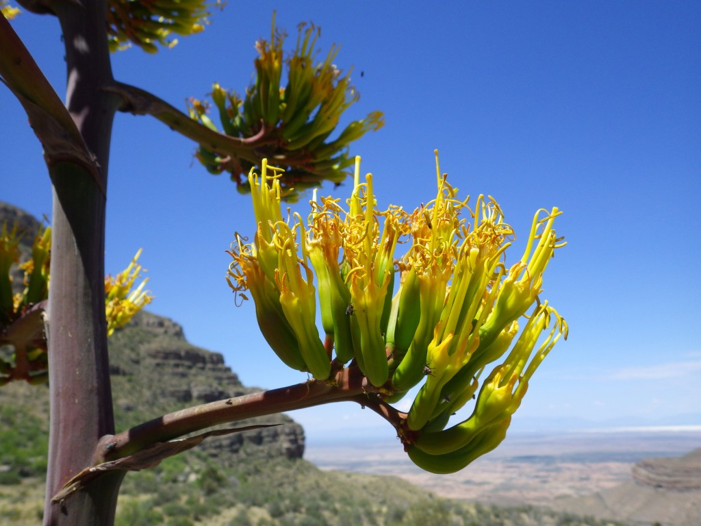
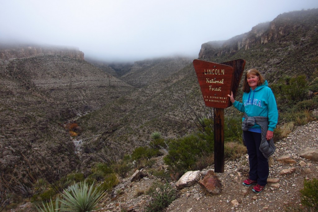
Baby barrel cactusMillipedeAgave bloomsCheckered whiptail lizardScott with a buckhorn chollaBeetleSpiny crevice lizardFossilsOcotillo bloomScott’s mother on Dog Canyon National Recreation Trail