Tag Archives: river

Grand Teton National Park

Wyoming

Managed by National Park Service

Established 1929

310,000 acres

Website: nps.gov/grte

Overview

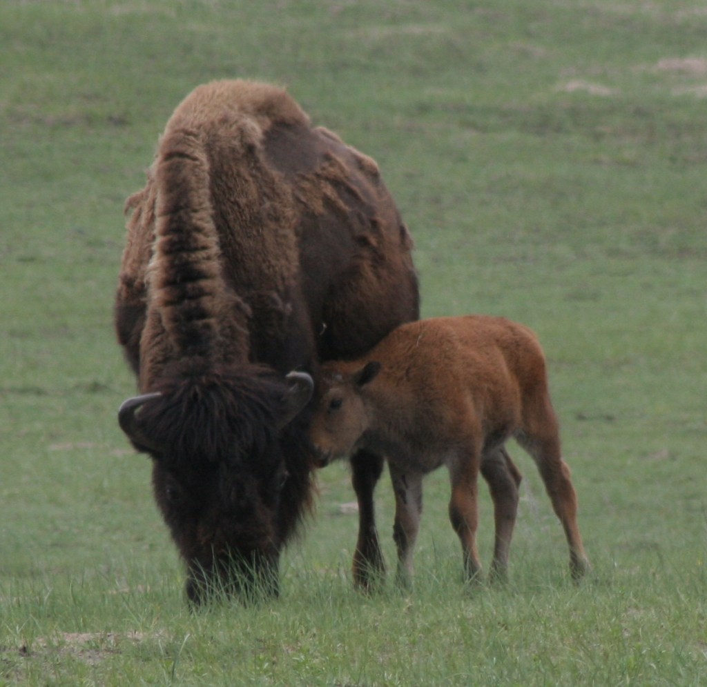
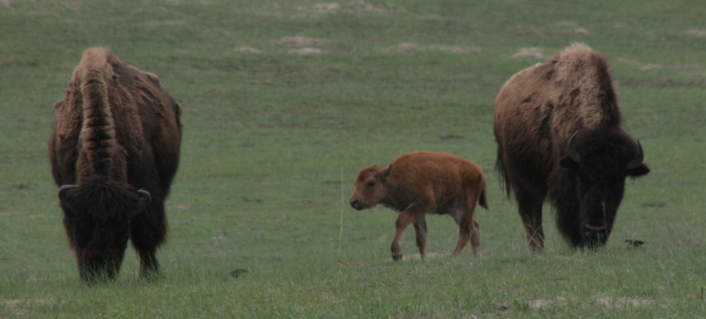
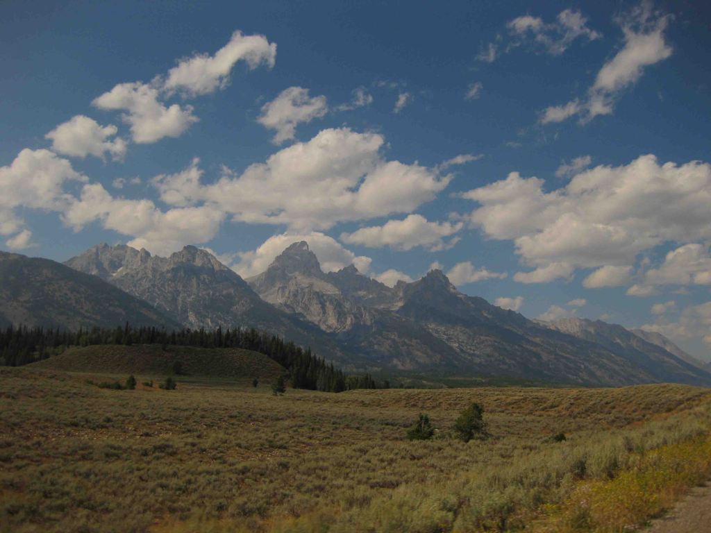
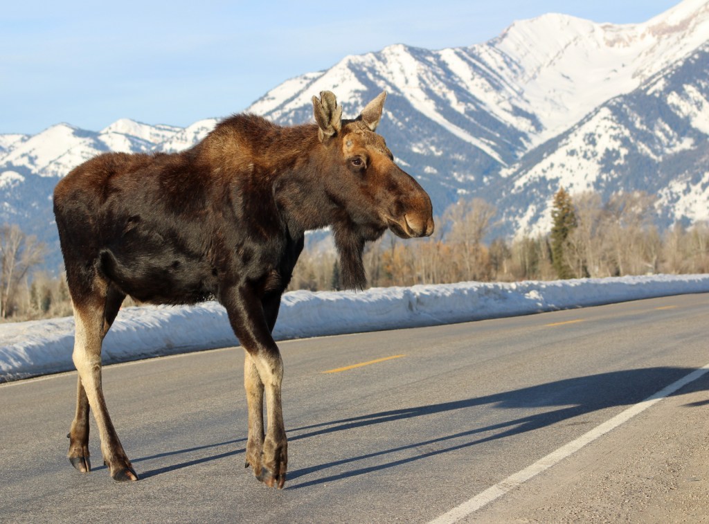
Just south of Yellowstone National Park, is one of the most recognizable skylines in the United States, topped by 13,772-foot tall Grand Teton Peak.  The Teton Mountains were established as a National Park in 1929, but the rest of the park has a strange history.  Land in the Jackson Hole valley was bought up by the Rockefeller family and attempted to be donated to the U.S. government for decades.  In 1943, President Franklin D. Roosevelt created Jackson Hole National Monument under the Antiquities Act, but it did not include the Rockefeller holdings.  It was not until 1950 that a deal was struck merging everything into Grand Teton National Park as we know it today.  Part of that negotiation was a requirement that in the future no land in Wyoming would ever be established as a National Monument under the Antiquities Act.

Learn more about how to visit this National Park in the expanded second edition of our guidebook A Park to Yourself: Finding Solitude in America’s 63 National Parks

Highlights

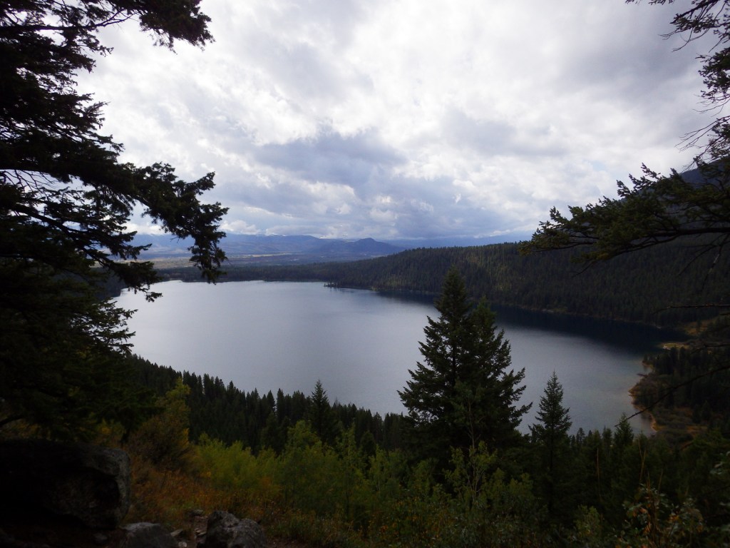
Jenny Lake, Inspiration Point, Jackson Lake Lodge, Oxbow Bend Turnout, Mormon Row

Must-Do Activity

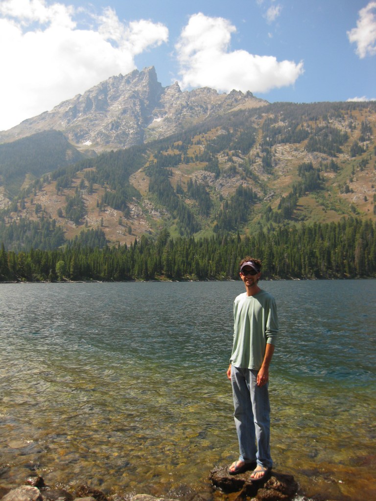
One of our favorite places in the park is Jenny Lake, which sparkles below 12,325-foot Teewinot Peak.  This is the trailhead for Cascade Canyon, but there are plenty of activities other than hiking, which include boating, horseback riding, mountain climbing, whitewater rafting, or cross-country skiing in the winter. 

Best Trail

You can hike around Jenny Lake to the lake to Hidden Falls and the waterfalls of Cascade Canyon, or you can take the shortcut aboard a shuttle boat (fee).  This popular trail can get very busy in the summer, which is true of most of the trails in the park.

Instagram-worthy Photo

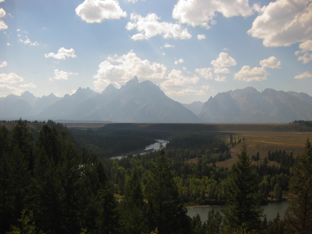
Oxbow Bend Turnout is found along Highway 89/191/287, north of Moran Junction Entrance Station.  It overlooks a curve in the Snake River towards the Teton Mountain Range, which is why we chose it for our original logo design (see below).

Peak Season

Summer

Hours

https://www.nps.gov/grte/planyourvisit/hours.htm

Fees

$35 per vehicle or America the Beautiful pass

Road Conditions

The only main road that are not paved is the short segment that connects Phelps Lake with Jackson Hole Ski Area, but there are other rough gravel roads that follow the Snake River.

Camping

The first-come, first-served tent-only campsites at Jenny Lake or Signal Mountain are usually full, so you can always try Gros Ventre Campground which has 350 sites and rarely fills up.  Reservations for sites with hook-ups are accepted at Colter Bay RV Park and Headwaters at Flagg Ranch, which is just north of the park boundaries on the John D. Rockefeller Jr. Memorial Parkway.

Related Sites

Yellowstone National Park (Wyoming-Montana-Idaho)

Fossil Butte National Monument (Wyoming)

Devils Tower National Monument (Wyoming)

This design we created to celebrate Grand Teton National Park is available on a variety of products at Cafe Press and Amazon.

Explore More – How did the valley of Jackson Hole (and the city of Jackson) get its name?

Know someone who loves National Parks? Gift them our travel guidebook A Park to Yourself: Finding Solitude in America’s 63 National Parks

Fort Donelson National Battlefield

Overview

Fort Donelson National Battlefield commemorates the first major Union victory of the Civil War.  It quickly followed the capture of Fort Henry on the Tennessee River (which is now flooded by Kentucky Lake).  The battle earned Union General U.S. Grant fame for his reply to Confederate General Simon Buckner: “No terms except an unconditional and immediate surrender can be accepted.”  This led to the joke that his initials stood for “Unconditional Surrender.”  After more than 12,000 Confederate troops were taken prisoner on February 16, 1862, the Union army soon took Nashville, Tennessee.

Highlights

Dover Hotel, Land Between the Lakes National Recreation Area, cannons

Must-Do Activity

Visitors today can take a six-mile driving tour to see the rifle pits, lower river battery, and earthworks along the Cumberland River, in addition to an exhibit on the first floor of the Dover Hotel (where terms of surrender were signed).  This hilly riverside park is also a nice place to exercise and watch for bald eagles and other wildlife. Fort Donelson National Cemetery is located nearby.

Best Trail

Fort Donelson National Battlefield is neighbors with Land Between the Lakes National Recreation Area, which is managed by the U.S. Forest Service.  Tucked between the Tennessee and Cumberland Rivers, this area was claimed through eminent domain by the Tennessee Valley Authority (TVA) when dams were built.  Outdoor recreation is now the focus with reservoirs, trails, bison and elk herds, a living history museum, and a planetarium.  Also, there are more than 200 cemeteries in this 170,000-acre area.

Instagram-worthy Photo

Giant cannons are mounted in the lower river battery along the Cumberland River.

Peak Season

Summer

Hours

https://www.nps.gov/fodo/planyourvisit/hours.htm

Fees

None for the National Battlefield, but there are entry fees for portions of Land Between the Lakes National Recreation Area

Road Conditions

All roads paved

Camping

There are numerous campgrounds in Land Between the Lakes National Recreation Area, as well as at Paris Landing State Park.

Related Sites

Shiloh National Military Park (Tennessee)

Big South Fork National River and Recreation Area (Tennessee)

Mammoth Cave National Park (Kentucky)

Explore More – Fort Donelson and which other nearby fort were havens for escaped slaves later in the Civil War?

Harpers Ferry National Historical Park

Overview

Robert Harper started ferrying folks across the Potomac River at this site in 1747.  It had a strategic location at the confluence of the Shenandoah and Potomac Rivers where the point of what is now the state of West Virginia meets the border of Maryland and Virginia.  Harpers Ferry is most famous for the 1859 raid led by abolitionist John Brown of Kansas in attempt to seize the federal armory to incite a slave rebellion.  His trial and execution for treason helped foment the Civil War, during which conflict the town changed hands between the two sides an astounding eight times!

Highlights

Historic buildings, museums, Jefferson Rock, Appalachian National Scenic Trail

Must-Do Activity

A portion of the town today is run as a series of museums by the National Park Service (NPS), though other parts remain open for business as restaurants, shops, and inns.  Parking is limited in town, so the NPS runs a shuttle (free with parking fee) two miles from their visitor center.

Best Trail

You can hike into town on the 2,185-mile Appalachian Trail that cuts right through the buildings and over the footbridge across the Potomac River.

Instagram-worthy Photo

Jefferson Rock is located just up the hill from town, named for Thomas Jefferson who visited in 1783.

Peak Season

Summer

Hours

https://www.nps.gov/hafe/planyourvisit/hours.htm

Fees

$20 to park at NPS visitor center or free with America the Beautiful pass

Road Conditions

There is limited parking in town so it is easier to take a shuttle from the NPS visitor center.

Camping

There are multiple private campgrounds in the area, as well as Maryland’s Gambrill State Park.

Related Sites

Shenandoah National Park (Virginia)

Fort Scott National Historic Site (Kansas)

New River Gorge National Park and Preserve (West Virginia)

Explore More – Which famous member of the Corps of Discovery visited the national armory in Harpers Ferry in 1803 before heading to the Pacific Ocean?

We are a participant in the Amazon Services LLC Associates Program, an affiliate advertising program designed to provide a means for us to earn fees by linking to Amazon.com and affiliated sites.

Niobrara National Scenic River

Overview

When most folks think of Nebraska they imagine endless dusty prairie scenes of the Oregon Trail, yet between the wide Platte and Missouri Rivers also runs the 535-mile long Niobrara River.  The Niobrara cuts across the 100th Meridian of Longitude that roughly divides in half the continental U.S.  This special area is home to species representative of the eastern forests, Rocky Mountains, boreal forests, and prairies; consequently it has high biodiversity.  The motto on the National Park Service (NPS) signs is “Public Waters, Private Land.”

Highlights

Fort Niobrara National Wildlife Refuge, Fort Falls Trail, Smith Falls State Park, canoeing, tubing

Must-Do Activity

The 76-mile section of river designated the Niobrara National Scenic River in 1991 begins within Fort Niobrara National Wildlife Refuge where the first 4.8 miles are closed to the public.  The 22-mile section starting from Cornell Bridge is the most popular portion for canoers, tubers, and people who float downstream in round metal cattle troughs.  The Niobrara River has a few big Class IV rapids, but nothing more than Class II through the first 27 miles.  We floated to the portage at dangerous Rocky Ford Rapid at high water in May and encountered only Class I rapids and a few strainers along the shorelines.

Best Trail

Pull off the river around Mile 15 in Smith Falls State Park to take the short boardwalk to a 63-foot tall waterfall.  The waterfalls along these cliffs are interesting because instead of pouring off a cut bank they develop a prominent ledge that grows as the limestone is dissolved and redeposited (like a cave formation).  You can also drive to the state park and walk over the Niobrara River on the Verdigre Bridge, originally built in 1910 and relocated here in 1996.

Instagram-worthy Photo

Do not miss the opportunity to drive the dirt road through Fort Niobrara National Wildlife Refuge to see the bison herd, especially in May when the bison calves are born.  The refuge also contains the short Fort Falls Trail, which forms a loop with views of a 45-foot tall waterfall.

Peak Season

Summer, though water levels drop after June.

Hours

https://www.nps.gov/niob/planyourvisit/hours.htm

Fees

None for the river, but there is a $1 per person launch fee in Fort Niobrara National Wildlife Refuge and entry/camping fees at Smith Falls State Park.

Road Conditions

The dirt roads in Fort Niobrara National Wildlife Refuge and Smith Falls State Park are well-maintained and passable to all vehicles.

Camping

Camping options are limited since most of the river banks are privately owned, though Smith Falls State Park offers a campground ($6/person/night) and other private campsites are marked on river maps.

Related Sites

Missouri National Recreation River (Nebraska-South Dakota)

Agate Fossil Beds National Monument (Nebraska)

Scotts Bluff National Monument (Nebraska)

Explore More – Named for a town in Nebraska, the Valentine Formation holds what types of fossils?

Blackstone River Valley National Historical Park

Overview

Roger Williams National Memorial used to be the only National Park Service (NPS) site in Rhode Island, but in 2014 Blackstone River Valley was upgraded from an affiliated National Heritage Corridor to a National Historical Park.  It commemorates the industrial revolution that changed the landscape of America during the 1800s, as well as the immigration of factory workers that changed its face.  Another NPS-affiliated point of interest in the tiny state is Touro Synagogue National Historic Site (admission charged) in Newport.

Highlights

Slater Mill Historic Site, Blackstone River State Park, Statue of Hope Fountain

Must-Do Activity

Formerly known as the John H. Chafee Blackstone River Valley National Heritage Corridor, this NPS unit remains a partnership between government agencies, non-profits, and businesses in Massachusetts and Rhode Island.  Its centerpiece is the nation’s first successful water-powered cotton-spinning factory: Slater Mill Historic Site in Pawtucket, Rhode Island, which offers free ranger-guided tours.  By 1880, this “hardest working river” was one of the most polluted in the country, but has recovered so that canoeists can float portions of its 46-mile length.

Best Trail

Blackstone River State Park has a free museum (inside the Kelly House) and a section of the canal that followed the river.  There are 3.5 miles of the 14-mile (of a planned 48) paved bikeway along the canal towpath within this Rhode Island park.  Another section of trail lies within Blackstone River and Canal Heritage State Park near River Bend Farm in Massachusetts.

Instagram-worthy Photo

The Statue of Hope Fountain was dedicated on November 12, 1904 in the town of Hopedale, Massachusetts.  It was carved from Carrara marble by Waldo Story and was once considered the “finest drinking fountain in the United States.” We found it a little creepy looking.

Peak Season

Summer

Hours

https://www.nps.gov/blrv/planyourvisit/hours.htm

Fees

None

Road Conditions

All major roads paved

Camping

Rhode Island State Parks manages several campgrounds, including George Washington State Campground in Chepachet.

Related Sites

Roger Williams National Memorial (Rhode Island)

New Bedford Whaling National Historical Park (Massachusetts)

Lowell National Historical Park (Massachusetts)

Explore More – When did English immigrant Samuel Slater take over a failed mill to start the first successful water-powered cotton-spinning factory in America?