Tag Archives: National Recreation Area

White Rocks National Recreation Area

Robert T. Stafford White Rocks National Recreation Area

Vermont

Managed by U.S. Forest Service, Eastern Region

22,624 acres

Website: https://www.fs.usda.gov/recarea/gmfl/recarea/?recid=64987

Overview

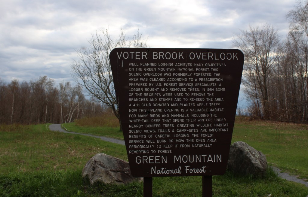
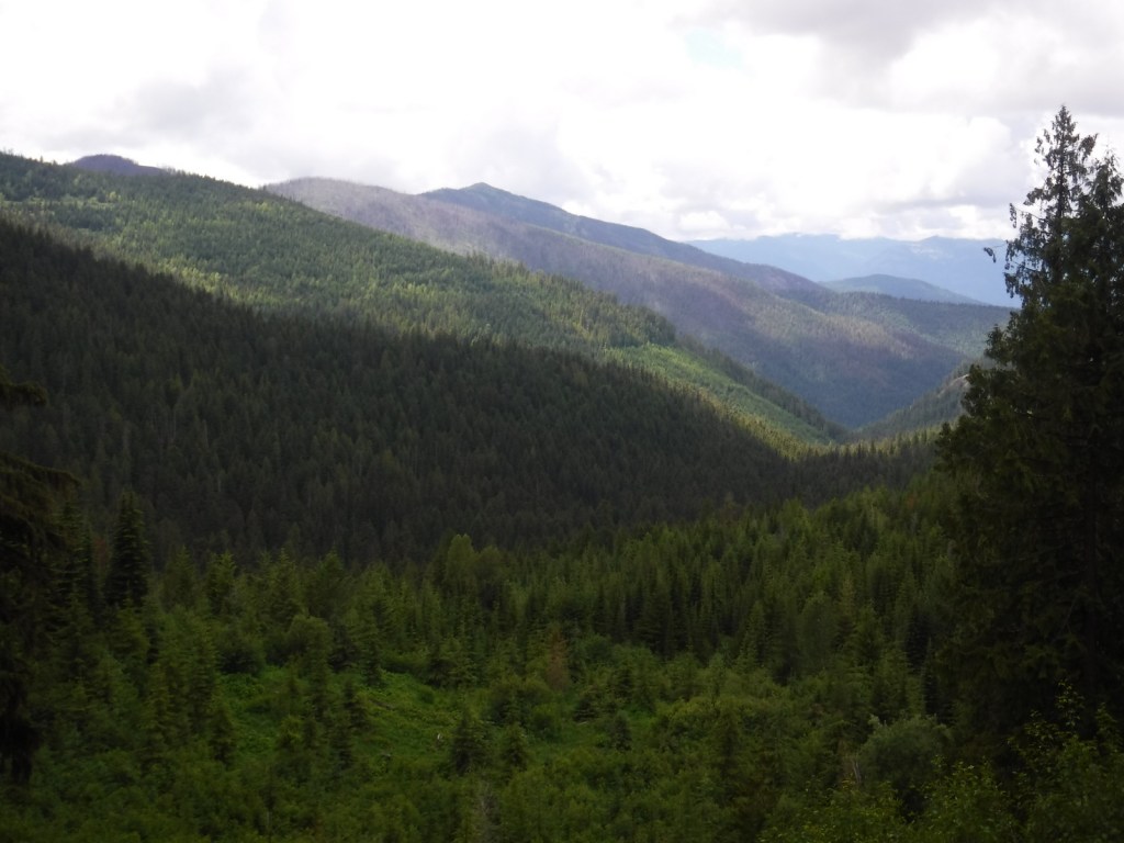
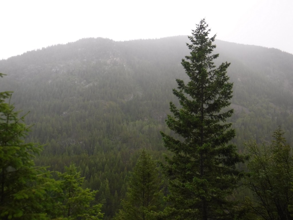
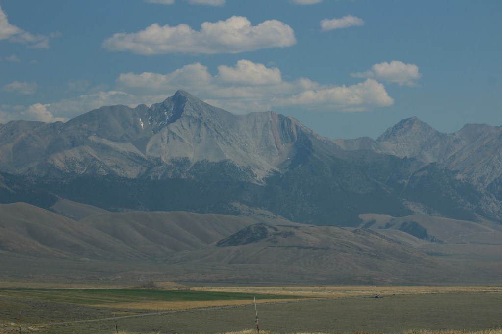
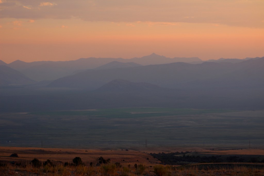
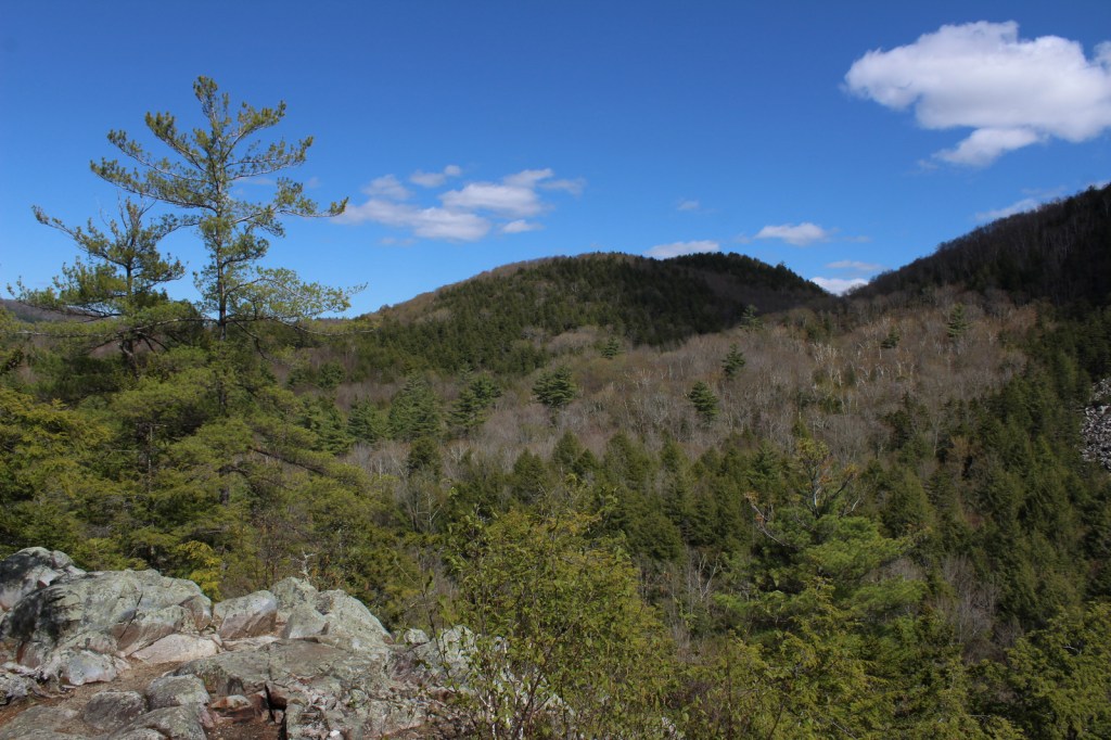
White Rocks National Recreation Area is located in the southern portion of Vermont’s Green Mountain National Forest and was officially renamed Robert T. Stafford White Rocks National Recreation Area.  It encompasses Big Branch Wilderness, Peru Peak Wilderness, Big Branch Observation Area, and its namesake White Rocks Picnic Area (see Must-Do Activity).  A section of the Long Trail (which in 1931 became the first named long-distance hiking trail in America) passes through this area, where it coincides with the newer Appalachian National Scenic Trail (AT).  Other popular activities include biking, fishing, snowshoeing, cross-country skiing, and snowmobiling.

Highlights

Big Branch Observation Area, White Rocks Day Use Area, Bully Brook, Ice Beds Trail, Keewaydin Trail, White Rocks Cliffs Trail, Greenwall Shelter, Long Trail, Appalachian National Scenic Trail

Must-Do Activity

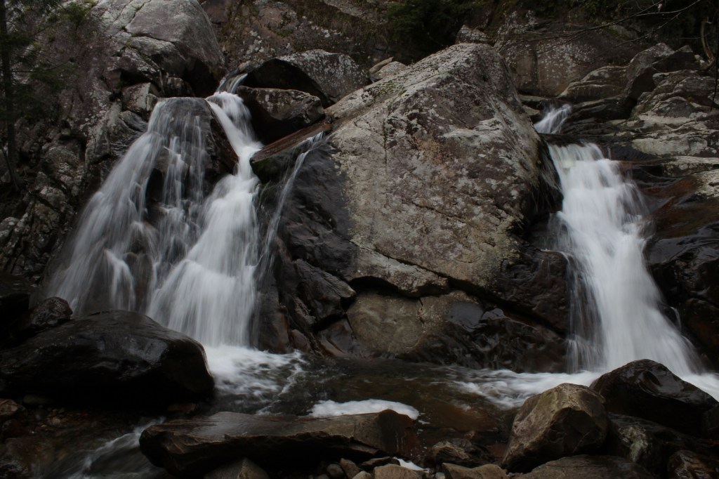
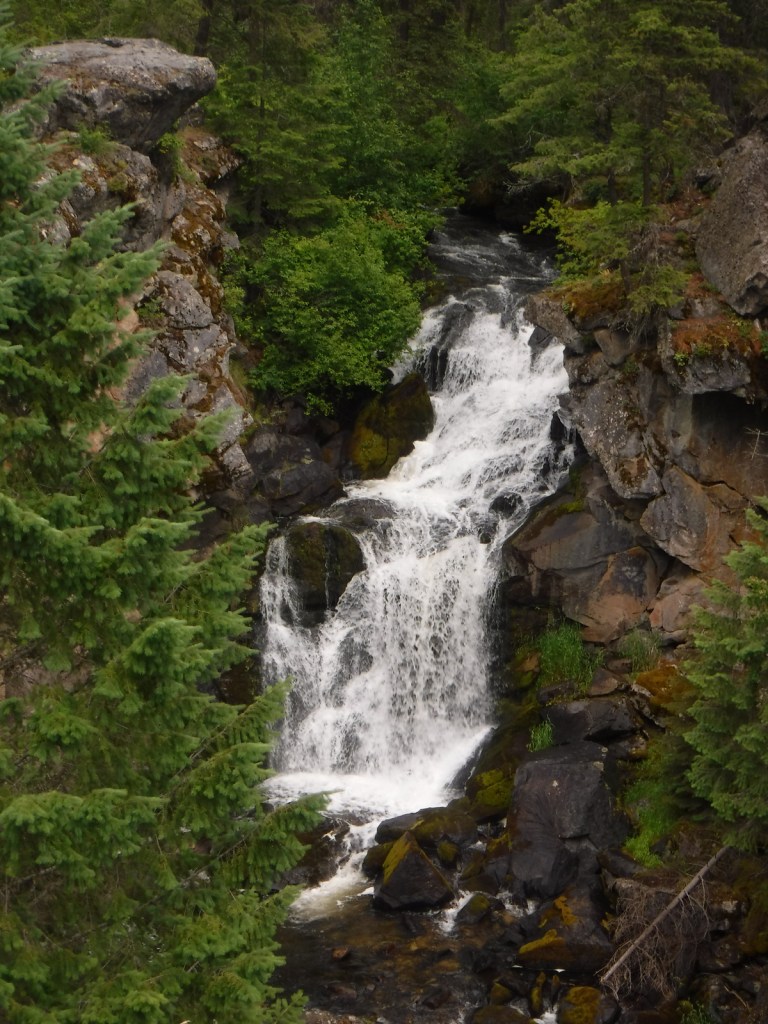
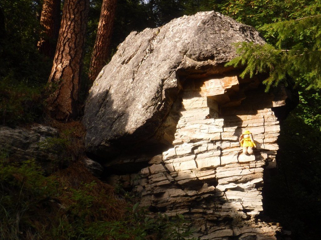
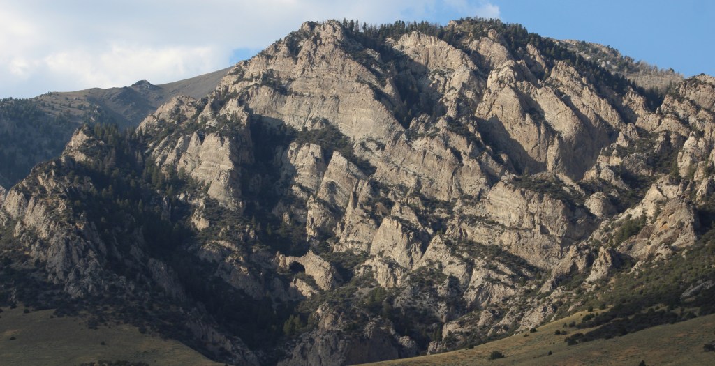
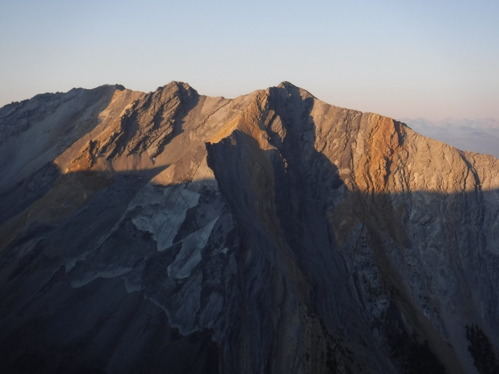
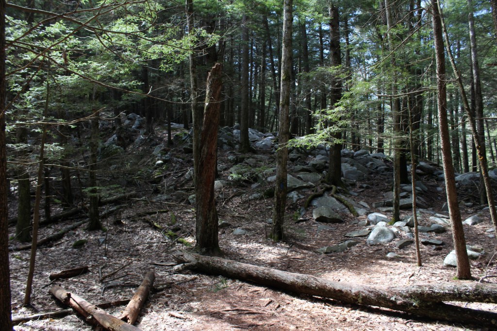
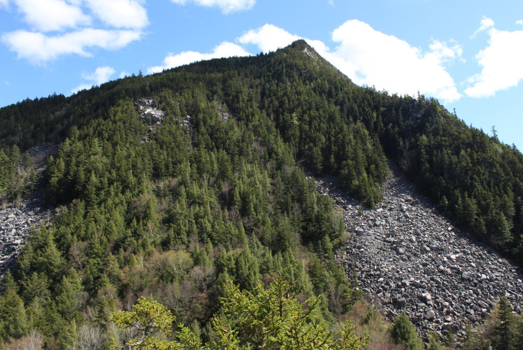
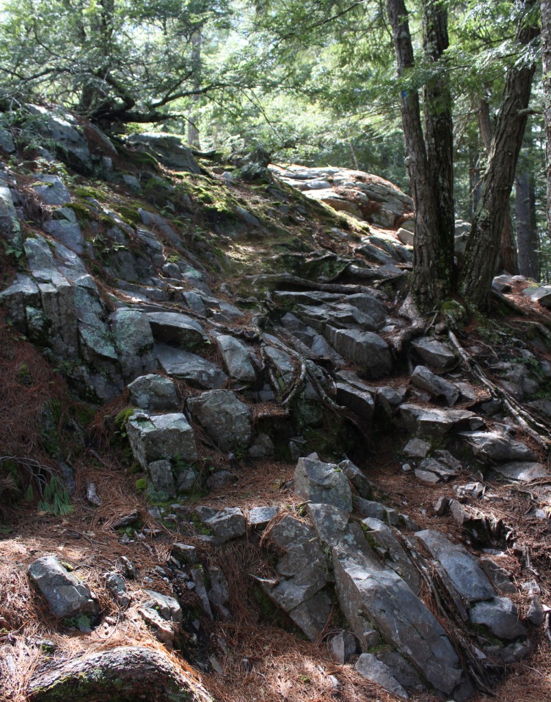
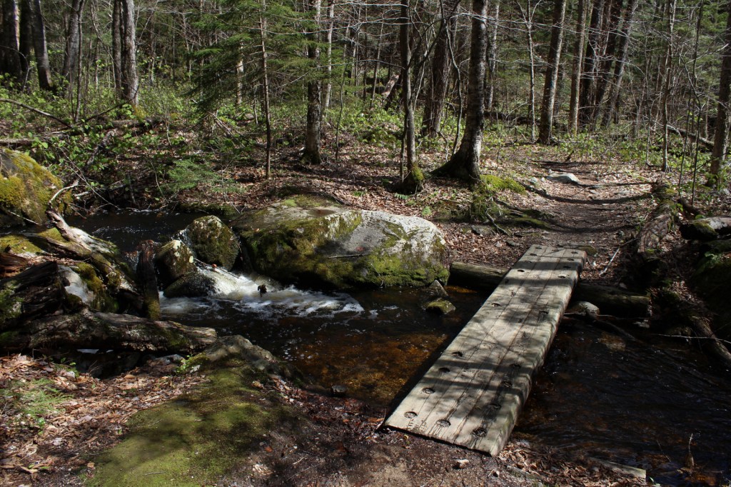
A great place to access Robert T. Stafford White Rocks National Recreation Area is the White Rocks Day Use Area off State Route 140.  Several trails start from the picnic area, including a short walk to a cascading waterfall on Bully Brook.  Less than a mile up the Ice Beds Trail, a short climb reaches a viewpoint of the white rocks, a glacier-scoured cliff of Cheshire quartzite, which was used by Native Americans to make tools.  Continue on this trail 0.9 miles one-way to the Ice Beds where ice melts deep in a scree slope throughout the summer.  You probably will not see any ice, but it is deep in the rocky recesses and releases cool drafts of air.  We were told by a local that there is a black bear named Jenny that hangs out around the trailhead.

Best Trail

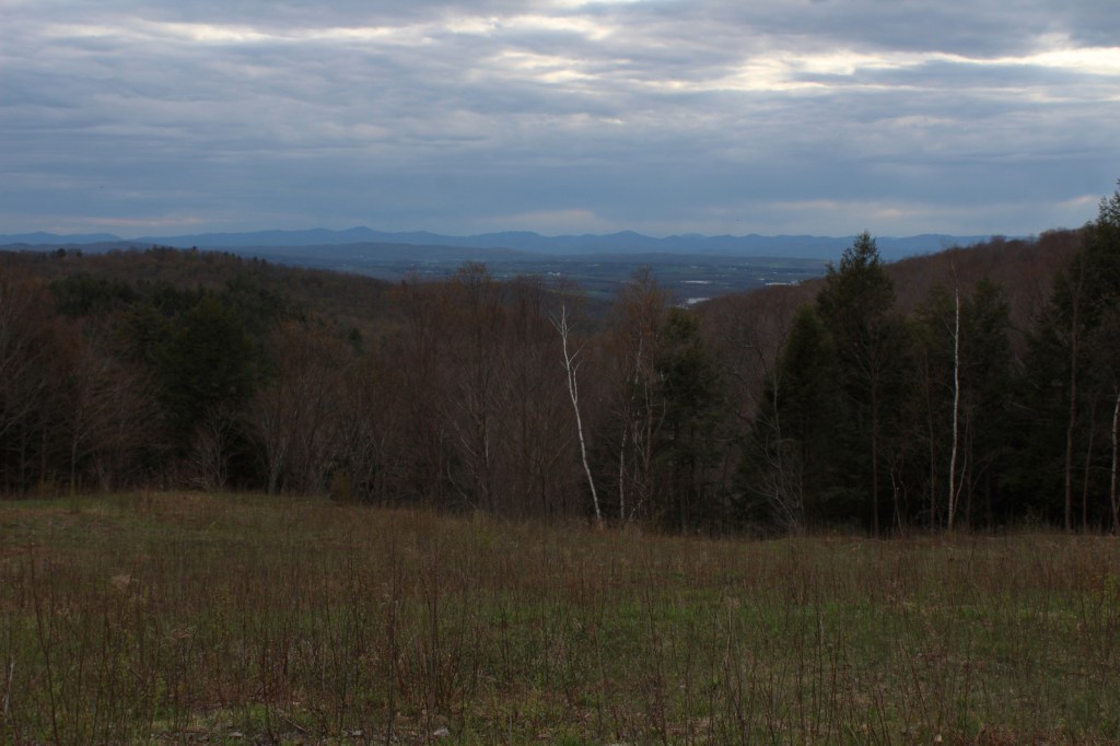
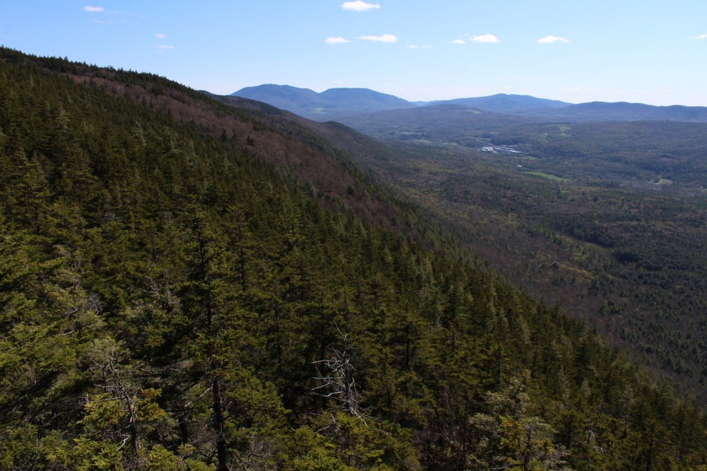
In 0.4 miles from White Rocks Day Use Area, Keewaydin Trail connects with the Long Trail and Appalachian Trail (AT).  By going south, the trail ascends 1,250 feet to a cutoff for the Greenwall Shelter and just past there watch for a stone cairn on the right side.  From there a side trail descends 0.2 miles to an overlook above the White Rock Cliffs providing views of the Adirondack and Taconic Mountains (3.8 miles roundtrip).

Instagram-worthy Photo

Visible less than a mile up the Ice Beds Trail, the white rocks are a glacier-scoured cliff of Cheshire quartzite once used by Native Americans to make tools.

Peak Season

Summer

Fees

None

Road Conditions

State Route 140 is paved, but the access road to White Rocks Day Use Area is an unpaved road passable by RVs.

Camping

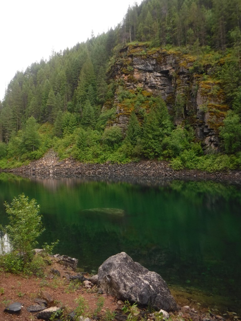
Overnight shelters on the Long Trail/AT at Greenwall and Minerva Hinchey are free, while camping at Little Rock Pond, Peru Peak, Stratton Pond, and Griffith Lake requires a $5 per person, per night fee.  Drive-up campgrounds are located on Forest Road 10 at Big Branch and Black Branch near the Big Branch Wilderness.

Related Sites

Green Mountain National Forest (Vermont)

Moosalamoo National Recreation Area (Vermont)

Marsh-Billings-Rockefeller National Historical Park (Vermont)

Explore More – Who was Robert T. Stafford?

Moosalamoo National Recreation Area

Moosalamoo National Recreation Area

Vermont

Managed by U.S. Forest Service, Eastern Region

15,875 acres

Website: https://www.fs.usda.gov/recarea/gmfl/recreation/recarea/?recid=64903&actid=29

Overview

Created by the New England Wilderness Act of 2006, Moosalamoo National Recreation Area is located in the northern portion of Vermont’s Green Mountain National Forest.  Moosalamoo (pronounced moose-ah-la-moo) comes from the Abenaki word for a moose call.  Recreation here is centered around water, with the Falls of Lana on Sucker Brook, a hike-in campground on Silver Lake, and boating on Sugar Hill Reservoir formed by Goshen Dam.  There are 70 miles of hiking trails, which are also open to mountain bikers, equestrians, and cross-country skiers in the winter.  Blueberry picking is a fun activity in the fall along trails and in cultivated fields at Blueberry Hill Inn in Goshen.

Highlights

Falls of Lana, Silver Lake, Voter Brook Overlook, Sugar Hill Reservoir , Robert Frost Interpretive Trail, Goshen Trail, Chandler Ridge-Leicester Hollow Loop, Mt. Moosalamoo Trail

Must-Do Activity

A short, steep hike from Silver Lake South Trailhead takes you underneath a welded steel penstock (or water pipe) that is part of a hydroelectric project.  From here, carefully go left down the rocks on an unmarked route to the base of the Falls of Lana.  The trail continues to the Rattlesnake Cliffs (closed seasonally due to raptor nesting) and Silver Lake, which has a backcountry campground.  Another popular hike climbs about 1,500 feet in 2.5 miles to the top of Mt. Moosalamoo, with an additional 0.2-mile sidetrip to the South Vista.

Best Trail

Robert Frost, a four-time Pulitzer Prize winner in poetry, spent his summers at the Bread Loaf School of English, which he cofounded.  On Highway 125, the Robert Frost Interpretive Trail is a handicap accessible boardwalk with posted poems by the author that also connects into the Crosswalk, North Star, Afternoon Delight, and Sundown Trails.  Look for evidence of beavers near the ponds and the South Branch of the Middlebury River, as well as blueberries and huckleberries growing in old fields (maintained with prescribed fire).  Unique to Forest Service trailheads, this one is a bus stop on the Tri-Valley Transit route.

Instagram-worthy Photo

Voter Brook Overlook was clearcut and planted with apple trees to provide a nice viewshed in this otherwise dense hardwood forest.

Peak Season

Summer

Fees

None

Road Conditions

All the gravel roads we drove were in good shape during the spring and we were so impressed by one new road culvert we stopped to take a photo (see below).

Camping

Open from Memorial Day through Labor Day, Moosalamoo Campground has 18 campsites located at the base of the Mt. Moosalamoo Trail, near Voter Brook Overlook.  There are a couple dispersed campsites also on the road, but we had one of our worst nights camping here with college kids blasting music late and another group waking us up before sunrise.  The backpacking campground at Silver Lake is nice, or you can stay at Branbury State Park on Lake Dunmore.

Related Sites

Green Mountain National Forest (Vermont)

White Rocks National Recreation Area (Vermont)

Marsh-Billings-Rockefeller National Historical Park (Vermont)

Saint-Gaudens National Historical Park (New Hampshire)

Nearest National Park

Acadia

Explore More – Although his name is not Lana, the Falls of Lana are named for which U.S. Army General who served in the 1848 Mexican-American War?

Land Between The Lakes National Recreation Area

Land Between The Lakes National Recreation Area

Kentucky, Tennessee

Managed by U.S. Forest Service, Southern Region

170,310 acres

Website: https://landbetweenthelakes.us/

Overview

In western Kentucky, the U.S. Forest Service manages 106,458-acres as Land Between The Lakes National Recreation Area (and not part of any National Forest).  It gets its name from the narrow strip of land left after the damming of the Tennessee River to create Kentucky Lake and the Cumberland River to create Lake Barkley.  The dams were constructed by the Tennessee Valley Authority, who managed this area for recreation until 1999.  In 1991, this area was designated a UNESCO Biosphere Reserve, but was withdrawn from the program by the Trump administration.  On December 10, 2021, an EF-4 tornado hit the northern portion of the National Recreation Area and recovery is ongoing.

Highlights

Woodlands Trace National Scenic Byway, Elk and Bison Prairie, Golden Pond Planetarium, Homeplace 1850’s Farm, Golden Pond Visitors Center

Must-Do Activity

In addition to the traditional watersports, Land Between The Lakes National Recreation Area has several attractions found along the Woodlands Trace National Scenic Byway.  These include developed areas (with fees) like the Golden Pond Visitor Center and Planetarium, Elk and Bison Prairie, Woodlands Nature Station, Turkey Bay Off-Highway Vehicle Area, and Homeplace 1850’s Farm (across the border in Tennessee).  The roadside pullout for the Great Western Furnace is worth a stop to check out the 1854 charcoal furnace used to create pig-iron.

Best Trail

The North-South Trail runs 59 miles from Kentucky’s Nickell Branch Backcountry Area to Tennessee’s Devils Backbone State Natural Area (near where Civil War-era Fort Henry was submerged beneath Kentucky Lake). 

Instagram-worthy Photo

Starting in the 1970s, the Tennessee Valley Authority conducted prescribed burns and reseeded to expand patches of native grasses on 700 acres that became the Elk and Bison Prairie (that officially opened in 1996).  There is also a South Bison Range along the Woodlands Trace National Scenic Byway in Tennessee.

Peak Season

Summer

Fees

It is free to drive through Land Between The Lakes National Recreation Area and park at many trailheads, but most attractions require an admission fee.

Road Conditions

Woodlands Trace National Scenic Byway is paved (as is the 3.5-mile loop in the Elk and Bison Prairie) and the gravel roads are well maintained.

Camping

There are several lakeside campgrounds, including Wrangler’s Campground with horse stalls.  For those interested in backpacking, there are multiple free backcountry areas to explore, including the Devils Backbone State Natural Area where we camped.  The unique Annual Backcountry Camping Permit only costs $30 per person (three-day permits $7).

Related Sites

Fort Donelson National Battlefield (Kentucky-Tennessee)

Big South Fork National Recreation Area (Kentucky-Tennessee)

Daniel Boone National Forest (Kentucky)

Nearest National Park

Mammoth Cave

Explore More – Where were the elk reintroduced from into the Elk and Bison Prairie?

Colville National Forest

Colville National Forest

Washington

Managed by U.S. Forest Service, Pacific Northwest Region

1,029,617 acres (954,409 federal/ 75,208 other)

Website: https://www.fs.usda.gov/colville

Overview

In northeast Washington, Colville National Forest is divided into two sections on either side of the Columbia River.  In the west are the Kettle River Mountains, which are crossed by Sherman Pass Scenic Byway (Highway 20).  To the east, the remote Selkirk Mountains contain the Salmo-Priest Wilderness that spills over into Kaniksu National Forest.  Colville National Forest also borders Little Pend Oreille National Wildlife Refuge and Lake Roosevelt National Recreation Area.

Highlights

Sherman Pass Scenic Byway, Pewee Falls, Sullivan Lake, Marble Creek Falls, Trout Lake, Kettle Creek National Recreation Trail, Crowell Ridge Trail, Sherman Creek Trail, Grassy Top National Recreation Trail, Brown’s Lake Interpretive Trail, Pacific Northwest National Scenic Trail

Must-Do Activity

In the Selkirk Mountains east of the Pend Oreille River, the large Sullivan Lake is a scenic spot for boating and camping.  Designated in 1978, the Sullivan Lake National Recreation Trail runs 4.3 miles between the two campgrounds located at either end of the lake.  Colville National Forest is also known for 200-foot-tall Pewee Falls that cascades into the Boundary Dam Reservoir near the Canadian border, but we did not make it up there.

Best Trail

Hoodoo Canyon Trail is 4.8 miles one-way and accessible from two trailheads, one on unpaved Deadman Creek Road and the other at Trout Lake Campground, which is five miles from the Sherman Pass Scenic Byway.  We started out in the rain from our dispersed campsite along Deadman Creek Road and the trail soon made a steep climb through a dense conifer forest.  Eventually the route leveled out and we got our first view of shamrock green Emerald Lake, so we took a well-worn path down to its shoreline.  The trail was officially closed at the 3.2-mile point due to a small landslide (see photo), but it was not hard to navigate past that spot to gain a view of Trout Lake, at which point we turned around.

Watchable Wildlife

The remote Selkirk Mountains represent the sole place south of Canada where there is a herd of mountain caribou.  Grizzly bears, Canadian lynx, mountain lions, and gray wolves also inhabit this wild borderland region.  More common species include mule deer, bighorn sheep, moose, beavers, bald eagles, and loons.

Instagram-worthy Photo

The water of Emerald Lake truly lives up to its gem of a name, even on a cloudy day.

Peak Season

Summer

Fees

None

Road Conditions

Sherman Pass Scenic Byway (Highway 20) is paved, but most the roads we drove through Colville National Forest were unpaved but in very good condition.

Camping

Trout Lake Campground seemed like a nice spot, secluded but only five miles off the Sherman Pass Scenic Byway.  We found many excellent dispersed campsites along the unpaved portions of Deadman Creek Road.

Wilderness Areas

Salmo-Priest Wilderness (also in Kaniksu National Forest)

Related Sites

Lake Roosevelt National Recreation Area (Washington)

Ross Lake National Recreation Area (Washington)

Lake Chelan National Recreation Area (Washington)

Nearest National Park

North Cascades

Conifer Tree Species

Douglas-fir, grand fir, subalpine fir, lodgepole pine, western larch, western redcedar

Flowering Tree Species

syringa, quaking aspen, Pacific dogwood, red alder, balsam poplar, dwarf birch, paper birch, Piper’s hawthorn, boxelder, Bebb willow, western mountain-ash, choke cherry, western serviceberry, red alder, mountain alder

Explore More – Who was Andrew Colvile, other than the man that Fort Colville [sic] was misnamed for in 1825?

Learn more about this and the 154 other National Forests in our new guidebook Out in the Woods

We are a participant in the Amazon Services LLC Associates Program, an affiliate advertising program designed to provide a means for us to earn fees by linking to Amazon.com and affiliated sites.

Challis National Forest

Challis National Forest

Idaho

Managed by U.S. Forest Service, Intermountain Region

2,488,105 acres (2,463,471 federal/ 24,634 other)

Website: https://www.fs.usda.gov/scnf/

Overview

Challis National Forest covers the southern portion of the co-managed Salmon-Challis National Forest in central Idaho.  It includes the northern parts of Sawtooth National Recreation Area and a section of the Salmon Wild and Scenic River, as well as several northwest-southeast running mountain ranges.  In the forest’s scenic Lost River Range, 12,667-foot Borah Peak is the highest point in Idaho.  Further south near Arco, a steep half-mile trail leads to King Mountain Natural Arch in Bridge Canyon, a limestone formation with an 80-foot span. 

Highlights

Salmon River Scenic Byway, Stanley Museum, Sunbeam Hot Springs, Custer Adventure Motorway, Yankee Fork Hot Springs, Lemhi Range, White Knob Mountains, Camas Meadows, Challis Creek Lakes, Hidden Mouth Cave, Sawtooth Lake, White Cloud Peaks, Grover Creek Lake, Borah Peak

Must-Do Activity

The Salmon River Scenic Byway runs 162 miles to Lost Trail Pass, starting in Stanley where it intersects with the Sawtooth and Ponderosa Pine Scenic Byways.  Challis National Forest manages the free Stanley Museum there inside the historic Valley Creek Ranger Station.  Further down the road, the Sunbeam Bathhouse was built in 1937 by the Civilian Conservation Corps (CCC) at a hot springs on the Salmon River where people still go to soak seeking the perfect spot between the frigid river and scalding spring water.

Best Trail

We previously covered the trail to stunning Sawtooth Lake in our post on Sawtooth National Recreation Area.  While it is not for everyone due to its strenuousness, we will write here about the route up 12,667-foot Borah Peak.  From its beginning (which we started in the dark) the entire trail is incredibly steep, so much so that we ran back down the final two miles because it was easier on our knees.  The route gains 5,400 feet of elevation in 4.5 miles and often requires the use of your hands, but no special climbing equipment.  Even if you decide to turn around at Chicken-Out Ridge before ascending the Knife Edge, the panoramic scenery is well worth the effort.

Watchable Wildlife

This is a fairly arid portion of the west, so you are more likely to see a ground squirrel or coyote than any other wildlife.  Trout fishing is a popular activity in the Salmon River.  Large mammalian species include elk, mule deer, pronghorns, and black bears.  Ravens and a variety of birds of prey catch the thermals around Borah Peak.

Instagram-worthy Photo

The view of King Mountain Natural Arch’s 80-foot span is arguably better while driving in than it is after ascending the treacherous final mile of road and hiking the steep half-mile trail to its overlook (see below).

Peak Season

Late summer due to snowpack

Fees

None

Road Conditions

The road from Highway 93 to the Borah Peak Campground and Trailhead is well maintained.  The last mile of road to the trailhead for King Mountain Natural Arch requires a high-clearance vehicle, but the nine miles of unpaved roads before that are decent and well signed (although we got a flat tire).

Camping

The campground at the base of Borah Peak is only $5 per night and allows climbers to get an early start.  There are many campgrounds along the Salmon River Scenic Byway and historic Yankee Fork Road/ Custer Adventure Motorway.

Wilderness Areas

Frank Church-River of No Return Wilderness (also in Bitterroot, Boise, Nez Perce, Payette, and Salmon National Forests)

Jim McClure-Jerry Peak Wilderness (also run by the Bureau of Land Management)

Sawtooth Wilderness (also in Boise and Sawtooth National Forests)

Related Sites

Caribou National Forest (Idaho-Utah-Wyoming)

Craters of the Moon National Monument and Preserve (Idaho)

Minidoka National Historic Site (Idaho-Washington)

Nearest National Park

Yellowstone

Conifer Tree Species

Engelmann spruce, subalpine fir, ponderosa pine, lodgepole pine, limber pine, whitebark pine, Douglas-fir, Rocky Mountain juniper

Flowering Tree Species

quaking aspen, water birch, Rocky Mountain maple, boxelder, Bebb willow, blue elderberry, chokecherry, curlleaf mountain-mahogany, white alder, syringa, sagebrush

Explore More – How many Civilian Conservation Corps (CCC) camps were in Idaho during the Great Depression?

Learn more about Challis and the 154 other National Forests in our new guidebook Out in the Woods

We are a participant in the Amazon Services LLC Associates Program, an affiliate advertising program designed to provide a means for us to earn fees by linking to Amazon.com and affiliated sites.