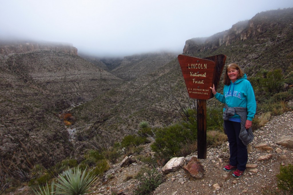
Lincoln National Forest is best known as the birthplace of Smokey Bear, a black bear cub that survived a 1950 wildfire in the Capitan Mountains and became a national symbol. The nearby Smokey Bear Historical State Park is the final resting place for the famous bear that passed away at Washington D.C.’s National Zoo in 1976. Lincoln National Forest includes parts of the Guadalupe, Sacramento, Sierra Blanca/White Mountains, Capitan, and Gallinas ranges. There are several long trails through the National Forest, including the 20-mile Crest Trail in the White Mountain Wilderness and the 11-mile South Base Trail in the Capitan Wilderness. All but one mile of the 29-mile-long Rim Trail is open to OHVs.
Highlights
Sunspot Scenic Byway, Billy the Kid Scenic Byway, Trestle Recreation Area, Sitting Bull Falls, Sierra Blanca Peak, Rim Trail, Willie White Trail, Dog Canyon National Recreation Trail, Capitan Peak Trail
Must-Do Activity
Sunspot Scenic Byway (State Road 6563) provides great views and access to one of the world’s largest solar observatories that is open for tours on summer weekends. At its remote southern end, the National Forest borders both Carlsbad Caverns and Guadalupe Mountains National Parks. Roads only connect with the latter, where a short detour takes you to the half-mile trail for 150-foot-tall Sitting Bull Falls. In 1898, the Alamogordo and Sacramento Mountain Railway was constructed to access timberland 4,747 feet in the mountains above. One of its scenic remnants is the 320-foot trestle over Mexican Canyon near Cloudcroft. Lincoln National Forest has six fire lookouts listed on the National Register of Historic Places, including the stone Monjeau Lookout built by the Civilian Conservation Corps (CCC) that is accessible on a steep dirt road. Given its proximity to Carlsbad Caverns National Park, it is not surprising that there are hundreds of caves in the National Forest that require a permit to explore.
Best Trail
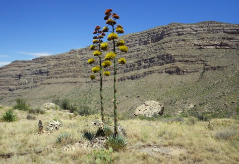
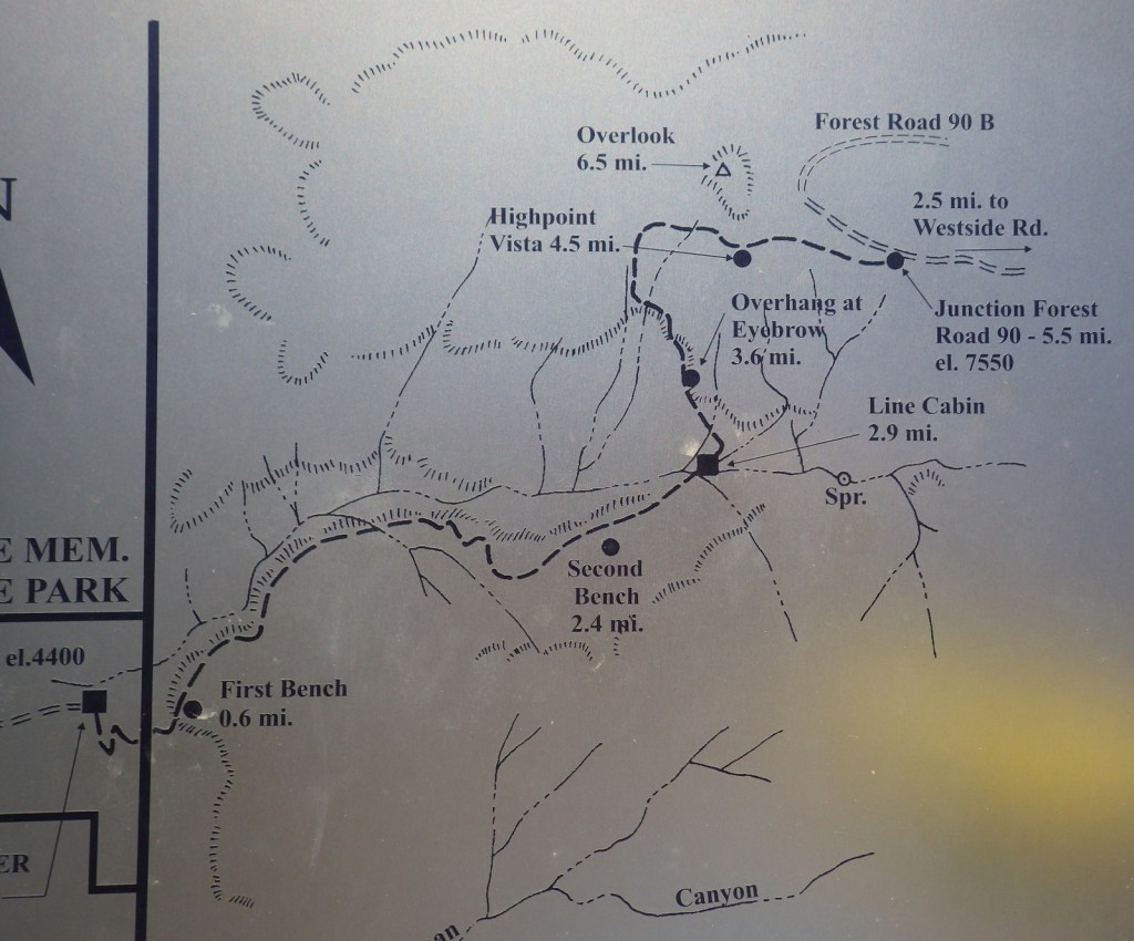
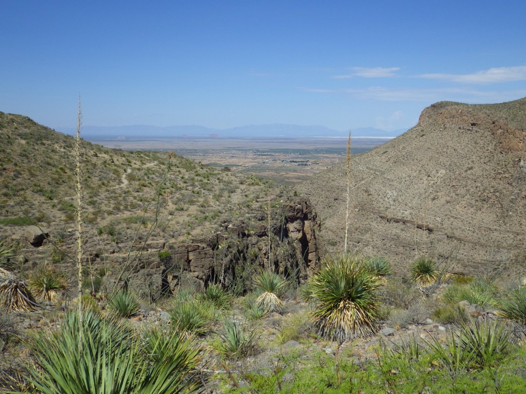
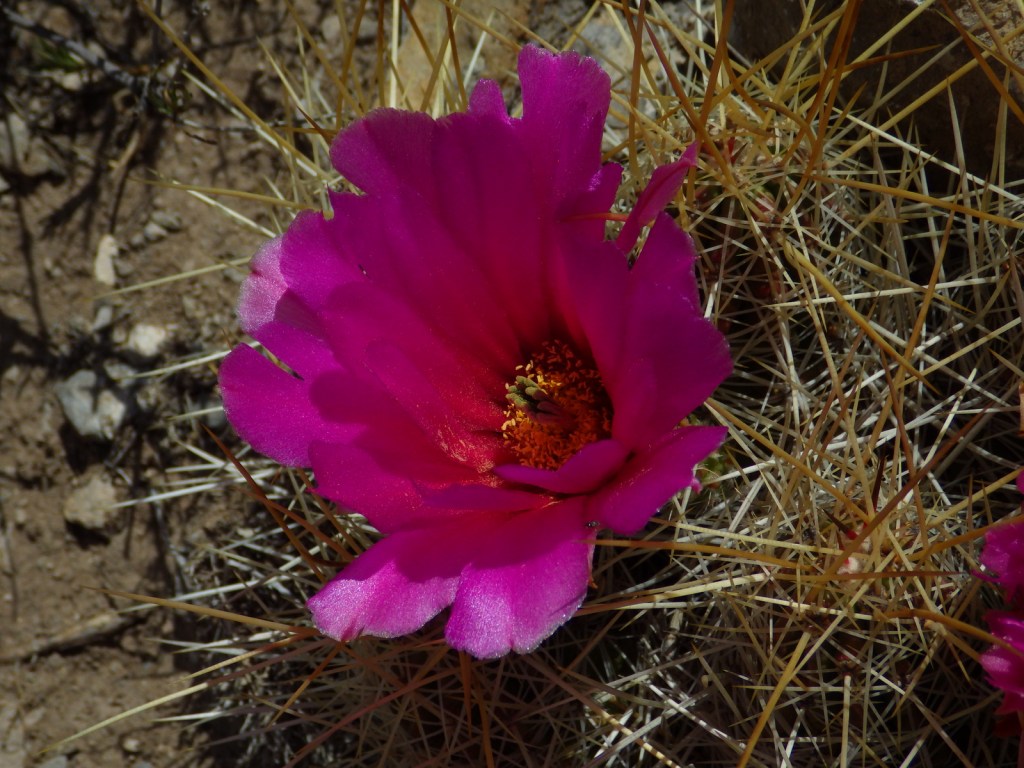
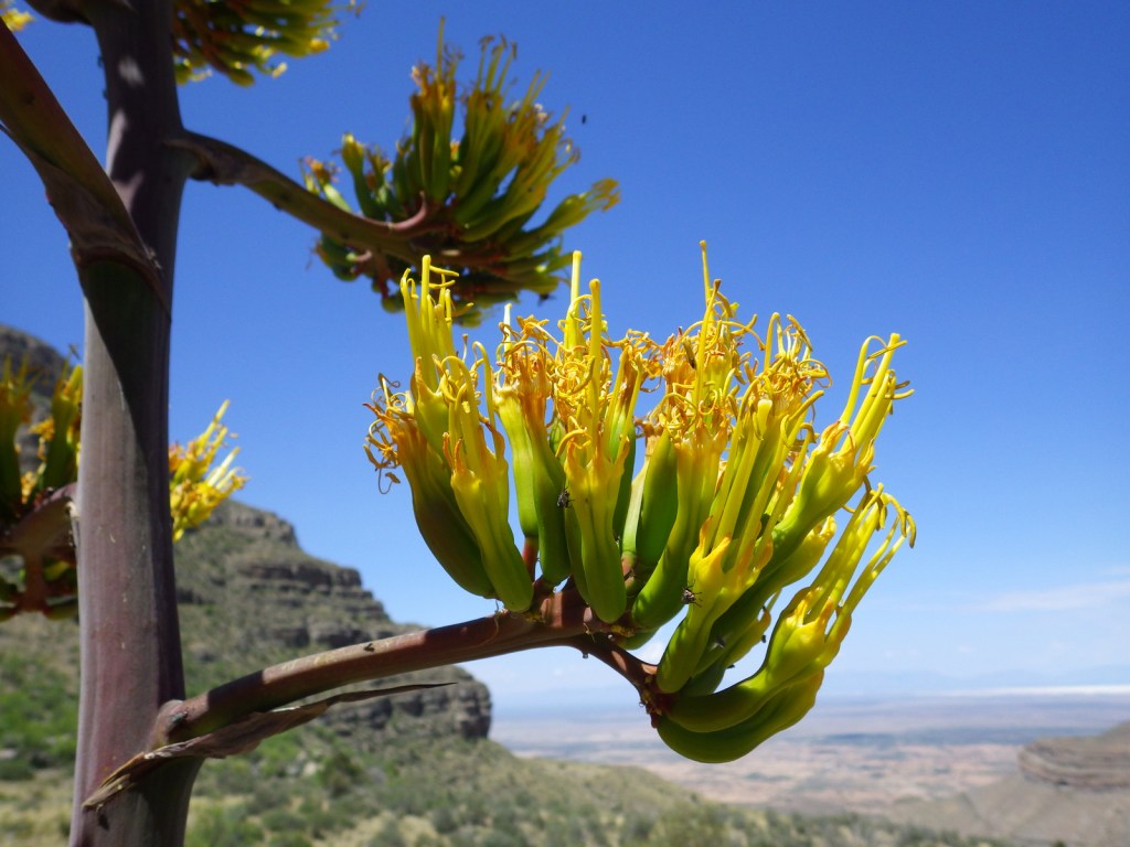
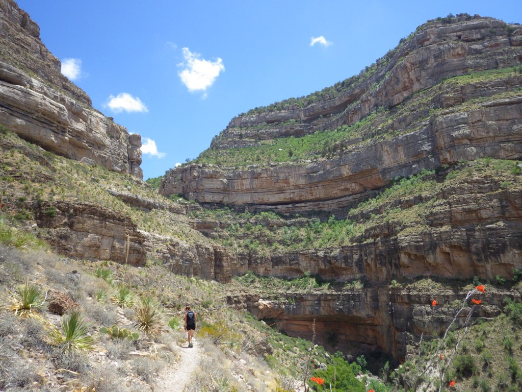
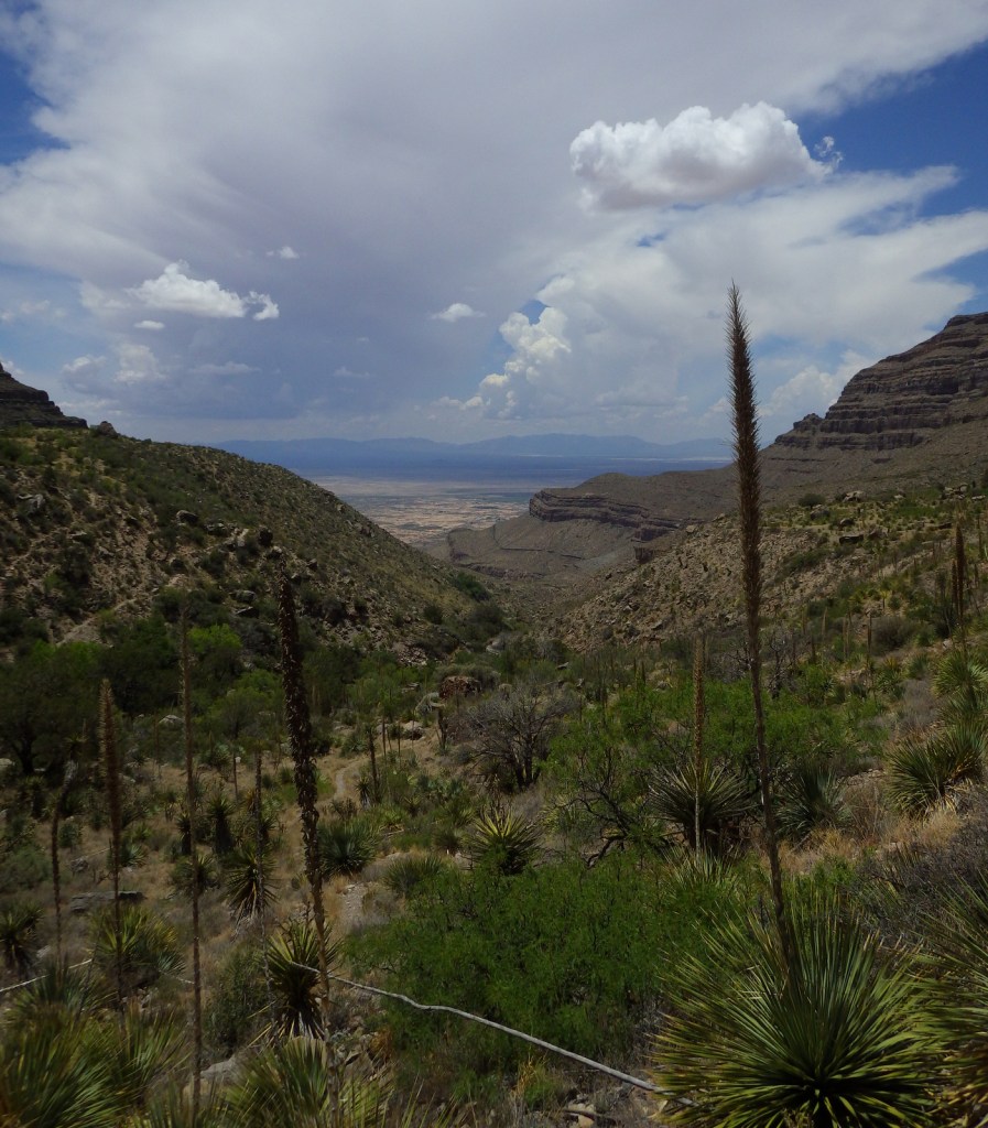
Dog Canyon National Recreation Trail follows a prehistoric travel route into the Sacramento Mountains east of White Sands National Park. The trailhead starts in Oliver Lee Memorial State Park, which has a nice campground and charges a day use fee (though we have seen cars avoid this by parking just outside its entrance). The 5.5-mile one-way trail climbs quickly above a beautiful canyon providing views of the Tularosa Basin before leveling out. Past the cabin ruins at the three-mile point, look for fossils along the trail as it again steeply rises into the agave and cacti-studded mountains. After gaining more than 3,000 feet in elevation, it dead ends at Forest Road 90B.
Watchable Wildlife
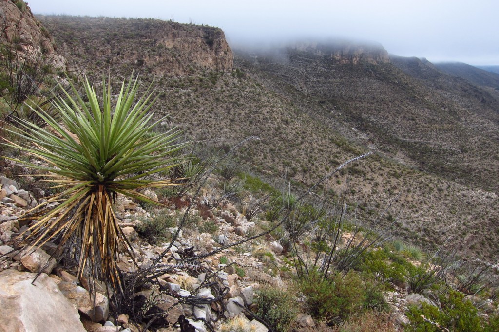
Ecosystems in the National Forest vary widely since it is spread across several mountain ranges and encompasses Chihuahuan Desert, pinyon-juniper woodlands, pine forests, and alpine meadows above 11,000 feet. Game species include elk, mule deer, black bear, mountain lion, and exotic Barbary sheep.
Photographic Opportunity
Look for fossils in the rocks along Dog Canyon National Recreation Trail.
Peak Season
Spring and fall
Fees
None
Road Conditions
The Sunspot Scenic Byway and the road into Oliver Lee Memorial State Park are both paved and maintained, although the paved access road (137) through Lincoln National Forest to the north part of Guadalupe Mountains National Park has many potholes in it. Be aware that there are also four-wheel-drive only roads to some trailheads.
Camping
There are a few developed campgrounds in the middle of the National Forest off Highway 82. Although not all areas are open to dispersed camping, popular spots include Upper Bonito Dispersed Camping Area northwest of Ruidoso and Lower Karr Canyon south of Cloudcroft.
Baby barrel cactusMillipedeAgave bloomsCheckered whiptail lizardScott with a buckhorn chollaBeetleSpiny crevice lizardFossilsOcotillo bloomScott’s mother on Dog Canyon National Recreation Trail
Last year we published our guidebook 50 States of Great: Road Trip Guide to America, so we decided to start a new type of blog post where we create a travel itinerary for all 50 states, in addition to our usual National Forest and National Park entries. After starting with Kansas, Georgia, Idaho, Rhode Island, Minnesota, and Hawai‘i we decided to do a state in the southwest. Arizona probably needs two separate itineraries, with the southern deserts being a great destination in the winter and the high-elevation northern part of the state better in the summer (see Day 8+). We made an ambitious seven-day plan starting in the south, with plenty of options to extend the trip. Scott grew up in Arizona, so he could have easily made this a four-week itinerary and still left out many good options.
On the Mexican border sits 330,689 acres of undeveloped Sonoran Desert recognized as a UNESCO International Biosphere Reserve in 1976. Its namesake cactus is more common further south and shares this landscape with 27 other species of cacti, including the famous saguaro. The park’s jagged Ajo Mountains are mostly volcanic rhyolite and to see them at their best, we recommend driving the 21-mile dirt road loop in the evening before turning in for the night at the excellent Twin Peaks Campground, run by the National Park Service (NPS).
Arizona has 19 National Monuments (more than any other state), so if you flew into Sky Harbor Airport in Phoenix start with the one located right off Interstate 10.
Desert bighorn sheep can be seen in this remote part of southwest Arizona south of Quartzsite. Cibola and Imperial National Wildlife Refuges along the Colorado River are good spots for birding.
Southwest of Tucson, Arizona in a nondescript stretch of desert are the remains of an underground Intercontinental Ballistic Missile (ICBM) silo built in 1963, during the height of the Cold War. The nuclear warhead and rocket fuel was long ago removed from the site, but otherwise everything has been preserved. A tour guide takes you below ground in the original elevator to explain the steps required to unleash this devastating weapon.
The Catalina Highway ascends from Tucson through multiple life zones from saguaro-dotted desert to ponderosa pine forests at more than 9,000 feet in elevation. The expansive vistas along the drive are worth the many switchbacks, with Windy Point Vista is an especially beautiful wayside in the pinyon-juniper woodland zone. At the base of the Santa Catalina Mountains, also within Coronado National Forest, tram rides are available through beautiful Sabino Canyon Recreation Area.
If you didn’t get your fill of cacti the first day, you will at this park with separate sections east and west of Tucson. If you only have time for one, we recommend the eastern Rincon Mountain District.
South of Tucson in Tubac, San Cayetano de Tumacácori is a Spanish mission founded in 1691 by Padre Kino and abandoned in 1848. It became a National Monument in 1908 when it was restored to its ruined state based on photographs dating from 1868.
The highly decorated cave was not discovered until 1974, when its location was kept a tight secret while efforts were made to preserve it for future visitors. There are two guided tours on paved trails offered, and if you space out your reservations far enough you can take a hike on the 2.4-mile Foothills Loop Trail in between.
Bisbee
The copper mining center of Bisbee was once the largest city between El Paso and San Francisco. The well-maintained Victorian architecture and flights of steep staircases give this border town a unique atmosphere.
The park does not actually contain a statue or large memorial to Coronado. It does have a steep three-quarter mile trail to a 600-foot long limestone cave bearing Coronado’s name, which visitors can explore on their own with flashlights.
Tucked away in the southeastern corner of Arizona, millions of years of erosion left behind a spectacular collection of rhyolite rock formations that rise above surrounding evergreen trees. All the trails are good, but we recommend an all-day hike through Echo Canyon to the Heart of Rocks Loop where you will find formations resembling camels, ducks, and anything else you can imagine.
Salt River Canyon
Start driving north and be sure to stop for photos where U.S. Highway 60 drops steeply into this gorgeous canyon between Globe and Show Low.
Optional stop at Wilcox Playa Wildlife Area
In the winter, sandhill cranes stay in large numbers in the wetlands south of Wilcox and Interstate 10.
To visit the NPS visitor center, the literal “must-do activity” is to hike 1.5 miles from the trailhead. You do pass interpretive signs, a cemetery, and ruins along the way.
A paved walkway behind the Rainbow Forest Museum is a great place to start, as NPS rangers give guided tours there throughout the day. It is worth a hike to Agate House and a connection to the Giant Logs Trail to see more petrified wood, but be sure to bring water with you in the summer since there is no shade.
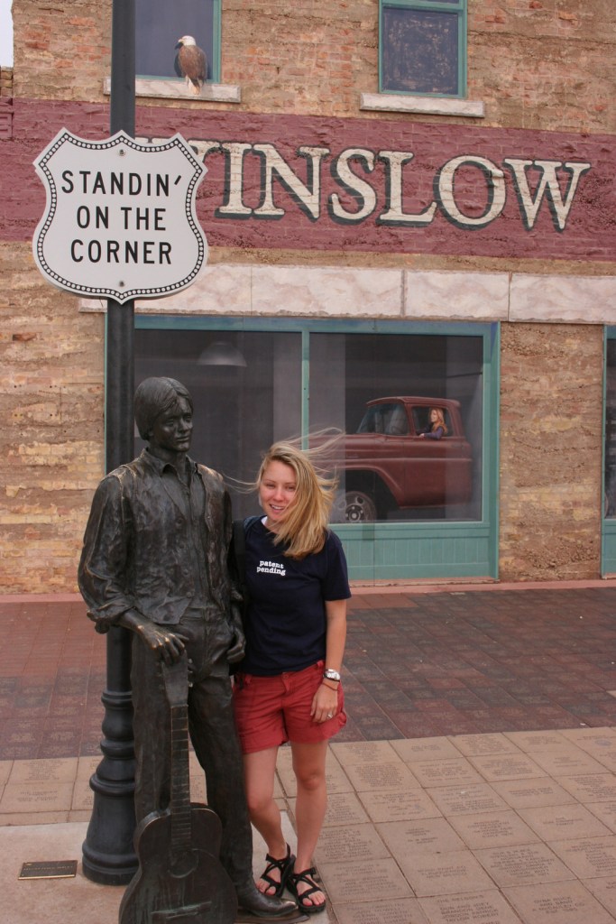
“Standin’ on the corner” statue in Winslow
Jackson Browne and Glenn Frey probably could not have guessed when they penned the 1970s anthem “Take It Easy” that it would inspire a statue in an Arizona town on historic Route 66. Perhaps even more fitting is the mural behind it that shows the reflection of a girl driving a flatbed truck. Located off Interstate 40, Winslow is a great place “to loosen your load.”
Cameron Trading Post
As a kid, Scott’s family would always spend the night at the hotel here before taking friends and family to the Grand Canyon National Park. Try the mutton stew or Indian taco in the restaurant at this historic spot.
Optional stop at Meteor Crater
There is a good museum at this big, round hole in the ground along Interstate 40. It is definitely worth seeing once in your life.
Heading north from Flagstaff, a 36-mile loop drive through Sunset Crater Volcano National Monument to adjacent Wupatki National Monument passes by the red-hued cinder cone through ponderosa pine forests and sunflower-filled meadows on its way to an arid, rocky high desert region that is dotted with Sinagua ruins from around AD 1100. Nearby cliff dwellings were built in Walnut Canyon National Monument around the same time by another group of Sinagua. To get up close with the cliff dwellings inside shallow limestone caves requires a hike down 200 stairs on the one-mile loop Island Trail.
Visit the South Rim of the park from the less busy eastern entrance and stop at the Watchtower and other scenic views along the way. It is worth spending a few nights here and hiking (or riding a mule) to the bottom of the canyon, but that is not for everyone. If you come in the summer, consider a trip to the North Rim or remote Toroweap (online permit required).
Optional stop at Little Colorado River Gorge Navajo Tribal Park
Famous for art galleries and New Age mysticism, the red rock city of Sedona offer plenty of stores and restaurants. Be sure to leave some time to explore some unpaved roads and hiking trails in the surrounding area.
There are numerous trails in the National Forest around Sedona, where sandstone buttes (like Bell Rock and Cathedral Rock) dominate the landscape. The shady West Fork Trail in Oak Creek Canyon is perfect on hot summer days, though in the winter it is also beautiful covered in snow and ice.
Optional stop at Sycamore Canyon Wilderness
This designated Wilderness (55,937 acres) is shared between three National Forests: Coconino, Kaibab, and Prescott. The easiest way in is on the Parsons Trail located outside Clarkdale, west of Sedona. The trailhead is accessed by driving the dirt Forest Road 131 for 10.5 miles from where it splits off near Tuzigoot National Monument.
The Sinagua pueblo at Tuzigoot had about 110 rooms and is estimated to have housed 200 to 300 people. You can walk inside portions of the ruin, including a section with a reconstructed roof.
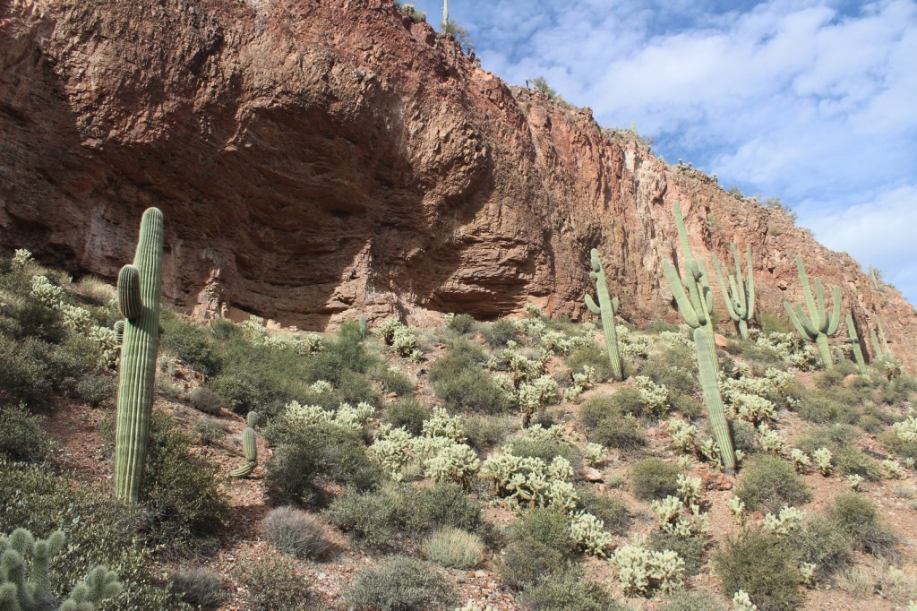
These cliff ruins east of Phoenix are worth the hike up to, as are many parts of Tonto National Forest, especially the Flat Iron, Hieroglyph Canyon, and Weaver’s Needle.
This is a unique NPS site with livestock (sheep, horses, turkeys) and a hands-on play area for children, as well as the original dusty store which allows visitors to travel back into the late-1800s. There are frequent Navajo rug weaving demonstrations and tours inside the Hubbell Home are available for a fee.
In the heart of the Navajo Nation in northeast Arizona lies this picturesque National Monument. Humans have inhabited this area for 4,500 years, leaving behind numerous pictographs and the dramatic ruins of Ancestral Puebloan cliff dwellings.
Visitors can reserve spots on the ranger-led day hike to Betatakin cliff dwelling or the 20-person backpacking trips to Keet Seel that are offered twice per month in the summer. The latter is a strenuous trip covering 17 miles total with numerous stream crossings and all water must be carried in. The hardest part is at the end, when a 1,000 foot climb awaits, but it is worth it to be one of the few who get to see Keet Seel, the 150-room ruin that is second in size only to Cliff Palace at Mesa Verde National Park.
Monument Valley Navajo Tribal Park
On the border of Arizona and Utah, entrance into Monument Valley Navajo Tribal Park allows you to see the iconic Mitten Buttes in person, which have served as a backdrop for countless films. You can even pitch your tent at The View Campground overlooking the red rock formations.
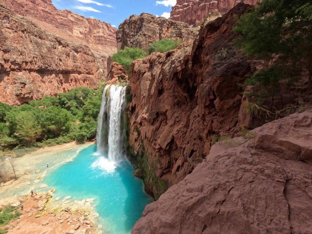
Havasupai Reservation
It is hard to argue against Mooney Falls and the other waterfalls in Havasu Canyon as being the most outstanding in the state, but it can be difficult (and expensive) to obtain one of the limited reservations available to visit the Havasupai Reservation that borders Grand Canyon National Park.
Retention ponds keep this area green in the hot summer months where ducks paddle and dragonflies buzz through the humid air. When a NPS ranger is present, you can walk around inside Winsor Castle, a Mormon fort that dates back to 1870.
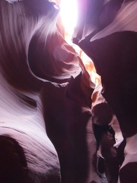
Antelope Canyon
Guided tours are required to access these beautiful slot canyons located on private land on the Navajo Nation
You might want to bring your “selfie stick” to iconic Horseshoe Bend Overlook, a short 0.7-mile one-way hike from the parking area on Highway 89 outside Page.
At Arizona Hot Springs, pools are formed by sandbags in a narrow canyon. It is accessible from Liberty Bell Trailhead by a 6.5-mile out-and-back hike through a beautiful arroyo down to Black Canyon (now the upper reaches of Lake Mohave formed by a dam) on the Colorado River. The trail is closed during the hot summer months, but you can still access it by boat from Willow Beach Marina or just downstream from the Hoover Dam (with a special permit). Further south on Lake Mohave, stop at Emerald Cove for incredible photographs.
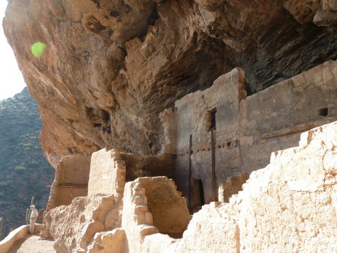
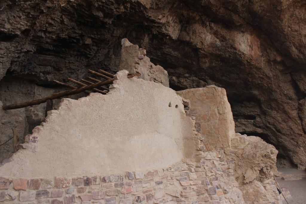
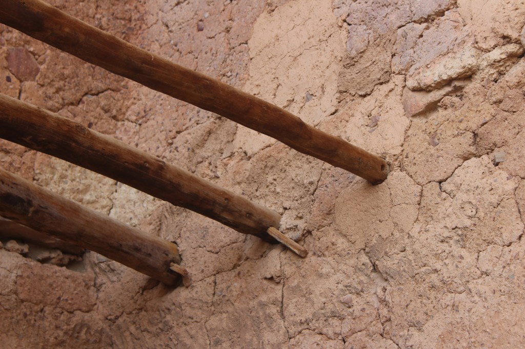
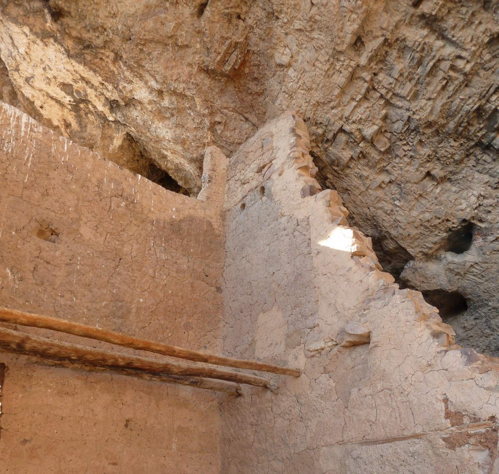
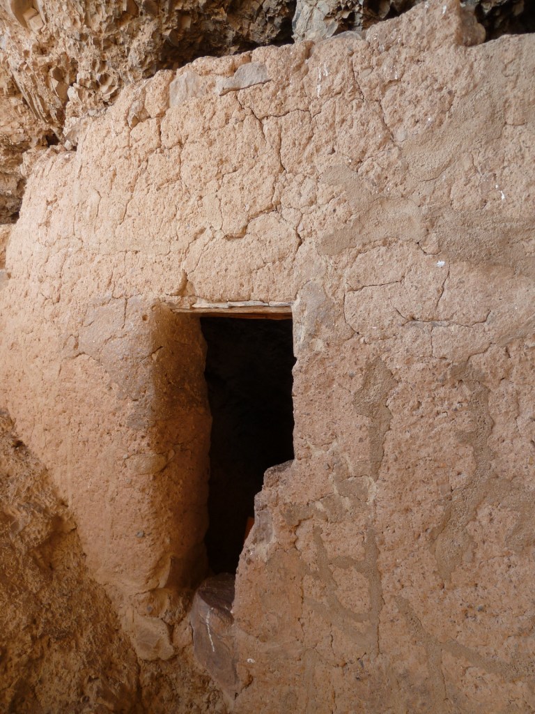
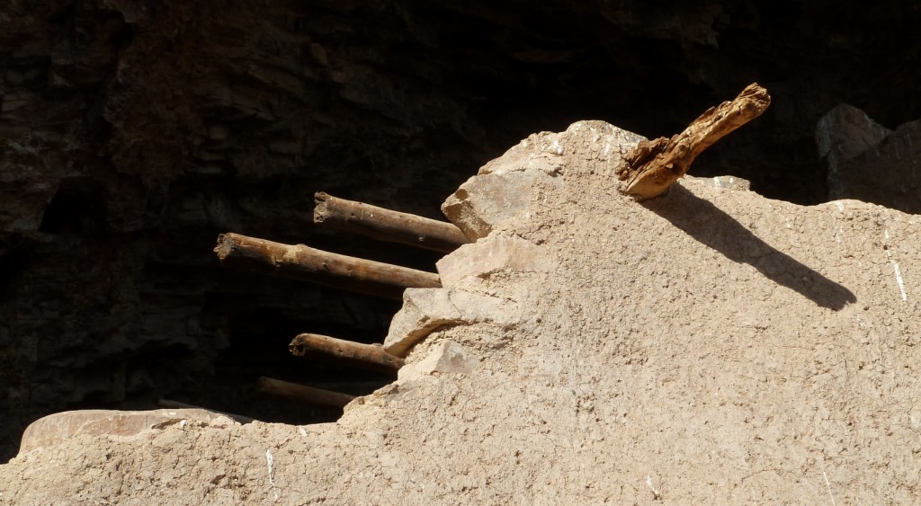
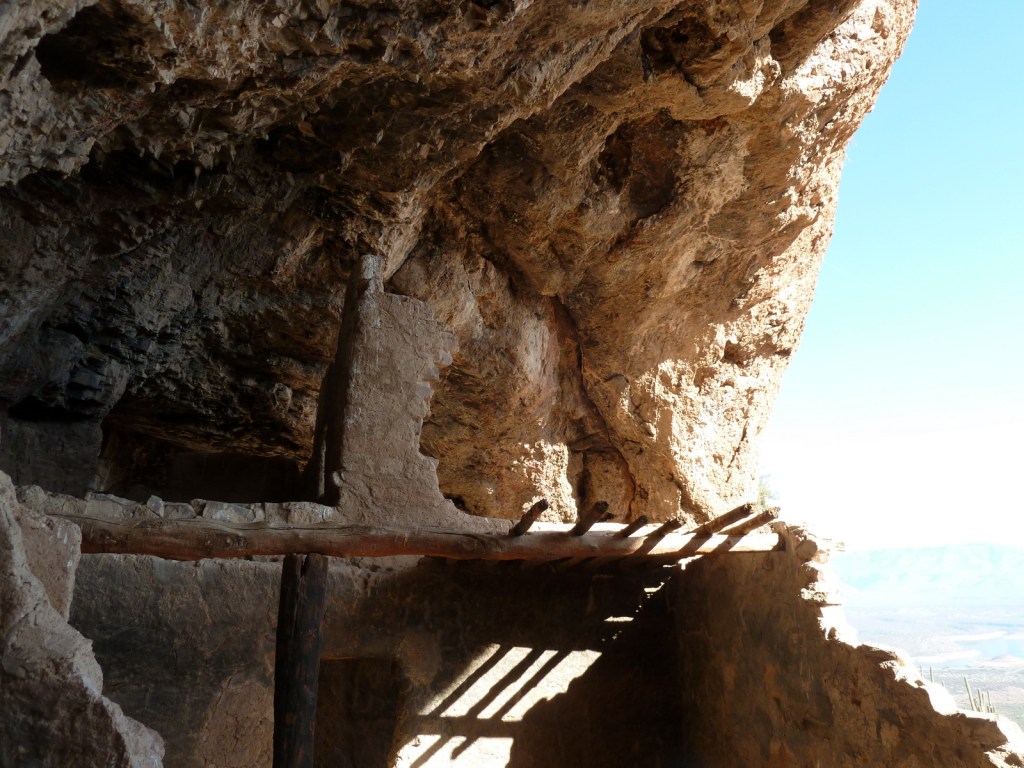
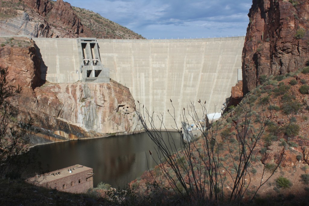
After farming along the Salt River (or Rio Salado) for centuries, in the 1300s the Salado people moved to natural caves where they constructed cliff dwellings. Perhaps following catastrophic flooding or drought, the entire Tonto Basin was abandoned by 1450. When construction of Theodore Roosevelt Dam began in 1906, its namesake President protected these ruins using the power of the 1906 Antiquities Act.
Museum, film, Lower Cliff Dwelling, Upper Cliff Dwelling guided tour
Must-Do Activity
Every visitor who is in good enough shape for the 350 foot ascent should make their way up to Lower Cliff Dwelling (with 28 rooms) after watching the film at the National Park Service visitor center. While at the top, talk to the volunteer stationed there for more information about the people who once inhabited the ruins. Only offered from November through April, the 10 a.m. ranger-guided tour (reservations required) to the Upper Cliff Dwelling (with 40 rooms) crosses washes and ascends 600 feet via switchbacks and 60 steps over a three-mile roundtrip.
Best Trail
The paved trail to the Lower Cliff Dwelling gains 350 feet of elevation in a half-mile, providing excellent views of Theodore Roosevelt Lake.
Photographic Opportunity
Hiking to Lower Cliff Dwelling is a good introduction to native plants of the Sonoran Desert, including the iconic saguaro cactus, yucca, sotol, cholla, and barrel cactus.
Highway 188 provides paved access to Tonto National Monument between Payson and Globe, while Arizona Highway 88 (“Apache Trail”) is unpaved past Canyon Lake and until December 2024 that section was closed due to a wash out in 2019. Together they make for a beautiful scenic loop drive suitable for high-clearance vehicles.
Camping
There are campgrounds around Theodore Roosevelt Lake and within Tonto National Forest, which also allows dispersed camping in some areas.
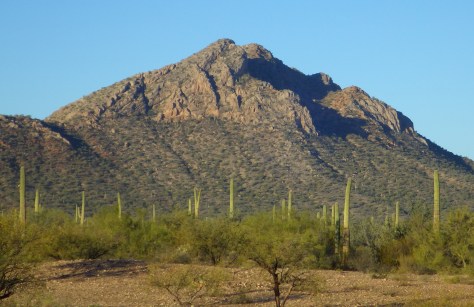
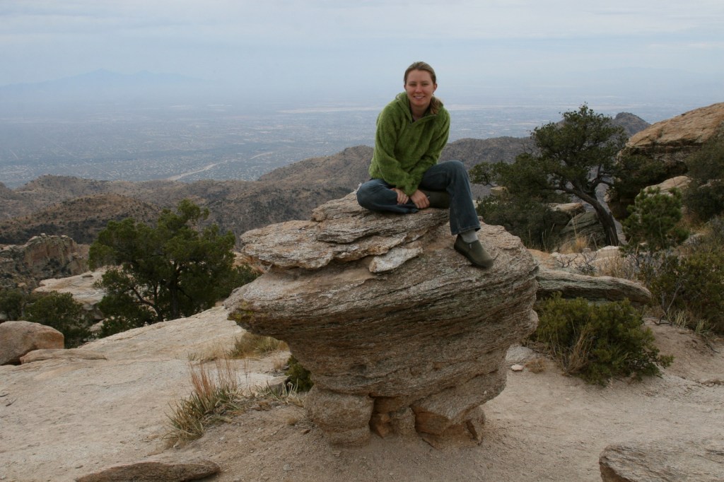
Coronado National Forest is sprinkled across the southeastern Arizona landscape, encompassing many forested “sky islands” that rise above the surrounding Sonoran Desert. The isolation of these ranges has led to the evolution of some endemic species of plants and animals unique to this region. That isolation also allows for clear night skies, so there are several peaks with astronomical observatories. The most visited portion of the forest is the Santa Catalina Mountains, easily accessible along the paved 35-mile-long Catalina Highway east of Tucson, Arizona.
Highlights
Catalina Highway, Sabino Canyon Recreation Area, Mt. Lemmon, Windy Point, Madera Canyon, Sky Island Scenic Byway, Mt. Graham, Onyx Cave, Madera Canyon, Mt. Hopkins Observatory, Pena Blanca Lake, Ramsey Canyon, Miller Peak, Cochise Stronghold
Must-Do Activity
The Santa Catalina Mountains offer many recreational opportunities, from road biking to downhill skiing at the top of 9,157-foot Mt. Lemmon (the southernmost ski area in the U.S.). The scenic beauty and expansive vistas along the Catalina Highway are worth the many switchbacks, and you might drive past some of the most famous triathletes in the world who train here in the winter. The drive ascends through multiple life zones from saguaro-dotted desert to ponderosa pine forest. At the base of the Santa Catalina Mountains is the busy Sabino Canyon Recreation Area (fee).
Best Trail
Box Camp Trail is special to us as it was the site of our first date, marriage proposal, and wedding ceremony. Over the course of 13 miles, Box Camp Trail drops 5,000 feet in elevation from ponderosa pine forest through pinyon-juniper woodland to the desert of Sabino Canyon dominated by saguaro cacti. The rugged trail disappears in places, but offers incredible views along the way. Route finding is required as the trail is somewhat overgrown (with downed trees from wildfires), plus the one-way hike requires two cars, one left at Sabino Canyon Recreation Area and one at the trailhead on the Catalina Highway.
Watchable Wildlife
The Sonoran Desert is home to numerous unique wildlife species from roadrunners to Coues white-tailed deer. Many of the animals are nocturnal to avoid the heat of the day, including ringtails (or ring-tailed cats), kangaroo rats, and javelinas (or collared peccaries). The “sky islands” provide habitat for black bears, coyotes, skunks, mountain lions, bobcats, pronghorns, mule deer, and elk. Sabino Canyon Recreation Area is known for its coatis, relatives of raccoons that typically travel in packs.
Instagram-worthy Photo
Windy Point is a spectacular overlook along the Catalina Highway in the pinyon-juniper woodland zone. Not a bad spot for wedding photos, if we do say so ourselves.
Peak Season
Spring and fall
Fees
There is a fee to park at Sabino Canyon Recreation Area, plus a charge for the tram ride. Check the USFS website for details.
Road Conditions
The paved Catalina Highway is sometimes closed due to snow and ice in the winter. There are some rough roads in this part of the Sonoran Desert, and especially be aware of the potential for flash flooding.
Camping
There are designated campgrounds along the Catalina Highway and throughout Coronado National Forest. We dispersed camped near Dragoon Springs Station south of Interstate 10, but the access roads were in bad shape.
Santa Catalina MountainsTiff in the Santa Catalina MountainsSanta Catalina Mountains with saguaro in foregroundSanta Catalina MountainsScott and Wendigo on Box Camp TrailTiff at Windy PointBox Camp Trail wedding ceremonyWedding photos at Windy PointDragoon Springs Station
Emory oak, Arizona oak, Mexican blue oak, Arizona rosewood, black alder, Arizona walnut, velvet ash, Arizona sycamore, quaking aspen
Explore More – Who was the famous ecologist that studied the similarity of increasing elevation to increasing latitude more than a century ago in the Santa Catalina Mountains?
Learn more about this and the 154 other National Forests in our new guidebook Out in the Woods
We are a participant in the Amazon Services LLC Associates Program, an affiliate advertising program designed to provide a means for us to earn fees by linking to Amazon.com and affiliated sites.
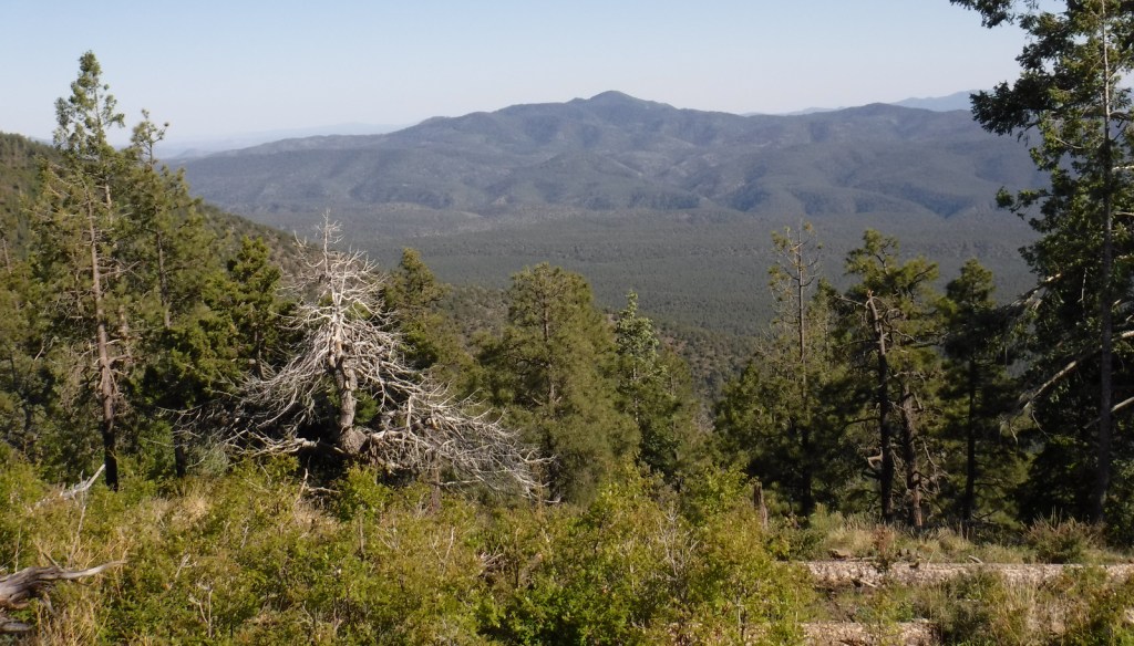
Growing up in Arizona, we only ever heard this referred to as Apache-Sitgreaves National Forest since it was merged in 1974. The more eastern Apache National Forest section represents about 69% of the combined forests total acreage and partly spills into New Mexico. On its west side it borders the Fort Apache and the San Carlos Indian Reservations, only containing one side of Mt. Baldy (which is famous for its ski resort). The National Forest contains the eastern portions of the White Mountains and Mogollon Rim, a forested escarpment that cuts 200 miles across much of the state of Arizona.
Highlights
Coronado Trail Scenic Byway, Mt. Baldy, Butler Canyon, Escudilla National Recreation Trail, Hannagan Meadow, Chitty Canyon, Big Tree Trail, Eagle National Recreation Trail
Must-Do Activity
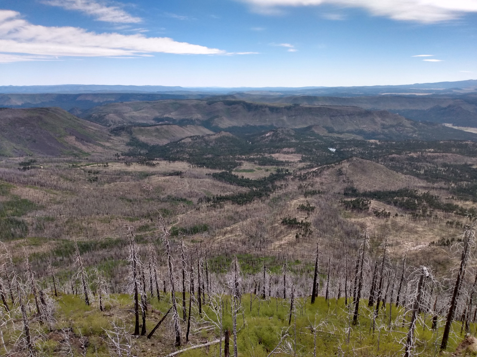
The Coronado Trail Scenic Byway (Highway 191) is a narrow, winding paved road that runs 120 miles north-south through Apache National Forest and is the best way to explore. Near the northern end of the highway, a steep unpaved road leads east up to the trailhead for Escudilla National Recreation Trail. A fire burned the 10,912-foot mountain that the trail summits and on our hike in May 2020 we counted 75 downed trees that we had to step over, both on the three miles in and the three miles out. To the east, the remote Blue Range Primitive Area was created in 1933, but has yet to receive Wilderness designation. About 18 miles south of Alpine make a stop at the historic Hannagan Meadow lodge, the only place to get gas along the route (or air if like us you have to put on your spare tire). The highway continues south dropping down from the Mogollon Rim into a more desert-like environment.
Best Trail
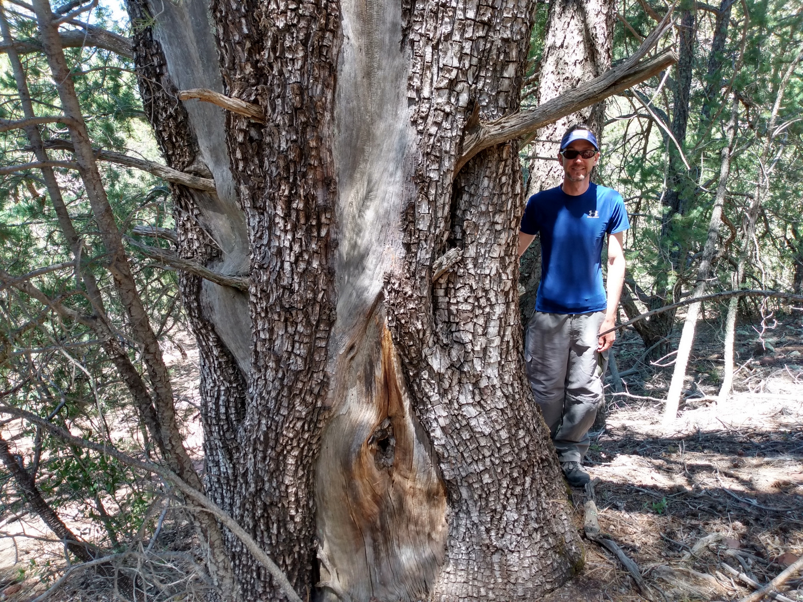
A short, but worthwhile hike descends west from Sardine Saddle near the southern end of the Coronado Trail Scenic Byway. At the end of the 0.4-mile trail is the largest Arizona cypress tree growing in the United States (97 feet tall with a 181-inch trunk circumference). There are also some big alligator juniper trees growing near the bottom of the canyon, and if you see their bark you will realize why they got their name.
Watchable Wildlife
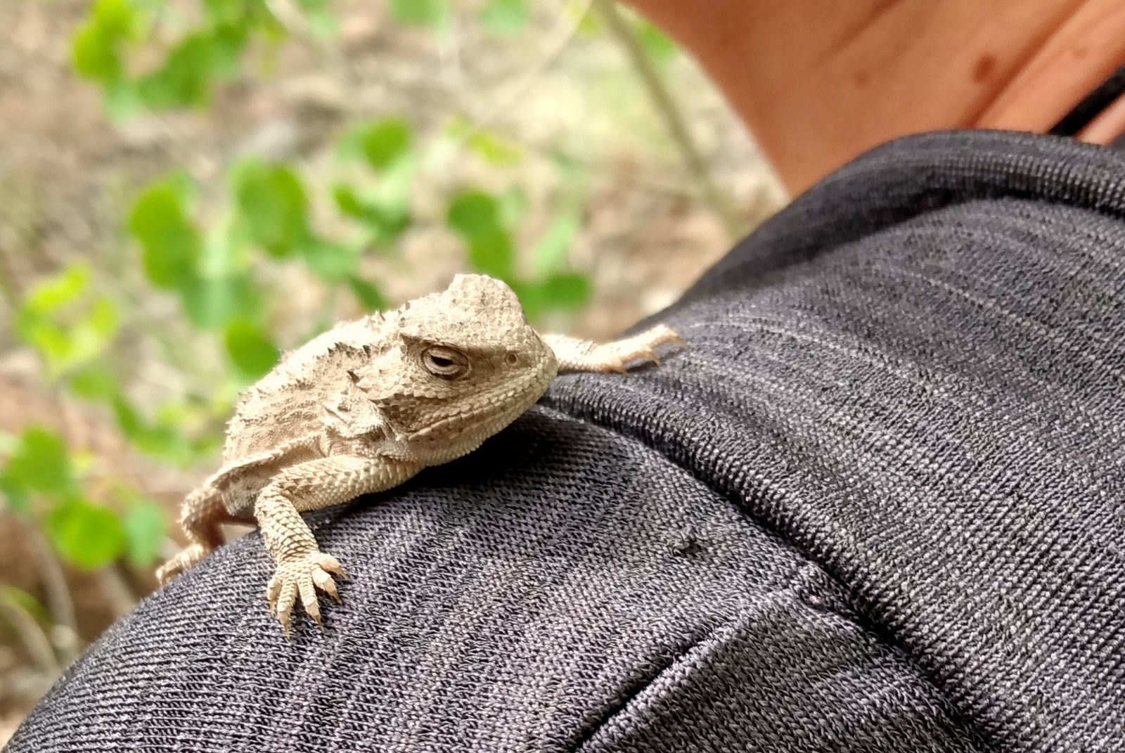
We were excited to find horned lizards (a.k.a. frogs or toads) along the Escudilla National Recreation Trail. The cliffs of the Mogollon Rim provide good thermal updrafts so are a good place to looks for turkey vultures and a variety of raptors. The ranges of mule deer and Coues whitetail deer overlap in this part of the country. We saw turkeys on the road back to Rose Spring Trail (Forest Road 54).
Instagram-worthy Photo
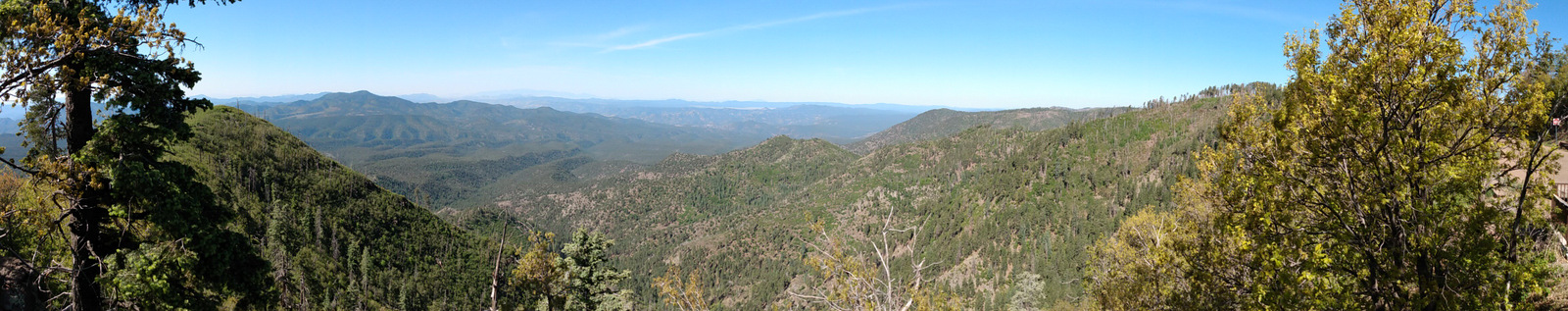
There are great views from atop the Mogollon Rim at Blue Point Overlook on the Coronado Trail Scenic Byway.
Peak Season
Spring and fall
Fees
None
Road Conditions
Highway 191 is paved, but is a slow drive due to its many curves. Many of the side roads are very rough and a high-clearance vehicle is recommended. We got a flat tire on the rocky Forest Road 54.
Camping
There are several developed campgrounds, including one at Luna Lake and several along the East Fork of the Black River. Dispersed camping options abound, including on the road to Escudilla National Recreation Trail and we found a nice campsite near the entrance to Forest Road 54.
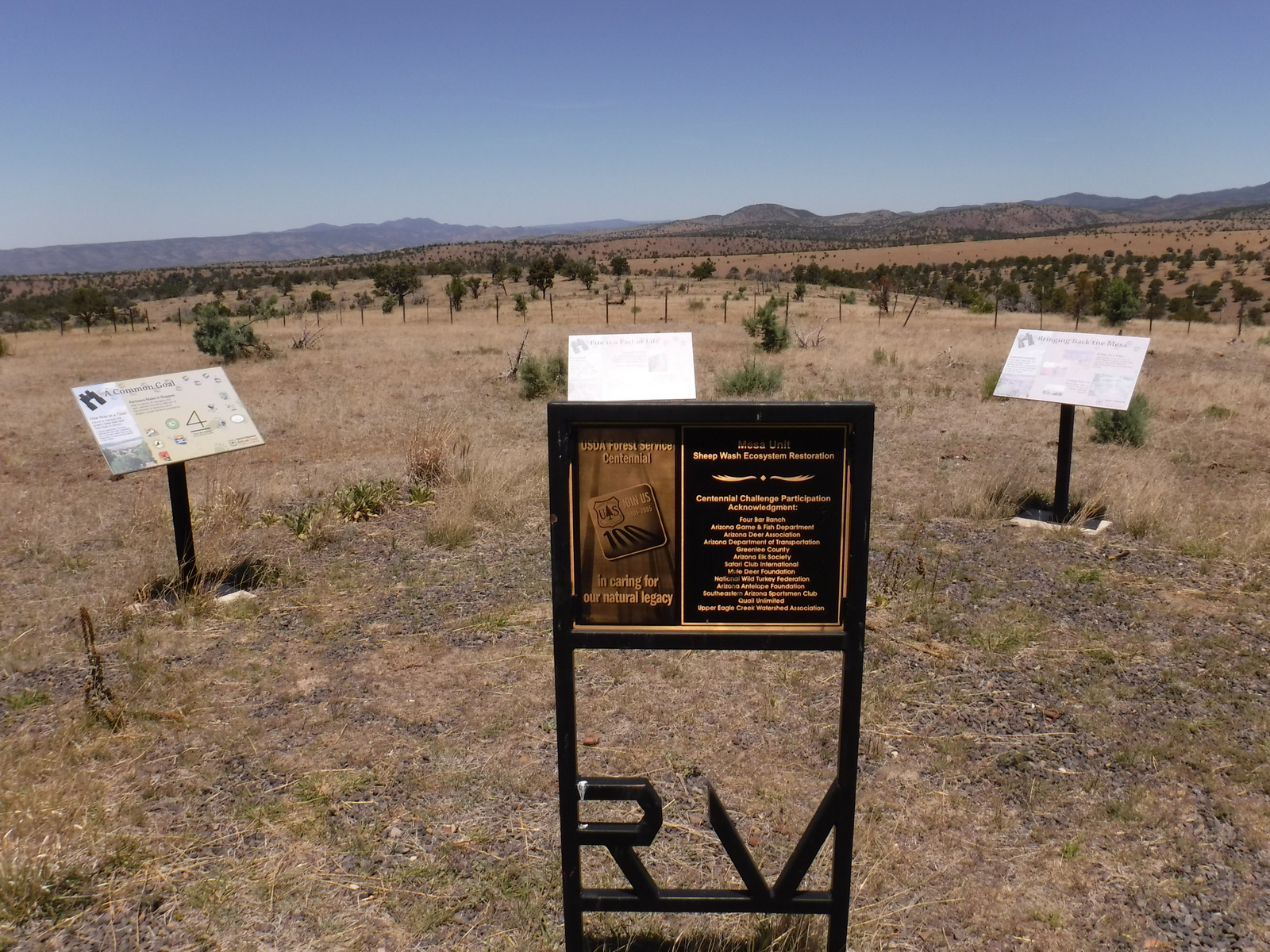
Scott and his mother on Escudilla National Recreation TrailHorned lizardHornzed lizard on Tiff’s shoulderView from Escudilla National Recreation TrailScott and Tiff at the end of Escudilla National Recreation TrailAspen groveAspen tree eating Wilderness boundary signTurkeysTiff in a hammock at our dispersed campsiteInterpretive signs along the Coronado Trail Scenic BywayCoronado Trail Scenic BywayScott’s mother with the champion Arizona cypressClaret cup hedgehog cactusScott with an alligator juniper tree
We are a participant in the Amazon Services LLC Associates Program, an affiliate advertising program designed to provide a means for us to earn fees by linking to Amazon.com and affiliated sites.
Start your U.S. National Parks, National Forests, and National Monuments adventure here!