Tag Archives: North Carolina

Croatan National Forest

Croatan National Forest

North Carolina

Managed by U.S. Forest Service, Southern Region

308,234 acres (159,885 federal/ 148,349 other)

Website: https://www.fs.usda.gov/nfsnc

Overview

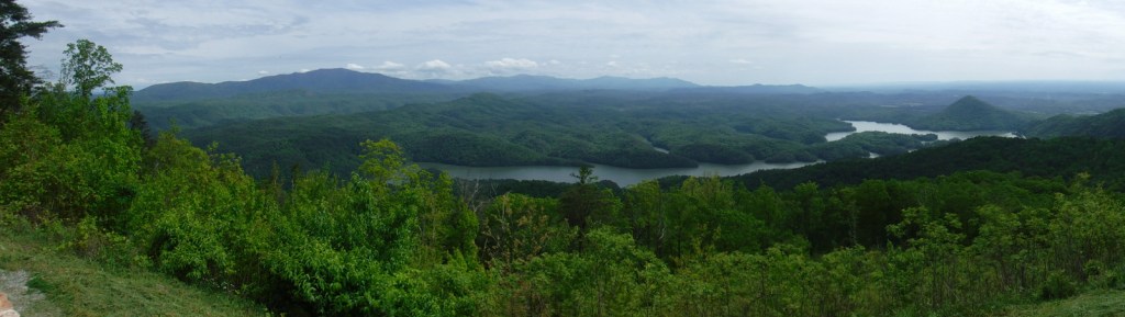
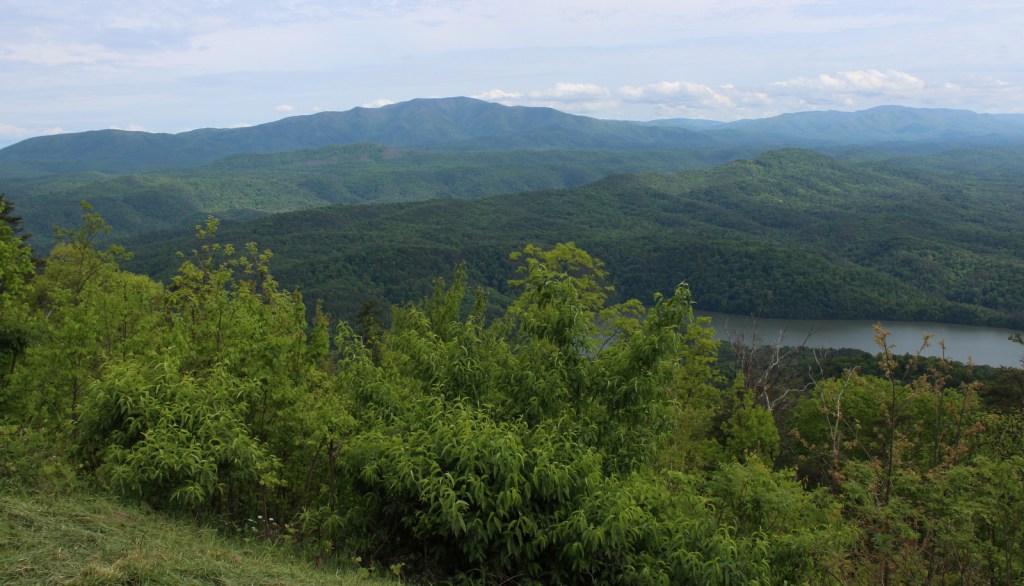
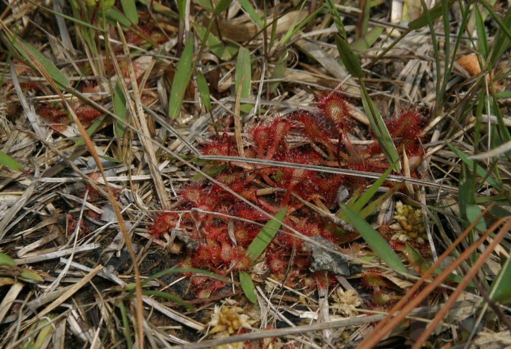
The sandy soil of North Carolina’s coastal plain is where you will find Croatan National Forest, the land of the longleaf pine (which is the official state tree).  Longleaf pines are adapted to frequent surface fires by going through a “grass stage” when young, so the Forest Service conducts controlled burns in some stands.  Much of the National Forest has standing water (in pocosins and Carolina bays), which is why there is not a single trail through its 31,000 acres of designated Wilderness areas.  Pocosins are raised bogs and home to 11 species of carnivorous plants, including the federally-protected Venus flytrap.  A Carolina bay is one of many oval-shaped depressions typically filled with water that are oriented in a northwest-southeast direction across the coastal plain.  They range in size from small ponds to two miles in diameter, but the exact cause of their formation is unknown.

Highlights

Cedar Point Tideland National Recreation Trail, Flanner Beach, Fishers Landing, Brice Creek canoe trail, Black Swamp OHV Trail, Island Creek Trail, Patsy Pond Nature Trail, Cedar Point Tideland National Recreation Trail, Neusiok Trail

Must-Do Activity

To find some of the 11 species of carnivorous plants in Croatan National Forest, you will have to work a little bit.  Pull off one of the highways that bisect the area and hike to the edge of a pocosin, where scrubby vegetation grows in highly-acidic black soil.  Pitcher plants, bladderworts, sundews, and Venus flytraps utilize different methods to capture insects and spiders in order to sap their nitrogen and other nutrients that are scarce in the water-logged soil.  To trigger a tiny Venus flytrap to close, an insect must touch one hair twice or multiple hairs within 20 seconds.  They are often found adjacent to larger pitcher plants, which lure insects inside by color or odor, then are too slick-walled to escape.  Sundews and the butterwort utilize a sticky substance to capture their prey.  The five species of bladderworts float in shallow water where they capture swimming prey that trigger a trap door.

Best Trail

The Cedar Point Tideland National Recreation Trail is a 1.4-mile loop located partially on a boardwalk near the mouth of the White Oak River.  There are also two long trails through the swamps and pine forests: Neusiok Trail (21 miles) and Weetock Trail (14 miles).  There are no designated trails through Croatan National Forest’s 31,000 acres of designated Wilderness areas. 

Watchable Wildlife

Black bears in this region can get very big since they generally do not hibernate in the winter.  Other large mammals found are bobcats, raccoons, river otters, and muskrats.  Great blue herons, snowy egrets, ospreys, bald eagles, peregrine falcons, wild turkeys, woodcocks, and northern bobwhite quail are major bird species.  There are a variety of reptiles and amphibians, including alligators, anoles, cottonmouths, copperheads, canebrake rattlesnakes, pigmy rattlesnakes, and eastern diamondback rattlesnakes.  The tannic-stained blackwater supports fish like warmouth, redfin pickerel, sunfish, bowfin, yellow bullhead catfish, and the rare swampfish (a species of cavefish). 

Instagram-worthy Photo

Carnivorous pitcher plants have large showy flowers that bloom in early May.

Peak Season

Spring and fall

Fees

None

Road Conditions

The major highways (17, 58, 70) that cross the National Forest are paved, and the sandy, unpaved roads are generally in good shape except when flooded.

Camping

There are Forest Service campgrounds at Flanner Beach on the Neuse River and Cedar Point along the White Oak River.

Wilderness Areas

Catfish Lake South Wilderness

Pocosin Wilderness

Pond Pine Wilderness

Sheep Ridge Wilderness

Related Sites

Cape Lookout National Seashore (North Carolina)

Fort Raleigh National Historic Site (North Carolina)

Moores Creek National Battlefield (North Carolina)

Nearest National Park

Congaree

Conifer Tree Species

baldcypress, longleaf pine, loblolly pine, shortleaf pine, pond pine, eastern redcedar, Atlantic white-cedar

Flowering Tree Species

black gum, umbrella magnolia, southern magnolia, northern red oak, southern red oak, white oak, water oak, chestnut oak, overcup oak, black cherry, sassafras, American holly, yaupon holly, Hercules’ club, sweetgum, red maple, sugar maple, white alder, witch hazel, American beech, black walnut, tulip-poplar, hophornbeam, musclewood, red mulberry, flowering dogwood, loblolly bay, red bay, sweet bay magnolia, titi

Explore More – What is the origin of the National Forest’s name and how does it relate to Fort Raleigh National Historic Site?

Learn more about this and the 154 other National Forests in our new guidebook Out in the Woods

We are a participant in the Amazon Services LLC Associates Program, an affiliate advertising program designed to provide a means for us to earn fees by linking to Amazon.com and affiliated sites.

Cherokee National Forest

Cherokee National Forest

Tennessee, North Carolina

Managed by U.S. Forest Service, Southern Region

1,204,847 acres (655,598 federal/ 549,249 other)

Website: https://www.fs.usda.gov/cherokee

Overview

The southern Appalachian Mountains have some of the highest biodiversity in the United States, with more than 20,000 species of plants and animals.  In the heart of this region, Cherokee National Forest is located north and south of Great Smoky Mountains National Park in eastern Tennessee.  Abundant rainfall and steep terrain make whitewater rafting a popular activity, especially on the Ocoee National Wild and Scenic River.

Highlights

Cherohala Skyway, Hiwassee River, Bald River Falls, Ocoee Scenic Byway, Boyd Gap Observation Site, Turtletown Creek Falls Scenic Area, Ocoee Whitewater Center, Coker Creek Scenic Area, Dudley Falls Picnic Area, Watauga Lake, Rock Creek Gorge Scenic Area, Laurel Fork Falls, Bald Mountain Ridge Scenic Area, Unaka Mountains Scenic Area, Doe River Gorge Scenic Area, Backbone Rock, Rogers Ridge Scenic Area, Conasauga River Blue Hole, Gee Creek Falls, Roan High Knob, Falls Branch Falls, Tanasi Trail System, John Muir National Recreation Trail, Margarette Falls Trail, Warrior’s Passage National Recreation Trail, Appalachian National Scenic Trail

Must-Do Activity

Cherokee National Forest is celebrated for its numerous waterfalls, two highlights being 60-foot-tall Margarette Falls and 65-foot Benton Falls, both accessible by short hikes.  If you visit during the fall foliage season, popular driving routes include the 26-mile Ocoee Scenic Byway and 43-mile Cherohala Skyway that climbs over 4,500 feet in elevation into North Carolina’s Nantahala National Forest.  We were intrigued by reading about the Conasauga River Blue Hole, where visitors can snorkel with fish and turtles in the shallows and deep pools. 

Best Trail

On the north side of Ocoee Lake, the Clemmer Trailhead is located right along Highway 30, a quarter mile off Highway 64.  From here one trail follows picturesque Rock Creek Gorge, which is known for its waterfalls.  Mountain bikers can follow several other trails and connect into the trail system around Benton Falls and McCamy Lake in the Chilhowee Recreation Area.  Altogether, the National Forest boasts 700 miles of trail, including a famous stretch of the Appalachian National Scenic Trail through the Roan Highlands.

Watchable Wildlife

Large mammals found in Cherokee National Forest include white-tailed deer, raccoons, skunks, opossums, river otters, beavers, squirrels, bobcats, red foxes, gray foxes, coyotes, and black bears.  In addition to songbirds common to eastern forests, watch the skies for turkey vultures, peregrine falcons, bald eagles, and a variety of hawks.  This area is known for its high diversity of salamanders, including hellbenders and Jordan’s salamanders.  This region also has many reptiles, like eastern box turtles, common snapping turtles, southeastern five-lined skinks, timber rattlesnakes, northern copperheads, and rat snakes (like the one we saw on the Benton Falls Trail). The many streams and rivers support rainbow, brook, and brown trout, while lakes have largemouth bass, bluegills, and crappies.

Instagram-worthy Photo

The whitewater rapids are less intense on the Hiwassee River, which is also followed by Highway 30, the 21-mile long John Muir National Recreation Trail, and a portion of the 300-mile Benton MacKaye Trail. 

Peak Season

Summer and fall

Fees

There is a $3 day-use fee at the Chilhowee Recreation Area and there are likely fees to park elsewhere in this massive National Forest. 

Road Conditions

The scenic byways we drove were all paved, but we found the gravel road up to Chilhowee Recreation Area to be rough and steep, though still easy enough for any passenger car.

Camping

There are countless campgrounds in Cherokee National Forest, but Chilhowee Campground near McKamy Lake seemed nice and provided access to an extensive trail system.

Wilderness Areas

Bald River Gorge Wilderness

Big Frog Wilderness (also in Chattahoochee National Forest)

Big Laurel Branch Wilderness

Citico Creek Wilderness

Cohutta Wilderness (also in Chattahoochee National Forest)

Gee Creek Wilderness

Joyce Kilmer-Slickrock Wilderness (also in Nantahala National Forest)

Little Frog Mountain Wilderness

Pond Mountain Wilderness

Sampson Mountain Wilderness

Unaka Mountain Wilderness

Related Sites

Andrew Johnson National Historic Site (Tennessee)

Manhattan Project National Historical Park (Tennessee-New Mexico-Washington)

Chickamauga and Chattanooga National Military Park (Georgia)

Nearest National Park

Great Smoky Mountains

Conifer Tree Species

eastern hemlock, eastern white pine, loblolly pine, shortleaf pine, Table Mountain pine, pitch pine

Flowering Tree Species

tulip-poplar, sassafras, flowering dogwood, mountain laurel, pawpaw, American beech, white basswood, sweet buckeye, sugar maple, red maple, mountain maple, moosewood maple, yellowwood, yellow birch, cucumber magnolia, black cherry, sourwood, pale hickory, mockernut hickory, rock chestnut oak, scarlet oak, black oak, white oak, southern red oak, Catawba rhododendron, yellow birch, sweet bay magnolia, white ash, mountain-ash, mountain-laurel

Explore More – The National Forest’s Ocoee Whitewater Center hosted events during the Summer Olympics in what year?

Learn more about Cherokee and the 154 other National Forests in our new guidebook Out in the Woods

We are a participant in the Amazon Services LLC Associates Program, an affiliate advertising program designed to provide a means for us to earn fees by linking to Amazon.com and affiliated sites.

Guilford Courthouse National Military Park

Overview

Even in the wake of Patriot victories at Kings Mountain and Cowpens, the British army was not giving up their southern colonies without a fight.  Major General Nathanael Greene was in charge of the Continental Army in the southern theater and his troops were aggressively pursued by British General Charles Cornwallis.  Although he lost the battle on March 15, 1781, Greene’s name was later applied to the nearby town of Greensboro, North Carolina.

Highlights

Museum, film, Hoskins Farm, Major General Nathanael Greene statue

Must-Do Activity

Start at the National Park Service (NPS) visitor center, watch the short film (also available on the NPS website), then make stops along the 2.25-mile auto tour.  You will learn the story of what took place on March 15, 1781, when Greene’s defensive position at Guilford Courthouse was attacked by British forces.  While the Patriots withdrew they only suffered 7% casualties, compared to the British who lost 28% of their army, leading them to eventually retreat to Yorktown, Virginia.  After the battle, Greene continued to fight, leading his men against overmatched backcountry outposts of British troops such as the one at Ninety Six, South Carolina. 

Best Trail

In addition to the auto tour route, a paved bicycle path wends through the battlefield.  The lovely 229-acre Guilford Courthouse National Military Park is heavily utilized for recreation by the local people of Greensboro.  As such, you are allowed to walk your dog in the park. In the summer, you can also walk around Hoskins Farm, though its buildings are closed, as is the old Colonial Heritage Center.

Instagram-worthy Photo

Many monuments line the pathways that cut through 229-acre Guilford Courthouse National Military Park, with the equestrian statue of Major General Nathanael Greene being the most prominent.

Peak Season

Summer

Hours

https://www.nps.gov/guco/planyourvisit/hours.htm

Fees

None

Road Conditions

All roads paved

Camping

The city of Greensboro operates a campground with showers south of town.

Explore More – Which British politician remarked, “Another such victory would destroy the British Army” following the battle at Guilford Courthouse?

Cape Hatteras National Seashore

Overview

The Outer Banks of North Carolina have sparked the imaginations of travelers ever since British colonists landed here in 1585.  If you are seeking undeveloped beaches that have changed little over the centuries then this is the place to go.  The 70 miles of barrier islands protected as Cape Hatteras National Seashore are interrupted only by small seaside villages and one long section by Pea Island National Wildlife Refuge.  Bodie Island and Hatteras Island are connected by bridges, but Ocracoke Island is only accessible by ferry.

Highlights

1870 Cape Hatteras Lighthouse, 1872 Bodie Island Lighthouse, Ocracoke Island Campground, beaches

Must-Do Activity

The main National Park Service (NPS) visitor center is located at iconic Cape Hatteras Lighthouse where you can learn about shipwrecks, pirates, and the monumental effort to move the 208-foot tall brick structure in 1999.  Further down Highway 12, pick up a free ferry to Ocracoke Island, a renowned vacation destination.  Several campgrounds are found along the seashore, including one on Ocracoke.  Since this remote strip of sand is not easy to get to, you will want to spend at least a night or two.

Best Trail

Walking the beach and collecting seashells is the most popular diversion, but there are also the Hammock Hills Nature Trail on Ocracoke Island and Buxton Woods Nature Trail on Hatteras Island.

Instagram-worthy Photo

Ocracoke Lighthouse is the oldest operating lighthouse in North Carolina, dating back to 1823, but it is not open to enter inside.

Peak Season

Summer

Hours

https://www.nps.gov/caha/planyourvisit/hours.htm

Fees

None, except a fee is charged to climb Bodie Island and Cape Hatteras Lighthouses

Road Conditions

All main roads are paved and there are designated access points to drive on the beach.

Camping

There are four NPS campgrounds and they all take reservations.

Related Sites

Cape Lookout National Seashore (North Carolina)

Fort Raleigh National Historic Site (North Carolina)

Wright Brothers National Memorial (North Carolina)

Explore More – The Outer Banks are known as the “Graveyard of the Atlantic,” so how many shipwrecks have been recorded in this area?

Wright Brothers National Memorial

Overview

The Wright Brothers hailed from Dayton, Ohio but they came to the Outer Banks of North Carolina for the sustained winds they needed to get their winged contraptions off the ground.  They glided from the top of Kill Devil Hill more than a thousand times between 1900 and 1902.  Then on December 17, 1903 they finally made history: twelve-seconds of motor-powered, man-carrying flight in a heavier-than-air airplane.  After the fourth and longest flight (59 seconds) that day the flying machine was irreparably crashed and the brothers headed back to Ohio. 

Highlights

Museum, replica flyer and glider, monument, sculpture

Must-Do Activity

Since 1932, a massive granite monument has stood atop the 90-foot tall hill, which is actually a sand dune stabilized with planted grass.  Visitors to Kitty Hawk will also find a replica flyer and glider, reconstructed hangar, boulders marking the landing spot of each of the four flights, and a life-size bronze sculpture added on the first flight centennial in 2003. 

Best Trail

A paved walkway connects the Wright Brothers Monument atop Kill Devil Hill with the five boulders marking the lift-off point and four landings that occurred on December 17, 1903.

Instagram-worthy Photo

A full-scale replica of the 1903 flyer is located inside the museum run by the National Park Service (NPS).  Rangers give lectures in that room throughout the day, also explaining details of the replica 1902 glider.

Peak Season

Summer and every December 17

Hours

https://www.nps.gov/wrbr/planyourvisit/hours.htm

Fees

$10 per person or America the Beautiful pass

Road Conditions

All roads paved

Camping

There are NPS campgrounds located south of the memorial in Cape Hatteras National Seashore.

Related Sites

Dayton Aviation Heritage National Historical Park (Ohio)

Fort Raleigh National Historic Site (North Carolina)

Cape Hatteras National Seashore (North Carolina)

Explore More – The 1903 flyer on display here is a replica, so where is the original exhibited?

We are a participant in the Amazon Services LLC Associates Program, an affiliate advertising program designed to provide a means for us to earn fees by linking to Amazon.com and affiliated sites.