Overview
Perry’s Victory and International Peace Memorial is located on South Bass Island in western Lake Erie. Commodore Oliver Hazard Perry not only had the best name in the War of 1812, his naval victory near here on September 10, 1813 was a turning point. The 1817 Rush-Bagot Agreement is still in effect today, assuring that the U.S. and Canada maintain the world’s longest undefended international border. The 352-foot tall memorial tower was built between 1912-15 and became part of the National Park Service (NPS) system in 1936.

Highlights
Museum, film, 352-foot tall memorial tower, black squirrels
Must-Do Activity
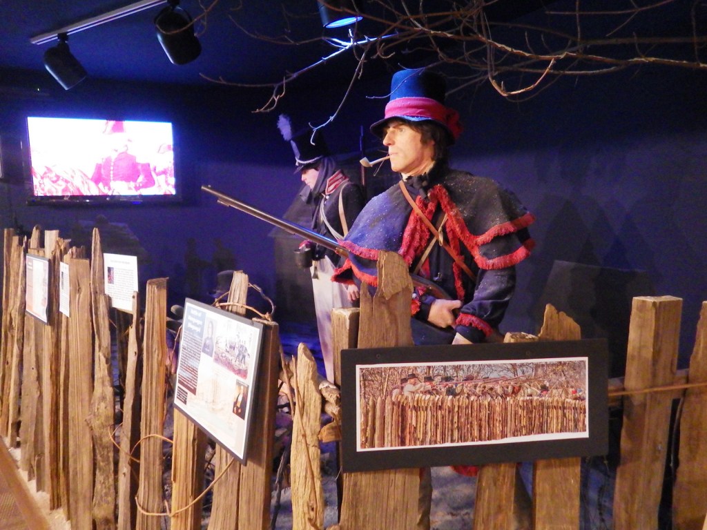
After departing from your ferry or airplane, head to the NPS visitor center for the free museum and film, then pay for your ticket to ascend the granite memorial tower in an elevator. On a sunny day the views from the 317-foot tall viewing level across Lake Erie are splendid, including the shoreline of Canada and the roller coasters at Cedar Point. The rotunda at the tower’s base also contains the remains of three American and three British soldiers who died during the 1813 battle.
Best Trail
It is about two miles from the ferry terminal to the NPS visitor center, but if the weather is nice it is a pleasant walk on roads that are not busy.
Instagram-worthy Photo
The windows facing the memorial tower at the NPS visitor center are mirrored, which makes for a really interesting and distorted reflection.

Peak Season
Summer (May to October is the only time you can enter the memorial)
Hours
Open seasonally: https://www.nps.gov/pevi/planyourvisit/hours.htm
Fees
Free for museum, $10 per person for elevator to top of tower or free with America the Beautiful pass
Road Conditions
South Bass Island is only accessible by boat or airplane. Ferry service allows you to bring your own vehicle to the island, which is small enough to walk everywhere or drive in a rental golf cart.
Camping
South Bass Island State Park has more than 100 primitive campsites on the island and East Harbor State Park on the mainland has more than 500 campsites with modern facilities.
Related Sites
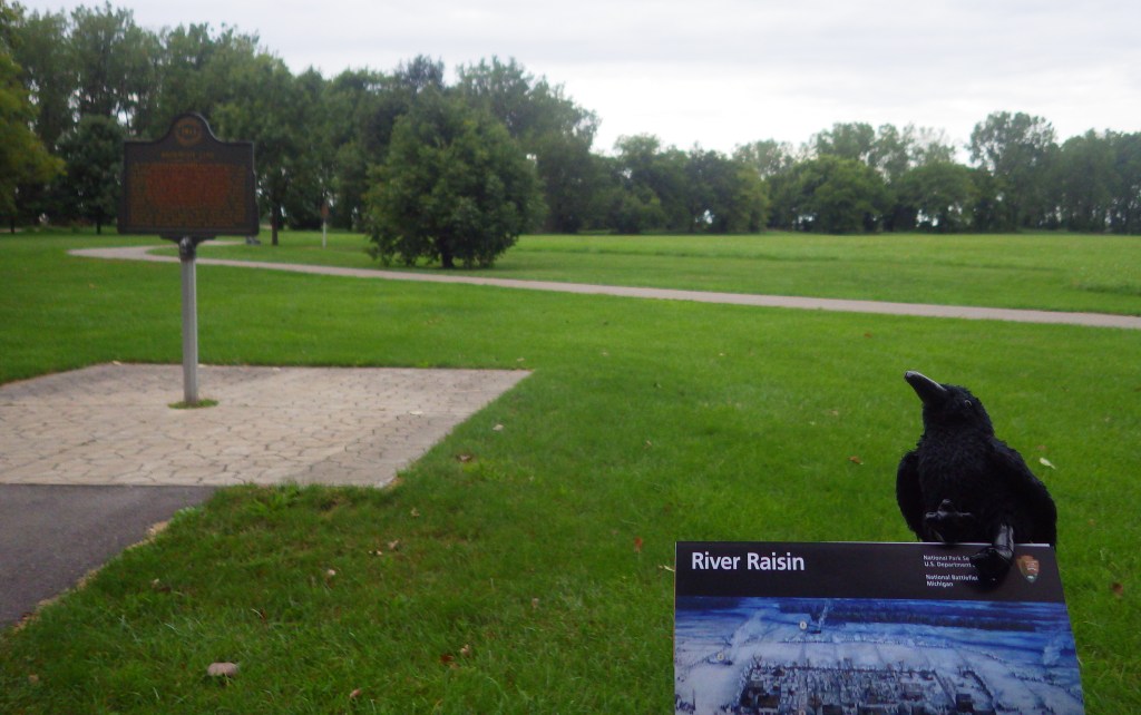
River Raisin National Battlefield Park (Michigan)
Cuyahoga Valley National Park (Ohio)
Dayton Aviation Heritage National Historical Park (Ohio)

The MV Put-In-Bay ferry to the island 
A view of the monument from the boat 

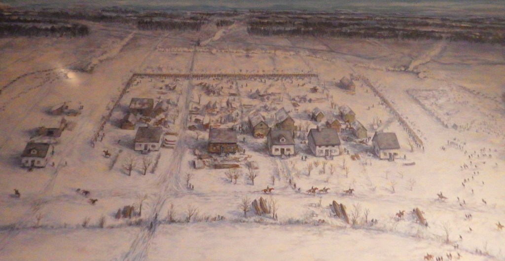
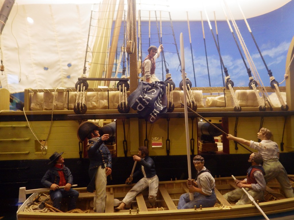
Artist’s depiction of the battle 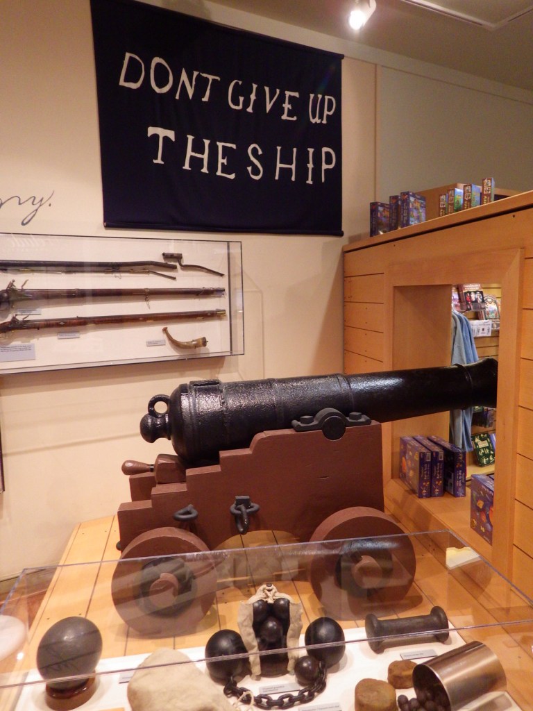
Don’t give up the ship! 
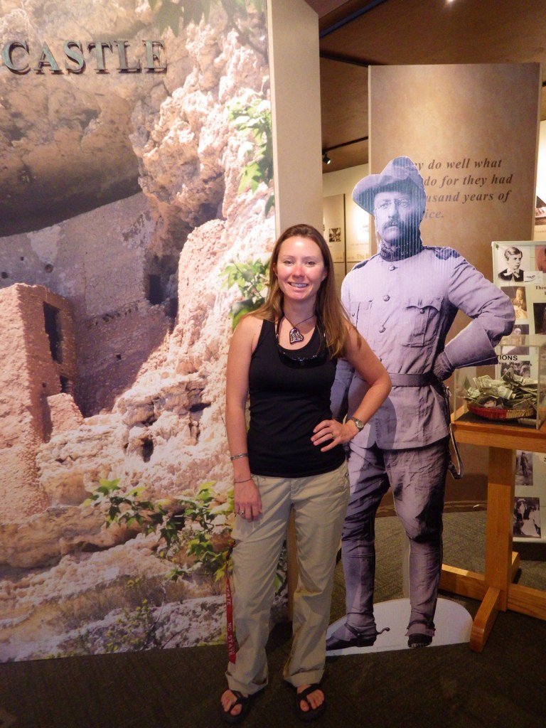
Tiff with Oliver Hazard Perry 
Tiff on the viewing platform 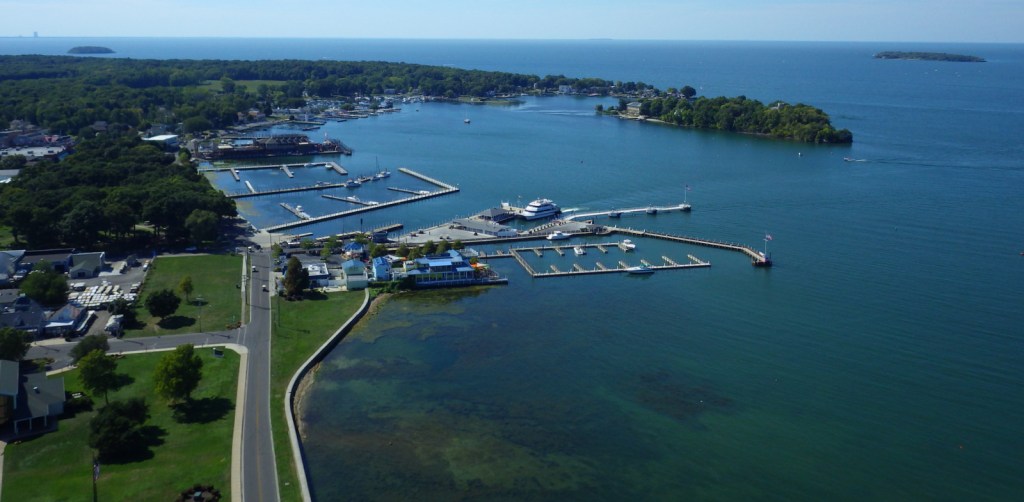
Looking at Lake Erie from the viewing platform 

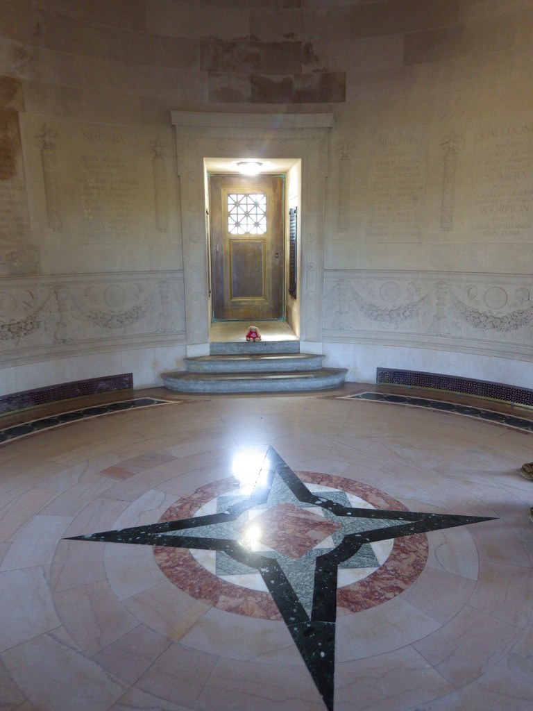
The rotunda is also a mausoleum
Explore More – What is the significance of the “DON’T GIVE UP THE SHIP” flag?

We are a participant in the Amazon Services LLC Associates Program, an affiliate advertising program designed to provide a means for us to earn fees by linking to Amazon.com and affiliated sites.