East of the Continental Divide in Montana, Lewis and Clark National Forest is split across eight mountain ranges east and west of the Missouri River. The largest western section butts up against Glacier National Park to the north and includes parts of the Scapegoat and the Bob Marshall Wilderness areas, which provide crucial habitat for grizzly/brown bears and world-class places for backpacking. The Lewis and Clark Forest Reserve dates back to 1897, with the now-defunct Jefferson and Absaroka National Forests added in 1932 and 1945 respectively. Since 2014, it has been co-managed with Helena National Forest.
Highlights
King Hill Scenic Byway, Cataract Falls, Sun River Gorge, Gibson Reservoir, Mt. Wright, Deep Creek Loop National Recreation Trail, Windy Mountain Trail, Crystal Cascades Trail, Crystal Lake Shoreline Loop Trail, Continental Divide National Scenic Trail
Must-Do Activity
We have always wanted to visit the National Park Service and U.S. Forest Service’s 25,000 square-foot Lewis and Clark Interpretive Center in Great Falls, Montana. It features an exhibit hall, hiking trails, and a 158-seat theater, and it is open daily in the summer and Wednesday through Sunday in the offseason. We have also wanted to backpack in the rugged Snowy Mountains, which draw backcountry skiers in the winter and horseback riders in the summer. We will have to return to this central part of Montana, which includes one of our favorite places to explore: Upper Missouri River Breaks National Monument run by the Bureau of Land Management.
Best Trail
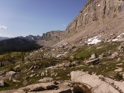
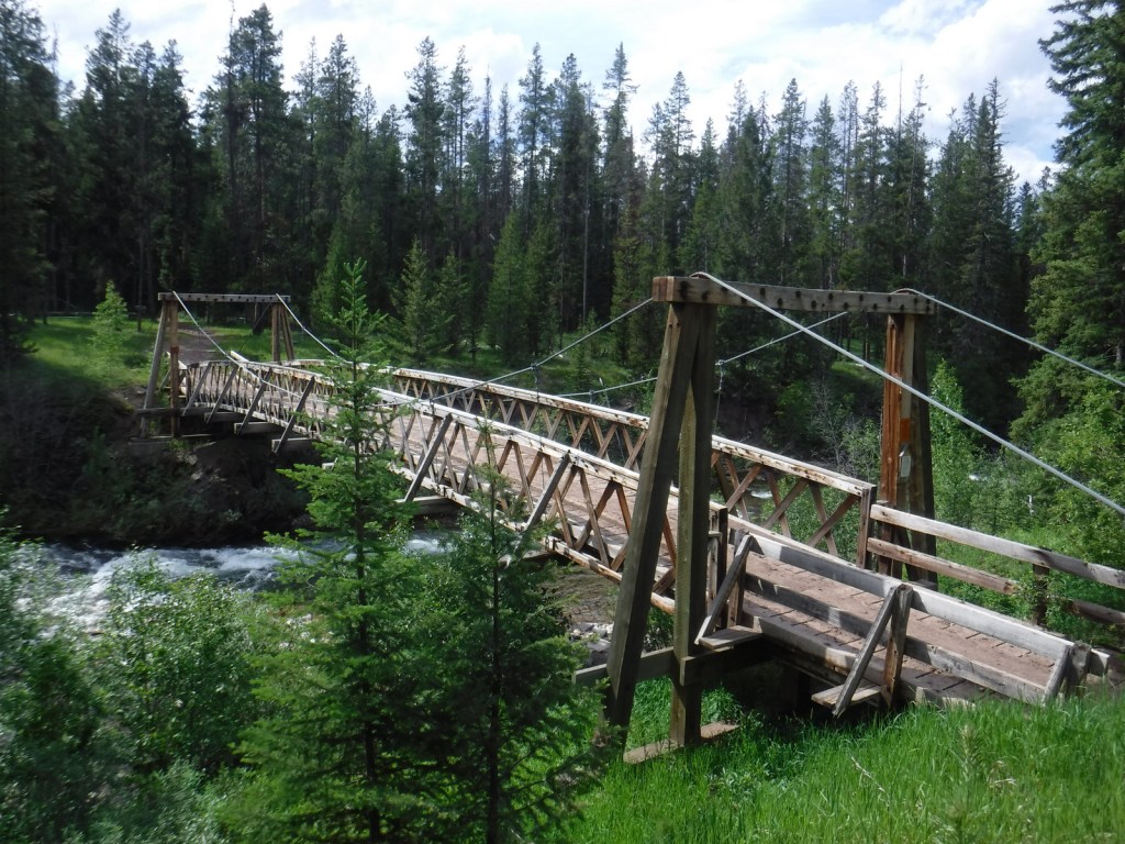
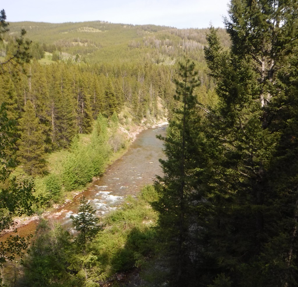
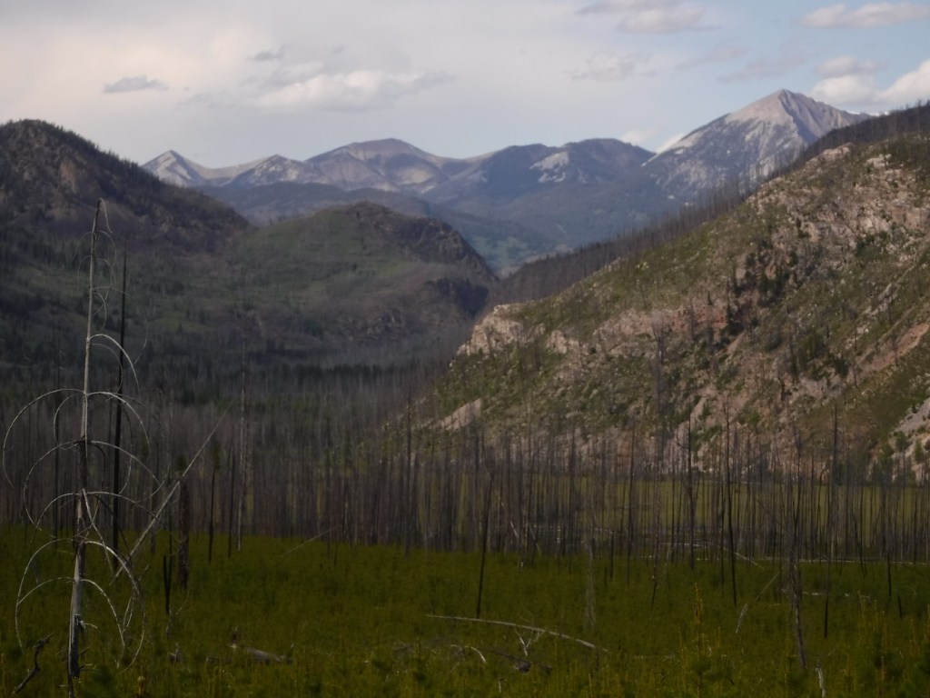
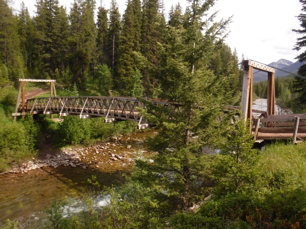
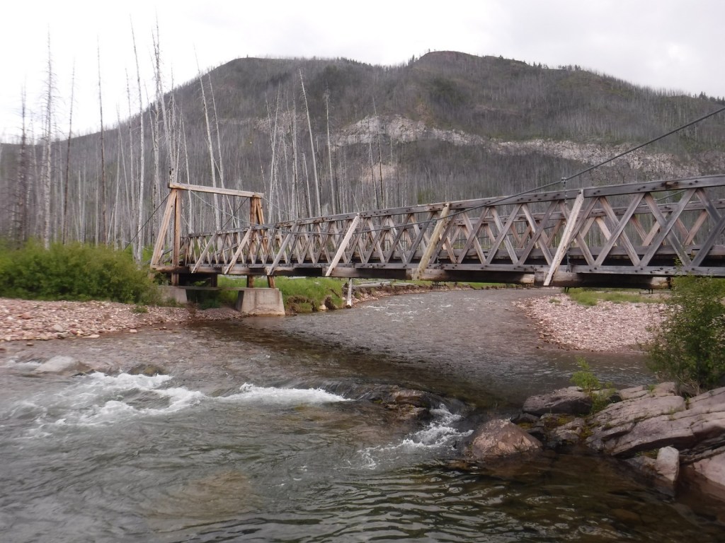
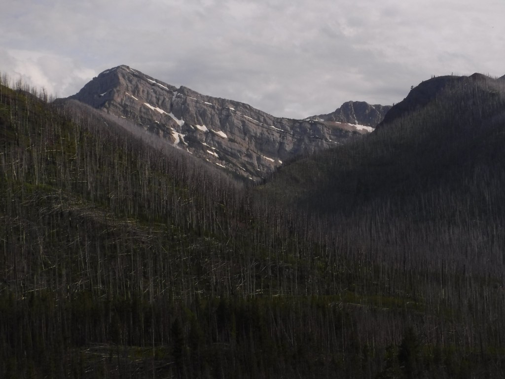
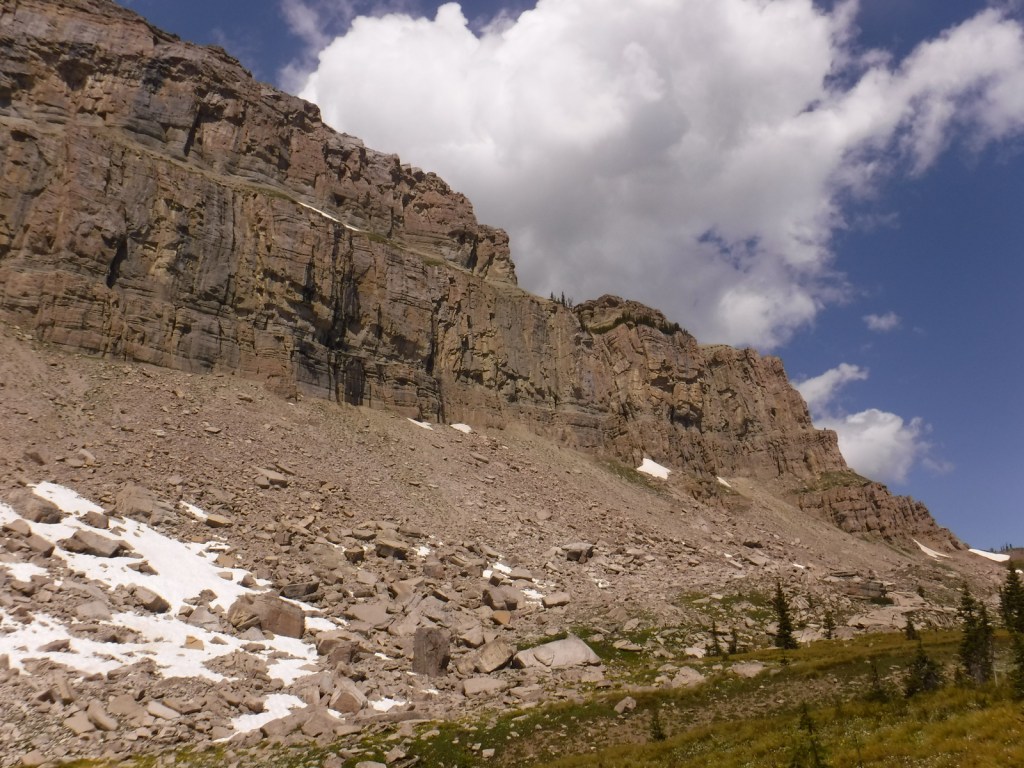
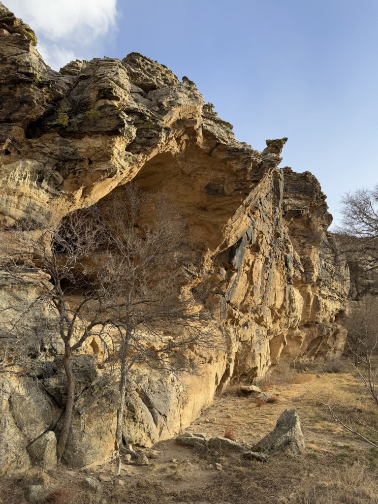
One of the most famous formations along the Continental Divide National Scenic Trail is the 15-mile long Chinese Wall, a 1,000-foot-tall cliff composed of five-million-year-old limestone. Its closest access is 15 miles one-way from the South Fork Sun Trailhead, which is often marked as Packers on maps at the end of the gravel Benchmark Road (Forest Road 235). The trail begins by following the South Fork Sun River before crossing a bridge and entering the Bob Marshall Wilderness. We got a late start on the way in and came across a grizzly/brown bear grazing near the trail that evening and, on the drive out, we stopped to photograph three moose near Wood Lake Campground and a common loon in Anderson Lake.
Watchable Wildlife
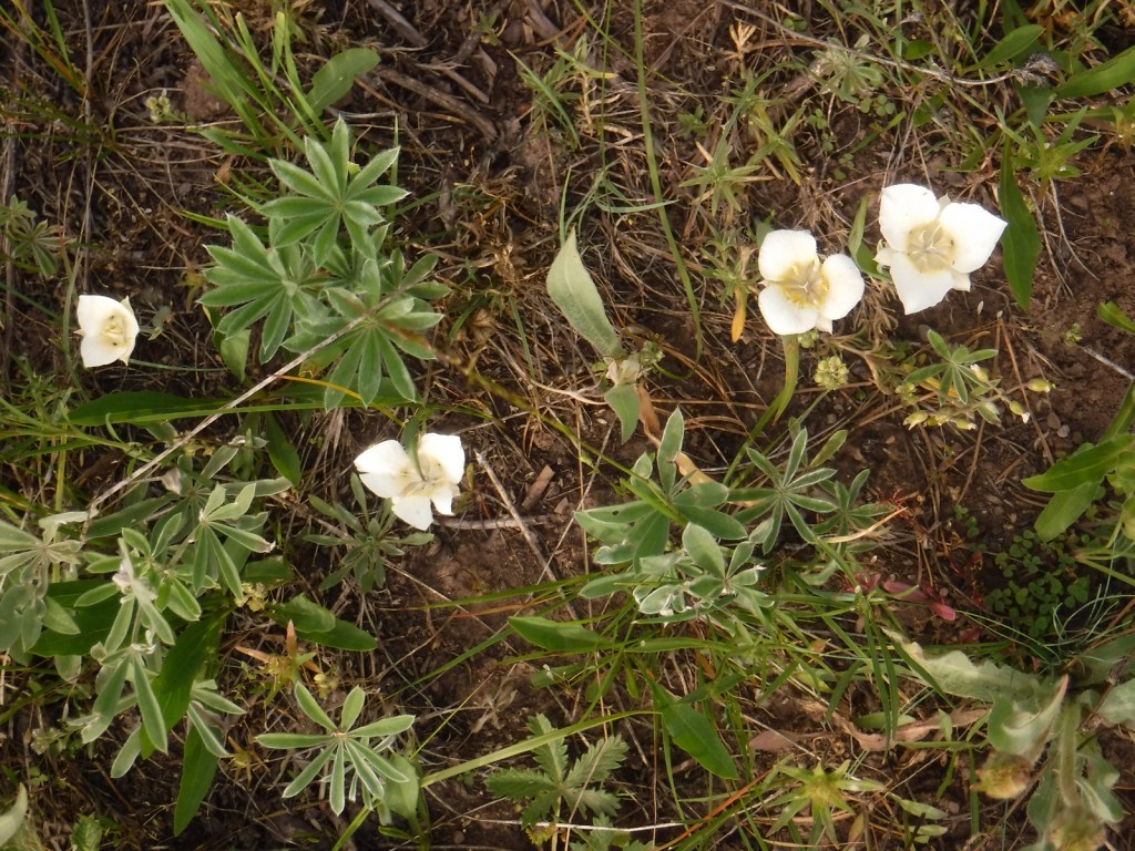
Grizzly/brown bears are the most famous residents of the National Forest. Additional mammals include black bears, mountain lions, Canada lynxes, wolverines, mule deer, Columbian white-tailed deer, mountain goats, bighorn sheep, elk, and moose. Bald eagles, red-tailed hawks, and three types of grouse are often spotted. There are excellent fly-fishing opportunities in the 1,600 miles of rivers and streams.
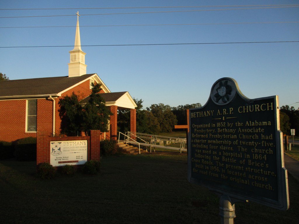
None except for the Lewis and Clark Interpretive Center in Great Falls, which costs $8 per person or you can use an America the Beautiful pass.
Road Conditions
We drove the gravel Benchmark Road (Forest Road 235), which was long and in excellent condition.
Camping
There are 29 vehicle-accessible campgrounds in Lewis and Clark National Forest, including Wood Lake Campground near the South Fork Sun Trailhead. Backcountry and dispersed camping options abound.
Lassen National Forest Reserve dates back to 1905, then a decade later when Lassen Peak explosively erupted (the first eruption to be photographed in the continental U.S.), 106,589-acre Lassen Volcanic National Park was carved out. The two federal areas are connected by the 187-mile-long Lassen Scenic Byway (Highways 44 and 89) that traces the volcanic legacy of the southern Cascade Range. The 41,100-acre Ishi Wilderness was named in 1984 to honor the last surviving member of the Yahi band of Southern Yanas, taken from his native home near Oroville in 1911 and employed as a janitor at the University of California’s Anthropology Museum in San Francisco until his death from tuberculosis five years later.
Highlights
Lassen Scenic Byway, Lake Almanor, Eagle Lake, Subway Cave, Hat Creek Recreational Area, Triangle Lake, Heart Lake National Recreation Trail, Bizz Johnson Trail, Spencer Meadows National Recreation Trail, Pacific Crest National Scenic Trail
Must-Do Activity
Lassen National Forest runs campgrounds and boat ramps on both Lake Almanor and Eagle Lake, although most of their shorelines are privately owned. Between the two lakes is the town of Susanville, where a railroad bed abandoned in 1978 was converted into the Bizz Johnson Trail that follows the Susan River for 26 miles. The trail features 12 river crossings and two tunnels with scenic mountain views. Camping is restricted to specific portions of the trail. The 20,546-acre Caribou Wilderness was one of America’s first Primitive Areas designated in 1932 and along with the 16,335-acre Thousand Lakes Wilderness was established immediately following passage of the 1964 Wilderness Act. In a proposed Wilderness area on the west side of Lassen Volcanic National Park, Heart Lake National Recreation Trail is a 2.4-mile one-way hike up to a glacial lake that connects to the longer Twin Meadows Trail.
Best Trail
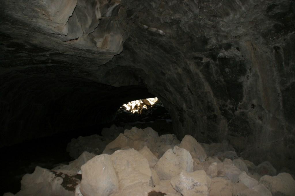
Subway Cave is only 1,300 feet long, but the lava tube is the main attraction in Lassen National Forest, with free guided tours offered on summer weekends. Lava flowed through here less than 2,000 years ago and interpretive signs along the 0.7-mile loop trail explain lavacicles and other geologic oddities. A flashlight is necessary to explore past the openings of the 46°F cave, which drops to four feet in some places with a maximum ceiling of 17 feet. One mile south on the Lassen Scenic Byway (Highway 44) is the 1.7-mile roundtrip Spatter Cone Trail (across from Hat Creek Campground). The trail passes a variety of volcanic formations in a forest of Jeffrey pine trees.
Watchable Wildlife
Lassen National Forest is home to black bears, pine martens, mountain lions, bobcats, red foxes, coyotes, and a few gray wolves that migrated south from Oregon. You are most likely to see mule deer or one of the variety of chipmunks or squirrels. Bird sightings include mountain chickadees, Steller’s jays, Clark’s nutcrackers (at high elevations), and eight species of woodpeckers such as pileated and white-headed.
Photographic Opportunity
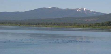
Sitting at 4,505 feet in elevation, Lake Almanor stretches for 13 miles near Chester, California and is a good place for summer boating and fishing.
Peak Season
Summer
Fees
None
Road Conditions
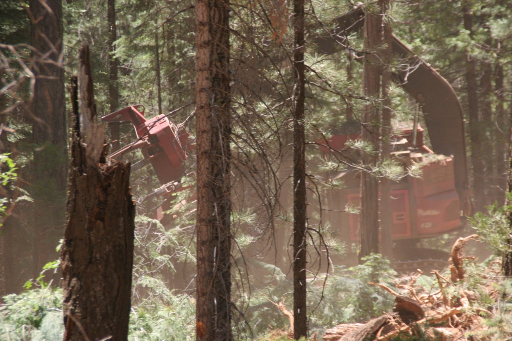
Subway Cave is located right off Lassen Scenic Byway (Highways 44 and 89) and most of the unpaved roads we have explored in the National Forest have been maintained, probably because of the continued harvesting activities that we witnessed on our field trip from Cal Poly University in 2010.
Camping
Lassen National Forest runs campgrounds on both Lake Almanor and Eagle Lake, plus Hat Creek Recreational Area has seven campgrounds. If you are looking to disperse camp outside Lassen Volcanic National Park, take the road west outside the southern entrance (but keep a clean campsite as we saw a black bear in the area).
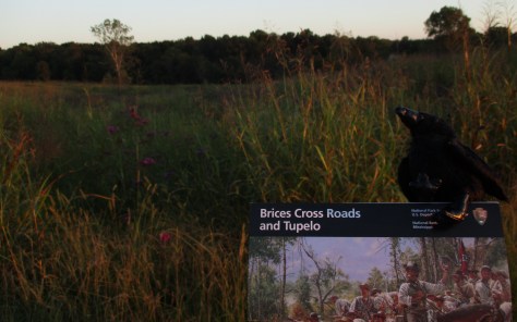
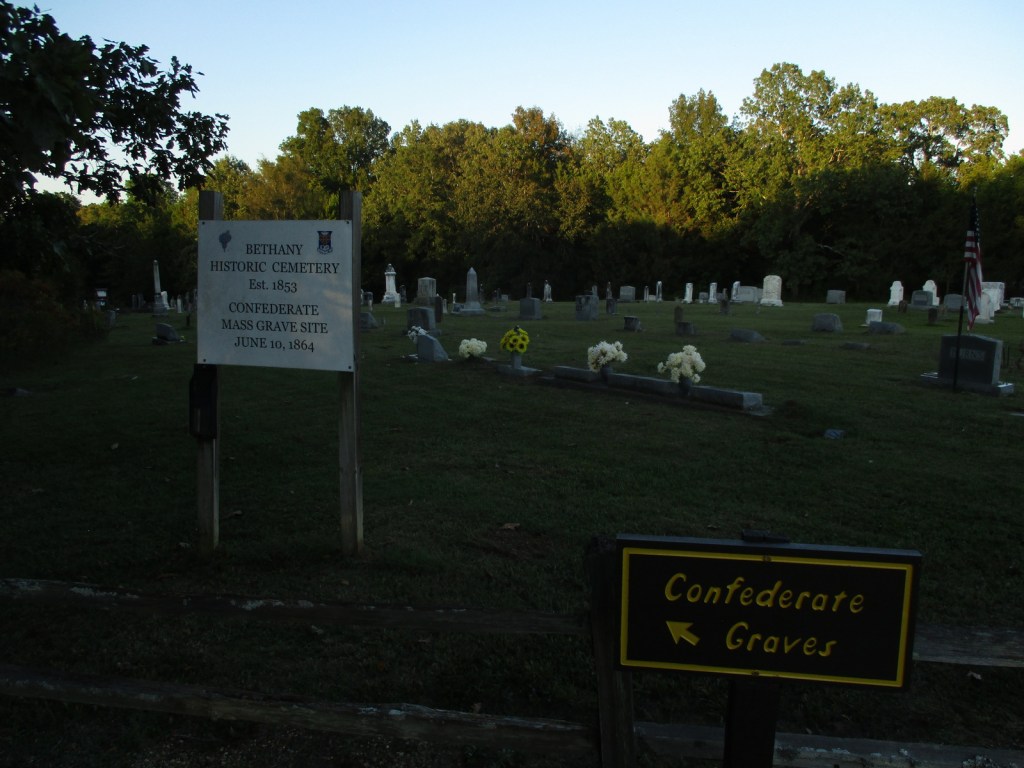
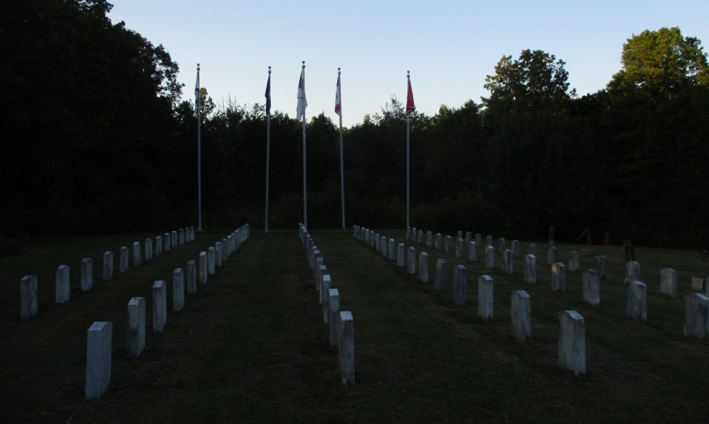
During General Sherman’s “march to the sea” in 1864, he dispatched troops under Brigadier General Samuel D. Sturgis to northern Mississippi to protect the 151-mile Nashville & Chattanooga Railroad line from Major General Nathan Bedford Forrest’s Confederate cavalry. The two sides clashed on June 10 at this site in northern Mississippi, when a larger Union force of 8,100 men was routed by 3,500 Confederates. However, Sherman’s supply line remained intact during his march towards Atlanta.
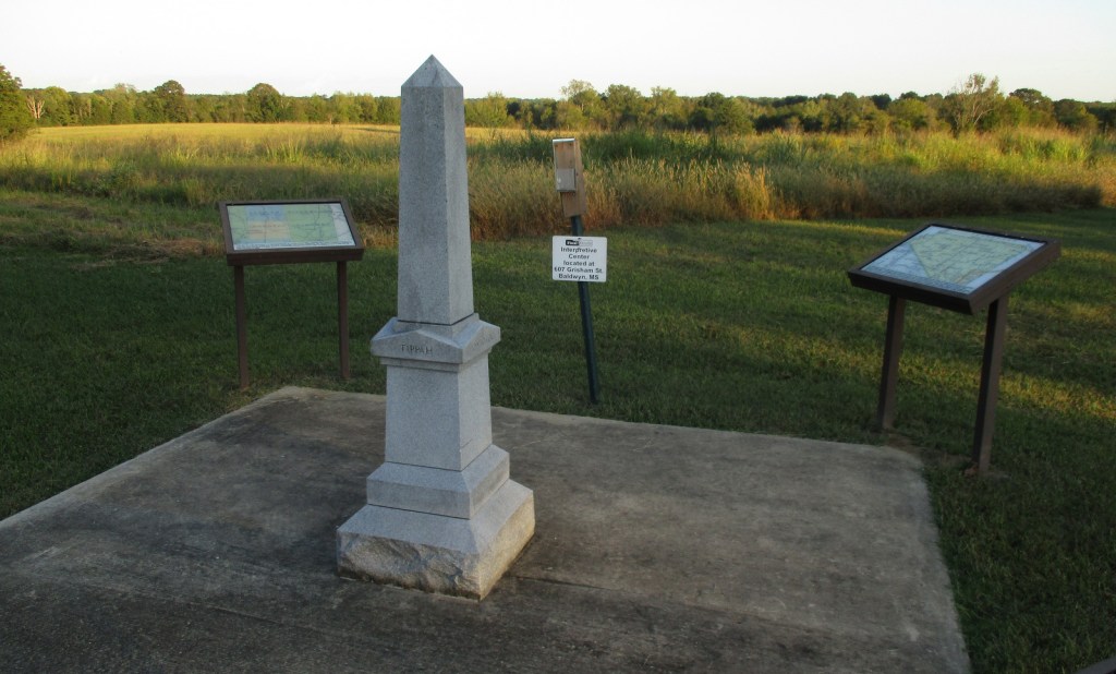
The National Park Service site here is tiny with no facilities and only a couple interpretive signs, but a local battlefield commission owns 1,400 acres with walking trails. The nearby Mississippi Final Stands Interpretive Center is located five miles east of the battlefield in Baldwyn. For a passport stamp, stop at the Natchez Trace Parkway visitor center outside Tupelo. We arrived at Brices Cross Roads National Battlefield Site near sunset, but we were still able to explore the small park at the four-way stop at the crossroads of Highway 370.
Best Trail
A local battlefield commission owns 1,400 acres with miles of walking trails, with the longest located at Log Cabin Knoll.
Instagram-worthy Photo
A monument was erected where the Brice home once stood, used as a place to treat the wounded of both armies during the battle.
Explore More – Who was the Colonel that commanded several regiments of United States Colored Troops (USCT) instrumental in the defensive actions that protected the Union Army’s retreat across the Tishomingo River?
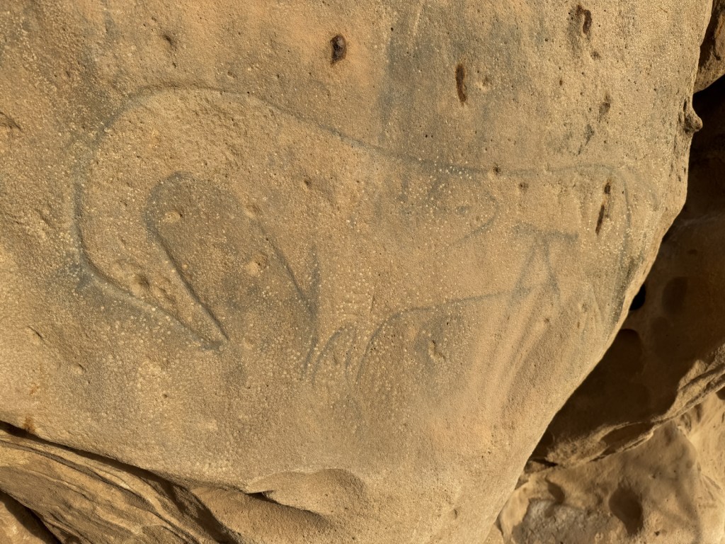
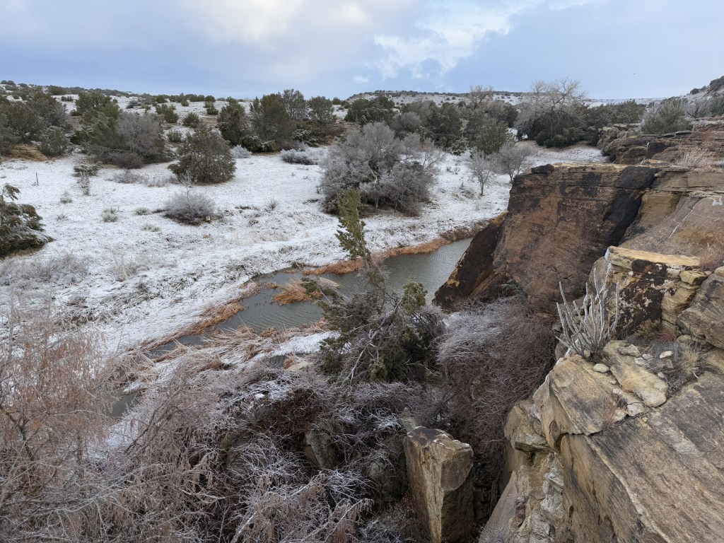
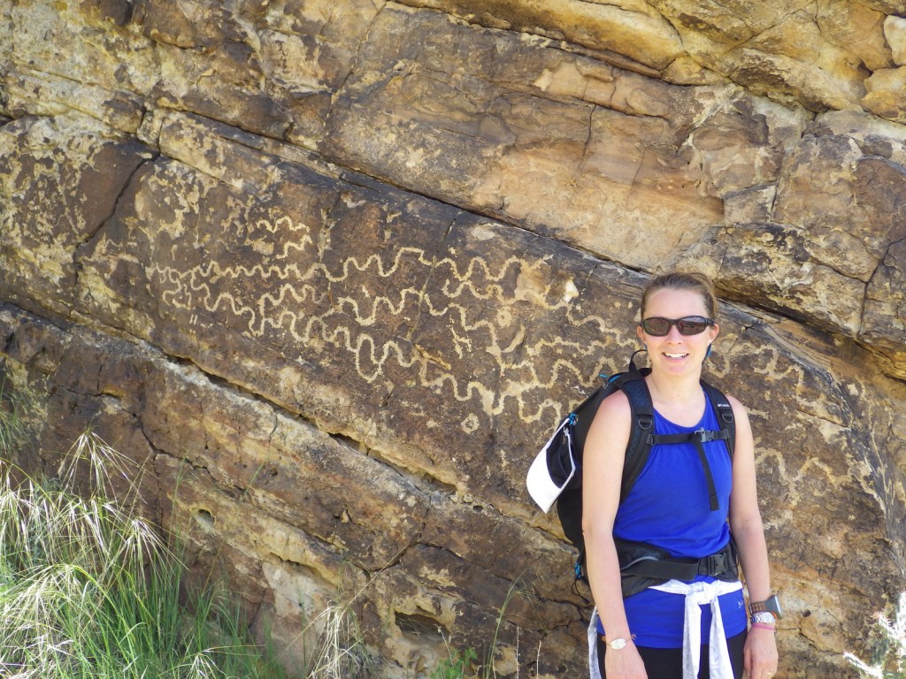
Near the Oklahoma border in southeast Colorado, Comanche National Grassland is comprised of two areas of shortgrass prairie co-managed with Pike and San Isabel National Forests and Cimarron National Grassland (in nearby Kansas). The Timpas Unit is in the watershed of the Purgatoire (or Picket Wire) River, while the more southern Carrizo Unit is mostly centered around Carrizo Creek, a tributary of the Cimarron River. There is a long history of human use of the canyons here, with petroglyphs dating back as far back as 8,000 years. Before giving the National Grassland its name, the Comanche pushed the Apache out of this area in the 1700s and their circular tipi rings can still be found. A branch of the Santa Fe National Historic Trail runs through the northern Timpas Unit with interpretive sites at Sierra Vista Overlook and Timpas Picnic Area (including a three-mile trail following the wagon tracks between the two).
Highlights
Picture Canyon, Crack Cave, Picket Wire Canyon, Dolores Mission, Rourke Ranch, Carrizo Canyon, Vogel Canyon, Santa Fe National Historic Trail
Must-Do Activity
Petroglyphs can be seen on trails near Vogel Canyon and Carrizo Canyon Picnic Areas, with the most famous found in Picture Canyon. It is about 16 miles of unpaved roads to access Picture Canyon from Highway 287, and there are vault toilets and picnic tables at the site. From there, the U.S. Forest Service traditionally leads a hike on Arch Rock Trail to Crack Cave on both the spring and fall equinox, when at dawn the sun’s rays illuminate a specific petroglyph that is usually behind a locked gate that blocks a narrow opening in the sandstone. A similar petroglyph with deeply-carved lines can be seen in an opening above a blue-tinted pictograph about a quarter-mile down the trail. Rock climbing is also a draw here, with a few permanent anchors in the sandstone behind the picnic tables.
Best Trail
It is a 17-mile drive down unpaved roads to Picket Wire Canyon, where a long trail leads to dinosaur tracks (19 miles out-and-back) and Rourke Ranch National Historic District (25 miles) that dates back to 1871. There are approximately 1,900 tracks left by Apatosaurs and Allosaurs over 150-million years ago. Along the way, look for petroglyphs, a model of a dinosaur fossil, and the ruins of Dolores Mission (see Photographic Opportunity).
Watchable Wildlife
Elevations range from 3,900 to 6,200 feet atop Fallas Mesa with ponderosa pine, pinyon pine, juniper, Gambel oak, and cottonwoods trees found in moister areas. Yucca and cacti are common in the prairie, as are desert-dwelling creatures like roadrunners and tarantulas (we saw one crossing the road). Hunters come here for mule deer, elk, pronghorn, and wild turkey in season. The National Grassland contains a lek for lesser prairie chickens, but it is typically closed during mating season due to their endangered status. About 328 bird species have been identified here, including many eastern birds at the extent of their range.
Photographic Opportunity
On the way to the dinosaur track site in Picket Wire Canyon, hikers pass Dolores Mission with a cemetery and the ruins of a small Catholic church dating back to 1898.
Peak Season
Spring and fall
Fees
None
Road Conditions
We have almost gotten stuck twice on the long dirt roads in Comanche National Grassland, once in deep mud following a spring thunderstorm and another time on thick ice following a spring blizzard.
Camping
It is free to disperse camp almost anywhere not on private lands in Comanche National Grassland, with the exception of the parking lots at the following canyons: Picture, Carrizo, Vogel, and Picket Wire.
Picture Canyon Picnic AreaArch Rock TrailSurprise overnight blizzardCarrizo CreekTiff and a tarantulaTarantulaTiff in Picket Wire CanyonSunflower and ladybugTiff with petroglyphsA shoulder blade (replica) from an ApatosaurusScott with dinosaur tracksBobcat on the trailTiff getting some lunch by the Picket Wire RiverAn old cemetery at Dolores MissionPetroglyphsA storm rolling inRaven about the grassland
Explore More – The markings in Crack Cave are theorized by some people to spell out what word in Ogam (an ancient Celtic alphabet)?
Last year we published our guidebook 50 States of Great: Road Trip Guide to America, so we decided to start a new type of blog post where we create a travel itinerary for all 50 states, in addition to our usual National Forest and National Park entries. After starting by jumping around to Kansas, Georgia, Idaho, Rhode Island, Minnesota, Hawai’i, and Arizona, we headed back to the south for Louisiana. Just in time for Mardi Gras, we made an ambitious seven-day plan starting in New Orleans, with plenty of options to extend the trip.
Eating beignets is a great way to start your trip to Louisiana, and this is the most touristy place to get them, located on the Riverwalk in New Orleans.
It is easy to spend an entire day here (fee) because of all the interactive exhibits and informational touchscreen kiosks. You do not even have to leave for lunch, since the Soda Shop and American Sector Restaurant & Bar are on site. We recommend you purchase a ticket including the 4-D film Beyond All Boundaries and the submarine experience based on the final mission of the USS Tang. This is our vote for #1 museum in the entire U.S.
French Quarter
Every American needs to visit the French Quarter at least once in their life (although whether that’s during the wildness of Mardi Gras is up to you), and it is walkable from the National WWII Museum. Consider stopping by iconic Lafayette Square, Old Ursuline Convent Museum, or the New Orleans Pharmacy Museum.
Ghost Tour
We have heard rave reviews about the ghost tours offered in New Orleans, and hope to attend one someday to compare it to the others we have done.
We camped here and it felt like we were off in the wild while still within the city’s suburbs.
Day 2
New Orleans Jazz National Historical Park
The New Orleans Jazz Museum (fee) is located in the old U.S. mint building right in the heart of the historic French Quarter. Check the online schedule for musical performances put on by the National Park Service (NPS) and enter the free visitor center shared with Jean Lafitte National Historical Park and Preserve.
Go out to lunch in New Orleans
Louisiana is famous for its Cajun food, including gumbo, étouffée, jambalaya, po’boys, and red beans and rice.
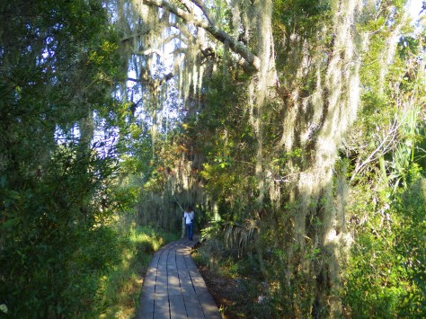
Make sure you visit the 24,000-acre Barataria Preserve to experience the bayous of Louisiana, whether you hike or take a boat tour (fee). South of downtown New Orleans off Highway 45, keep your feet dry by hiking the boardwalks on the Bayou Coquille Trail. In addition, this park includes three Acadian Cultural Centers spread throughout southwestern Louisiana.
Optional stop at Chalmette Battlefield
Another part of Jean Lafitte National Historical Park and Preserve encompasses the land where Andrew Jackson led the defeat of the British to retain New Orleans for the U.S. after the end of the War of 1812.
Day 3
Baton Rouge
Check out the art-deco capitol building where you might see white pelicans floating on the lake next door. We read that the pelican on the state flag is supposed to be a brown pelican (the official state bird) even though the artist made it white so it stood out against the blue background. Also consider visiting the Old State Capitol, Old Governor’s Mansion, or USS Kidd destroyer ship.
Optional drive along the Lake Ponchartrain Causeway
Not the most direct route between New Orleans and the capital city, this 23.8-mile causeway is considered the longest continuous bridge over water in the world. It is free to drive northbound, but don’t attempt it when it’s smoky or foggy, as it becomes very dangerous to drive.
Optional stop at LSU Tigers game
Louisiana State University is located in Baton Rouge and they are famous for their tailgating scene and raucous fans who support their perennially excellent football, women’s basketball, and gymnastics teams.
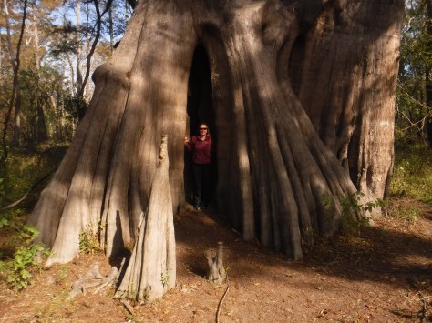
Northwest of Baton Rouge, the largest of all baldcypress trees in the U.S. is found at the end of a flat, half-mile trail, where there is a new boardwalk built around the tree to protect its roots. This area is located down six miles of dirt road full of potholes (and is sometimes flooded).
Louisiana is home to 24 National Wildlife Refuges, many found in its southern half where bayous are full of alligators and mostly uninhabited by humans, like this one west of Baton Rouge.
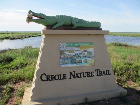
In southwest Louisiana, this route traverses 180 miles of pavement around Calcasieu Lake and the Gulf of Mexico coastline. Much of the state’s oceanfront is inaccessible swamp, but in this corner of the state there are 26 miles of beautiful sandy beaches where ocean waves and seashells await. Consider spending the night in Holly Beach.
Further inland, there are 700,000 acres of wetlands that attract waterfowl to Sabine National Wildlife Refuge, while the surrounding area is used by farmers to grow rice and raise crawfish.
There are eight parcels that constitute the sprawling 603,360-acre Kisatchie National Forest, which has over 40 developed recreation sites and 100 miles of trails. It encompasses lakes for boating and swimming, plus baldcypress-lined bayous for canoeing and fishing. Old-growth longleaf pine forests can be accessed by the paved Longleaf Trail Scenic Byway, just off Interstate 49. A 1.5-mile interpretive loop at Longleaf Vista is a good place to start.
Red Dirt National Wildlife Management Preserve
Camping is allowed in this area next to the 8,700-acre Kisatchie Hills Wilderness where you can backpack along trails. Kisatchie National Forest also offers several lakefront camping areas elsewhere. Lake Fausse Pointe, Lake Bistineau, and Chicot State Parks all have campgrounds with lake access, as well cabins available for rent.
The Creole Nature Trail Adventure Point is a self-guided audio tour and starts off Interstate 10 in Sulphur, where a museum has hands-on displays that introduce visitors to local wildlife and Cajun culture.
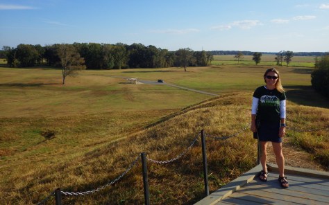
Settled 3,700 years ago by hunter-gatherers, this ancient city with a population estimated at 1,500 was situated along Bayou Macon in northeast Louisiana. The inhabitants constructed several mounds, the most impressive is 72-feet-tall in the shape of a bird, which required approximately 15-million basket-loads of soil to complete.
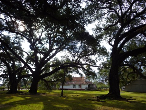
Oakland Plantation survived the Civil War intact, but in the wake of Reconstruction tenant farming created a new form of indentured servitude. Self-guided tours of the site take you through the mule barn, several cottages, and an old general store that still looks open for business along Highway 494. Slave/tenant quarters are also preserved at Magnolia Plantation downstream, but the main house is closed to the public.
Festivals dedicated to celebrating and eating frogs and crawfish; it does not get any more Louisiana than that! Also, consider arriving during one of the many music festivals dedicated to jazz, zydeco, or other regional musical styles.
An annual battle reenactment takes place at the site of a siege during the Civil War; further north, another Civil War reenactment is held at Pleasant Hill.
This forested Wildlife Management Area is located between Monroe and Alexandria in central Louisiana. It includes Rock Falls, which at 17 feet in height is the tallest waterfall in the state, accessible on a seven-mile trail.