The Vietnam Veterans Memorial Fund was incorporated as a nonprofit charity in 1979 to build a monument listing all the names of those killed or missing during the Vietnam War. It was originally the idea of Jan Scruggs, an infantry corporal, and it was important to the veterans that it not make a political statement about the controversial war in Southeast Asia. Selected from 1,421 design entries, Maya Ying Lin intended her memorial to be a quiet, protected place for reflection. The polished black marble she chose to inscribe the half-inch-tall names also reflects the surrounding trees and grass in Constitution Gardens adjacent to the National Mall. The $7-million cost of the memorial was entirely funded by corporate and private donations, including those from 275,000 individual Americans.
Highlights
Memorial wall, Three Soldiers sculpture, Vietnam Women’s Memorial, In Memory plaque
Must-Do Activity
Located near the Lincoln Memorial, the walls of the Vietnam Veterans Memorial stretch 246.75 feet in length, inscribed with 58,256 names listed chronologically by date of casualty. People come to make rubbings of their loved one’s name and often leave small items at its base. Added nearby in 1984, a life-size bronze sculpture by Frederick Hart depicts three male soldiers beneath a 60-foot flagpole. The In Memory plaque was added in 2004 to recognize the many men and women who served and later died from causes related to the war.
Best Trail
There is no trail here, but there is always plenty of walking done when visiting the many memorials on the National Mall.
Photographic Opportunity
Dedicated on November 11, 1993, the Vietnam Women’s Memorial is a bronze sculpture by Glenna Goodacre that depicts three women helping a fallen soldier. There were also eight yellowwood trees planted to commemorate the eight servicewomen killed in action in Vietnam.
Peak Season
Spring and fall
Hours
Open 24 hours
Fees
None
Road Conditions
Traffic can be slow and parking expensive in Washington, D.C., so consider taking the Metro to the National Mall.
Camping
There are National Park Service campgrounds in Maryland’s Greenbelt Park and Virginia’s Prince William Forest Park.
Related Sites
Korean War Veterans Memorial (District of Columbia)
Explore More – When her design was selected in 1981, Maya Ying Lin was a 21-year-old student from Athens, Ohio; where was she attending college at the time?
Last year we published our guidebook 50 States of Great: Road Trip Guide to America, so we decided to start a new type of blog post where we create a travel itinerary for all 50 states, in addition to our usual National Forest and National Park entries. After starting with Kansas, Georgia, Idaho, Rhode Island, Minnesota, and Hawai‘i we decided to do a state in the southwest. Arizona probably needs two separate itineraries, with the southern deserts being a great destination in the winter and the high-elevation northern part of the state better in the summer (see Day 8+). We made an ambitious seven-day plan starting in the south, with plenty of options to extend the trip. Scott grew up in Arizona, so he could have easily made this a four-week itinerary and still left out many good options.
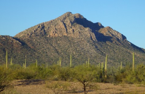
On the Mexican border sits 330,689 acres of undeveloped Sonoran Desert recognized as a UNESCO International Biosphere Reserve in 1976. Its namesake cactus is more common further south and shares this landscape with 27 other species of cacti, including the famous saguaro. The park’s jagged Ajo Mountains are mostly volcanic rhyolite and to see them at their best, we recommend driving the 21-mile dirt road loop in the evening before turning in for the night at the excellent Twin Peaks Campground, run by the National Park Service (NPS).
Arizona has 19 National Monuments (more than any other state), so if you flew into Sky Harbor Airport in Phoenix start with the one located right off Interstate 10.
Desert bighorn sheep can be seen in this remote part of southwest Arizona south of Quartzsite. Cibola and Imperial National Wildlife Refuges along the Colorado River are good spots for birding.
Southwest of Tucson, Arizona in a nondescript stretch of desert are the remains of an underground Intercontinental Ballistic Missile (ICBM) silo built in 1963, during the height of the Cold War. The nuclear warhead and rocket fuel was long ago removed from the site, but otherwise everything has been preserved. A tour guide takes you below ground in the original elevator to explain the steps required to unleash this devastating weapon.
The Catalina Highway ascends from Tucson through multiple life zones from saguaro-dotted desert to ponderosa pine forests at more than 9,000 feet in elevation. The expansive vistas along the drive are worth the many switchbacks, with Windy Point Vista is an especially beautiful wayside in the pinyon-juniper woodland zone. At the base of the Santa Catalina Mountains, also within Coronado National Forest, tram rides are available through beautiful Sabino Canyon Recreation Area.
If you didn’t get your fill of cacti the first day, you will at this park with separate sections east and west of Tucson. If you only have time for one, we recommend the eastern Rincon Mountain District.
South of Tucson in Tubac, San Cayetano de Tumacácori is a Spanish mission founded in 1691 by Padre Kino and abandoned in 1848. It became a National Monument in 1908 when it was restored to its ruined state based on photographs dating from 1868.
The highly decorated cave was not discovered until 1974, when its location was kept a tight secret while efforts were made to preserve it for future visitors. There are two guided tours on paved trails offered, and if you space out your reservations far enough you can take a hike on the 2.4-mile Foothills Loop Trail in between.
Bisbee
The copper mining center of Bisbee was once the largest city between El Paso and San Francisco. The well-maintained Victorian architecture and flights of steep staircases give this border town a unique atmosphere.
The park does not actually contain a statue or large memorial to Coronado. It does have a steep three-quarter mile trail to a 600-foot long limestone cave bearing Coronado’s name, which visitors can explore on their own with flashlights.
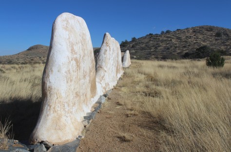
Tucked away in the southeastern corner of Arizona, millions of years of erosion left behind a spectacular collection of rhyolite rock formations that rise above surrounding evergreen trees. All the trails are good, but we recommend an all-day hike through Echo Canyon to the Heart of Rocks Loop where you will find formations resembling camels, ducks, and anything else you can imagine.
Salt River Canyon
Start driving north and be sure to stop for photos where U.S. Highway 60 drops steeply into this gorgeous canyon between Globe and Show Low.
Optional stop at Wilcox Playa Wildlife Area
In the winter, sandhill cranes stay in large numbers in the wetlands south of Wilcox and Interstate 10.
To visit the NPS visitor center, the literal “must-do activity” is to hike 1.5 miles from the trailhead. You do pass interpretive signs, a cemetery, and ruins along the way.
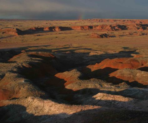
A paved walkway behind the Rainbow Forest Museum is a great place to start, as NPS rangers give guided tours there throughout the day. It is worth a hike to Agate House and a connection to the Giant Logs Trail to see more petrified wood, but be sure to bring water with you in the summer since there is no shade.
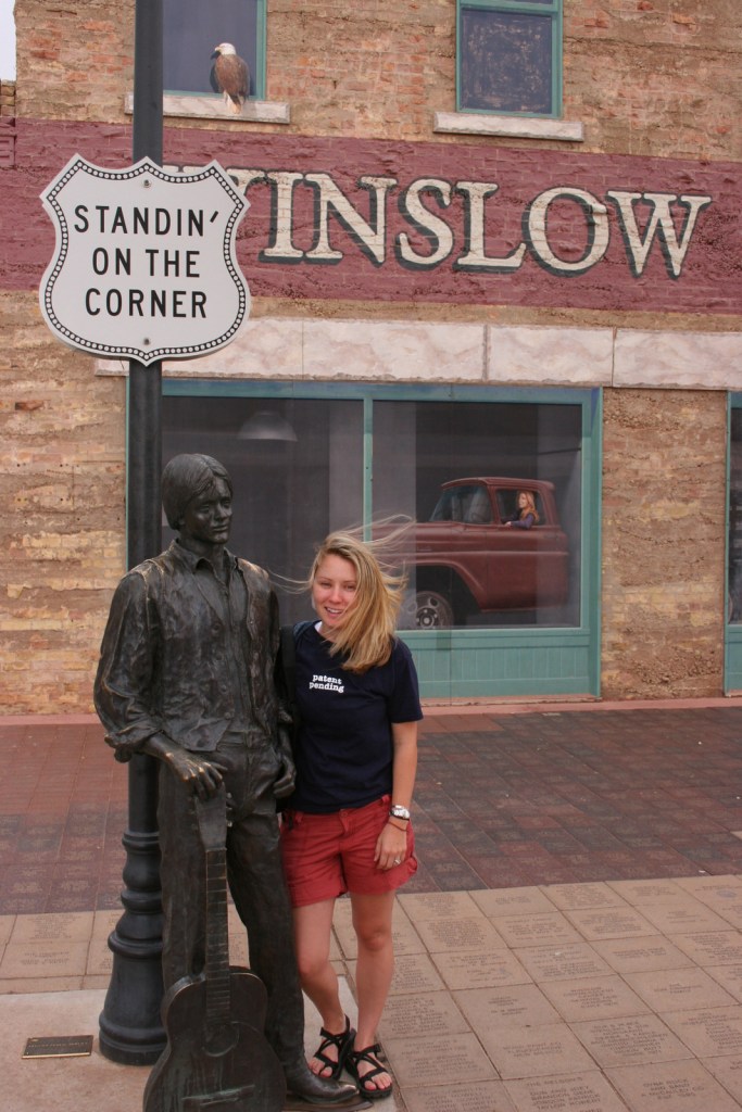
“Standin’ on the corner” statue in Winslow
Jackson Browne and Glenn Frey probably could not have guessed when they penned the 1970s anthem “Take It Easy” that it would inspire a statue in an Arizona town on historic Route 66. Perhaps even more fitting is the mural behind it that shows the reflection of a girl driving a flatbed truck. Located off Interstate 40, Winslow is a great place “to loosen your load.”
Cameron Trading Post
As a kid, Scott’s family would always spend the night at the hotel here before taking friends and family to the Grand Canyon National Park. Try the mutton stew or Indian taco in the restaurant at this historic spot.
Optional stop at Meteor Crater
There is a good museum at this big, round hole in the ground along Interstate 40. It is definitely worth seeing once in your life.
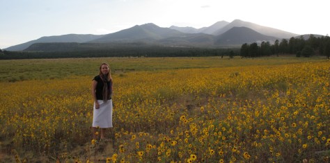
Heading north from Flagstaff, a 36-mile loop drive through Sunset Crater Volcano National Monument to adjacent Wupatki National Monument passes by the red-hued cinder cone through ponderosa pine forests and sunflower-filled meadows on its way to an arid, rocky high desert region that is dotted with Sinagua ruins from around AD 1100. Nearby cliff dwellings were built in Walnut Canyon National Monument around the same time by another group of Sinagua. To get up close with the cliff dwellings inside shallow limestone caves requires a hike down 200 stairs on the one-mile loop Island Trail.
Visit the South Rim of the park from the less busy eastern entrance and stop at the Watchtower and other scenic views along the way. It is worth spending a few nights here and hiking (or riding a mule) to the bottom of the canyon, but that is not for everyone. If you come in the summer, consider a trip to the North Rim or remote Toroweap (online permit required).
Optional stop at Little Colorado River Gorge Navajo Tribal Park
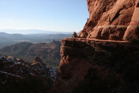
Famous for art galleries and New Age mysticism, the red rock city of Sedona offer plenty of stores and restaurants. Be sure to leave some time to explore some unpaved roads and hiking trails in the surrounding area.
There are numerous trails in the National Forest around Sedona, where sandstone buttes (like Bell Rock and Cathedral Rock) dominate the landscape. The shady West Fork Trail in Oak Creek Canyon is perfect on hot summer days, though in the winter it is also beautiful covered in snow and ice.
Optional stop at Sycamore Canyon Wilderness
This designated Wilderness (55,937 acres) is shared between three National Forests: Coconino, Kaibab, and Prescott. The easiest way in is on the Parsons Trail located outside Clarkdale, west of Sedona. The trailhead is accessed by driving the dirt Forest Road 131 for 10.5 miles from where it splits off near Tuzigoot National Monument.
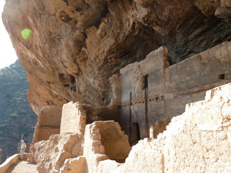
The Sinagua pueblo at Tuzigoot had about 110 rooms and is estimated to have housed 200 to 300 people. You can walk inside portions of the ruin, including a section with a reconstructed roof.
These cliff ruins east of Phoenix are worth the hike up to, as are many parts of Tonto National Forest, especially the Flat Iron, Hieroglyph Canyon, and Weaver’s Needle.
This is a unique NPS site with livestock (sheep, horses, turkeys) and a hands-on play area for children, as well as the original dusty store which allows visitors to travel back into the late-1800s. There are frequent Navajo rug weaving demonstrations and tours inside the Hubbell Home are available for a fee.
In the heart of the Navajo Nation in northeast Arizona lies this picturesque National Monument. Humans have inhabited this area for 4,500 years, leaving behind numerous pictographs and the dramatic ruins of Ancestral Puebloan cliff dwellings.
Visitors can reserve spots on the ranger-led day hike to Betatakin cliff dwelling or the 20-person backpacking trips to Keet Seel that are offered twice per month in the summer. The latter is a strenuous trip covering 17 miles total with numerous stream crossings and all water must be carried in. The hardest part is at the end, when a 1,000 foot climb awaits, but it is worth it to be one of the few who get to see Keet Seel, the 150-room ruin that is second in size only to Cliff Palace at Mesa Verde National Park.
Monument Valley Navajo Tribal Park
On the border of Arizona and Utah, entrance into Monument Valley Navajo Tribal Park allows you to see the iconic Mitten Buttes in person, which have served as a backdrop for countless films. You can even pitch your tent at The View Campground overlooking the red rock formations.
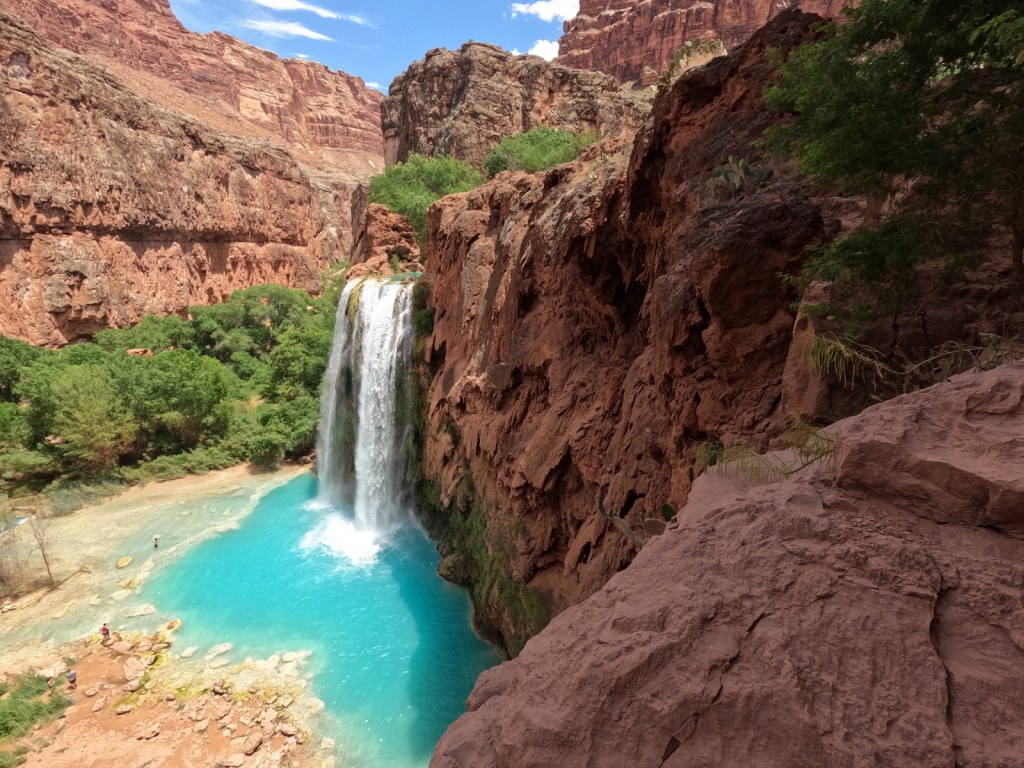
Havasupai Reservation
It is hard to argue against Mooney Falls and the other waterfalls in Havasu Canyon as being the most outstanding in the state, but it can be difficult (and expensive) to obtain one of the limited reservations available to visit the Havasupai Reservation that borders Grand Canyon National Park.
Retention ponds keep this area green in the hot summer months where ducks paddle and dragonflies buzz through the humid air. When a NPS ranger is present, you can walk around inside Winsor Castle, a Mormon fort that dates back to 1870.
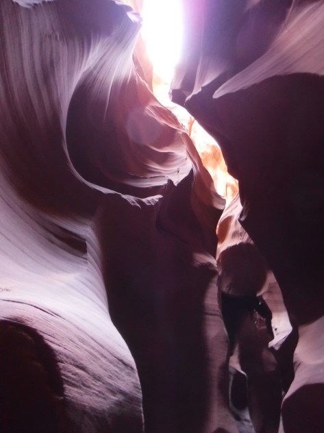
Antelope Canyon
Guided tours are required to access these beautiful slot canyons located on private land on the Navajo Nation
You might want to bring your “selfie stick” to iconic Horseshoe Bend Overlook, a short 0.7-mile one-way hike from the parking area on Highway 89 outside Page.
At Arizona Hot Springs, pools are formed by sandbags in a narrow canyon. It is accessible from Liberty Bell Trailhead by a 6.5-mile out-and-back hike through a beautiful arroyo down to Black Canyon (now the upper reaches of Lake Mohave formed by a dam) on the Colorado River. The trail is closed during the hot summer months, but you can still access it by boat from Willow Beach Marina or just downstream from the Hoover Dam (with a special permit). Further south on Lake Mohave, stop at Emerald Cove for incredible photographs.
Best time of year: Summer for the state fair and access to the northern lakes
We recently published our guidebook 50 States of Great: Road Trip Guide to America, so we decided to start a new type of blog post where we create a travel itinerary for all 50 states, in addition to our usual National Forest and National Park entries. After starting with Kansas, Georgia, Idaho, and Rhode Island, we decided to do a state that is part Midwest and part North Woods. We made an ambitious seven-day plan starting in the southern Minnesota, with plenty of options to extend the trip.
Located in the small town of Austin, this free museum is full of interactive exhibits and photo opportunities, but the best part is that it does not take itself too seriously. Even if you do not like to eat the canned “spiced ham” product, you will come to appreciate its significance to World War II history and pop culture, as well as its amazing gift shop with more branded products than you can imagine.
Niagara Cave is a privately-owned show cave named for its 60-foot-tall underground waterfall that is only viewable on guided tours. Not far away, Forestville/Mystery Cave State Park contains the state’s longest cave (47 degrees year round) which also offers guided tours.
If you come into the state from the southwest corner, consider a stop at a spot that people have come for 2,000 years to mine the red quartzite rock (also known as catlinite). The soft sedimentary stone is relatively easy to carve into smoking pipes and effigies. April through October, you can watch American Indian carvers at the National Park Service (NPS) museum demonstrate how to sculpt this soft yet durable stone into hollow pipes and other beautiful ornaments, some of which you can buy in the gift shop.
Fans of the author’s “Little House” series of books will want to see a replica of the Ingalls’ home in Walnut Grove and some of the family’s historic heirlooms.
Indoor shopping malls are still thriving in the Twin Cities (Minneapolis-St. Paul) metropolitan area, perhaps due to the cold and snowy winter weather. The most famous is the Mall of America with its indoor amusement park and 520 stores, making it the largest mall in the western hemisphere (and eleventh largest in the world).
This park follows 72 miles of the great river’s course through Minnesota, from busy metropolitan sections in the Twin Cities to secluded stretches of water where it reaches its confluence with the Saint Croix National Scenic Riverway. In downtown Minneapolis, Minnehaha Regional Park contains its namesake falls celebrated in Henry Wadsworth Longfellow’s Song of Hiawatha. Nearby, St. Anthony Falls is the only true waterfall along the entire length of the Mississippi River, now controlled by a lock and dam.
Optional stop at University of Minnesota Golden Gophers’ football game
We saw wild turkeys wandering around this beautiful campus that sits on a bluff east of the Mississippi River. Nobody seems to be exactly sure what a golden gopher is (possibly a thirteen-lined ground squirrel), but their mascot Goldie is the cutest in all of college football. Huntington Bank Stadium has one of the best pregame areas with plenty of photo ops and a pep rally held outside the hockey arena, plus we got free Culver’s custard, a clear bag giveaway, and Mystic Lake casino provided free towels and “spinny video thing.” The football team typically schedules their home opener on the Thursday before Labor Day during the Minnesota State Fair.
You will need all day to visit America’s best state fair that is held annually the 12 days before Labor Day, welcoming more than two-million visitors annually. The fair has the standard carnival rides, butter sculptures, farm animals, and artwork, as well as stages where musicians, comedians, and magicians perform throughout the day. Some of the unique food offerings include hotdish-on-a-stick, poutine, fried cheese curds, pronto pup, fried pickles, pork chop-on-a-stick, and fried buckeyes (chocolate and peanut butter candy). Since it started in 1979, Sweet Martha’s Cookie Jar has been overfilling buckets of fresh-baked chocolate chip cookies for customers, making up to 200,000 cookies an hour. To wash all that down, you might want to visit one of the stands offering all-you-can-drink milk.
If you are still hungry after the Minnesota State Fair then you probably didn’t do it right, but we will make one of our rare restaurant recommendations for this unique spot in downtown Minneapolis with interesting décor and really good food (try the poutine or walleye bites).
Day 4
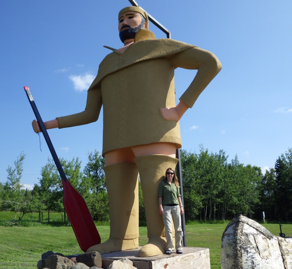
Paul Bunyan Expressway
The legendary giant lumberjack Paul Bunyan is a big deal in Minnesota and he has statues honoring him in many towns along the Paul Bunyan Expressway. The 18-foot-tall statues in Bemidji were originally built in 1937 to honor these larger-than-life heroes and continue to be an essential roadside attraction. In Brainerd, Paul Bunyan Land is an entire amusement park built around a 26-foot-tall talking statue of Paul and 19-foot Babe, the latter refurbished after it blew over in a 2006 windstorm.
The Lost 40 is 144 acres of old-growth red and white pine forest that was never logged due to a surveying error that mapped the area as part of Coddington Lake in 1882. The oldest tree here is more than 250 years old and can be seen on an easy one-mile loop trail with interpretive signs. The trailhead is located east of Blackduck on well-signed back roads that are also popular for snowshoeing in the winter. Nearby, Camp Rabideau is perhaps the best preserved Civilian Conservation Corps (CCC) camp left from the 1930s, with free guided tours in the summer.
Lake Itasca is considered the headwaters of the Mississippi River and is located just west of Highway 71 at the beginning of the 2,069-mile-long Great River Road that goes all the way to Louisiana.
Day 5
Roadside Sculptures
Driving north on Highway 71, there is seemingly another great roadside attraction located every few miles. We saw the statues of Uncle Dan Campbell in Big Falls, Jack Pine Savage in Littlefork, the world’s largest crow in Belgrade, and a giant black duck in the town of Blackduck. Right outside Voyageurs National Park, which surrounds Lake Kabetogama, was our favorite—a giant walleye with a saddle for riding. If Kabetogama seems like a mouthful, rest assured that everyone, including park rangers, simply calls it “Lake Kab.”
The park is famous for its manmade destinations, including Kettle Falls Hotel, Hoist Bay Resort, and the unique sculptures at Ellsworth Rock Gardens. Try to get out on one of Minnesota’s 10,000 lakes via a ranger-led tour or take your own boat to one of the shoreline campsites inaccessible by car (permit required). Reservations can be made for the ranger-guided North Canoe Voyage that lets passengers paddle a 26-foot canoe, just like the French-Canadian “voyageurs” of old.
Day 6
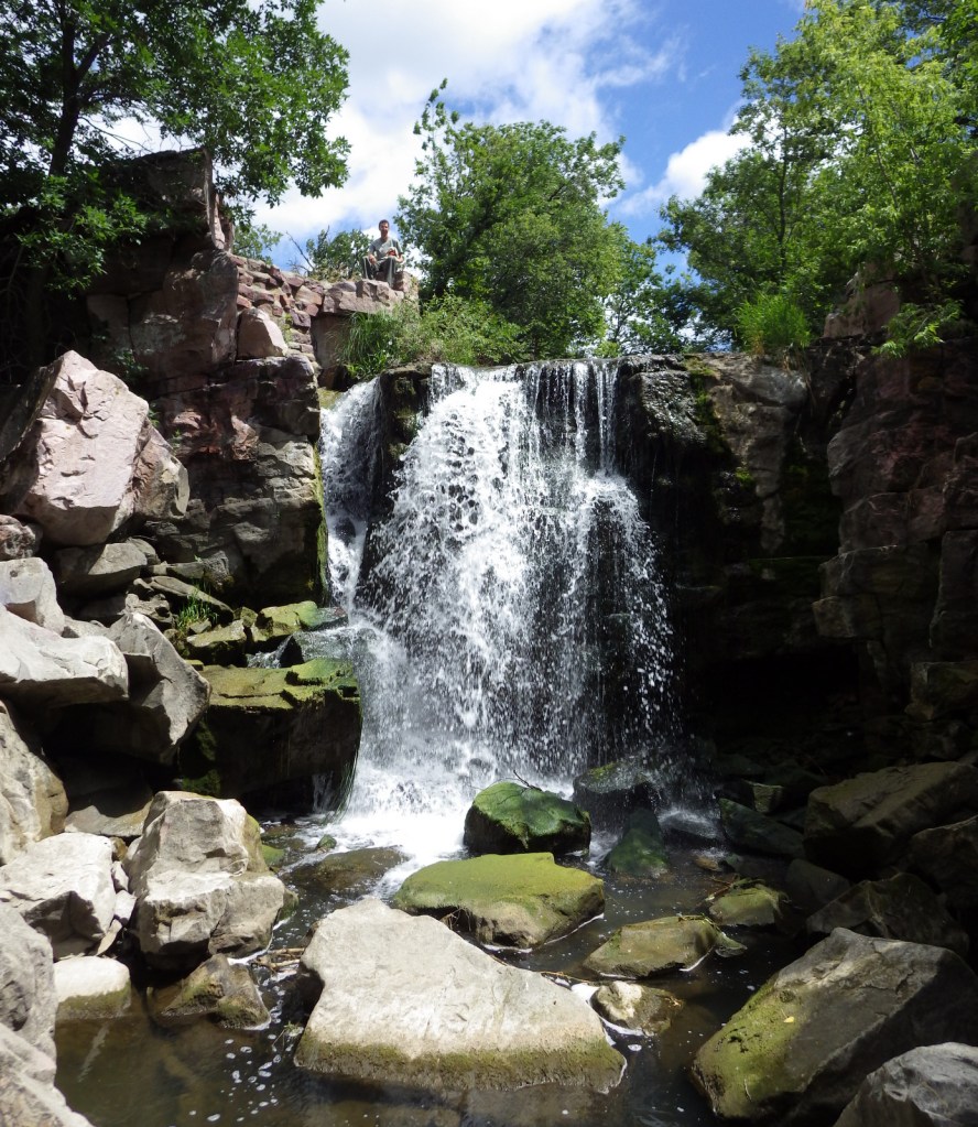
Kawishiwi Falls in Ely
The little town of Ely is the gateway to the Boundary Waters Canoe Area Wilderness (see below), but even if you are just passing through be sure to make the short hike to Kawishiwi Falls below the dam on Garden Lake.
Gray wolves (called timber wolves regionally) reside in the North Woods and while a few lucky travelers might hear them howling, your best bet to see one is at the Wolf Center. It also has a section dedicated to Sigurd Olson, a talented local author and naturalist.
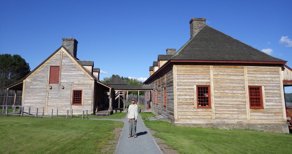
French-Canadian voyageurs had to walk their canoes and goods along an eight-mile-long portage to bypass the rapids on the Pigeon River. In 1784, the end of the trail on the edge of Lake Superior became the site of the North West Company headquarters where they held an annual rendezvous, where today visitors can walk around the reconstructed buildings and talk with the costumed reenactors during the summer.
Optional stop at Two Harbors
North of Duluth, the North Shore Scenic Drive passes through the town of Two Harbors where there is a giant rooster at Weldon’s Gifts and a huge statue of Pierre the Voyageur outside the Earthwood Inn. If you press the speaker button at the statue’s base, Pierre will tell you all about the history of the region, but he never explains why he is not wearing any pants.
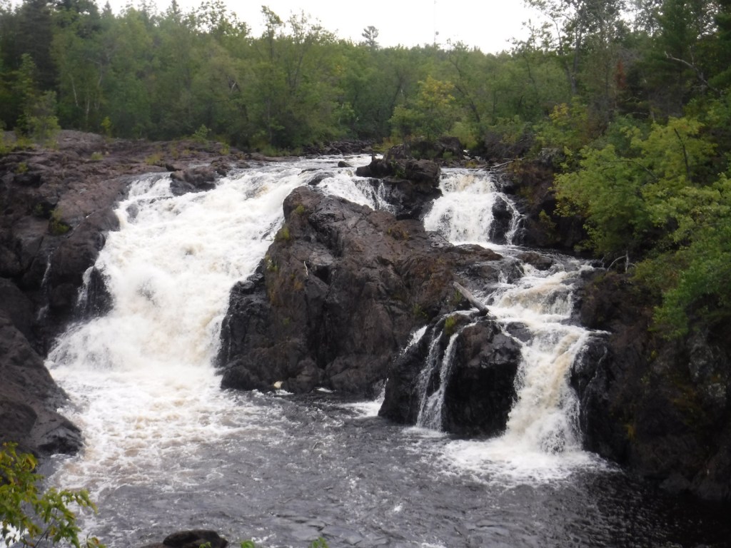
In addition to encompassing the state’s highest mountain, Superior National Forest also offers scenic drives on the Gunflint Trail (County Road 12), Fernberg Road (State Route 169), and Echo Trail (County Road 116). Vermilion Gorge Trail is an easy 1.5-mile one-way hike to a narrow canyon cut through Canadian Shield rock in the small community of Crane Lake (on the east side of Voyageurs National Park). Not far away down a dirt road, a short trail leads to Vermilion Falls where the same river cuts a narrow channel through the rock.
Permits for the peak season can be hard to come by for the world’s premiere destination for backcountry canoeing, so plan ahead. This one-million-acre preserve has more than 1,000 lakes with over 1,500 miles of canoe routes and 2,200 designated backcountry campsites. In addition to its famous water routes with numerous portages, a few overland trails exist like the 12-mile Angleworm Trail and the 39-mile Kekekebic Trail, an official part of the North Country National Scenic Trail.
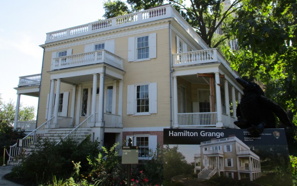
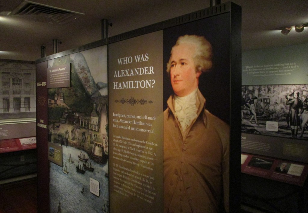
Anyone who has watched the musical Hamilton is familiar with the life story of Alexander Hamilton. Hamilton Grange National Memorial is the only National Park Service (NPS) site dedicated to this “founding father.” It is also the only one of 45 National Memorials built by the person it honors. What you may not know is that his historic home in New York City has been moved twice, once in 1889 and again in 2008.
Highlights
Museum, tour, statue at St. Luke’s Episcopal Church
Must-Do Activity
The Grange gets its name from the Hamilton family’s ancestral home in Scotland. Built in 1802 on a 32-acre estate in Upper Manhattan, Hamilton only lived there two years before being shot and killed in an infamous duel with Aaron Burr. Today you enter the home through the basement where the NPS runs a museum. Access upstairs is available on guided tours or during daily “open house” hours, but you must leave large items in lockers.
Best Trail
None
Instagram-worthy Photo
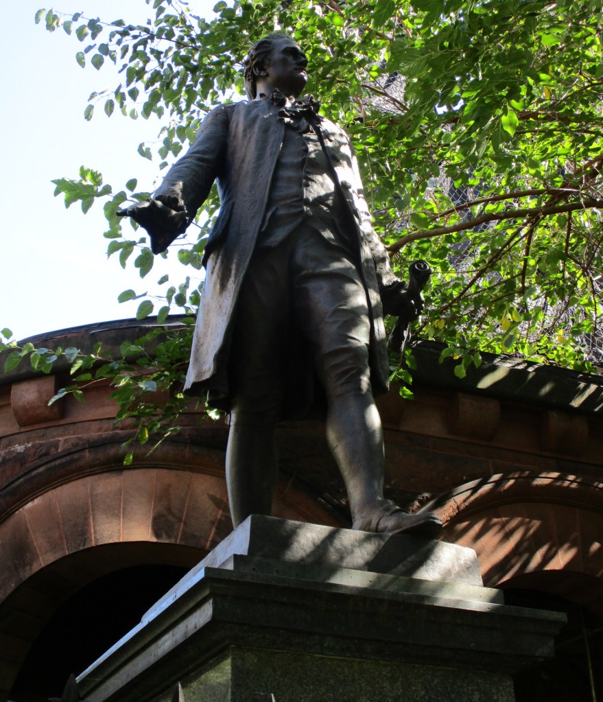
The Grange was tucked between St. Luke’s Episcopal Church and an apartment building until 2008 when the NPS moved it to St. Nicholas Park, part of the original 32-acre estate. A statue of Alexander Hamilton still stands where the house resided for more than a century.
Explore More – After resuming his law practice in 1795, Hamilton represented free and enslaved African Americans and defended a newspaper editor sued for slander by which future president?
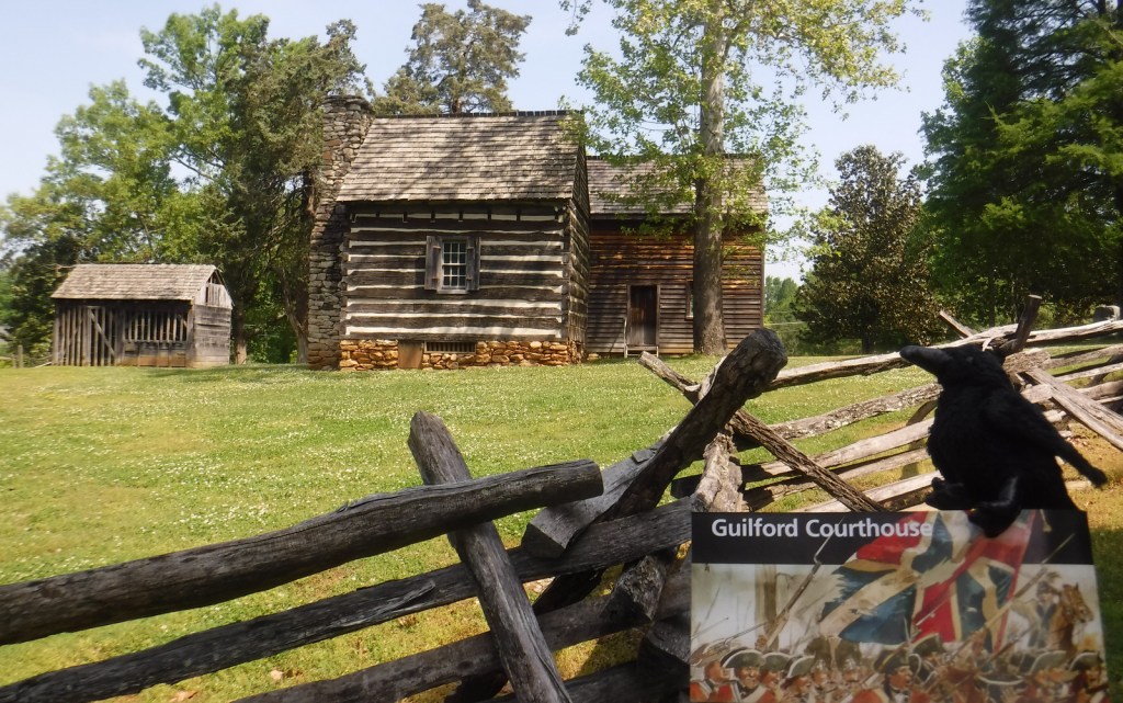
Even in the wake of Patriot victories at Kings Mountain and Cowpens, the British army was not giving up their southern colonies without a fight. Major General Nathanael Greene was in charge of the Continental Army in the southern theater and his troops were aggressively pursued by British General Charles Cornwallis. Although he lost the battle on March 15, 1781, Greene’s name was later applied to the nearby town of Greensboro, North Carolina.
Highlights
Museum, film, Hoskins Farm, Major General Nathanael Greene statue
Must-Do Activity
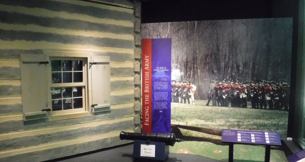
Start at the National Park Service (NPS) visitor center, watch the short film (also available on the NPS website), then make stops along the 2.25-mile auto tour. You will learn the story of what took place on March 15, 1781, when Greene’s defensive position at Guilford Courthouse was attacked by British forces. While the Patriots withdrew they only suffered 7% casualties, compared to the British who lost 28% of their army, leading them to eventually retreat to Yorktown, Virginia. After the battle, Greene continued to fight, leading his men against overmatched backcountry outposts of British troops such as the one at Ninety Six, South Carolina.
Best Trail
In addition to the auto tour route, a paved bicycle path wends through the battlefield. The lovely 229-acre Guilford Courthouse National Military Park is heavily utilized for recreation by the local people of Greensboro. As such, you are allowed to walk your dog in the park. In the summer, you can also walk around Hoskins Farm, though its buildings are closed, as is the old Colonial Heritage Center.
Instagram-worthy
Photo
Many monuments line the pathways that cut through 229-acre Guilford Courthouse National Military Park, with the equestrian statue of Major General Nathanael Greene being the most prominent.