Gila National Forest
New Mexico
Managed by U.S. Forest Service, Southwestern Region
2,797,628 acres (2,710,659 federal/ 86,969 other)
Website: https://www.fs.usda.gov/gila
Overview
Nearly 25% of Gila National Forest is designated Wilderness, and the renowned Gila Wilderness became the world’s first such-titled area on June 3, 1924. There are multiple hot springs that attract backpackers to this area and 95% of thru-hikers on the Continental Divide National Scenic Trail (CDT) veer from the official route to enjoy its beauty. The nearby Aldo Leopold Wilderness is named for the Forest Service ranger that helped campaign for that designation and later became a famous ecologist and author of A Sand County Almanac (see our Top 10 Non-Fiction Books on Trees and Forests). In 2016, the Cosmic Campground became the first International Dark Sky Sanctuary in North America (and one of only 18 in the world), so it is a great spot for stargazing. Gila National Forest also manages the part of Arizona’s Apache National Forest that is in New Mexico, adding an additional 614,202 acres.

Highlights
Inner Loop Scenic Byway, Hulsey Lake, Cosmic Campground, Turkey Creek Hot Springs, Lake Roberts, Signal Peak, Quemado Lake, Chimney Rock Canyon, Jordan Hot Springs, Sawmill National Recreation Trail, Catwalk National Recreation Trail, Wood Haul Road National Recreation Trail, Continental Divide National Scenic Trail
Must-Do Activity
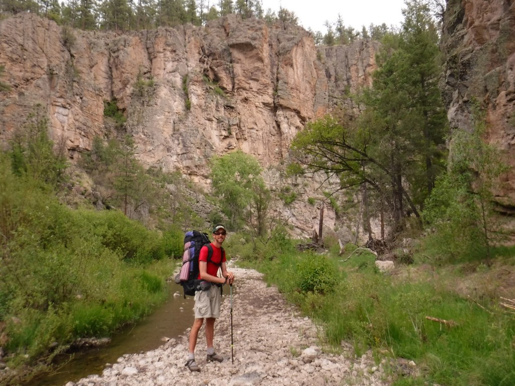
You do not have to journey far into the Gila Wilderness to reach Lightfeather Hot Springs on the Middle Fork Trail. Less than a mile down the trail a shallow pool is formed by stacked rocks where 150-degree hot springs water combines with the cool Middle Fork of the Gila River. It is a great place to watch and listen to wildlife. Seven miles further is Jordan Hot Springs, a very popular backpacking destination that requires countless stream crossings (it is best to wear fast-drying shoes and use trekking poles). The trailhead is located 43 miles north of Silver City on the Inner Loop Scenic Byway, not far from a visitor center co-managed by the Forest Service and National Park Service (that operates nearby Gila Cliff Dwellings National Monument). The Gila Wilderness is the reason this National Forest made it on our list of the Top 10 National Forests for Backpacking.
Best Trail
The most popular spot in Gila National Forest is the Catwalk National Recreation Trail, which requires driving through two stream crossings that are doable by a passenger car when the water is low. The one-mile trail is partially elevated above Whitewater Creek on wide, steel grates complete with handrails. The Catwalk started in 1893 as a way for miners to service a four-inch water pipe, then fell into disrepair before being upgraded by the Civilian Conservation Corps (CCC) in 1935. Today’s safer, tourist-friendly Catwalk was installed in 1961. This trail made our list of the Top 10 Day Hiking Trails in National Forests.
Watchable Wildlife
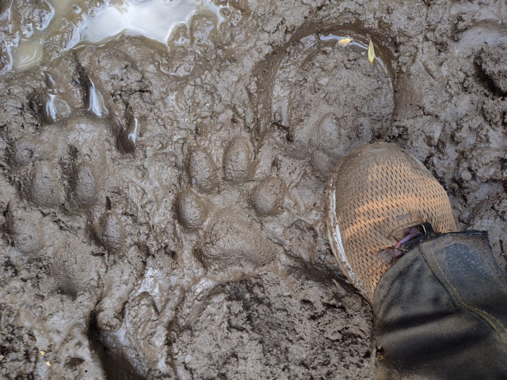
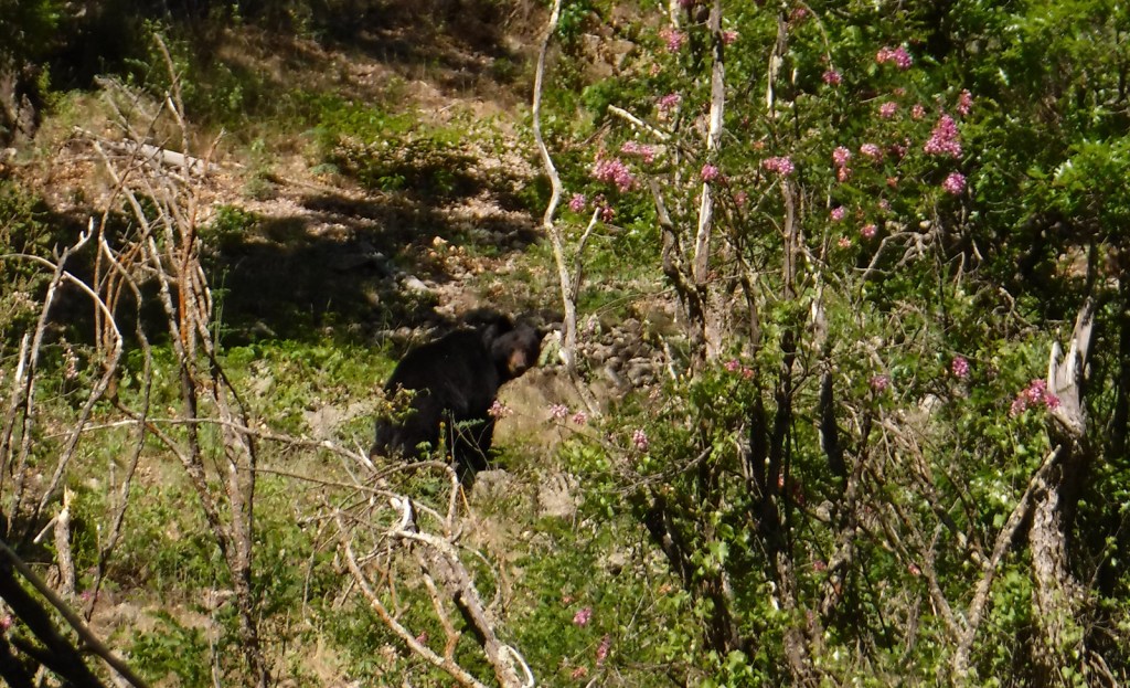
The Gila River gives its name to this National Forest, as well as animals like the venomous Gila monster, Gila woodpecker, and fish, including a trout, topminnow, and several species of chub. Mexican wolves have been reintroduced to this region, and other predators like mountain lions, bobcats, and black bears (we saw one and followed another’s wet footprints while backpacking near Gila Cliff Dwellings National Monument). Unique mammals include the javelina (collared peccary), gray fox, white-nosed coatimundi, and Coues white-tailed deer. Mule deer, elk, pronghorns, and bighorn sheep are additional ungulates found in Gila National Forest. Large birds include roadrunners, Mexican spotted owls, bald eagles, ospreys, peregrine falcons, and wild turkeys. Most of our wildlife encounters were with reptiles like horned lizards (a.k.a. frogs or toads), western fence lizards, and rattlesnakes.
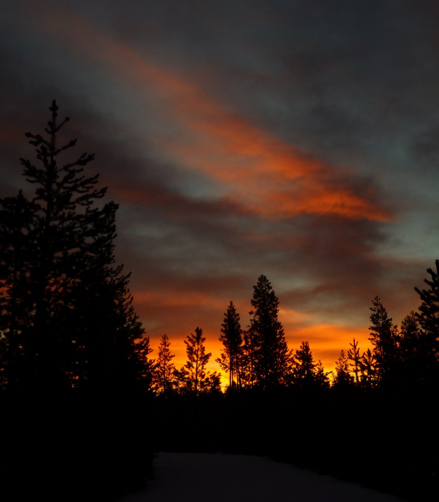
Instagram-worthy Photo
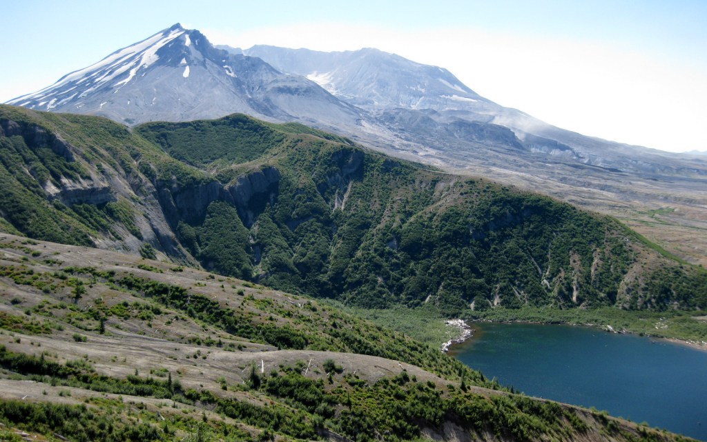
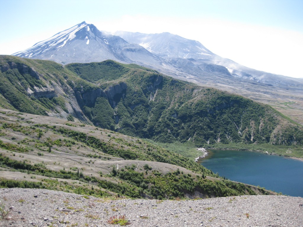
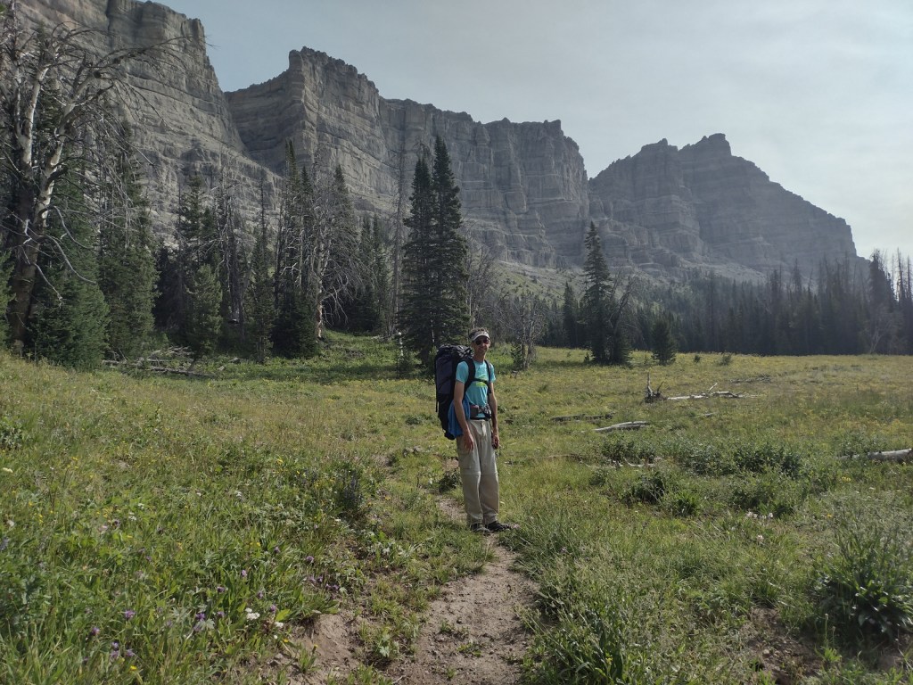
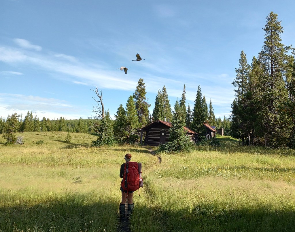
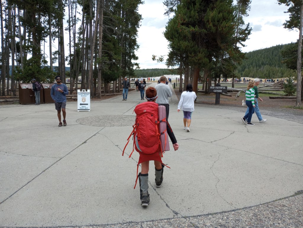
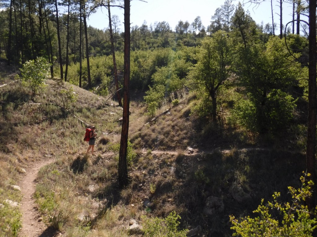
In May 2020, we did a 72-mile backpacking loop connecting the West Fork of the Gila River with the Middle Fork, through gorgeous canyons and old-growth forests protected as the Gila Wilderness since 1924.

Peak Season
Summer
Fees
There is a parking fee at Catwalk National Recreation Trail (or you can display an America the Beautiful Pass), but some cars parked across the river to avoid paying.
Road Conditions
The eastern part of Inner Loop Scenic Byway is paved to the visitor center co-managed by the Forest Service and National Park Service, but the western portion is unpaved and has some steep grades not recommended for RVs. The unpaved road to Catwalk National Recreation Trail with its two stream crossings is doable with a passenger car when the water is low.
Camping
Cosmic Campground became the first International Dark Sky Sanctuary in North America (and one of only 14 in the world), so it is a great spot for stargazing. Pueblo Park Campground offers a trail through Chimney Rock Canyon and Upper End Campground is near 72-acre Lake Roberts. Cottonwood Campground is located near the Blue Range Wilderness on the Arizona border. In eastern Gila National Forest along Highway 152 are found both Upper Gallinas and Iron Creek Campgrounds. In the north, there are three campgrounds on 131-acre Quemado Lake and the Continental Divide National Scenic Trail cuts through primitive Apache Creek Campground.
Wilderness Areas
Aldo Leopold Wilderness
Blue Range Wilderness
Gila Wilderness
Related Sites
Gila Cliff Dwellings National Monument (New Mexico)
Apache National Forest (Arizona-New Mexico)
Cibola National Forest (New Mexico)
Nearest National Park


two-needle pinyon pine, ponderosa pine, Chihuahua pine, southwestern white pine, white fir, one-seed juniper
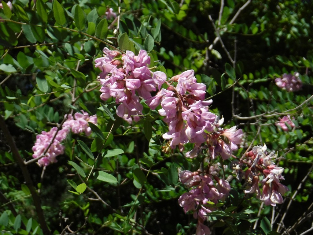
Gambel oak, gray oak, silverleaf oak, New Mexico locust, quaking aspen, narrowleaf cottonwood, Fremont cottonwood, Arizona alder, Arizona sycamore, Arizona walnut, boxelder, velvet ash, netleaf hackberry, mountain-mahogany, chokecherry
Explore More – Gila is a Spanish simplification of the Yuma word “hah-quah-sa-eel,” translated as what?

Learn more about this and the 154 other National Forests in our new guidebook Out in the Woods
We are a participant in the Amazon Services LLC Associates Program, an affiliate advertising program designed to provide a means for us to earn fees by linking to Amazon.com and affiliated sites.