Tag Archives: National Historic Trail

Kansas Road Trip Itinerary

Kansas

52,325,581 acres (2.3% of U.S.)

Statehood 1861 (34th of 50)

Capital: Topeka

Population:  2,937,880 (35th of 50)

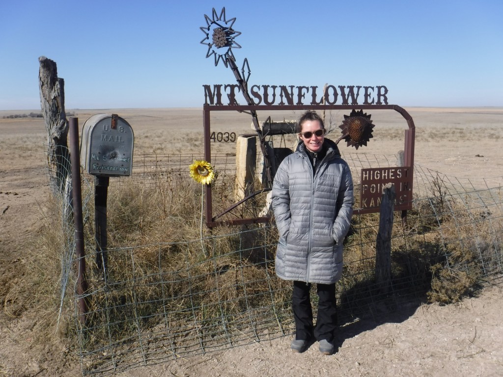
High Point: Mt. Sunflower (4,041 feet)

Best time of year: Fall for apple picking, football games, OZtoberFest, and fall foliage

We recently published our guidebook 50 States of Great: Road Trip Guide to America, so we decided to start a new type of blog post where we create a travel itinerary for all 50 states, in addition to our usual National Forest and National Park entries.  We are starting with Kansas, an often-overlooked travel destination where we have had a lot of fun on multiple visits dating back to 2007.  We made a seven-day plan starting in the southwest corner of the state, with plenty of options to extend the trip.

Day 1

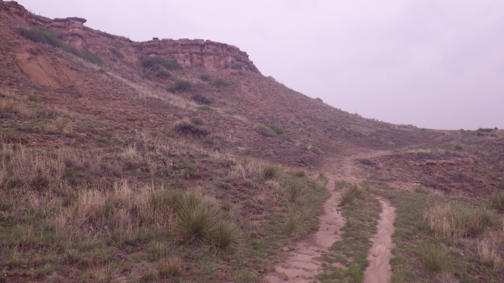
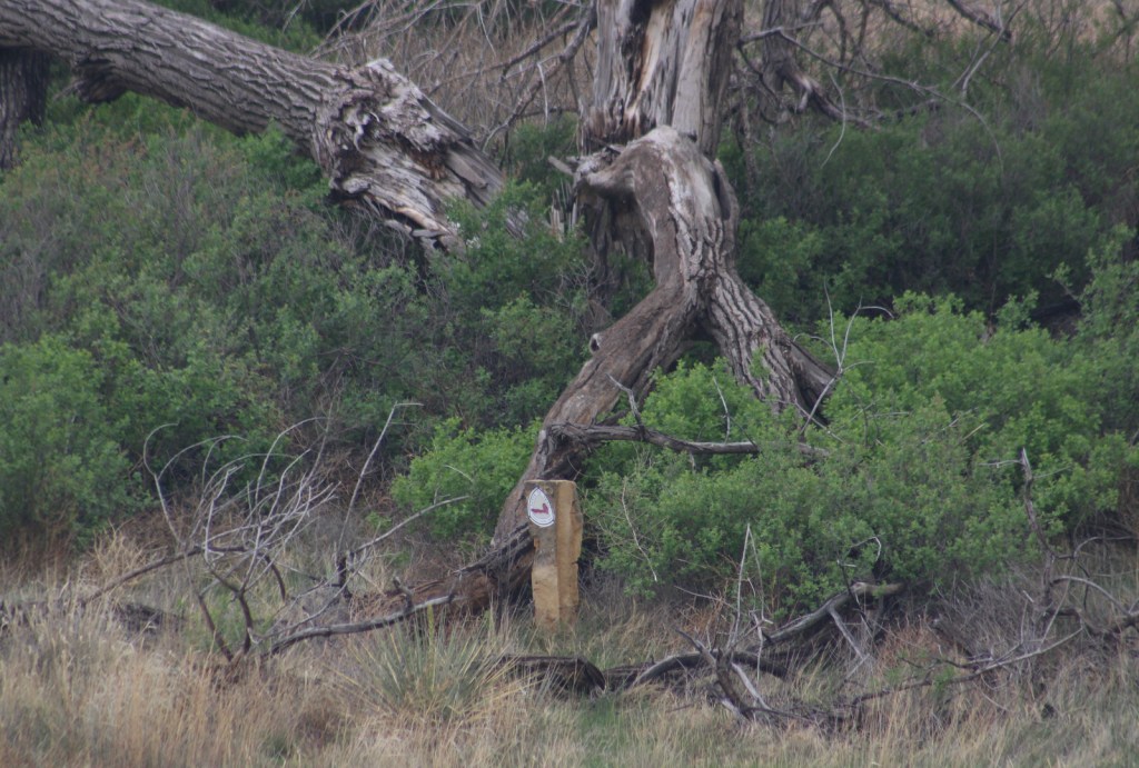
Cimarron National Grassland (click here for our blog post) / Santa Fe National Historic Trail

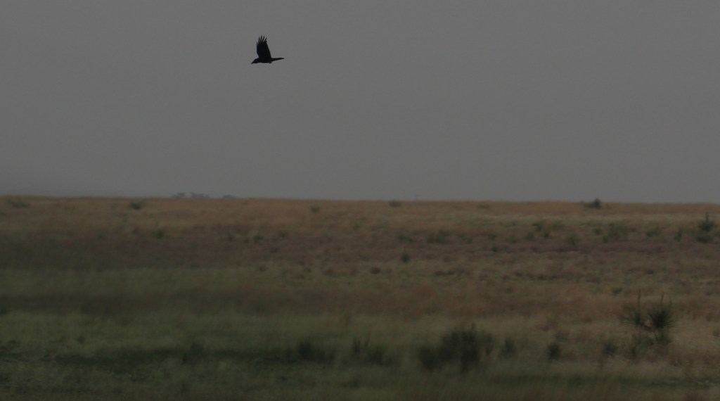
The state’s largest parcel of public land at 108,175 acres contains Middle Springs, Cottonwood Picnic Area (with the 10.5-mile Turkey Trail), and Point of Rocks, an important landmark on the Santa Fe Trail and third highest point in Kansas.  In the spring, birdwatchers gather at two viewing blinds to watch the elaborate mating rituals of lesser prairie-chickens, one of the more than 360 bird species identified here. 

Liberal

Dorothy’s House landed here after it was swept up in the tornado to the Land of Oz, located next to the free Seward County Coronado Museum.  While visiting, you can pose with your favorite character from L. Frank Baum’s allegory along a yellow brick walkway. 

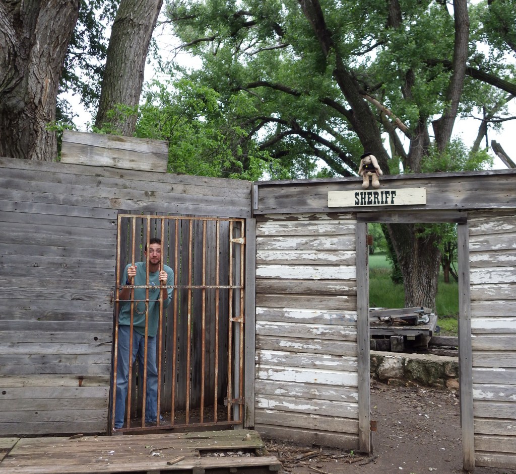
Optional stop at Dalton Gang Hideout Museum

Walk the 95-foot-long escape tunnel built by the notorious outlaw family beneath their farmhouse to evade law enforcement. 

Day 2

Big Well Museum in Greensburg

Completed in 1888, it is the world’s largest hand dug well at 109 feet deep (and 32 feet in diameter) to access the massive Ogallala Aquifer.  On May 4, 2007, the town of Greensburg was devastated by a powerful tornado, but the resilient population rebuilt around the historic well. 

Boot Hill Museum in Dodge City

This bloody frontier town earned the moniker “Wickedest Little City in America.”  Even though the buildings on Front Street are mostly reproductions, there remains an authentic Wild West vibe in the air as you walk past artifacts from the 1800s.  If you plan to spend the night after your visit to the Boot Hill Museum, consider paying extra for the brisket dinner and nightly variety show (in the summer) at the Long Branch Saloon. 

Optional stop at Dodge City Zoo

Across the railroad tracks from the Boot Hill Museum, the Dodge City Zoo in Wright Park offers free admission to see a multitude of mammals and birds. 

Day 3

Fort Larned National Historic Site (click here for our blog post)

The fort was only active from 1860 to 1878, but after becoming private property it continued to function as a working ranch which explains why it is in such good shape today.  Costumed re-enactors are really what make this site special, from the blacksmith to the schoolteacher to the commissar to the officers’ wives. 

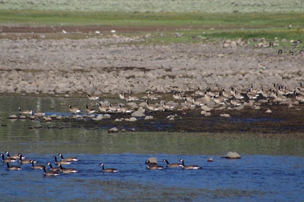
Quivira National Wildlife Refuge

A 14-mile auto route and hiking trails to observation blinds offer great opportunities to see a variety of birds and mammals in this wetland south of the great bend of the Arkansas River.

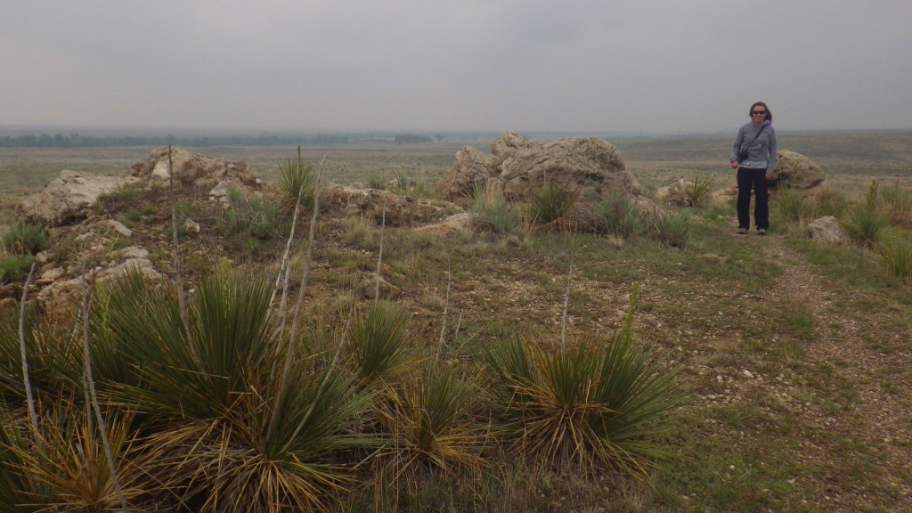
Optional stops at Geographic Center, Coronado Heights Park, Big Basin Prairie Preserve, and Mushroom Rock State Park

Roadside attractions in central Kansas include the Geographic Center of the 48 contiguous states and the hilltop tower at Coronado Heights Park near historic Lindsborg.  There is also a small herd of bison in 1,818-acre Big Basin Prairie Preserve.  At Mushroom Rock State Park, interesting sandstone concretions held together by calcium carbonate have withstood the erosion that washed away the surrounding bedrock over time.

Day 4

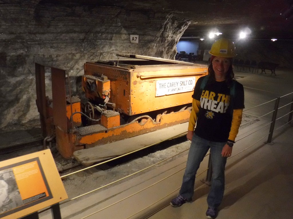
Strataca in Hutchinson

Strataca takes visitors in an elevator 650 feet down through the Equus Beds Aquifer into an underground salt mine with 67 miles of tunnels.  A tram tour (hardhat provided) is part of the admission price, as is the opportunity to take home a big chunk of salt. 

Cosmosphere in Hutchinson

Cosmosphere International SciEd Center and Space Museum contains the largest collection of space artifacts outside the Smithsonian’s National Air and Space Museum in Washington, D.C.

Wichita

The state’s largest city and “Airplane Capital of the World” has the Great Plains Nature Center, Kansas Aviation Museum, and a fun dinner theater at Mosley Street Melodrama.

Optional stop at Hutchinson Zoo

Another one of the many free zoos located throughout Kansas.

Day 5

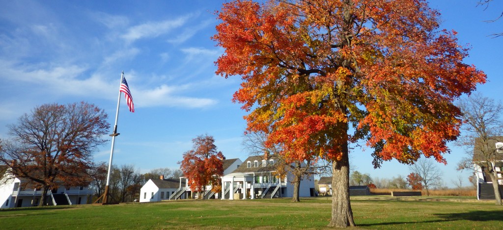
Fort Scott National Historic Site (click here for our blog post)

The maple trees were changing colors during our November visit to Fort Scott National Historic Site, their vibrant leaves in sharp contrast to the fort’s white buildings. 

Louisburg Cider Mill

Fall is a great time to visit the cider mill to see the apples being processed and eat some freshly made cider donuts.

Tallgrass Prairie National Preserve (click here for our blog post)

There are many miles of trails that wander through the 10,894-acre preserve that is jointly run by the Nature Conservancy and National Park Service.  A reintroduced bison herd roams these hills, where you can visit the historic Spring Hill Ranch and the one-room Lower Fox Creek School, which was open from 1884 to 1930. 

Brown v. Board of Education National Historic Site (click here for our blog post)

In downtown Topeka, you can tour the former African-American-only Monroe Elementary School, restored to its 1950s appearance with some classrooms turned into exhibits on the civil rights movement worldwide. 

Optional stop at Kansas University in Lawrence

Come for a college football or basketball game and stay to see the original rules for basketball written by Dr. James Naismith, the free Spencer Museum of Art, the historic Natural History Museum, and numerous Jayhawk statues across campus.

Day 6

Kansas City

Not all the best attractions of Kansas City are in Missouri, so explore the beautiful Museum at PrairieFire, try some famous barbecue at Joe’s gas station, and go apple picking in the fall at Cider Hill Family Orchard.

Wamego

Like Liberal on the other side of the state, Wamego also has a Wizard of Oz-themed part of town and holds the annual OZtoberFest in October.

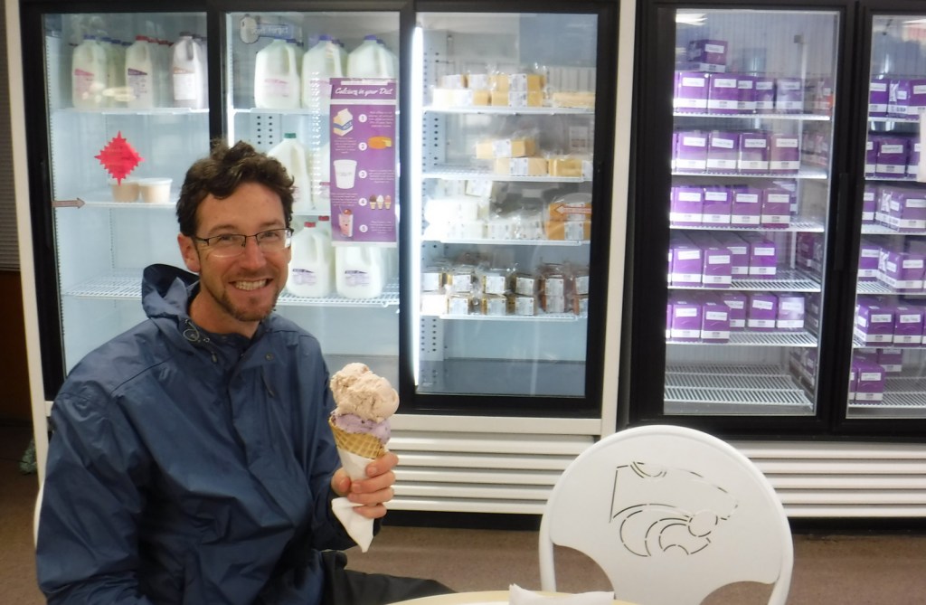
Optional stop at Kansas State University in Manhattan

Sample some Purple Pride and Apple Dapple ice cream at Call Hall Dairy Bar, then visit the free Beach Museum of Art and the American Museum of Baking inside Emerson Library that displays a sample of Egyptian bread dating back 3,800 years (insert fruit cake joke here).  Kansas State University Gardens is a great stop regardless of the season given its fountains and Insect Zoo with a modest $3 entry fee. 

Day 7

Ft. Leavenworth

Check in and get your day pass from the military visitor center before driving onto the army base to visit the Buffalo Soldiers Memorial and Frontier Army Museum at Fort Leavenworth.

Atchison

Amelia Earhart Birthplace Museum and Haunted Tours that include the infamous Sallie House.

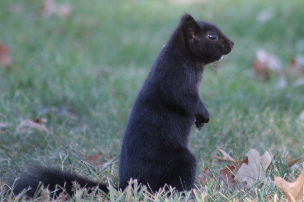
Optional stop at Marysville

An Oregon Trail town founded in 1855 that still has its old Pony Express Station located downtown near the beautiful 1891 Marshall County Courthouse.  It is also home to a population of black squirrels that are reportedly escapees from a traveling circus. 

Day 8+ optional swing through northwestern Kansas

Nicodemus National Historic Site (click here for our blog post)

Founded in 1877 by former slaves from Kentucky freed after the Civil War, this historic town is representative of the African-American population boom in Kansas that jumped from only 627 to 43,107 between 1860 and 1880.

Mt. Sunflower

You can drive to the top of Kansas, a small hill near the western border with Colorado.

Buffalo Bill bronze sculpture in Oakley

An impressive 9,000-pound bronze statue stands outside a Cultural Center highlighting Buffalo Bill’s fascinating life.  Also worthwhile is the Fick Fossil and History Museum.

Monument Rocks

A dirt road detour south of Interstate 70 takes travelers to Monument Rocks, the first National Natural Landmark designated by the U.S. Department of the Interior in 1968.  The 70-foot-tall chalk formations are chock full of fossils formed 80-million years ago during the Cretaceous Period.  The white monoliths really light up at sunset and sunrise, but since they are on private property no camping is allowed at the site. 

Learn more about Kansas’ Most Scenic Drive, Wonderful Waterfall, Top State Park, and other categories in in our new travel guidebook 50 States of Great: Road Trip Guide to America.

Cimarron National Grassland

Cimarron National Grassland

Kansas

Managed by U.S. Forest Service, Rocky Mountain Region

116,319 acres (108,176 federal/ 8,143 other)

Website: https://www.fs.usda.gov/psicc

Overview

Following the devastating “Dust Bowl,” several Congressional Acts in the 1930s allowed the federal government to purchase and restore damaged agricultural lands in the Great Plains.  Most of the 20 National Grasslands have their origin in these times, which is why they are often a patchwork of federal and private ownership.  Cimarron National Grassland is no exception, although its fairly contiguous swath of government land in the southwest corner of Kansas represents the largest parcel of public land in the entire state.  Today recreation is one of the multiple uses of this landscape, that also includes cattle grazing and oil/gas drilling.  There are 200 stock ponds here (a few stocked with gamefish), plus the Cimarron River, which even when appearing dry often flows a foot below the surface.  Cimarron is a Spanish word for a feral horse, like an American mustang.

Highlights

Point of Rocks, Cimarron Overlook, Middle Spring, Cottonwood Picnic Area, Cimarron Recreation Area, Turkey Trail, Companion Trail, Santa Fe National Historic Trail

Must-Do Activity

Point of Rocks is the third-highest point in Kansas and was a major landmark on the Cimarron Route of the Santa Fe National Historic Trail that later became a permanent settlement.  There are no buildings left here, but the parking lot offers interpretive signs and a great view across the Cimarron River.  A steep trail from the top accesses the Companion Trail that parallels the Santa Fe National Historic Trail for 19 miles through the National Grassland.  A mile back towards Highway 27, Middle Spring is on the National Register of Historic Places as one of only three reliable water sources along the Cimarron Route. 

Best Trail

The Turkey Trail is open to OHVs and connects 10.5 miles from Cottonwood Picnic Area to Cimarron Recreation Area, where the Cimarron River Trail continues east for another ten miles or so.

Watchable Wildlife

Cimarron National Grassland is one of the best places in Kansas for birdwatching with more than 360 species identified.  There are two lesser prairie-chicken leks with permanent blinds set up for watching spring mating rituals.  During our short visit we spotted ravens, turkey vultures, shrikes, redwing blackbirds, mourning doves, meadowlarks, red-headed woodpeckers, barn swallows, kingbirds, Bullock’s orioles, canvasbacks, and some variety of hawk.  Based on the signs there are also mountain plovers and burrowing owls, which inhabit the burrows of prairie dogs and can imitate the sound of a prairie rattlesnake.  When we arrived at the smoke-obscured overlook for Point of Rocks we startled a group of four mule deer, and we also read that elk were reintroduced here at one point.

Instagram-worthy Photo

Cottonwood Picnic Area is fenced off from river access, but it has picnic tables and a playground with old-school equipment like teeter-totters.  There is also a fun table with metal seats from old tractors and two old tractors unearthed in 2003 after being buried to stabilize the river bank following floods in the 1930s.

Peak Season

Spring

Fees

None

Road Conditions

Paved Highway 27 cuts north-south through the National Grassland bisecting the unpaved Sea of Grass Auto Tour, which we found to be in good shape at least for the three miles to Point of Rocks.

Camping

Cimarron Recreation Area offers 14 campsites, fishing ponds, and a corral for horses, plus dispersed camping is allowed in most of the National Grassland.

Related Sites

Tallgrass Prairie National Preserve (Kansas)

Fort Larned National Historic Site (Kansas)

Nicodemus National Historic Site (Kansas)

Nearest National Park

Great Sand Dunes

Explore More – Passed in 1937, what Congressional Act requires 25% of revenue generated by the National Grasslands to be returned to the county for schools and roads?

Fishlake National Forest     

Fishlake National Forest           

Utah

Managed by U.S. Forest Service, Intermountain Region

1,539,737 acres (1,461,226 federal/ 78,511 other)

Website: https://www.fs.usda.gov/fishlake

Overview

Much of Fishlake National Forest is at high elevation in central Utah, which is also true of its namesake Fish Lake that sits at 8,800 feet.  Fish Lake is the largest natural mountain lake in Utah and lent its name to the Fish Lake Cutoff on the Old Spanish Trail, which ran from Santa Fe to Los Angeles.  There are hundreds of miles of trails open to ATVs in the National Forest, including the 238-mile Paiute ATV Trail and the Gooseberry ATV Trails accessible from Interstate 70.  There are also plenty of trails for hikers, backpackers, mountain bikers, and equestrians, including the trail that crosses the South Fork of North Creek Trail 60 times as it covers ten miles leaving from beautiful Blue Lake at the base of Mt. Baldy.

Highlights

Beaver Canyon Scenic Byway, Wildcat Guard Station, Tushar Mountains, Delano Peak, Bullion Falls, Pistol Rock, Koosharem Canyon, Fishlake Scenic Byway, Fool Creek Canyon petroglyphs, Blue Lake, Bullion Canyon Trail System, Skyline National Recreation Trail, Lakeshore Trail, Old Spanish National Historic Trail

Must-Do Activity

Fish Lake’s most famous resident is the aspen clone dubbed Pando (meaning “I spread” in Latin).  Connected by a single root system, stems of Pando cover 106 acres and it is estimated to have started growing 80,000 years ago, arguably making it the oldest and heaviest living organism on the planet.  Campers enjoy the popular Lakeshore Trail that is in four discontinuous sections adding up to about 15 miles.  We found the road to Pelican Promontory on the north side of the lake too rough for our passenger vehicle and the five-mile Pelican Canyon Trail too overgrown to follow after a mile, although we did see (and hear) a northern goshawk on nest. 

Best Trail

In the Tushar Mountains, Beaver Canyon Scenic Byway (Highway 153) switchbacks its way up to several trailheads for the 8.3-mile-long Skyline National Recreation Trail.  We attempted to access Lake Stream Trailhead in the middle, but found the road at Puffer Lake required high-clearance.  Instead, we drove the rough quarter-mile spur road to Big Flat Trailhead (at 10,220 feet in elevation) and hiked two miles to a rocky outcrop with good views.  We did not attempt to drive to the trail’s western terminus at Big John Flat Trailhead that sits beneath 12,173-foot Delano Peak.

Watchable Wildlife

We first heard and then saw a northern goshawk on a nest (see photos) as we struggled to follow the overgrown Pelican Canyon Trail at Fish Lake.  Additional birds of note are bald eagles, kestrels, several species of owls, turkey vultures, Canada geese, white pelicans, and wild turkeys.  Ungulates found here are elk, mule deer, pronghorns, bighorn sheep, mountain goats, and even some moose.  Other large mammals include black bears, bobcats, mountain lions, red foxes, coyotes, pine martens, minks, badgers, porcupines, beavers, snowshoe hares, and pika.  As you might expect from a National Forest named Fishlake, fishing is a popular activity in the lakes and streams for rainbow trout, lake trout, splake, and other species, even in the winter.

Instagram-worthy Photo

Stop at the informational pullout on the Fishlake Scenic Byway to read about the Fish Lake Cutoff of the Old Spanish Trail, then get your photo with the metal cutouts of a pack train in the sagebrush flats near Zedd’s Meadow.

Peak Season

Summer

Fees

$5 day use fee at Ponderosa Picnic Area or America the Beautiful pass

Road Conditions

There are some rough roads in this area that require high-clearance vehicles, including the ones to Pelican Promontory and Puffer Lake.  Fishlake Scenic Byway and Beaver Canyon Scenic Byway are paved, but connecting between the two required driving some good gravel roads that were already snow free during our mid-June visit.

Camping

The Aquarius Ranger Station is available for rental from May through October, as are the historic cabins at the Gooseberry Administrative Site.  There are several campgrounds at Fish Lake and others located throughout the National Forest, in addition to one scenic spot on a ridge adjacent to the Second Crossing of Salina Creek in the White Mountains.

Wilderness Areas

None

Related Sites

Dixie National Forest (Utah)

Bryce Canyon National Park (Utah)

Cedar Breaks National Monument (Utah)

Nearest National Park

Capitol Reef

Conifer Tree Species

subalpine fir, white fir, Engelmann spruce, Douglas-fir, ponderosa pine, singleleaf pinyon pine, Utah juniper

Flowering Tree Species

quaking aspen, Gambel oak, bigtooth maple, Fremont cottonwood, sagebrush

Explore More – Which famous American explorer named the Old Spanish Trail in the 1840s (hint: he has a National Forest named after him, but maybe not the one you first think)?

Learn more about this and the 154 other National Forests in our new guidebook Out in the Woods

We are a participant in the Amazon Services LLC Associates Program, an affiliate advertising program designed to provide a means for us to earn fees by linking to Amazon.com and affiliated sites.

Clearwater National Forest

Clearwater National Forest

Idaho

Managed by U.S. Forest Service, Northern Region

1,722,132 acres (1,679,952 federal/ 42,180 other)

Website: https://www.fs.usda.gov/nezperceclearwater

Overview

In central Idaho, Clearwater National Forest was established in 1908 and administratively combined with Nez Perce National Forest in 2012.  A great place to start is the Forest Service visitor center at Lolo Pass on the Idaho-Montana border southwest of Missoula, where you will learn about the Corps of Discovery’s visit in 1805.  Elsewhere, the North Fork of the Clearwater River ends in the Dworshak Reservoir where a separate section of the National Forest can be explored on the White Pine Scenic Byway and Elk River Backcountry Byway.  The latter accesses Giant Cedar Grove and Elk Creek Falls, which is three separate waterfalls totaling a 140-foot drop.

Highlights

White Pine Scenic Byway, Lolo Pass, Lolo Motorway, DeVoto Memorial Grove, Colgate Licks, Jerry Johnson Hot Springs, Shoestring Falls, Elk Creek Falls, Giant Cedar Grove, Aquarius Natural Area, Nez Perce (Nee-Me-Poo) National Historic Trail, and Lewis and Clark National Historic Trail, Down River Trail, Beason Meadows National Recreation Trail

Must-Do Activity

Most of the recreational activity in Clearwater National Forest occurs along the Northwest Passage Scenic Byway (Highway 12), which runs west from the Lolo Pass visitor center along the Lochsa National Wild and Scenic River.  The legendary dirt road called the Lolo Motorway (see below) can be accessed from several points along this route.  Both the famous Jerry Johnson Hot Springs and the smaller Weir Creek Hot Springs are reachable from roadside trailheads.  Also along Highway 12, short trails lead through the DeVoto Memorial Grove of western redcedars and Colgate Licks mineral springs.

Best Trail

From parking areas on both sides of Highway 12, it is only about a one-mile easy walk to Jerry Johnson Hot Springs where multiple pools can be found creekside and uphill at the source.  The trail continues along Warm Springs Creek into the Selway-Bitterroot Wilderness and beyond. 

Watchable Wildlife

The North Fork of the Clearwater and the Lochsa Rivers provide habitat for fish and water-loving animals like moose, raccoons, river otters, muskrats, beavers, fishers, ospreys, and bald eagles.  The mountains are home to elk, mule deer, mountain goats, black bears, martens, red foxes, gray wolves, and mountain lions.

Instagram-worthy Photo

A short trail leads through the DeVoto Memorial Grove of western redcedars, named for author Bernard DeVoto.

Peak Season

Summer

Fees

None

Road Conditions

The scenic 73-mile Lolo Motorway is a single-lane, dirt road that tracks both the Nez Perce (Nee-Me-Poo) and Lewis and Clark National Historic Trails.  Also labeled Forest Road 500, it follows a ridgeline north of the Lochsa River and several steep access roads climb to meet it from Highway 12.  High-clearance vehicles (or motorcycles) are a must and four-wheel drive is required on the rougher western end of the route.  Driving up Parachute Hill Forest Road 569 and down Saddle Camp Forest Road 107 makes for a good four-hour loop with short stops at the Indian Post Office and Devils Chair.

Camping

Although it is close to Highway 12, the pleasant Jerry Johnson Campground is one of several campgrounds found along the Lochsa National Wild and Scenic River and located only a short drive from the trailhead for the hot springs.

Wilderness Areas

Selway-Bitterroot Wilderness (also in Bitterroot, Nez Perce, and Lolo National Forests)

Related Sites

Challis National Forest (Idaho)

Big Hole National Battlefield (Montana)

Nez Perce National Historical Park (Idaho-Oregon-Montana)

Nearest National Park

Glacier

Conifer Tree Species

western redcedar, western larch, grand fir, subalpine fir, Douglas-fir, Engelmann spruce, western white pine, ponderosa pine, lodgepole pine, limber pine, whitebark pine, Pacific yew, Rocky Mountain juniper

Flowering Tree Species

quaking aspen, Pacific dogwood, red alder, balsam poplar, paper birch, Piper’s hawthorn

Explore More – What famous group built the 73-mile-long Lolo Motorway in the 1930s?

Learn more about Clearwater and the 154 other National Forests in our new guidebook Out in the Woods

We are a participant in the Amazon Services LLC Associates Program, an affiliate advertising program designed to provide a means for us to earn fees by linking to Amazon.com and affiliated sites.

Chugach National Forest

Chugach National Forest

Alaska

Managed by U.S. Forest Service, Alaska Region

6,908,540 acres (5,384,460 federal/ 1,524,080 other)

Website: https://www.fs.usda.gov/chugach/

Overview

Roughly the size of New Hampshire, Chugach National Forest stretches from Seward, Alaska to the east beyond Cordova.  It encompasses 3,500 miles of shoreline in scenic Prince William Sound, one of the sport fishing world’s top destinations for halibut, ling cod, and salmon.  It is the northernmost and westernmost of all 155 National Forests, and 30% of its acreage is covered by glaciers (including 22 tidewater glaciers).  Chugach National Forest was established in 1907 from part of a Forest Reserve originally created in 1892, only 25 years after Alaska was purchased from Russia.

Highlights

Seward Scenic Byway, Turnagain Arm, Portage Glacier, Porcupine Campground, Russian River, Columbia Glacier, Million Dollar Bridge, Childs Glacier, Grayling Lake, Porcupine Creek Falls, Hope Point Trail, Iditarod National Historic Trail, Johnson Pass Trail, Russian Lakes Trail

Must-Do Activity

Cut off from the road system of Alaska, Cordova is a fishing village on Prince William Sound at the end of the Copper River Delta, which is considered the largest contiguous wetlands complex on North America’s Pacific coast.  Surrounded by Chugach National Forest, Cordova’s road network was dramatically shortened in 2011 when the mighty Copper River washed out a bridge 36 miles outside of town.  Now if you want to get to the dramatic Million Dollar Bridge or stunning Childs Glacier you have to arrange a trip by air boat.  Starting in 1911, the Million Dollar Bridge brought railcars full of copper ore from Kennecott Mine (which is now part of Wrangell-St. Elias National Park and Preserve).  Just across the Million Dollar Bridge, a short climb up a small hill provides great views of Miles Lake and the surrounding area.

Best Trail

There are over 500 miles of designated trails in the National Forest, including several long trails on the Kenai Peninsula, which is accessible by paved roads from Anchorage.  Three trails popular with backpackers are the 23-mile Johnson Pass Trail, 22-mile long Russian Lakes Trail (with three Forest Service cabins for rent along its route), and 39-mile Resurrection Pass Trail (with eight Forest Service cabins). 

Watchable Wildlife

Chugach National Forest provides nesting habitat for millions of birds, including a huge population of bald eagles and more than 200 colonies of seabirds.  Large mammals include moose, caribou, Sitka black-tailed deer, Dall sheep, mountain goats, pine martens, coyotes, gray wolves, black bears, and grizzly/brown bears.  Marine mammals include humpback whales, minke whales, Dall’s porpoises, Steller sea lions, and sea otters.  Rivers and creeks provide spawning beds for all five species of Pacific salmon: chinook/king, sockeye/red, coho/silver, chum/dog, and pink/humpback. 

Instagram-worthy Photo

Boat tours out of the beautiful port of Valdez get close to the massive Columbia Glacier, a tidewater glacier that produces so many icebergs that it is inaccessible from the water.

Peak Season

Summer

Fees

None

Road Conditions

There are not many roads in Chugach National Forest, and to access the Million Dollar Bridge and Childs Glacier outside Cordova you will need to arrange a trip by air boat since a bridge washed out in 2011.

Camping

There are 16 campgrounds in Chugach National Forest, including the Porcupine Campground in Hope near a creek popular for salmon fishing.

Wilderness Areas

Nellie Juan-College Fiord Wilderness Study Area

Related Sites

Katmai National Park and Preserve (Alaska)

Wrangell-St. Elias National Park and Preserve (Alaska)

Glacier Bay National Park and Preserve (Alaska)

Nearest National Park

Kenai Fjords

Conifer Tree Species

Sitka spruce, western hemlock, mountain hemlock, yellow-cedar

Flowering Tree Species

thinleaf alder, balsam poplar, paper birch, Scouler willow, Bebb willow, feltleaf willow, undergreen willow, Barclay willow, netleaf willow, arctic willow, Sitka willow, Sitka mountain-ash, Oregon crab apple

Explore More – Chugach National Forest covers nearly seven-million acres of land, but how many miles of Forest Service roads are there?

Learn more about Chugach and the 154 other National Forests in our new guidebook Out in the Woods

We are a participant in the Amazon Services LLC Associates Program, an affiliate advertising program designed to provide a means for us to earn fees by linking to Amazon.com and affiliated sites.