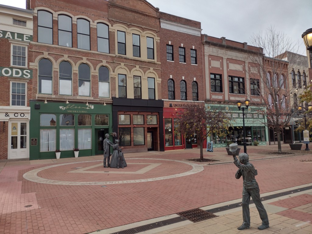
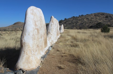
In 1908, African Americans made up only 5.5% of Springfield’s population of 47,000. However, racial tensions ran high across the nation, and, on August 14, a mob formed outside the jail where two African-American men were accused of separate incidents of sexual assault and murder. When the crowd found out the prisoners had been secretly moved 60 miles away, a full riot broke out. They destroyed buildings, looted, and lynched two prominent members of the African-American community—a barber named Scott Burton and the wealthy William Donnegan. By the time the National Guard arrived to restore order, seven people were dead and the mob had already burned the African-American neighborhood known as the “Badlands” to the ground. Eventually, the trials of the 80 riot suspects at the Old Court House led to only one conviction for petty larceny. While the rape suspect, George Richardson, was released when his accuser admitted fabricating the story, Joe James was convicted of murder and executed on October 23, 1908 despite being legally exempt from the death penalty as a minor. These events catalyzed the formation of the National Association for the Advancement of Colored People (NAACP) a few months later in New York City.
Walking tour, Acts of Intolerance sculpture, mural, Old Court House, Springfield and Central Illinois African American History Museum, Oak Ridge Cemetery, Mechanicsburg Cemetery
Must-Do Activity
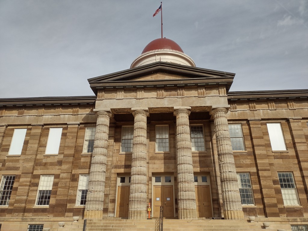
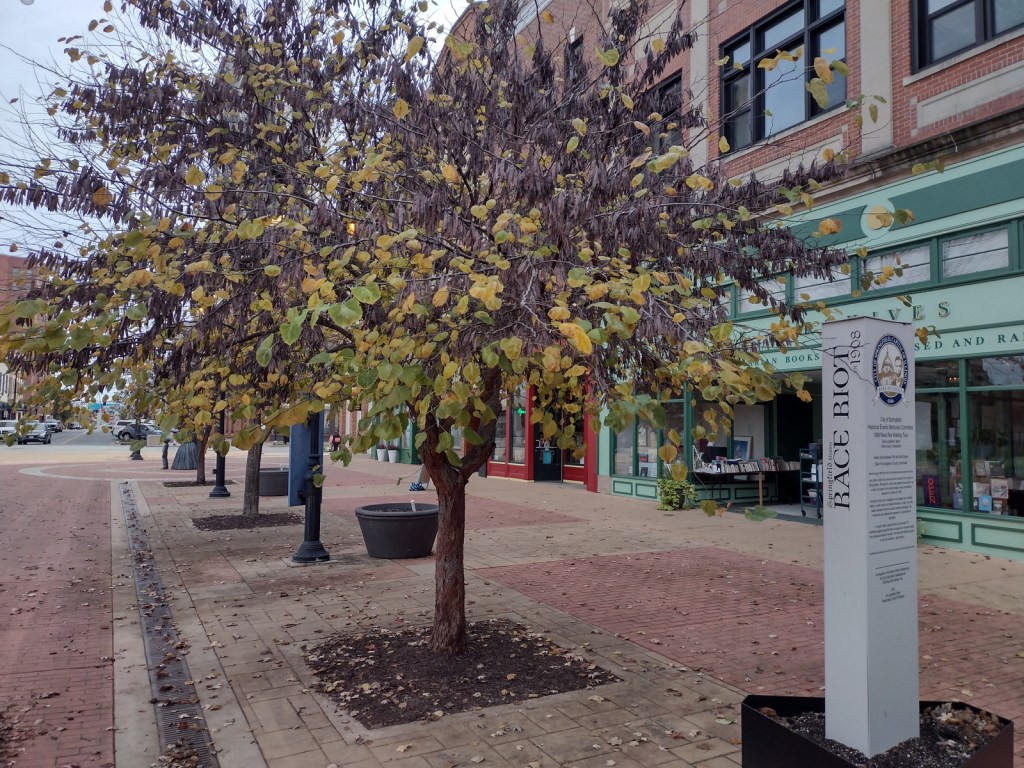
Before the National Monument was designated in 2024, the city of Springfield had already created a walking tour highlighting the events of the 1908 race riot marked by seven silver pillars. After starting at the former site of the jail, the tour moves to where Loper’s Restaurant once stood; its white owner having assisted in moving the prisoners, his restaurant and his car were destroyed. During the frenzy, a restaurant patron named Louis Johnson was shot and killed. There are five other stops detailing the events chronologically, but they do not include the mural inside HSHS St. John’s Hospital Women & Children’s Clinic, which is next to the officially designated National Monument boundaries where the foundations of five homes burned in the “Badlands” remain fenced off. Upon our visit less than three months after its creation, the National Park Service visitor center for Lincoln Home National Historic Site did not have any information on the new National Monument, but they already had a passport stamp.
Best Trail
When followed in chronological order, the walking tour bounces back and forth across the city, so you will get your steps in that day. In the summer, guided tours are offered from the Springfield Convention and Visitors Bureau. Alternatively, you can drive the route and read the descriptions in the publication available online and from the visitors bureau.
Photographic Opportunity
After the burning of the “Badlands” neighborhood, two chimneys were about the only structures left standing. The sculptor Preston Jackson utilized this imagery in his work Acts of Intolerance that depicts scenes of the race riot in bas relief. Dedicated in 2009, it stands across the street from the Abraham Lincoln Presidential Library in Union Square Park.
There is no free parking in downtown Springfield, so you can use a parking meter or the NPS pay lot at Lincoln Home National Historic Site.
Camping
Lincoln’s New Salem State Historic Site is 20 miles northwest of Springfield and its campground has running water. Further north, Starved Rock State Park is a beautiful spot for camping, and it also offers a historic lodge.
Related Sites
New Philadelphia National Historic Site (Illinois)
Last year we published our guidebook 50 States of Great: Road Trip Guide to America, so we decided to start a new type of blog post where we create a travel itinerary for all 50 states, in addition to our usual National Forest and National Park entries. After starting with Kansas, Georgia, Idaho, Rhode Island, Minnesota, and Hawai‘i we decided to do a state in the southwest. Arizona probably needs two separate itineraries, with the southern deserts being a great destination in the winter and the high-elevation northern part of the state better in the summer (see Day 8+). We made an ambitious seven-day plan starting in the south, with plenty of options to extend the trip. Scott grew up in Arizona, so he could have easily made this a four-week itinerary and still left out many good options.
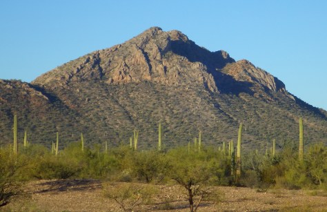
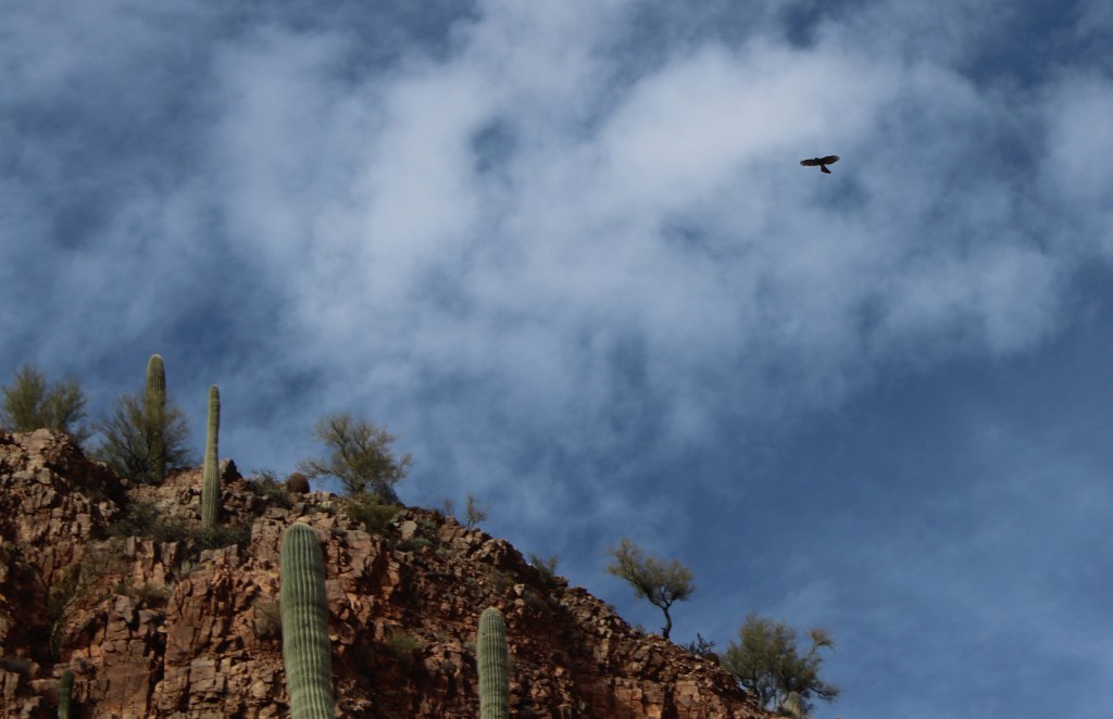
On the Mexican border sits 330,689 acres of undeveloped Sonoran Desert recognized as a UNESCO International Biosphere Reserve in 1976. Its namesake cactus is more common further south and shares this landscape with 27 other species of cacti, including the famous saguaro. The park’s jagged Ajo Mountains are mostly volcanic rhyolite and to see them at their best, we recommend driving the 21-mile dirt road loop in the evening before turning in for the night at the excellent Twin Peaks Campground, run by the National Park Service (NPS).
Arizona has 19 National Monuments (more than any other state), so if you flew into Sky Harbor Airport in Phoenix start with the one located right off Interstate 10.
Desert bighorn sheep can be seen in this remote part of southwest Arizona south of Quartzsite. Cibola and Imperial National Wildlife Refuges along the Colorado River are good spots for birding.
Southwest of Tucson, Arizona in a nondescript stretch of desert are the remains of an underground Intercontinental Ballistic Missile (ICBM) silo built in 1963, during the height of the Cold War. The nuclear warhead and rocket fuel was long ago removed from the site, but otherwise everything has been preserved. A tour guide takes you below ground in the original elevator to explain the steps required to unleash this devastating weapon.
The Catalina Highway ascends from Tucson through multiple life zones from saguaro-dotted desert to ponderosa pine forests at more than 9,000 feet in elevation. The expansive vistas along the drive are worth the many switchbacks, with Windy Point Vista is an especially beautiful wayside in the pinyon-juniper woodland zone. At the base of the Santa Catalina Mountains, also within Coronado National Forest, tram rides are available through beautiful Sabino Canyon Recreation Area.
If you didn’t get your fill of cacti the first day, you will at this park with separate sections east and west of Tucson. If you only have time for one, we recommend the eastern Rincon Mountain District.
South of Tucson in Tubac, San Cayetano de Tumacácori is a Spanish mission founded in 1691 by Padre Kino and abandoned in 1848. It became a National Monument in 1908 when it was restored to its ruined state based on photographs dating from 1868.
The highly decorated cave was not discovered until 1974, when its location was kept a tight secret while efforts were made to preserve it for future visitors. There are two guided tours on paved trails offered, and if you space out your reservations far enough you can take a hike on the 2.4-mile Foothills Loop Trail in between.
Bisbee
The copper mining center of Bisbee was once the largest city between El Paso and San Francisco. The well-maintained Victorian architecture and flights of steep staircases give this border town a unique atmosphere.
The park does not actually contain a statue or large memorial to Coronado. It does have a steep three-quarter mile trail to a 600-foot long limestone cave bearing Coronado’s name, which visitors can explore on their own with flashlights.
Tucked away in the southeastern corner of Arizona, millions of years of erosion left behind a spectacular collection of rhyolite rock formations that rise above surrounding evergreen trees. All the trails are good, but we recommend an all-day hike through Echo Canyon to the Heart of Rocks Loop where you will find formations resembling camels, ducks, and anything else you can imagine.
Salt River Canyon
Start driving north and be sure to stop for photos where U.S. Highway 60 drops steeply into this gorgeous canyon between Globe and Show Low.
Optional stop at Wilcox Playa Wildlife Area
In the winter, sandhill cranes stay in large numbers in the wetlands south of Wilcox and Interstate 10.
To visit the NPS visitor center, the literal “must-do activity” is to hike 1.5 miles from the trailhead. You do pass interpretive signs, a cemetery, and ruins along the way.
A paved walkway behind the Rainbow Forest Museum is a great place to start, as NPS rangers give guided tours there throughout the day. It is worth a hike to Agate House and a connection to the Giant Logs Trail to see more petrified wood, but be sure to bring water with you in the summer since there is no shade.
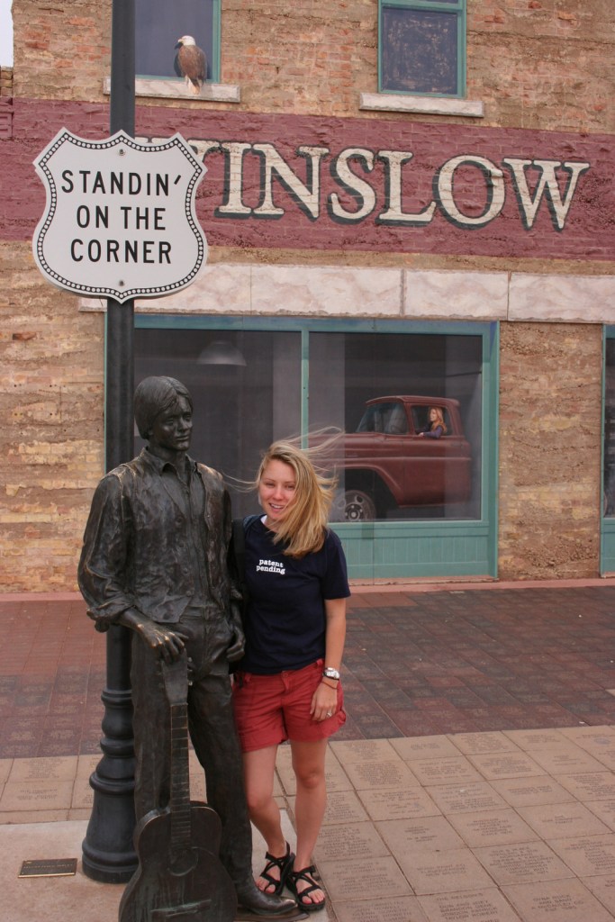
“Standin’ on the corner” statue in Winslow
Jackson Browne and Glenn Frey probably could not have guessed when they penned the 1970s anthem “Take It Easy” that it would inspire a statue in an Arizona town on historic Route 66. Perhaps even more fitting is the mural behind it that shows the reflection of a girl driving a flatbed truck. Located off Interstate 40, Winslow is a great place “to loosen your load.”
Cameron Trading Post
As a kid, Scott’s family would always spend the night at the hotel here before taking friends and family to the Grand Canyon National Park. Try the mutton stew or Indian taco in the restaurant at this historic spot.
Optional stop at Meteor Crater
There is a good museum at this big, round hole in the ground along Interstate 40. It is definitely worth seeing once in your life.
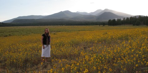
Heading north from Flagstaff, a 36-mile loop drive through Sunset Crater Volcano National Monument to adjacent Wupatki National Monument passes by the red-hued cinder cone through ponderosa pine forests and sunflower-filled meadows on its way to an arid, rocky high desert region that is dotted with Sinagua ruins from around AD 1100. Nearby cliff dwellings were built in Walnut Canyon National Monument around the same time by another group of Sinagua. To get up close with the cliff dwellings inside shallow limestone caves requires a hike down 200 stairs on the one-mile loop Island Trail.
Visit the South Rim of the park from the less busy eastern entrance and stop at the Watchtower and other scenic views along the way. It is worth spending a few nights here and hiking (or riding a mule) to the bottom of the canyon, but that is not for everyone. If you come in the summer, consider a trip to the North Rim or remote Toroweap (online permit required).
Optional stop at Little Colorado River Gorge Navajo Tribal Park
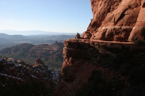
Famous for art galleries and New Age mysticism, the red rock city of Sedona offer plenty of stores and restaurants. Be sure to leave some time to explore some unpaved roads and hiking trails in the surrounding area.
There are numerous trails in the National Forest around Sedona, where sandstone buttes (like Bell Rock and Cathedral Rock) dominate the landscape. The shady West Fork Trail in Oak Creek Canyon is perfect on hot summer days, though in the winter it is also beautiful covered in snow and ice.
Optional stop at Sycamore Canyon Wilderness
This designated Wilderness (55,937 acres) is shared between three National Forests: Coconino, Kaibab, and Prescott. The easiest way in is on the Parsons Trail located outside Clarkdale, west of Sedona. The trailhead is accessed by driving the dirt Forest Road 131 for 10.5 miles from where it splits off near Tuzigoot National Monument.
The Sinagua pueblo at Tuzigoot had about 110 rooms and is estimated to have housed 200 to 300 people. You can walk inside portions of the ruin, including a section with a reconstructed roof.
These cliff ruins east of Phoenix are worth the hike up to, as are many parts of Tonto National Forest, especially the Flat Iron, Hieroglyph Canyon, and Weaver’s Needle.
This is a unique NPS site with livestock (sheep, horses, turkeys) and a hands-on play area for children, as well as the original dusty store which allows visitors to travel back into the late-1800s. There are frequent Navajo rug weaving demonstrations and tours inside the Hubbell Home are available for a fee.
In the heart of the Navajo Nation in northeast Arizona lies this picturesque National Monument. Humans have inhabited this area for 4,500 years, leaving behind numerous pictographs and the dramatic ruins of Ancestral Puebloan cliff dwellings.
Visitors can reserve spots on the ranger-led day hike to Betatakin cliff dwelling or the 20-person backpacking trips to Keet Seel that are offered twice per month in the summer. The latter is a strenuous trip covering 17 miles total with numerous stream crossings and all water must be carried in. The hardest part is at the end, when a 1,000 foot climb awaits, but it is worth it to be one of the few who get to see Keet Seel, the 150-room ruin that is second in size only to Cliff Palace at Mesa Verde National Park.
Monument Valley Navajo Tribal Park
On the border of Arizona and Utah, entrance into Monument Valley Navajo Tribal Park allows you to see the iconic Mitten Buttes in person, which have served as a backdrop for countless films. You can even pitch your tent at The View Campground overlooking the red rock formations.
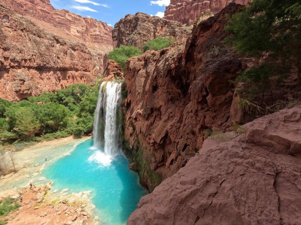
Havasupai Reservation
It is hard to argue against Mooney Falls and the other waterfalls in Havasu Canyon as being the most outstanding in the state, but it can be difficult (and expensive) to obtain one of the limited reservations available to visit the Havasupai Reservation that borders Grand Canyon National Park.
Retention ponds keep this area green in the hot summer months where ducks paddle and dragonflies buzz through the humid air. When a NPS ranger is present, you can walk around inside Winsor Castle, a Mormon fort that dates back to 1870.
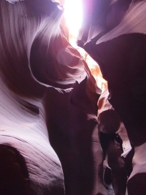
Antelope Canyon
Guided tours are required to access these beautiful slot canyons located on private land on the Navajo Nation
You might want to bring your “selfie stick” to iconic Horseshoe Bend Overlook, a short 0.7-mile one-way hike from the parking area on Highway 89 outside Page.
At Arizona Hot Springs, pools are formed by sandbags in a narrow canyon. It is accessible from Liberty Bell Trailhead by a 6.5-mile out-and-back hike through a beautiful arroyo down to Black Canyon (now the upper reaches of Lake Mohave formed by a dam) on the Colorado River. The trail is closed during the hot summer months, but you can still access it by boat from Willow Beach Marina or just downstream from the Hoover Dam (with a special permit). Further south on Lake Mohave, stop at Emerald Cove for incredible photographs.
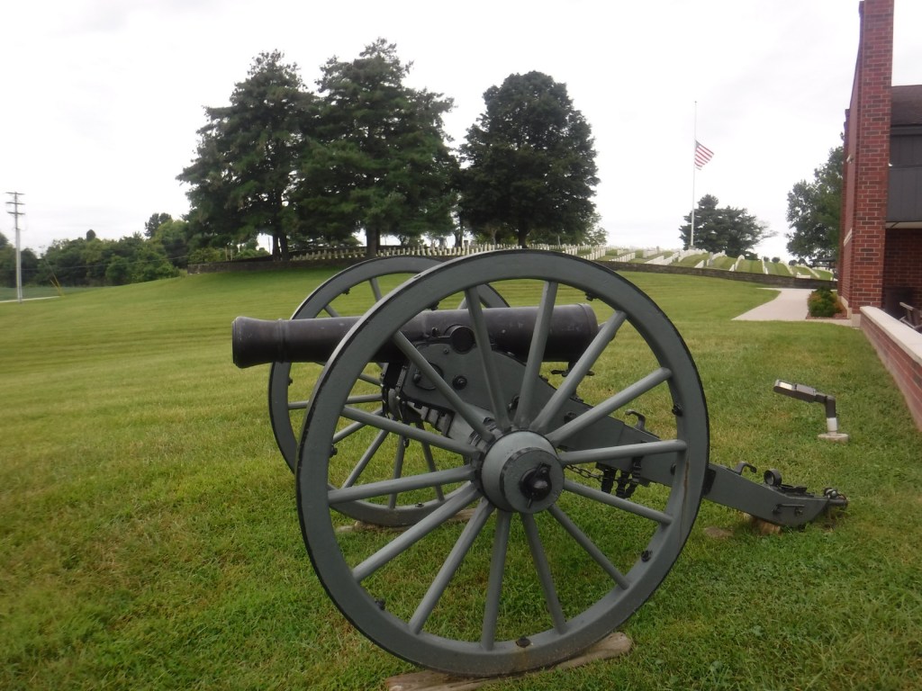
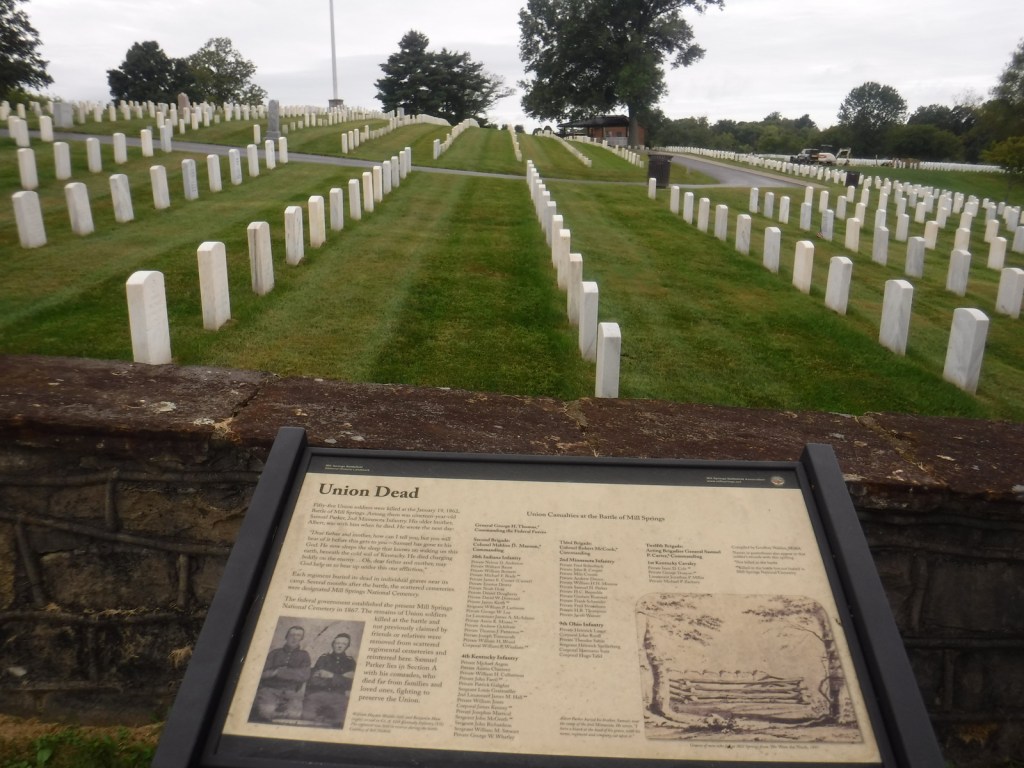
During the Civil War, the Battle of Mill Springs started on January 19, 1862 in the Union state of Kentucky (where slavery was still legal). North of the Cumberland River, a surprise attack by the Confederate Army was repelled and celebrated as the first decisive Union victory in the western theater. The battlefield was declared a National Historic Landmark in 1993 and acquired by the National Park Service (NPS) in 2020.
Museum, film, Mill Springs National Cemetery, Zollicoffer Park, Brown-Lanier House, Mill Springs Mill, Lake Cumberland
Must-Do Activity
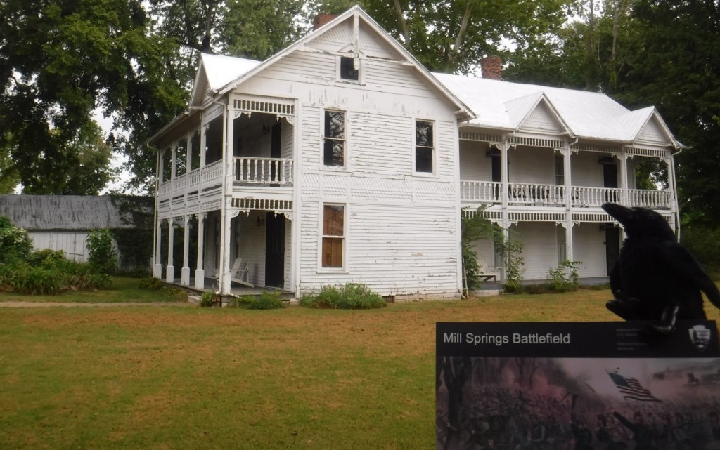
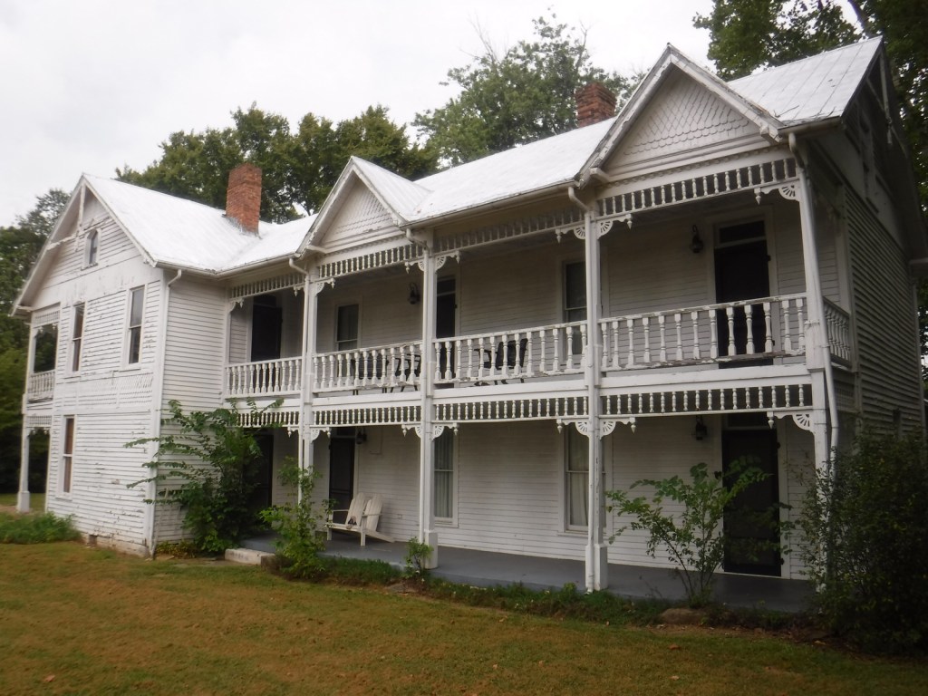
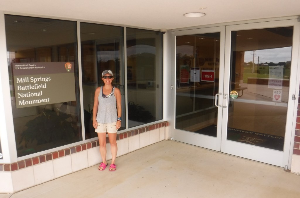
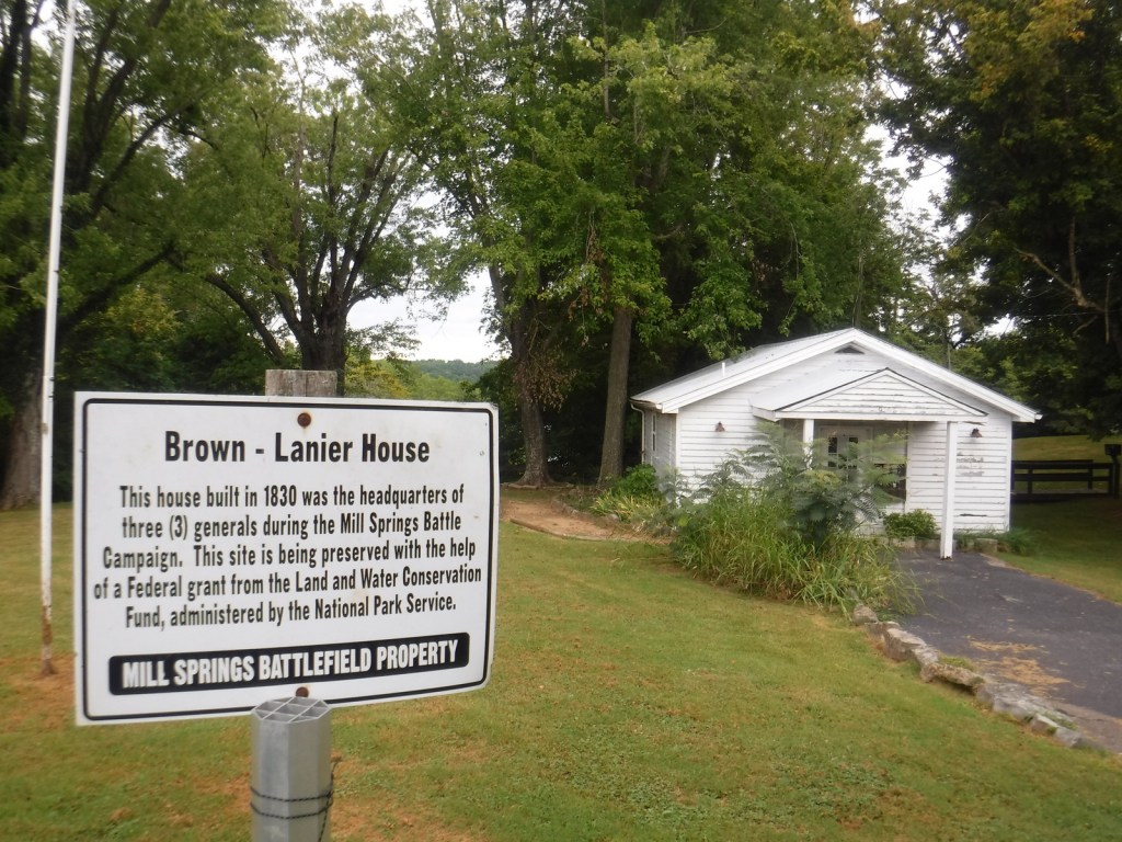
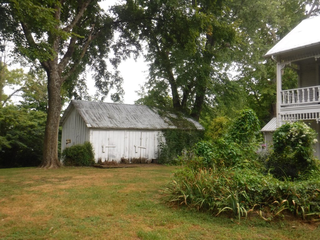
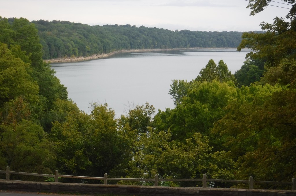
Start your visit by watching the film at the NPS visitor center next to Mill Springs National Cemetery, opened in 1867 as one of 12 original National Cemeteries. The driving tour starts from there south down Kentucky Highway 235 to Zollicoffer Park where there are markers for Confederate General Felix K. Zollicoffer (buried beneath the “Zollie Tree”) and a Confederate mass grave. There are six more stops on the driving tour north of Lake Cumberland, but there is no bridge across the reservoir, so to reach the final two stops requires backtracking and connecting to Kentucky Highway 1275. There you will reach the Brown-Lanier House at Mill Springs that was utilized by both sides of the battle. Open seasonally to the public, the working grist mill on Lake Cumberland dates to 1877 and is managed by the Army Corps of Engineers. The final tour stop is at the West-Metcalfe House that served as a Confederate headquarters and hospital, but is not currently open.
Best Trail
A 0.75-mile walking trail in Zollicoffer Park goes down into a ravine that was behind the Confederate lines, as explained by interpretive signs there. You can also walk to the edge of Lake Cumberland at Ferry Landing on the north shore and Mill Springs Mill on the south shore.
Photographic Opportunity
Built in 1860, the Brown-Lanier House offers guided tours inside the house that was twice hit by artillery during the Battle of Mill Springs.
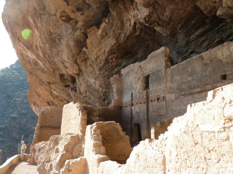
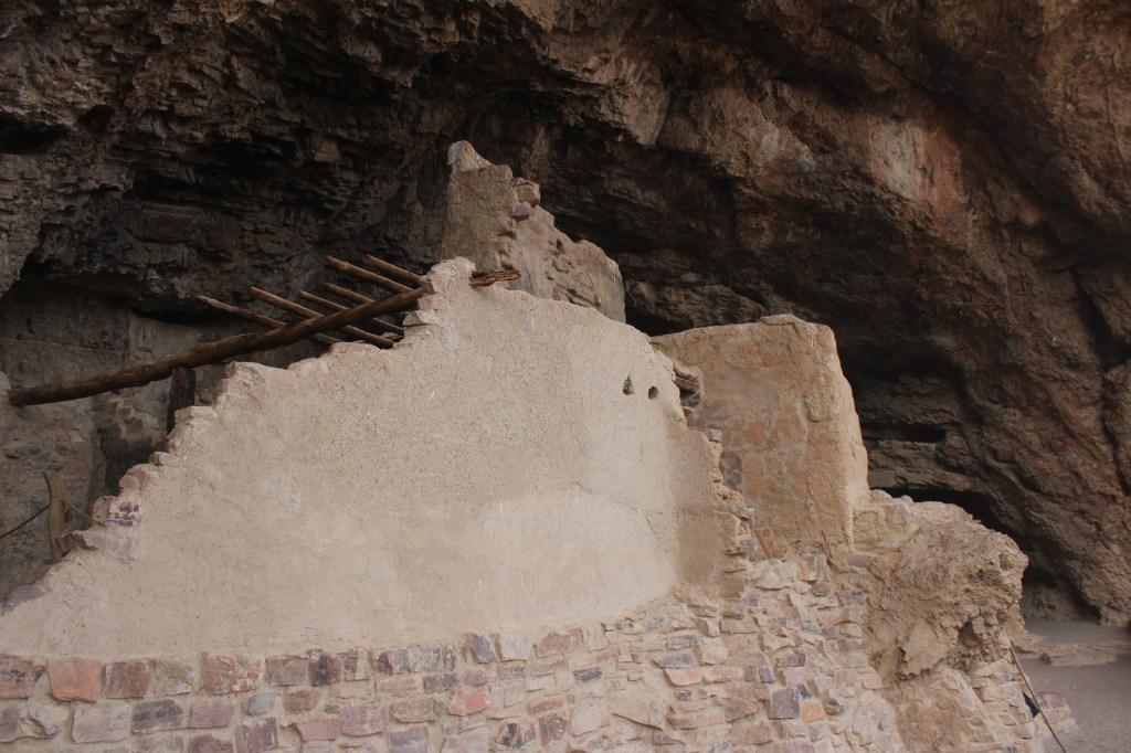
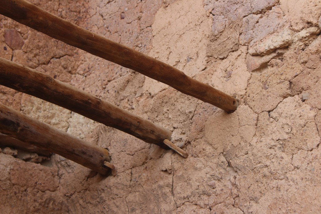
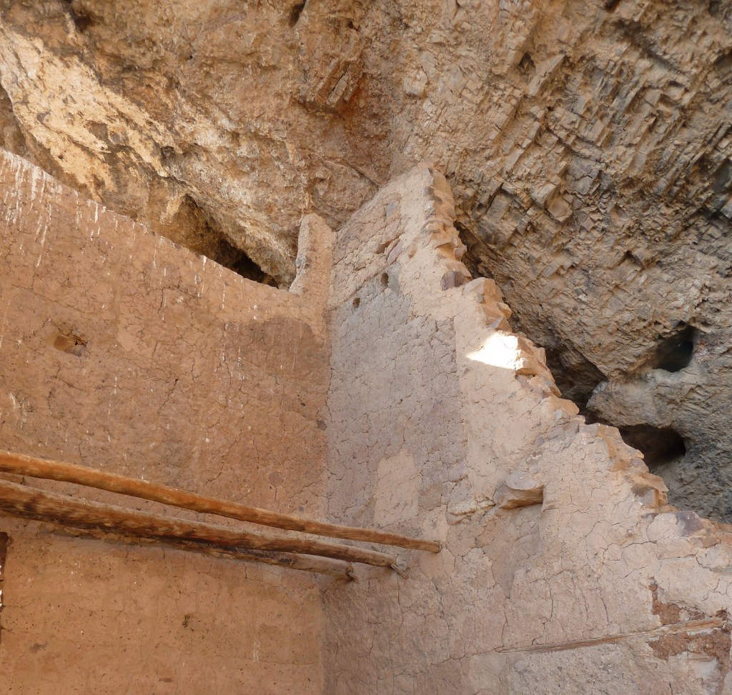
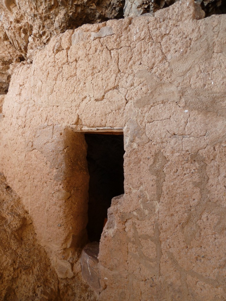
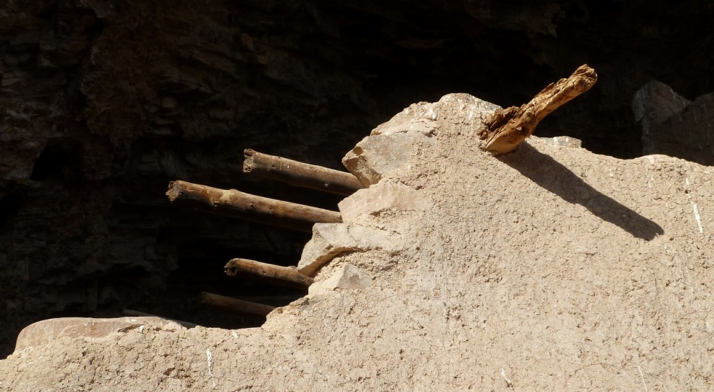
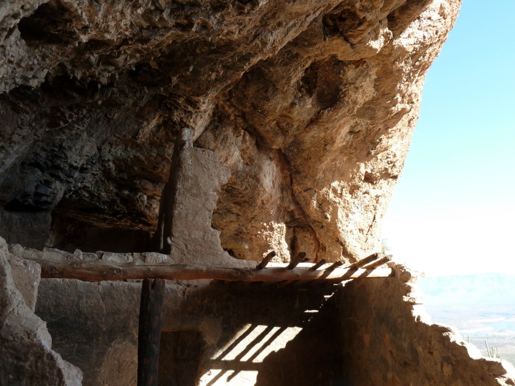
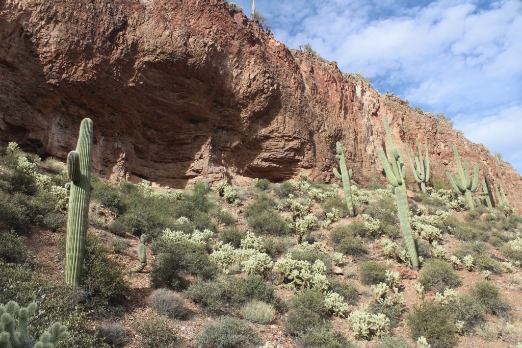
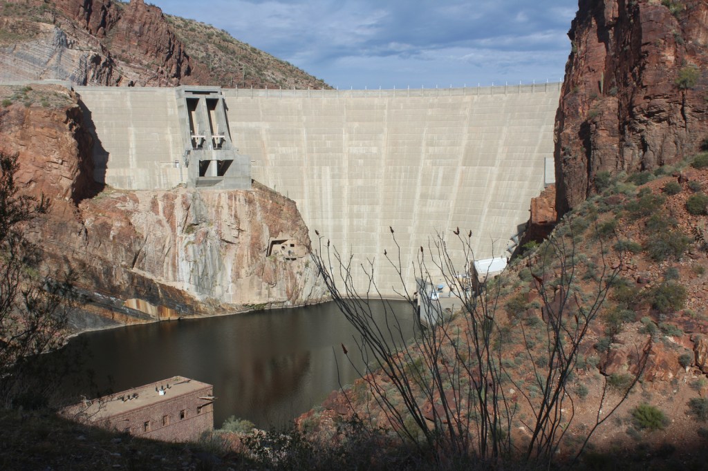
After farming along the Salt River (or Rio Salado) for centuries, in the 1300s the Salado people moved to natural caves where they constructed cliff dwellings. Perhaps following catastrophic flooding or drought, the entire Tonto Basin was abandoned by 1450. When construction of Theodore Roosevelt Dam began in 1906, its namesake President protected these ruins using the power of the 1906 Antiquities Act.
Museum, film, Lower Cliff Dwelling, Upper Cliff Dwelling guided tour
Must-Do Activity
Every visitor who is in good enough shape for the 350 foot ascent should make their way up to Lower Cliff Dwelling (with 28 rooms) after watching the film at the National Park Service visitor center. While at the top, talk to the volunteer stationed there for more information about the people who once inhabited the ruins. Only offered from November through April, the 10 a.m. ranger-guided tour (reservations required) to the Upper Cliff Dwelling (with 40 rooms) crosses washes and ascends 600 feet via switchbacks and 60 steps over a three-mile roundtrip.
Best Trail
The paved trail to the Lower Cliff Dwelling gains 350 feet of elevation in a half-mile, providing excellent views of Theodore Roosevelt Lake.
Photographic Opportunity
Hiking to Lower Cliff Dwelling is a good introduction to native plants of the Sonoran Desert, including the iconic saguaro cactus, yucca, sotol, cholla, and barrel cactus.
Highway 188 provides paved access to Tonto National Monument between Payson and Globe, while Arizona Highway 88 (“Apache Trail”) is unpaved past Canyon Lake and until December 2024 that section was closed due to a wash out in 2019. Together they make for a beautiful scenic loop drive suitable for high-clearance vehicles.
Camping
There are campgrounds around Theodore Roosevelt Lake and within Tonto National Forest, which also allows dispersed camping in some areas.
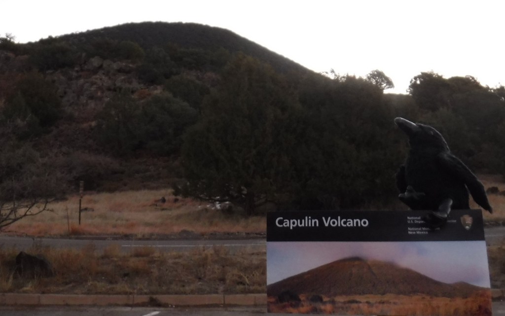
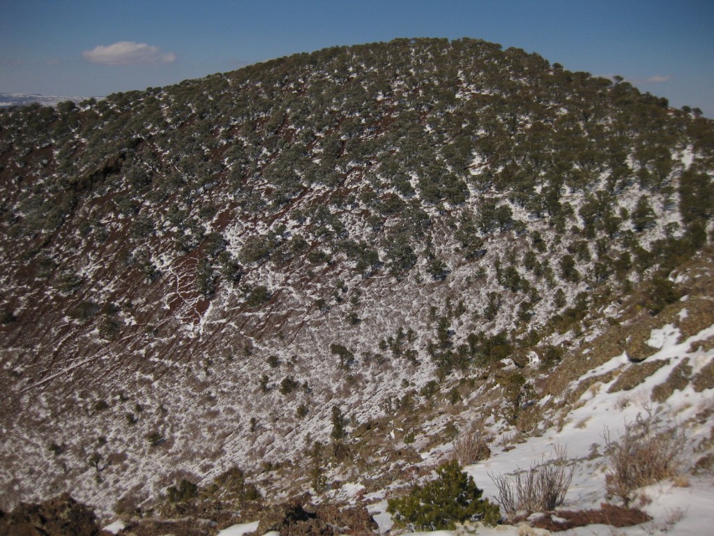
Capulin Volcano is a cinder cone that started to form 60,000 years ago in the Raton-Clayton Volcanic Field of northeast New Mexico. It would eventually erupt enough to rise 1,300 feet above the surrounding landscape and cover 16 square miles with lava. The volcanic field was last active about 10,000 years ago, so not nearly as recently as Arizona’s Sunset Crater Volcano National Monument. Capulin is the Spanish name for the native choke cherry tree (Prunus virginiana).
Start your visit at the National Park Service visitor center off Highway 325 where you can view the exhibits and watch the film. A two-mile drive leads from there to the rim of Capulin Volcano at 8,182 feet of elevation, where there are two hiking trails. At the top, watch the skies for golden eagles and the stems of trees and bushes for dense groupings of ladybugs.
Best Trail
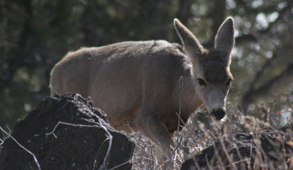
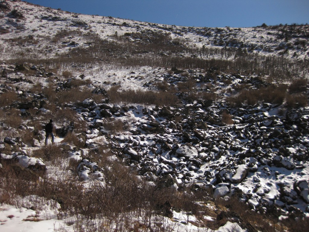
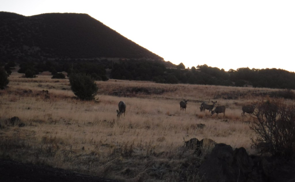
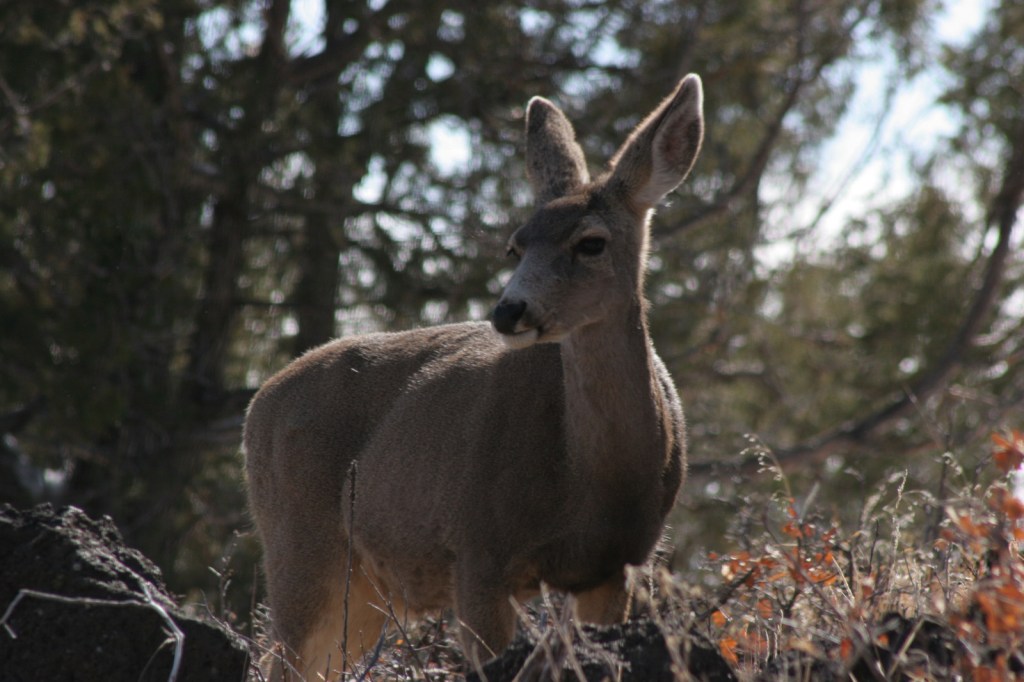
There are two trails at the top of the cinder cone, one that drops to the bottom of the crater in 0.2 miles and another that circles the rim for one mile (going counterclockwise is recommended as less strenuous). There is also the one-mile Lava Flow Trail loop and a short paved Nature Walk at the visitor center, as well as the Boca Trail that loops 1.7 miles along the western base of Capulin Volcano where you might see mule deer.
Photographic Opportunity
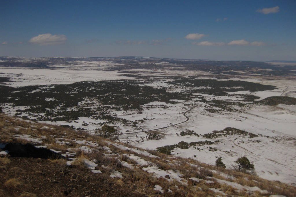
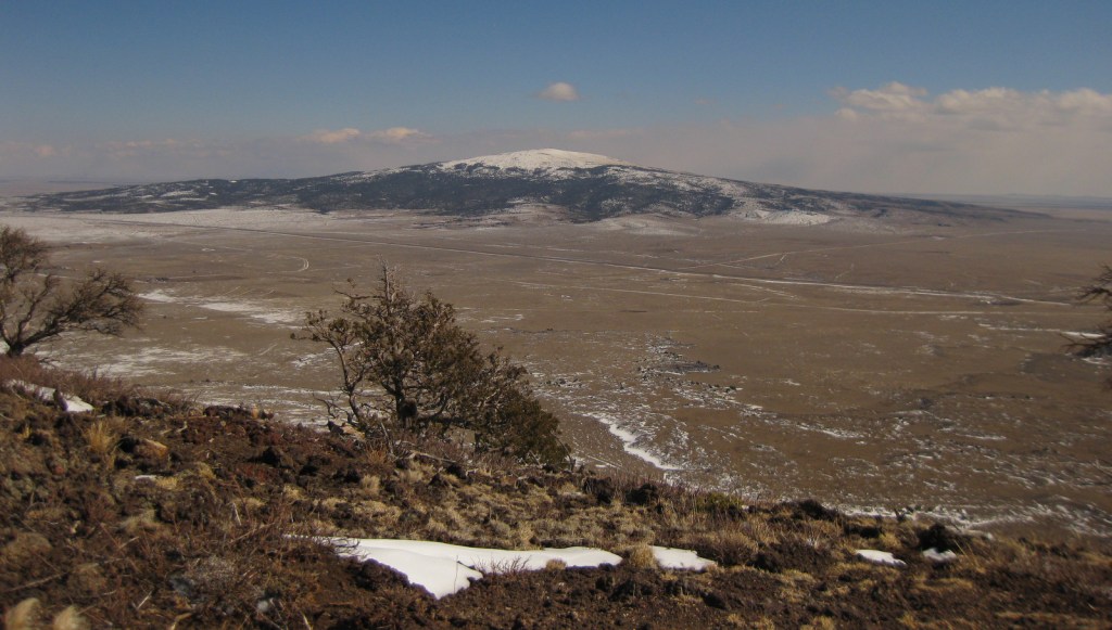
The crater of the cinder cone is about 415 feet below the rim, which offers views into Colorado, Texas, and Oklahoma on a clear day.
The road is paved two miles from the visitor center to the parking lot at the top of Capulin Volcano, but gated off overnight even though the park is International Dark-Sky Association Gold Tier Certified.
Camping
There is not an NPS campground at the National Monument, but we have stayed at the nice campground at Sugarite State Park 33 miles west in Raton near Interstate 25. Kiowa National Grassland and Clayton Lake State Park also offer camping.