Tag Archives: museum

Capulin Volcano National Monument

Capulin Volcano National Monument

New Mexico

Managed by National Park Service

Established 1916

793 acres

Website: nps.gov/cavo

Overview

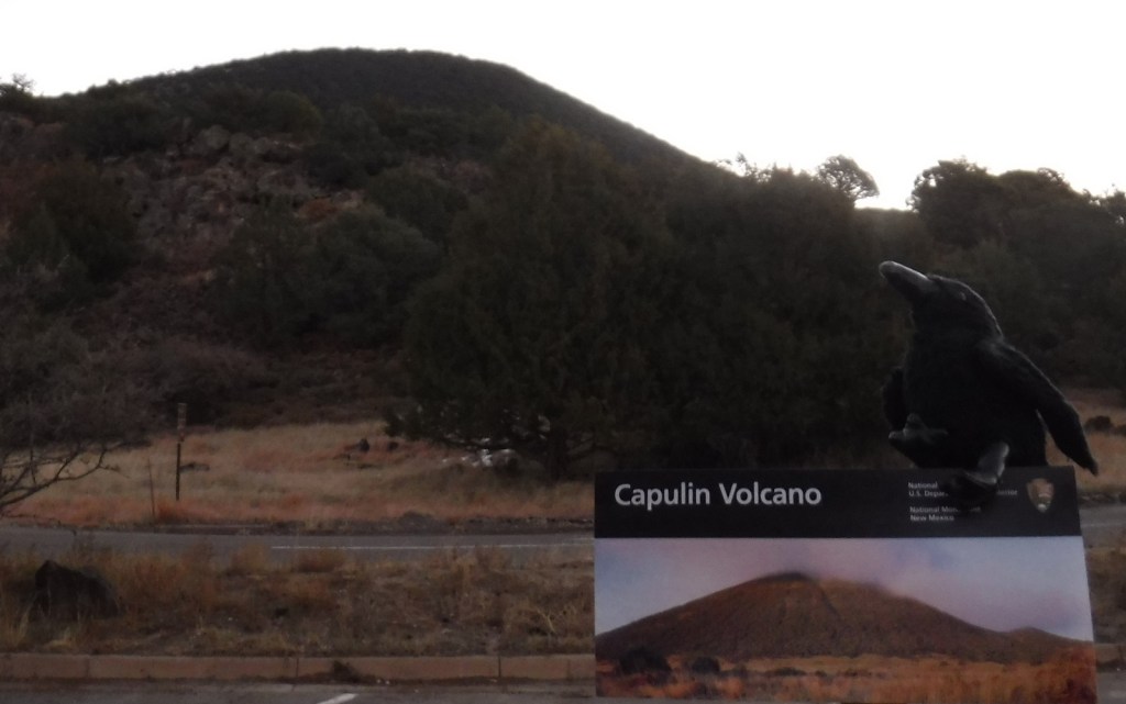
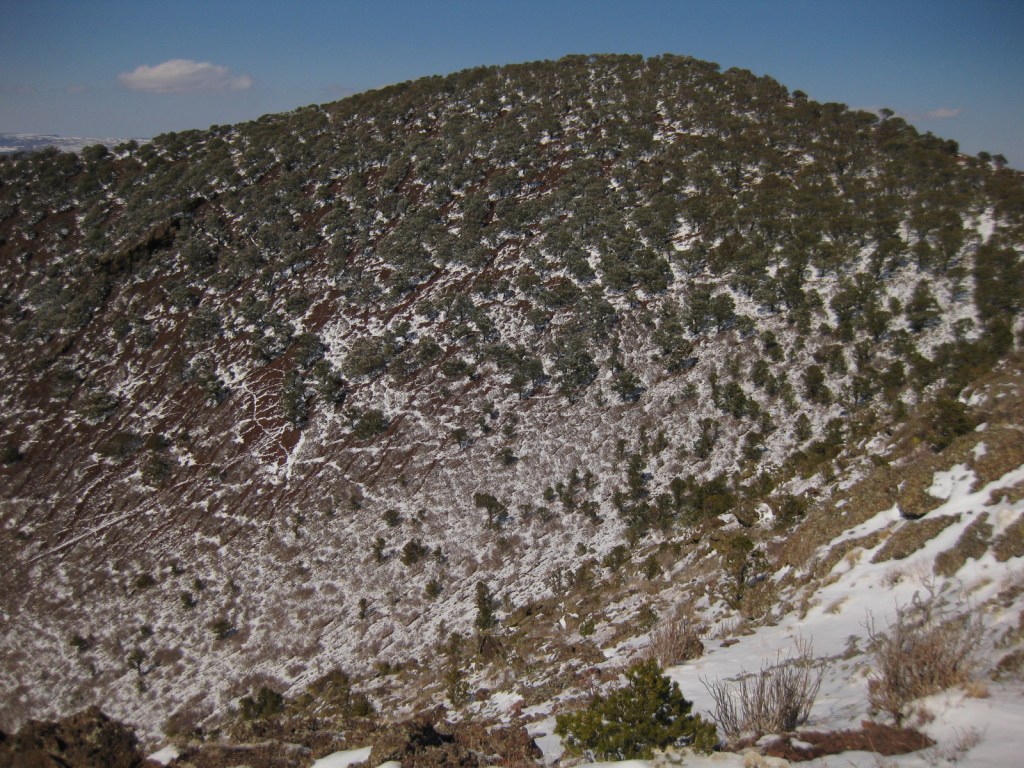
Capulin Volcano is a cinder cone that started to form 60,000 years ago in the Raton-Clayton Volcanic Field of northeast New Mexico.  It would eventually erupt enough to rise 1,300 feet above the surrounding landscape and cover 16 square miles with lava.  The volcanic field was last active about 10,000 years ago, so not nearly as recently as Arizona’s Sunset Crater Volcano National Monument.  Capulin is the Spanish name for the native choke cherry tree (Prunus virginiana).

Learn more about the other 137 National Monuments in our book Monumental America: Your Guide to All 138 National Monuments. It is now available for sale on Amazon.com.

Highlights

Museum, film, Capulin Volcano

Must-Do Activity

Start your visit at the National Park Service visitor center off Highway 325 where you can view the exhibits and watch the film.  A two-mile drive leads from there to the rim of Capulin Volcano at 8,182 feet of elevation, where there are two hiking trails.  At the top, watch the skies for golden eagles and the stems of trees and bushes for dense groupings of ladybugs.

Best Trail

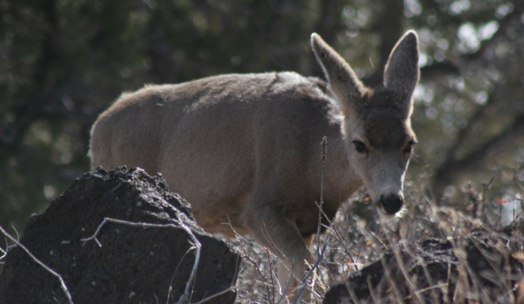
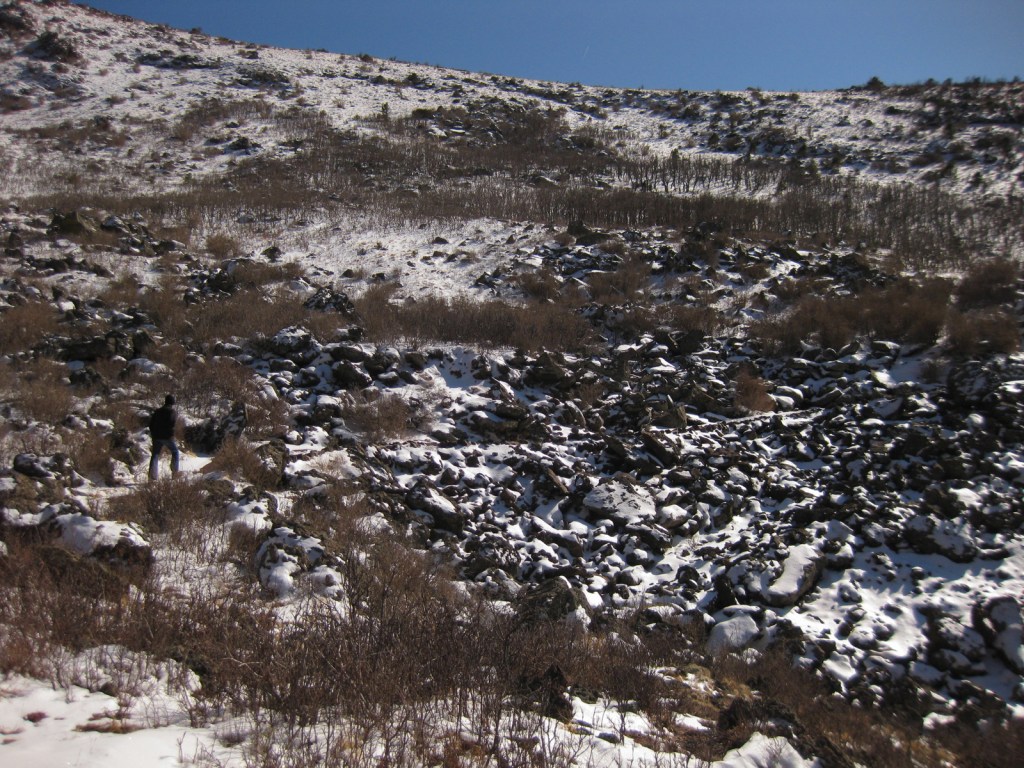
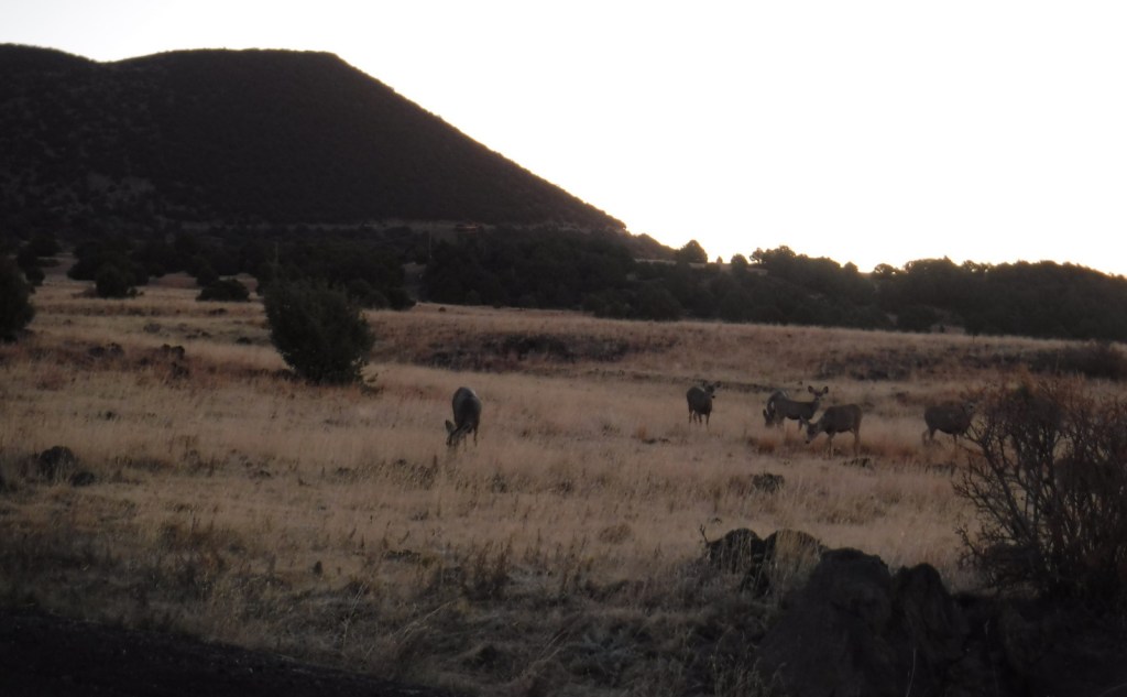
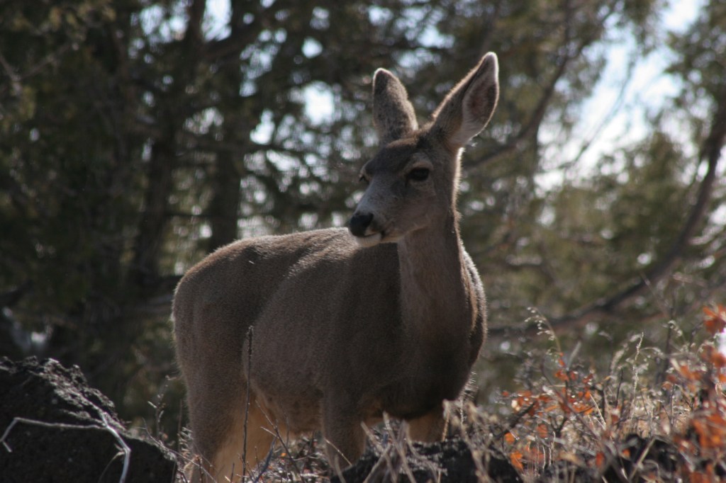
There are two trails at the top of the cinder cone, one that drops to the bottom of the crater in 0.2 miles and another that circles the rim for one mile (going counterclockwise is recommended as less strenuous).  There is also the one-mile Lava Flow Trail loop and a short paved Nature Walk at the visitor center, as well as the Boca Trail that loops 1.7 miles along the western base of Capulin Volcano where you might see mule deer.

Photographic Opportunity

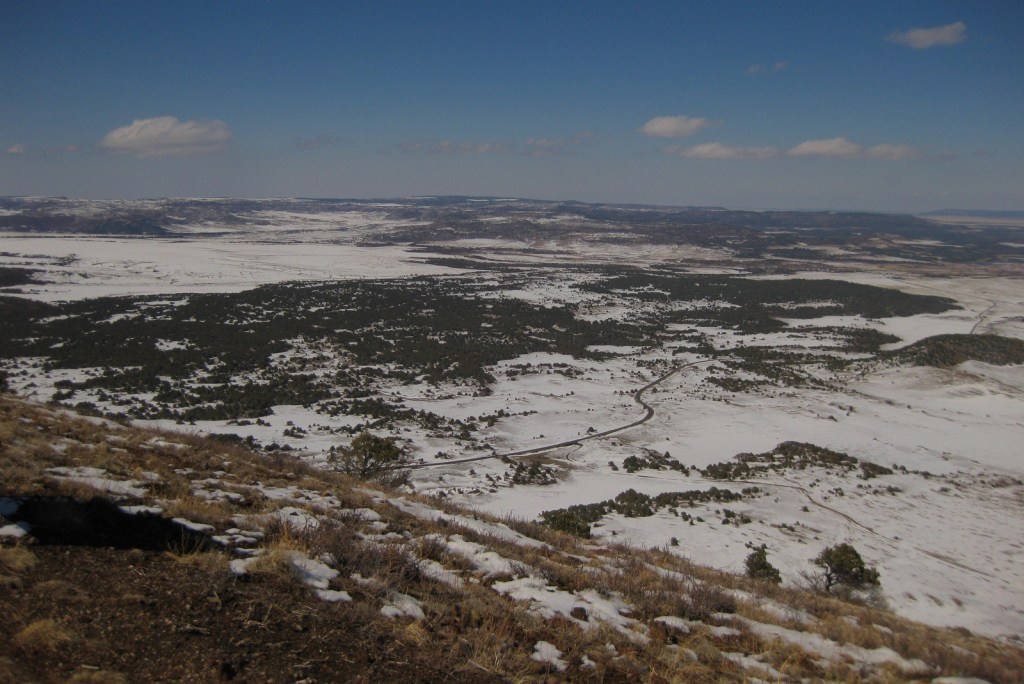
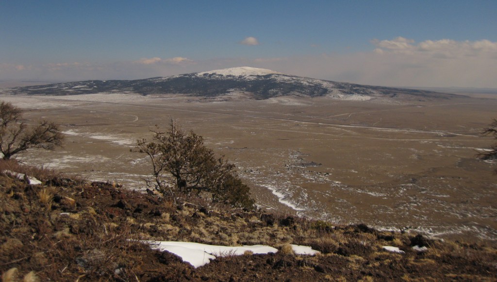
The crater of the cinder cone is about 415 feet below the rim, which offers views into Colorado, Texas, and Oklahoma on a clear day. 

Peak Season

Summer

Hours

https://www.nps.gov/cavo/planyourvisit/hours.htm

Fees

$10 per vehicle or America the Beautiful pass

Road Conditions

The road is paved two miles from the visitor center to the parking lot at the top of Capulin Volcano, but gated off overnight even though the park is International Dark-Sky Association Gold Tier Certified.

Camping

There is not an NPS campground at the National Monument, but we have stayed at the nice campground at Sugarite State Park 33 miles west in Raton near Interstate 25.  Kiowa National Grassland and Clayton Lake State Park also offer camping.

Related Sites

Sunset Crater Volcano National Monument (Arizona)

Fort Union National Monument (New Mexico)

Pecos National Historical Park (New Mexico)

Explore More – In May 1971, which two Apollo 16 astronauts did geologic training at Capulin Volcano?

Learn more about the other 137 National Monuments in our book Monumental America: Your Guide to All 138 National Monuments

Pipe Spring National Monument

Pipe Spring National Monument

Arizona

Managed by National Park Service

Established 1923

40 acres

Website: nps.gov/pisp

Overview

Near the Utah border, Pipe Spring National Monument is located near the turn off from Highway 389 for Grand Canyon-Parashant National Monument and the remote Toroweap Overlook in western Grand Canyon National Park.  Likewise, it is only 60 miles from Utah’s famous Zion National Park, so it makes a good stopping point if you are also visiting Kaibab National Forest or the North Rim of the Grand Canyon.  The oasis surrounding the three natural springs here demonstrate what this soil can produce when given a little bit of extra water.  Ancestral Puebloans and Kaibab Paiute Indians have been coming here for over 1,000 years and it was an important stop on the Old Spanish Trail.  In 1858, Pipe Spring was named by Mormon/Latter-day Saint missionary Jacob Hamblin on his way to the Hopi mesas.  Following the 1866 Black Hawk War, Mormon settlers built a sandstone fort called Winsor Castle around the source of the main spring where polygamists used to hide their plural wives before selling the ranch in 1895.  Today this park on the secluded Arizona Strip is recognized by the International Dark Sky Association.

Learn more about the other 137 National Monuments in our book Monumental America: Your Guide to All 138 National Monuments. It is now available for sale on Amazon.com.

Highlights

Museum, film, garden, ponds, Winsor Castle

Must-Do Activity

Retention ponds keep Pipe Spring National Monument green in the hot summer months where ducks paddle and dragonflies buzz through the humid air.  The National Park Service manages a garden with living history demonstrations given occasionally, plus there is livestock including chickens and two longhorns.  When a ranger is present, you can walk around inside Winsor Castle, a Mormon fort that dates back to 1870.  If you visit during the summer, we recommend you cool off after some time outside by watching the short film and exploring the museum and gift shop.  The museum is co-managed with the Kaibab Band of Paiute Indians whose reservation surrounds the site. On December 7, 2024, the park was open late for the Holiday Traditions event with caroling, Victorian-era crafts, and free food.

Best Trail

The half-mile Ridge Trail leads uphill to an overlook of the Kaibab Plateau and distant Mt. Trumbull in Grand Canyon-Parashant National Monument.

Photographic Opportunity

The modest dimensions of Winsor Castle make it unlikely to be confused with Windsor Castle in England.

Peak Season

Summer

Hours

https://www.nps.gov/pisp/planyourvisit/hours.htm

Fees

$10 per person or America the Beautiful pass

Road Conditions

There is a paved parking lot located off Highway 389.

Camping

The Kaibab Band of Paiute Indians runs a small campground adjoining Pipe Spring National Monument.  Dispersed camping is allowed in Kaibab National Forest and the millions of acres run by the Bureau of Land Management on the Arizona Strip.

Related Sites

Grand Canyon National Park (Arizona)

Grand Canyon-Parashant National Monument (Arizona)

Baaj Nwaavjo I’tah Kukveni – Ancestral Footprints of the Grand Canyon National Monument (Arizona)

Explore More – Which indigenous tribes banded together during the 1866 Black Hawk War?

Learn more about the other 137 National Monuments in our book Monumental America: Your Guide to All 138 National Monuments

Charles Young Buffalo Soldiers National Monument

Charles Young Buffalo Soldiers National Monument

Ohio

Managed by National Park Service

Established 2013

60 acres

Website: nps.gov/chyo

Overview

Charles Young was born to enslaved parents in 1864 and went on to become only the third African American to graduate from the U.S. Military Academy at West Point despite being the target of constant insults and social isolation.  He was commissioned an Army officer, serving with the “Buffalo Soldiers,” so named by American Indians because their hair and ferocious fighting style was similar to the bison.  Young became the first African American to serve as the Superintendent of a National Park when he commanded troops at General Grant (now Kings Canyon) and Sequoia National Parks in 1903.  Four years later, Young and his family purchased the 1839-built house he called “Youngsholm” after teaching military science at nearby Wilberforce University for over a decade.  His military career took him to the Philippines, Dominican Republic, Haiti, Mexico, and Liberia, but he was not allowed to fight in Europe during World War I.  In 1922, Young died while serving as a military attaché in Africa and after a campaign by his family and notable African-American celebrities his body was reinterred at Arlington National Cemetery.

Learn more about the other 137 National Monuments in our book Monumental America: Your Guide to All 138 National Monuments. It is now available for sale on Amazon.com.

Highlights

Youngsholm, film, living history demonstrations

Must-Do Activity

A “15-month renovation” of Youngsholm began in October 2021 to restore the house and add an elevator, which in typical government fashion was not finished until April 2024.  There is a film focused on his life as a civil rights trailblazer that is played on the second floor of the house, which you can also watch online before visiting.  We also recommend the 2023 PBS special Buffalo Soldiers that focuses extensively on Charles Young.  None of the rooms inside Youngsholm are furnished, but there are many informational signs about Young and the Buffalo Soldiers.  In addition, 30-minute talks on a variety of topics are given on most weekends by park rangers and there is a Junior Ranger booklet for the site.

Best Trail

None

Photographic Opportunity

A short drive across Highway 42 from Youngsholm takes you to Wilberforce University where there is an Ohio Historical Marker telling the story of Charles Young’s connection with the school. 

Peak Season

Summer

Hours

https://www.nps.gov/chyo/planyourvisit/hours.htm

Fees

None

Road Conditions

Youngsholm is located right off paved Highway 42 near the campus of Wilberforce University.

Camping

The scenic Hocking Hills State Park has 172 campsites (reservations recommended) and is one of the most popular places to camp in Ohio.  Hueston Woods State Park offers 490 campsites, 59 cabins, and a lodge.

Related Sites

Dayton Aviation Heritage National Historical Park (Ohio)

Hopewell Culture National Historical Park (Ohio)

Fort Davis National Historic Site (Texas)

Explore More – What fraternity of African-American leaders is represented by the purple-and-green stained-glass window in Youngsholm?

Learn more about the other 137 National Monuments in our book Monumental America: Your Guide to All 138 National Monuments

Gateway Arch National Park

Gateway Arch National Park

Missouri

Managed by National Park Service

Established 1935 National Expansion Memorial, 2018 National Park

91 acres

Website: nps.gov/jeff

Overview

On February 22, 2018, the 60th National Park in the U.S. was created from what was formerly Jefferson National Expansion Memorial in St. Louis, Missouri.  Gateway Arch National Park encompasses 91 acres on the Mississippi River, including the historic 1828 courthouse and the iconic 630-foot-tall arch that was finished in 1965.  We first visited on our cross-country road trip in 2007 and returned in 2016 while the underground museum was under construction and the greenway was extended over Interstate 44.  When we came back in 2022, the courthouse was closed for renovation, but the museum had reopened with exhibits explaining the importance of this city as a starting point for the settlement of the west after President Thomas Jefferson signed the Louisiana Purchase, doubling the size of the country in 1803.  It is by far the smallest of the 63 National Parks (5,457 acres less than Hot Springs), which begs the question: Why wasn’t this designated a National Historical Park instead?

Learn more about how to visit this National Park in the expanded second edition of our guidebook A Park to Yourself: Finding Solitude in America’s 63 National Parks

Highlights

Gateway Arch, tram, film, museum, Old Courthouse, Old Cathedral

Must-Do Activity

Unlike other National Parks, this one does not preserve a natural landmark, but it does have claustrophobia-inducing tram cars (fee) that take you four-minutes to the top of the Gateway Arch for excellent views across Illinois and Missouri.  It is worth the hassle to go through a security screening to see the new museum.  The 35-minute film Monument to the Dream is also available for a fee. 

Best Trail

There are sidewalks that follow the Mississippi River and loop around the arch.  Be sure to cross the street to the Old Courthouse where the first of two trials in the infamous Dred Scott case was held in 1854.  Continue west behind to the courthouse to the Kiener Memorial Fountain for a photo that frames the building beneath the Gateway Arch.

Photographic Opportunity

The 630-foot-tall Gateway Arch is the defining landmark of St. Louis, but the historic 1834 Old Cathedral still serves as an active Catholic Church inside the park boundaries.

Peak Season

Summer

Hours

https://www.nps.gov/jeff/planyourvisit/hours.htm

Fees

There is no fee to walk the grounds or pass through security for the museum and gift shop, but you do have to pay to view the film or ride the tram to the top of Gateway Arch.  When open, the Old Courthouse is also free to enter.

Road Conditions

All roads are paved, but parking can be tricky.  We suggest paying for a parking garage or paying to park on the river levee near the paddlewheel boats, since car break-ins are common in downtown St. Louis.

Camping

This is the only National Park without the option to camp, so consider heading southwest to the wonderful Ozark National Scenic Riverways or Mark Twain National Forest.  In southeast Missouri, Johnson’s Shut-Ins State Park is rated as one of the best RV campgrounds in the country.

Related Sites

Ulysses S. Grant National Historic Site (Missouri)

Ste. Genevieve National Historical Park (Missouri)

Harry S Truman National Historic Site (Missouri)

Explore More – In 1947, how many city blocks were razed to make way for the memorial, including several historic buildings dating back to 1818?

We designed this Gateway Arch logo for the park available on Amazon.com

We are a participant in the Amazon Services LLC Associates Program, an affiliate advertising program designed to provide a means for us to earn fees by linking to Amazon.com and affiliated sites.

Tule Lake National Monument

Tule Lake National Monument

California

Managed by National Park Service and U.S. Fish and Wildlife Service

Established 2008

1,391 acres

Website: nps.gov/tule

Overview

Following the 1941 attack on Pearl Harbor, President Franklin D. Roosevelt signed an executive order authorizing the detention of more than 110,000 U.S. citizens of Japanese descent at ten concentration camps in the contiguous United States.  At Tule Lake War Relocation Center, 7,400 acres were enclosed by barbwire to hold about 12,000 people in northeast California.  Once a loyalty questionnaire was distributed throughout the ten camps, those considered disloyal to the U.S. government were all shipped to the renamed Tule Lake Segregation Center, which held 18,789 inmates at its peak.  Overcrowding, harassment, beatings, and a fatal farm accident led to riots and mass demonstrations, and martial law was declared from November 13, 1943 to January 15, 1944.  This camp was the last to be closed on March 20, 1946, months after the end of the war.  It was named a National Historic Landmark in 2006, and two years later became one of nine sites within World War II Valor in the Pacific National Monument (which included Pearl Harbor National Memorial).  When that was disbanded in 2019, Tule Lake National Monument was created.

Learn more about the other 137 National Monuments in our book Monumental America: Your Guide to All 138 National Monuments. It is now available for sale on Amazon.com.

Highlights

Tulelake-Butte Valley Fairgrounds Museum, Tule Lake Segregation Center prison

Must-Do Activity

Most of the buildings at Tule Lake Segregation Center were moved elsewhere following the war.  One of the few remaining structures is the prison, which is only accessible on ranger-guided tours offered Memorial Day to Labor Day on Thursdays through Sundays (call ahead for required reservations).  The concrete jail had six cells to hold 24 men, but incarcerated over 100 at one time mostly outside in Army tents used as unheated punishment quarters.  The prison is always visible from the National Park Service (NPS) visitor center off Highway 139.  It is worth getting a tour to go inside to see original graffiti from inmates and the reinstalled metal doors that were purchased by a private citizen in the 1940s and kept at their farm for decades.  Tulelake-Butte Valley Fairgrounds Museum (fee) has a one-hour audio tour and there are online virtual tours that show several sites within Tule Lake National Monument, including the inside of the jail prior to the restoration.

Best Trail

There are no designated trails there, but from the NPS visitor center near Newell you can photograph the rock formation known as Peninsula/Castle Rock (solely managed by the U.S. Fish and Wildlife Service).  It is also visible while checking out the rock art at Petroglyph Point within Lava Beds National Monument.

Photographic Opportunity

The Civilian Conservation Corps (CCC) was stationed at Camp Tulelake from 1935 to 1942, constructing 23 buildings and repairing canals.  Several small groups of Japanese Americans were held at Camp Tulelake to separate them from the general population at Tule Lake Segregation Center.  Later in the war, Italian and German POWs were stationed there before the buildings were transferred to the U.S. Fish and Wildlife Service.  Currently, tours of Camp Tulelake are not available due to ongoing preservation work, but you can photograph it through the fence on Hill Road and hike to bird viewing blinds in Tule Lake National Wildlife Refuge.

Peak Season

Summer

Hours

https://www.nps.gov/tule/planyourvisit/hours.htm

Fees

Ranger-guided tours require a reservation, but they are free.  There is an entrance fee for the museum at Tulelake-Butte Valley Fairgrounds.

Road Conditions

Highway 139 and Hill Road are paved, but most of the roads through the former Tule Lake Segregation Center and Tule Lake National Wildlife Refuge are unpaved.

Camping

Indian Well Campground is located in Lava Beds National Monument near the visitor center and Cave Loop Road.  Dirt roads in the nearby Modoc and Klamath National Forests provide free dispersed camping.

Related Sites

Manzanar National Historic Site (California)

Minidoka National Historic Site (Idaho-Washington)

Amache National Historic Site (Colorado)

Explore More – Providing crucial habitat along the Pacific Flyway, what type of migratory birds can be seen at Tule Lake, Clear Lake, and Modoc National Wildlife Refuges?

Learn more about the other 137 National Monuments in our book Monumental America: Your Guide to All 138 National Monuments