The National Park Service (NPS) administers the Natchez Trace Parkway, a two-lane All-American Road that extends 444 miles from Natchez, Mississippi to Nashville, Tennessee. The trace started as a game trail that was utilized as an American Indian footpath. Some of the mound builder sites protected here were inhabited when Hernando de Soto led the first Europeans into this area in 1540. The Natchez Trace was heavily used in the 1800s by “Kaintuck” flatboatmen returning from New Orleans who left the Mississippi River from Natchez, Mississippi and continued on foot north to Kentucky and beyond. Today you can still follow portions of the sunken trail worn down by travelers for centuries. The parkway began as a Civilian Conservation Corps (CCC) project during the Great Depression and the final two segments were completed in 2005.
Highlights
Rocky Springs, Owens Creek Waterfall, Emerald Mound, Mount Locust, Chickasaw Village, Meriwether Lewis Monument and Gravesite, Cypress Swamp Walk, Witch Dance Horse Trail, Natchez Trace National Scenic Trail
Must-Do Activity
Near Tupelo, the Parkway Visitor Center at Milepost 266 is a must-do stop to learn the history of the trace, and it also serves as the NPS contact station for tiny Brices Cross Roads National Battlefield Site and Tupelo National Battlefield. There are numerous roadside informational pullouts and trailheads along the route, so use the NPS app or pick up an official “unigrid” map. You can easily spend days exploring, but at a minimum we recommend you check out Emerald Mound, Mount Locust, Cypress Swamp, and Meriwether Lewis Monument and Grave Site.
Best Trail
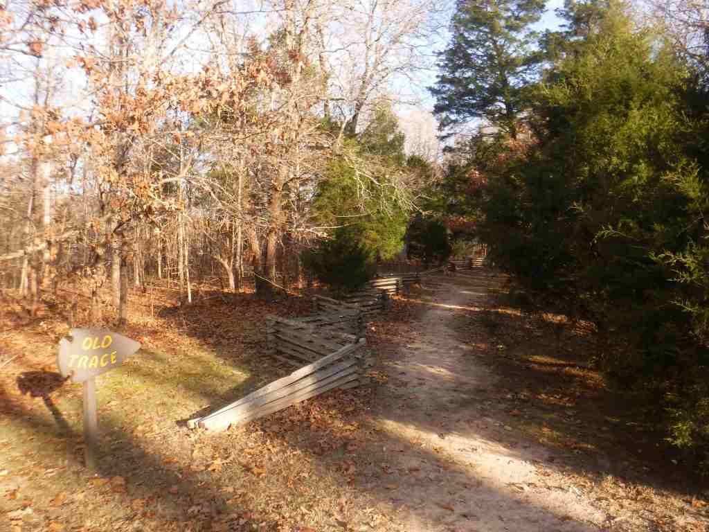
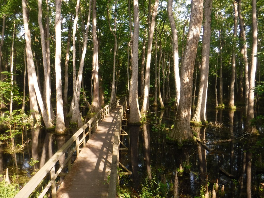
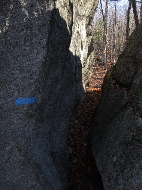
Our favorite trail is the Cypress Swamp Walk at Milepost 122, where a boardwalk crosses a scenic tupelo-baldcypress swamp. The Natchez Trace National Scenic Trail (click here for our blog post) does not follow the entire 444-mile parkway, but exists in five segments totaling 67 miles in length. There are also 15 miles of equestrian trails at Witch Dance (Milepost 233.2) in Tombigbee National Forest.
Photographic Opportunity
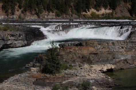
Not far from Natchez National Historical Park, Emerald Mound (a short detour at Milepost 10.3) is the second-largest American Indian ceremonial mound in the U.S. It stands 35 feet tall and 770 by 435 feet at its base.
The entire 444-mile Natchez Trace Parkway is paved from Natchez, Mississippi to Nashville, Tennessee with commercial traffic prohibited and a maximum speed limit of 50 miles per hour. There is a detour from Milepost 181 to 204 due to ongoing construction. Watch for bicycles and white-tailed deer on the road.
Camping
There are three free NPS campgrounds (at Milepost 54, 193.1, and 385.9) along the route, as well as those in sites like Mississippi’s Tishomingo State Park. The three NPS campgrounds have water and bathrooms (but no RV hookups), plus there are also five bike-only campsites along the route. Jeff Busby Campground closed in June 2025 for repairs.
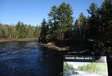
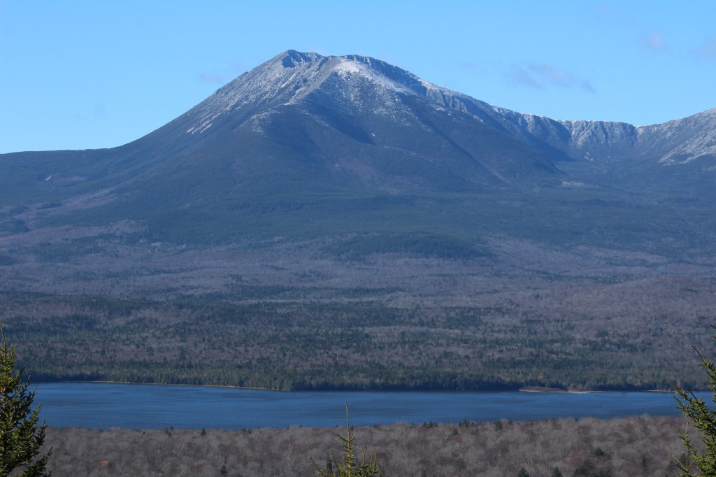
Central Maine is an ecological transition zone between boreal and broadleaf deciduous forests that provides habitat for Canada lynx, black bear, moose, and beaver. The waters are home to brook trout and Atlantic salmon, which are being reestablished with cooperation between government agencies and the Penobscot and other Wabanaki Nations. The official northern terminus of the Appalachian National Scenic Trail, Katahdin means “greatest mountain” in the Penobscot language and is the name of the 5,269-foot peak outside National Monument boundaries in neighboring Baxter State Park. This undeveloped landscape was purchased by the businesswoman Roxanne Quimby beginning in 2001 with the plan to turn it into a National Park. It was donated to the National Park Service to mark the centennial of its creation and, despite some controversy, was established by President Barack Obama.
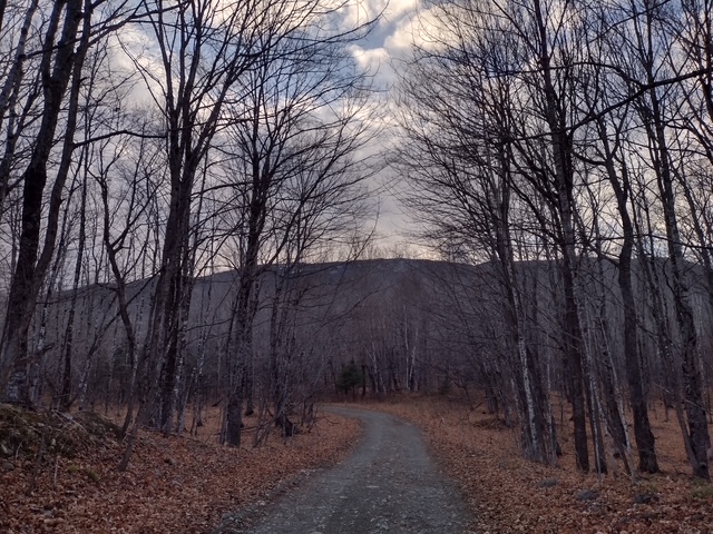
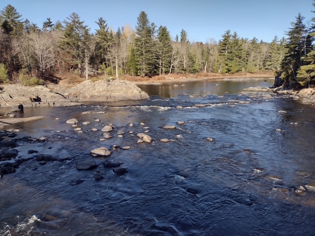
Opened in 2025 near the south entrance, the Tekαkαpimək Contact Station is seasonally open Friday through Sunday in a building inspired by Wabanaki culture. The National Park Service no longer works out of the Patten Lumbermen’s Museum (but it is still worth a visit). The 17-mile-long Katahdin Loop Road in the southern section of the National Monument is the most developed with picnic areas, vault toilets, and overlooks. The unpaved loop road is accessed from the east by miles of unpaved road and has no access to Baxter State Park. About 30 miles of the International Appalachian Trail runs through Katahdin Woods and Waters National Monument with lean-tos dispersed along the route. Other than hiking, visitors enjoy stargazing, birding, leaf peeping in the fall, canoeing the East Branch of the Penobscot River with portages around its many waterfalls. In the winter, there are opportunities for cross-country skiing, snowshoeing, and snowmobiling.
Best Trail
From the Haskell Gate at the end of New River Road, it is 3.5 miles out-and-back to Stair Falls on the East Branch of the Penobscot River. The first part follows an old road and the International Appalachian Trail before branching north at a signed junction to access the water and is also open to bicycles. The only trailhead accessed from a paved road is the 13.6-mile Seboeis Riverside Trail that starts outside the National Monument off Grand Lake Road.
Photographic Opportunity
One of the best views of Katahdin is from the top of Barnard Mountain, accessed by a two-mile one-way hike with 725 feet of elevation gain.
Every road within the National Monument is unpaved, so watch for potholes and logging trucks. The north and south entrances have gates that close seasonally.
Camping
Reservations are required to car camp at designated sites within Katahdin Woods and Waters National Monument and can be made online at Recreation.gov.
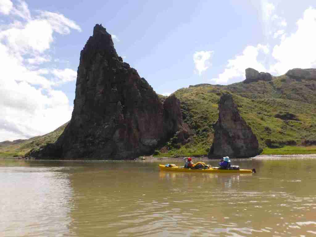
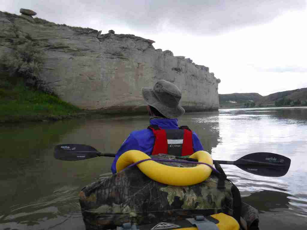
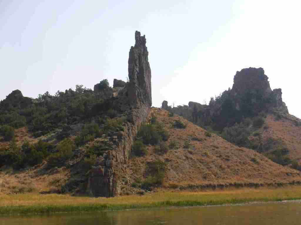
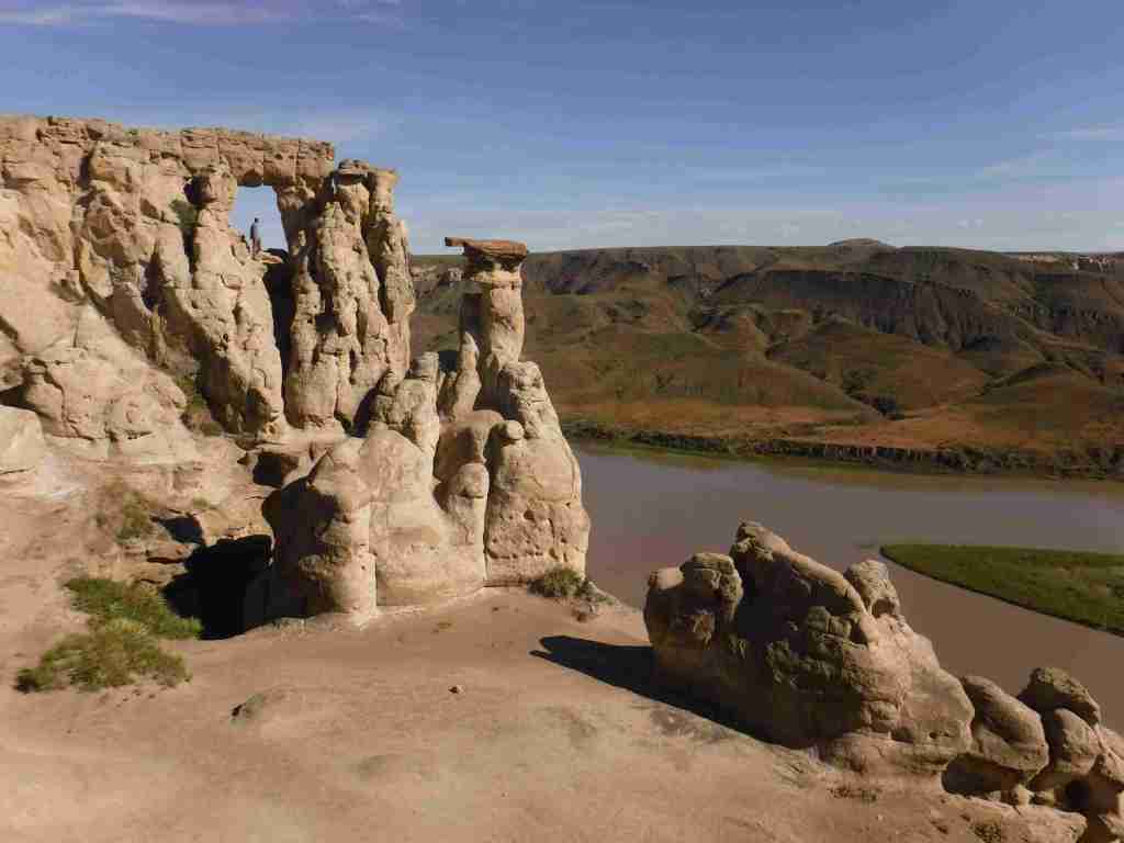
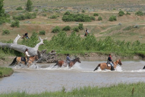
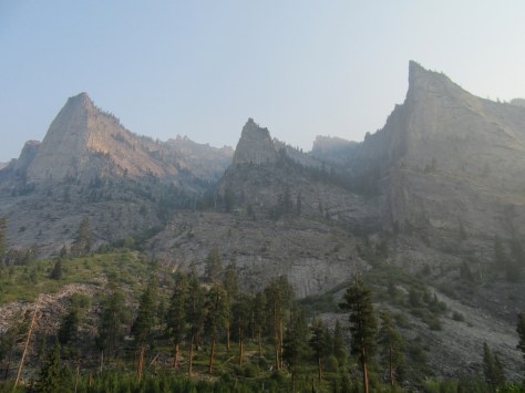
In central Montana, 149 miles of the Upper Missouri River were designated as a National Wild and Scenic River in 1976, upstream from the reservoir in Charles M. Russell National Wildlife Refuge. This stretch of the river still looks much the way it did when the Lewis and Clark expedition first explored it in 1805 and their former campsites are marked by posts. The breaks are a topographic area where the Missouri River eroded sedimentary rock that formed as horizontal layers laid down at the bottom of an ancient sea. The National Monument comprises public land in a matrix with private ranches, with cattle making the water unfit for filtering. There are a couple places to drive to along the river, but the best way to experience it is by floating a canoe or kayak down the non-motorized sections
Fort Benton, Decision Point, Neat Coulee, Citadel Rock, Hole-in-the-Wall, Lewis and Clark National Historic Trail
Must-Do Activity
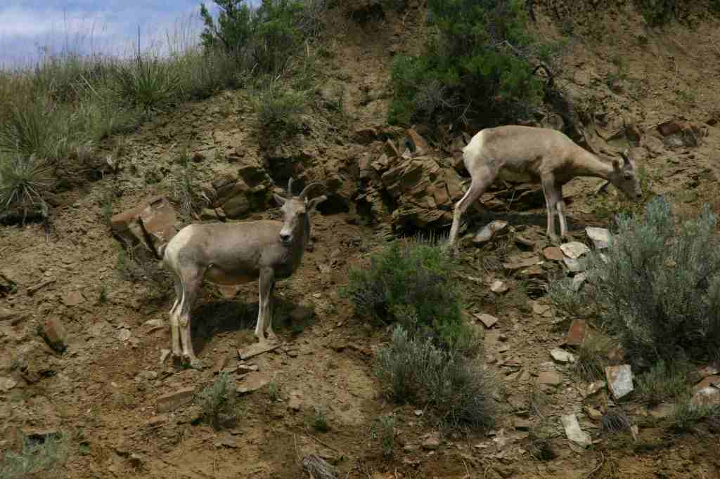
In Fort Benton, start your visit at the free interpretive center run by the Bureau of Land Management (BLM), then head downtown to learn more history by walking the riverfront of Fort Benton National Historic Landmark, including its many museums (admission fees charged) and sculptures of Lewis, Clark, Sacagawea and her son Pompey, and Shep (a local dog famous for his faithfulness). To find out more about the Corps of Discovery, check out the Lewis and Clark Interpretive Center upstream in Great Falls. The most scenic stretch to float lies in the 44 miles between Coal Banks Landing and Judith Landing where there are no rapids and the river current is so strong that paddling is mostly reserved for steering. A permit (fee) is required from the BLM, and we recommend you purchase a Boaters’ Guide and W.A.G. bags. Wildlife we spotted along the river included bighorn sheep, bald eagles, white pelicans, great blue herons, and beavers.
Best Trail
Only accessible by boat, the hike up the slot canyon at Neat Coulee from the Eagle Creek Developed Boat Camp is worth a stop. It is also possible to scramble up to the eight-foot-tall Hole-in-the-Wall arch that comes into view on the south side of the river just past Citadel Rock.
Photographic Opportunity
One of the few places with road access in Upper Missouri River Breaks National Monument, at Decision Point, Captains Lewis and Clark were not sure which was the main route: the Marias or Missouri River.
Peak Season
Summer
Fees
There is a small fee charged per person per day to be on the river, which helps pay for the maintenance of vault toilets along the route (other waste must be packed out in W.A.G. bags). An America the Beautiful pass covers the admission fee for the small museum at the BLM visitor center in Ft. Benton.
Road Conditions
Dirt roads doable by passenger vehicles lead to Coal Banks Landing and Judith Landing, while paved roads lead to put-ins at Chouteau County Fairgrounds in Ft. Benton and Kipp Recreation Area at the western edge of Charles M. Russell National Wildlife Refuge.
Camping
There are campgrounds at Chouteau County Fairgrounds, Coal Banks Landing, and Kipp Recreation Area. Throughout the National Monument developed riverside campgrounds can be accessed by boat, with dispersed camping allowed anywhere on public land (a good map is essential to avoid private land).
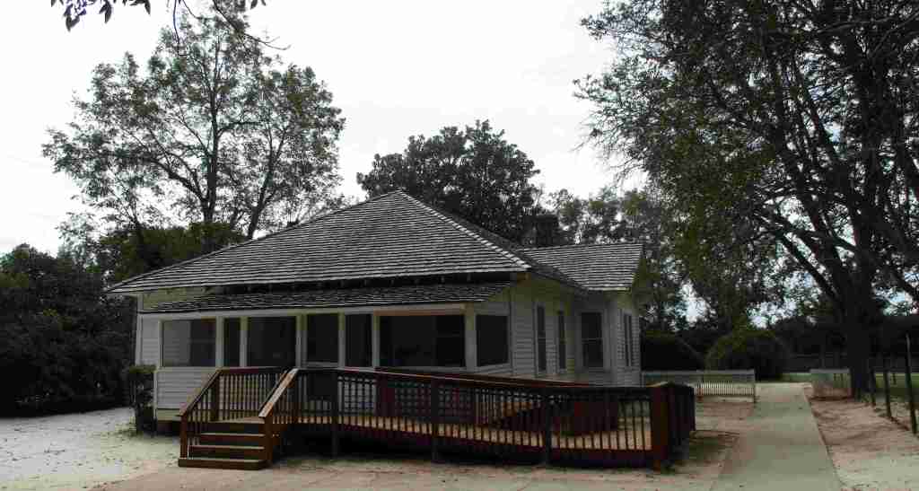
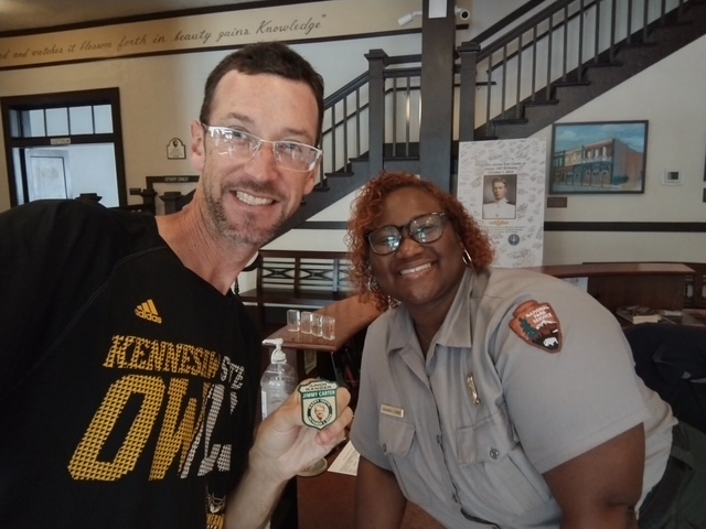
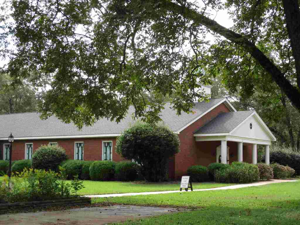
Jimmy Carter was the 39th U.S. President (1977-1981) and the first to reach the age of 100 before he passed away on December 29, 2024. Following his presidency, he and his wife (Rosalynn) returned to their hometown of Plains and cemented their legacy as diplomats and humanitarians, mostly through their work with the Carter Center in Atlanta (he was awarded a Nobel Peace Prize in 2002). Up until the end, Jimmy Carter taught Sunday school at Maranatha Baptist Church, which is open to the public. The National Historical Park encompasses Jimmy’s boyhood farm, high school, and the old Plains railroad depot. It also includes his residence since 1961, which continues to be closed but will eventually be turned into a museum by the National Park Service (NPS). In July 2025, the Carter Gardens and Burial Site of Jimmy and Rosalynn Carter opened to the public.
Highlights
Plains High School, film, train depot, boyhood farm, burial site, Carter Gardens
Must-Do Activity
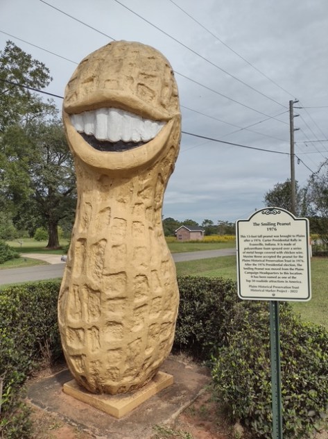
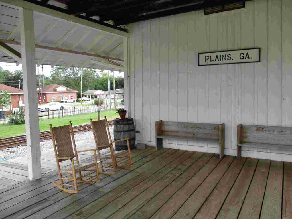
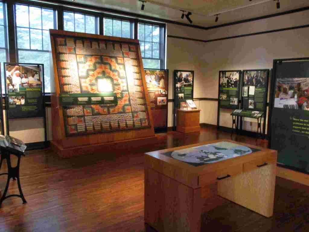
The best place to start a visit is the NPS visitor center and museum in the former Plains High School, which is full of artifacts and information on the Carters. Next, drive or walk to the main street, where the train depot that shut down in 1951 was turned into Jimmy’s presidential campaign headquarters. While downtown, check out the shops for souvenirs and try some boiled peanuts or soft-serve peanut-flavored ice cream. There are several other sites of interest around Plains, including the boyhood home, burial site, Carter Gardens, Maranatha Baptist Church, and peanut statue (see Photographic Opportunity).
Best Trail
A half-mile trail winds through the boyhood farm where Jimmy lived starting at age four. Farm animals and seasonal crops are raised here, including peanuts. You can take a self-guided tour through his boyhood home, which was restored to its appearance before electricity was installed in 1938.
Photographic Opportunity
While not part of the official National Historical Park, when you drive up Buena Vista Road to see Maranatha Baptist Church, you pass the 13-foot-tall Jimmy Carter peanut statue built during the 1976 presidential election to support the former peanut farmer.
Paved parking is available at the high school, train depot, and boyhood farm (located about three miles west of town).
Camping
About 30 miles away in each direction are campgrounds at Georgia Veterans State Park and Providence Canyon State Park (which is featured on a U-Haul super graphic).
Jimmy’s boyhood homeJimmy’s boyhood bedroomDowntown PlainsInside Plains High SchoolA 100th birthday card for JimmyScott earned a special 100th birthday Junior Ranger badgeMarantha Baptist ChurchVulturin’ about the park
Explore More – According to an urban legend, why was a hole cut in the back of the Jimmy Carter peanut statue by the U.S. Secret Service?
After we published our guidebook 50 States of Great: Road Trip Guide to America in 2023, we decided to start a new type of blog post where we create a travel itinerary for all 50 states, in addition to our usual public land entries. After starting with Kansas, Georgia, Idaho, Rhode Island, Minnesota, Hawai’i, Arizona, Louisiana, South Dakota, and Indiana, we decided to head back west to Montana. There are so many great trails in the state’s National Forests that we had a difficult time narrowing it down. We made an ambitious seven-day plan starting in southeast Montana on Interstate 90, with enough options to easily extend the trip into three weeks or more.
The best time to visit the National Monument is around June 25, the anniversary of Custer’s Last Stand when a reenactment of the battle is held on private land bordering the National Park Service site.
Makoshika State Park
It is illegal to remove dinosaur fossils from these badlands, but there are many on display at the visitor center, in addition to nearby museums (plus reservations can be made to dig on private land). The few campsites are in high demand to spend the night in these colorful canyons where caprocks rise high above juniper trees.
Optional stop at Pompeys Pillar National Monument
A sandstone monolith on the Yellowstone River has been a place for humans to record their passing for 11,000 years. The most famous inscription was left by Captain William Clark on July 25, 1806, the sole on-site evidence of the Corps of Discovery’s three-year journey.
This underappreciated gem in the National Park Service system features gorgeous scenery and abundant wildlife, including bighorn sheep and wild horses. The highlight is across the state line in Wyoming where Devil Canyon Overlook sits atop cliffs that drop over 1,000 feet straight down to the level of the narrow reservoir.
Gallatin Petrified Forest is only accessible by trail, either from a short two-mile one-way jaunt or by backpacking the 27-mile Gallatin Divide-Devils Backbone Trail. Earthquake Lake Geologic Area stretches along Highway 287 to commemorate the events that occurred around midnight on August 17, 1959, when a deadly magnitude 7.5 earthquake hit West Yellowstone.
Some of the National Forest’s miles of hiking trails access the Crazy Mountains and Hellroaring Plateau. The two-mile Glacier Lake Trail steadily climbs 1,100 feet then drops into a bowl containing a stunning reservoir that straddles the Wyoming-Montana border.
Optional drive on Beartooth All-American Road
Custer National Forest is famous for its stretch of Highway 212 that climbs from the prairie around the town of Red Lodge up to 10,947 feet at Beartooth Pass across the Wyoming border in Shoshone National Forest. The road follows the southern border of the giant 943,626-acre Absaroka-Beartooth Wilderness, which contains the highest point in Montana.
Located mostly in Wyoming and partly in Montana and Idaho, you could easily spend an entire summer in the world’s first National Park and not see all the thermal features, lakes, waterfalls, wildlife, and hiking trails.
Day 3
Lewis & Clark Caverns State Park
Once a U.S. National Monument, the state now runs a campground here and offers guided tours through a limestone show cave where bats live in the summer.
The free Potosi Campground is situated near the trailhead for Upper Potosi Hot Springs where a 0.8-mile trail leads past the uphill side of a clear 100°F pool with room for about six adults.
Optional stop at Chico Hot Springs
If you leave Yellowstone National Park north through Gardiner on Highway 89, consider stopping at this developed hot springs (fee) that offers live music poolside on some nights (especially if the park’s Boiling River was closed). In business since 1897, even Teddy Roosevelt stopped to rest here.
Day 4
Bannack State Park
East of Lemhi Pass on the Idaho border (which is also the Continental Divide National Scenic Trail through there), Bannack State Park preserves more than 50 buildings from a gold rush town that was the territorial capital in 1864.
The site of a surprise attack by the U.S. Army on the morning of August 9, 1877, where Nez Perce warriors forced the troops to retreat, capturing a Howitzer cannon and allowing women and children to escape toward the newly created Yellowstone National Park. Part of the widespread Nez Perce National Historical Park, a small visitor center here overlooks the battlefield and a paved road accesses trails through it.
Blodgett Creek Trail leads 12.6 miles one-way to Blodgett Lake, but you do not have to go that far to appreciate its incredible beauty.
Optional stop at Elkhorn Hot Springs
In the Pioneer Mountains, about ten miles north of Highway 278 is the privately owned Elkhorn Hot Springs (fee), a great place to relax after hiking. There is free dispersed camping to the north in Beaverhead National Forest.
Day 5
Travelers’ Rest State Park
Follow in the footsteps of the Lewis and Clark expedition by driving the Lolo Trail (Highway 12), soaking at Lolo Hot Springs, or walking around Travelers’ Rest State Park (still a great place to camp).
Missoula
Do as the University of Montana students do and float tubes down the Clark Fork River through town. In the summer, look for webcam-famous Iris the Osprey in the parking lot near the football stadium. The Historical Museum at Fort Missoula preserves buildings dating back to 1877, including an Alien Detention Center used during World War II.
Outside Missoula, there are many trails in Rattlesnake National Recreation Area and Blue Mountain Recreation Area, plus the Aerial Fire Depot and Smokejumper Center, Ninemile Historic Remount Depot, and Savenac Historic Tree Nursery Area.
This working ranch commemorates the nineteenth-century lifestyle of cattle barons and cowboys. Free guided tours are offered inside the large ranch house, and a self-guided walking tour enters 15 buildings with displays on the history of barbwire, branding irons, and much more.
Day 6
National Bison Range
Established in 1908 under President Theodore Roosevelt and now run by the Confederated Salish and Kootenai Tribes. Start at the visitor center, then take the 19-mile Red Sleep Mountain Drive to see mule deer, white-tailed deer, elk, pronghorns, bighorn sheep, and the namesake bison.
Jewel Basin Hiking Area is famous among backpackers, and further south so is Holland Lake, which has several campgrounds. The steep Holland-Gordon Trail passes Holland Falls as it climbs 2,100 feet in 5.8 miles to Upper Holland Lake and continues into “the Bob” (Bob Marshall Wilderness). Flathead National Forest contains more than 2,800 miles of hiking trails, including 38 miles of the Pacific Northwest National Scenic Trail and a stretch of the Continental Divide National Scenic Trail.
Optional stop at Mission Mountains Wilderness
Located within Flathead National Forest, a popular trail accesses multiple mountain lakes; it is only 1.5 miles one-way to Glacier Lake, but we recommend continuing to Turquoise Lake. It borders the Mission Mountains Tribal Wilderness (permits required).
Waterton-Glacier International Peace Park’s renowned Going-to-the-Sun Road was built to cross the park from east to west in the 1920s (reservations are required to drive it between 7 a.m. and 3 p.m. in the summer). At its highest point at 6,646-foot Logan Pass, the road crosses the Continental Divide National Scenic Trail.
In the state’s northwest corner, incredible views await at Blue Mountain Trail, Skyline National Recreation Trail, Scenery Mountain Lookout Trail, Ross Creek Scenic Area of old-growth western redcedar trees, and Kootenai Falls (located in a county park on the side of Highway 2).
Meriwether Lewis named the Gates of the Mountains on July 19, 1805, and today a two-hour jet boat tour on the Missouri River provides history on the Corps of Discovery, American Indian pictographs, the Mann Gulch Fire, and the collapse of Hauser Dam. A trail through Refrigerator Canyon is less than ten feet wide at its narrowest point, where towering 200-foot limestone cliffs keep it cool and breezy throughout the summer.
Great Falls
North of Helena on Interstate 15 is the Lewis and Clark Interpretive Center (fee), which is managed by the U.S. Forest Service on the banks of the Missouri River.
This 375,000-acre National Monument preserves a stretch of the Missouri River that still looks much the way it did when Lewis and Clark explored it. Start your journey by paying for permits at the Bureau of Land Management interpretive center in historic Fort Benton, where you can launch your canoe or kayak to access 149 miles of the river. There are developed boat camps with vault toilets along the route, or you can pick your own spot near one of the Corps of Discovery campsite markers.
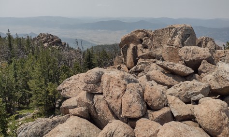
It includes portions of the Boulder Mountains, Flint Creek Range, and Elkhorn Mountains, as well as part of the Anaconda-Pintler Wilderness. Our favorite hike is Haystack Mountain National Recreation Trail off Interstate 15, where a climb of 2,000 feet ends at a mountaintop boulder field with panoramic views and the remnants of a fire lookout tower.
Backpacking is a major draw with trails in the Snowy Mountain Range and parts of the Scapegoat and Bob Marshall Wilderness areas, which provide crucial habitat for grizzly bears. It encompasses one of the most famous formations along the Continental Divide National Scenic Trail, the 15-mile long Chinese Wall (a 1,000-foot-tall cliff composed of five-million-year-old limestone).