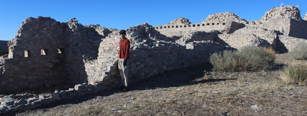
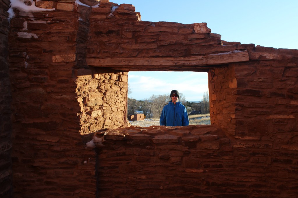
This interesting National Monument protects three separate Spanish missions that date to the 1600s, though its main visitor center in Mountainair, New Mexico is not next to any of them. Their location near salt flats led to the name Salinas and contributed to the pueblos’ abandonment when a major drought struck in the 1670s.
Highlights
Gran Quivira, Quarai, Abó, film at main visitor center
Must-Do Activity
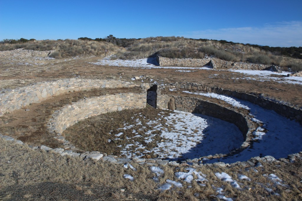
Gran Quivira has the remains of two churches (the second unfinished at the time of abandonment) and the most significantly excavated pueblo ruins (with kivas) of the three sites.
Best Trail
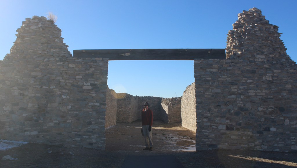
Each of the three pueblos has a paved walkway that leads
through its ruins that leaves from the parking lot and past its contact station
staffed by a National Park Service employee.
Instagram-worthy
Photo
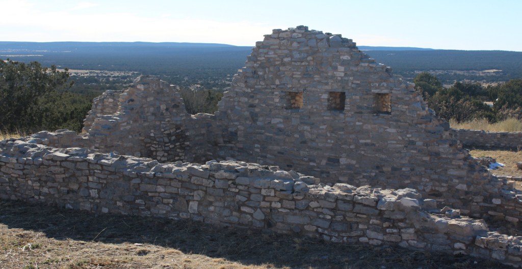
The church at Quarai is the most complete of the three sites and its red walls photograph well at sunset.
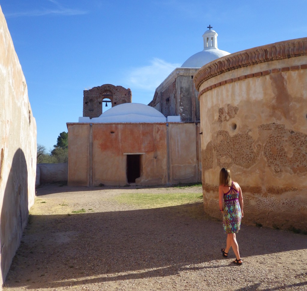
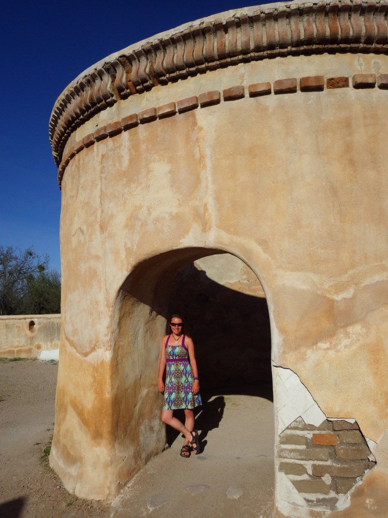
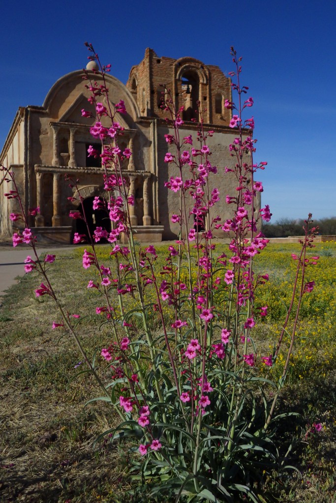
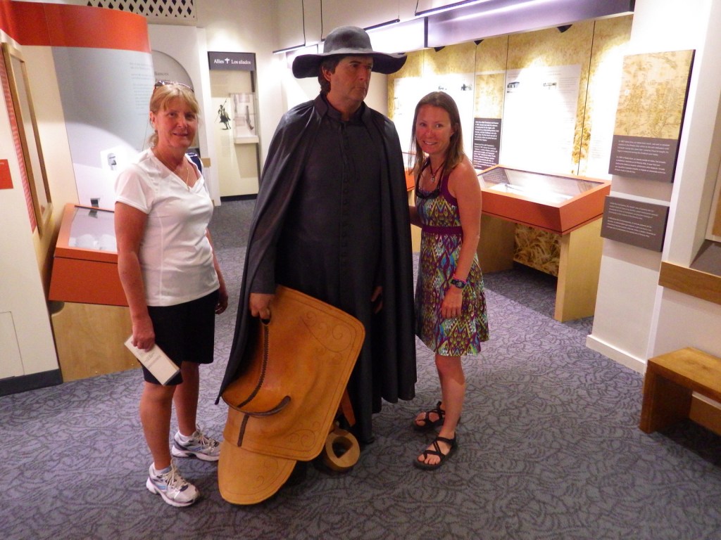
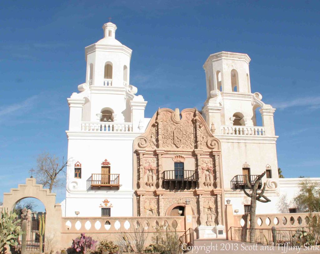
South of Tucson in Tubac, Arizona, San Cayetano de Tumacácori is a Spanish mission founded in 1691 by Padre Kino and abandoned in 1848. It became a National Monument in 1908 when it was restored to its ruined state based on photographs dating from 1868. Two additional mission ruins were added when it became a National Historical Park in 1990, but they are not open to the public except on special ranger-led tours January through March.
Highlights
Historic mission, historic museum (built in 1937)
Must-Do Activity
Jesuits, like the famous Padre Eusebio Kino, established
more than 20 missions in this part of the Sonoran Desert in the
late-1600s. Some of the Pimas they were
“serving” attacked in 1751, leading to the move of Tumacácori to its current
location and the establishment of Tubac Presidio (now a State Park). Mexico gained its independence from Spain in
1821 and the final phase of construction on the mission began two years
later. In 1853, the Gadsden Purchase
brought this region into the United States of America. When you visit the ruins of Tumacácori,
consider a trip north to beautiful San Xavier del Bac, which is still an active
church.
Best Trail
A 4-mile portion of the Juan Bautista de Anza National Historic Trail connects Tumacácori with Tubac Presidio State Historic Park, which offers a museum and an underground archaeological display.
Instagram-worthy
Photo
At the end of the day in the winter months, trees surrounding the mission cast interesting shadows on its stucco walls.
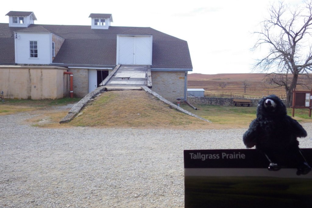
The tallgrass prairie formerly covered 170-million acres of North America, but today only 4% of that exists in a few isolated pockets due to conversion to agriculture. The Flint Hills of eastern Kansas were too rocky for tilling, so this was an ideal place to create Tallgrass Prairie National Preserve in 1996. Occasionally, land managers utilize fire to support fire-adapted native grasses against invasive species. Before our visit in November 2014, large areas were burned. The bison that live here enjoy eating the fresh green grass that sprouts following a fire and wildflowers thrive with the release of available soil nutrients.
Echo at Tallgrass Prairie
Highlights
Spring Hill Ranch, Lower Fox Creek School, bison herd
Must-Do Activity
After reading the interpretive panels at the visitor center,
walk around the buildings next door at the historic Spring Hill Ranch. The 1881 ranch house is open for tours seasonally.
Best Trail
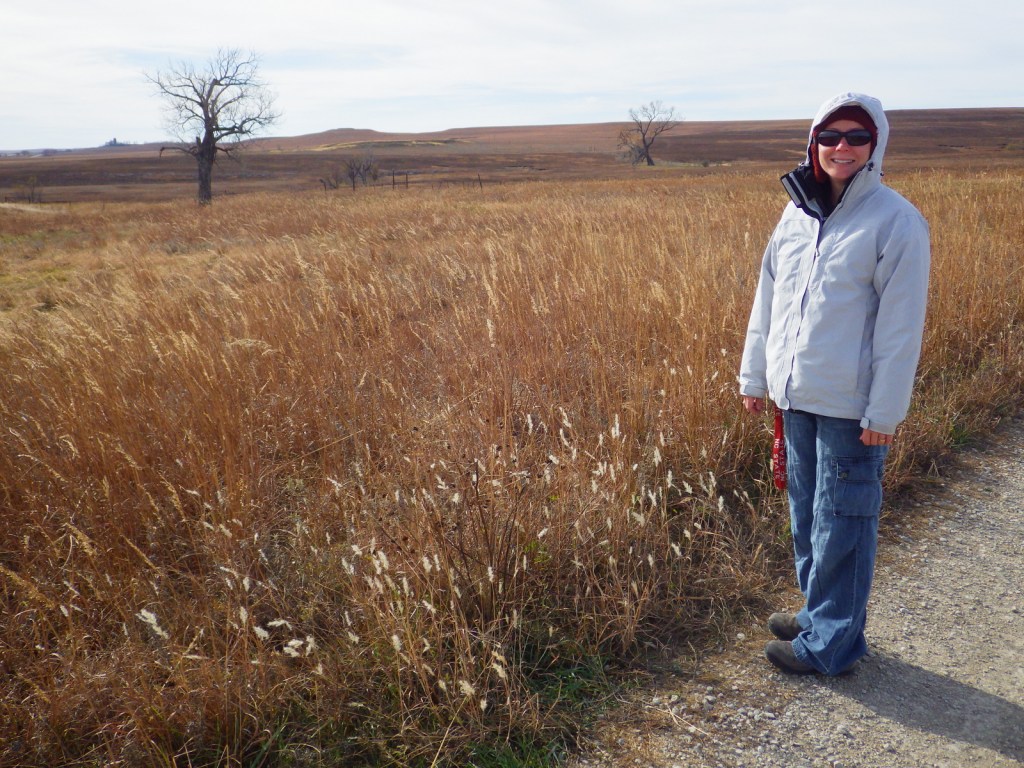
There are many trails that wander through the 10,894-acre
preserve that is jointly run by the Nature Conservancy and National Park
Service. Many loop options are possible,
but no backpacking is allowed, possibly due to the bison herd.
Instagram-worthy
Photo
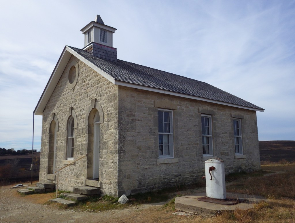
Just down the road from Spring Hill Ranch is the one-room Lower Fox Creek School which was open from 1884 to 1930. Its walls are made of local limestone.
Chase State Fishing Lake has 10 primitive campsites two miles outside Cottonwood Falls, Kansas. Several U.S. Army Corps of Engineers campgrounds surround Council Grove Lake, which is located 20 miles north.
Explore More – At first the grasslands may all look the same, but how many species of plants are found within Tallgrass Prairie National Preserve?
We are a participant in the Amazon Services LLC Associates Program, an affiliate advertising program designed to provide a means for us to earn fees by linking to Amazon.com and affiliated sites.
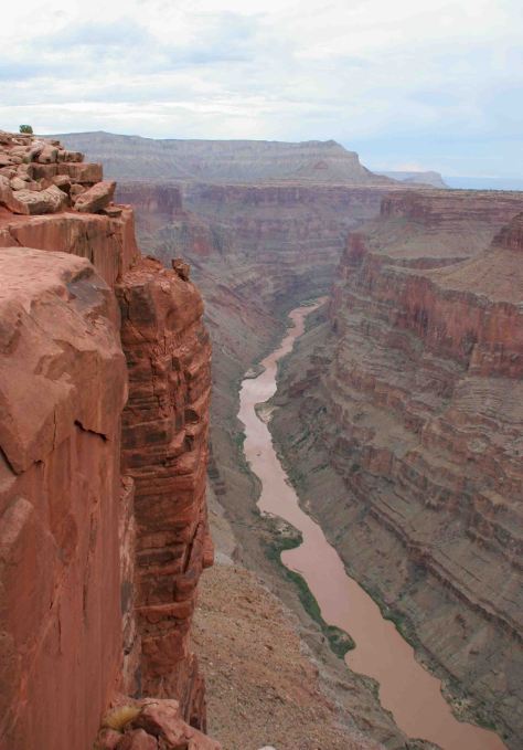
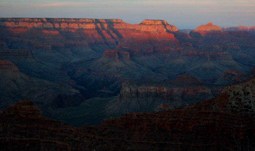
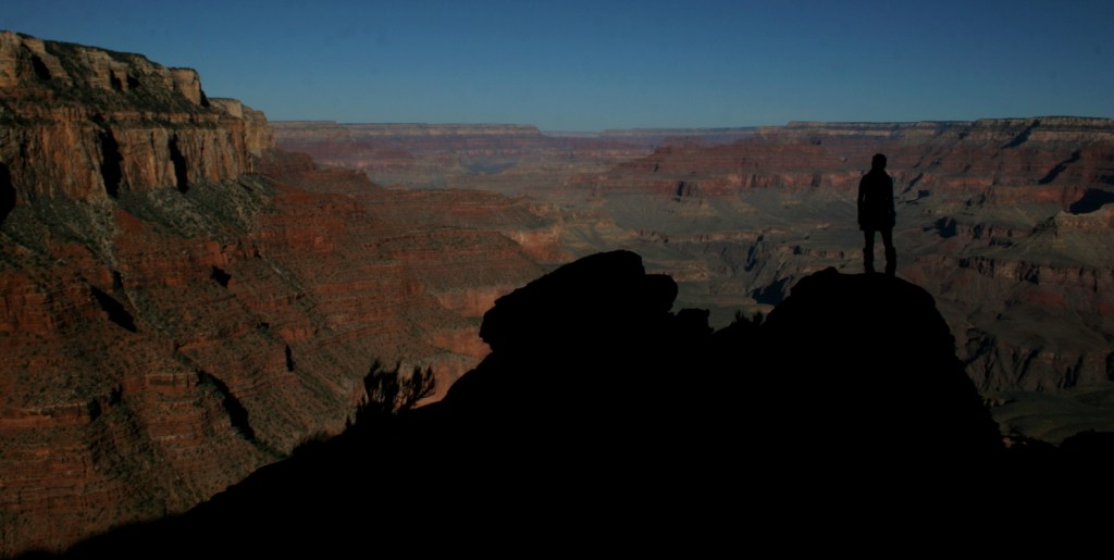
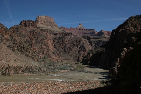
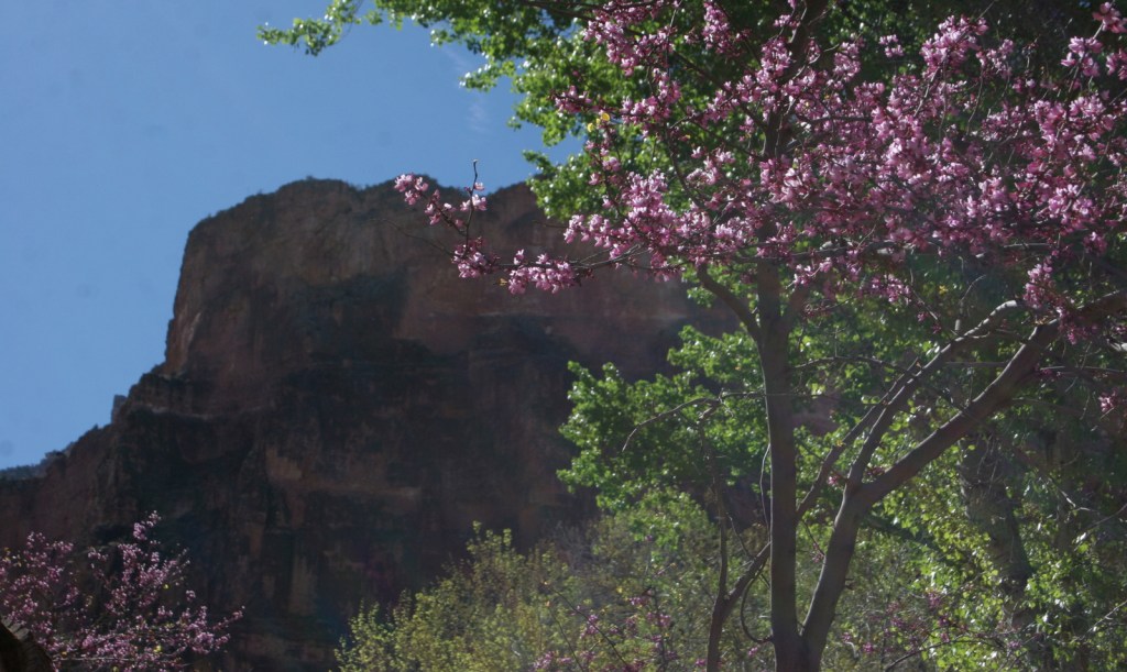
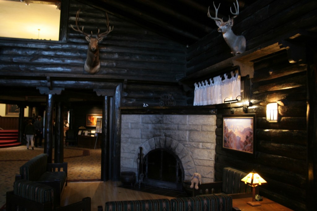
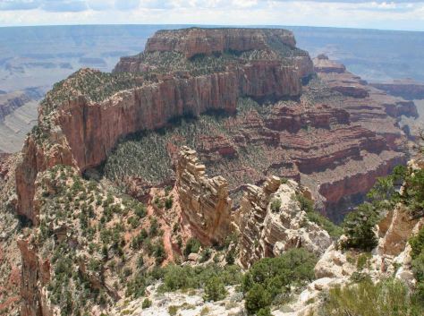
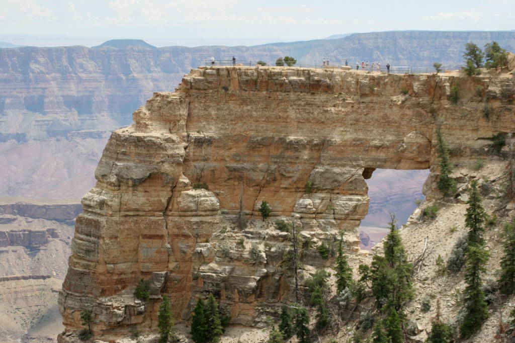
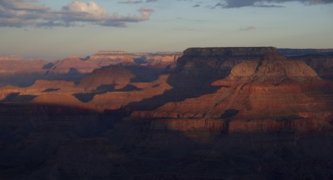
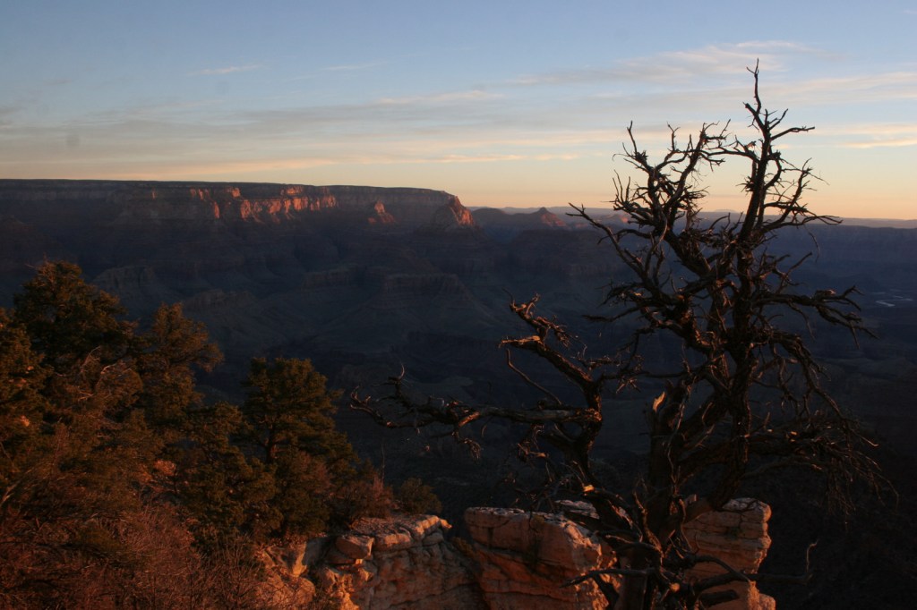
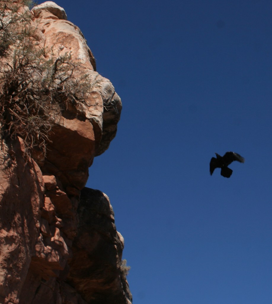
Grand Canyon National Park is generally considered one of the seven natural wonders of the world. Billions of years of geologic history have been laid bare by the cutting power of the Colorado River. It is cliché but true, you simply have to see this icon with your own eyes. It can be overwhelming. So can the crowds on the South Rim, but those tend to thin out if you hike a mile or two down a trail. If you have the time during the summer months, be sure to drive five hours over the forested Kaibab Plateau to reach the North Rim (which is only 10 miles away as the raven flies).
Desert View Watchtower, Hopi House, El Tovar Hotel, Phantom
Ranch, Toroweap Overlook, whitewater rafting the Colorado River
Must-Do Activity
Growing up in Arizona, Scott used to visit this park frequently, but he feels he never got to know it until he hiked to the bottom in 2016. Even if you only go a couple thousand feet down in elevation on the Grandview Trail or busy Bright Angel Trail, it will give you a new perspective on the canyon.
Best Trail
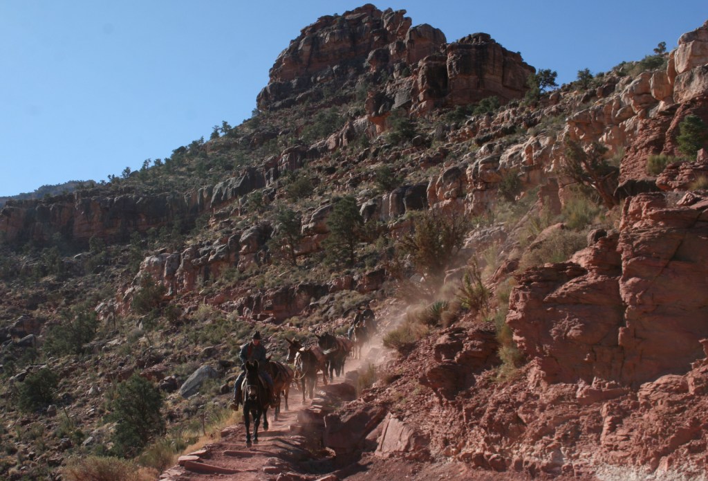
We day hiked the 18 miles from South Kaibab Trailhead (7200 feet elevation) down to Phantom Ranch (2500 feet) where we filled up with water on the way back up to Bright Angel Trailhead (6800 feet, with multiple water stations on the trail). Backcountry permits can turn this into a multiple day trek, but then you have to carry all your gear out.
Photographic Opportunity
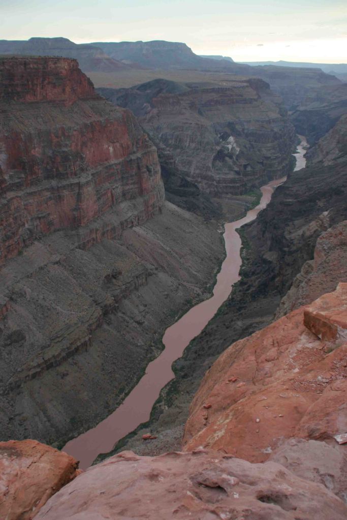
It is an arduous 90-mile one-way drive down a mostly dirt road to access Toroweap Overlook (free online permit required before arrival), but there is a reason photos from this fantastic overlook show up everywhere since the canyon walls are nearly vertical here.
Peak Season
Summer when it is very hot inside the canyon, though it can also be busy around the spring, fall, and December holidays.
Most roads are paved, and except for the very end of the 90-mile long graded dirt road to Toroweap Overlook is accessible to all passenger vehicles (free permit required).
Camping
The park has campgrounds on both rims, but you can also find dispersed camping in the neighboring Kaibab National Forest.
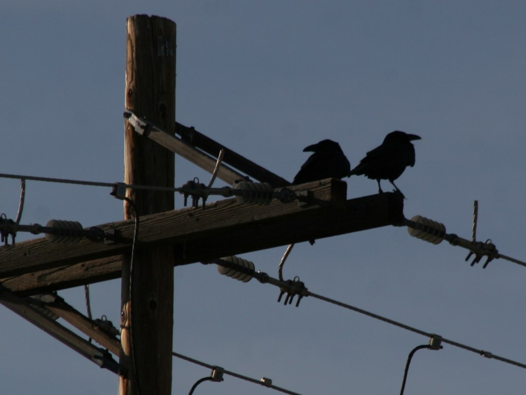
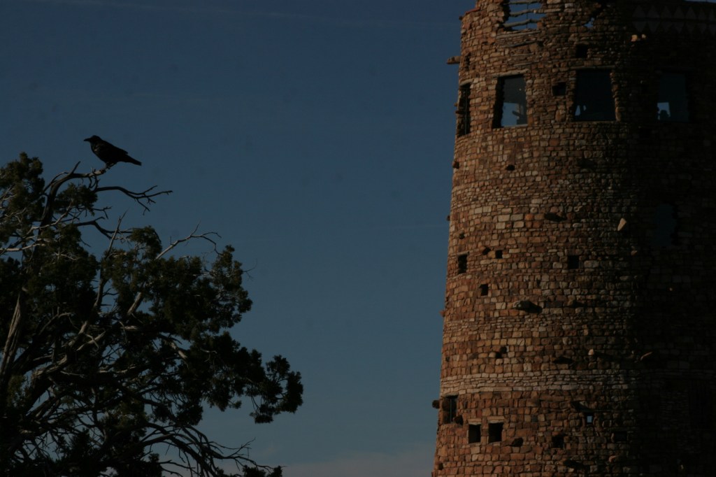
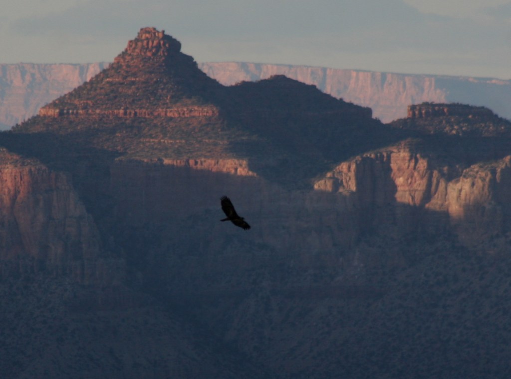
Raven at WatchtowerOn the South Kaibab TrailA view of the two bridgesOn the Bright Angel TrailThe historic El Tovar Hotel opened in 1905Toroweap OverlookRaven about the park
This design we created to celebrate Grand Canyon National Parkis available on a variety of products at Cafe Press and Amazon.
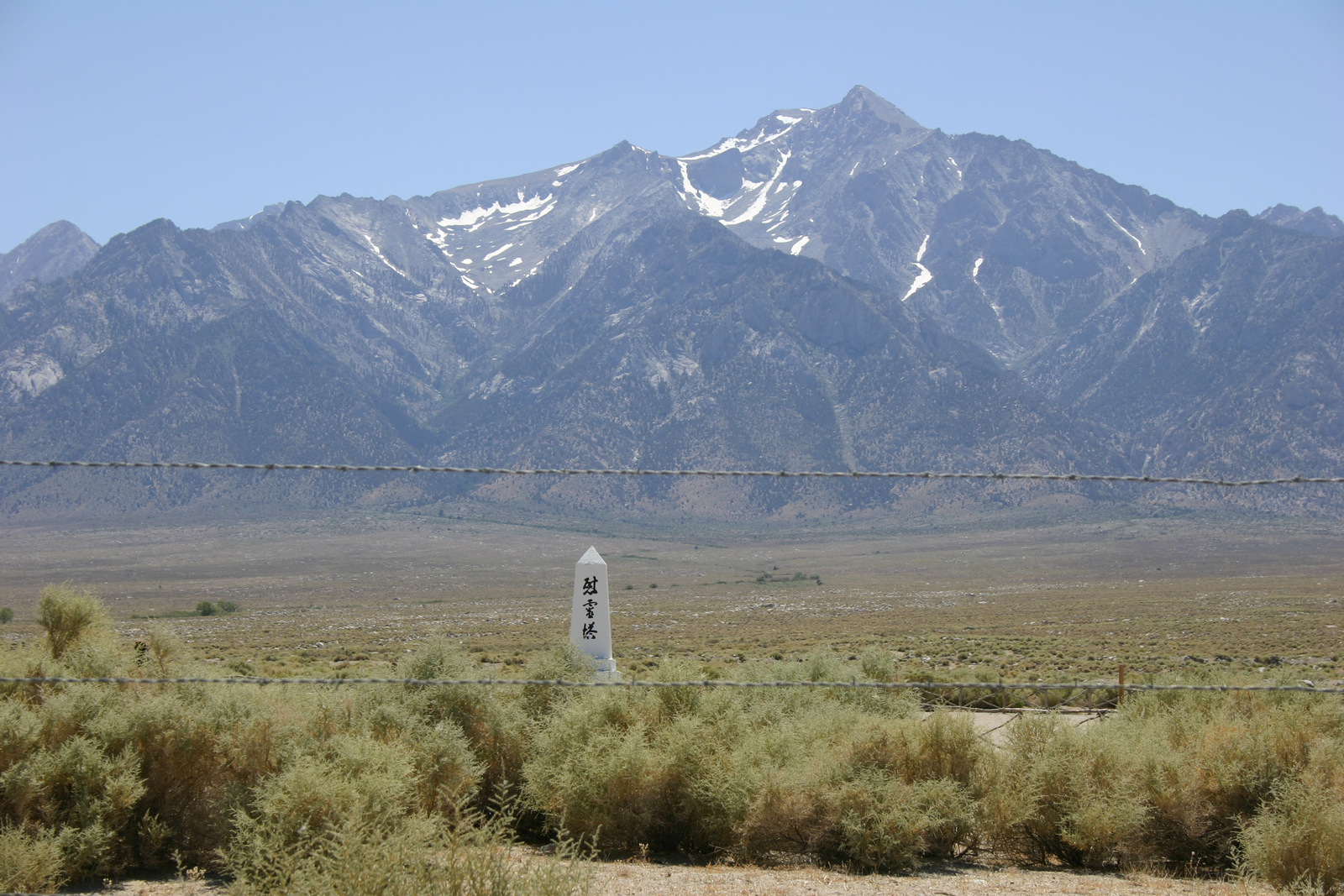
One of the many things that makes this country great is its willingness to remember inglorious moments in its past, such as the internment of Japanese-Americans during World War II. Following the 1941 attack on Pearl Harbor, President Franklin D. Roosevelt signed an executive order authorizing the detention of more than 110,000 U.S. citizens of Japanese descent. Manzanar War Relocation Center was the first of 10 internment camps built throughout the western U.S. It held about 10,000 citizens (mostly from Los Angeles, California) in 36 blocks of wooden barracks across a one square-mile fenced enclosure.
Highlights
Museum, film, reconstructed barracks, gardens, memorial
Must-Do Activity
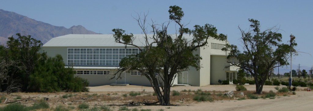
Opened in 2004, the National Park Service visitor center is
located inside the former camp auditorium, which now houses an excellent
museum. Self-guided walking and auto
tours take visitors to two reconstructed barracks, the camp gardens, and a
cemetery with the Manzanar Memorial.
Best Trail
You can walk or drive the 3.2-mile auto tour with 27
interpretive stops.
Instagram-worthy
Photo
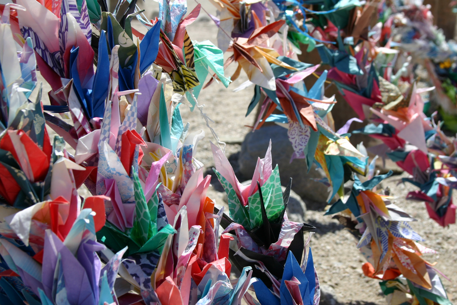
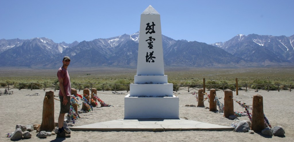
Located in the camp’s cemetery, the Manzanar Memorial is
often swathed in origami paper cranes.
Peak Season
Summer, though temperatures can get hot with little shade.
Manzanar is located right off Highway 395 west of Death Valley National Park and the dirt roads inside the site are passable by all vehicles.
Camping
Camping is available in Death Valley National Park and dispersed camping is allowed in the scenic Alabama Hills managed by the Bureau of Land Management.
The NPS visitor center is located inside the former camp auditorium
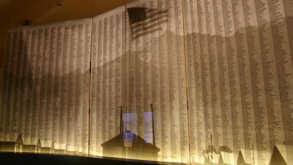
Inside the visitor center are the names of the 10,000 internees
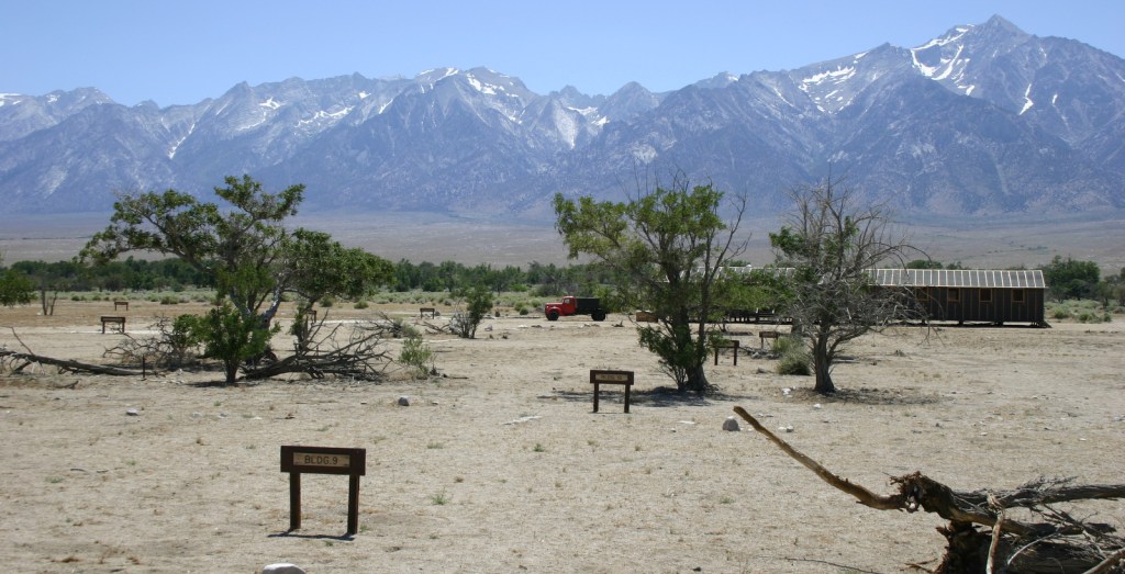
The Sierra Nevadas loom over the camp, which was notoriously windy
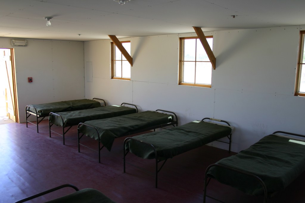
The barracks offered little privacy and almost no protection from winter weather.
This stone monument was erected in 1943 in one of the camp’s gardens
This guard shack is located at the entrance to the camp
Explore More – How
many Japanese-Americans served in the U.S. military during World War II?
Start your U.S. National Parks, National Forests, and National Monuments adventure here!