Since White Sands National Monument was upgraded to the 62nd National Park on December 20, 2019, we decided to update our guidebook to the parks. If you already bought your copy on Amazon, please find the new page 308 posted below. White Sands is one of our favorite of the many National Park Service units in New Mexico. You can read more about the park on this blog.
White Sands
New Mexico
148,558 acres
Established 2019
603,008 visitors in 2018
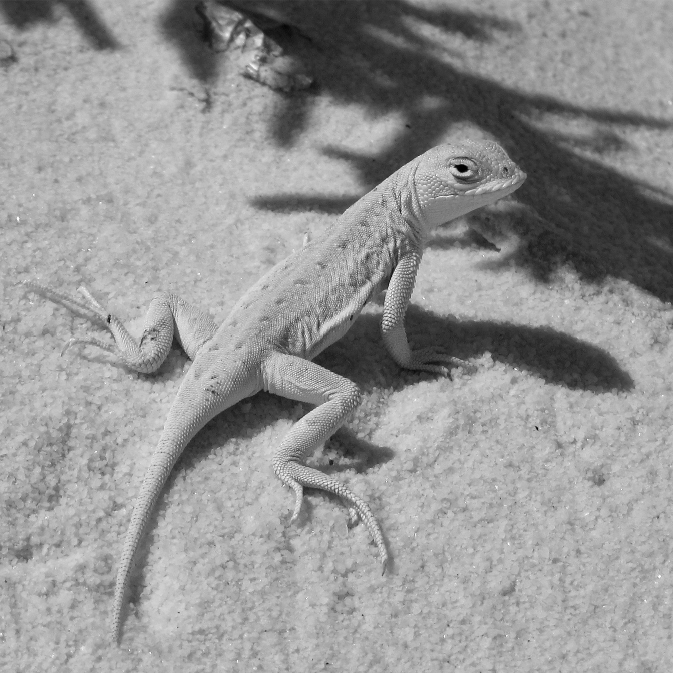
Dunes composed of gypsum make a great destination for snow sledding year round, especially when the sand is wet. Gypsum readily dissolves in water, but here it forms dunes because no river drains the Tularosa Basin. Follow markers on the five-mile roundtrip Alkali Flat Trail that goes up and down dunes and provides views of the San Andres Mountains. Most of the wildlife here is nocturnal, but during the day you may spot bleached earless lizards that evolved to camouflage in the gypsum. The white dunes take on the colors of the sunset if you attend the ranger-guided Sunset Stroll or backpack camp. There is no campground and only ten backcountry campsites, and their availability is dependent upon whether the military is conducting missile tests overnight, so call ahead or check the schedule online. Oliver Lee Memorial State Park offers a full service campground in a beautiful setting south of Alamogordo, New Mexico.


We are a participant in the Amazon Services LLC Associates Program, an affiliate advertising program designed to provide a means for us to earn fees by linking to Amazon.com and affiliated sites.