Tag Archives: National Park

Indiana Road Trip Itinerary

22,928,710 acres

Statehood 1816 (19th)

Capital: Indianapolis

Population: 6,785,528 (17th)

High Point: Hoosier Hill (1,257 feet)

Best time of year: Summer

Last year we published our guidebook 50 States of Great: Road Trip Guide to America, so we decided to start a new type of blog post where we create a travel itinerary for all 50 states, in addition to our usual National Forest and National Park entries.  After starting by jumping around to KansasGeorgia, Idaho, Rhode Island, Minnesota, Hawai’i, Arizona, Louisiana, and South Dakota, we headed to the Midwest for our tenth state.  We start in the northwest corner of Indiana on the shores of Lake Michigan near Chicago, then all roads lead to Indianapolis, so we head south with plenty of options to extend the trip. See for yourself why Indiana made it on our Top 10 States for State Parks list.

Day 1

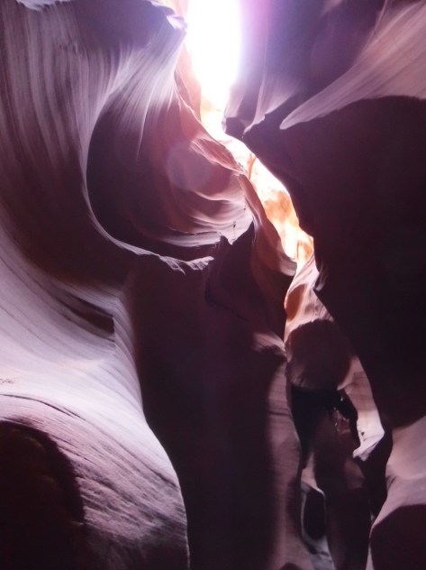
Indiana Dunes National Park (click here for our complete blog post)

Indiana Dunes National Lakeshore was originally created in 1966 as a compromise between industrialists seeking to build more steel mills and conservationists wanting to preserve biodiversity.  Though it is now one of the 63 National Parks, the quiet Dunewood Campground still provides hot showers in a wooded setting inland from the lakeshore.

Optional stop at Indiana Dunes State Park

Complete the 3 Dune Challenge by climbing the three tallest dunes in the State Park (separate entrance fee) to earn a prize at the visitor center shared with the National Park.

Day 2

Raclin Murphy Museum of Art

This museum on the University of Notre Dame campus in South Bend offers free admission and highlights Christian art from Europe.  Guided tours are offered of the famous football stadium year-round, and the Basilica of the Sacred Heart and adjacent Grotto of Our Lady of Lourdes spiritual shrine are always open.  On a college football gameday, do not miss the midnight drumming circle beneath the golden dome and other traditions throughout the day.

Optional stop at Studebaker National Museum

South Bend was once the headquarters for manufacturing Studebakers and the museum displays many made-in-Indiana automobiles.

Day 3

RV/MH Hall of Fame

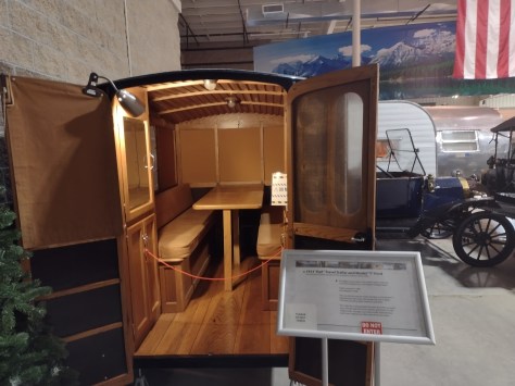
Elkhart is recognized as “the RV Capital of the World” since so many Recreational Vehicles are built in local factories.  The Hall of Fame first opened in 1991 then moved to a larger building where it exhibits more than 50 historic vehicles dating back to the 1913 Earl Travel Trailer.  You can also take a free plant tour of Jayco, Inc. to see RVs being manufactured in nearby Middlebury.

Optional stop at Hall of Heroes Superhero Museum

Six miles down the road in Elkhart, the Hall of Heroes Superhero Museum has more than 50,000 comic books and countless toys and movie props on display.  All-you-can-play arcade games are included with your admission.

Optional stop at Turkey Run State Park

This popular state park is about an hour west of Indianapolis and offers camping, hiking, swimming, kayaking, and fishing.

Day 4

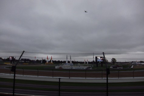
Indianapolis Motor Speedway

The first auto race took place here in 1909 and the first Indy 500 was held two years later.  The car that won that inaugural Indy 500 was the Marmon Wasp and it is held in the track’s Hall of Fame Museum, along with the Borg-Warner Trophy.  This is considered the world’s largest stadium (with a capacity of 257,325).  When cars are not running, you can take a bus tour around the oval (at significantly less than 200 miles-per-hour) and kiss the 36-inch strip of bricks at the finish line left unpaved. 

Optional stop at James A. Allison Exhibition Center

Down the road from the racetrack, the free James A. Allison Exhibition Center tells the story of a local auto parts builder who expanded his company (founded in 1915) into engines for military airplanes.

Optional stop at the Children’s Museum of Indianapolis

Hands-on exhibits abound in this renowned museum southeast of downtown.

Day 5

Spring Mill State Park

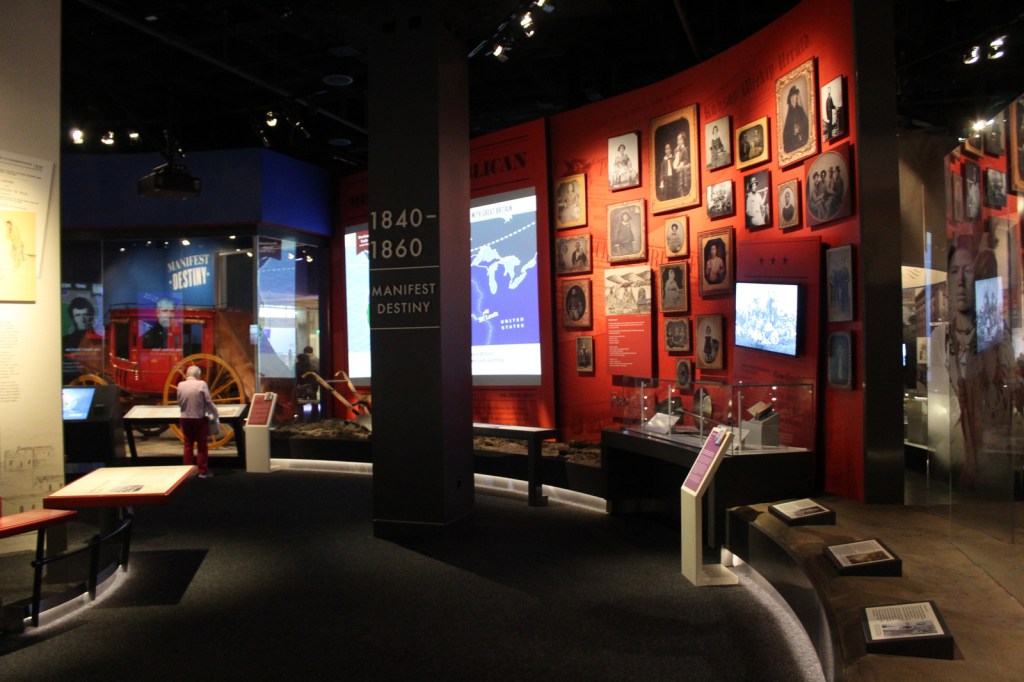
Today you can still buy cornmeal ground by the historic gristmill that runs for ten minutes every hour, part of Pioneer Village where costumed reenactors demonstrate chair caning, broom making, and fiddle making.  The park also contains trails, an elevated flume reconstructed by the Civilian Conservation Corps (CCC), Hamer Pioneer Gardens, guided boat trips that enter 500 feet into Twin Caves, and the Grissom Memorial Museum dedicated to the local hero who was the second American astronaut in space and died in a 1967 launchpad fire.

Optional stop at White River State Park

Located in downtown Indianapolis, this unique State Park surrounds the Indiana State Museum, Eiteljorg Museum of American Indian and Western Art, Indiana Zoo, and NCAA Hall of Champions featuring many interactive exhibits next door to the National Collegiate Athletics Association (NCAA) headquarters.

Day 6

Hoosier National Forest (click here for our complete blog post)

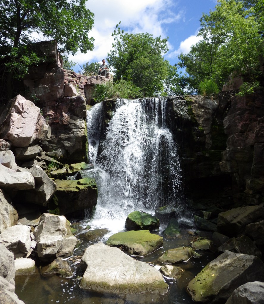
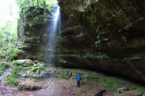
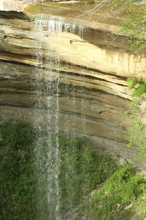
Created in 1935 from cutover and abandoned farmland, the National Forest’s best hike is Hemlock Cliffs Trail, a 1.2-mile loop through a canyon that passes two unique waterfalls.  A 0.8-mile trail runs through the 88 acres of old-growth forest of Pioneer Mothers Memorial Forest.  The tall trees here range in age from 150- to 600-years-old, and the black walnuts that grow in a moist cove known as Walnut Cathedral are considered the finest specimens in the country.

Optional stop at Muscatatuck National Wildlife Refuge

A visitor center and auto trail make this the most developed National Wildlife Refuge in Indiana for birding and fishing.  The nearby Big Oaks National Wildlife Refuge encompasses a former military property and requires special authorization to visit.

Day 7

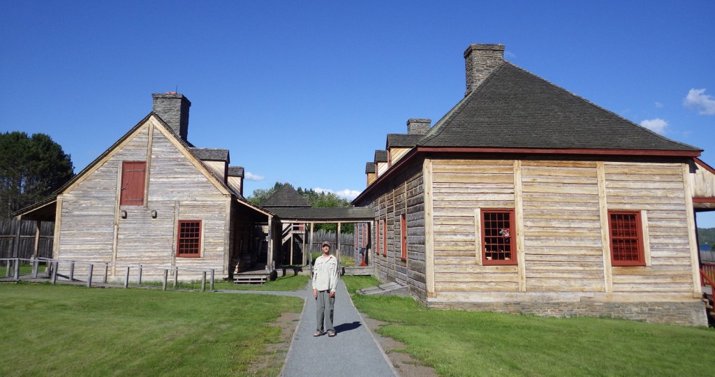
Lanier Mansion State Historic Site

The beautiful Lanier Mansion was built for James Franklin Doughty Lanier, a prominent businessman in the state of Indiana around the mid-1800s. The Greek Revival-style house was completed in 1844 and is one of the finest buildings in Madison’s National Historic Landmark District on the Ohio River.  Well-preserved Madison was an important waystation on the Underground Railroad. 

Clifty Falls State Park

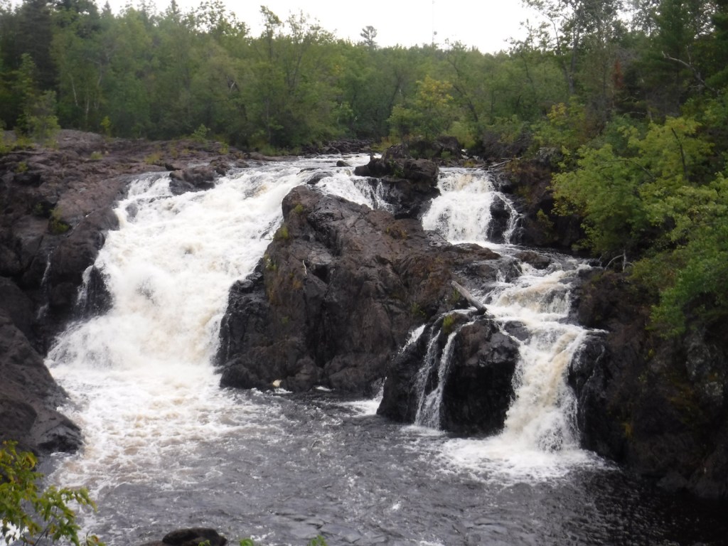
This park protects a deep, boulder-strewn canyon with several waterfalls, including one with a 60-foot drop.  It also has a campground and the blufftop Clifty Inn built in 1924 with views of the Ohio River.

Optional stop on the Indiana Cave Trail

A driving route connects several show caves in the southern part of the state where the brisk air is always a humid 57°F.  Highlights include Indiana Caverns, Wyandotte Caves State Recreation Area, Squire Boone Caverns, Marengo Cave, and Bluespring Caverns that offers a one-hour boat ride through America’s longest navigable underground river. 

Day 8+

George Rogers Clark National Historical Park (click here for our complete blog post)

A beautiful 80-foot-tall granite memorial was built on the site of Fort Sackville in the 1930s to commemorate the victory Clark led there on February 25, 1779.  After watching the 20-minute film in the visitor center in Vincennes, go inside the circular memorial with 16 columns in classic Greek style to see a bronze statue surrounded by seven murals.  You can then walk down the Wabash River to see the home of President William Henry Harrison and the old territorial capitol.

Holiday World

Located in the town of Santa Claus, this Christmas-themed amusement park has roller coasters, a water park, and many shops.

Lincoln Boyhood National Memorial (click here for our complete blog post)

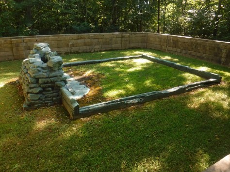
Take a walk past the pioneer cemetery to the Cabin Site Memorial where a bronze casting of sill logs and the fireplace hearthstones are at the site of Abraham Lincoln’s family cabin from 1829.  The Living Historical Farm has costumed interpreters in the summer that depict homestead life at an authentic cabin and several outbuildings that were moved here from other parts of Indiana.

Angel Mounds State Historic Site

Near Evansville is a 430-acre site where there are 11 grass-covered Mississippian mounds built as early as 1,000 years ago, plus a replica village, simulated excavation site, and a visitor center full of artifacts. 

Milan ’54 Museum

Commemorates the town’s 1954 high school boys’ basketball team that defeated the mighty Muncie Central for the state championship, as immortalized in the 1986 film Hoosiers.

Indiana Basketball Hall of Fame

In a state obsessed with basketball, this museum was moved from the capital city to New Castle in 1990 so it could have more room for expansion. 

Learn more about Indiana’s Most Scenic Drive, Top Backpacking Destination, and other categories in our travel guidebook 50 States of Great: Road Trip Guide to America.

Arizona Road Trip Itinerary

72,700,211 acres

Statehood 1912 (48th)

Capital: Phoenix

Population: 7,151,502 (14th)

High Point: Mt. Humphreys (12,643 feet)

Best time of year: Winter and spring

Last year we published our guidebook 50 States of Great: Road Trip Guide to America, so we decided to start a new type of blog post where we create a travel itinerary for all 50 states, in addition to our usual National Forest and National Park entries.  After starting with KansasGeorgiaIdahoRhode Island, Minnesota, and Hawai‘i we decided to do a state in the southwest.  Arizona probably needs two separate itineraries, with the southern deserts being a great destination in the winter and the high-elevation northern part of the state better in the summer (see Day 8+).  We made an ambitious seven-day plan starting in the south, with plenty of options to extend the trip.  Scott grew up in Arizona, so he could have easily made this a four-week itinerary and still left out many good options. 

Day 1

Organ Pipe Cactus National Monument (click here for our blog post)

On the Mexican border sits 330,689 acres of undeveloped Sonoran Desert recognized as a UNESCO International Biosphere Reserve in 1976.  Its namesake cactus is more common further south and shares this landscape with 27 other species of cacti, including the famous saguaro.  The park’s jagged Ajo Mountains are mostly volcanic rhyolite and to see them at their best, we recommend driving the 21-mile dirt road loop in the evening before turning in for the night at the excellent Twin Peaks Campground, run by the National Park Service (NPS).

Optional stop at Casa Grande Ruins National Monument (click here for our blog post)

Arizona has 19 National Monuments (more than any other state), so if you flew into Sky Harbor Airport in Phoenix start with the one located right off Interstate 10.

Optional stop at Kofa National Wildlife Refuge

Desert bighorn sheep can be seen in this remote part of southwest Arizona south of Quartzsite.  Cibola and Imperial National Wildlife Refuges along the Colorado River are good spots for birding.

Day 2

Titan Missile Museum

Southwest of Tucson, Arizona in a nondescript stretch of desert are the remains of an underground Intercontinental Ballistic Missile (ICBM) silo built in 1963, during the height of the Cold War.  The nuclear warhead and rocket fuel was long ago removed from the site, but otherwise everything has been preserved.  A tour guide takes you below ground in the original elevator to explain the steps required to unleash this devastating weapon. 

Coronado National Forest (click here for our blog post)

The Catalina Highway ascends from Tucson through multiple life zones from saguaro-dotted desert to ponderosa pine forests at more than 9,000 feet in elevation.  The expansive vistas along the drive are worth the many switchbacks, with Windy Point Vista is an especially beautiful wayside in the pinyon-juniper woodland zone.  At the base of the Santa Catalina Mountains, also within Coronado National Forest, tram rides are available through beautiful Sabino Canyon Recreation Area.

Optional stop at Saguaro National Park (click here for our blog post)

If you didn’t get your fill of cacti the first day, you will at this park with separate sections east and west of Tucson.  If you only have time for one, we recommend the eastern Rincon Mountain District.

Optional stop at Tumacácori National Historical Park (click here for our blog post)

South of Tucson in Tubac, San Cayetano de Tumacácori is a Spanish mission founded in 1691 by Padre Kino and abandoned in 1848.  It became a National Monument in 1908 when it was restored to its ruined state based on photographs dating from 1868.

Day 3

Kartchner Caverns State Park

The highly decorated cave was not discovered until 1974, when its location was kept a tight secret while efforts were made to preserve it for future visitors.  There are two guided tours on paved trails offered, and if you space out your reservations far enough you can take a hike on the 2.4-mile Foothills Loop Trail in between.

Bisbee

The copper mining center of Bisbee was once the largest city between El Paso and San Francisco.  The well-maintained Victorian architecture and flights of steep staircases give this border town a unique atmosphere. 

Optional stop at Coronado National Memorial (click here for our blog post)

The park does not actually contain a statue or large memorial to Coronado.  It does have a steep three-quarter mile trail to a 600-foot long limestone cave bearing Coronado’s name, which visitors can explore on their own with flashlights.

Day 4

Chiricahua National Monument (click here for our blog post)

Tucked away in the southeastern corner of Arizona, millions of years of erosion left behind a spectacular collection of rhyolite rock formations that rise above surrounding evergreen trees.  All the trails are good, but we recommend an all-day hike through Echo Canyon to the Heart of Rocks Loop where you will find formations resembling camels, ducks, and anything else you can imagine. 

Salt River Canyon

Start driving north and be sure to stop for photos where U.S. Highway 60 drops steeply into this gorgeous canyon between Globe and Show Low.

Optional stop at Wilcox Playa Wildlife Area

In the winter, sandhill cranes stay in large numbers in the wetlands south of Wilcox and Interstate 10.

Optional stop at Fort Bowie National Historic Site (click here for our blog post)

To visit the NPS visitor center, the literal “must-do activity” is to hike 1.5 miles from the trailhead.  You do pass interpretive signs, a cemetery, and ruins along the way.

Day 5

Petrified Forest National Park (click here for our blog post)

A paved walkway behind the Rainbow Forest Museum is a great place to start, as NPS rangers give guided tours there throughout the day.  It is worth a hike to Agate House and a connection to the Giant Logs Trail to see more petrified wood, but be sure to bring water with you in the summer since there is no shade.

“Standin’ on the corner” statue in Winslow

Jackson Browne and Glenn Frey probably could not have guessed when they penned the 1970s anthem “Take It Easy” that it would inspire a statue in an Arizona town on historic Route 66.  Perhaps even more fitting is the mural behind it that shows the reflection of a girl driving a flatbed truck.  Located off Interstate 40, Winslow is a great place “to loosen your load.”

Cameron Trading Post

As a kid, Scott’s family would always spend the night at the hotel here before taking friends and family to the Grand Canyon National Park.  Try the mutton stew or Indian taco in the restaurant at this historic spot.

Optional stop at Meteor Crater

There is a good museum at this big, round hole in the ground along Interstate 40.  It is definitely worth seeing once in your life.

Optional stops at Sunset Crater Volcano, Walnut Canyon, and Wupatki National Monuments (click here for our blog posts)

Heading north from Flagstaff, a 36-mile loop drive through Sunset Crater Volcano National Monument to adjacent Wupatki National Monument passes by the red-hued cinder cone through ponderosa pine forests and sunflower-filled meadows on its way to an arid, rocky high desert region that is dotted with Sinagua ruins from around AD 1100.  Nearby cliff dwellings were built in Walnut Canyon National Monument around the same time by another group of Sinagua.  To get up close with the cliff dwellings inside shallow limestone caves requires a hike down 200 stairs on the one-mile loop Island Trail. 

Day 6

Grand Canyon National Park (click here for our blog post)

Visit the South Rim of the park from the less busy eastern entrance and stop at the Watchtower and other scenic views along the way.  It is worth spending a few nights here and hiking (or riding a mule) to the bottom of the canyon, but that is not for everyone.  If you come in the summer, consider a trip to the North Rim or remote Toroweap (online permit required).

Optional stop at Little Colorado River Gorge Navajo Tribal Park

A nice overlook above a canyon along Highway 64 on the way into Grand Canyon National Park.

Day 7

Sedona

Famous for art galleries and New Age mysticism, the red rock city of Sedona offer plenty of stores and restaurants.  Be sure to leave some time to explore some unpaved roads and hiking trails in the surrounding area.

Coconino National Forest (click here for our blog post)

There are numerous trails in the National Forest around Sedona, where sandstone buttes (like Bell Rock and Cathedral Rock) dominate the landscape.  The shady West Fork Trail in Oak Creek Canyon is perfect on hot summer days, though in the winter it is also beautiful covered in snow and ice.

Optional stop at Sycamore Canyon Wilderness

This designated Wilderness (55,937 acres) is shared between three National Forests: Coconino, Kaibab, and Prescott.  The easiest way in is on the Parsons Trail located outside Clarkdale, west of Sedona.  The trailhead is accessed by driving the dirt Forest Road 131 for 10.5 miles from where it splits off near Tuzigoot National Monument.

Optional stop at Tuzigoot National Monument (click here for our blog post)

The Sinagua pueblo at Tuzigoot had about 110 rooms and is estimated to have housed 200 to 300 people.  You can walk inside portions of the ruin, including a section with a reconstructed roof.

Day 8+

Montezuma Castle National Monument (click here for our blog post)

If you are driving back south on Interstate 17 to Phoenix, this cliff dwelling makes a nice stop to break up the trip.

Tonto National Monument (click here for our blog post)

These cliff ruins east of Phoenix are worth the hike up to, as are many parts of Tonto National Forest, especially the Flat Iron, Hieroglyph Canyon, and Weaver’s Needle.

Hubbell Trading Post National Historic Site (click here for our blog post)

This is a unique NPS site with livestock (sheep, horses, turkeys) and a hands-on play area for children, as well as the original dusty store which allows visitors to travel back into the late-1800s.  There are frequent Navajo rug weaving demonstrations and tours inside the Hubbell Home are available for a fee. 

Canyon de Chelly National Monument (click here for our blog post)

In the heart of the Navajo Nation in northeast Arizona lies this picturesque National Monument.  Humans have inhabited this area for 4,500 years, leaving behind numerous pictographs and the dramatic ruins of Ancestral Puebloan cliff dwellings.

Navajo National Monument (click here for our blog post)

Visitors can reserve spots on the ranger-led day hike to Betatakin cliff dwelling or the 20-person backpacking trips to Keet Seel that are offered twice per month in the summer.  The latter is a strenuous trip covering 17 miles total with numerous stream crossings and all water must be carried in.  The hardest part is at the end, when a 1,000 foot climb awaits, but it is worth it to be one of the few who get to see Keet Seel, the 150-room ruin that is second in size only to Cliff Palace at Mesa Verde National Park.

Monument Valley Navajo Tribal Park

On the border of Arizona and Utah, entrance into Monument Valley Navajo Tribal Park allows you to see the iconic Mitten Buttes in person, which have served as a backdrop for countless films.  You can even pitch your tent at The View Campground overlooking the red rock formations. 

Havasupai Reservation

It is hard to argue against Mooney Falls and the other waterfalls in Havasu Canyon as being the most outstanding in the state, but it can be difficult (and expensive) to obtain one of the limited reservations available to visit the Havasupai Reservation that borders Grand Canyon National Park.

Baaj Nwaavjo I’tah Kukveni – Ancestral Footprints of the Grand Canyon National Monument (click here for our blog post)

The newest of Arizona’s 19 National Monuments includes the pictographs in Snake Gulch, part of Kaibab National Forest.

Pipe Spring National Monument (click here for our blog post)

Retention ponds keep this area green in the hot summer months where ducks paddle and dragonflies buzz through the humid air.  When a NPS ranger is present, you can walk around inside Winsor Castle, a Mormon fort that dates back to 1870. 

Antelope Canyon

Guided tours are required to access these beautiful slot canyons located on private land on the Navajo Nation

Glen Canyon National Recreation Area (click here for our blog post)

You might want to bring your “selfie stick” to iconic Horseshoe Bend Overlook, a short 0.7-mile one-way hike from the parking area on Highway 89 outside Page.

Lake Mead National Recreation Area (click here for our blog post)

At Arizona Hot Springs, pools are formed by sandbags in a narrow canyon.  It is accessible from Liberty Bell Trailhead by a 6.5-mile out-and-back hike through a beautiful arroyo down to Black Canyon (now the upper reaches of Lake Mohave formed by a dam) on the Colorado River.  The trail is closed during the hot summer months, but you can still access it by boat from Willow Beach Marina or just downstream from the Hoover Dam (with a special permit).  Further south on Lake Mohave, stop at Emerald Cove for incredible photographs.

Learn more about Arizona’s Most Scenic Drive, Wonderful Waterfall, Top State Park, and other categories in our new travel guidebook 50 States of Great: Road Trip Guide to America.

Gateway Arch National Park

Gateway Arch National Park

Missouri

Managed by National Park Service

Established 1935 National Expansion Memorial, 2018 National Park

91 acres

Website: nps.gov/jeff

Overview

On February 22, 2018, the 60th National Park in the U.S. was created from what was formerly Jefferson National Expansion Memorial in St. Louis, Missouri.  Gateway Arch National Park encompasses 91 acres on the Mississippi River, including the historic 1828 courthouse and the iconic 630-foot-tall arch that was finished in 1965.  We first visited on our cross-country road trip in 2007 and returned in 2016 while the underground museum was under construction and the greenway was extended over Interstate 44.  When we came back in 2022, the courthouse was closed for renovation, but the museum had reopened with exhibits explaining the importance of this city as a starting point for the settlement of the west after President Thomas Jefferson signed the Louisiana Purchase, doubling the size of the country in 1803.  It is by far the smallest of the 63 National Parks (5,457 acres less than Hot Springs), which begs the question: Why wasn’t this designated a National Historical Park instead?

Learn more about how to visit this National Park in the expanded second edition of our guidebook A Park to Yourself: Finding Solitude in America’s 63 National Parks

Highlights

Gateway Arch, tram, film, museum, Old Courthouse, Old Cathedral

Must-Do Activity

Unlike other National Parks, this one does not preserve a natural landmark, but it does have claustrophobia-inducing tram cars (fee) that take you four-minutes to the top of the Gateway Arch for excellent views across Illinois and Missouri.  It is worth the hassle to go through a security screening to see the new museum.  The 35-minute film Monument to the Dream is also available for a fee. 

Best Trail

There are sidewalks that follow the Mississippi River and loop around the arch.  Be sure to cross the street to the Old Courthouse where the first of two trials in the infamous Dred Scott case was held in 1854.  Continue west behind to the courthouse to the Kiener Memorial Fountain for a photo that frames the building beneath the Gateway Arch.

Photographic Opportunity

The 630-foot-tall Gateway Arch is the defining landmark of St. Louis, but the historic 1834 Old Cathedral still serves as an active Catholic Church inside the park boundaries.

Peak Season

Summer

Hours

https://www.nps.gov/jeff/planyourvisit/hours.htm

Fees

There is no fee to walk the grounds or pass through security for the museum and gift shop, but you do have to pay to view the film or ride the tram to the top of Gateway Arch.  When open, the Old Courthouse is also free to enter.

Road Conditions

All roads are paved, but parking can be tricky.  We suggest paying for a parking garage or paying to park on the river levee near the paddlewheel boats, since car break-ins are common in downtown St. Louis.

Camping

This is the only National Park without the option to camp, so consider heading southwest to the wonderful Ozark National Scenic Riverways or Mark Twain National Forest.  In southeast Missouri, Johnson’s Shut-Ins State Park is rated as one of the best RV campgrounds in the country.

Related Sites

Ulysses S. Grant National Historic Site (Missouri)

Ste. Genevieve National Historical Park (Missouri)

Harry S Truman National Historic Site (Missouri)

Explore More – In 1947, how many city blocks were razed to make way for the memorial, including several historic buildings dating back to 1818?

We designed this Gateway Arch logo for the park available on Amazon.com

We are a participant in the Amazon Services LLC Associates Program, an affiliate advertising program designed to provide a means for us to earn fees by linking to Amazon.com and affiliated sites.

Minnesota Road Trip Itinerary

50,961,114 acres

Statehood 1858 (32nd)

Capital: St. Paul

Population: 5,706,494 (22nd)

High Point: Eagle Mountain (2,302 feet)

Best time of year: Summer for the state fair and access to the northern lakes

We recently published our guidebook 50 States of Great: Road Trip Guide to America, so we decided to start a new type of blog post where we create a travel itinerary for all 50 states, in addition to our usual National Forest and National Park entries.  After starting with KansasGeorgia, Idaho, and Rhode Island, we decided to do a state that is part Midwest and part North Woods.  We made an ambitious seven-day plan starting in the southern Minnesota, with plenty of options to extend the trip.

Day 1

SPAM Museum

Located in the small town of Austin, this free museum is full of interactive exhibits and photo opportunities, but the best part is that it does not take itself too seriously.  Even if you do not like to eat the canned “spiced ham” product, you will come to appreciate its significance to World War II history and pop culture, as well as its amazing gift shop with more branded products than you can imagine.

Niagara Cave or Mystery Cave

Niagara Cave is a privately-owned show cave named for its 60-foot-tall underground waterfall that is only viewable on guided tours.  Not far away, Forestville/Mystery Cave State Park contains the state’s longest cave (47 degrees year round) which also offers guided tours.

Optional stop at Pipestone National Monument (click here for our blog post)

If you come into the state from the southwest corner, consider a stop at a spot that people have come for 2,000 years to mine the red quartzite rock (also known as catlinite).  The soft sedimentary stone is relatively easy to carve into smoking pipes and effigies.  April through October, you can watch American Indian carvers at the National Park Service (NPS) museum demonstrate how to sculpt this soft yet durable stone into hollow pipes and other beautiful ornaments, some of which you can buy in the gift shop.

Optional stop at Laura Ingalls Wilder Museum

Fans of the author’s “Little House” series of books will want to see a replica of the Ingalls’ home in Walnut Grove and some of the family’s historic heirlooms.

Day 2

Mall of America

Indoor shopping malls are still thriving in the Twin Cities (Minneapolis-St. Paul) metropolitan area, perhaps due to the cold and snowy winter weather.  The most famous is the Mall of America with its indoor amusement park and 520 stores, making it the largest mall in the western hemisphere (and eleventh largest in the world).

Mississippi National River and Recreation Area (click here for our blog post)

This park follows 72 miles of the great river’s course through Minnesota, from busy metropolitan sections in the Twin Cities to secluded stretches of water where it reaches its confluence with the Saint Croix National Scenic Riverway.  In downtown Minneapolis, Minnehaha Regional Park contains its namesake falls celebrated in Henry Wadsworth Longfellow’s Song of Hiawatha.  Nearby, St. Anthony Falls is the only true waterfall along the entire length of the Mississippi River, now controlled by a lock and dam.  

Optional stop at University of Minnesota Golden Gophers’ football game

We saw wild turkeys wandering around this beautiful campus that sits on a bluff east of the Mississippi River.  Nobody seems to be exactly sure what a golden gopher is (possibly a thirteen-lined ground squirrel), but their mascot Goldie is the cutest in all of college football.  Huntington Bank Stadium has one of the best pregame areas with plenty of photo ops and a pep rally held outside the hockey arena, plus we got free Culver’s custard, a clear bag giveaway, and Mystic Lake casino provided free towels and “spinny video thing.”  The football team typically schedules their home opener on the Thursday before Labor Day during the Minnesota State Fair.

Day 3

Minnesota State Fair

You will need all day to visit America’s best state fair that is held annually the 12 days before Labor Day, welcoming more than two-million visitors annually.  The fair has the standard carnival rides, butter sculptures, farm animals, and artwork, as well as stages where musicians, comedians, and magicians perform throughout the day.  Some of the unique food offerings include hotdish-on-a-stick, poutine, fried cheese curds, pronto pup, fried pickles, pork chop-on-a-stick, and fried buckeyes (chocolate and peanut butter candy).  Since it started in 1979, Sweet Martha’s Cookie Jar has been overfilling buckets of fresh-baked chocolate chip cookies for customers, making up to 200,000 cookies an hour.  To wash all that down, you might want to visit one of the stands offering all-you-can-drink milk.

Optional stop at Hell’s Kitchen restaurant

If you are still hungry after the Minnesota State Fair then you probably didn’t do it right, but we will make one of our rare restaurant recommendations for this unique spot in downtown Minneapolis with interesting décor and really good food (try the poutine or walleye bites).

Day 4

Paul Bunyan Expressway

The legendary giant lumberjack Paul Bunyan is a big deal in Minnesota and he has statues honoring him in many towns along the Paul Bunyan Expressway.  The 18-foot-tall statues in Bemidji were originally built in 1937 to honor these larger-than-life heroes and continue to be an essential roadside attraction.  In Brainerd, Paul Bunyan Land is an entire amusement park built around a 26-foot-tall talking statue of Paul and 19-foot Babe, the latter refurbished after it blew over in a 2006 windstorm.

Chippewa National Forest (click here for our blog post)

The Lost 40 is 144 acres of old-growth red and white pine forest that was never logged due to a surveying error that mapped the area as part of Coddington Lake in 1882.  The oldest tree here is more than 250 years old and can be seen on an easy one-mile loop trail with interpretive signs.  The trailhead is located east of Blackduck on well-signed back roads that are also popular for snowshoeing in the winter.  Nearby, Camp Rabideau is perhaps the best preserved Civilian Conservation Corps (CCC) camp left from the 1930s, with free guided tours in the summer.

Optional stop at Itasca State Park

Lake Itasca is considered the headwaters of the Mississippi River and is located just west of Highway 71 at the beginning of the 2,069-mile-long Great River Road that goes all the way to Louisiana.

Day 5

Roadside Sculptures

Driving north on Highway 71, there is seemingly another great roadside attraction located every few miles.  We saw the statues of Uncle Dan Campbell in Big Falls, Jack Pine Savage in Littlefork, the world’s largest crow in Belgrade, and a giant black duck in the town of Blackduck.  Right outside Voyageurs National Park, which surrounds Lake Kabetogama, was our favorite—a giant walleye with a saddle for riding.  If Kabetogama seems like a mouthful, rest assured that everyone, including park rangers, simply calls it “Lake Kab.”

Voyageurs National Park (click here for our blog post)

The park is famous for its manmade destinations, including Kettle Falls Hotel, Hoist Bay Resort, and the unique sculptures at Ellsworth Rock Gardens.  Try to get out on one of Minnesota’s 10,000 lakes via a ranger-led tour or take your own boat to one of the shoreline campsites inaccessible by car (permit required).  Reservations can be made for the ranger-guided North Canoe Voyage that lets passengers paddle a 26-foot canoe, just like the French-Canadian “voyageurs” of old. 

Day 6

Kawishiwi Falls in Ely

The little town of Ely is the gateway to the Boundary Waters Canoe Area Wilderness (see below), but even if you are just passing through be sure to make the short hike to Kawishiwi Falls below the dam on Garden Lake.

International Wolf Center in Ely

Gray wolves (called timber wolves regionally) reside in the North Woods and while a few lucky travelers might hear them howling, your best bet to see one is at the Wolf Center.  It also has a section dedicated to Sigurd Olson, a talented local author and naturalist.

Optional stop at United States Hockey Hall of Fame in Eveleth

As seen on the side of U-Haul trailers, Eveleth is home to this museum and shrine to American ice hockey players.

Day 7

North Shore Scenic Drive

The northwest shore of Lake Superior is a beautiful stretch of cliffs and waterfalls.  This 148-mile drive starts at the Canadian border near Grand Portage National Monument and passes on its way to Duluth several nice State Parks, including Grand Portage, Gooseberry Falls, Split Rock Lighthouse, Tettegouche, Temperance River, Cascade River, and Judge C. R. Magney State Parks

Grand Portage National Monument (click here for our blog post)

French-Canadian voyageurs had to walk their canoes and goods along an eight-mile-long portage to bypass the rapids on the Pigeon River.  In 1784, the end of the trail on the edge of Lake Superior became the site of the North West Company headquarters where they held an annual rendezvous, where today visitors can walk around the reconstructed buildings and talk with the costumed reenactors during the summer.

Optional stop at Two Harbors

North of Duluth, the North Shore Scenic Drive passes through the town of Two Harbors where there is a giant rooster at Weldon’s Gifts and a huge statue of Pierre the Voyageur outside the Earthwood Inn.  If you press the speaker button at the statue’s base, Pierre will tell you all about the history of the region, but he never explains why he is not wearing any pants. 

Day 8+

Superior National Forest

In addition to encompassing the state’s highest mountain, Superior National Forest also offers scenic drives on the Gunflint Trail (County Road 12), Fernberg Road (State Route 169), and Echo Trail (County Road 116).  Vermilion Gorge Trail is an easy 1.5-mile one-way hike to a narrow canyon cut through Canadian Shield rock in the small community of Crane Lake (on the east side of Voyageurs National Park).  Not far away down a dirt road, a short trail leads to Vermilion Falls where the same river cuts a narrow channel through the rock. 

Boundary Waters Canoe Area Wilderness

Permits for the peak season can be hard to come by for the world’s premiere destination for backcountry canoeing, so plan ahead.  This one-million-acre preserve has more than 1,000 lakes with over 1,500 miles of canoe routes and 2,200 designated backcountry campsites.  In addition to its famous water routes with numerous portages, a few overland trails exist like the 12-mile Angleworm Trail and the 39-mile Kekekebic Trail, an official part of the North Country National Scenic Trail.

Learn more about Minnesota’s Most Scenic Drive, Wonderful Waterfall, Top State Park, and other categories in our new travel guidebook 50 States of Great: Road Trip Guide to America.

Hawai‘i Volcanoes National Park

Hawai‘i Volcanoes National Park

Hawai‘i

Managed by National Park Service

Established 1916

344,812 acres

Website: nps.gov/havo

Overview

Hawai‘i National Park was created in 1916, before being split in 1961 into this park on the Big Island of Hawai‘i and Haleakala National Park on Maui.  Encompassing two of the world’s most active volcanoes (Kīlauea and Mauna Loa), Hawaiʻi Volcanoes National Park is constantly changing.  Indigenous people considered Kīlauea Caldera and its bubbling Halemaʻumaʻu Crater as the sacred home of Pele, goddess of the volcano.  This area first became a tourist attraction in the 1840s when Volcano House was still a grass shack.  A small, wooden hotel was built in 1877 that now serves as Volcano Art Center Gallery, before the larger lodge was finished in the 1940s on the edge of the caldera.  A strenuous backpacking trail summits the world’s largest shield volcano, 13,677-foot Mauna Loa, which erupted in 1926, 1942, 1950, 1984, and 2022. 

To learn more about the separate Kahuku Unit and how to find solitude in this National Park that saw 1.6-million visitors in 2023, check out our expanded 2nd edition of our guidebook A Park to Yourself: Finding Solitude in America’s 63 National Parks

Highlights

Volcano Art Center, Halemaʻumaʻu Crater, Chain of Craters Road, Kīlauea Iki Crater, Nāhuku (Thurston Lava Tube), Hōlei Sea Arch, Lava Tree Molds, Mauna Loa Overlook, Kīpukapuaulu Trail, Pu‘u Loa Petroglyphs Trail

Must-Do Activity

Arrive early or late at the visitor center to avoid tour bus crowds, then check with a ranger to find the best overlooks to view any volcanic activity in Halemaʻumaʻu Crater (depicted in our illustration below).  Consider returning to view the molten lava after dark, although parking can be a challenge.  The Chain of Craters Road leads 20 miles south from the forested caldera rim above 4,078 feet in elevation down to the sparsely vegetated seashore, descending through a wide range of environments before it dead ends into recent lava flows near the Hōlei Sea Arch and 1.5-mile Pu‘u Loa Petroglyphs Trail, where the crisp images chipped into the black lava have been spared from centuries of volcanic activity. 

Best Trail

Kīlauea Iki Trail makes a four-mile loop descending 400 feet to the bottom of the crater that was a lake of lava in 1959.  It is recommended to hike it in a counter-clockwise direction to avoid ascending the steepest sections. 

Instagram-worthy Photo

Kīlauea erupted nonstop from 1983 through 2018, when lava poured in a near constant stream into the ocean, and it has been sporadically active since then.  Lava made it into the #1 spot on our Top 10 Natural Phenomena to See in the U.S.

Peak Season

Year round or whenever a volcano is active

Hours

https://www.nps.gov/havo/planyourvisit/hours.htm

Fees

$30 per vehicle or America the Beautiful pass

Road Conditions

Chain of Craters Road is paved, but can be closed during volcanic eruptions, just as half of Crater Rim Drive has been closed since March 19, 2008.  The side road to Hilina Pali Overlook is usually closed beyond Kulanaokuaiki Campground.  The one-lane, potholed Mauna Loa Road is doable with a passenger vehicle if you take it slow, as is the unpaved road into the western Kahuku Unit. 

Camping

The name of Kulanaokuaiki Campground translates as “shaking earth,” and this nine-site primitive camp has no drinking water, unlike the concessionaire-run Nāmakanipaio Campground and Cabins on Highway 11.  Even though this is Hawai‘i, bring some warm clothes as it can be quite rainy and windy, especially when the volcano is erupting; the temperature around Halemaʻumaʻu Crater did not rise above 59°F all day during our 2023 visit.

Related Sites

Pu‘uhonua o Honaunau National Historical Park (Hawai‘i)

Kaloko-Honokohau National Historical Park (Hawai‘i)

Pu’ukohola Heiau National Historic Site (Hawai‘i)

Explore More – When was the 115,788-acre Kahuku Unit added to the National Park?

This design we created to celebrate Hawai’i Volcanoes National Park is available on a variety of products at Cafe Press
We designed this ‘ohi’a lehua logo for the park available on Amazon.com

We are a participant in the Amazon Services LLC Associates Program, an affiliate advertising program designed to provide a means for us to earn fees by linking to Amazon.com and affiliated sites.