Overview
Stretching nearly one mile (5,223 feet) in length, the Grand Coulee Dam was the first constructed across the mighty Columbia River between 1933 and 1942. In case you are wondering what a “coulee” is, that is a regional name for a canyon, many of which were carved by the walls of water that scoured this region after Lake Missoula burst through its ice dams periodically 15,000 to 13,000 years ago. The reservoir created by the dam was named for President Franklin D. Roosevelt, which is why the National Park Service (NPS) manages it as Lake Roosevelt National Recreation Area.

Highlights
Grand Coulee Dam Visitor Center, Fort Spokane, St. Paul’s Mission, watersports
Must-Do Activity
The Bureau of Reclamation manages the museum at Grand Coulee Dam Visitor Center and a free laser light show is projected on the mile-long dam during the summer months. Near a major river confluence, Fort Spokane was established in 1880 and now has a one-mile trail explaining its diverse history. The reservoir submerged the salmon fishing grounds at Kettle Falls that had been used for millennia. Native Americans still inhabit this region today, as the lake creates a border between the Colville and Spokane Indian Reservations. Campgrounds and boat launch sites are located all along the narrow lake’s 129-mile length, although some may close due to changing reservoir levels.
Best Trail
A quarter-mile trail with interpretive signs is located at St. Paul’s Mission, one of the oldest churches in Washington state. Here you will learn about (now submerged) Kettle Falls and the Hudson’s Bay Company’s historic impact on the region.
Instagram-worthy Photo
At the time, the Grand Coulee Dam became the largest masonry structure ever built, breaking a record held for 4,700 years by the Great Pyramid in Egypt.

Peak Season
Summer
Hours
https://www.nps.gov/laro/planyourvisit/hours.htm
Fees
The NPS charges a fee at boat launches and you cannot use the America the Beautiful pass. Grand Coulee Dam Visitor Center is free, as are the Keller Ferry and Gifford–Inchelium Ferry that cross the lake.
Road Conditions
There are some unpaved roads, but the designated Scenic Drive follows only paved roads and utilizes two free ferries.
Camping
There are 26 campgrounds available on a first-come, first-served basis, while sites at a few take reservations. Boat-in campgrounds and shoreline camping are both free.
Related Sites
Whitman Mission National Historic Site (Washington)
Glen Canyon National Recreation Area (Arizona-Utah)
Lake Mead National Recreation Area (Nevada-Arizona)

Bridge over Lake Roosevelt on Highway 395 

Wondon playing with the jackhammer at the dam museum 

Tiff posing inside a diving suit at the dam museum 

Water from all 50 states was poured at the grand opening 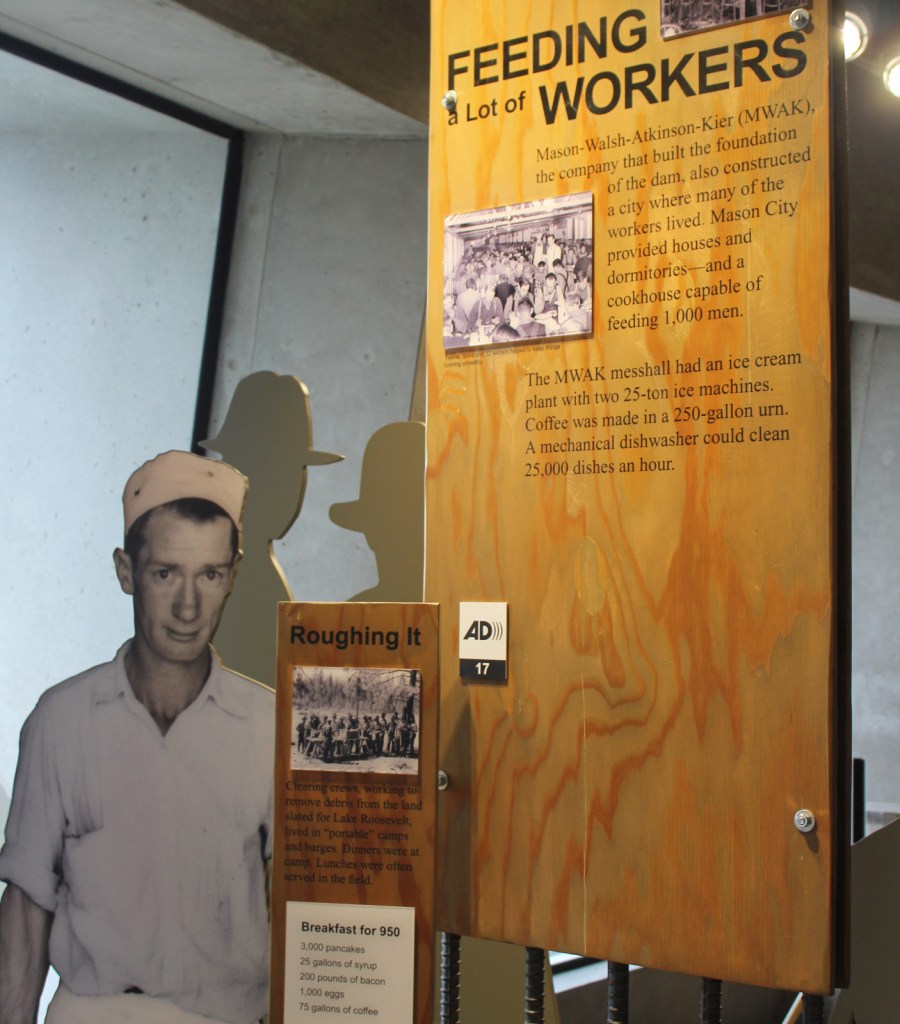


The frozen lake behind the dam in February
Explore More – During peak construction, how many people were employed at the Grand Coulee Dam?