Tag Archives: boating

Grand Island National Recreation Area

Grand Island National Recreation Area

Michigan

Managed by U.S. Forest Service, Eastern Region

13,279 acres

Website: https://www.fs.usda.gov/recarea/hiawatha/recarea/?recid=13270

Overview

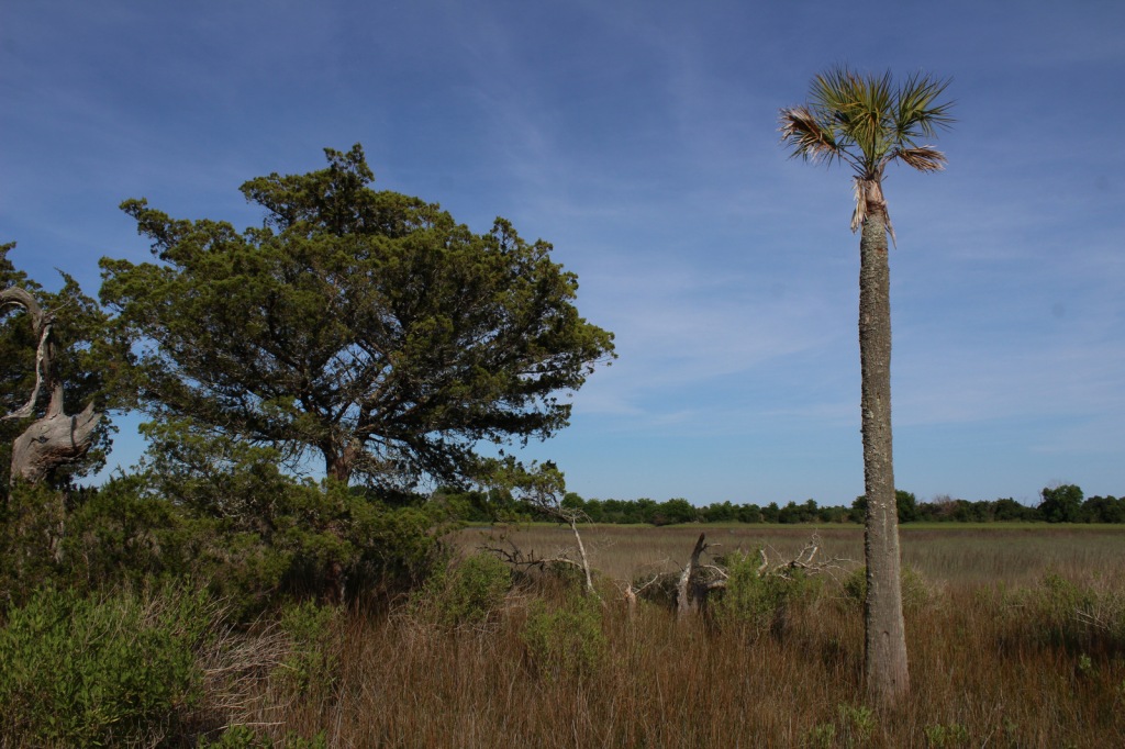
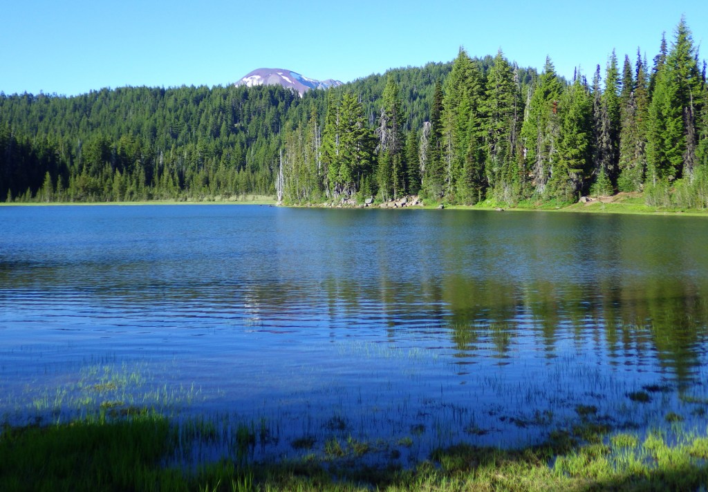
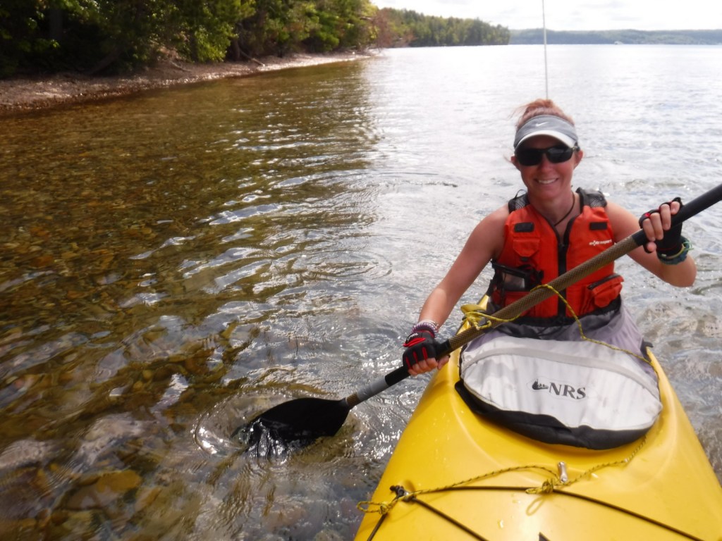
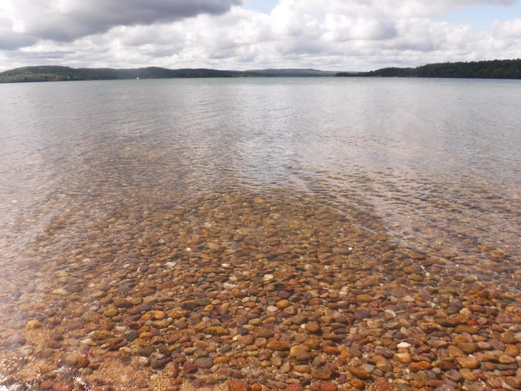
The turquoise color of Lake Superior beneath the sandstone cliffs of Grand Island National Recreation Area makes it seem warmer than it actually is.  Glaciers carved this island’s shoreline thousands of years ago and the Ice Age never seems far off in the lake’s cold waters.  Managed by Hiawatha National Forest, the most popular activities here are commercial boat tours, backpacking, and mountain biking the 20-mile loop around the island.  Paddling a sea kayak can be an unforgettable experience and guides can provide the necessary gear.  Most of the northern two-thirds of Grand Island is surrounded by cliffs with nowhere to land a boat, so be careful as large waves can become hazardous on Lake Superior. 

Highlights

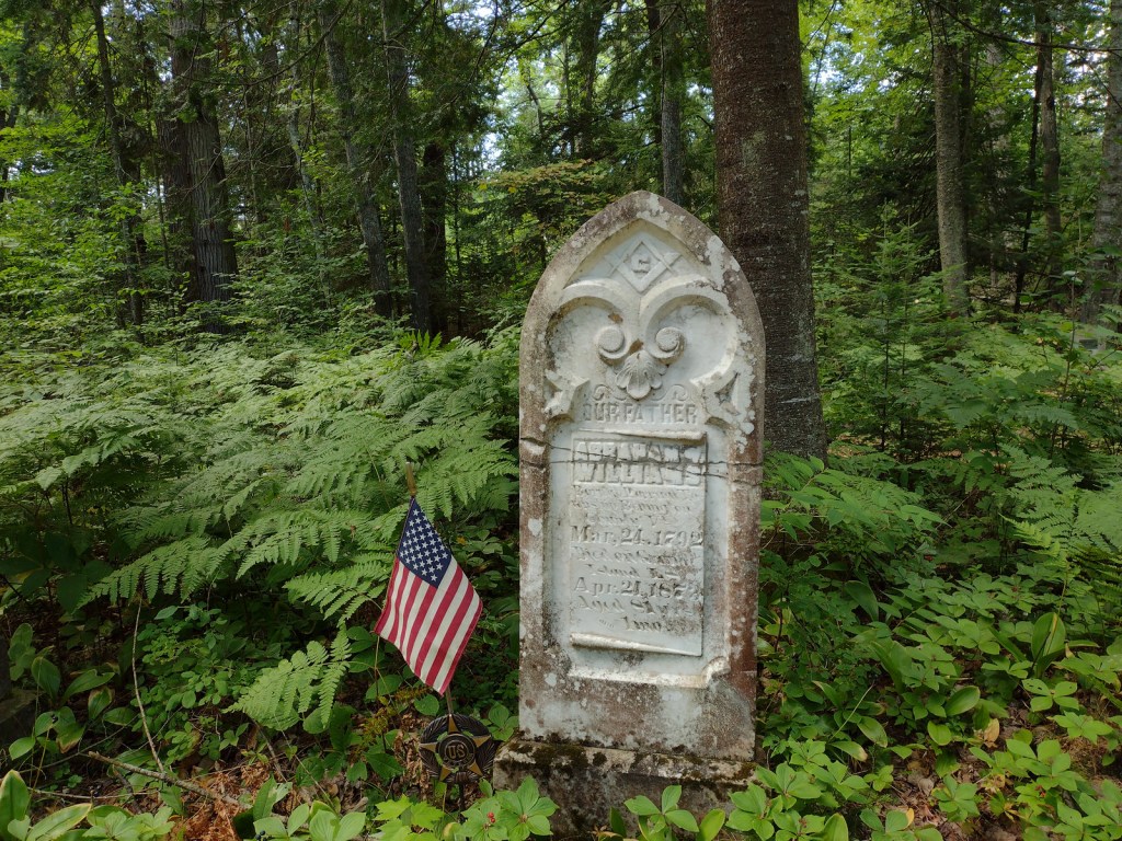
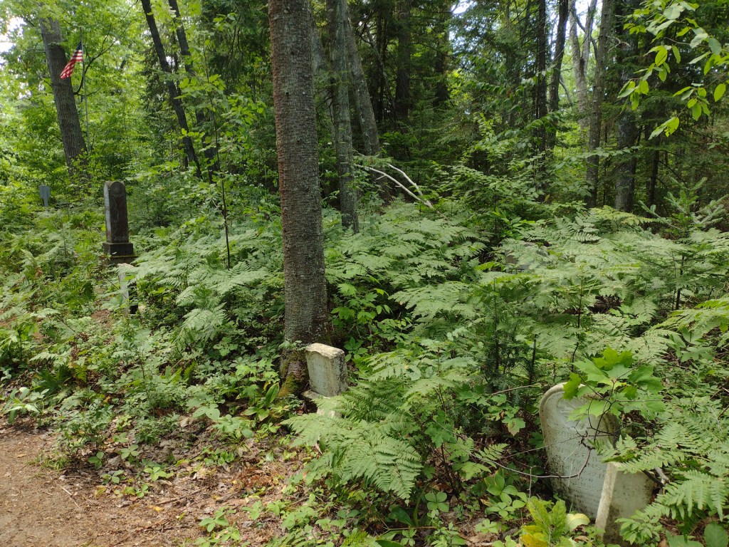
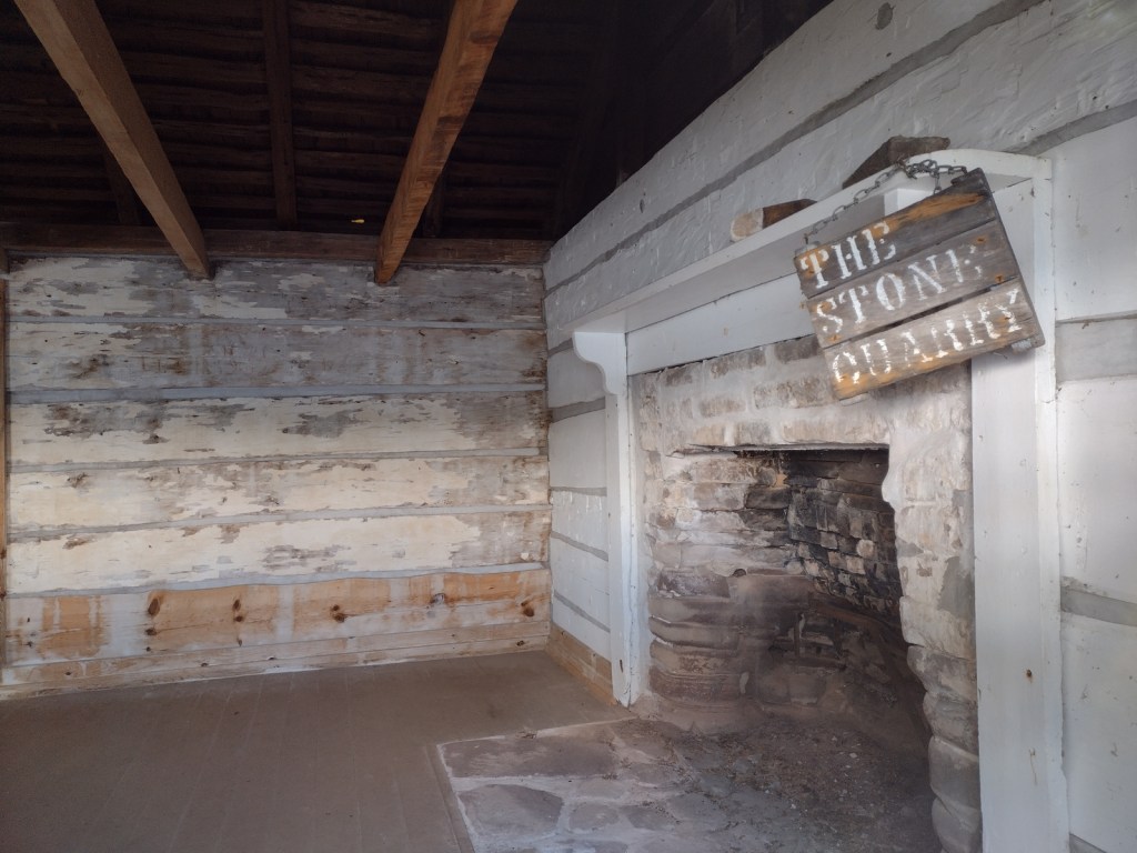
East Channel Lighthouse, 1870 wreck of the Bermuda, Williams-Powell Cemetery, Stone Quarry Cabin, Waterfall Beach Overlook, Merchandise Beach, Echo Lake

Must-Do Activity

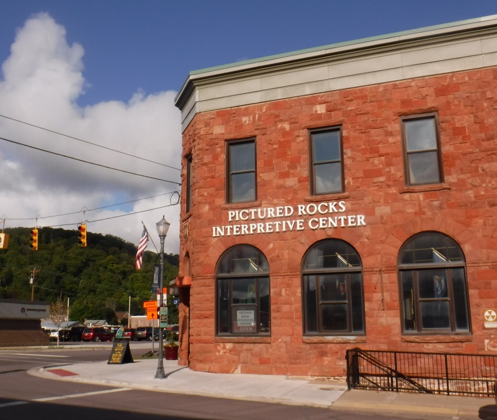
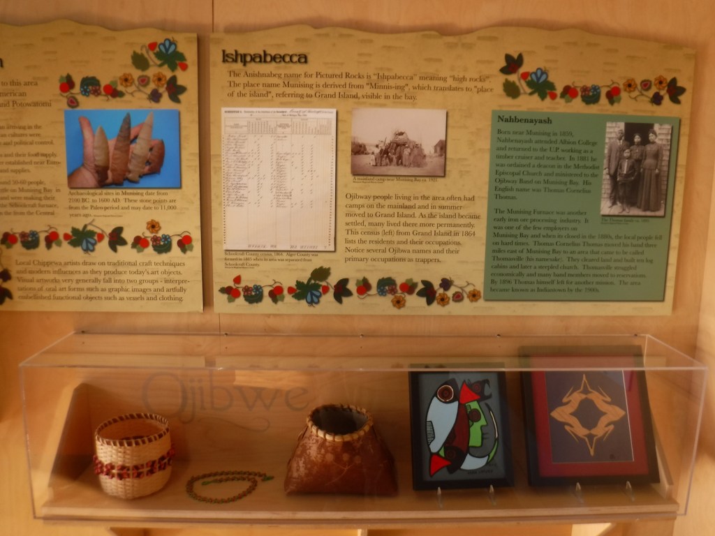
After a night spent at the free Hovey Lake Campground in Hiawatha National Forest, we kayaked to Grand Island from the ferry dock west of Munising to see East Channel Lighthouse and the 1870 wreck of the Bermuda from the water.  We then landed our boat on the sandy beach at Murray Bay Group Site to walk to Williams-Powell Cemetery and Stone Quarry Cabin.  You can pick up a guided boat tour from the docks in Munising that makes a long explanatory stop over the Bermuda or take the ferry to the island with your mountain bike for exploring.  Make sure to visit the free Pictured Rocks Interpretive Center in downtown Munising for informational displays provided by the U.S. Forest Service.

Best Trail

There is a 20-mile-long bike trail that circles Grand Island, with some inland trails (like the one to Echo Lake) and a few open only to hikers. The non-motorized trails are closed to eBikes.

Instagram-worthy Photo

East Channel Lighthouse is situated on private land near Wick Point, so no landing is allowed onshore there.

Peak Season

Summer

Fees

A day use fee of $5 per person, per trip applies if you land on the island. Ferry rides cost $23 per person and camping fees also apply ($8 to $10 per night).

Road Conditions

Bike trails around the southern part of Grand Island are roads also used by tour vans, so watch out for traffic.

Camping

There are many campsites on the island, including a few protected in Murray Bay about two miles from the Williams Landing ferry dock.  Reservations are required for camping except at Flat Rock, Cobble Cove, and Muskrat Point, which offer first-come, first-served campsites all in the southeast corner of Grand Island.

Related Sites

Hiawatha National Forest (Michigan)

Pictured Rocks National Lakeshore (Michigan)

Keweenaw National Historical Park (Michigan)

Nearest National Park

Isle Royale

Explore More – Given the common names of northern white-cedar or eastern arborvitae, why is Thuja occidentalis known as the “tree-of-life”?

Helena National Forest

Helena National Forest

Montana

Managed by U.S. Forest Service, Northern Region

1,175,125 acres (984,558 federal/ 190,567 other)

Website: https://www.fs.usda.gov/hlcnf

Overview

Helena National Forest surrounds Montana’s capital city of Helena, encompassing several mountain ranges.  The Big Belt Mountains were the site of the of the 1949 Mann Gulch Fire, which killed 13 smokejumpers who were immortalized in Norman Maclean’s classic book Young Men and Fire (see our Top 10 Non-Fiction Books on National Forests).  There is a Mann Gulch Memorial located in Meriwether Campground.  Much of the National Forest is grassland and sagebrush, with conifer trees dominating the canyons and mountain slopes.  In the winter, snowmobiling, snowshoeing, and cross-country skiing are popular pastimes.

Highlights

Gates of the Mountains, Mann Gulch Memorial, Lewis and Clark National Historic Trail Interpretive Center, Gypsy Lake, Crow Creek Falls, Elkhorn Mountains, Blackfoot Canyon, Red Mountain, Refrigerator Canyon, Hanging Valley National Recreation Trail, Meriwether Canyon Trail

Must-Do Activity

Meriwether Lewis named the Gates of the Mountains on July 19, 1805, and today a two-hour jet boat tour on the Missouri River details the history of the Corps of Discovery, American Indian pictographs, the Mann Gulch Fire, and the collapse of Hauser Dam.  North of Helena on Interstate 15 in Great Falls is the Lewis and Clark National Historic Trail Interpretive Center, which is run by the U.S. Forest Service.

Best Trail

Refrigerator Canyon is less than ten feet wide at its narrowest point, where towering 200-foot limestone cliffs keep it cool and breezy throughout the summer.  The trailhead is accessed by driving 12 miles of washboard road that turns left off paved York Road just after crossing near the dam that forms Hauser Lake on the Missouri River.  It is a short quarter-mile hike to reach the canyon’s pinch point that was full of rock climbers during our visit.  The route then gets steeper, gaining 1,100 feet in two miles and providing excellent mountain views.  The trail eventually levels out and continues for another seven miles past Bear Prairie in the Gates of the Mountains Wilderness.  It can be connected to the Meriwether Canyon Trail, which dead ends at the Missouri River 18 miles from the Refrigerator Canyon Trailhead.

Watchable Wildlife

Grizzly bears can be found in the Scapegoat Wilderness in the northwest part of Helena National Forest where it borders Lewis and Clark National Forest (considered part of the massive Bob Marshall Wilderness complex connecting to Glacier National Park).  Other predators include black bears, gray wolves, wolverines, ermine, mountain lions, bobcats, and Canada lynx.  River otters and beavers can be found on the Missouri River.  Grazing ungulates commonly seen are elk, moose, mule deer, and pronghorn, in addition to bighorn sheep and mountain goats at higher elevations.  Trout streams and lakes provide fishing opportunities for humans, as well as bald eagles and ospreys.

Instagram-worthy Photo

You might see rock climbers blocking narrow Refrigerator Canyon, but be sure to continue through on the steep trail for beautiful views of the Gates of the Mountains Wilderness.

Peak Season

Summer

Fees

None

Road Conditions

The washboard road back to Refrigerator Canyon was in good enough shape for our passenger vehicle.

Camping

A Mann Gulch Memorial is located in Meriwether Campground, plus there are numerous other campgrounds and dispersed campsites located throughout the National Forest’s network of unpaved roads.

Wilderness Areas

Gates of the Mountains Wilderness

Scapegoat Wilderness (also in Lewis and Clark National Forest)

Related Sites

Beaverhead National Forest (Montana)

Deerlodge National Forest (Montana)

Flathead National Forest (Montana)

Nearest National Park

Glacier

Conifer Tree Species

lodgepole pine, ponderosa pine, limber pine, whitebark pine, Rocky Mountain juniper, Douglas-fir, alpine larch, subalpine fir

Flowering Tree Species

quaking aspen, balsam poplar, narrowleaf cottonwood, Rocky Mountain maple, paper birch, willow, red-osier dogwood, choke cherry

Explore More – Before it changed its name to Helena in 1864, what was the name of the gold mining camp that became Montana’s state capital?

Learn more about this and the 154 other National Forests in our guidebook Out in the Woods

Francis Marion National Forest

Francis Marion National Forest

South Carolina

Managed by U.S. Forest Service, Southern Region

414,700 acres (258,864 federal/ 155,836 other)

Website: https://www.fs.usda.gov/scnfs

Overview

Located on South Carolina’s coast between Myrtle Beach and Charleston, Francis Marion National Forest was devastated by the 130-mile-per-hour winds of Hurricane Hugo in 1989.  Young and damaged trees have grown back in the subtropical coniferous and maritime forests, although some attractions like the Sewee Shell Ring Boardwalk have never been rebuilt.  Other historic sites in the National Forest include the 1768 St. James Church, Battery Warren from the Civil War, and Watahan Historical Area, which has colonial plantations and the site of a 1782 Revolutionary War battle.  On the Santee River, Guilliard Lake Scenic Area has three trails that visit an old-growth baldcypress forest, but the National Forest’s four Wildernesses are mostly inaccessible wetlands. 

Highlights

Sewee Visitor and Environmental Education Center, Buck Hall Recreation Area, Battery Warren Historic Site, Huger Recreation Area, Honey Hill Recreation Area, I’on Swamp Interpretive Trail, Shell Ring Trail, Palmetto Trail

Must-Do Activity

Sewee Visitor and Environmental Education Center is a good place to start a visit, and includes an exhibit on reintroducing red wolves.  Not far away, Sewee Shell Ring Boardwalk was never rebuilt after Hurricane Hugo in 1989, but the trail to the boardwalk remains open (despite what you might read online).  A one-mile loop trail takes visitors to a 4,000-year-old ceremonial ring made of oyster shells and a 600-year-old shell midden, but no longer out into the salt marsh.  Another historic walk is the I’on Swamp Interpretive Trail where signs explain the embankments and ditches built by slaves to create rice paddies.

Best Trail

A free permit is required to backpack the Palmetto Trail on its 47-mile stretch through Francis Marion National Forest.  The easternmost seven miles of this statewide trail was opened in 2003 running from the Swamp Fox Trailhead to Buck Hall Recreation Area (fee) on the Intracoastal Waterway bordering Cape Romain National Wildlife Refuge.  Both trailheads are easily accessible from Highway 17.  This sandy section of the Palmetto Trail is known as the Awendaw Passage because it follows Awendaw Creek for most of its length.  There are bridges and boardwalks built over the wettest areas, but very few good places to set up a campsite due to the density of the forest understory. 

Watchable Wildlife

We saw a variety of wildlife in Francis Marion National Forest, including coastal species you do not find in any other National Forest, like crabs and mussels.  The salt marshes provide habitat for large birds like Mississippi kites, ospreys, little blue herons, and great egrets.  We spotted red-headed woodpeckers and pileated woodpeckers, and there are also endangered red-cockaded woodpeckers.  While backpack camping, we saw fireflies, bats, fox squirrels, and a seldom-seen whippoorwill, a bird known for its distinctive, repetitive calls at night.  In Awendaw Creek, we saw a muskrat and four-foot-long rat snake, but did not find any alligators or river otters. 

Instagram-worthy Photo

Battery Warren was built by slaves during the Civil War so soldiers could defend the railroad bridge across the Santee River.  The earth embankments are still visible at the end of a short trail maintained by the U.S. Forest Service.

Peak Season

Spring

Fees

There is a fee to park and launch a boat at Buck Hall Recreation Area.  A free permit (available online) is required to backpack camp on the Palmetto Trail in Francis Marion National Forest.

Road Conditions

The main roads cutting through the National Forest are paved, and even the unpaved roads we drove were flat, packed sand.

Camping

Buck Hall Campground is located at a boat launch on the Intracoastal Waterway, while scenic Edmund Campground has Spanish moss-draped trees near the northern end of Wambaw Creek Wilderness.  Huger Campground and Halfway Campground are located along the Palmetto Trail.  Extensive wetlands and thick woodlands make dispersed camping and backpacking difficult in Francis Marion National Forest.

Wilderness Areas

Hell Hole Bay Wilderness

Little Wambaw Swamp Wilderness

Wambaw Creek Wilderness

Wambaw Swamp Wilderness

Related Sites

Fort Sumter and Fort Moultrie National Historical Park (South Carolina)

Reconstruction Era National Historical Park (South Carolina)

Charles Pinckney National Historic Site (South Carolina)

Croatan National Forest (North Carolina)

Nearest National Park

Congaree

Conifer Tree Species

baldcypress, longleaf pine, shortleaf pine, loblolly pine

Flowering Tree Species

tulip-poplar, sweetgum, American holly, yaupon holly, live oak,  overcup oak, water oak, cherrybark oak, willow oak, southern red oak, white oak, American beech, green ash, red bay, red buckeye, swamp cottonwood, water tupelo, water locust, water hickory, bitternut hickory, sweet bay magnolia, Carolina willow, titi, southern bayberry

Explore More – What was Francis Marion’s nickname earned by employing guerilla tactics against the British during the American Revolutionary War?

Learn more about this and the 154 other National Forests in our new guidebook Out in the Woods

We are a participant in the Amazon Services LLC Associates Program, an affiliate advertising program designed to provide a means for us to earn fees by linking to Amazon.com and affiliated sites.

Deschutes National Forest

Deschutes National Forest

Oregon

Managed by U.S. Forest Service, Pacific Northwest Region

1,853,929 acres (1,596,900 federal/ 257,029 other)

Website: https://www.fs.usda.gov/deschutes

Overview

Bend, Oregon is the gateway to Deschutes National Forest, with the beautiful Cascade Lakes Scenic Byway located west of town.  To the south, Newberry National Volcanic Monument is also managed by the U.S. Forest Service, which we will cover in our next blog post.  The Deschutes River was named La Rivière aux Chutes by French trappers because Celilo Falls was located near its confluence with the Columbia River.  Deschutes National Forest contains five Wilderness areas, six National Wild and Scenic Rivers, Metolius Conservation Area, and part of Oregon Cascade Recreation Area (mostly in Umpqua National Forest).

Highlights

Newberry National Volcanic Monument, Cascade Lakes Scenic Byway, Devils Lake, Mt. Bachelor, Sparks Lake, Broken Top, Three Sisters, McKenzie Pass-Santiam Pass Scenic Byway, Skeleton Cave, Pacific Crest National Scenic Trail

Must-Do Activity

The 66-mile-long (89-mile loop) Cascade Lakes Scenic Byway curves around the mountains west of Bend past numerous lakes reflecting multiple snow-capped peaks—a real photographers’ paradise.  To spend the golden hours up here, consider staying at campgrounds on the shores of Lava Lake or Sparks Lake with excellent views of Broken Top and South Sister Peak.  Like Mt. Hood to the north, 9,065-foot Mt. Bachelor is known for its ski resort.  A summer trip up Pine Marten Express Lift offers unsurpassed panoramas of the Cascades and Newberry National Volcanic Monument.

Best Trail

Sisters Mirror Lake is four miles and 650 feet up from a trailhead on the Cascade Lakes Scenic Byway and is located on the Pacific Crest National Scenic Trail.  Just as a warning, this entire trail was thick with aggressive mosquitoes on our hike in mid-July.

Watchable Wildlife

Elk, pronghorn, and mule deer are large ungulates found in Deschutes National Forest.  Carnivorous mammals include black bears, coyotes, mountain lions, and bobcats.  Large birds frequently seen are bald eagles, Canada geese, mallards, and whistling swans, and the northern spotted owl is a species of concern.  There are many lakes found throughout the National Forest that support a variety of gamefish, including bull trout (a threatened species).

Instagram-worthy Photo

Sparks Lake is a great place to watch the sun set behind the Cascades.

Peak Season

Summer

Fees

There is a day use fee for Newberry National Volcanic Monument.

Road Conditions

Cascade Lakes Scenic Byway is paved, as are the main roads into Newberry National Volcanic Monument, but there are many miles of logging roads to explore, too.

Camping

Campgrounds on the shores of Lava Lake or Sparks Lake provide views of Broken Top and South Sister Peak.  Walk-in campsites on crystal clear Devils Lake offer a bit more secluded experience.

Wilderness Areas

Diamond Peak Wilderness (also in Willamette National Forest)

Mt. Jefferson Wilderness (also in Mt. Hood and Willamette National Forests)

Mt. Thielsen Wilderness (also in Umpqua and Winema National Forests)

Mt. Washington Wilderness (also in Willamette National Forest)

Three Sisters Wilderness (also in Willamette National Forest)

Related Sites

Newberry National Volcanic Monument (Oregon)

Crooked River National Grassland (Oregon)

John Day Fossil Beds National Monument (Oregon)

Nearest National Park

Crater Lake

Conifer Tree Species

ponderosa pine, lodgepole pine, western white pine, sugar pine, western juniper, Douglas-fir, western redcedar, white fir, subalpine fir

Flowering Tree Species

quaking aspen, balsam poplar, Bebb willow

Explore More – The namesake of the Deschutes River (Celilo Falls) is now underwater behind what dam on the Columbia River?

Learn more about this and the 154 other National Forests in our new guidebook Out in the Woods

We are a participant in the Amazon Services LLC Associates Program, an affiliate advertising program designed to provide a means for us to earn fees by linking to Amazon.com and affiliated sites.

Delta National Forest

Delta National Forest

Mississippi

Managed by U.S. Forest Service, Southern Region

118,150 acres (60,898 federal/ 57,252 other)

Website: https://www.fs.usda.gov/mississippi

Overview

In western Mississippi, the U.S. Forest Service manages the entirety of Delta National Forest as Sunflower Wildlife Management Area through a Memorandum of Understanding with the state of Mississippi.  The Big and Little Sunflower Rivers run through these bottomland hardwood forests west of the Yazoo River, flooding the landscape throughout the summer.  This is the only National Forest preserving bottomland hardwood forests, which have primarily been converted to agriculture due to their rich soil.  It was in Delta National Forest that the idea for the Teddy Bear was born in 1902, when President Theodore Roosevelt refused to shoot a tethered black bear while hunting. 

Highlights

Blue Lake Recreation Area, Kay Cypress Tree, Lost Lake, Howlett Bayou, Green Ash-Overcup Oak-Sweetgum Research Natural Areas, Rock Bottom Trail

Must-Do Activity

This National Forest is unique because it is flooded throughout the summer, so it is primarily used from September through March.  All vehicles must display a free Daily Visitor Use Permit and all ATV, horse, and bike riders must carry a pass (fee) on the multi-use trails.  The Yazoo-Mississippi Delta (or simply “the Delta”) is a distinct section of western Mississippi renowned for its blues musicians. Throughout this area, there are blues clubs and museums dedicated to preserving the memories of Muddy Waters, B.B. King, Bessie Smith, and others.

Best Trail

Delta National Forest has two main developed areas at Blue Lake and the Little Sunflower River, with Blue Lake Nature Trail and Rock Bottom Trail found at these sites respectively.  Both were flooded during our April visit, so in lieu of hiking, we opted to launch our inflatable kayak and paddle around Blue Lake to get up close to some huge baldcypress trees. 

Watchable Wildlife

Declared National Natural Landmarks in 1976, the Green Ash-Overcup Oak-Sweetgum Research Natural Areas are rare examples of pristine bottomland hardwood forests.  To improve wintering waterfowl conditions, three of the five greentree reservoirs are pumped and over 100 acres are planted as wildlife food plots.  Established in 1978, the neighboring Panther Swamp National Wildlife Refuge is one of seven refuges in the Theodore Roosevelt National Wildlife Refuge Complex.  The forest’s white-tailed deer herd is in very good condition, as are the numbers of wild turkeys, fox squirrels, swamp rabbits, river otters, raccoons, and American alligators.  The forest is known for its 32 different species of butterflies that congregate in July, with an average population of 21,000.

Instagram-worthy Photo

Across from Blue Lake on unpaved Fire Tower Road, be sure to stop at the Kay Cypress Tree, which is more than ten feet in diameter.

Peak Season

Winter

Fees

All vehicles in Sunflower Wildlife Management Area must display a free Daily Visitor Use Permit and all ATV, horse, and bike riders must carry a pass (fee) on the multi-use trails. 

Road Conditions

Fire Tower Road is unpaved, but was flat and above floodwater levels during our April visit, as was the road atop the dike along the Little Sunflower River.

Camping

Camping is only allowed at 57 primitive sites with a permit obtainable online ($7 per night fee). 

Wilderness Areas

None

Related Sites

Bienville National Forest (Mississippi)

De Soto National Forest (Mississippi)

Vicksburg National Military Park (Mississippi)

Nearest National Park

Hot Springs

Conifer Tree Species

baldcypress

Flowering Tree Species

Nuttall’s oak, overcup oak, cherrybark oak, willow oak, water oak, bur oak, swamp chestnut oak, water hickory, sweetgum, boxelder, swamp red maple, American elm, green ash, sugarberry, September elm, honeylocust, pecan, black gum, red mulberry, persimmon, deciduous holly, swamp dogwood

Explore More – What was the name of the legendary hunting guide and woodsman who found and tied up the black bear that Teddy Roosevelt refused to shoot in 1902?

Learn more about this and the 154 other National Forests in our new guidebook Out in the Woods

We are a participant in the Amazon Services LLC Associates Program, an affiliate advertising program designed to provide a means for us to earn fees by linking to Amazon.com and affiliated sites.