Tag Archives: arch

Gateway Arch National Park

Gateway Arch National Park

Missouri

Managed by National Park Service

Established 1935 National Expansion Memorial, 2018 National Park

91 acres

Website: nps.gov/jeff

Overview

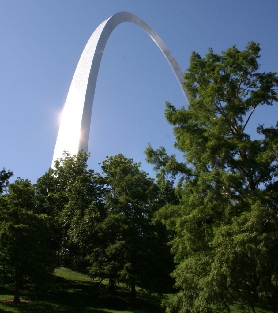
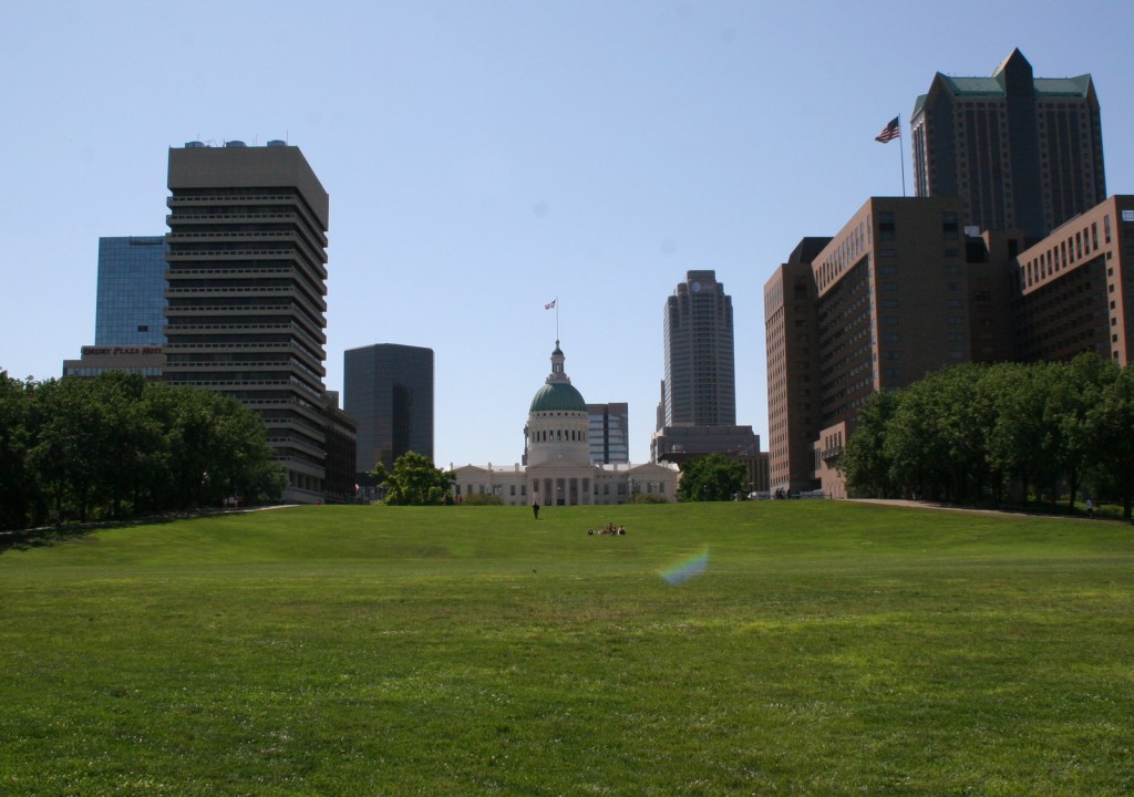
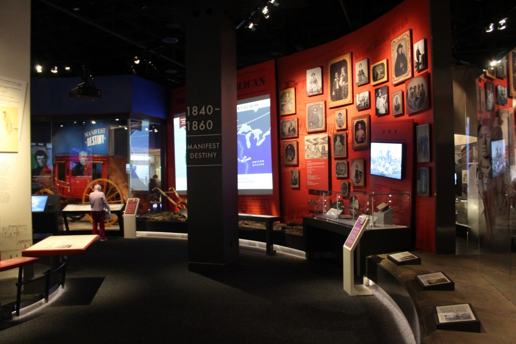
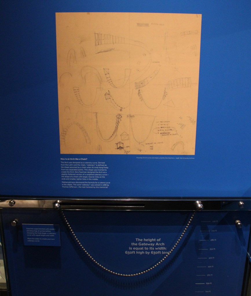
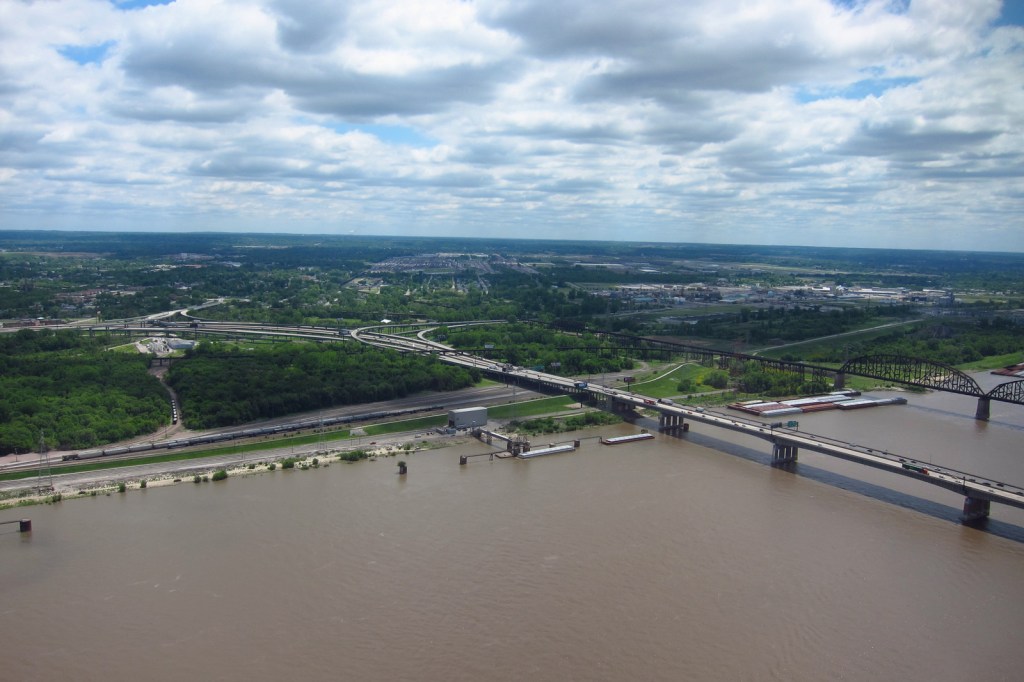
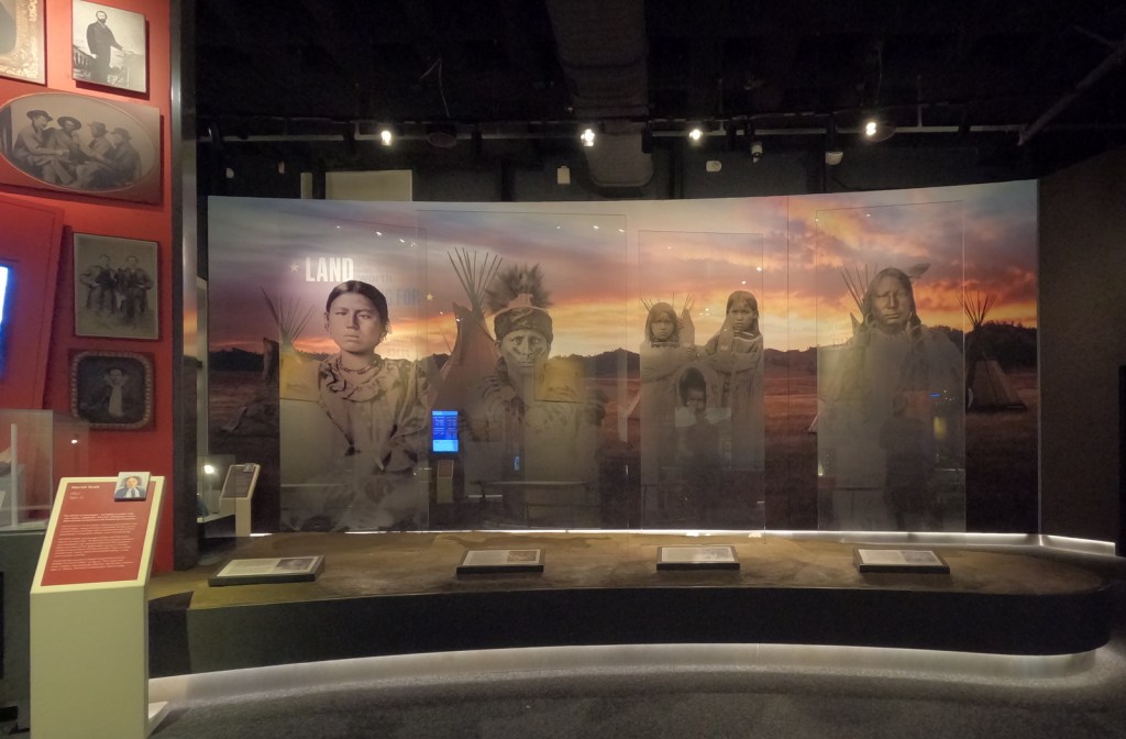
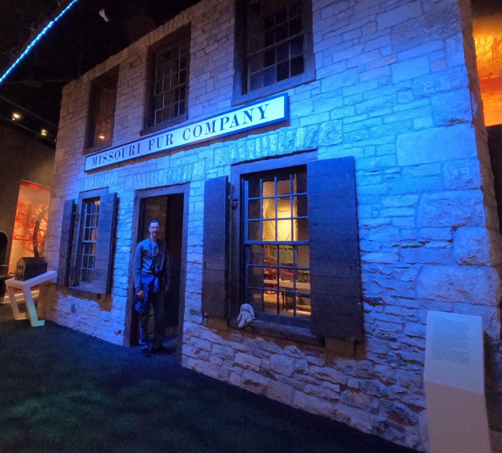
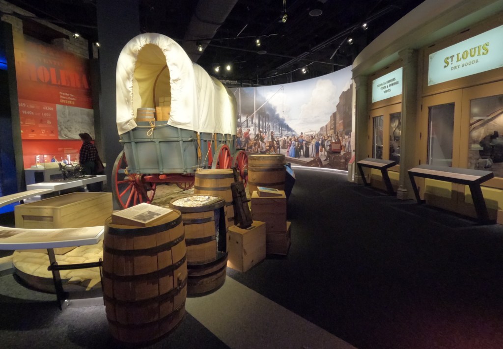
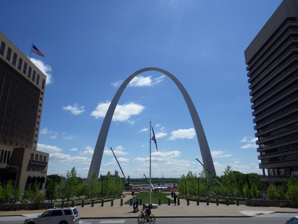
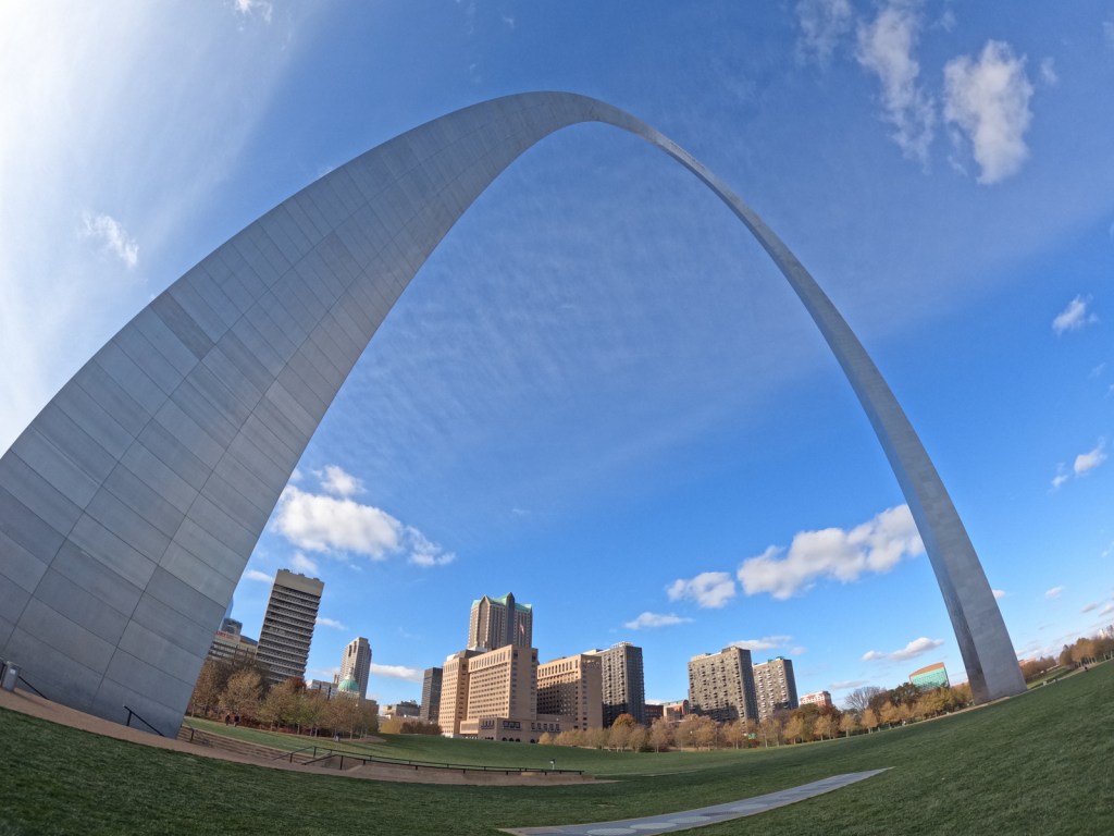
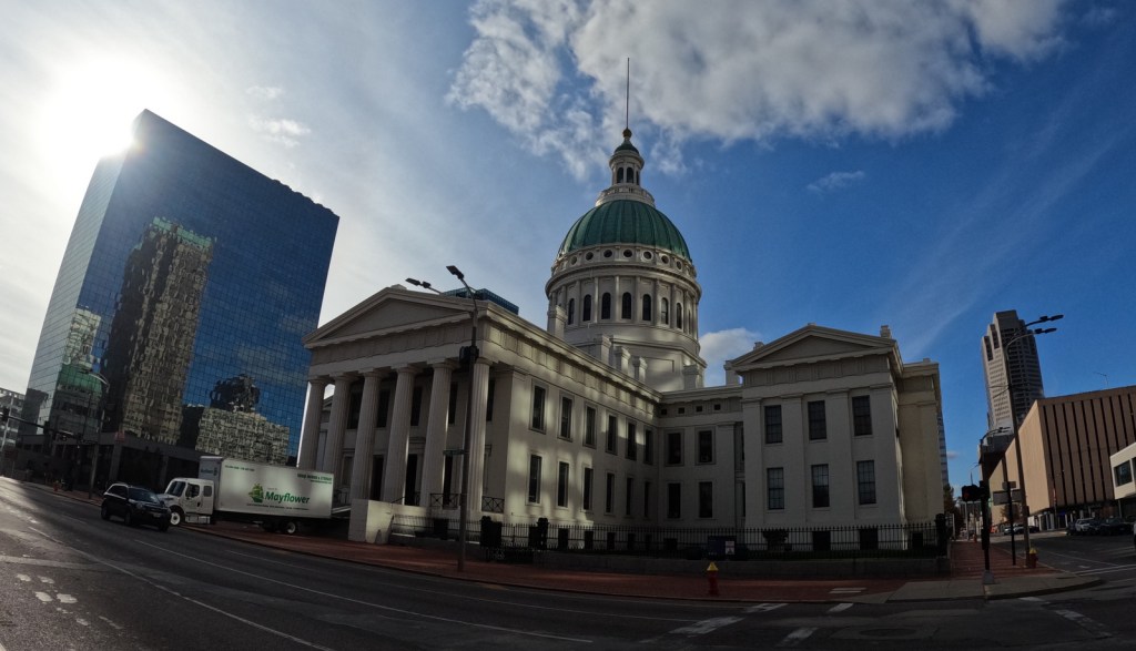
On February 22, 2018, the 60th National Park in the U.S. was created from what was formerly Jefferson National Expansion Memorial in St. Louis, Missouri.  Gateway Arch National Park encompasses 91 acres on the Mississippi River, including the historic 1828 courthouse and the iconic 630-foot-tall arch that was finished in 1965.  We first visited on our cross-country road trip in 2007 and returned in 2016 while the underground museum was under construction and the greenway was extended over Interstate 44.  When we came back in 2022, the courthouse was closed for renovation, but the museum had reopened with exhibits explaining the importance of this city as a starting point for the settlement of the west after President Thomas Jefferson signed the Louisiana Purchase, doubling the size of the country in 1803.  It is by far the smallest of the 63 National Parks (5,457 acres less than Hot Springs), which begs the question: Why wasn’t this designated a National Historical Park instead?

Learn more about how to visit this National Park in the expanded second edition of our guidebook A Park to Yourself: Finding Solitude in America’s 63 National Parks

Highlights

Gateway Arch, tram, film, museum, Old Courthouse, Old Cathedral

Must-Do Activity

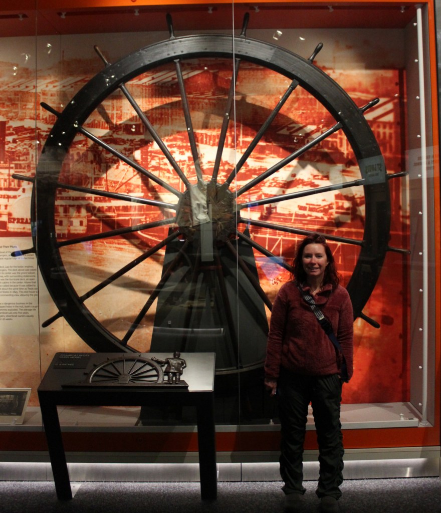
Unlike other National Parks, this one does not preserve a natural landmark, but it does have claustrophobia-inducing tram cars (fee) that take you four-minutes to the top of the Gateway Arch for excellent views across Illinois and Missouri.  It is worth the hassle to go through a security screening to see the new museum.  The 35-minute film Monument to the Dream is also available for a fee. 

Best Trail

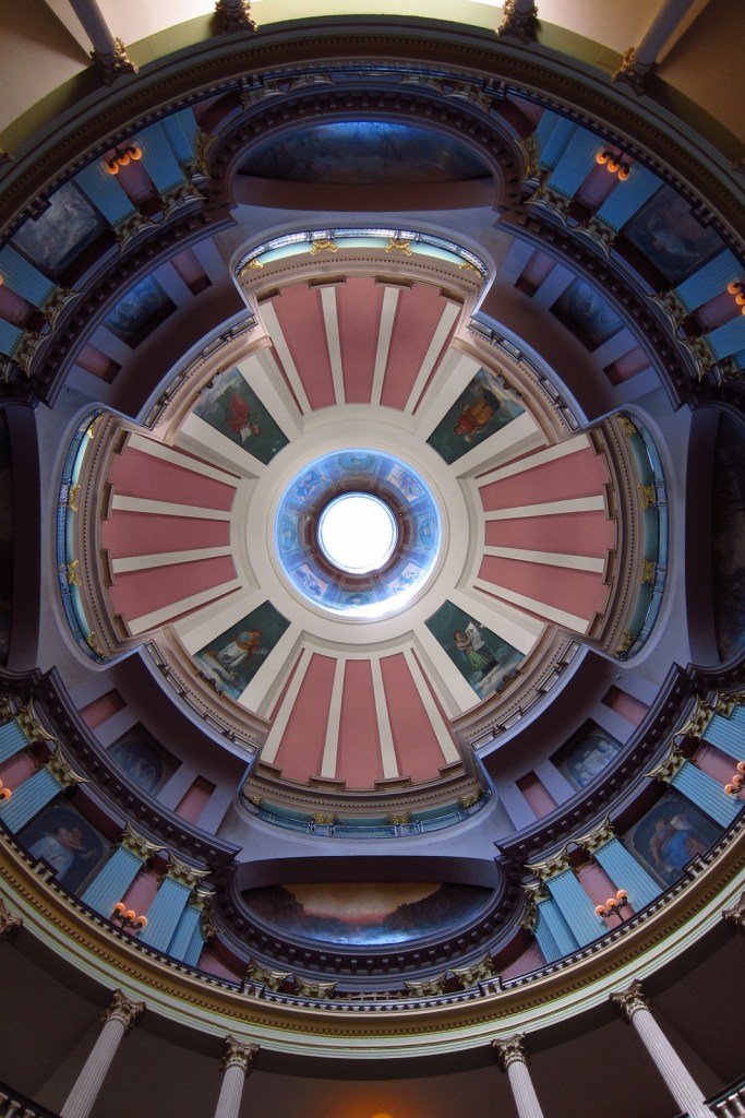
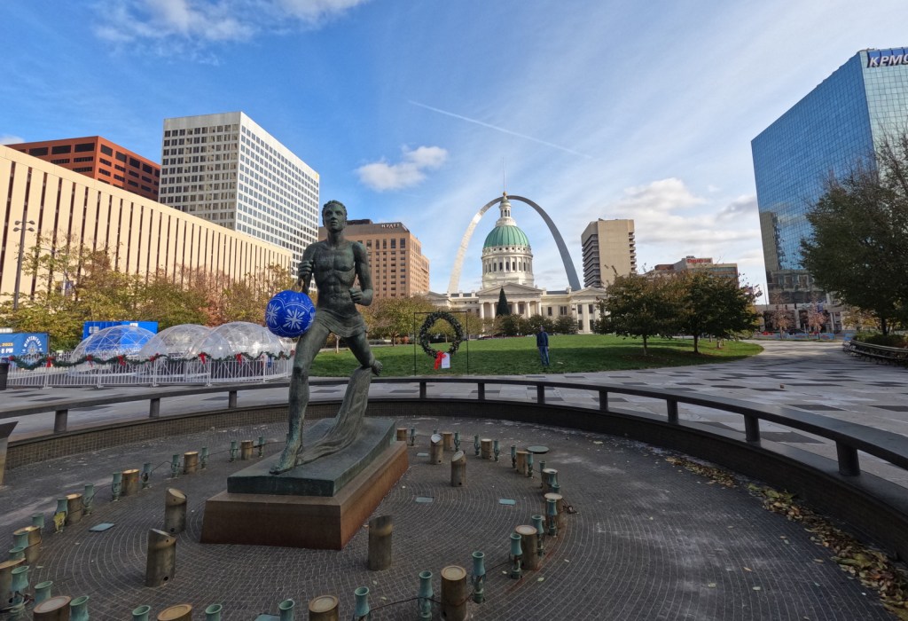
There are sidewalks that follow the Mississippi River and loop around the arch.  Be sure to cross the street to the Old Courthouse where the first of two trials in the infamous Dred Scott case was held in 1854.  Continue west behind to the courthouse to the Kiener Memorial Fountain for a photo that frames the building beneath the Gateway Arch.

Photographic Opportunity

The 630-foot-tall Gateway Arch is the defining landmark of St. Louis, but the historic 1834 Old Cathedral still serves as an active Catholic Church inside the park boundaries.

Peak Season

Summer

Hours

https://www.nps.gov/jeff/planyourvisit/hours.htm

Fees

There is no fee to walk the grounds or pass through security for the museum and gift shop, but you do have to pay to view the film or ride the tram to the top of Gateway Arch.  When open, the Old Courthouse is also free to enter.

Road Conditions

All roads are paved, but parking can be tricky.  We suggest paying for a parking garage or paying to park on the river levee near the paddlewheel boats, since car break-ins are common in downtown St. Louis.

Camping

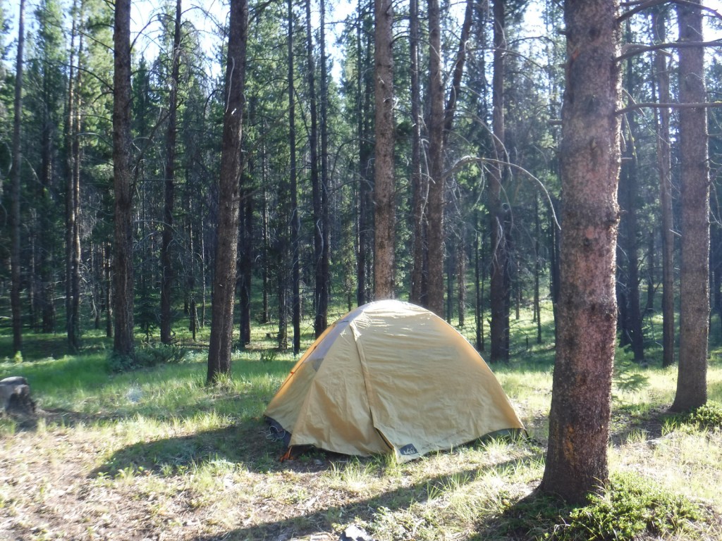
This is the only National Park without the option to camp, so consider heading southwest to the wonderful Ozark National Scenic Riverways or Mark Twain National Forest.  In southeast Missouri, Johnson’s Shut-Ins State Park is rated as one of the best RV campgrounds in the country.

Related Sites

Ulysses S. Grant National Historic Site (Missouri)

Ste. Genevieve National Historical Park (Missouri)

Harry S Truman National Historic Site (Missouri)

Explore More – In 1947, how many city blocks were razed to make way for the memorial, including several historic buildings dating back to 1818?

We designed this Gateway Arch logo for the park available on Amazon.com

We are a participant in the Amazon Services LLC Associates Program, an affiliate advertising program designed to provide a means for us to earn fees by linking to Amazon.com and affiliated sites.

Gallatin National Forest

Gallatin National Forest

Montana

Managed by U.S. Forest Service, Northern Region

2,151,461 acres (1,819,515 federal/ 331,946 other)

Website: https://www.fs.usda.gov/main/custergallatin/home

Overview

Gallatin National Forest borders much of the north and west sides of Yellowstone National Park, providing important wildlife habitat in the Absaroka-Beartooth and Lee Metcalf Wilderness areas.  The National Forest also contains portions of the Bridger Range and Crazy Mountains north of Bozeman and Interstate 90.  The Gallatin Petrified Forest is only accessible by trail, either from a short two-mile one-way jaunt (that gains 650 feet of elevation) or by backpacking the 27-mile Gallatin Divide-Devils Backbone Trail.  Free permits are available from Forest Service Ranger Stations to collect up to 20 cubic-inches of petrified wood each year.  Since 2014, it has been co-managed as the Custer-Gallatin National Forest, stretching east into South Dakota.

Highlights

Earthquake Lake Visitor Center, film, Fairy Lake, Devils Slide, Flathead Pass, Big Timber Canyon, Palisade Falls, Spire Rock Campground, Natural Bridge, Kersey Lake, Hardscrabble Peak, Pine Creek Falls, Bridger Mountains National Recreation Trail, Spanish Creek Trail, Red Canyon Trail, Petrified Forest Interpretive Trail

Must-Do Activity

Earthquake Lake Geologic Area stretches along Highway 287 to commemorate the events that occurred around midnight on August 17, 1959 when a magnitude 7.5 earthquake hit West Yellowstone, Montana.  The strongest earthquake ever recorded in the Rocky Mountains caused a hillside to crumble and block the Madison River and form Quake Lake, which is still there today.  Seiches (“lake tsunamis”) on Hebgen Lake and landslides claimed 28 lives and trapped hundreds campers.  The next day, after Forest Service smokejumpers parachuted in to assist survivors, the most seriously injured were evacuated out by helicopter.  Today there is an interpretive auto tour with multiple stops along the highway.  In addition, a visitor center operates in the summer where they show a film and the 0.3-mile Landslide Trail has signs explaining the events and how the massive Memorial Boulder crossed from one side of the valley to the other in less than 20 seconds (see Instagram-worthy Photo).

Best Trail

Pine Creek Falls is located 1.3 miles from the Pine Creek Campground after a 400 foot elevation gain.  The popular route first enters a burned forest then crosses a bridge over the creek at a half-mile before reaching the waterfall where most hikers turn around.  The trail gets steeper as it continues another four miles to Pine Creek Lake climbing about 3,400 feet, including one grueling stretch that ascends 1,800 feet in only 1.3 miles.

Watchable Wildlife

There are more than 4,000 miles of streams and rivers in the National Forest, including major tributaries of the Yellowstone and Missouri Rivers.  This makes Gallatin National Forest one of the premiere fly fishing destinations in the U.S. and also attracts bald eagles and ospreys.  Due to its proximity to Yellowstone National Park, there are also gray wolves and grizzly bears.  Other large mammals include elk, mule deer, moose, bighorn sheep, pronghorns, mountain lions, and black bears.

Instagram-worthy Photo

Memorial Boulder and Sister Boulder used to be located across the valley, but during the 1959 earthquake these six-million-pound dolomite slabs crossed the half-mile distance in less than 20 seconds.

Peak Season

Summer

Fees

None

Road Conditions

The roads are paved up to the Earthquake Lake Visitor Center, Pine Creek Campground, and Big Sky Mountain Village (south of Bozeman).  It is 13 miles (mostly unpaved) from Highway 89 to the Petrified Forest Interpretive Trail, and there is a free campground where Rock Creek Road dead ends at the trailhead.  There are also many miles of four-wheel-drive roads to explore throughout the National Forest.

Camping

There are many campgrounds in Gallatin National Forest (like Eagle Creek just outside Gardiner on the northern border of Yellowstone National Park), as well as dispersed camping options. 

Wilderness Areas

Absaroka-Beartooth Wilderness (also in Custer and Shoshone National Forests)

Lee Metcalf Wilderness (also in Beaverhead National Forest)

Related Sites

Custer National Forest (Montana-South Dakota)

Big Hole National Battlefield (Montana)

BeaverheadDeerlodge National Forest (Montana)

Nearest National Park

Yellowstone

Conifer Tree Species

lodgepole pine, ponderosa pine, whitebark pine, subalpine fir, Douglas-fir, Engelmann spruce

Flowering Tree Species

quaking aspen, balsam poplar, cottonwood, alder, mountain maple, mountain ash

Explore More – Why was the National Forest named after Albert Gallatin?

Learn more about this and the 154 other National Forests in our new guidebook Out in the Woods

We are a participant in the Amazon Services LLC Associates Program, an affiliate advertising program designed to provide a means for us to earn fees by linking to Amazon.com and affiliated sites.

Daniel Boone National Forest

Daniel Boone National Forest

Kentucky

Managed by U.S. Forest Service, Southern Region

2,047,092 acres (706,680 federal/ 1,340,412 other)

Website: https://www.fs.usda.gov/dbnf/

Overview

Daniel Boone National Forest is spread across the Cumberland Plateau in Kentucky, covering more than two-million acres when including private land and the 145,839-acre Redbird Purchase Unit.  The National Forest also surrounds three popular State Parks: Buckhorn Lake, Cumberland Falls, and Natural Bridge.  The latter is adjacent to the spectacular Red River Gorge Geological Area, which is a major reason Daniel Boone National Forest sees more than one-million visitors annually.  The forest has nearly 100 developed recreation areas and 600 miles of trails, plus several historic sites like Clear Creek Iron Furnace, Nada Railroad Tunnel, and Camp Wildcat (site of the first Civil War engagement of regular troops in Kentucky).

Highlights

Zilpo Scenic Byway, Red River Gorge Geological Area, Nada Tunnel, Cave Run Lake Recreation Area, Lick Creek Falls, Clear Creek Iron Furnace, Camp Wildcat, Laurel River Lake Recreation Area, Chimney Top Rock, Chestnut Knob, Yahoo Arch, Sheltowee Trace National Recreation Trail

Must-Do Activity

In the rolling hills of the Cumberland Plateau, Red River Gorge Geological Area is full of enough sandstone arches to keep you busy exploring for days.  Although 91-foot long Koger Arch was closed during our visit, we enjoyed short hikes to 75-foot Sky Bridge and 32-foot Princess Arch.  Rock Bridge Trail is a 1.3-mile loop that passes the sole natural bridge in the area with water flowing through it, and the only one formed by a waterfall cutting through the sandstone. 

Best Trail

The 282-mile-long Sheltowee Trace National Recreation Trail runs from Tennessee north into the southern end of Daniel Boone National Forest and Big South Fork National River and Recreation Area (where a camping permit is required by the National Park Service).  The trail marked by white turtle blazes passes through Alum Ford primitive campground on the Big South Fork of the Columbia River.  From Yahoo Falls Scenic Area, a short jaunt takes hikers to 113-foot-tall Yahoo Falls, which you can walk behind.  Yahoo Arch (17 feet tall) is accessible further up that two-mile section of trail or from a separate Forest Service trailhead on KY700, as is Markers Arch on a separate half-mile spur.

Watchable Wildlife

Major mammals found in Daniel Boone National Forest include black bear, coyote, bobcat, red fox, gray fox, mink, white-tailed deer, gray squirrel, muskrat, opossum, raccoon, cottontail rabbit, woodchuck, and three species of bat.  Wild turkey, northern bobwhite quail, ruffed grouse, red-cockaded woodpecker, and bald eagle are some of the 194 bird species identified.  Copperheads and timber rattlesnakes are two types of venomous snakes found here.  Lakes and streams have rainbow trout, largemouth bass, smallmouth bass, bluegill, crappie, and muskie.

Instagram-worthy Photo

Kentucky is riddled with caves—from the manmade Louisville Mega Cavern to Mammoth Cave National Park.  Daniel Boone National Forest has an estimated 1,500 to 2,000 limestone caves, in addition to small overhangs in the sandstone of Red River Gorge Geological Area.

Peak Season

Summer

Fees

There is not a day use fee to park, hike, or picnic in Red River Gorge Geological Area (unless you park overnight).

Road Conditions

Most of the trailheads in Red River Gorge Geological Area are accessed by well-marked and well-maintained dirt roads.

Camping

South of Interstate 64, Cave Run Lake stretches across 8,270 acres in northeastern Kentucky where we spent the night at a Forest Service campground on a cross-country roadtrip in 2007.  There are campgrounds in Red River Gorge Geological Area, where backpacking in the Clifty Wilderness only costs $5 per day per car for a permit.

Wilderness Areas

Beaver Creek Wilderness

Clifty Wilderness

Related Sites

Big South Fork National Recreation Area (Kentucky-Tennessee)

Cumberland Gap National Historical Park (Kentucky -Tennessee-Virginia)

Land Between The Lakes National Recreation Area (Kentucky-Tennessee)

Nearest National Park

Mammoth Cave

Conifer Tree Species

eastern hemlock, loblolly pine, Virginia pine, pitch pine, shortleaf pine

Flowering Tree Species

chestnut oak, scarlet oak, black oak, northern red oak, white oak, rock chestnut oak, tulip-poplar, American beech, mockernut hickory, bitternut hickory, pignut hickory, black gum, white ash, sassafras, mountain laurel, basswood, red mulberry, witch hazel, sugar maple, red maple, sourwood, cucumber magnolia, bigleaf magnolia, flowering dogwood, serviceberry, pawpaw, river birch, sycamore, silver maple, black willow, sweetgum, devil’s walkingtick, white rhododendron, Cumberland azalea

Explore More – In what year did the frontiersman Daniel Boone fight in the Battle of Blue Licks during the American Revolution?

Learn more about this and the 154 other National Forests in our new guidebook Out in the Woods

We are a participant in the Amazon Services LLC Associates Program, an affiliate advertising program designed to provide a means for us to earn fees by linking to Amazon.com and affiliated sites.

Challis National Forest

Challis National Forest

Idaho

Managed by U.S. Forest Service, Intermountain Region

2,488,105 acres (2,463,471 federal/ 24,634 other)

Website: https://www.fs.usda.gov/scnf/

Overview

Challis National Forest covers the southern portion of the co-managed Salmon-Challis National Forest in central Idaho.  It includes the northern parts of Sawtooth National Recreation Area and a section of the Salmon Wild and Scenic River, as well as several northwest-southeast running mountain ranges.  In the forest’s scenic Lost River Range, 12,667-foot Borah Peak is the highest point in Idaho.  Further south near Arco, a steep half-mile trail leads to King Mountain Natural Arch in Bridge Canyon, a limestone formation with an 80-foot span. 

Highlights

Salmon River Scenic Byway, Stanley Museum, Sunbeam Hot Springs, Custer Adventure Motorway, Yankee Fork Hot Springs, Lemhi Range, White Knob Mountains, Camas Meadows, Challis Creek Lakes, Hidden Mouth Cave, Sawtooth Lake, White Cloud Peaks, Grover Creek Lake, Borah Peak

Must-Do Activity

The Salmon River Scenic Byway runs 162 miles to Lost Trail Pass, starting in Stanley where it intersects with the Sawtooth and Ponderosa Pine Scenic Byways.  Challis National Forest manages the free Stanley Museum there inside the historic Valley Creek Ranger Station.  Further down the road, the Sunbeam Bathhouse was built in 1937 by the Civilian Conservation Corps (CCC) at a hot springs on the Salmon River where people still go to soak seeking the perfect spot between the frigid river and scalding spring water.

Best Trail

We previously covered the trail to stunning Sawtooth Lake in our post on Sawtooth National Recreation Area.  While it is not for everyone due to its strenuousness, we will write here about the route up 12,667-foot Borah Peak.  From its beginning (which we started in the dark) the entire trail is incredibly steep, so much so that we ran back down the final two miles because it was easier on our knees.  The route gains 5,400 feet of elevation in 4.5 miles and often requires the use of your hands, but no special climbing equipment.  Even if you decide to turn around at Chicken-Out Ridge before ascending the Knife Edge, the panoramic scenery is well worth the effort.

Watchable Wildlife

This is a fairly arid portion of the west, so you are more likely to see a ground squirrel or coyote than any other wildlife.  Trout fishing is a popular activity in the Salmon River.  Large mammalian species include elk, mule deer, pronghorns, and black bears.  Ravens and a variety of birds of prey catch the thermals around Borah Peak.

Instagram-worthy Photo

The view of King Mountain Natural Arch’s 80-foot span is arguably better while driving in than it is after ascending the treacherous final mile of road and hiking the steep half-mile trail to its overlook (see below).

Peak Season

Late summer due to snowpack

Fees

None

Road Conditions

The road from Highway 93 to the Borah Peak Campground and Trailhead is well maintained.  The last mile of road to the trailhead for King Mountain Natural Arch requires a high-clearance vehicle, but the nine miles of unpaved roads before that are decent and well signed (although we got a flat tire).

Camping

The campground at the base of Borah Peak is only $5 per night and allows climbers to get an early start.  There are many campgrounds along the Salmon River Scenic Byway and historic Yankee Fork Road/ Custer Adventure Motorway.

Wilderness Areas

Frank Church-River of No Return Wilderness (also in Bitterroot, Boise, Nez Perce, Payette, and Salmon National Forests)

Jim McClure-Jerry Peak Wilderness (also run by the Bureau of Land Management)

Sawtooth Wilderness (also in Boise and Sawtooth National Forests)

Related Sites

Caribou National Forest (Idaho-Utah-Wyoming)

Craters of the Moon National Monument and Preserve (Idaho)

Minidoka National Historic Site (Idaho-Washington)

Nearest National Park

Yellowstone

Conifer Tree Species

Engelmann spruce, subalpine fir, ponderosa pine, lodgepole pine, limber pine, whitebark pine, Douglas-fir, Rocky Mountain juniper

Flowering Tree Species

quaking aspen, water birch, Rocky Mountain maple, boxelder, Bebb willow, blue elderberry, chokecherry, curlleaf mountain-mahogany, white alder, syringa, sagebrush

Explore More – How many Civilian Conservation Corps (CCC) camps were in Idaho during the Great Depression?

Learn more about Challis and the 154 other National Forests in our new guidebook Out in the Woods

We are a participant in the Amazon Services LLC Associates Program, an affiliate advertising program designed to provide a means for us to earn fees by linking to Amazon.com and affiliated sites.

Bridger National Forest

Bridger National Forest

Wyoming

Managed by U.S. Forest Service, Intermountain Region

1,744,705 acres (1,736,115 federal/ 8,590 other)

Website: https://www.fs.usda.gov/btnf

Overview

The peaks of the Wind River Range not only represent the Continental Divide, but also a division between Bridger-Teton National Forest and Shoshone National Forest which happen to be in two different U.S. Forest Service Regions.  These mountains are our favorite place to go backpacking in the entire world with jagged peaks that rival the Teton Range for picturesqueness and a fraction of the visitors (except at overcrowded Titcomb Basin and the Cirque of the Towers).  Read more about our 120-mile trip on the Highline Trail in our newspaper article.

Highlights

Fremont Lake, Kendall Warm Springs, Green River Lakes, Wind River Range, Titcomb Basin, Periodic Spring geyser, Lake Alice, Wyoming Range National Recreation Trail, Highline Trail, Continental Divide National Scenic Trail

Must-Do Activity

From Pinedale, Wyoming, a 50-mile partially-paved drive leads to the campground at Green River Lakes, which opens up into a beautiful valley that frames photogenic Squaretop Mountain.  Hiking around the northerly of the two lakes makes a great couple-hour jaunt, but if you are looking for a unique destination add the two-mile spur to fascinating Clear Creek Natural Bridge.  Here the water pours through and continues to widen a four-foot tall gap in the limestone.  Starting from the campground, the Highline Trail is a 72-mile one-way trek popular with backpackers.  The first ten miles are very flat following the river to Beaver Meadows, which offers 360° mountain views. 

Best Trail

Further south in the Wind River Range than stunning Squaretop Mountain, it is only eight miles from Big Sandy Trailhead to the Cirque of the Towers, which is famous among rock climbers and actually in neighboring Shoshone National Forest.  Even though there were a lot of campers back there, we found a secluded spot between Big Sandy Lake and Clear Lake in Bridger National Forest.  When we finally made it over 10,800-foot Jackass Pass to the cirque, it was full of fog and hail was dropping from the sky.  Although we have been back on a sunny day, that was the more memorable experience, which is why we selected a photo from that morning for the cover of our new guidebook Out in the Woods (see bottom of this post).

Watchable Wildlife

On the way to Green River Lakes outside Pinedale, Wyoming, make time for a quick stop at Kendall Warm Springs where the water is a constant 85°F but is protected from human bathing.  The main attraction is a fish less than 2-inches long, the endangered Kendall Warm Springs dace.  During spawning (which occurs frequently throughout the year due to the warm water), the males turn purple and the females light green.  U.S. Forest Service biologists keep careful track of the population and if you’re lucky, you’ll meet them when they are out there conducting a survey.  On the trails and roads, keep an eye out for moose, elk, mule deer, pronghorns, both black and grizzly bears, and badgers (even in the middle of the day).  Trout fishing is also a major attraction to this area’s many lakes and streams.

Instagram-worthy Photo

This incredible view of Squaretop Mountain and Green River Lakes is at the end of a long drive down a washboard dirt road; maybe that is why it is on the Wyoming license plate.

Peak Season

Summer

Fees

None

Road Conditions

The long dirt roads back to the trailheads at Big Sandy and Green River Lakes are well maintained, and we have never had a problem accessing them in a passenger vehicle.  Limited parking when you get there is the bigger problem.

Camping

The campground at Green River Lakes has an incredible view of Squaretop Mountain (which is on the Wyoming license plate).  There are more dispersed campsites on the road to Big Sandy Trailhead than Green River Lakes.

Wilderness Areas

Bridger Wilderness

Related Sites

Shoshone National Forest (Wyoming)

Fossil Butte National Monument (Wyoming)

Yellowstone National Park (Wyoming-Montana-Idaho)

Nearest National Park

Grand Teton (Wyoming)

Conifer Tree Species

Engelmann spruce, subalpine fir, Douglas-fir, lodgepole pine, ponderosa pine, limber pine, whitebark pine

Flowering Tree Species

quaking aspen, Rocky Mountain maple, bog birch, Booth’s willow, red osier dogwood, sagebrush

Explore More – What is the entire length of the stream that is the only place where the endangered Kendall Warm Springs dace lives (before it pours into the chilly Green River, home to a genetically distinct dace population)?

Learn more about Bridger and the 154 other National Forests in our new guidebook Out in the Woods

We are a participant in the Amazon Services LLC Associates Program, an affiliate advertising program designed to provide a means for us to earn fees by linking to Amazon.com and affiliated sites.