To celebrate reaching the milestone of our 200th blog posts, we are linking to our top 10 posts from 101-200 based on number of likes. Click here to see our Top 10 from the first 100 (or here if you want to see all of our Top 10 Lists). Thank you to our readers for continuing to inspire us to visit new National Park Service (NPS) units and share the wonders with you all. We are planning a roadtrip to the southern U.S. in September to visit some new NPS sites.
Our first hardcopy guidebook to the National Parks was released in November 2019!
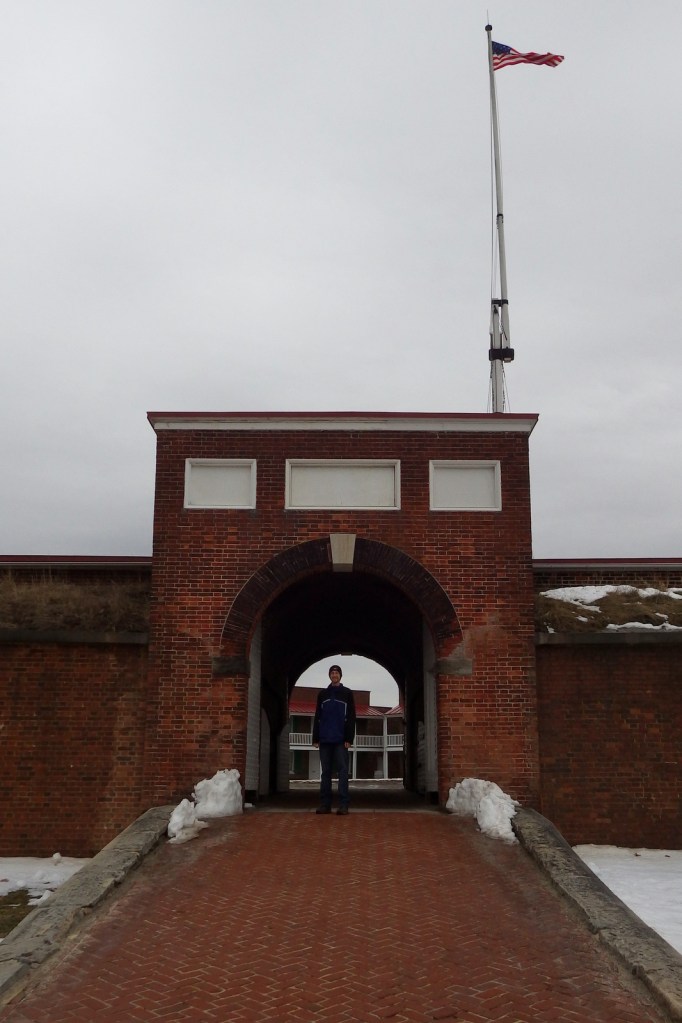
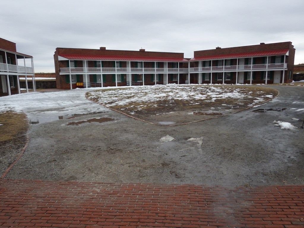
More than 200 years ago, Fort McHenry survived a 25-hour bombardment from the British navy and inspired Francis Scott Key to write “The Star-Spangled Banner” (which did not officially become the U.S. national anthem until 1931). The flag flying the night of September 13, 1814 measured 42 x 30 feet! It is no wonder he was stirred while watching “the rockets’ red glare” from aboard a U.S. truce ship under British guard floating in the Chesapeake Bay outside Baltimore, Maryland. The Congreve rocket was a new type of weapon at the time, and, luckily for the Americans, very inaccurate.
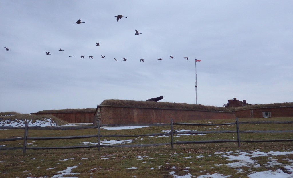
Geese flyover!
Highlights
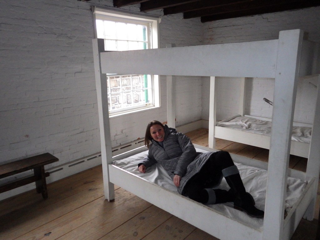
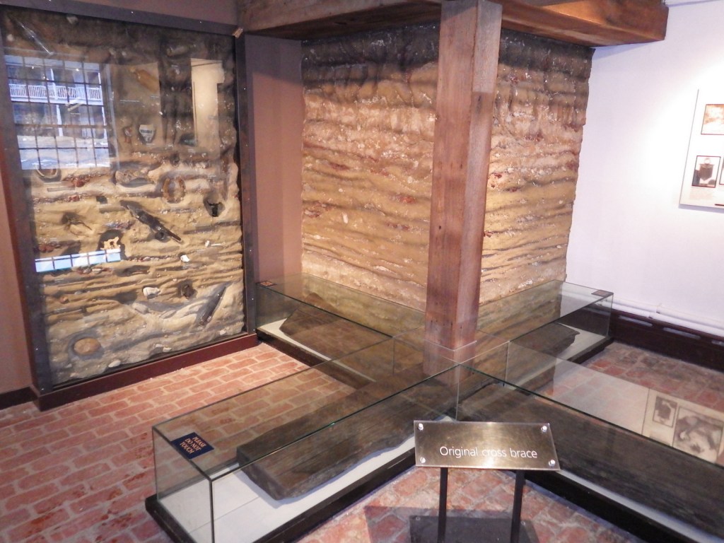
Museum, film, fort, twice daily flag changes
Must-Do Activity
Fort McHenry went on to serve as a temporary prison during the Civil War, when its many cannons were pointed towards the city of Baltimore so Confederate sympathizers would not secede from the Union. During World War I, the fort served as a veterans’ hospital before being designated a National Park Service (NPS) unit in 1925. Later it was re-designated Fort McHenry National Monument and Historic Shrine, the only park with this unique distinction.
Best Trail
Star Spangled Banner National Historic Trail is not a hiking trail so much as it is a collection of sites related to the War of 1812 in and around the Chesapeake Bay and Potomac River.
Instagram-worthy Photo
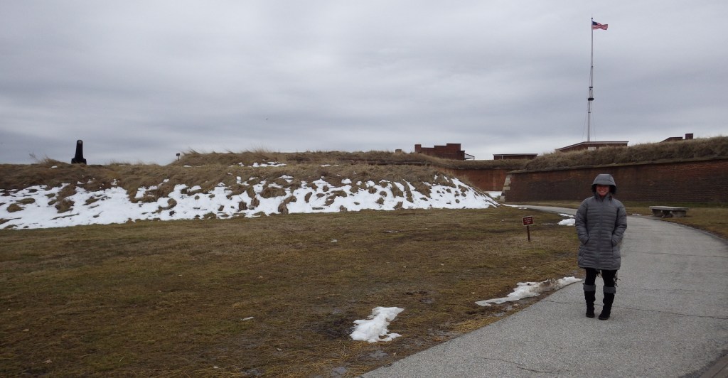
Our flag is still there. This is officially the only NPS unit where the U.S. flag flies 24 hours a day. Daily flag changes take place at 9:30 a.m. and 4:20 p.m., weather permitting.
Explore More – When a new state is added to the union, the newly redesigned flag is first flown over Fort McHenry, so when did that last occur?
We are a participant in the Amazon Services LLC Associates Program, an affiliate advertising program designed to provide a means for us to earn fees by linking to Amazon.com and affiliated sites.
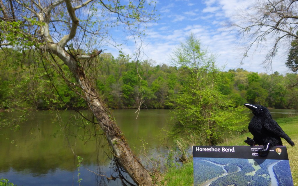
It was near Daviston, Alabama on March 27, 1814 that a fortified village of Upper Creek (or Red Stick) Indians was attacked by a superior force under the leadership of Major General Andrew Jackson. Jackson started by firing cannons at the barricade for two hours, then his overanxious Indian allies pressed the issue by crossing the river to fight. Jackson quickly ordered his men to charge and overtook the stronghold. This proved to be the final battle of the Creek Indian War of 1813-14, which is considered part of the War of 1812. In the treaty that followed, the tribe ceded much of the land that became the state of Alabama to the United States. When Jackson became president in 1828, he signed the Indian Removal Bill and soon both the Upper Creeks and his former Indian allies were forced west on the Trail of Tears.
Highlights
Museum, film, auto tour, nature trail
Must-Do Activity
A short but good film is the best way to start learning about this lesser known yet important battle of the War of 1812 that brought fame to Andrew Jackson. A diorama in the visitor center illustrates the fortifications used at Horseshoe Bend. On the three-mile auto tour, only short walks are required from any interpretive pullout.
Best Trail
An alternative to the auto tour is a 2.8-mile nature trail that visits the same interpretive sites.
Instagram-worthy Photo
A tight curve in the Tallapoosa River in eastern Alabama provided the name for Horseshoe Bend National Military Park. Indian allies of the U.S. started the 1814 battle by swimming then paddling stolen canoes across the river to get behind the fortifications.
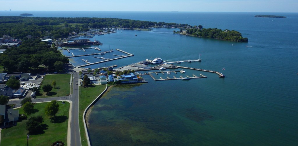
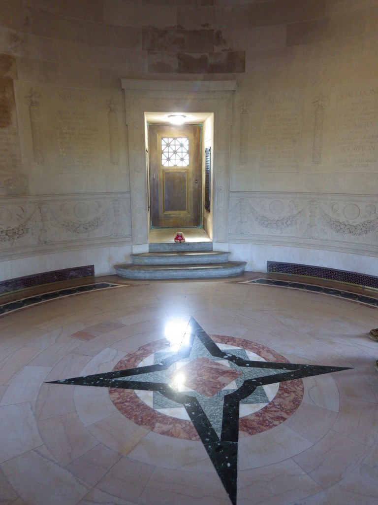
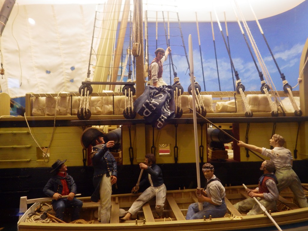
Perry’s Victory and International Peace Memorial is located on South Bass Island in western Lake Erie. Commodore Oliver Hazard Perry not only had the best name in the War of 1812, his naval victory near here on September 10, 1813 was a turning point. The 1817 Rush-Bagot Agreement is still in effect today, assuring that the U.S. and Canada maintain the world’s longest undefended international border. The 352-foot tall memorial tower was built between 1912-15 and became part of the National Park Service (NPS) system in 1936.
Highlights
Museum, film, 352-foot tall memorial tower, black squirrels
Must-Do Activity
After departing from your ferry or airplane, head to the NPS visitor center for the free museum and film, then pay for your ticket to ascend the granite memorial tower in an elevator. On a sunny day the views from the 317-foot tall viewing level across Lake Erie are splendid, including the shoreline of Canada and the roller coasters at Cedar Point. The rotunda at the tower’s base also contains the remains of three American and three British soldiers who died during the 1813 battle.
Best Trail
It is about two miles from the ferry terminal to the NPS visitor center, but if the weather is nice it is a pleasant walk on roads that are not busy.
Instagram-worthy Photo
The windows facing the memorial tower at the NPS visitor center are mirrored, which makes for a really interesting and distorted reflection.
Peak Season
Summer (May to October is the only time you can enter the memorial)
Free for museum, $10 per person for elevator to top of tower or free with America the Beautiful pass
Road Conditions
South Bass Island is only accessible by boat or airplane. Ferry service allows you to bring your own vehicle to the island, which is small enough to walk everywhere or drive in a rental golf cart.
Camping
South Bass Island State Park has more than 100 primitive campsites on the island and East Harbor State Park on the mainland has more than 500 campsites with modern facilities.
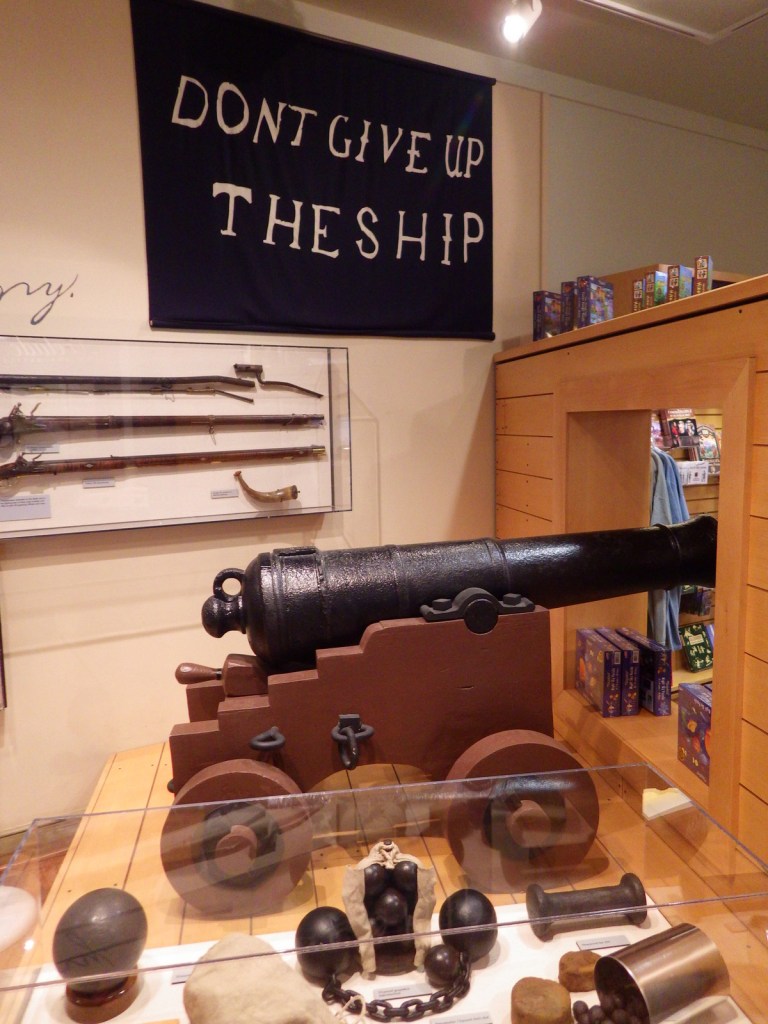
Explore More – What is the significance of the “DON’T GIVE UP THE SHIP” flag?
We are a participant in the Amazon Services LLC Associates Program, an affiliate advertising program designed to provide a means for us to earn fees by linking to Amazon.com and affiliated sites.
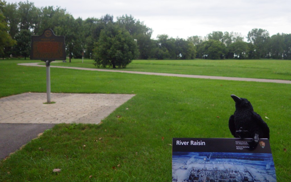
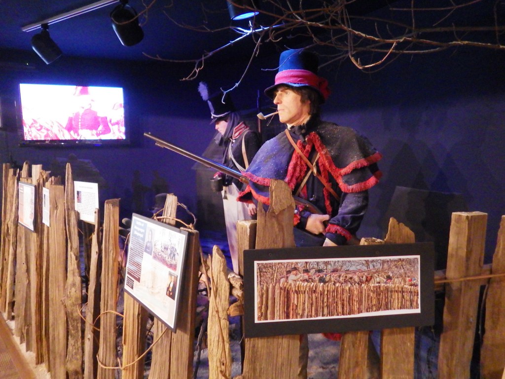
River Raisin National Battlefield Park is located in Monroe, Michigan near where the mouth of the river empties into Lake Erie. During the War of 1812, the U.S. had a plan to invade Canada which fell through after the surrender of Detroit. Five months later in January 1813, U.S. troops were heading towards Detroit when they made a detour to Frenchtown to drive off a small detachment of Canadians. Following an initial victory, a few mornings later a British surprise attack captured or killed all but 33 of nearly 1,000 troops. When Indian allies of the British returned to scalp six (according to the British) or 42 (according to the Americans) injured prisoners the devastating defeat became immortalized in the rallying cry “Remember the Raisin!”
Highlights
Museum, film, River Raisin Heritage Trail
Must-Do Activity
River Raisin National Battlefield Park was not authorized until 2009, so it has a nice new visitor center opened in 2011. The National Park Service (NPS) has even attempted to make it kid-friendly by creating a stuffed animal of Major Muskrat with multiple costume options available in the gift shop. It is not often that an NPS site commemorates an American defeat in battle. In 1813, the U.S. went onto victory at the Battle of Lake Erie and the Battle of Thames in southern Ontario. For some reason, the Canadians do not have their own National Historic Site dedicated to that one.
Best Trail
The 42-acre park is mostly a lawn with a paved path dotted by interpretive signs. You can also hook into the River Raisin Heritage Trail, which takes you to Sterling Stare Park on Lake Erie.
Instagram-worthy Photo
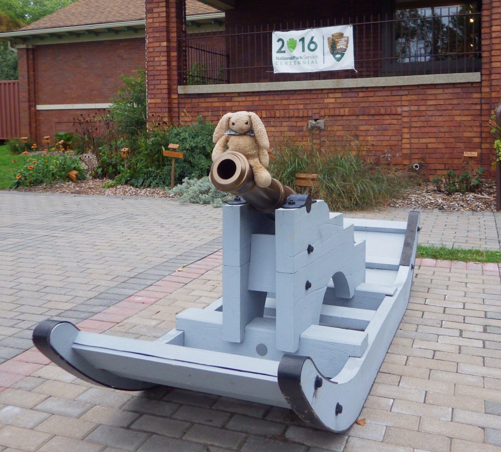
A replica of a cannon used at the January battle is on sled runners; pretty unique!
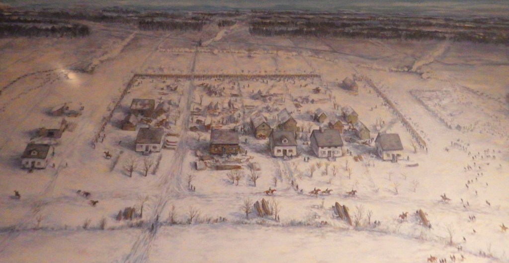
A painting provides an overview of the River Raisin battle
A diorama of Perry’s battle on Lake Erie
River Raisin Heritage Trail
Explore More – Native Americans were left out of the Treaty of Ghent that ended the War of 1812, so when did the U.S. sign the Treaty of Springwells officially ending hostilities?
Start your U.S. National Forests, National Parks, and National Monuments adventure here!