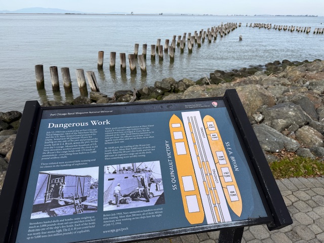
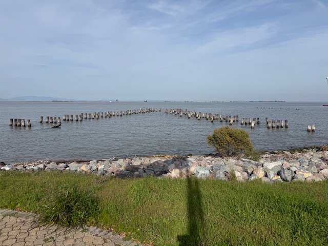
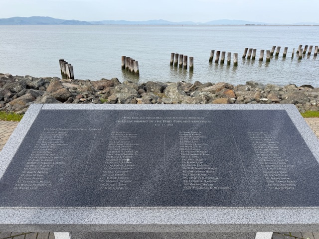
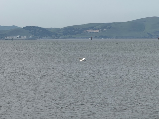
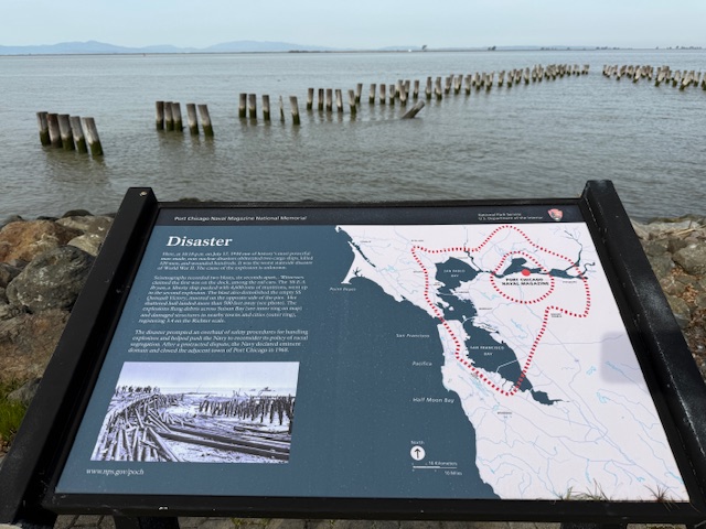
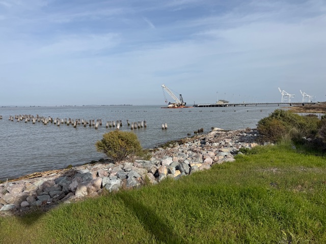
On July 17, 1944 at 10:18 p.m., a massive explosion at a U.S. Navy facility rocked the San Francisco Bay area. The blast started at a pier where munitions were being loaded onto two ships and killed 320 men. The majority of the dead were African American sailors who were segregated at the time and not allowed to serve in combat roles or as officers. After refusing to return to unsafe working conditions, 206 sailors were convicted after a summary courts-martial, and the “Port Chicago 50” were sentenced to 15 years imprisonment for mutiny. After receiving negative publicity, the Navy actually became the first of the military branches to integrate during World War II, well before President Truman required it in 1948. On January 6, 1946, the Navy released 47 of the 50 men being held and in 2024, the Navy posthumously exonerated all 256 men and vacated any remaining dishonorable discharges.
Highlights
Memorial, film, revetment
Must-Do Activity
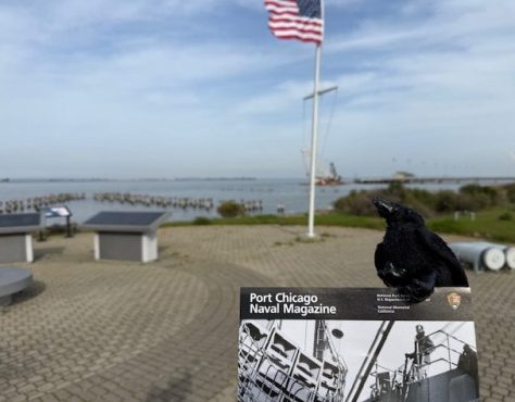
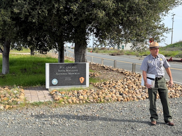
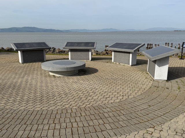
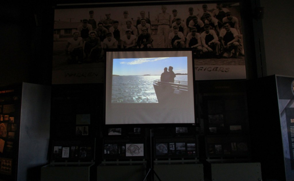
The memorial is located on an active military base called Military Ocean Terminal Concord on Suisun Bay. Therefore, all visitors are required to be U.S. Citizens and must make a reservation at least two weeks before their visit by calling or emailing the National Park Service (NPS) to receive a background check. Tours are given only on Thursdays, Fridays, or Saturdays and meet at John Muir National Historic Site (where you can watch a short film) in Martinez where the group boards government vehicles to drive to the site. After a thorough search of the vehicle and each visitor getting checked off a list, it is a short drive to the memorial where the NPS ranger explains the history of the site at two locations with time to walk around and take photos (but only of the memorial area).
Best Trail
None
Photographic Opportunity
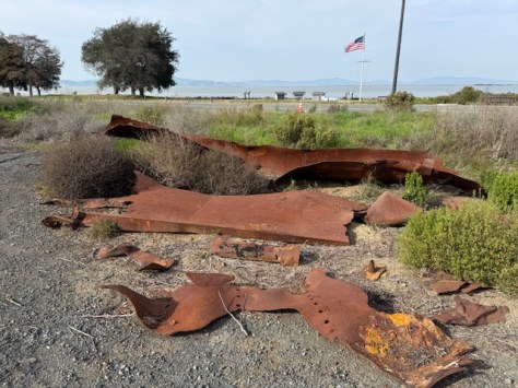
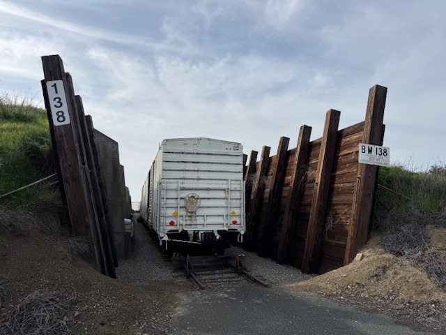
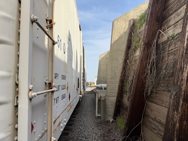
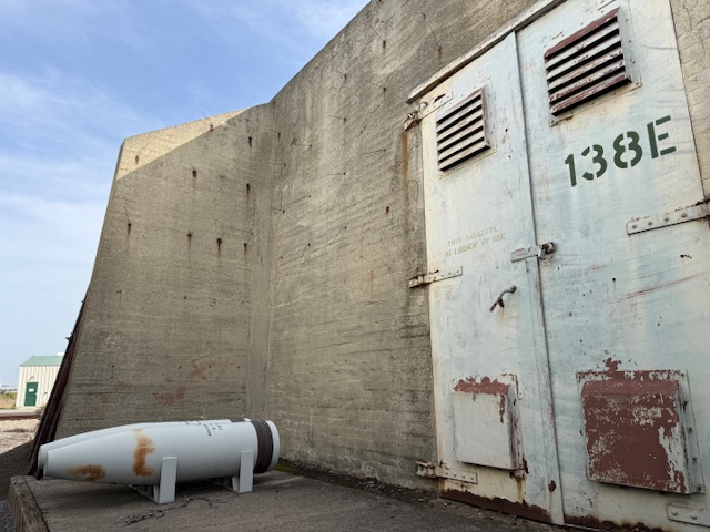
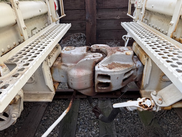
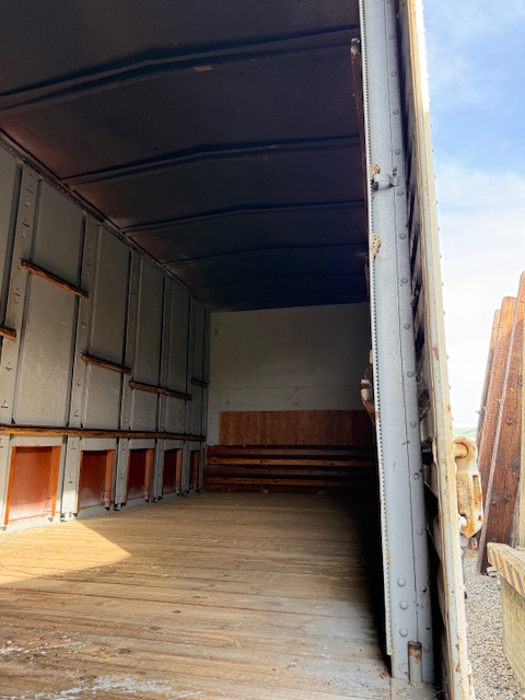
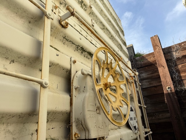
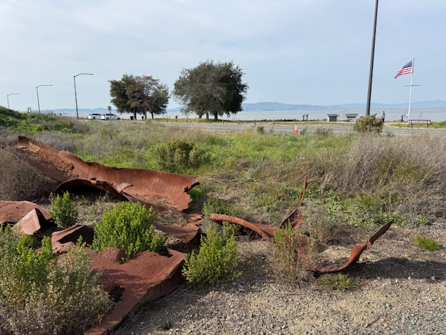
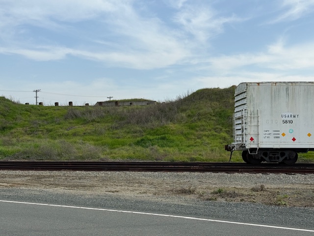
Shrapnel from the 1944 blast is located at the first stop on the guided tour where historic train cars are parked in a revetment.
Peak Season
Summer
Hours
Tours are available only on Thursdays, Fridays, or Saturdays when the base is not closed to civilians.
Explore More – What future Supreme Court Justice observed the courts-martial and has a regional park named in his honor near Port Chicago Naval Magazine National Memorial?
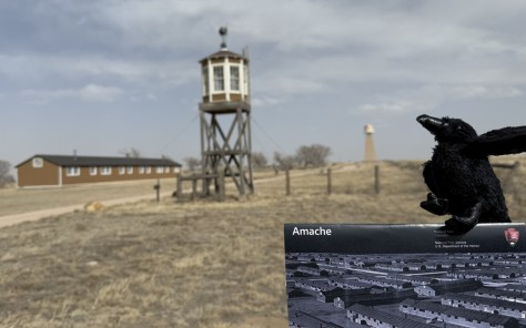
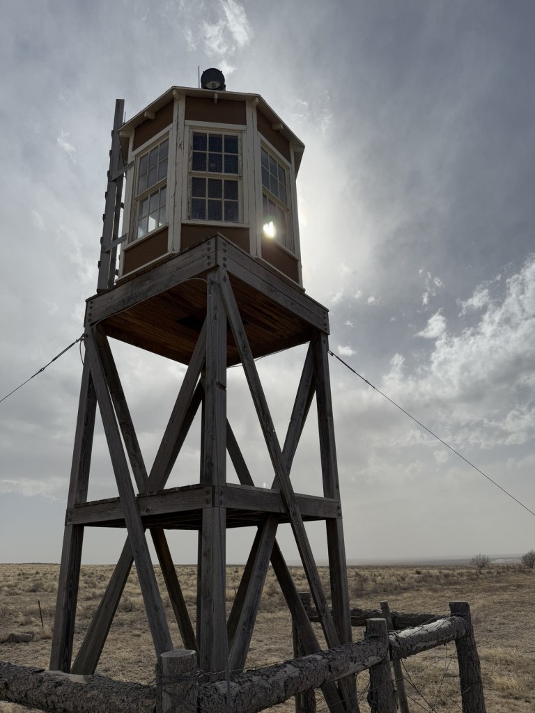
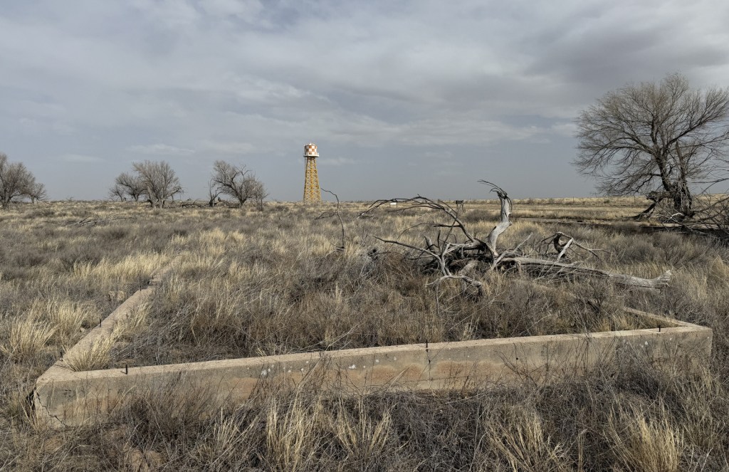
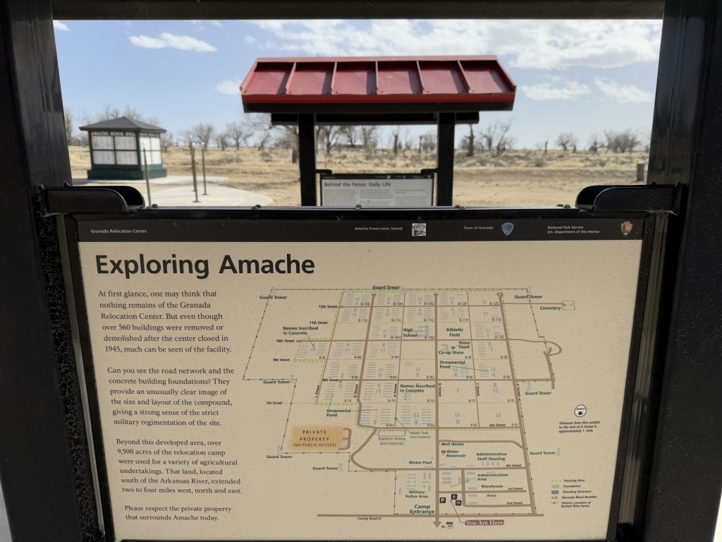
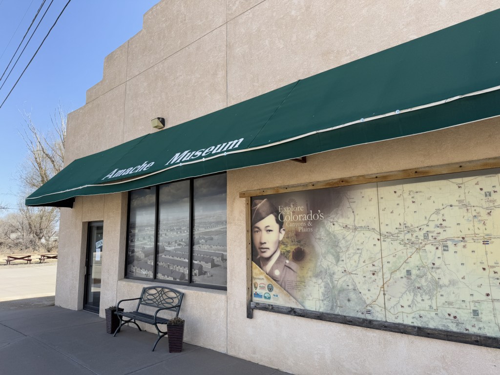
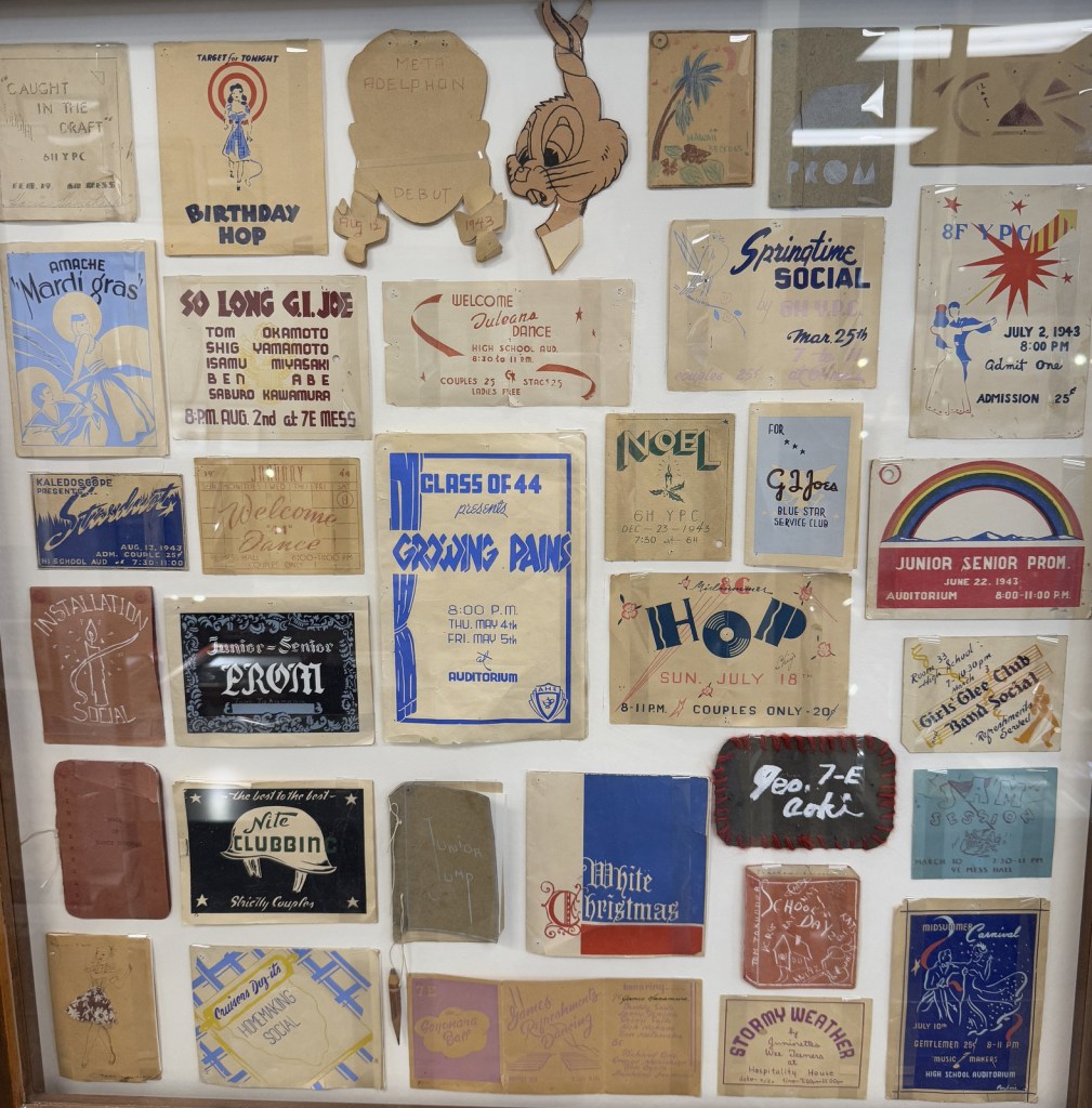
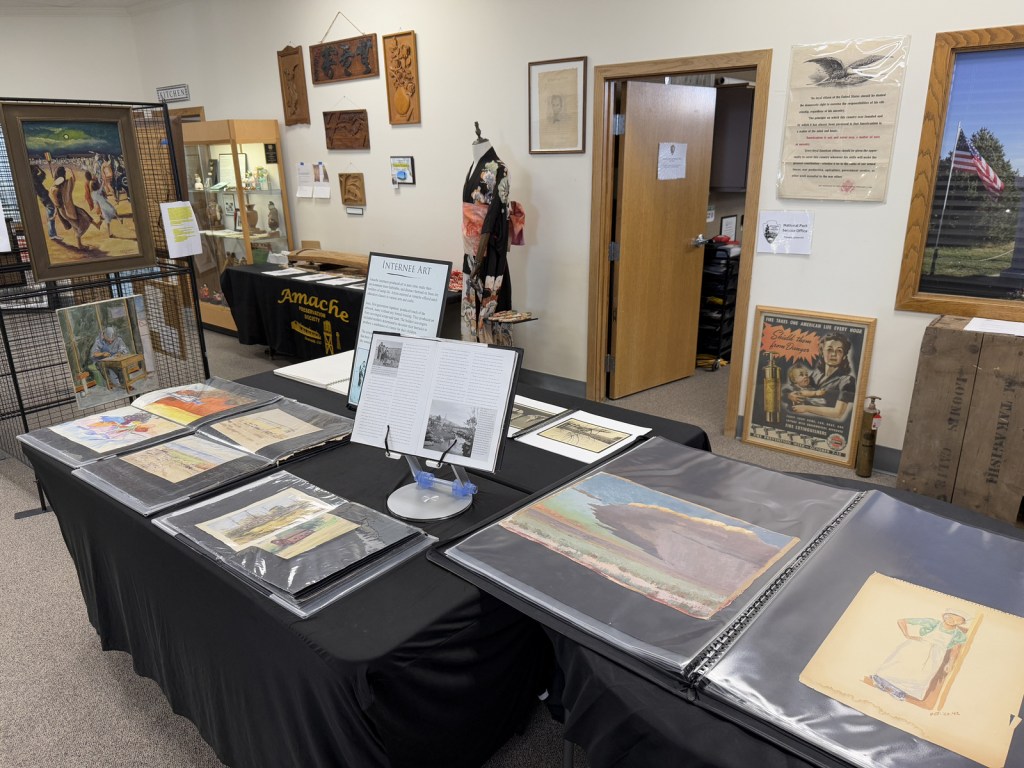
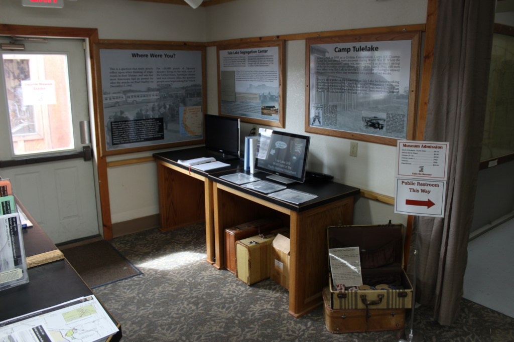
Added to the National Park Service (NPS) system on February 15, 2024, Amache National Historic Site is the fifth unit dedicated to remembering the sad story of the forced internment of 110,000 Japanese-Americans during World War II. Operated between 1942 and 1945, at its peak the Granada Relocation Center in southeast Colorado housed 7,310 incarcerees making it the state’s tenth largest city at the time. Although it does not have a visitor center, the site of the internment camp is more developed than other new NPS sites since it was previously added to the National Register of Historic Places in 1994 and then designated a National Historic Landmark in 2006. Learn more about the history of these camps by checking out the Related Sites below and watching some of our Top 10 World War II Films or reading one of the Top 10 World War Novels.
Highlights
Amache Museum, water tower, barracks, guard tower, cemetery, Recreation Hall
Must-Do Activity
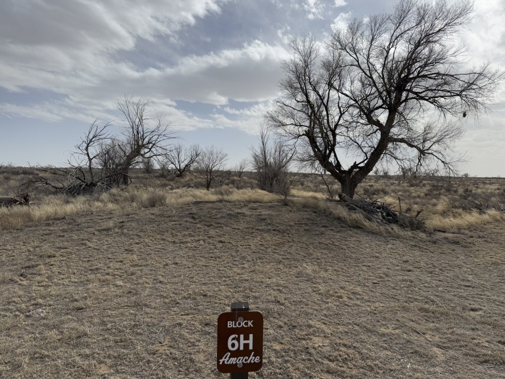
Start at the excellent Amache Museum in Granada, which is run by local high school students and has free admission (donations accepted). Be sure to pick up a map of the driving tour or visit the website (https://amache.org/driving-tour-map-podcasts) to listen to the audio recordings at each stop (there is smartphone coverage on site). Drive the route in order or skip around, but make it a point to see Stop 4 (guard tower and barracks), Stop 8 (cemetery), and the Rec Hall. Starting in June 2025, ranger-led tours will be offered at 10 a.m. on the first and third Friday of the summer months.
Best Trail
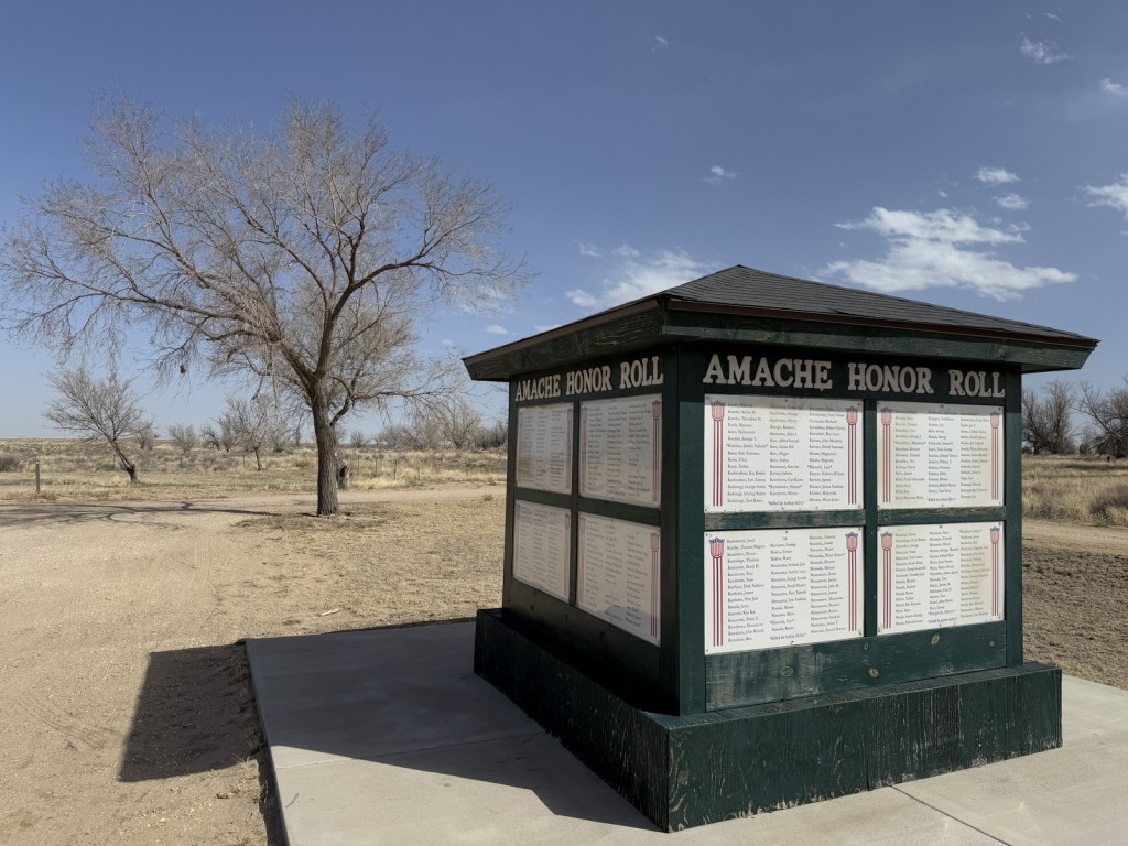
There is a short loop trail with many interpretive signs at the picnic area when you first arrive at the site by the Honor Roll square structure. There is also an off-trail walk to the old koi pond at Stop 2 that you can navigate if you listen to the directions on the audio recordings.
Photographic Opportunity
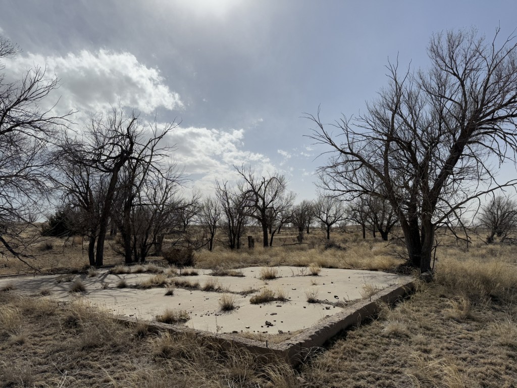
The reconstructed barracks and guard tower at the south end of the site are two of the only structures standing above the open prairie. They are near the water tower, which is worth a short detour to see.
Explore More – Most of the 10,000 acres dedicated to Granada Relocation Center was for agriculture, so how many acres were used for residential and administrative buildings?
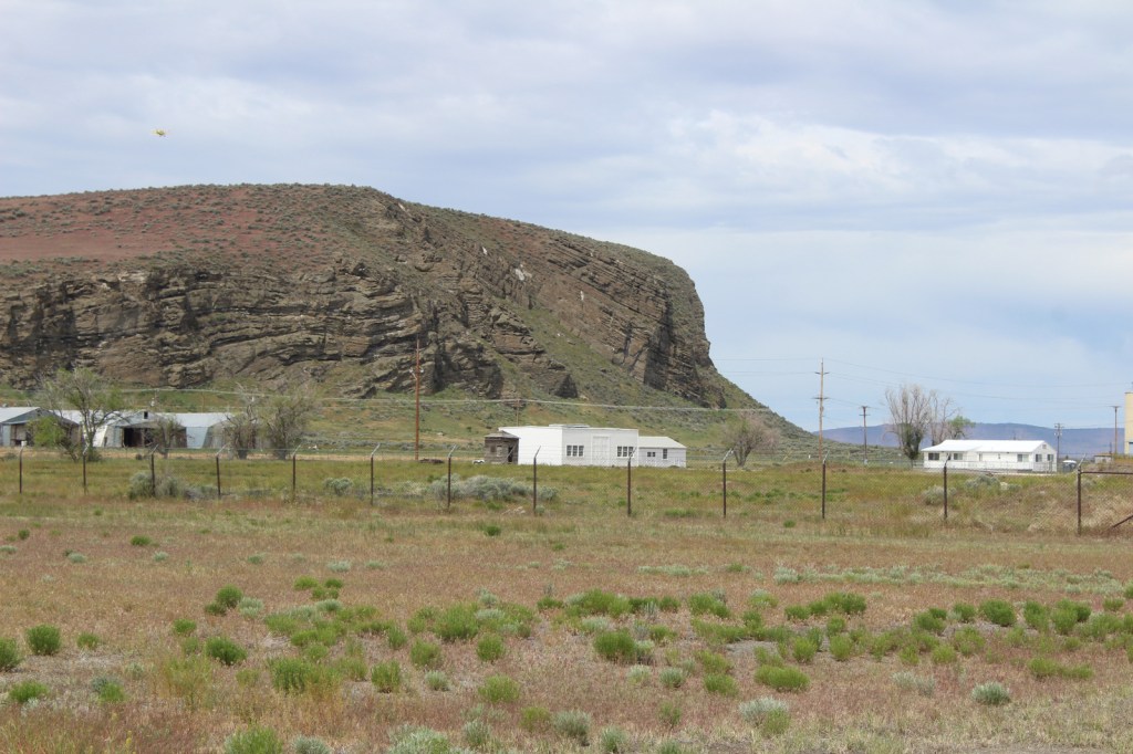
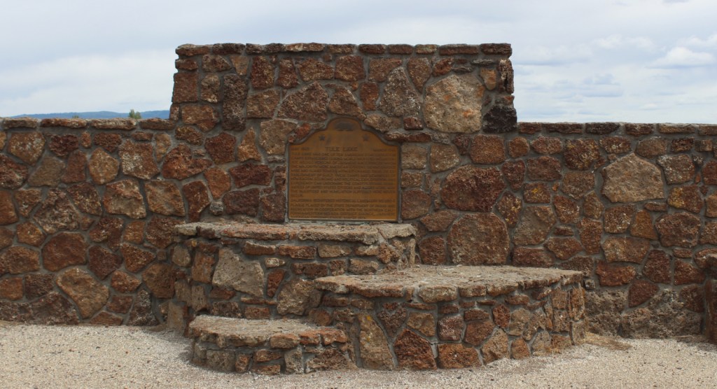
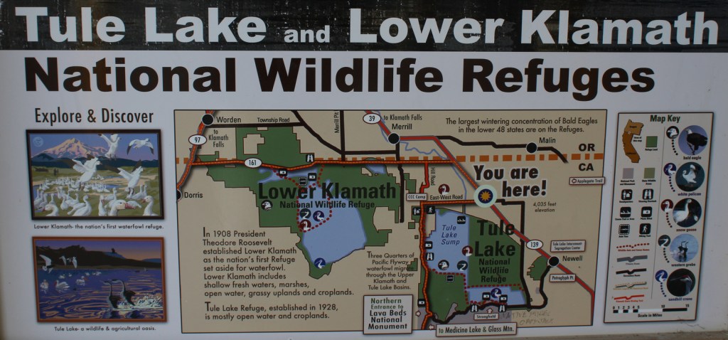
Following the 1941 attack on Pearl Harbor, President Franklin D. Roosevelt signed an executive order authorizing the detention of more than 110,000 U.S. citizens of Japanese descent at ten concentration camps in the contiguous United States. At Tule Lake War Relocation Center, 7,400 acres were enclosed by barbwire to hold about 12,000 people in northeast California. Once a loyalty questionnaire was distributed throughout the ten camps, those considered disloyal to the U.S. government were all shipped to the renamed Tule Lake Segregation Center, which held 18,789 inmates at its peak. Overcrowding, harassment, beatings, and a fatal farm accident led to riots and mass demonstrations, and martial law was declared from November 13, 1943 to January 15, 1944. This camp was the last to be closed on March 20, 1946, months after the end of the war. It was named a National Historic Landmark in 2006, and two years later became one of nine sites within World War II Valor in the Pacific National Monument (which included Pearl Harbor National Memorial). When that was disbanded in 2019, Tule Lake National Monument was created.
Tulelake-Butte Valley Fairgrounds Museum, Tule Lake Segregation Center prison
Must-Do Activity
Most of the buildings at Tule Lake Segregation Center were moved elsewhere following the war. One of the few remaining structures is the prison, which is only accessible on ranger-guided tours offered Memorial Day to Labor Day on Thursdays through Sundays (call ahead for required reservations). The concrete jail had six cells to hold 24 men, but incarcerated over 100 at one time mostly outside in Army tents used as unheated punishment quarters. The prison is always visible from the National Park Service (NPS) visitor center off Highway 139. It is worth getting a tour to go inside to see original graffiti from inmates and the reinstalled metal doors that were purchased by a private citizen in the 1940s and kept at their farm for decades. Tulelake-Butte Valley Fairgrounds Museum (fee) has a one-hour audio tour and there are online virtual tours that show several sites within Tule Lake National Monument, including the inside of the jail prior to the restoration.
Best Trail
There are no designated trails there, but from the NPS visitor center near Newell you can photograph the rock formation known as Peninsula/Castle Rock (solely managed by the U.S. Fish and Wildlife Service). It is also visible while checking out the rock art at Petroglyph Point within Lava Beds National Monument.
Photographic Opportunity
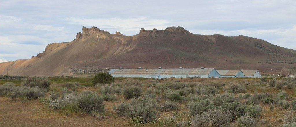
The Civilian Conservation Corps (CCC) was stationed at Camp Tulelake from 1935 to 1942, constructing 23 buildings and repairing canals. Several small groups of Japanese Americans were held at Camp Tulelake to separate them from the general population at Tule Lake Segregation Center. Later in the war, Italian and German POWs were stationed there before the buildings were transferred to the U.S. Fish and Wildlife Service. Currently, tours of Camp Tulelake are not available due to ongoing preservation work, but you can photograph it through the fence on Hill Road and hike to bird viewing blinds in Tule Lake National Wildlife Refuge.
Ranger-guided tours require a reservation, but they are free. There is an entrance fee for the museum at Tulelake-Butte Valley Fairgrounds.
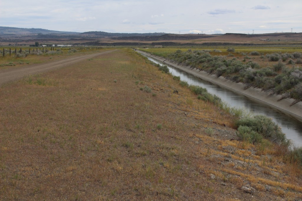
Road Conditions
Highway 139 and Hill Road are paved, but most of the roads through the former Tule Lake Segregation Center and Tule Lake National Wildlife Refuge are unpaved.
Tulelake-Butte Valley Fairgrounds MuseumTiff at Tulelake-Butte Valley Fairgrounds MuseumTulelake-Butte Valley Fairgrounds MuseumPeninsula/Castle RockCrop dusterTiff walking to the prisonInside the prisonHistoric graffitiHistoric graffiti in JapaneseNPS visitor centerTule Lake National Wildlife Refuge mapReflections on Tule Lake
Explore More – Providing crucial habitat along the Pacific Flyway, what type of migratory birds can be seen at Tule Lake, Clear Lake, and Modoc National Wildlife Refuges?
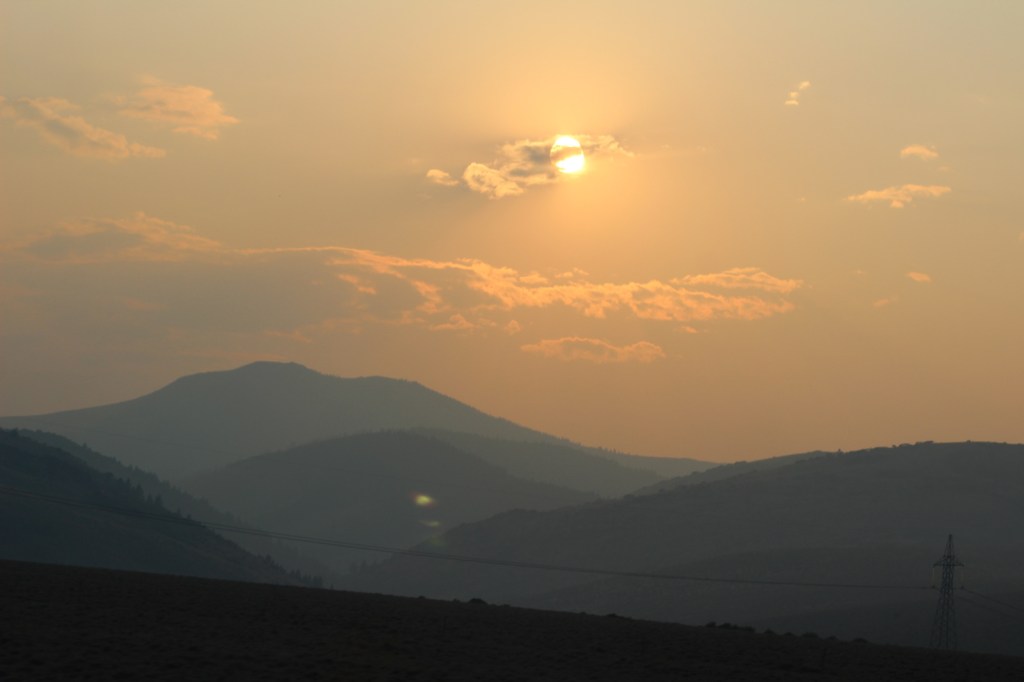
In central Oregon, the sagebrush-dominated high desert is also known as the Oregon Outback because of its rural resemblance to the arid Australian bush. Fremont National Forest encompasses the wooded mountains that rise to the west above Lake Abert and Summer Lake in the Warner Valley, an important wetland area for wildlife. In addition, a separate section located to the southeast covers the Warner Mountains and Abert Rim. The cliffs of Hadley Butte are popular with hang gliders. The Mitchell Monument honors the six American civilians who lost their lives during World War II when a Japanese balloon bomb exploded after traveling 6,000 miles.
Highlights
Oregon Outback Scenic Byway, Goodlow Mountain Natural Area, Drake Peak Lookout, North Warner Viewpoint, Abert Rim, Heart Lake, North Fork of Sprague National Wild and Scenic River, Mitchell Monument, Cottonwood Lake, Crane Mountain National Recreation Trail, Fremont National Recreation Trail, Gearhart Mountain Trail
Must-Do Activity
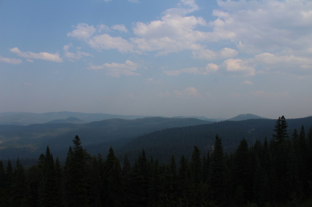
While it is not an official trail, the 4.6-mile out-and-back hike to Coleman Rim does have a good payoff with views of the Chewaucan River Valley. It is reached by driving nine miles up paved Forest Road 3360 from Highway 140, then turning right for two miles on gravel Forest Road 024 to Shepard Camp Creek. From there, you start hiking north to the head of Shepard Camp Meadow, while watching for black-tailed deer, sandhill cranes, and the numerous cattle that frequent this area. At that point, the route starts to gain elevation as it turns east through a forest of ponderosa pine, Sierra white fir, and western white pine trees. You will likely have to climb over a few downed trees as you navigate toward the rocky Coleman Rim that sits above 7,000 feet in elevation.
Best Trail
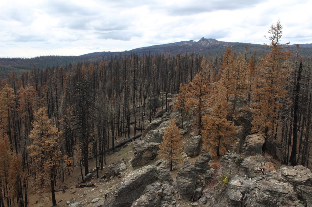
After the Bootleg Fire swept through the area between our 2020 and 2022 visits, it was amazing to see the differences around Gearhart Mountain. We drove as far up the mountain as we could to Lookout Rock Trailhead, parking at the edge of the Gearhart Mountain Wilderness, walking up the gated road to a fire lookout tower that remained unburnt on its rocky ridgetop. It was difficult to the follow the official Gearhart Mountain trail because of downed trees and the blanket of dead needles on the forest floor, but it was worth a look around to see the fire’s aftermath (please exercise caution due to the hazards of standing dead trees). The trail accesses the volcanic Palisade Rocks within one mile from the trailhead.
Watchable Wildlife
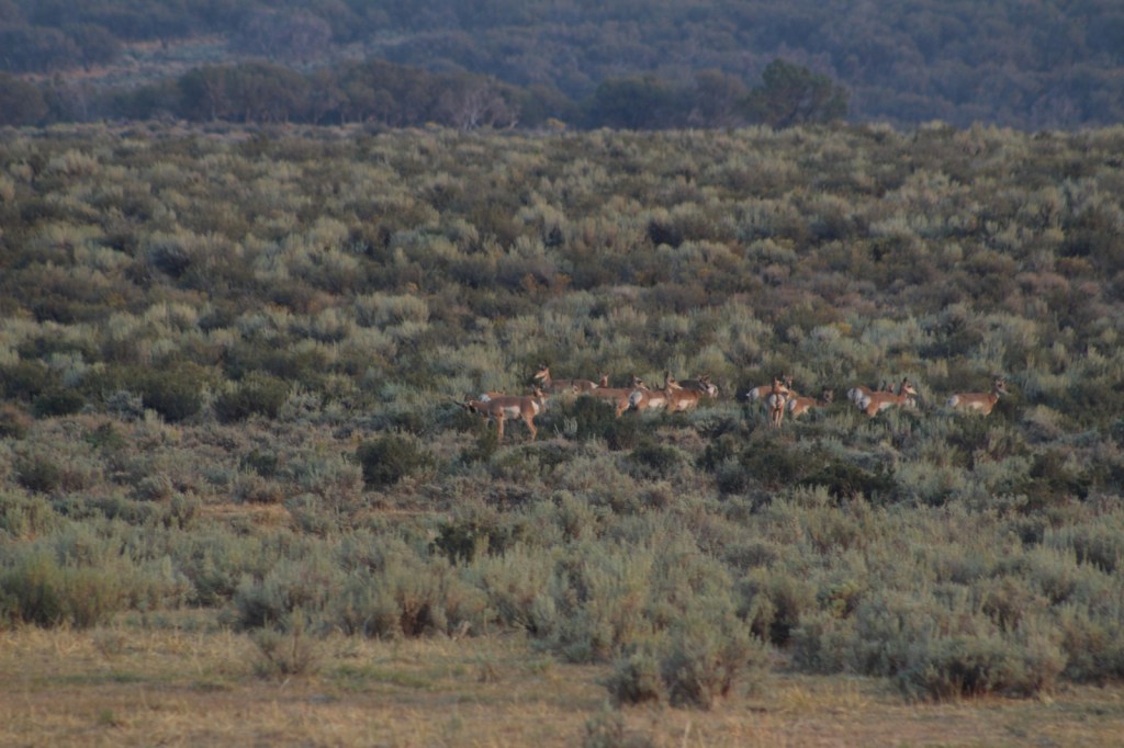
Mule deer, elk, and pronghorns are large ungulates found in Fremont National Forest, sharing habitat with carnivores like black bears, coyotes, mountain lions, and bobcats. The National Forest borders Summer Lake and several large wetlands that are important stops for migrating birds on the Pacific Flyway. Commonly seen waterfowl are Canada geese, mallards, and whistling swans, and the elusive northern spotted owl nests in old-growth forests. There are largemouth bass in the lakes, while streams support several species of trout, including the threatened bull trout.
Instagram-worthy Photo
Nearly 10,000 Fugo balloons were launched by the Japanese during World War II, but only one caused casualties, killing six American civilians when it exploded on May 5, 1945. At the Mitchell Monument, you can read their story and see a ponderosa pine tree that still contains shrapnel from the balloon bomb.
Peak Season
Summer
Fees
None
Road Conditions
Paved Highway 140 runs east-west through the heart of the National Forest, while Highway 395 splits a separate southeastern section on the California border. We found unpaved Forest Road 34 to be full of potholes, but it got better the further east we went towards the Mitchell Monument and Gearhart Mountain. Even after the 2021 fire, we found Forest Road 3660 to the Coleman Rim to be a good gravel road, while Forest Road 024 was a bit overgrown.
Camping
This is a good National Forest for dispersed camping, but we also passed Corral Creek Campground on our way up to Gearhart Mountain and Cottonwood Recreation Area offers a campground on a lake. Rentals are available in the summer for the Drake Peak Lookout, Currier Guard Station, and Bald Butte Lookout.
View from Coleman RimHiking to Coleman RimMule deerLichenHiking to Coleman RimView from Highway 140PronghornsMitchell MonumentLookout Rock TrailheadDamage from the 2021 Bootleg FireFire tower survived the 2021 Bootleg FireBurnt spruce conesPonderosa pines
Explore More – The National Forest is named after John C. Fremont who explored this area for the U.S. Army Corps of Engineers and went on to take control of the California Republic (for which he was convicted of mutiny and later pardoned), serve as a U.S. Senator, run twice for President, and then resign while Governor of what U.S. territory?
Learn more about this and the 154 other National Forests in our new guidebook Out in the Woods
We are a participant in the Amazon Services LLC Associates Program, an affiliate advertising program designed to provide a means for us to earn fees by linking to Amazon.com and affiliated sites.
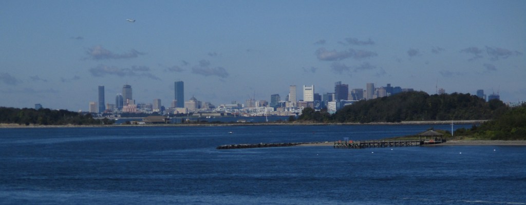
Established in 1996, there are 34 separate sites encompassed within Boston Harbor Islands National Recreation Area. Not all of the areas are islands, some, like Worlds End, are the tips of peninsulas with roads accessing them from the suburbs of Boston, Massachusetts. The park is a managed by a hodgepodge of agencies, including the U.S. Coast Guard’s Boston Light on Little Brewster Island (open to ranger-led tours in the summer months).
Highlights
Worlds End, Governors Island, Webb Memorial State Park, Spectacle Island
Must-Do Activity
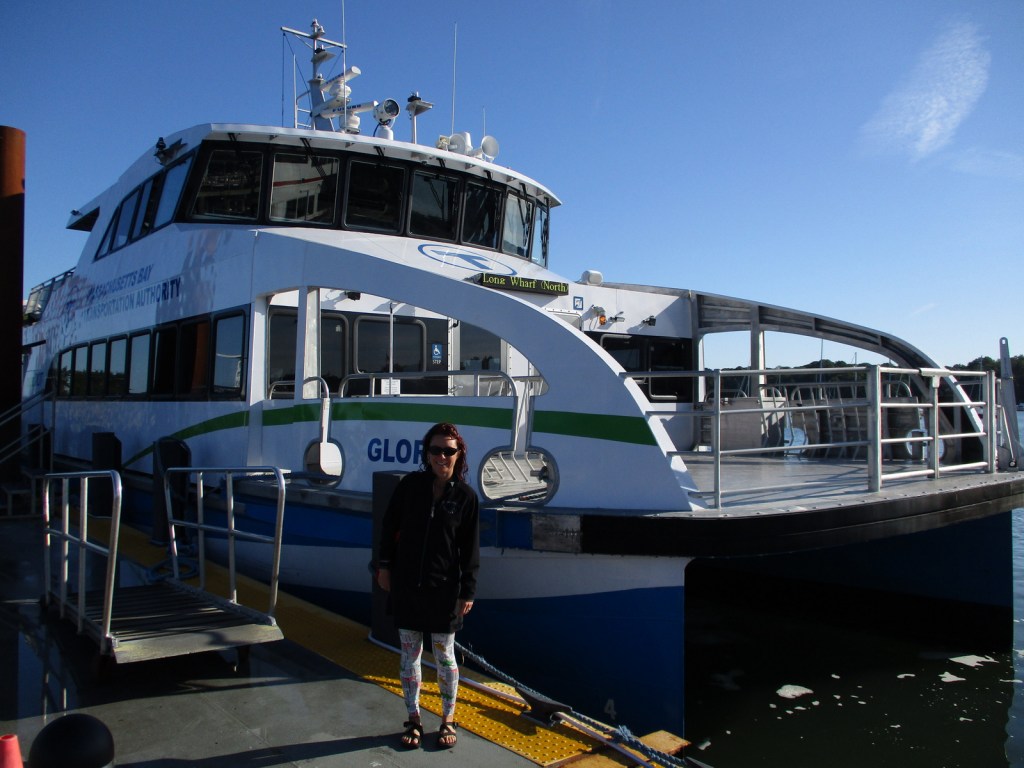
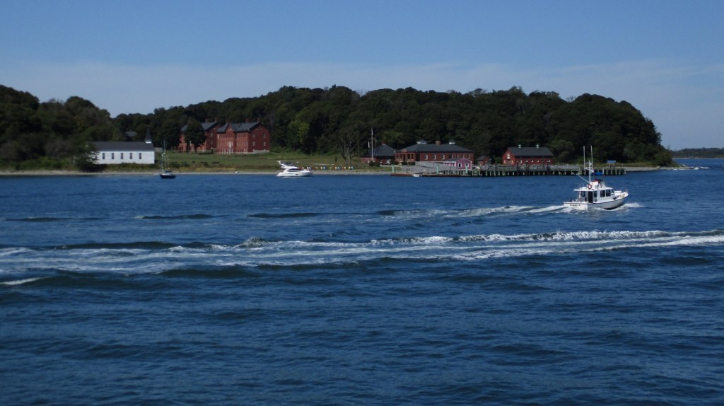
It is probably best to pick one island and thoroughly explore it by catching a ferry from Long Wharf North in downtown Boston, Hingham Shipyard, or Pemberton Point in Hull. We chose Georges Island which is mostly taken up by Fort Warren, which dates back to 1850. During the Civil War, the fort served as an artillery base and a prison. The National Park Service (NPS) operates an excellent museum on the island and shows a film on its history. Georges and Spectacle Islands are the only two islands that offer food for sale, plus they have water taxis leave from each dock to access many of the other islands.
Best Trail
Spectacle Island has five miles of hiking trails and also contains the highest point within Boston Harbor Islands National Recreation Area at 157 feet in elevation.
Instagram-worthy Photo
The site of the first lighthouse in America, Boston Light on Little Brewster Island can be seen from Georges Island and is open to guided tours in the summer.
Passengers ferries charge fares, but there is not an entrance fee to the islands or Webb Memorial State Park.
Road Conditions
Most of the islands do not allow private vehicles, but you can bring your bicycle onto the ferries. Webb Memorial State Park, Deer Island, Worlds End, and Nut Island are accessible by paved roads in the Boston area.
Camping
There are yurts on Peddocks Island and tent camping is allowed on Bumpkin, Grape, Peddocks, and Lovells Islands from late June through Labor Day. Backcountry permits are required for stays on undeveloped islands.