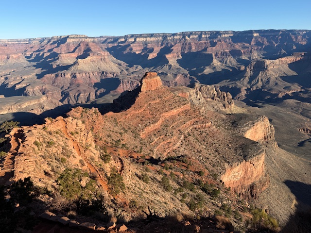
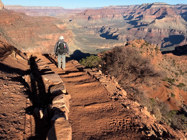
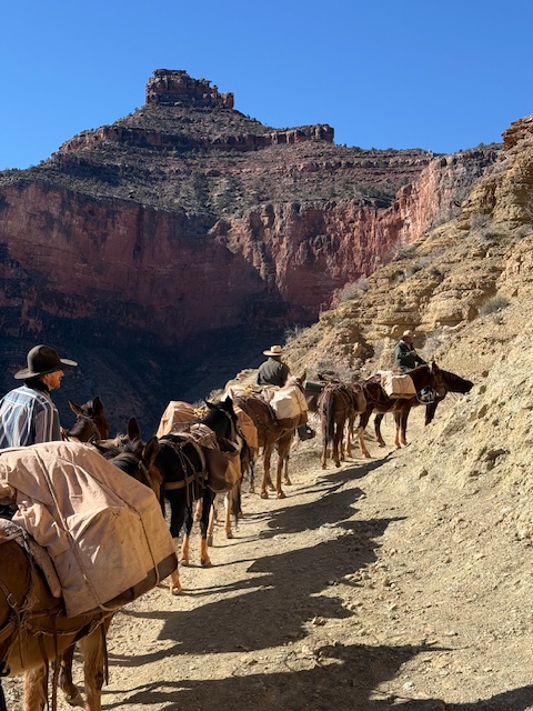
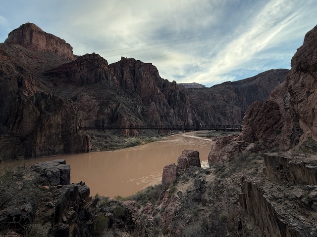
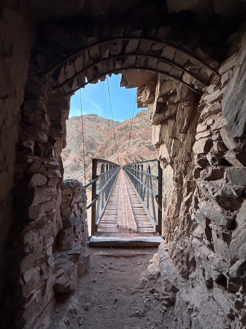
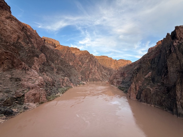
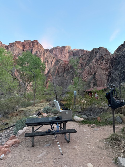
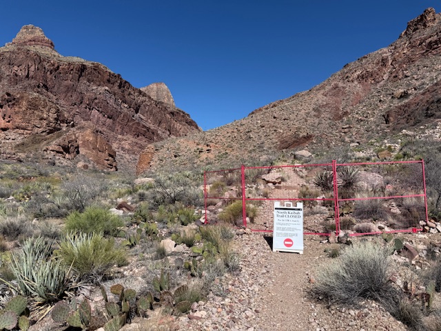
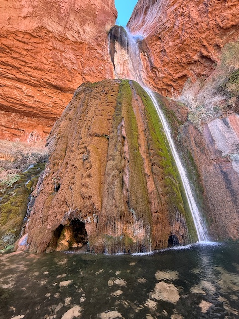
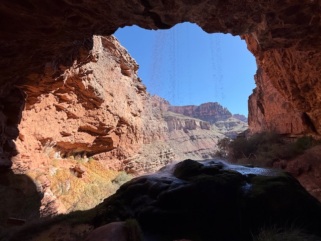
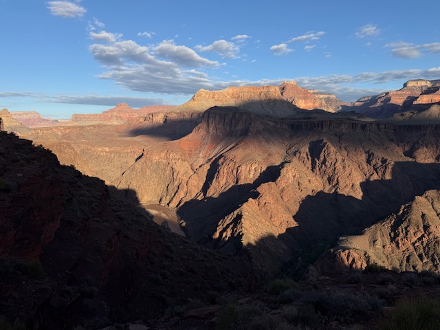
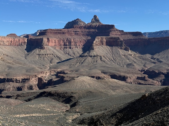
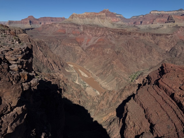
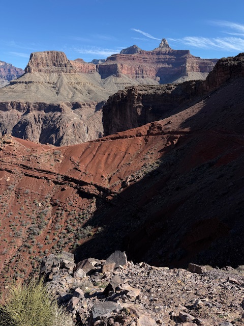
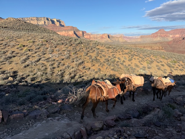
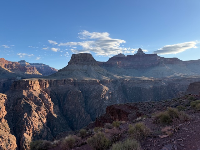
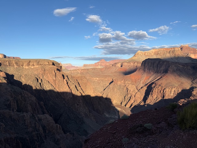
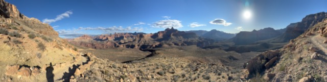
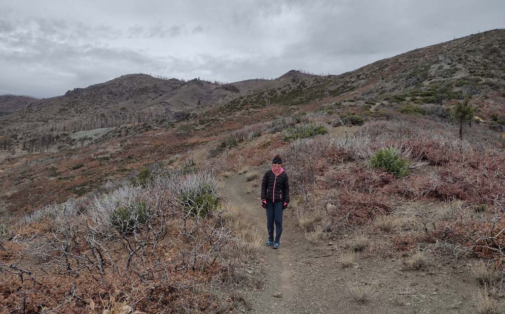
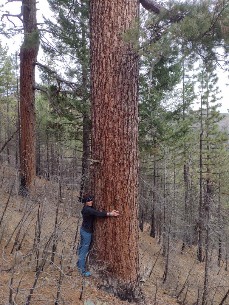
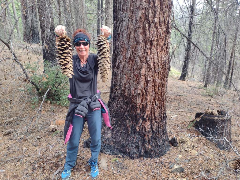
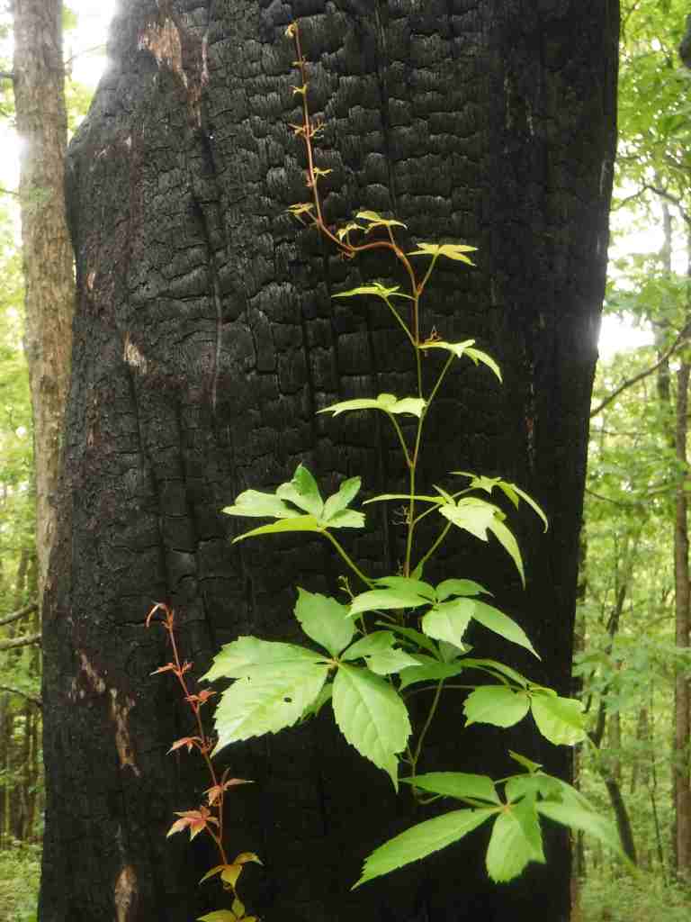
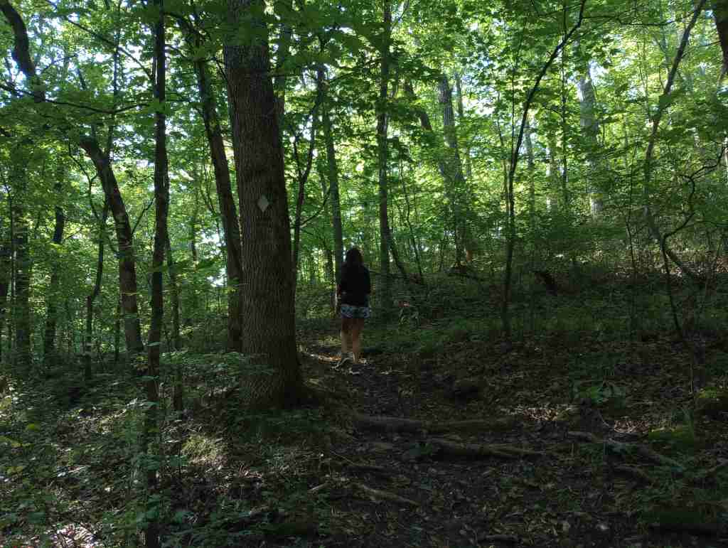
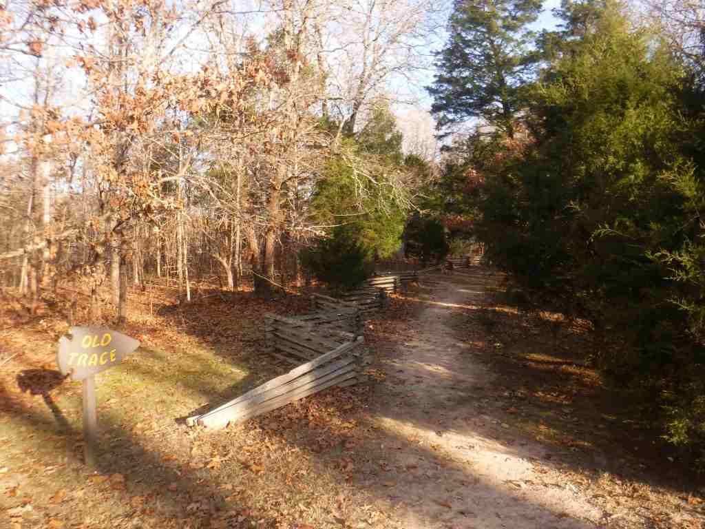
Since the Arizona National Scenic Trail cannot be done as a thru-hike this year, I took a non-traditional approach and started at Mile 700 in Grand Canyon National Park. Due to last summer’s Dragon Bravo Fire, more than 20 miles of the trail is closed on the North Rim. The six-mile stretch of North Kaibab Trail to Ribbon Falls opened up this week, so I made a reservation to spend the night in Bright Angel Campground. The weather was perfect, the scenery sublime, there were lots of ravens flying around, and (as I read) this time of year there were no bugs so I “cowboy camped” without a tent. What a privilege to get a campsite in such an incredible place listening to the creek. I carried my full backpack the seven miles down to the campground, then stashed most of my gear, refilled my water bottle, and headed six miles to the thigh-deep stream crossing for stunning Ribbon Falls, with an elevation gain of about 1,900 feet from the Colorado River. All told, I descended about 7,000 feet across 23 miles on Wednesday, but my left knee held up really well, either due to all the training or trekking poles. Thursday morning I made the hike out in three hours, impressing myself. I feel ready for the physical challenge of the 800-mile Arizona Trail! I am very grateful to be able to choose to do this hard and rewarding type of activity in my beautiful home state.
Originally called California National Forest in 1908, this area between Interstate 5 and Highway 101 was renamed Mendocino National Forest 24 years later. It stretches north-south along the Coast Range covering parts of six counties north of San Francisco. Similar to Los Padres National Forest, it contains rocky serpentine ridgelines where only specially adapted plants can tolerate the heavy metals in the soil, like Sargent cypress and the shorter McNab cypress. Both species can be found along Frenzel Creek near Little Stoney Campground. In 1953, a Forest Service employee and 14 volunteer firefighters died in the Rattlesnake Fire and a memorial overlooking Rattlesnake Canyon is located off Forest Highway 7 on Alder Springs Road. Mendocino National Forest includes the northern portion of Berryessa Snow Mountain National Monument (see our full blog post), established in 2015 and administered in cooperation with the Bureau of Land Management.
Know someone who loves the National Forests? Gift them our travel guidebook Out in the Woods so they can learn more about all 155 National Forests.
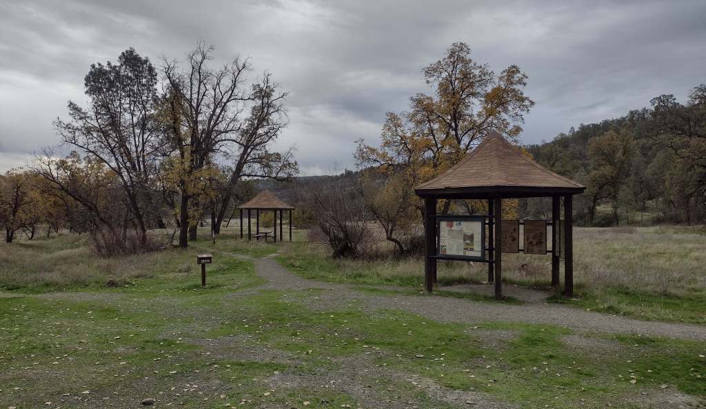
There are 18 National Forests in California (the most of any state), but Mendocino is the only one not crossed by a paved highway. It is a wonderful destination for outdoor recreation, both motorized and non-motorized, including Hull Mountain which is popular with hang gliders. Lake Pillsbury is 2,280 acres and offers boat ramps, campgrounds, and a resort, while 35-acre Letts Lake has a campground and access to hiking trails.
Best Trail
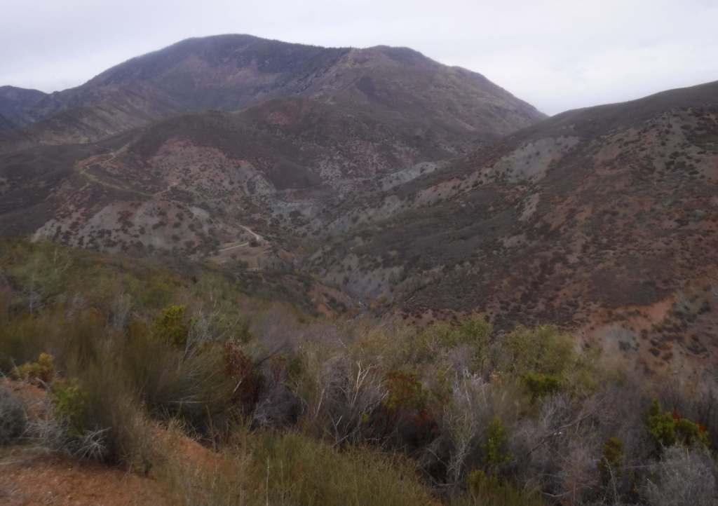
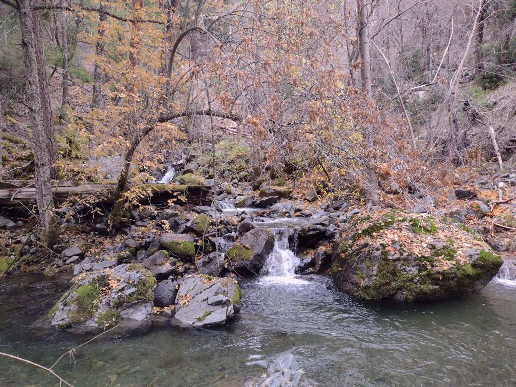
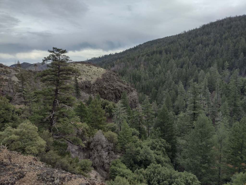
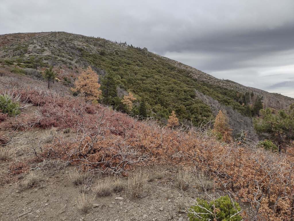
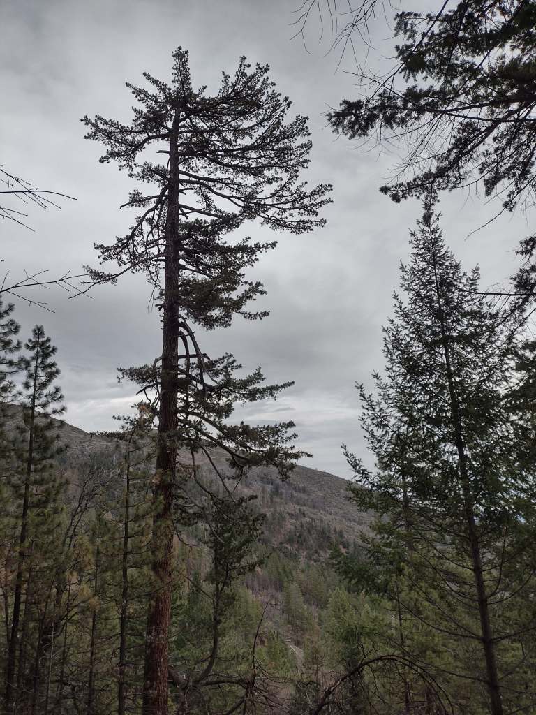
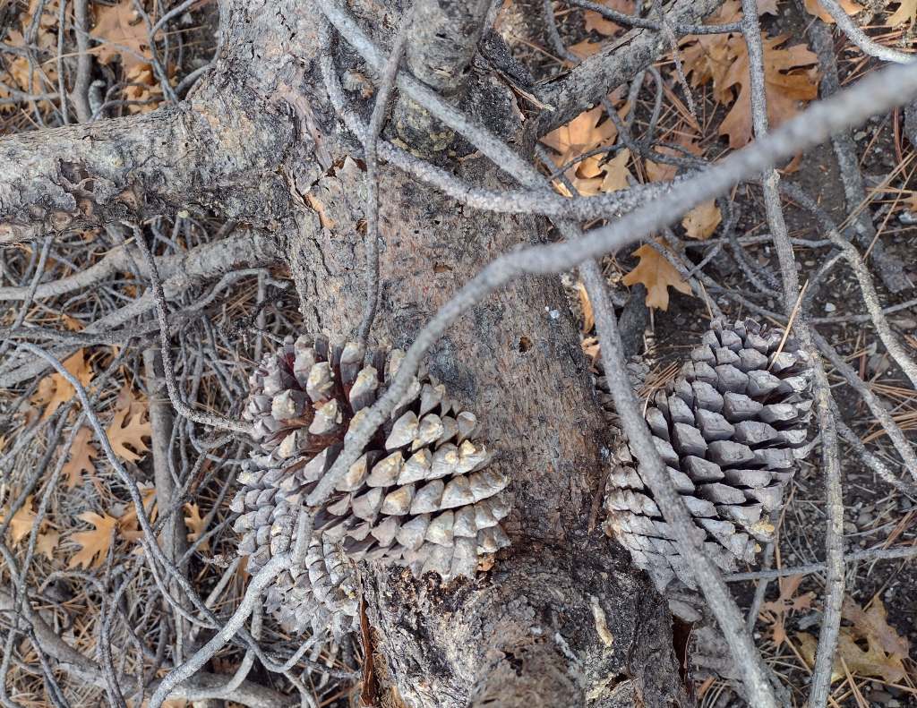
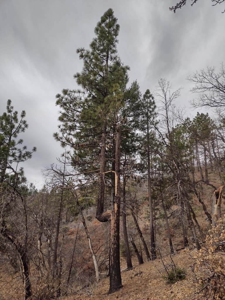
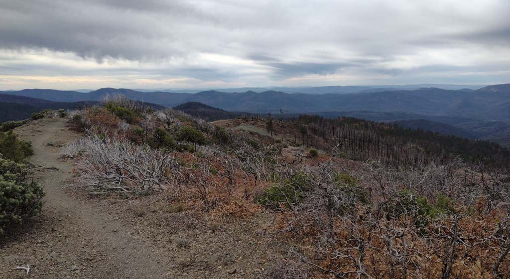
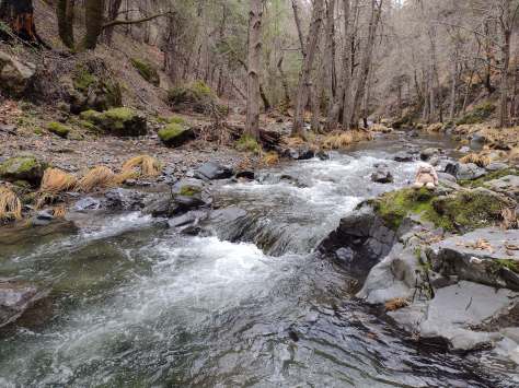
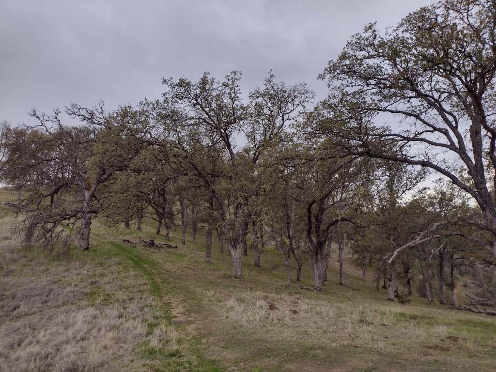
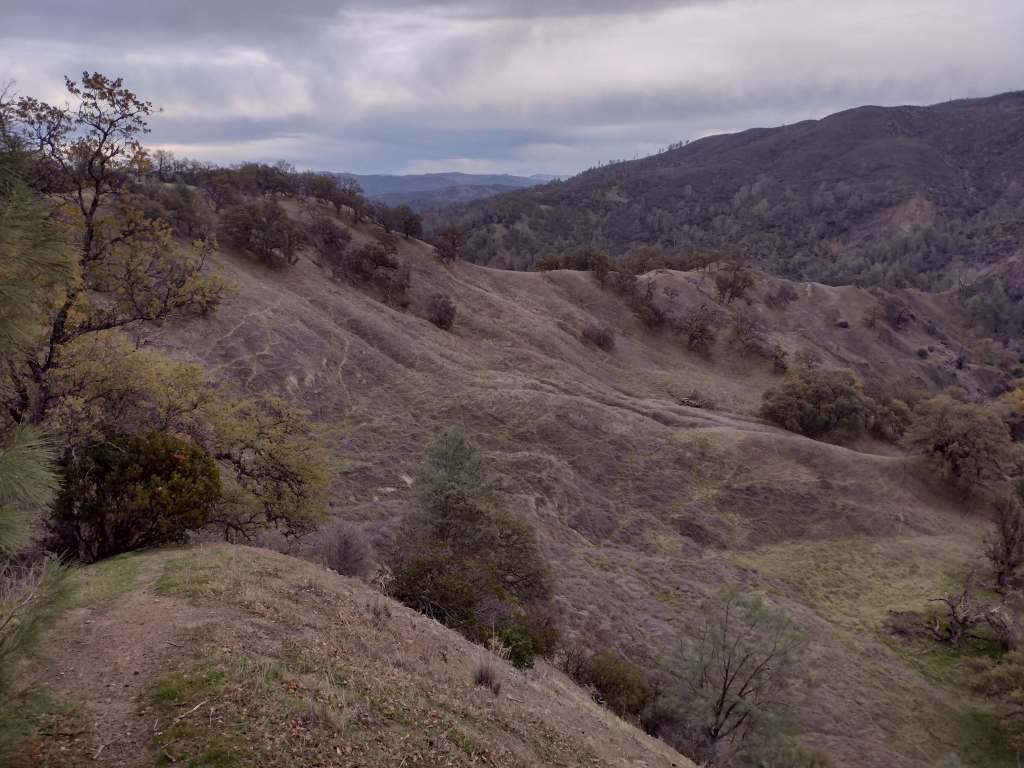
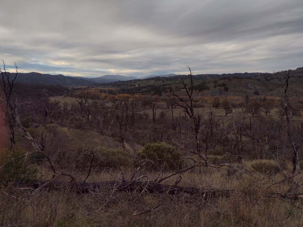
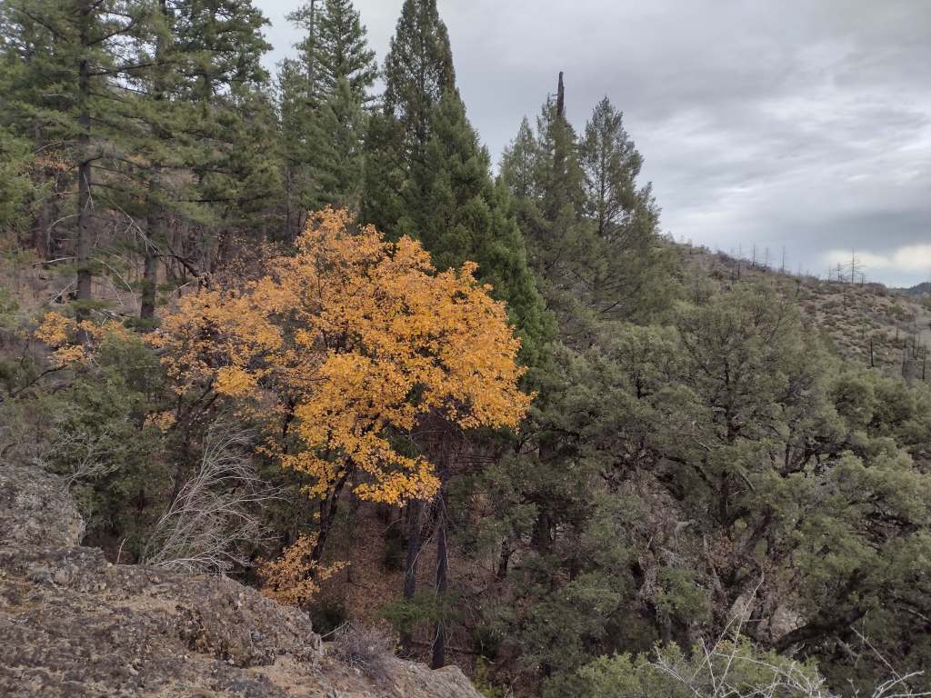
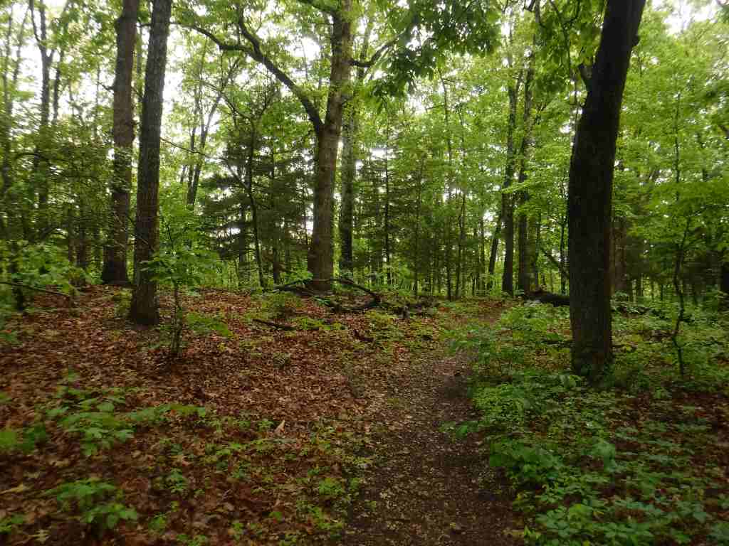
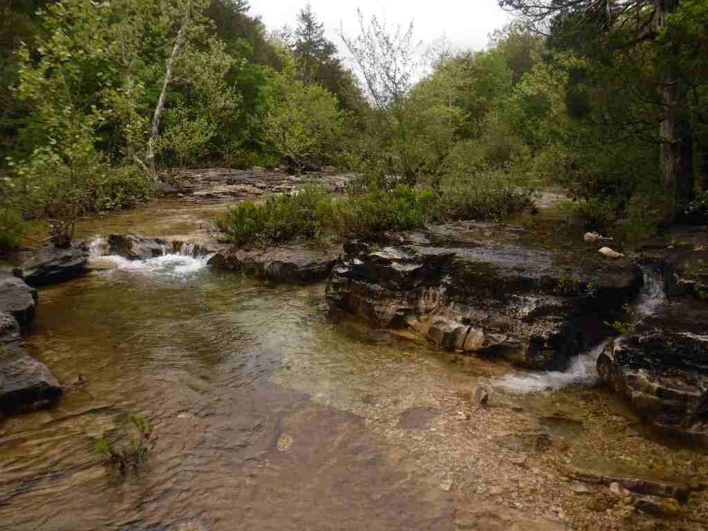
As we drove the winding road from Stonyford to the tiny roadside pullout for Deafy Glade Trail, we passed campgrounds full of RVs that were getting ready for a motorcycle event. Our hike took us far from any road noise, as we dropped down to and waded across the frigid South Fork of Stony Creek and then climbed steeply to 5,300 feet in elevation. The trail continued to the summit of 7,056-foot Snow Mountain, but we already had great views of the Rice Valley and decided to turn around at the 4.5-mile point, just inside the official boundary of the Snow Mountain Wilderness. We expected a desolate landscape after reading about recent fires, but about three-quarters of the trees along the trail were still alive and showed only minor charring at their bases.
Watchable Wildlife
Mendocino National Forest protects a biodiverse area home to tule elk, black-tailed deer, river otters, black bears, and mountain lions. Rivers that drain these highlands are used by California coastal chinook salmon and Northern California steelhead. Fishing in the lakes is a popular activity and a chance to see ospreys and bald eagles.
Photographic Opportunity
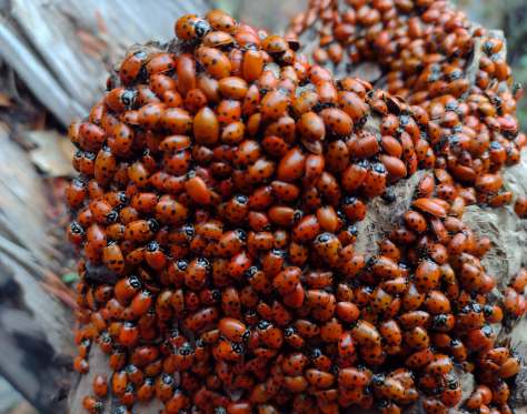
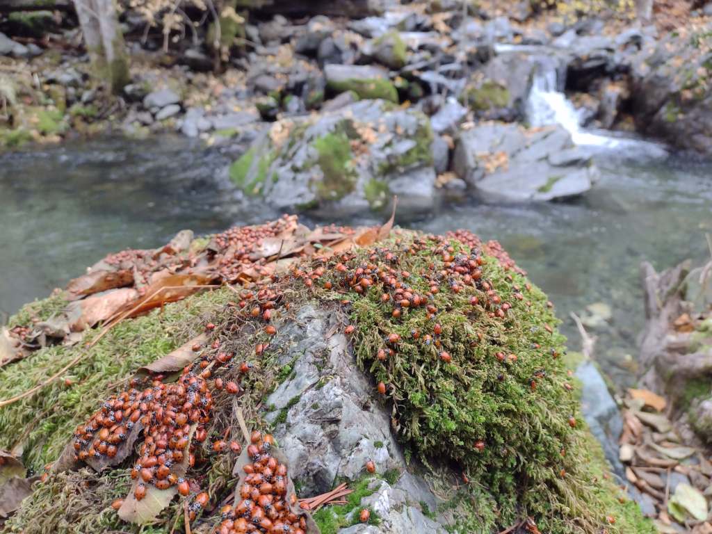
On Deafy Glade Trail, there were congregations of lady bugs that numbered in the hundreds along the South Fork of Stony Creek.
Peak Season
Summer
Fees
None
Road Conditions
Fouts Springs Road (Forest Road M10) is a well-maintained gravel road that crosses the National Forest west of Stonyford. That area is popular with motorcycles and OHVs, so keep an eye out for them while driving.
Camping
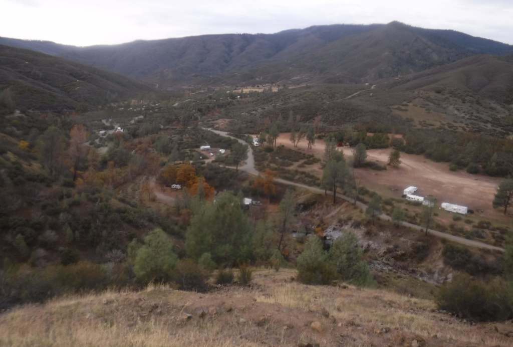
Mendocino National Forest manages Bear Creek Campground and Lower Nye Dispersed Campground among many others, plus there are countless places for dispersed camping.
Wilderness Areas
Sanhedrin Wilderness
Snow Mountain Wilderness
Yolla Bolly-Middle Eel Wilderness (also in Six Rivers and Trinity National Forests)
Yuki Wilderness (also run by the Bureau of Land Management)
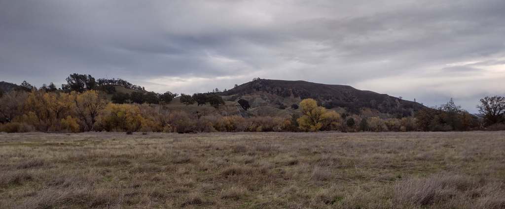
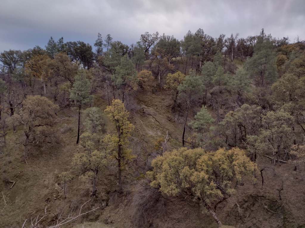
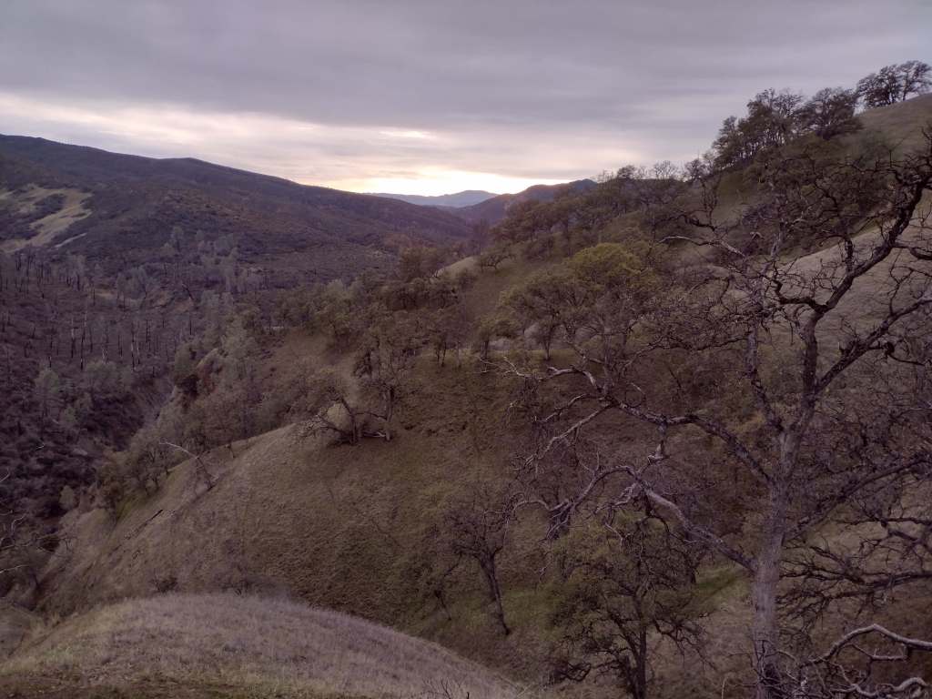
North of the San Francisco Bay and west of Interstate 5, flat-topped 7,056-foot Snow Mountain sheds water into the Berryessa Valley and the Sacramento River. High elevations are dominated by conifers, while below there are oak-studded hillsides, canyons full of riparian trees, and rocky serpentine ridgelines where only specially adapted plants can tolerate the heavy metals in the soil. In 2024, the 13,696-acre Molok Luyuk (“Condor Ridge” in the Patwin language) was added to the National Monument since it contains evidence of human occupation dating back more than 10,000 years.
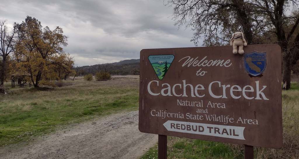
Cache Creek Wilderness, Knoxville Recreation Area, Nye Cabin, Prather Mill, Deafy Glade Trail, Redbud Trail
Must-Do Activity
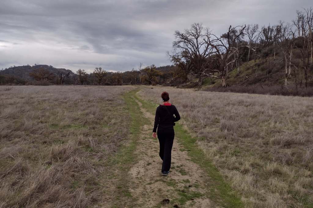
In the portion of the National Monument run by the Bureau of Land Management, Cache Creek Wilderness is one of the main attractions for whitewater rafting and backpacking. Redbud and Judge Davis Trailheads off paved Highway 20 provide the easiest access for hikers. Further south, Knoxville Recreation Area encompasses rugged terrain for exploration with off-highway vehicles (OHVs). The northern portion of Berryessa Snow Mountain National Monument within Mendocino National Forest has a network of dirt roads that are also popular with OHV riders. In the far north, Hull Mountain is utilized by hang gliders.
Best Trail
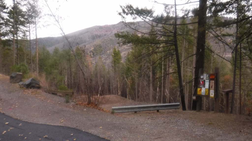
In Mendocino National Forest, Deafy Glade Trail starts at a tiny roadside pullout along Fouts Springs Road where campgrounds were full of RVs getting ready for a motorcycle event. Our hike took us far from any road noise, past congregations of lady bugs that numbered in the hundreds as we waded across the frigid South Fork of Stony Creek and climbed steeply to the boundary of the 60,076-acre Snow Mountain Wilderness. The trail continues to climb 4,300 feet total to the summit over the course of eight miles. It is half that length with only 2,000 feet of elevation gain from the west via Summit Trail, although the last 1.5 miles of the access road may be impassable to vehicles.
Photographic Opportunity
From our turnaround spot on Deafy Glade Trail we got great views of the Rice Valley.
Peak Season
Spring
Fees
None
Road Conditions
Fouts Springs Road (Forest Road M10) is a well-maintained gravel road that crosses the National Forest west of Stonyford. That area is popular with OHVs, so keep an eye out for them. Further south, Highway 20 is a paved route to trailheads in Berryessa Snow Mountain National Monument, but four-wheel-drive may be required to access Buck Island Campground. The new Molok Luyuk section northeast of Clear Lake is reached by the gravel Walker Ridge Road that requires a high-clearance vehicle.
Camping
Mendocino National Forest manages Bear Creek Campground and Lower Nye Dispersed Campground, plus numerous others outside the National Monument boundaries. There are several campgrounds on Lake Berryessa, in addition to the ones at Clear Lake State Park and Cache Creek Canyon Regional Park.
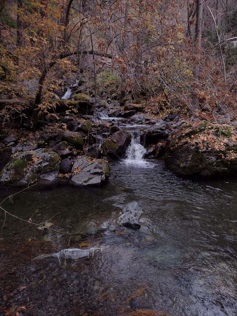
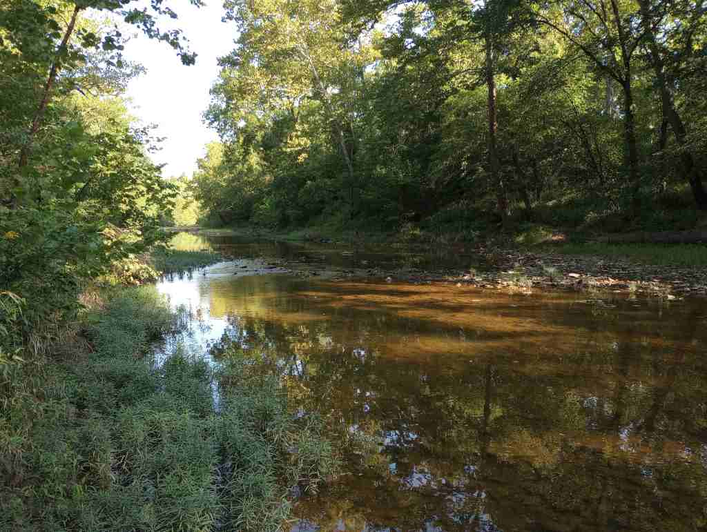
In the 1970s, the more northerly Clark National Forest in Missouri was administratively combined with Mark Twain National Forest, encompassing 11% of the state’s forests across 29 counties. Much of the forest was planted by the Civilian Conservation Corps (CCC), with their work still visible at the Rolla Ranger Station and Winona Ranger Station Historic Districts. Spread across nine separate units throughout southern Missouri’s Ozark Mountains, Mark Twain National Forest’s Karst topography is full of caves, sinkholes, streams, and springs. Greer Spring is the second largest in Missouri with a daily flow of 222-million gallons as it drains 1.25 miles into the Eleven Point National Scenic River. Greer Spring is accessible by a one-mile trail downhill from Highway 19, but no fishing or wading is allowed.
Know someone who loves the National Forests? Gift them our travel guidebook Out in the Woods so they can learn more about this and the 154 other National Forests.
Highlights
Glade Top Trail Scenic Byway, Blue Buck Knob Scenic Byway, Greer Spring, Table Rock Lake, Council Bluff Recreation Area, Overcup Oak Sink, Silver Mine Recreation Area, Bellevue Trail, Cedar Creek Trail, Devil’s Backbone Trail, Ridge Runner National Recreation Trail, Big Piney Trail, Ozark Trail
Must-Do Activity
Most trails in Mark Twain National Forest are open to hikers, mountain bikers, and equestrians, including Ridge Runner National Recreation Trail that totals 33 miles. Two areas at Chadwick and Sutton Bluff are designated for ATV, UTV, and motorcycle use. Fishing is a popular activity on the Eleven Point National Scenic River and numerous lakes, like Noblett Lake and Table Rock Lake. There are so many recreation areas spread around this massive National Forest, it is impossible to cover them all here. We recommend you start with one of the spots listed under Highlights above.
Best Trail
Mark Twain National Forest has several long trails that explore its 78,000 acres of Wilderness areas, including sections of the 350-mile Ozark Trail. Northeast of Branson, Hercules-Glades Wilderness protects 12,413 acres of forested hillsides, limestone outcroppings, and glades of native grasses. There are three trailheads on the edge of the Wilderness, but we chose Blair Ridge because of its paved access 5.3 miles off Highway 160. From a small roadside parking area, the trail follows a ridgeline for 1.2 miles to some excellent backpacking campsites that overlook the countryside before it drops 600 feet in the next mile. At that point the trail intersects with Coy Bald Trail, which can be taken a short distance to a small scenic waterfall on Long Creek.
Watchable Wildlife
The Ozark Mountains provide habitat for common eastern species like white-tailed deer, wild turkeys, gray squirrels, cottontail rabbits, red foxes, and raccoons. You may also encounter venomous copperheads, timber rattlesnakes, and pygmy rattlesnakes. The oak savannahs are home to several endemic plants, as well as prickly pear cacti and animals more associated with the Southwest U.S., like roadrunners, collared lizards, scorpions, and tarantulas. Gamefish include smallmouth bass, largemouth bass, rock bass, walleye, and rainbow trout.
Photographic Opportunity
Between Jefferson City and Columbia, Pine Ridge Recreation Area accesses Cedar Creek Trail, which has multiple trailheads and four loops totaling 36 miles.
Peak Season
Spring and fall
Fees
There are day use fees at several sites, including $5 at Noblett Lake and $2 at Blue Hole Trailhead and North Fork Recreation Area
Road Conditions
Many of the curvy back roads in Mark Twain National Forest are paved, such as Blair Ridge that led to a trailhead 5.3 miles off Highway 160. There are likely some rough unpaved roads in the Ozarks, so check road conditions before departing.
Camping
There are numerous campgrounds in Mark Twain National Forest, although it can be harder to find good dispersed campsites due to the proximity to private land. In the northernmost area outside Columbia, we paid to camp in the quiet Pine Ridge Recreation Area. On the edge of the Hercules-Glades Wilderness at the Hercules Tower (with restrooms) and Coy Bald Trailheads, there are a handful of car camping sites for free.
sweetgum, water tupelo, sugar maple, red maple, boxelder, honeylocust, Ohio buckeye, red buckeye, black cherry, sassafras, persimmon, Kentucky coffee tree, black gum, blackjack oak, Nuttall oak, overcup oak, white oak, black oak, scarlet oak, post oak, black hickory, shagbark hickory, mockernut hickory, bitternut hickory, brookside alder
Explore More – Mark Twain National Forest’s Greer Spring is the second largest natural spring in Missouri, so which one is in first place?
Know someone who loves the National Forests? Gift them our travel guidebook Out in the Woods so they can learn more about this and the 154 other National Forests.
The National Park Service (NPS) administers the Natchez Trace Parkway, a two-lane All-American Road that extends 444 miles from Natchez, Mississippi to Nashville, Tennessee. The trace started as a game trail that was utilized as an American Indian footpath. Some of the mound builder sites protected here were inhabited when Hernando de Soto led the first Europeans into this area in 1540. The Natchez Trace was heavily used in the 1800s by “Kaintuck” flatboatmen returning from New Orleans who left the Mississippi River from Natchez, Mississippi and continued on foot north to Kentucky and beyond. Today you can still follow portions of the sunken trail worn down by travelers for centuries. The parkway began as a Civilian Conservation Corps (CCC) project during the Great Depression and the final two segments were completed in 2005.
Highlights
Rocky Springs, Owens Creek Waterfall, Emerald Mound, Mount Locust, Chickasaw Village, Meriwether Lewis Monument and Gravesite, Cypress Swamp Walk, Witch Dance Horse Trail, Natchez Trace National Scenic Trail
Must-Do Activity
Near Tupelo, the Parkway Visitor Center at Milepost 266 is a must-do stop to learn the history of the trace, and it also serves as the NPS contact station for tiny Brices Cross Roads National Battlefield Site and Tupelo National Battlefield. There are numerous roadside informational pullouts and trailheads along the route, so use the NPS app or pick up an official “unigrid” map. You can easily spend days exploring, but at a minimum we recommend you check out Emerald Mound, Mount Locust, Cypress Swamp, and Meriwether Lewis Monument and Grave Site.
Best Trail
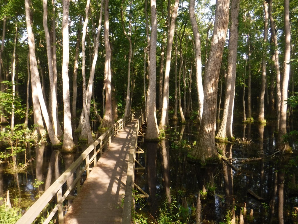
Our favorite trail is the Cypress Swamp Walk at Milepost 122, where a boardwalk crosses a scenic tupelo-baldcypress swamp. The Natchez Trace National Scenic Trail (click here for our blog post) does not follow the entire 444-mile parkway, but exists in five segments totaling 67 miles in length. There are also 15 miles of equestrian trails at Witch Dance (Milepost 233.2) in Tombigbee National Forest.
Photographic Opportunity
Not far from Natchez National Historical Park, Emerald Mound (a short detour at Milepost 10.3) is the second-largest American Indian ceremonial mound in the U.S. It stands 35 feet tall and 770 by 435 feet at its base.
The entire 444-mile Natchez Trace Parkway is paved from Natchez, Mississippi to Nashville, Tennessee with commercial traffic prohibited and a maximum speed limit of 50 miles per hour. There is a detour from Milepost 181 to 204 due to ongoing construction. Watch for bicycles and white-tailed deer on the road.
Camping
There are three free NPS campgrounds (at Milepost 54, 193.1, and 385.9) along the route, as well as those in sites like Mississippi’s Tishomingo State Park. The three NPS campgrounds have water and bathrooms (but no RV hookups), plus there are also five bike-only campsites along the route. Jeff Busby Campground closed in June 2025 for repairs.