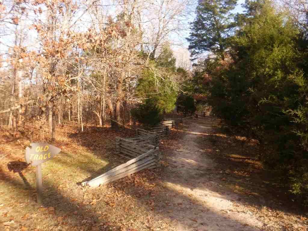
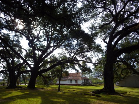
The National Park Service (NPS) administers the Natchez Trace Parkway, a two-lane All-American Road that extends 444 miles from Natchez, Mississippi to Nashville, Tennessee. The trace started as a game trail that was utilized as an American Indian footpath. Some of the mound builder sites protected here were inhabited when Hernando de Soto led the first Europeans into this area in 1540. The Natchez Trace was heavily used in the 1800s by “Kaintuck” flatboatmen returning from New Orleans who left the Mississippi River from Natchez, Mississippi and continued on foot north to Kentucky and beyond. Today you can still follow portions of the sunken trail worn down by travelers for centuries. The parkway began as a Civilian Conservation Corps (CCC) project during the Great Depression and the final two segments were completed in 2005.
Highlights
Rocky Springs, Owens Creek Waterfall, Emerald Mound, Mount Locust, Chickasaw Village, Meriwether Lewis Monument and Gravesite, Cypress Swamp Walk, Witch Dance Horse Trail, Natchez Trace National Scenic Trail
Must-Do Activity
Near Tupelo, the Parkway Visitor Center at Milepost 266 is a must-do stop to learn the history of the trace, and it also serves as the NPS contact station for tiny Brices Cross Roads National Battlefield Site and Tupelo National Battlefield. There are numerous roadside informational pullouts and trailheads along the route, so use the NPS app or pick up an official “unigrid” map. You can easily spend days exploring, but at a minimum we recommend you check out Emerald Mound, Mount Locust, Cypress Swamp, and Meriwether Lewis Monument and Grave Site.
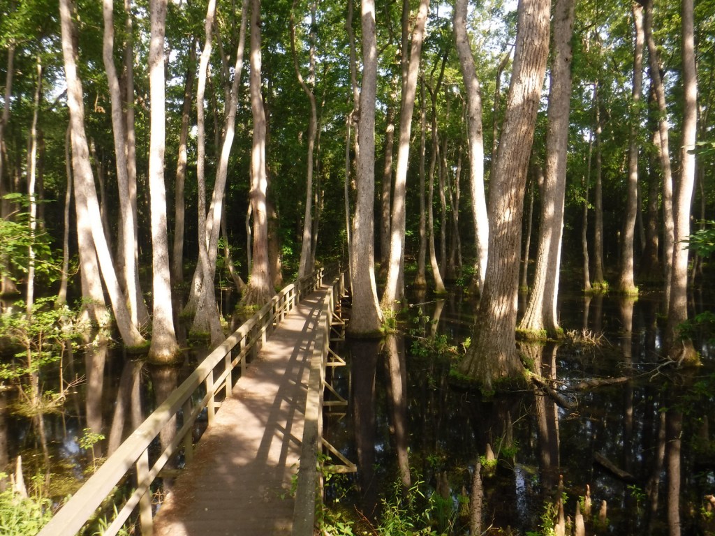
Best Trail
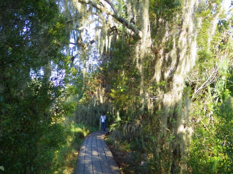
Our favorite trail is the Cypress Swamp Walk at Milepost 122, where a boardwalk crosses a scenic tupelo-baldcypress swamp. The Natchez Trace National Scenic Trail (click here for our blog post) does not follow the entire 444-mile parkway, but exists in five segments totaling 67 miles in length. There are also 15 miles of equestrian trails at Witch Dance (Milepost 233.2) in Tombigbee National Forest.
Photographic Opportunity
Not far from Natchez National Historical Park, Emerald Mound (a short detour at Milepost 10.3) is the second-largest American Indian ceremonial mound in the U.S. It stands 35 feet tall and 770 by 435 feet at its base.
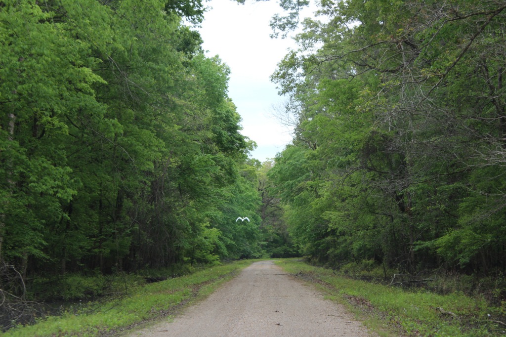
The entire 444-mile Natchez Trace Parkway is paved from Natchez, Mississippi to Nashville, Tennessee with commercial traffic prohibited and a maximum speed limit of 50 miles per hour. There is a detour from Milepost 181 to 204 due to ongoing construction. Watch for bicycles and white-tailed deer on the road.
Camping
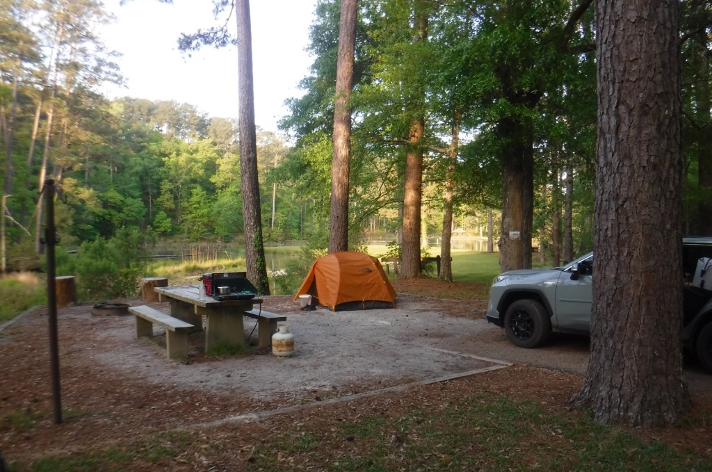
There are three free NPS campgrounds (at Milepost 54, 193.1, and 385.9) along the route, as well as those in sites like Mississippi’s Tishomingo State Park. The three NPS campgrounds have water and bathrooms (but no RV hookups), plus there are also five bike-only campsites along the route. Jeff Busby Campground closed in June 2025 for repairs.
Last year we published our guidebook 50 States of Great: Road Trip Guide to America, so we decided to start a new type of blog post where we create a travel itinerary for all 50 states, in addition to our usual National Forest and National Park entries. After starting by jumping around to Kansas, Georgia, Idaho, Rhode Island, Minnesota, Hawai’i, and Arizona, we headed back to the south for Louisiana. Just in time for Mardi Gras, we made an ambitious seven-day plan starting in New Orleans, with plenty of options to extend the trip.
Eating beignets is a great way to start your trip to Louisiana, and this is the most touristy place to get them, located on the Riverwalk in New Orleans.
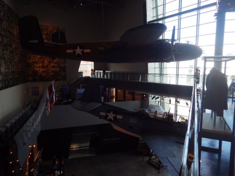
It is easy to spend an entire day here (fee) because of all the interactive exhibits and informational touchscreen kiosks. You do not even have to leave for lunch, since the Soda Shop and American Sector Restaurant & Bar are on site. We recommend you purchase a ticket including the 4-D film Beyond All Boundaries and the submarine experience based on the final mission of the USS Tang. This is our vote for #1 museum in the entire U.S.
French Quarter
Every American needs to visit the French Quarter at least once in their life (although whether that’s during the wildness of Mardi Gras is up to you), and it is walkable from the National WWII Museum. Consider stopping by iconic Lafayette Square, Old Ursuline Convent Museum, or the New Orleans Pharmacy Museum.
Ghost Tour
We have heard rave reviews about the ghost tours offered in New Orleans, and hope to attend one someday to compare it to the others we have done.
We camped here and it felt like we were off in the wild while still within the city’s suburbs.
Day 2
New Orleans Jazz National Historical Park
The New Orleans Jazz Museum (fee) is located in the old U.S. mint building right in the heart of the historic French Quarter. Check the online schedule for musical performances put on by the National Park Service (NPS) and enter the free visitor center shared with Jean Lafitte National Historical Park and Preserve.
Go out to lunch in New Orleans
Louisiana is famous for its Cajun food, including gumbo, étouffée, jambalaya, po’boys, and red beans and rice.
Make sure you visit the 24,000-acre Barataria Preserve to experience the bayous of Louisiana, whether you hike or take a boat tour (fee). South of downtown New Orleans off Highway 45, keep your feet dry by hiking the boardwalks on the Bayou Coquille Trail. In addition, this park includes three Acadian Cultural Centers spread throughout southwestern Louisiana.
Optional stop at Chalmette Battlefield
Another part of Jean Lafitte National Historical Park and Preserve encompasses the land where Andrew Jackson led the defeat of the British to retain New Orleans for the U.S. after the end of the War of 1812.
Day 3
Baton Rouge
Check out the art-deco capitol building where you might see white pelicans floating on the lake next door. We read that the pelican on the state flag is supposed to be a brown pelican (the official state bird) even though the artist made it white so it stood out against the blue background. Also consider visiting the Old State Capitol, Old Governor’s Mansion, or USS Kidd destroyer ship.
Optional drive along the Lake Ponchartrain Causeway
Not the most direct route between New Orleans and the capital city, this 23.8-mile causeway is considered the longest continuous bridge over water in the world. It is free to drive northbound, but don’t attempt it when it’s smoky or foggy, as it becomes very dangerous to drive.
Optional stop at LSU Tigers game
Louisiana State University is located in Baton Rouge and they are famous for their tailgating scene and raucous fans who support their perennially excellent football, women’s basketball, and gymnastics teams.
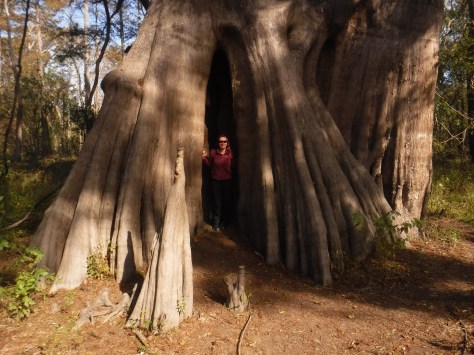
Northwest of Baton Rouge, the largest of all baldcypress trees in the U.S. is found at the end of a flat, half-mile trail, where there is a new boardwalk built around the tree to protect its roots. This area is located down six miles of dirt road full of potholes (and is sometimes flooded).
Louisiana is home to 24 National Wildlife Refuges, many found in its southern half where bayous are full of alligators and mostly uninhabited by humans, like this one west of Baton Rouge.
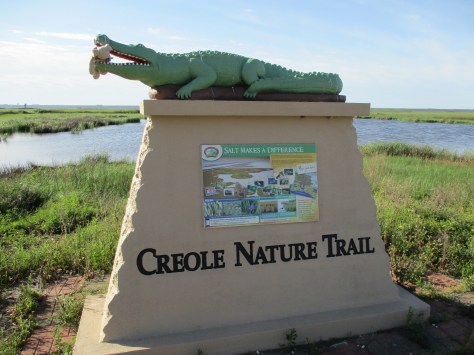
In southwest Louisiana, this route traverses 180 miles of pavement around Calcasieu Lake and the Gulf of Mexico coastline. Much of the state’s oceanfront is inaccessible swamp, but in this corner of the state there are 26 miles of beautiful sandy beaches where ocean waves and seashells await. Consider spending the night in Holly Beach.
Further inland, there are 700,000 acres of wetlands that attract waterfowl to Sabine National Wildlife Refuge, while the surrounding area is used by farmers to grow rice and raise crawfish.
There are eight parcels that constitute the sprawling 603,360-acre Kisatchie National Forest, which has over 40 developed recreation sites and 100 miles of trails. It encompasses lakes for boating and swimming, plus baldcypress-lined bayous for canoeing and fishing. Old-growth longleaf pine forests can be accessed by the paved Longleaf Trail Scenic Byway, just off Interstate 49. A 1.5-mile interpretive loop at Longleaf Vista is a good place to start.
Red Dirt National Wildlife Management Preserve
Camping is allowed in this area next to the 8,700-acre Kisatchie Hills Wilderness where you can backpack along trails. Kisatchie National Forest also offers several lakefront camping areas elsewhere. Lake Fausse Pointe, Lake Bistineau, and Chicot State Parks all have campgrounds with lake access, as well cabins available for rent.
The Creole Nature Trail Adventure Point is a self-guided audio tour and starts off Interstate 10 in Sulphur, where a museum has hands-on displays that introduce visitors to local wildlife and Cajun culture.
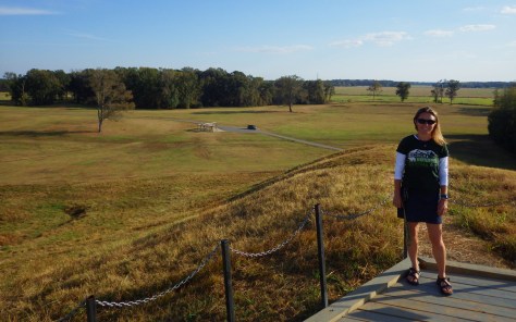
Settled 3,700 years ago by hunter-gatherers, this ancient city with a population estimated at 1,500 was situated along Bayou Macon in northeast Louisiana. The inhabitants constructed several mounds, the most impressive is 72-feet-tall in the shape of a bird, which required approximately 15-million basket-loads of soil to complete.
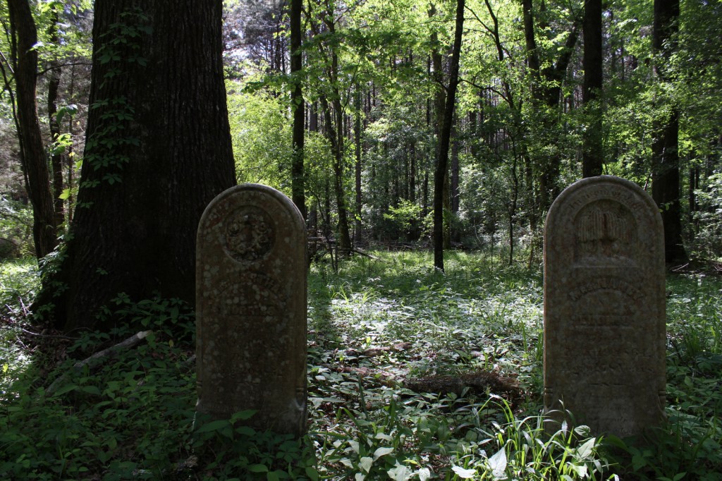
Oakland Plantation survived the Civil War intact, but in the wake of Reconstruction tenant farming created a new form of indentured servitude. Self-guided tours of the site take you through the mule barn, several cottages, and an old general store that still looks open for business along Highway 494. Slave/tenant quarters are also preserved at Magnolia Plantation downstream, but the main house is closed to the public.
Festivals dedicated to celebrating and eating frogs and crawfish; it does not get any more Louisiana than that! Also, consider arriving during one of the many music festivals dedicated to jazz, zydeco, or other regional musical styles.
An annual battle reenactment takes place at the site of a siege during the Civil War; further north, another Civil War reenactment is held at Pleasant Hill.
This forested Wildlife Management Area is located between Monroe and Alexandria in central Louisiana. It includes Rock Falls, which at 17 feet in height is the tallest waterfall in the state, accessible on a seven-mile trail.
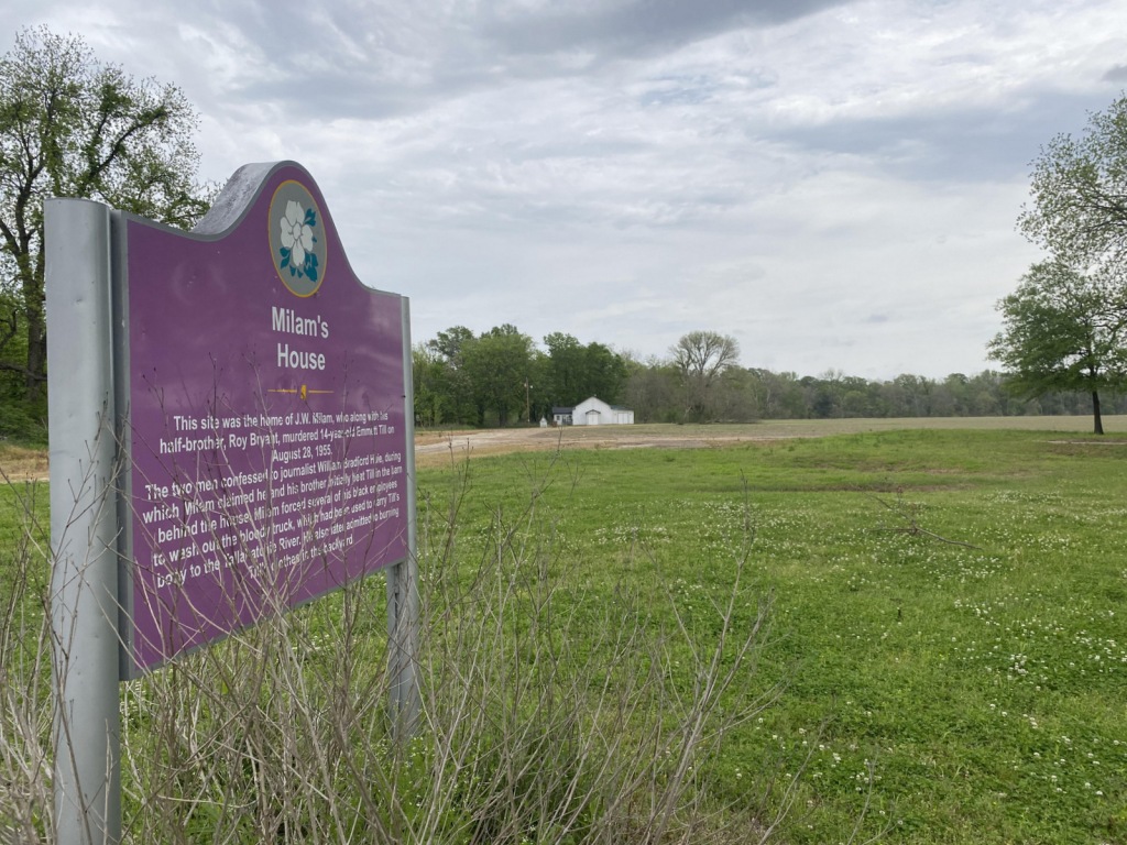
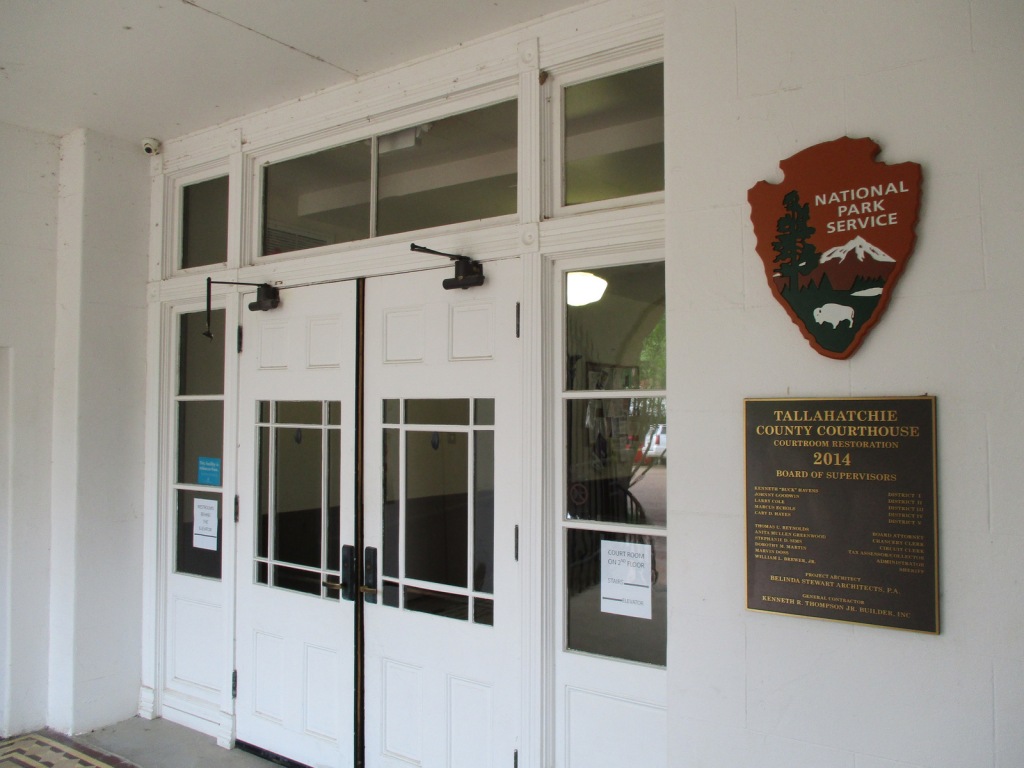
In 1955, 14-year-old Emmett “Bo” Till left Chicago to visit family in Mississippi, where he whistled at Carolyn Bryant, a white woman who ran the Bryant’s Grocery & Meat Market in the town of Money. A few nights later on August 28, Carolyn’s husband (Roy Bryant) and his half-brother (John William “J.W.” Milam) abducted Emmett Till from his relatives’ house. They took Emmett to Milam’s farm where he was tortured and killed according to their admission in Look magazine a year later. After Till’s body was recovered at Graball Landing and sent back to Chicago for a funeral, a five-day trial took place in Sumner’s Tallahatchie County Courthouse where Bryant and Milam were acquitted of the crime. It is probably not a coincidence that the National Monument was proclaimed by President Joe Biden following the release of the 2022 film Till. Not open to the public but also part of the National Monument in Illinois, the Roberts Temple Church of God in Christ in the Chicago neighborhood of Bronzeville is where Mamie Till-Mobley insisted on an open-casket funeral service so the public could see the terrible results of the murder. Historians believe the outcry over this lynching of a 14-year-old boy helped lead to the Civil Rights Act of 1957.
Highlights
Emmett Till Interpretive Center, Tallahatchie County Courthouse, Emmett Till Historic Intrepid Center (ETHIC), Black Bayou Bridge, Graball Landing, Greenwood statue, Bryant’s Grocery site
Must-Do Activity
Emmett Till Historic Intrepid Center (ETHIC) is located in a former cotton gin near the site of Emmett Till’s torture and murder on the farm of “J.W.” Milam in Glendora, Mississippi. Established in 2005, there is an atmosphere to the museum that bears the full weight of history, heightened by the short introductory video showing Emmett Till’s family members’ recollections of the events of 1955. Inside, there is a recreation of the Bryant’s Grocery & Meat Market storefront, as well as a coffin with the prop used in the film Till depicting Emmett’s shockingly disfigured head. The museum also has artifacts highlighting the Mississippi Delta’s history with slavery, indigenous people, and blues music (specifically Sonny Boy Williamson II). Although not part of the National Monument, we recommend a half-hour drive south to Money to see the ruins of Bryant’s Grocery & Meat Market with a restored gas station next door, part of the Mississippi Freedom Trail.
Best Trail
From ETHIC, drive or walk to the Black Bayou Bridge where Emmett “Bo” Till’s body was dumped into the Black Bayou tied to a heavy fan from the cotton gin. We were grateful to get a personal tour from Tamita Davis who helps run ETHIC. It is also a short drive down a dirt road to Graball Landing on the Tallahatchie River where there is a small interpretive sign explaining it as the site Till’s body was recovered.
Instagram-worthy Photo
The National Park Service operates out of the Emmett Till Interpretive Center, located in a strip mall opposite the Tallahatchie County Second District Courthouse in Sumner, Mississippi. It has limited hours, but the courtroom where the September 1955 trial was held was unlocked when we visited on a Tuesday morning.
$12 per adult at ETHIC, $5 donation recommended at Emmett Till Interpretive Center
Road Conditions
Paved roads lead to the Tallahatchie County Courthouse in Sumner and Emmett Till Historic Intrepid Center (ETHIC) in Glendora, where a gravel road in good shape leads to Graball Landing.
Camping
To the south, Delta National Forest offers online reservations for campsites (September through March when the forest is not seasonally flooded).
Related Sites
Medgar and Myrlie Evers Home National Monument (Mississippi)
Birmingham Civil Rights National Monument (Alabama)
Emmett Till Historic Intrepid Center (ETHIC) in Glendora, MSScott at reconstructed Bryant’s Grocery inside ETHICCopy of Look magazine articleTamita Davis with Scott and his aunt on Black Bayou BridgeBlack BayouScott on Black Bayou BridgeGlendora, MSRoad to Graball LandingGraball LandingRestored gas station in Money, MSRemnants of Byant’s Grocery in Money, MSTallahatchie County Courthouse in Sumner, MSEmmett Till Interpretive Center in Sumner, MSEmmett Till Interpretive Center in Sumner, MSTallahatchie County CourthouseTallahatchie County CourthouseTallahatchie County CourthouseTallahatchie County CourthouseFarm fields around Sumner, MS
Explore More – A statue of Emmett Till was added in 2022 to Greenwood, Mississippi’s Rail Spike Park, but what city in Colorado has his statue alongside one of Dr. Martin Luther King, Jr.?
In southwest Mississippi, Homochitto National Forest is comprised of former cotton fields purchased and replanted with trees by the federal government in the 1930s. It is named for the 90-mile-long Homochitto (“huh-mah-CHIT-ah”) River that runs through the forest on its way to the Mississippi River south of Natchez. All six National Forests in Mississippi are managed as one administrative unit, including Bienville, De Soto, Delta, Holly Springs, Homochitto, and Tombigbee National Forests. The Homochitto district ranger station is located in Meadville.
Highlights
Clear Springs Lake Recreation Area, Pipes Lake Recreation Area, Mt. Nebo Recreation Area, Stephenson Lookout Tower, Pellucid Bayou, Brushy Creek Loop, Tally’s Creek Trail, Richardson Creek Trail
Must-Do Activity
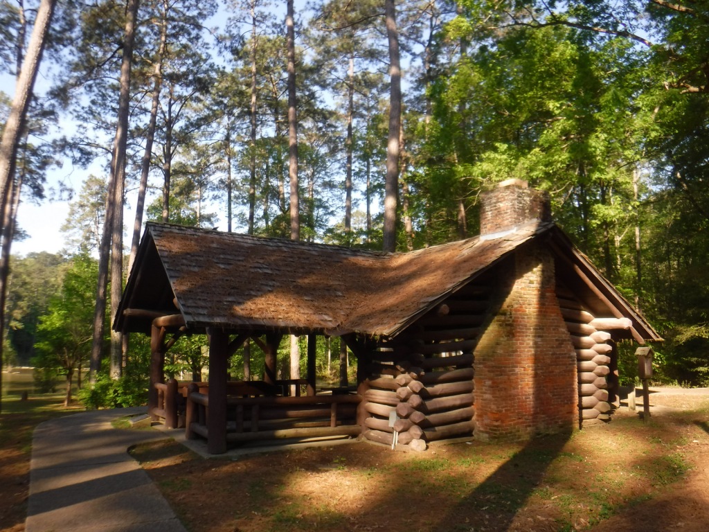
Homochitto National Forest has developed facilities at three small lakes: Clear Springs, Pipes, and Mt. Nebo. A one-mile trail encircles scenic Clear Springs Lake, which has a picnic shelter built by the Civilian Conservation Corps (CCC) in 1935 listed on the National Register of Historic Places. Elsewhere, Brushy Creek Loop is a 5.7-mile horse trail that is not recommended for hikers due to abundant mud and manure.
Best Trail
Just north of the Clear Springs Lake Campground is a trailhead (fee) for three long hiking trails, also maintained for mountain biking. Only the 10-mile-long Richardson Creek Trail was open during our visit with Tally’s Creek (10.8 miles) and Mill Branch (5.6 miles) closed due to downed trees. The route was well-marked with red blazes and had several nice bridges as it wound through the forested hills around Richardson Creek.
Watchable Wildlife
Clear Springs Lake has a sign warning of alligators, but we did not see any reptiles other than painted turtles. While camping overnight we heard what possibly was a frog making an interesting call that sounded like a lightsaber from Star Wars. Birds we spotted were a wild turkey, cardinal, goldfinch, and tufted titmouse. It is likely the National Forest allows hunting for white-tailed deer, wild turkey, ducks, and invasive wild pigs. Fishing for largemouth bass, catfish, and other species is allowed at Clear Springs, Pipes, and Mt. Nebo Lakes.
Instagram-worthy Photo
The picnic shelter at Clear Springs Lake was built by the Civilian Conservation Corps (CCC) in 1935 and is listed on the National Register of Historic Places.
Peak Season
Spring and fall
Fees
Clear Springs Lake Recreation Area charges a day use fee of $5 per vehicle or half price with the America the Beautiful pass.
Road Conditions
The road is paved to Clear Springs Lake, about 32 miles east of Natchez.
Camping
There is a nice campground with showers on Clear Springs Lake, accessed by a paved road four miles south of Highway 84. Campsites with hookups cost $20 per night and those without cost $7.
In western Mississippi, the U.S. Forest Service manages the entirety of Delta National Forest as Sunflower Wildlife Management Area through a Memorandum of Understanding with the state of Mississippi. The Big and Little Sunflower Rivers run through these bottomland hardwood forests west of the Yazoo River, flooding the landscape throughout the summer. This is the only National Forest preserving bottomland hardwood forests, which have primarily been converted to agriculture due to their rich soil. It was in Delta National Forest that the idea for the Teddy Bear was born in 1902, when President Theodore Roosevelt refused to shoot a tethered black bear while hunting.
Highlights
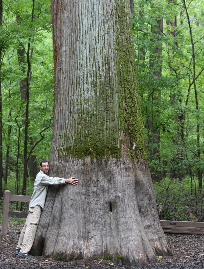
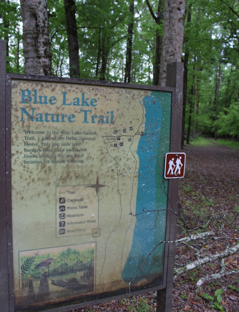
Blue Lake Recreation Area, Kay Cypress Tree, Lost Lake, Howlett Bayou, Green Ash-Overcup Oak-Sweetgum Research Natural Areas, Rock Bottom Trail
Must-Do Activity
This National Forest is unique because it is flooded throughout the summer, so it is primarily used from September through March. All vehicles must display a free Daily Visitor Use Permit and all ATV, horse, and bike riders must carry a pass (fee) on the multi-use trails. The Yazoo-Mississippi Delta (or simply “the Delta”) is a distinct section of western Mississippi renowned for its blues musicians. Throughout this area, there are blues clubs and museums dedicated to preserving the memories of Muddy Waters, B.B. King, Bessie Smith, and others.
Best Trail
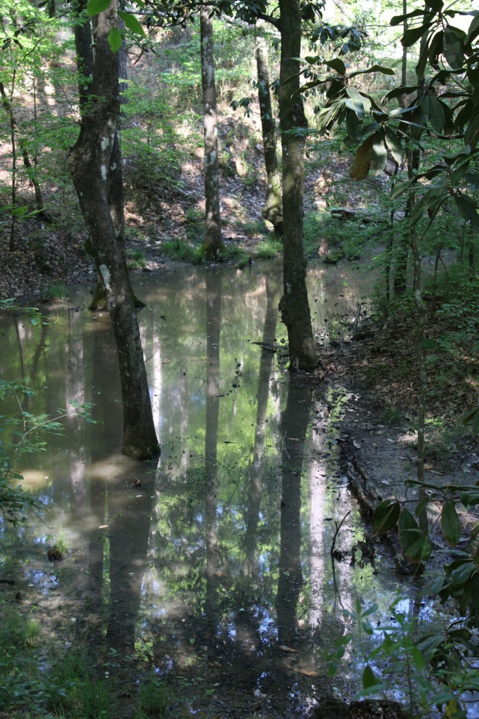
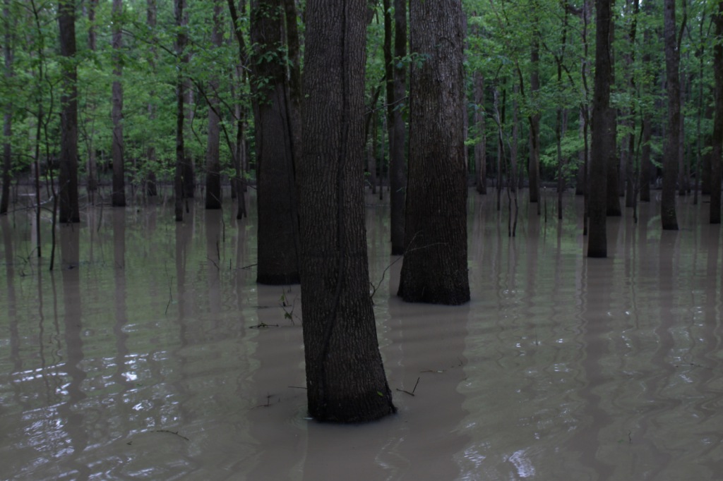
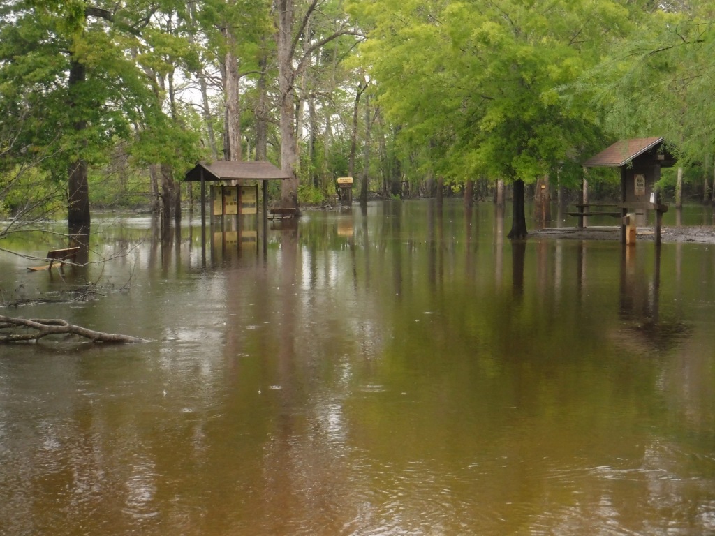
Delta National Forest has two main developed areas at Blue Lake and the Little Sunflower River, with Blue Lake Nature Trail and Rock Bottom Trail found at these sites respectively. Both were flooded during our April visit, so in lieu of hiking, we opted to launch our inflatable kayak and paddle around Blue Lake to get up close to some huge baldcypress trees.
Watchable Wildlife
Declared National Natural Landmarks in 1976, the Green Ash-Overcup Oak-Sweetgum Research Natural Areas are rare examples of pristine bottomland hardwood forests. To improve wintering waterfowl conditions, three of the five greentree reservoirs are pumped and over 100 acres are planted as wildlife food plots. Established in 1978, the neighboring Panther Swamp National Wildlife Refuge is one of seven refuges in the Theodore Roosevelt National Wildlife Refuge Complex. The forest’s white-tailed deer herd is in very good condition, as are the numbers of wild turkeys, fox squirrels, swamp rabbits, river otters, raccoons, and American alligators. The forest is known for its 32 different species of butterflies that congregate in July, with an average population of 21,000.
Instagram-worthy Photo
Across from Blue Lake on unpaved Fire Tower Road, be sure to stop at the Kay Cypress Tree, which is more than ten feet in diameter.
Peak Season
Winter
Fees
All vehicles in Sunflower Wildlife Management Area must display a free Daily Visitor Use Permit and all ATV, horse, and bike riders must carry a pass (fee) on the multi-use trails.
Road Conditions
Fire Tower Road is unpaved, but was flat and above floodwater levels during our April visit, as was the road atop the dike along the Little Sunflower River.
Camping
Camping is only allowed at 57 primitive sites with a permit obtainable online ($7 per night fee).
Scott’s mother on Blue LakeBlue LakeBlue LakeA flooded Blue Lake Nature TrailWhite egret on Fire Tower RoadDesignated campsite flooded in summerDesignated campsiteLittle Sunflower RiverRock Bottom Trail flooded in summerBlue Lake nesting box
Nuttall’s oak, overcup oak, cherrybark oak, willow oak, water oak, bur oak, swamp chestnut oak, water hickory, sweetgum, boxelder, swamp red maple, American elm, green ash, sugarberry, September elm, honeylocust, pecan, black gum, red mulberry, persimmon, deciduous holly, swamp dogwood
Explore More – What was the name of the legendary hunting guide and woodsman who found and tied up the black bear that Teddy Roosevelt refused to shoot in 1902?
Learn more about this and the 154 other National Forests in our new guidebook Out in the Woods
We are a participant in the Amazon Services LLC Associates Program, an affiliate advertising program designed to provide a means for us to earn fees by linking to Amazon.com and affiliated sites.
Start your U.S. National Parks, National Forests, and National Monuments adventure here!