Tag Archives: history

Colville National Forest

Colville National Forest

Washington

Managed by U.S. Forest Service, Pacific Northwest Region

1,029,617 acres (954,409 federal/ 75,208 other)

Website: https://www.fs.usda.gov/colville

Overview

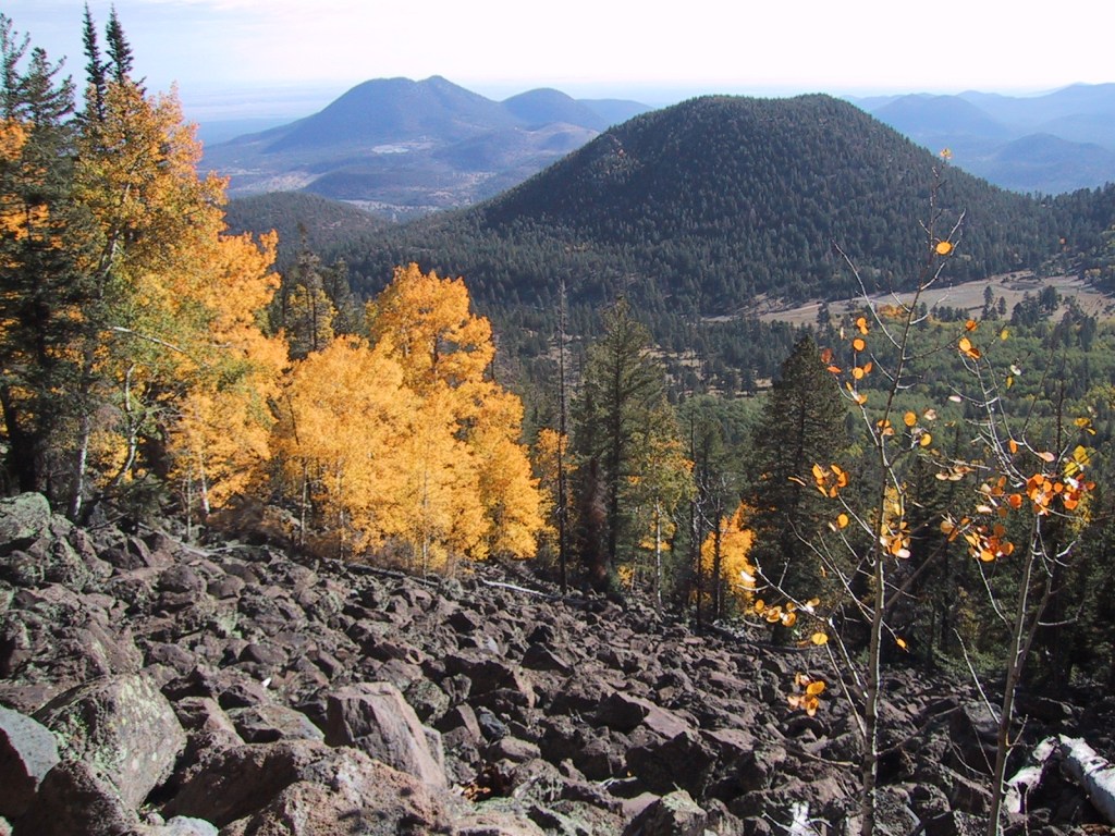
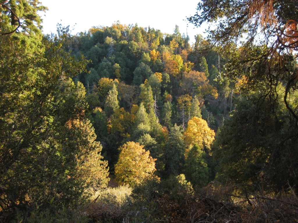
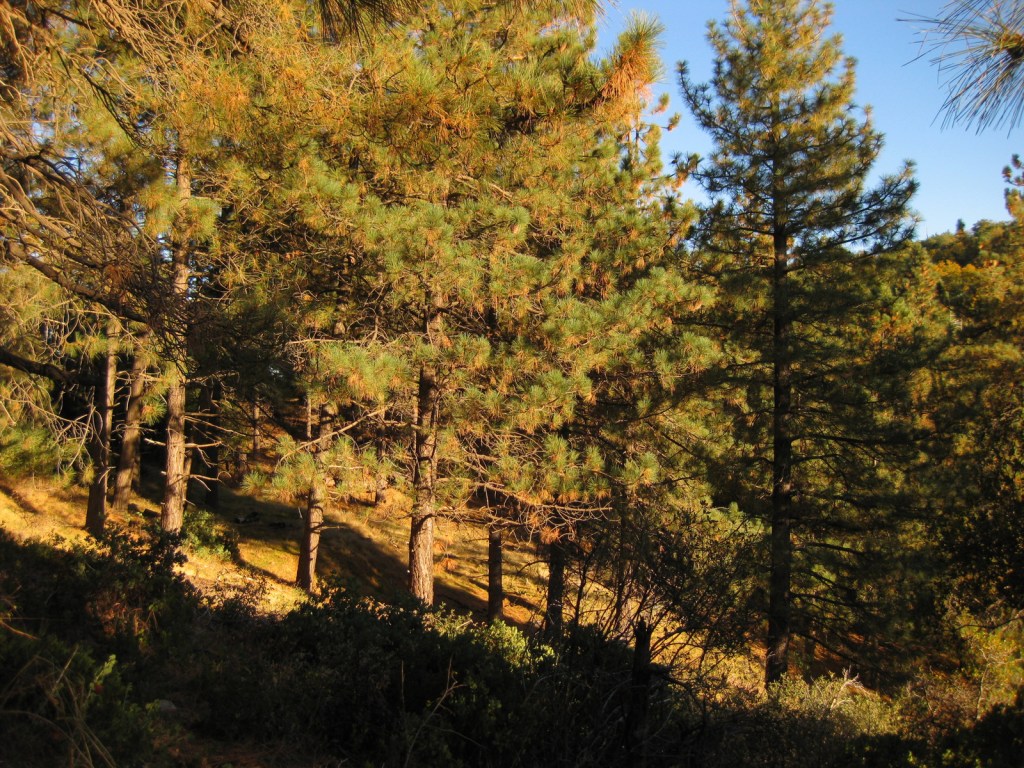
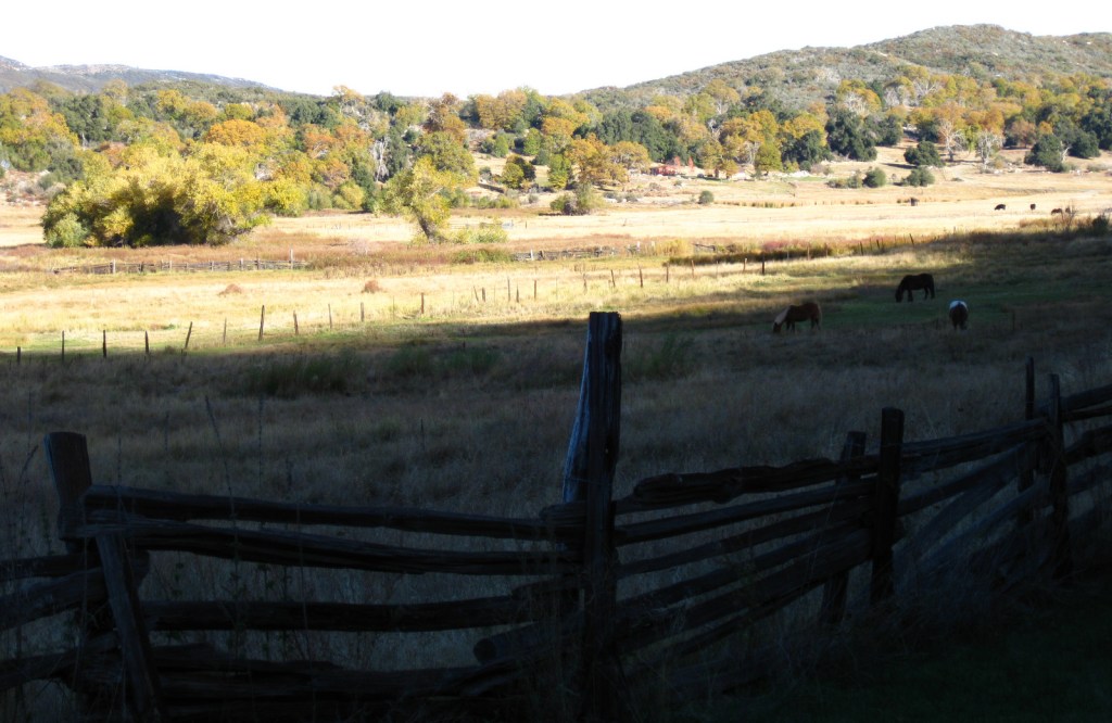
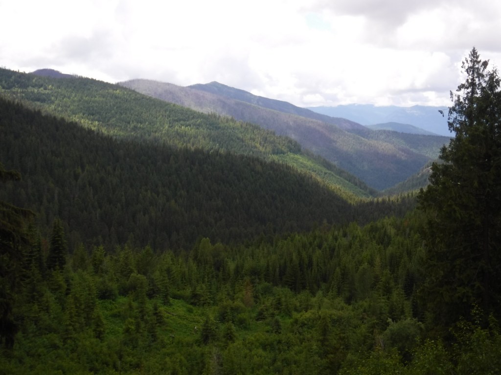
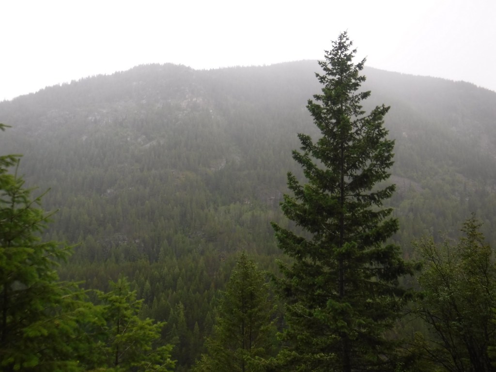
In northeast Washington, Colville National Forest is divided into two sections on either side of the Columbia River.  In the west are the Kettle River Mountains, which are crossed by Sherman Pass Scenic Byway (Highway 20).  To the east, the remote Selkirk Mountains contain the Salmo-Priest Wilderness that spills over into Kaniksu National Forest.  Colville National Forest also borders Little Pend Oreille National Wildlife Refuge and Lake Roosevelt National Recreation Area.

Highlights

Sherman Pass Scenic Byway, Pewee Falls, Sullivan Lake, Marble Creek Falls, Trout Lake, Kettle Creek National Recreation Trail, Crowell Ridge Trail, Sherman Creek Trail, Grassy Top National Recreation Trail, Brown’s Lake Interpretive Trail, Pacific Northwest National Scenic Trail

Must-Do Activity

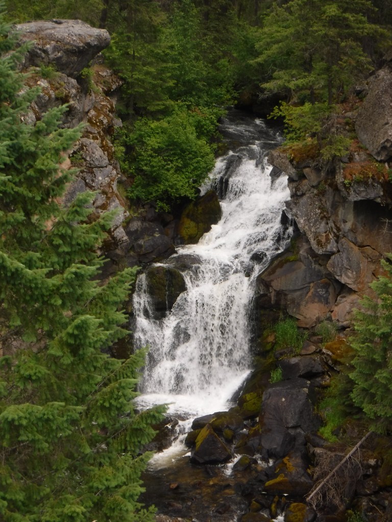
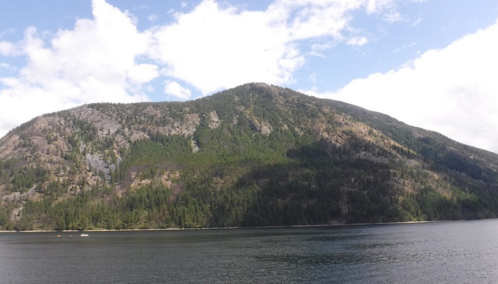
In the Selkirk Mountains east of the Pend Oreille River, the large Sullivan Lake is a scenic spot for boating and camping.  Designated in 1978, the Sullivan Lake National Recreation Trail runs 4.3 miles between the two campgrounds located at either end of the lake.  Colville National Forest is also known for 200-foot-tall Pewee Falls that cascades into the Boundary Dam Reservoir near the Canadian border, but we did not make it up there.

Best Trail

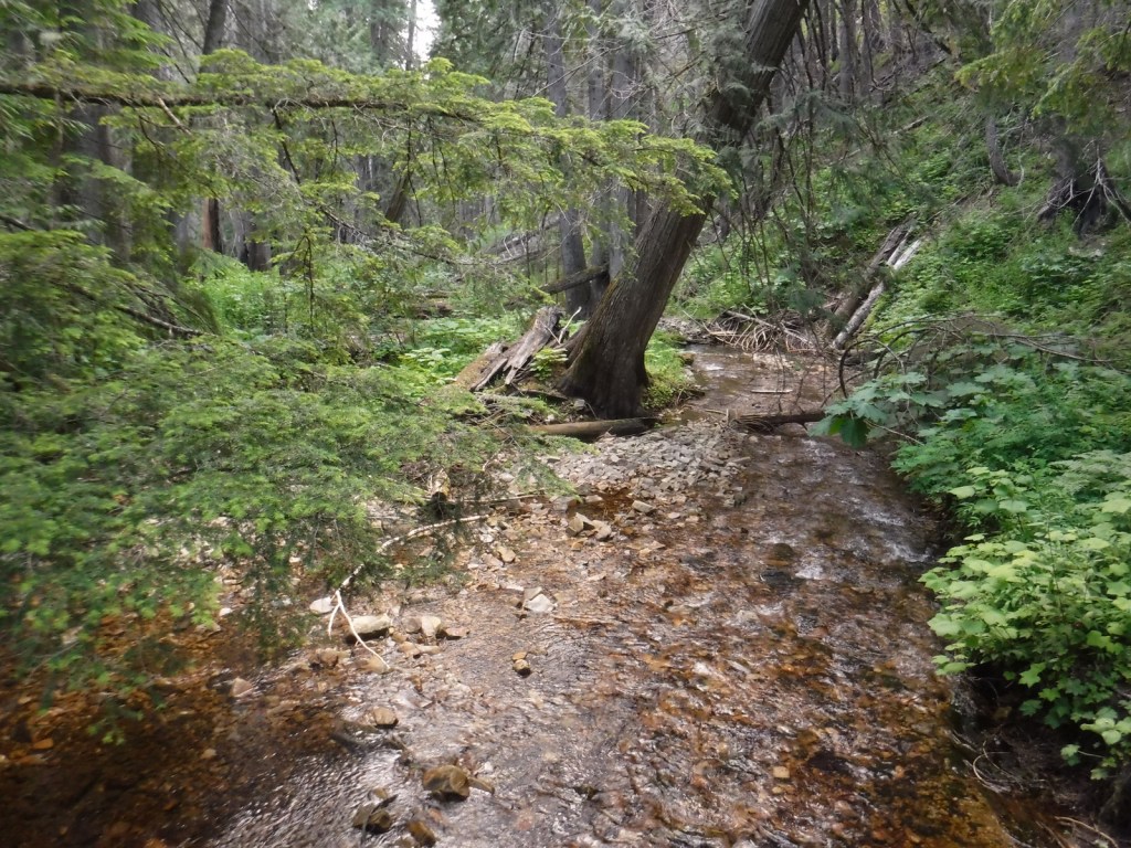
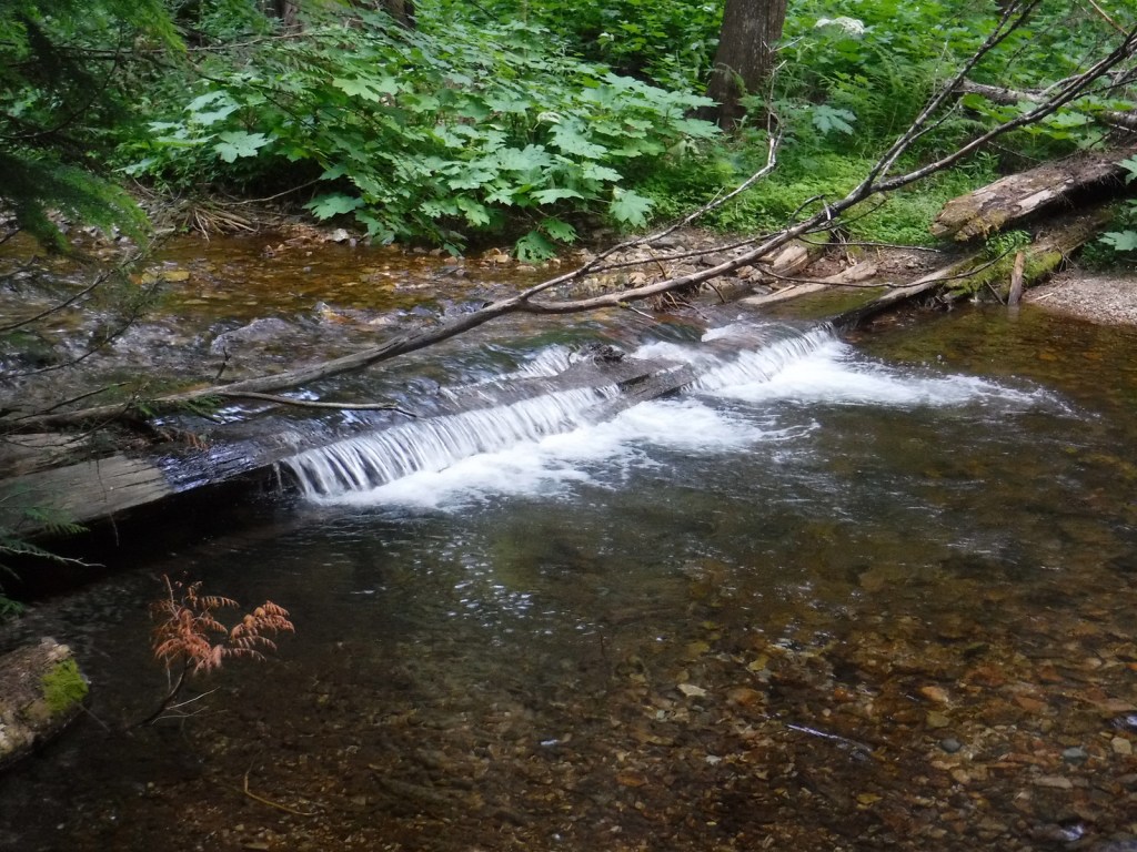
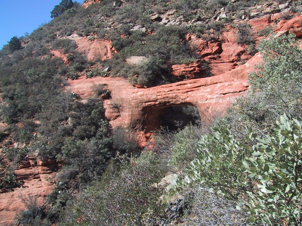
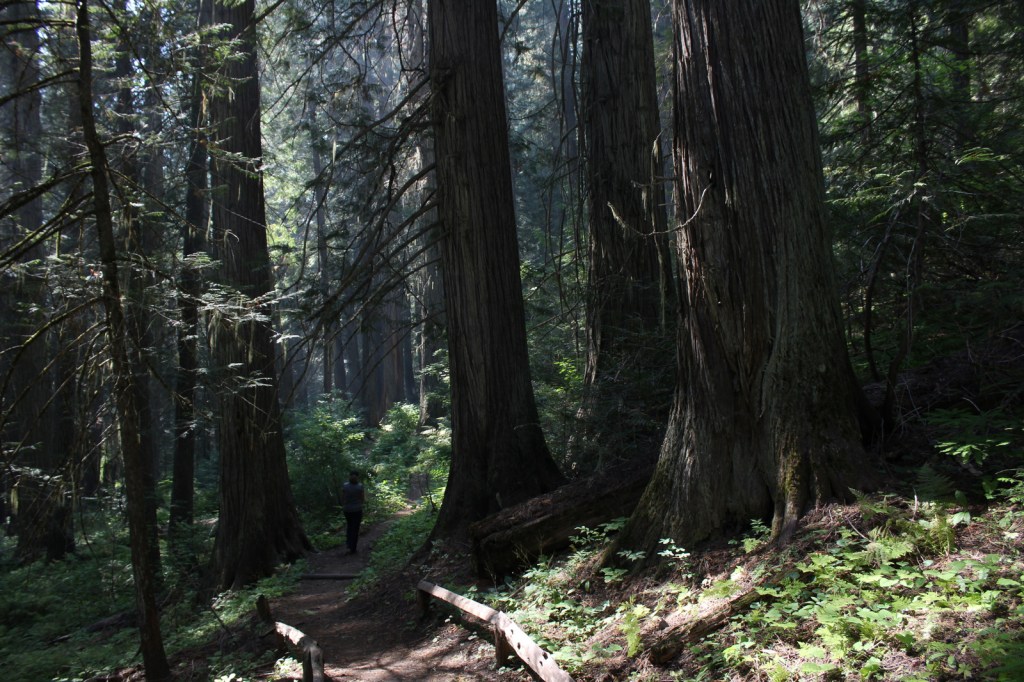
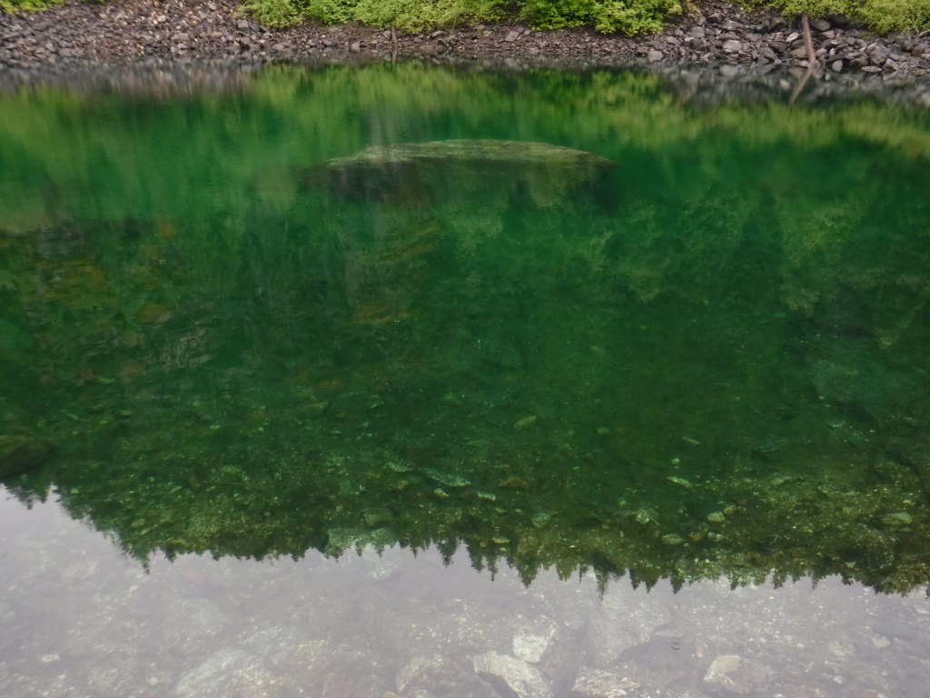
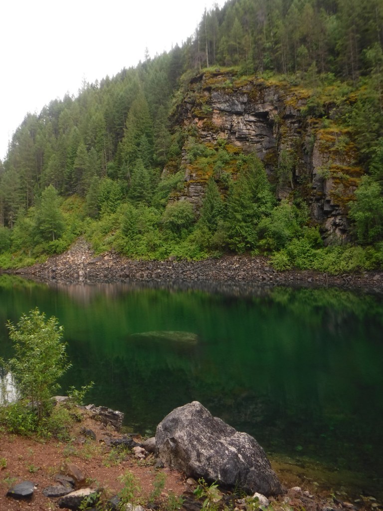
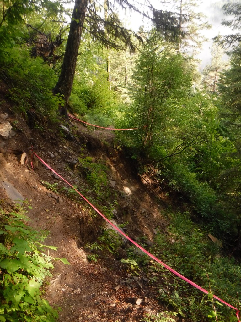
Hoodoo Canyon Trail is 4.8 miles one-way and accessible from two trailheads, one on unpaved Deadman Creek Road and the other at Trout Lake Campground, which is five miles from the Sherman Pass Scenic Byway.  We started out in the rain from our dispersed campsite along Deadman Creek Road and the trail soon made a steep climb through a dense conifer forest.  Eventually the route leveled out and we got our first view of shamrock green Emerald Lake, so we took a well-worn path down to its shoreline.  The trail was officially closed at the 3.2-mile point due to a small landslide (see photo), but it was not hard to navigate past that spot to gain a view of Trout Lake, at which point we turned around.
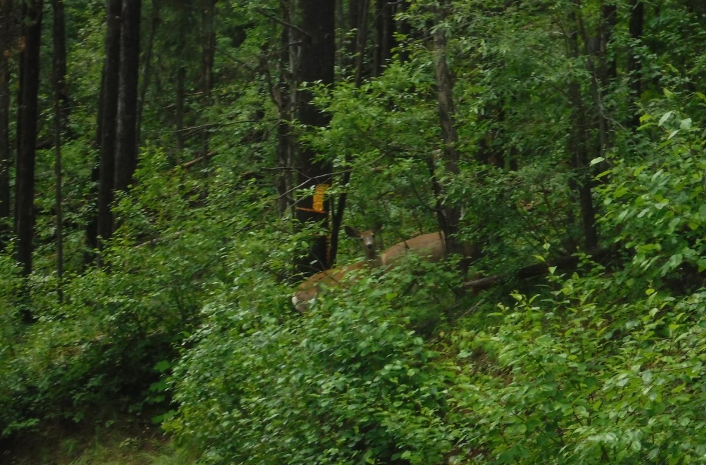
Watchable Wildlife

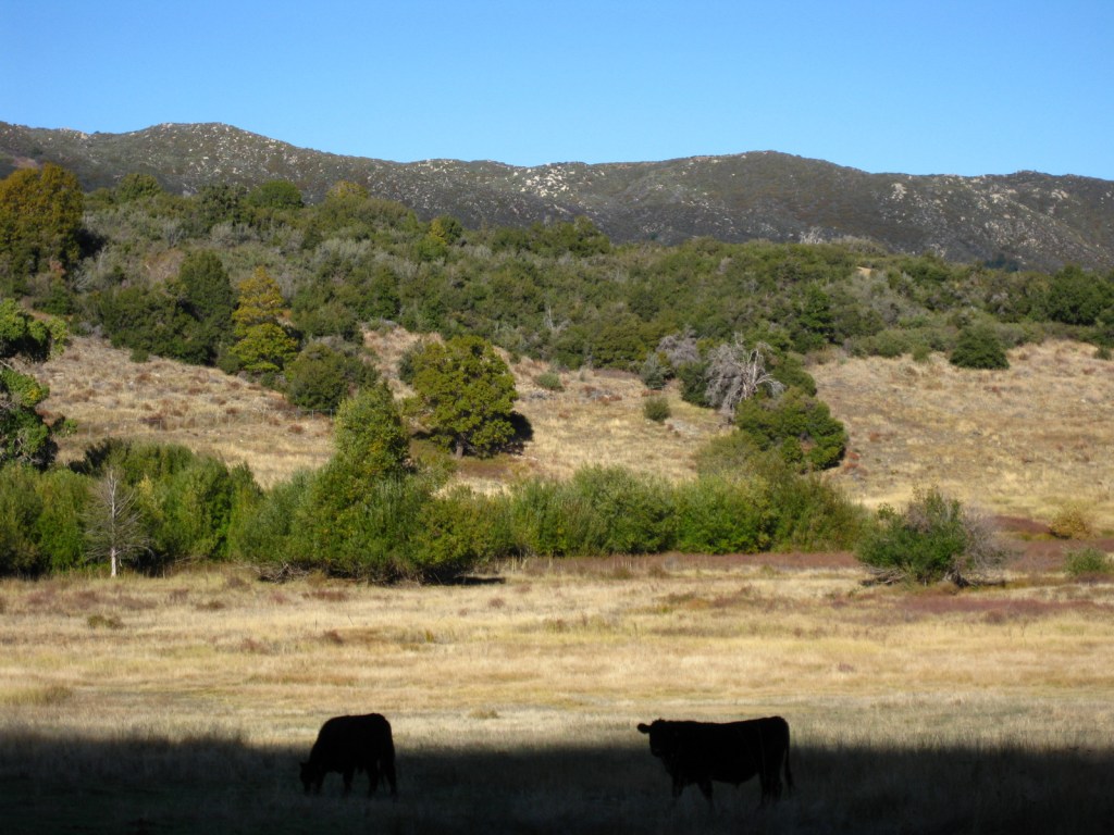
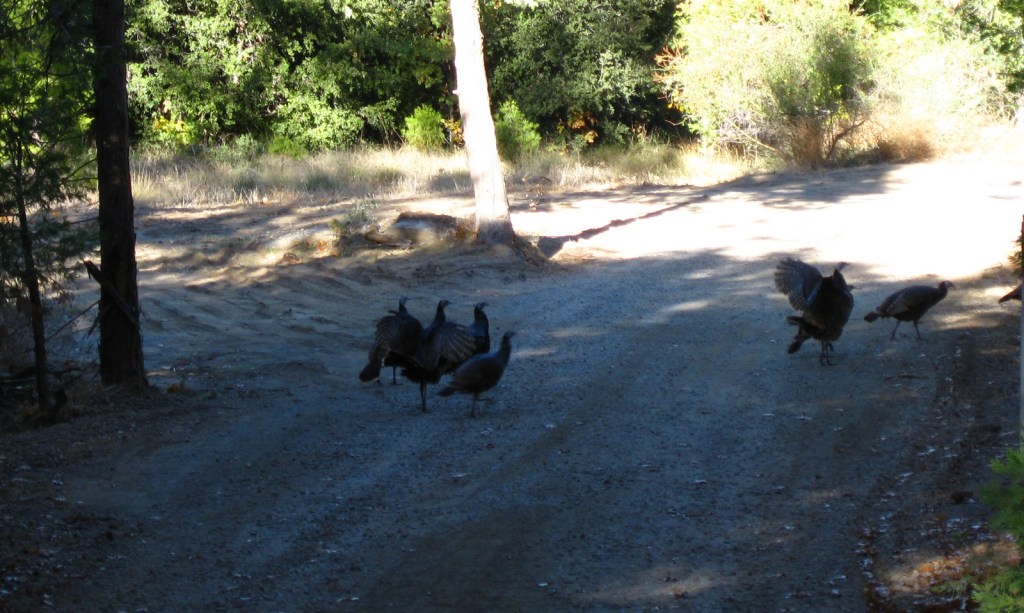
The remote Selkirk Mountains represent the sole place south of Canada where there is a herd of mountain caribou.  Grizzly bears, Canadian lynx, mountain lions, and gray wolves also inhabit this wild borderland region.  More common species include mule deer, bighorn sheep, moose, beavers, bald eagles, and loons.

Instagram-worthy Photo

The water of Emerald Lake truly lives up to its gem of a name, even on a cloudy day.

Peak Season

Summer

Fees

None

Road Conditions

Sherman Pass Scenic Byway (Highway 20) is paved, but most the roads we drove through Colville National Forest were unpaved but in very good condition.

Camping

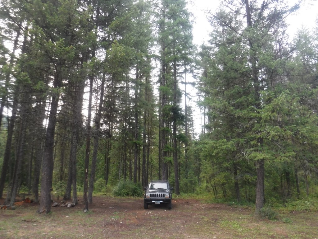
Trout Lake Campground seemed like a nice spot, secluded but only five miles off the Sherman Pass Scenic Byway.  We found many excellent dispersed campsites along the unpaved portions of Deadman Creek Road.

Wilderness Areas

Salmo-Priest Wilderness (also in Kaniksu National Forest)

Related Sites

Lake Roosevelt National Recreation Area (Washington)

Ross Lake National Recreation Area (Washington)

Lake Chelan National Recreation Area (Washington)

Nearest National Park

North Cascades

Conifer Tree Species

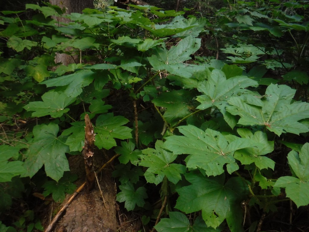
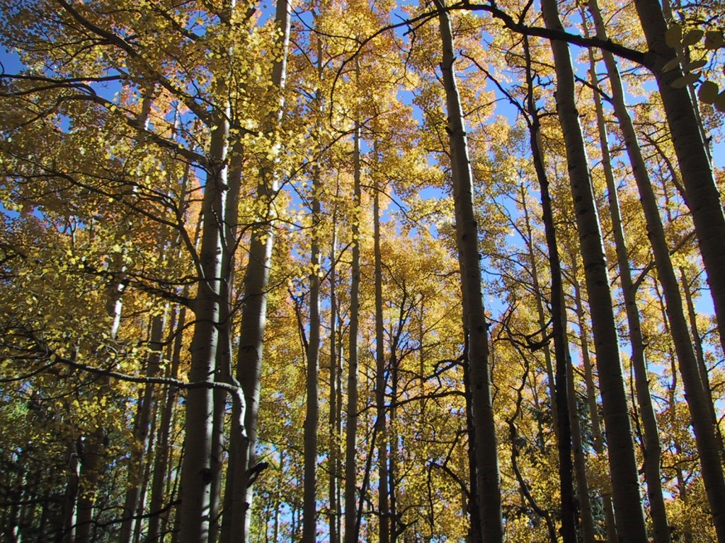
Douglas-fir, grand fir, subalpine fir, lodgepole pine, western larch, western redcedar

Flowering Tree Species

syringa, quaking aspen, Pacific dogwood, red alder, balsam poplar, dwarf birch, paper birch, Piper’s hawthorn, boxelder, Bebb willow, western mountain-ash, choke cherry, western serviceberry, red alder, mountain alder

Explore More – Who was Andrew Colvile, other than the man that Fort Colville [sic] was misnamed for in 1825?

Learn more about this and the 154 other National Forests in our new guidebook Out in the Woods

We are a participant in the Amazon Services LLC Associates Program, an affiliate advertising program designed to provide a means for us to earn fees by linking to Amazon.com and affiliated sites.

Coeur d’Alene National Forest

Coeur d’Alene National Forest

Idaho

Managed by U.S. Forest Service, Northern Region

801,759 acres (725,797 federal/ 75,962 other)

Website: https://www.fs.usda.gov/ipnf/

Overview

Coeur d’Alene National Forest is located on both sides of Interstate 90, east of the city of Coeur d’Alene, which was the French name given to the indigenous people.  In 1973, it was joined with Kaniksu and St. Joe National Forests to form Idaho Panhandle National Forests.  A good base for exploration, Wallace is a silver mining boomtown that refused to die despite its close call during the infamous Big Burn of 1910 (read more about it and the Pulaski Tunnel in Timothy Egan’s book).  On the Montana border, Lookout Pass Ski Area provides permits, equipment rentals, and shuttles for the famous Route of the Hiawatha bicycling trail (that is technically in St. Joe National Forest).

Highlights

Lake Hayden, Lookout Pass, Prichard Bridge, Stevens Lake, Willow Creek Falls, Steamboat Rock, Grassy Mountain Lookout, Lake Hayden, Settler’s Grove of Ancient Cedars, Pulaski Tunnel Trail

Must-Do Activity

North of Wallace, a good dirt road follows the West Fork of Eagle Creek to the Settler’s Grove of Ancient Cedars.  This 173-acre stand contains western redcedar trees up to seven feet in diameter, as well as large western hemlocks.  Fire has burned through the understory of this grove freeing nutrients for a lush growth of ferns and devil’s-club.  Look for a geocache near the sign that reads “end of Cedar Grove Trail” and points uphill to Trail No. 162, which continues another three miles.

Best Trail

The Idaho Centennial Trail follows the mountainous Idaho-Montana border on the eastern side of Coeur d’Alene National Forest, although it does dip west to cross Interstate 90 near the town of Mullan.  The old Mullan Road was cut through this rugged area in 1859-61; the terrain was so steep that workers had to construct 47 bridges to cover a distance of only 28 miles. 

Watchable Wildlife

Coeur d’Alene National Forest is home to mule deer, elk, moose, black bears, bobcats, coyotes, and mountain lions.  This close to Canada, it is also possible to find grizzly bears and gray wolves.  Common large birds include ospreys, golden eagles, bald eagles, wild turkeys, and ravens.  Although the National Forest does not encompass Lake Coeur d’Alene, it does contain many of the rivers and creeks that feed it, which provide incredible fishing opportunities.

Instagram-worthy Photo

There are some impressive western redcedar trees growing in the Settler’s Grove of Ancient Cedars.

Peak Season

Summer

Fees

None

Road Conditions

Even the paved roads we drove north of Wallace were slow going—very steep with hairpin switchbacks.  Once we got on the unpaved road following the West Fork of Eagle Creek, it was wide and flat.  We drove through Coeur d’Alene National Forest to access Bullion Pass on a four-wheel-drive-only road up a steep three-mile-long grade about a mile west (on a paved frontage road) from the Dena Mosa-Lookout Pass Rest Area on eastbound Interstate 90.

Camping

There are campgrounds located throughout the National Forest, including Mokins Bay Campground on Hayden Lake and Bell Bay Campground on Lake Coeur d’Alene.  We found a good dispersed campsite along the West Fork of Eagle Creek on the road to the Settler’s Grove of Ancient Cedars.

Wilderness Areas

None

Related Sites

Challis National Forest (Idaho)

Clearwater National Forest (Idaho)

Nez Perce National Historical Park (Idaho-Oregon-Montana)

Nearest National Park

Glacier

Conifer Tree Species

western redcedar, Engelmann spruce, lodgepole pine, western white pine, Douglas-fir, western hemlock, grand fir, subalpine fir, Pacific yew, western larch

Flowering Tree Species

quaking aspen, Pacific dogwood, red alder, balsam poplar, dwarf birch, paper birch, Piper’s hawthorn, boxelder, Bebb willow, western mountain-ash, choke cherry, western serviceberry, red alder, mountain alder

Explore More – How did the Coeur d’Alene tribe get its French name?

Learn more about this and the 154 other National Forests in our new guidebook Out in the Woods

We are a participant in the Amazon Services LLC Associates Program, an affiliate advertising program designed to provide a means for us to earn fees by linking to Amazon.com and affiliated sites.

Coconino National Forest

Coconino National Forest

Arizona

Managed by U.S. Forest Service, Southwestern Region

2,013,804 acres (1,855,955 federal/ 157,849 other)

Website: https://www.fs.usda.gov/coconino/

Overview

Coconino National Forest has an elevation range of 10,000 feet from the Verde River up to 12,637-foot Mt. Humphreys, the highest point in Arizona.  It borders four other National Forests: Kaibab, Prescott, Sitgreaves, and Tonto.  The National Forest encompasses two busy recreational areas: the red rocks around Sedona and the San Francisco Peaks north of Flagstaff.  While in college for three years at Northern Arizona University, Scott probably hiked 100 different trails and more than 1,000 miles through Coconino National Forest.  He and his Siberian husky would often wake up early to get a hike in before class, including one moonlit summiting of Mt. Humphreys completed in time for an 8 a.m. lecture. See where it ended up on our list of Top 10 Summit Trails in National Forests.

Highlights

Oak Creek Canyon, Bell Rock, Vultee Arch, Cathedral Rock, Sycamore Canyon, Honanki Ruins, Wet Beaver Creek, San Francisco Peaks, Mt. Humphreys, Lockett Meadow, Mt. Elden, West Clear Creek, Upper Lake Mary, West Fork Trail, Kachina Trail, Bear Jaw Canyon Trail, Dixon Lewis Trail

Must-Do Activity

North of Sedona is the deep, shady Oak Creek Canyon that houses a diversity of plant species, including riparian trees like sycamore and walnut.  The steep, forested walls make for beautiful scenery, but also create ideal conditions for crown fires as evidenced in 2006 and 2014.  The steep Wilson Mountain South Trail #10 provides extraordinary panoramas and the shady West Fork Trail #108 is perfect on hot summer days, though in the winter it is also beautiful covered in snow and ice.  The remains of the historic lodge and orchard at the latter site provide a glimpse into the past of a place immortalized in Zane Grey’s novel The Call of the Canyon.  Continue driving north up Highway 89A for unforgettable hairpin turns that lead to Oak Creek Vista and on to Flagstaff.

Best Trail

The San Francisco Peaks are the remains of an extinct volcano that forms the dramatic mountain skyline north of Flagstaff.  You cannot actually see the highest summit (12,637-foot Mt. Humphreys) from town, but you will if you drive Highway 180 toward Grand Canyon National Park.  The shortest route to the top leaves from 8,800 feet at Arizona Snowbowl Ski Resort and is nine miles roundtrip.  For the more adventurous: start on the Inner Basin Trail from Lockett Meadow (now requires three-mile hike on closed road), hike 19 miles roundtrip via the Weatherford Trail, or tack on seven miles to Snowbowl on the scenic Kachina Trail.  The San Francisco Peaks are beautiful (especially when aspen trees turn in the fall), but can be dangerous during thunderstorms that occur almost every afternoon during monsoon season.   Nostalgia may have been a factor in naming this #1 on the list of Top 10 National Forests for Day Hiking.

Watchable Wildlife

Elk are the most prevalent charismatic megafauna in Coconino National Forest, although mule deer and pronghorns are also common.  We have encountered black bears in the San Francisco Peaks and rattlesnakes in Sycamore Canyon.  Tassel-eared squirrels are the noisiest residents of the ponderosa pine forests, enough so that Bertie the talking squirrel became the main character in the children’s book Scott illustrated while working for the Ecological Restoration Institute at Northern Arizona University.

Instagram-worthy Photo

The cliff dwelling in Sedona’s Lost Canyon is in a beautiful spot overlooking a wide green valley that cuts between the red rock buttes and escarpments.  There is water in this narrow canyon, feeding the tall Arizona cypress trees below.  Just outside the cave, juniper trees offered firewood, pinyon pine produced edible nuts, and yucca plants provided thread for its former residents.  To the north numerous canyons drain the ponderosa pine forests where elk and mule deer reside in the summer.

Peak Season

Summer

Fees

A day-use fee applies at nearly every trailhead in Sedona, but an America the Beautiful pass can be substituted. A $6 online reservation per vehicle is required to park at Dixon Lewis (formerly Waterfall) Trail to Fossil Creek from April 1 to October 1.

Road Conditions

Most of the dirt roads through Coconino National Forest are well maintained, especially around Sedona.  One exception to that is Woody Mountain Road that requires high-clearance once you get past the first 20 miles or so towards the Mogollon Rim above Sycamore Canyon.

Camping

Lockett Meadow Campground is special place that came in at #4 on our Top 10 Campgrounds in National Forests list.  However, camping there now requires a three-mile hike up the road since it closed following the Pipeline Fire (which does mean you are more likely to get a campsite). The coveted campsites in Oak Creek Canyon on scenic Highway 89A are full throughout the summer and fall (online reservations available).

Wilderness Areas

Fossil Springs Wilderness

Kachina Peaks Wilderness

Kendrick Mountain Wilderness (also in Kaibab National Forest)

Mazatzal Wilderness (also in Tonto National Forest)

Munds Mountain Wilderness

Red Rock-Secret Mountain Wilderness

Strawberry Crater Wilderness

Sycamore Canyon Wilderness (also in Prescott and Kaibab National Forests)

West Clear Creek Wilderness

Wet Beaver Wilderness

Related Sites

Sunset Crater Volcano National Monument (Arizona)

Montezuma Castle National Monument (Arizona)

Walnut Canyon National Monument (Arizona)

Nearest National Park

Petrified Forest

Conifer Tree Species

ponderosa pine, limber pine, Rocky Mountain bristlecone pine, two-needle pinyon pine, Douglas-fir, subalpine fir, white fir, Engelmann spruce, alligator juniper, one-seed juniper, Utah juniper, Rocky Mountain juniper, Arizona cypress

Flowering Tree Species

Gambel oak, quaking aspen, New Mexico locust, boxelder, bigtooth maple, Arizona sycamore, Arizona walnut, Arizona alder, velvet ash

Explore More – What is largest natural lake in the state of Arizona, which is found atop Coconino National Forest’s Anderson Mesa (although it is often dried up in the summer)?

Learn more about this and the 154 other National Forests in our travel guidebook Out in the Woods

Cleveland National Forest

Cleveland National Forest

California

Managed by U.S. Forest Service, Pacific Southwest Region

568,634 acres (439,281 federal/ 129,353 other)

Website: https://www.fs.usda.gov/cleveland

Overview

In southwestern California, Cleveland National Forest was established in 1908 and named for the U.S. President who added 21-million acres to the Forest Reserve system in the 1890s.  The National Forest is notable for its Mediterranean climate and low elevation (its highest point is 6,271-foot Monument Peak).  Most of its acreage is chaparral, not forest, making it more prone to frequent wildfires.  Despite its proximity to San Diego and the densely-populated Pacific Coastline, it contains four designated Wilderness areas. 

Highlights

Sunrise Scenic Byway, Henshaw Scenic Vista, Monument Peak, Three Sisters Falls, Laguna Mountain Recreation Area, Cedar Creek Falls, Sunset Trail, Noble Canyon National Recreation Trail, Agua Tibia Trail, San Juan Loop Trail, Desert View Nature Trail, Pioneer Mail Trail, Observatory Trail

Must-Do Activity

Located ten miles north of Highway 76, Palomar Mountain is best known as the home of Caltech’s Palomar Observatory, which was established in 1928.  It is open daily for tours of the A.W. Greenway Jr. Visitor Center and the 200-inch Hale Telescope, which reigned as the world’s largest from 1949 until 1975.  Two miles downhill is the Forest Service’s Observatory Campground and the trailhead for the 2.2-mile one-way Observatory National Recreation Trail.  An Adventure Pass is required to park here, but not if you start at the observatory.  The trail gains about 900 feet in elevation as it climbs through an oak-pine forest to the Palomar Observatory (that sits at 5,598 feet in elevation) providing views of the Mendenhall Valley. 

Best Trail

The Sunset Trail makes a 4.6-mile loop from the Meadows Trailhead at mile marker 19 on the Sunrise Scenic Byway.  The trail provides a view of the Pacific Ocean after passing meadows, ponds, and oak savannahs. 

Watchable Wildlife

Despite its proximity to the San Diego metropolitan area, Cleveland National Forest is home to black bears, gray foxes, bobcats, and mountain lions.  Black-tailed deer, bighorn sheep, wild turkeys, and coyotes are more likely to be encountered by visitors.

Instagram-worthy Photo

Look for acorn woodpeckers’ seed caches riddled into some of the Jeffrey pine trees in the forest.

Peak Season

Winter

Fees

An Adventure Pass is required to park at several trailheads (including the Observatory Trail) throughout the National Forest, but an America the Beautiful pass can be substituted.

Road Conditions

The Sunrise Scenic Byway and the road to Palomar Observatory are both paved, although there are many unpaved routes through the National Forest.

Camping

Two miles downhill from the Palomar Observatory is the Forest Service’s Observatory Campground, a great place to stay if you plan to attend a star party on moonless nights.  Palomar Mountain State Park also has a campground.

Wilderness Areas

Agua Tibia Wilderness (also run by the Bureau of Land Management)

Hauser Wilderness

Pine Creek Wilderness

San Mateo Canyon Wilderness

Related Sites

Channel Islands National Park (California)

Cabrillo National Monument (California)

Mojave National Preserve (California)

Nearest National Park

Joshua Tree

Conifer Tree Species

Jeffrey pine, Coulter pine, white fir, California juniper, Arizona cypress, Tecate cypress

Flowering Tree Species

Engelmann oak, coast live oak, California black oak, manzanita

Explore More – Who was the U.S. President that established the first 13-million acres of Forest Reserves starting in 1891, prior to Grover Cleveland?

Learn more about Cleveland and the 154 other National Forests in our new guidebook Out in the Woods

We are a participant in the Amazon Services LLC Associates Program, an affiliate advertising program designed to provide a means for us to earn fees by linking to Amazon.com and affiliated sites.

Clearwater National Forest

Clearwater National Forest

Idaho

Managed by U.S. Forest Service, Northern Region

1,722,132 acres (1,679,952 federal/ 42,180 other)

Website: https://www.fs.usda.gov/nezperceclearwater

Overview

In central Idaho, Clearwater National Forest was established in 1908 and administratively combined with Nez Perce National Forest in 2012.  A great place to start is the Forest Service visitor center at Lolo Pass on the Idaho-Montana border southwest of Missoula, where you will learn about the Corps of Discovery’s visit in 1805.  Elsewhere, the North Fork of the Clearwater River ends in the Dworshak Reservoir where a separate section of the National Forest can be explored on the White Pine Scenic Byway and Elk River Backcountry Byway.  The latter accesses Giant Cedar Grove and Elk Creek Falls, which is three separate waterfalls totaling a 140-foot drop.

Highlights

White Pine Scenic Byway, Lolo Pass, Lolo Motorway, DeVoto Memorial Grove, Colgate Licks, Jerry Johnson Hot Springs, Shoestring Falls, Elk Creek Falls, Giant Cedar Grove, Aquarius Natural Area, Nez Perce (Nee-Me-Poo) National Historic Trail, and Lewis and Clark National Historic Trail, Down River Trail, Beason Meadows National Recreation Trail

Must-Do Activity

Most of the recreational activity in Clearwater National Forest occurs along the Northwest Passage Scenic Byway (Highway 12), which runs west from the Lolo Pass visitor center along the Lochsa National Wild and Scenic River.  The legendary dirt road called the Lolo Motorway (see below) can be accessed from several points along this route.  Both the famous Jerry Johnson Hot Springs and the smaller Weir Creek Hot Springs are reachable from roadside trailheads.  Also along Highway 12, short trails lead through the DeVoto Memorial Grove of western redcedars and Colgate Licks mineral springs.

Best Trail

From parking areas on both sides of Highway 12, it is only about a one-mile easy walk to Jerry Johnson Hot Springs where multiple pools can be found creekside and uphill at the source.  The trail continues along Warm Springs Creek into the Selway-Bitterroot Wilderness and beyond. 

Watchable Wildlife

The North Fork of the Clearwater and the Lochsa Rivers provide habitat for fish and water-loving animals like moose, raccoons, river otters, muskrats, beavers, fishers, ospreys, and bald eagles.  The mountains are home to elk, mule deer, mountain goats, black bears, martens, red foxes, gray wolves, and mountain lions.

Instagram-worthy Photo

A short trail leads through the DeVoto Memorial Grove of western redcedars, named for author Bernard DeVoto.

Peak Season

Summer

Fees

None

Road Conditions

The scenic 73-mile Lolo Motorway is a single-lane, dirt road that tracks both the Nez Perce (Nee-Me-Poo) and Lewis and Clark National Historic Trails.  Also labeled Forest Road 500, it follows a ridgeline north of the Lochsa River and several steep access roads climb to meet it from Highway 12.  High-clearance vehicles (or motorcycles) are a must and four-wheel drive is required on the rougher western end of the route.  Driving up Parachute Hill Forest Road 569 and down Saddle Camp Forest Road 107 makes for a good four-hour loop with short stops at the Indian Post Office and Devils Chair.

Camping

Although it is close to Highway 12, the pleasant Jerry Johnson Campground is one of several campgrounds found along the Lochsa National Wild and Scenic River and located only a short drive from the trailhead for the hot springs.

Wilderness Areas

Selway-Bitterroot Wilderness (also in Bitterroot, Nez Perce, and Lolo National Forests)

Related Sites

Challis National Forest (Idaho)

Big Hole National Battlefield (Montana)

Nez Perce National Historical Park (Idaho-Oregon-Montana)

Nearest National Park

Glacier

Conifer Tree Species

western redcedar, western larch, grand fir, subalpine fir, Douglas-fir, Engelmann spruce, western white pine, ponderosa pine, lodgepole pine, limber pine, whitebark pine, Pacific yew, Rocky Mountain juniper

Flowering Tree Species

quaking aspen, Pacific dogwood, red alder, balsam poplar, paper birch, Piper’s hawthorn

Explore More – What famous group built the 73-mile-long Lolo Motorway in the 1930s?

Learn more about Clearwater and the 154 other National Forests in our new guidebook Out in the Woods

We are a participant in the Amazon Services LLC Associates Program, an affiliate advertising program designed to provide a means for us to earn fees by linking to Amazon.com and affiliated sites.