Tag Archives: driving tour

Little Bighorn Battlefield National Monument

Montana

Managed by National Park Service

Established 1879

765 acres

Website: www.nps.gov/libi

Overview

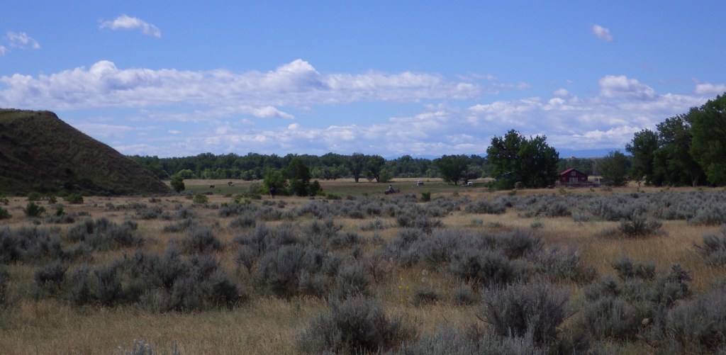
You may not recall the 1876 battle at the Little Bighorn River in southern Montana, but most Americans (even children) recognize its label “Custer’s Last Stand.”  For such a relatively minor skirmish in the bloody 1800s, it has an outsized legend that only grows with time.  At this site more than 140 years ago, a large portion of the 7th U.S. Cavalry met their demise for tactical reasons still debated to this day.  The blame is generally placed upon Lieutenant Colonel George Armstrong Custer who was believed to be jockeying for a presidential nomination in the 1876 election.  Today this National Park Service (NPS) site is located on the Crow Indian Reservation in southern Montana, just off Interstate 90.

Know someone who loves exploring new National Monuments? Gift them our book Monumental America: Your Guide to All 138 National Monuments that is available for sale on Amazon.com.

Highlights

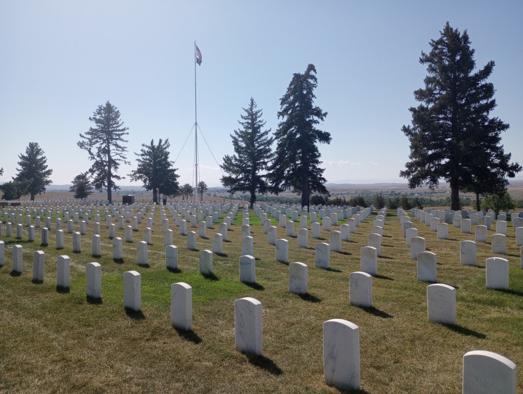
Museum, Custer National Cemetery, driving tour, Last Stand Hill, Indian Memorial

Must-Do Activity

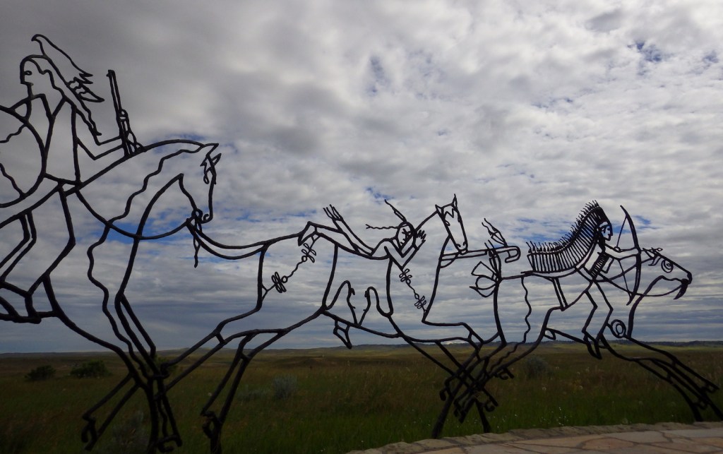
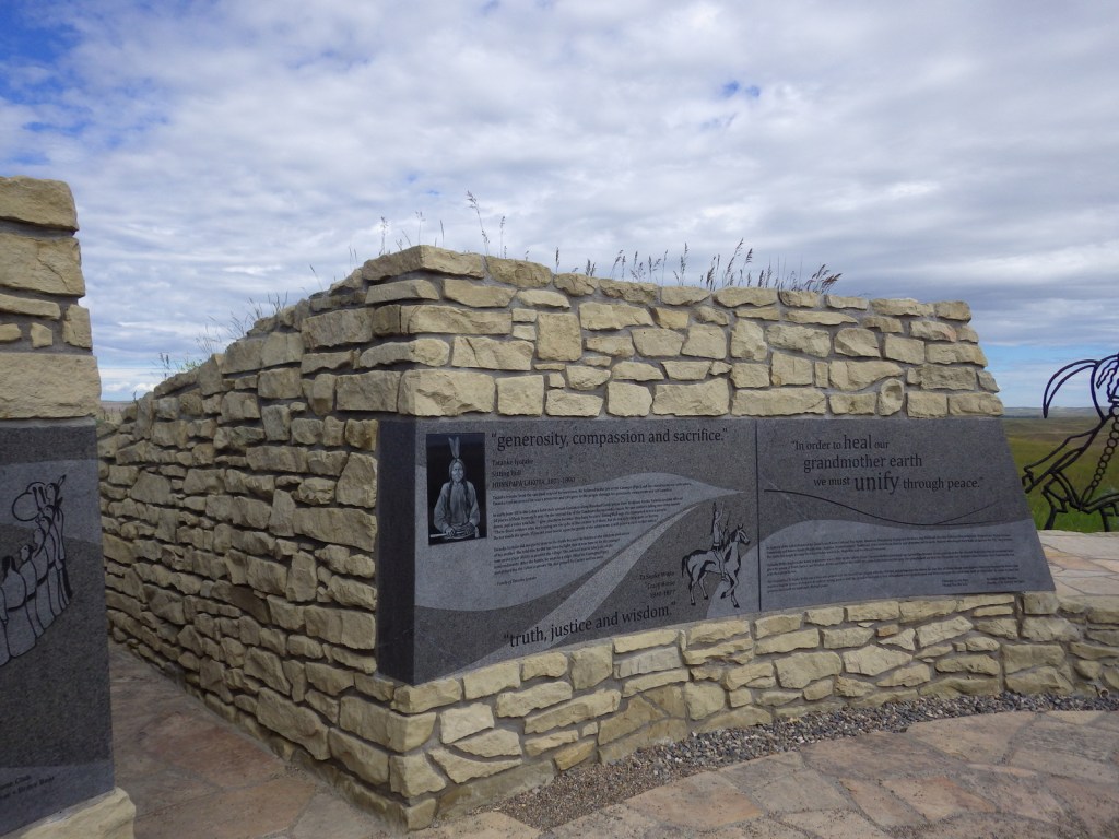
On June 25, 1876, with only 600 soldiers, Custer attempted to defeat a temporary village composed of multiple tribes numbering over 7,000 individuals.  Never before had so large an American Indian encampment been collected anywhere on the Great Plains.  Renowned war chiefs Sitting Bull, Crazy Horse, Two Moons, and many others have their words memorialized at the Indian Memorial, not built at Little Bighorn Battlefield National Monument until 2003 near the mass grave on Last Stand Hill.  Be sure to come in late June for the opportunity to witness a historical reenactment of the famous battle, which is held on the Crow Indian Reservation adjacent to the 765-acre National Monument.

Best Trail

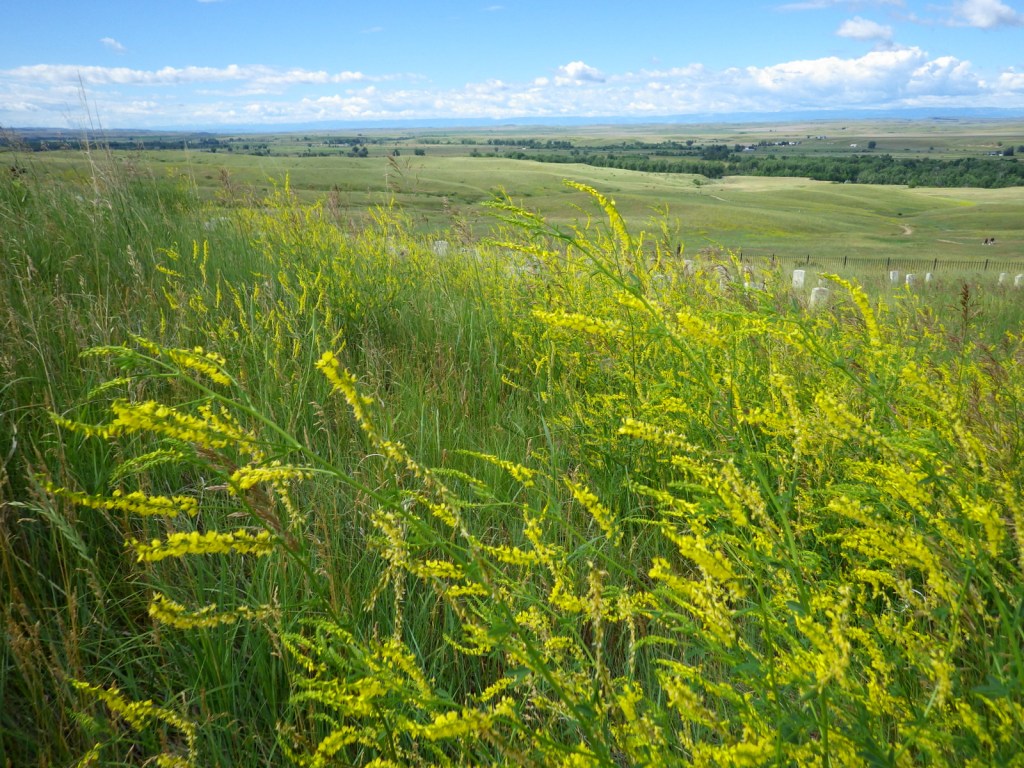
Deep Ravine Trail is a half-mile out-and-back hike that was first laid out in the immediate aftermath of the battle to mark the sites of casualties with wooden stakes made from teepee poles, and then in 1890 replaced by white marble markers.

Photographic Opportunity

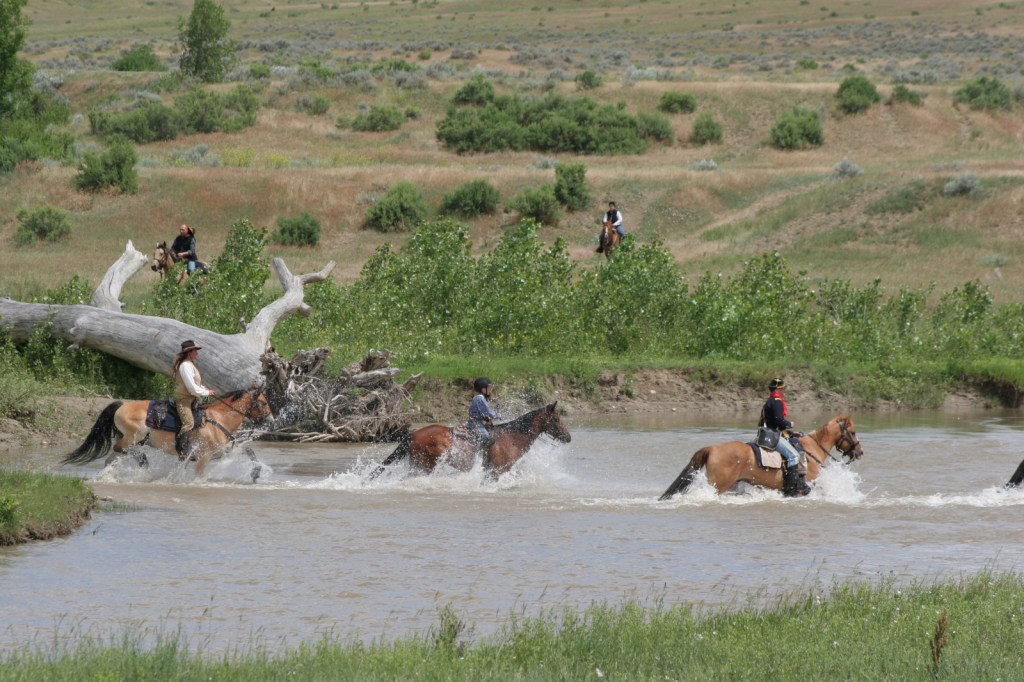
The Battle of the Little Bighorn Reenactment is a two-hour, fully narrated presentation explaining the significance of the Battle of the Greasy Grass (as the American Indians call it).  The site of the reenactment is a ford where Lieutenant Colonel Custer’s battalion came closest to the encampment where 1,800 warriors of the Sioux, Cheyenne, and Arapahoe Nations were gathered to protect their families.  American Indian riders go bareback, leaping on and off their ponies with ease, while saddled 7th U.S. Cavalry re-enactors splash through the fast-flowing Little Bighorn River astride powerful horses.

Peak Season

Summer (the best time of year to visit is around the June 25 anniversary when a reenactment of the battle is held)

Hours

https://www.nps.gov/libi/planyourvisit/hours.htm

Fees

$25 per vehicle or America the Beautiful pass

Road Conditions

All roads are paved, including the 4.5-mile-long road to the Reno-Benteen Battlefield.

Camping

There is a small, private campground at the exit from Interstate 90, but the nearest NPS campground is 40 miles away at Bighorn Canyon National Recreation Area.

Related Sites

Washita Battlefield National Historic Site (Oklahoma)

Big Hole National Battlefield (Montana)

Devils Tower National Monument (Wyoming)

Nearest National Park

Yellowstone

Explore More – When was Custer National Cemetery originally established and when did it become part of a National Monument?

Learn more about the other 137 National Monuments in our book Monumental America: Your Guide to All 138 National Monuments

Lyndon B. Johnson National Historical Park

Overview

Lyndon B. Johnson National Historical Park is composed of two separate sites located 14 miles apart in Johnson City and Stonewall, Texas.  Museums here highlight the significant legislation that passed during his presidency from 1963-1969, including the pivotal Civil Rights Act, and, for nature lovers, the Wilderness Act.  Additions to the National Park Service (NPS) system during his presidency were extensive, including five sites in his home state of Texas (see Related Sites below).

Highlights

Johnson Settlement, films, Texas White House, Johnson Family Cemetery

Must-Do Activity

The 36th President of the United States is typically referred to as LBJ.  Birders know an “LBJ” as an acronym for those hard to identify “little brown jobs” that flit away before you can focus them in your binoculars.  Fittingly, President LBJ’s wife was named Lady Bird, and together they did much to preserve our public lands for native plants and animals.  Around the boyhood home where LBJ grew up in Johnson City, there are plenty of birds to watch, as well as longhorn cattle.  A driving tour through the Stonewall property (14 miles west) requires a permit from the LBJ State Park and Historic Site.  Once you get that, tickets for a guided tour of the Texas White House are available at the NPS visitor center located inside the Airplane Hangar.

Best Trail

A walking tour through Johnson City includes stops at Withers and Spauldings General Store, LBJ’s boyhood home, and barns and cabins that date back to the 1800s within the Johnson Settlement.

Instagram-worthy Photo

Longhorn cattle can be seen at the Johnson Settlement in Johnson City, Texas.  Hereford cattle are still raised at the working ranch in Stonewall.

Peak Season

Spring and fall

Hours

https://www.nps.gov/lyjo/planyourvisit/hours.htm

Fees

None except for the Texas White House tour ($3 per person or free with the America the Beautiful pass)

Road Conditions

All roads paved

Camping

East of Johnson City, Pedernales Falls State Park has a campground, as does Lady Bird Johnson Municipal Park in Fredericksburg, Texas.

Related Sites

Guadalupe Mountains National Park (Texas)

Padre Island National Seashore (Texas)

Alibates Flint Quarries National Monument (Texas)

Explore More – Which resort in Florida (later owned by a future U.S. President) was designated a National Historic Site under the Johnson administration (then eventually sold and disbanded)?

Little River Canyon National Preserve

Overview

Authorized in 1992, Little River Canyon National Preserve covers about 14,000 acres in northeast Alabama.  Elevations range from 1,900-foot tall Lookout Mountain down to 650-foot Weiss Lake reservoir, as the Little River plunges from the Cumberland Plateau.  With cliffs up to 600 feet in height, this unique gorge contains several endemic species of plants and animals.  Only the southern half of the preserve is readily accessible by roads, with DeSoto State Park offering the best way to see the northern section.

Highlights

Little River Falls, Canyon Mouth, Graces High Falls

Must-Do Activity

Start your visit at the Little River Canyon Center on Highway 35, then make the short drive to the parking area for 45-foot tall Little River Falls.  From there, drive Highway 176 for 11 miles along the west side of the canyon, which has nine scenic overlooks, including one for seasonal Graces High Falls.

Best Trail

There are a few short trails in the preserve, many of which drop steeply from the rim to the riverside.  At the southern end near the intersection of Highways 273 and 275 is Canyon Mouth, a flat trail that follows alongside the Little River.  There is better hiking and even more waterfalls in nearby DeSoto State Park.

Instagram-worthy Photo

Graces High Falls is 133 feet tall, making it the tallest (aboveground) waterfall in Alabama, but it only flows in the spring and after large rain events.

Peak Season

Spring

Hours

https://www.nps.gov/liri/planyourvisit/hours.htm

Fees

None except at Canyon Mouth ($15 per day or America the Beautiful pass)

Road Conditions

All roads paved

Camping

De Soto State Park offers camping, in addition to excellent hiking trails to several waterfalls.  There are also three backcountry campsites in Little River Canyon National Preserve available from February through September with a permit.

Related Sites

Russell Cave National Monument (Alabama)

Horseshoe Bend National Military Park (Alabama)

Tuskegee Airmen National Historic Site (Alabama)

Explore More – How many endemic species of caddisflies are found in Little River Canyon and nowhere else on Earth?

Appomattox Court House National Historical Park

Overview

If the name Appomattox Court House rings a bell, that is because in U.S. History class you learned it was where the Civil War ended on April 9, 1865.  There was a courthouse in the town of Appomattox Court House, Virginia, but that is not where Robert E. Lee and Ulysses S. Grant signed surrender papers; actually it was the home of Wilmer McLean.  In 1893, the McLean house was completely disassembled to be turned into an offsite museum, but was later brought back and rebuilt by the National Park Service (NPS).  The county jail is one of several other restored buildings in the park originally designated a National Monument in 1935 and changed to a National Historical Park in 1954.

Highlights

Museum, film, reconstructed McLean House, guided tours

Must-Do Activity

The restored courthouse now serves as the NPS visitor center and museum, from where visitors can start their walk through Meeks General Store, Clover Hill Tavern, the county jail, and other period buildings.  Much of the furniture from the McLean House was taken as souvenirs by Union officers, as well as a doll owned by 7-year-old Lula McLean that was not returned until 1992.

Best Trail

A four-mile hiking trail connects the Village of Appomattox Court House with the April 9, 1865 battlefield and the two General’s headquarters.

Instagram-worthy Photo

You have to take a photo inside the restored room in the McLean house where Lee surrendered his army of 9,000 men, essentially ending the Civil War.

Peak Season

Summer

Hours

https://www.nps.gov/apco/planyourvisit/hours.htm

Fees

None

Road Conditions

All roads paved

Camping

None in the park, but the campground at Holliday Lake State Park is only 12 miles away.

Related Sites

Petersburg National Battlefield (Virginia)

Richmond National Battlefield Park (Virginia)

Booker T. Washington National Monument (Virginia)

Explore More – Seven regiments of African American soldiers in the Union Army participated in the Battle of Appomattox Court House; how many men is that?

Gettysburg National Military Park

Overview

The turning point of the Civil War undoubtedly occurred on July 3, 1863 in Gettysburg, Pennsylvania, especially when considered in combination with the capture of Vicksburg, Mississippi.  After the Confederate invasion of the North was repulsed at Antietam, the next year General Robert E. Lee led 75,000 troops into Pennsylvania to face 88,289 Union soldiers.  After three days of fighting, there were 51,000 men killed, wounded, or missing; the most of any battle on American soil.  It can take more than one full day to visit Gettysburg National Military Park, especially if you add on a bus tour to neighboring Eisenhower National Historic Site.

Highlights

Museum, film, Cyclorama painting, driving tour, David Wills House, cannons

Must-Do Activity

It is free to take the 24-mile long driving tour, but an admission fee is charged for the museum (opened in 2008) that covers the entire Civil War, including Lincoln’s famous Gettysburg Address.  You should also consider watching the excellent 45-minute film A New Birth of Freedom (narrated by Morgan Freeman) and viewing the audio-visual program for the Cyclorama (a 377×42-foot original oil painting on a round canvas that depicts Pickett’s Charge of July 3, 1863).  Commercial bus tours are available and you can also hire a licensed guide to ride in your car and provide a personal two-hour tour past the 1,300 monuments and memorials where so many men gave “the last full measure.”

Best Trail

If you have read The Killer Angels by Michael Shaara, you will want to get out of your car and walk around Little Round Top, which overlooks the infamous Devil’s Den, Peach Orchard, and Wheatfield.  The High Water Mark Trail and Soldiers’ National Cemetery Trail are each about one mile in length.

Instagram-worthy Photo

This site is perhaps best known for President Lincoln’s 272-word Gettysburg Address, which he gave in two minutes following a two-hour speech by Edward Everett.  Newspaper reviews from the next day were not favorable for the President.

Peak Season

Summer, though it was very busy even on a weekday in October 2016.

Hours

https://www.nps.gov/gett/planyourvisit/hours.htm

Fees

Free driving tour, $15 per adult for films and museum (no discount for America the Beautiful pass)

Road Conditions

All roads paved

Camping

There a numerous private campgrounds around Gettysburg, and the National Park Service’s Catoctin Mountain Park is only 20 miles away, as are Caledonia and Corodus State Parks.

Related Sites

Antietam National Battlefield (Maryland)

Eisenhower National Historic Site (Pennsylvania)

Allegheny Portage Railroad National Historic Site (Pennsylvania)

Explore More – When was the Cyclorama painting by French artist Paul Philippoteaux completed?

We are a participant in the Amazon Services LLC Associates Program, an affiliate advertising program designed to provide a means for us to earn fees by linking to Amazon.com and affiliated sites.