Tag Archives: backpacking

Bridger National Forest

Bridger National Forest

Wyoming

Managed by U.S. Forest Service, Intermountain Region

1,744,705 acres (1,736,115 federal/ 8,590 other)

Website: https://www.fs.usda.gov/btnf

Overview

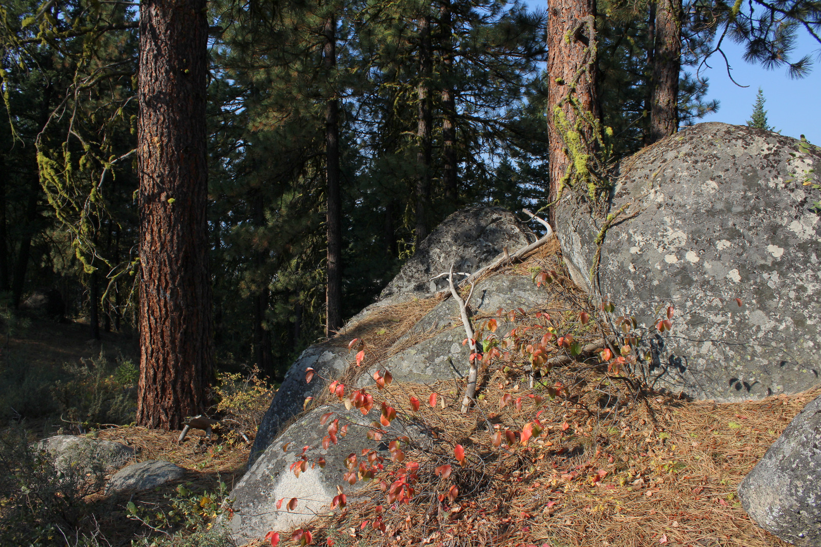
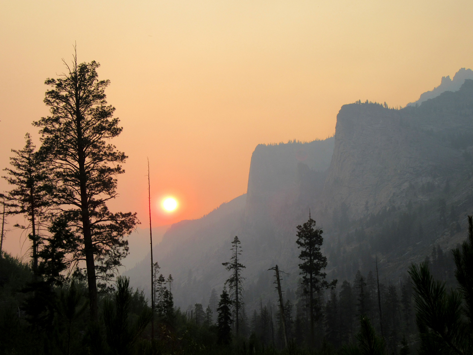
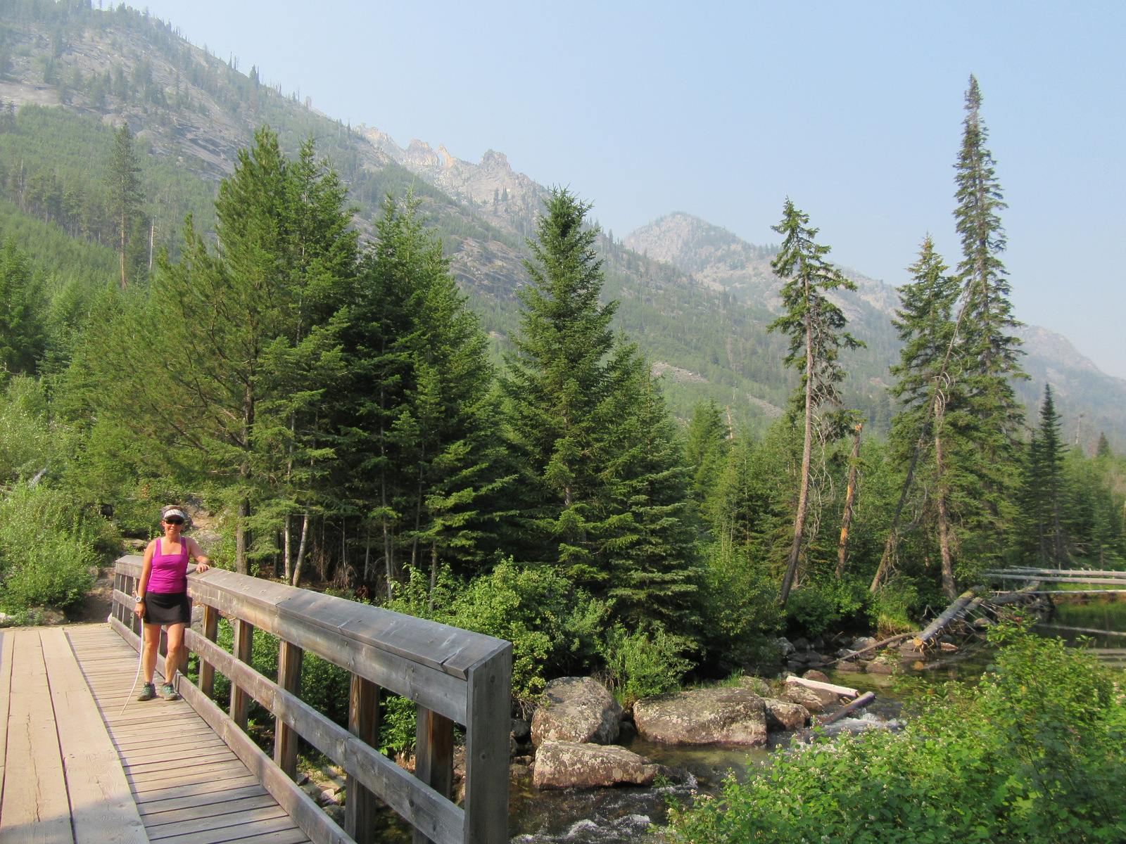
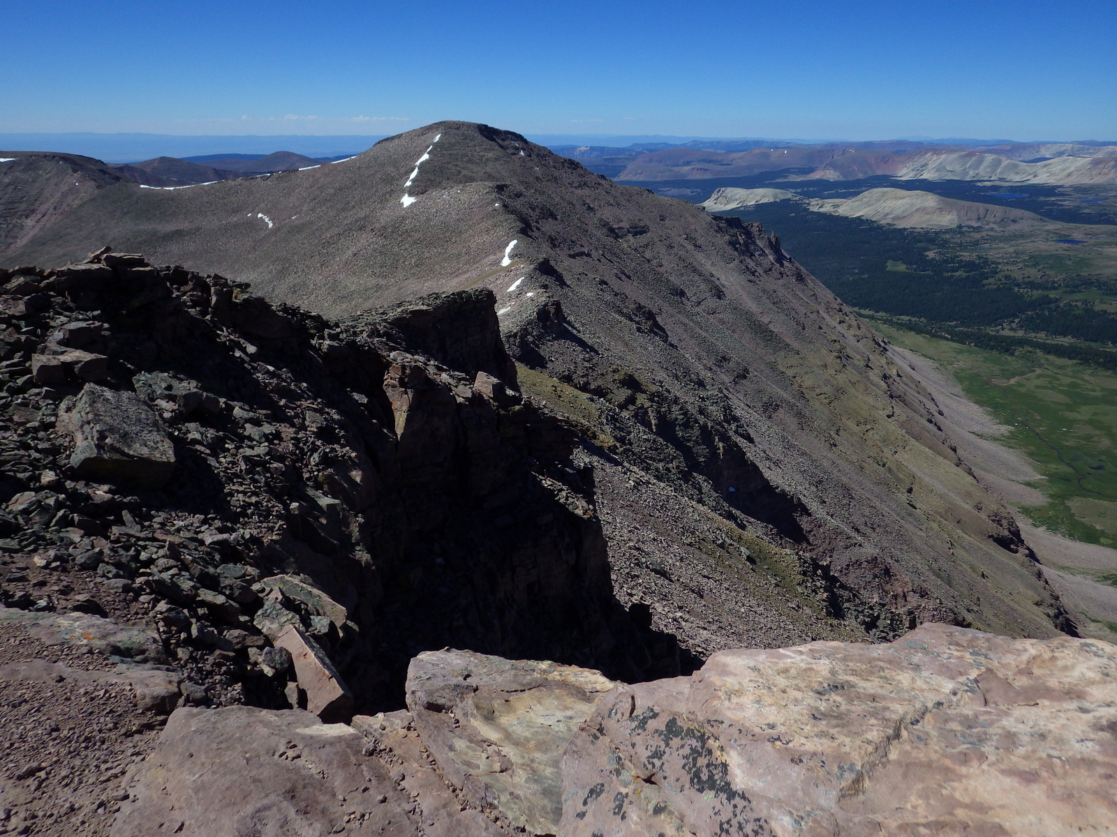
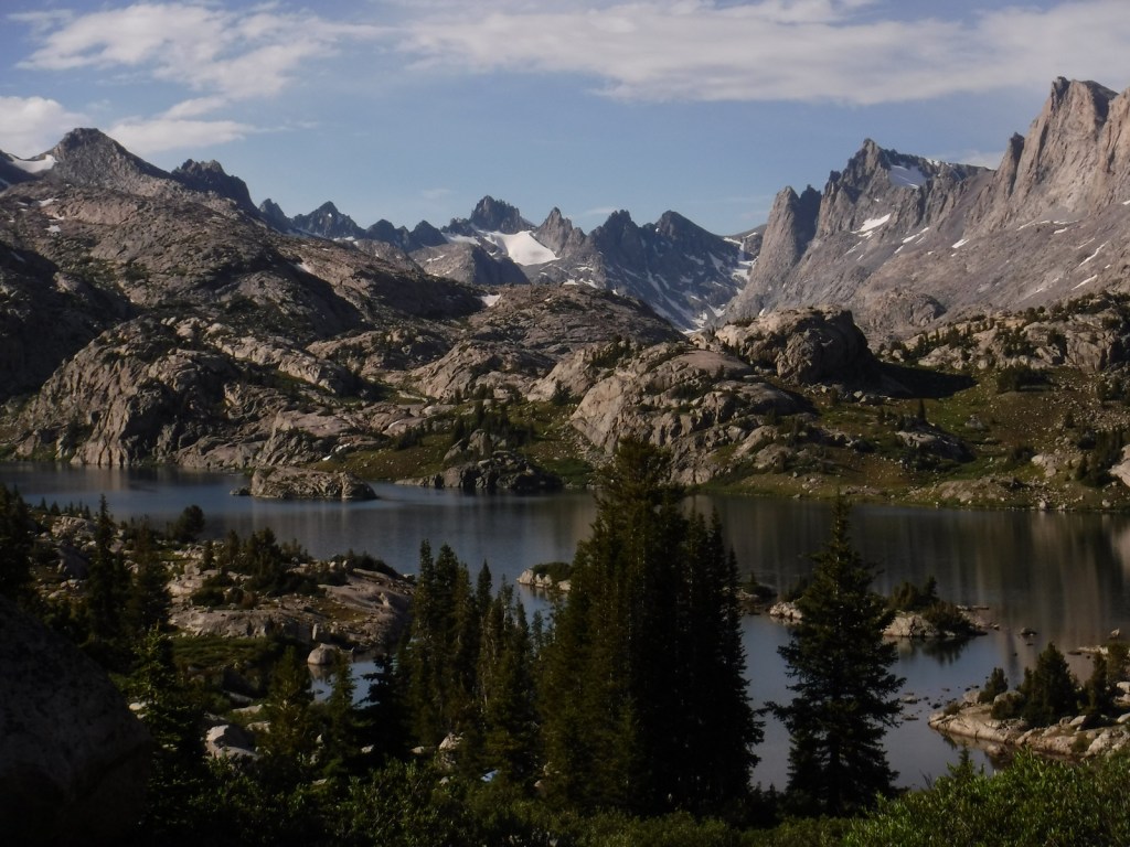
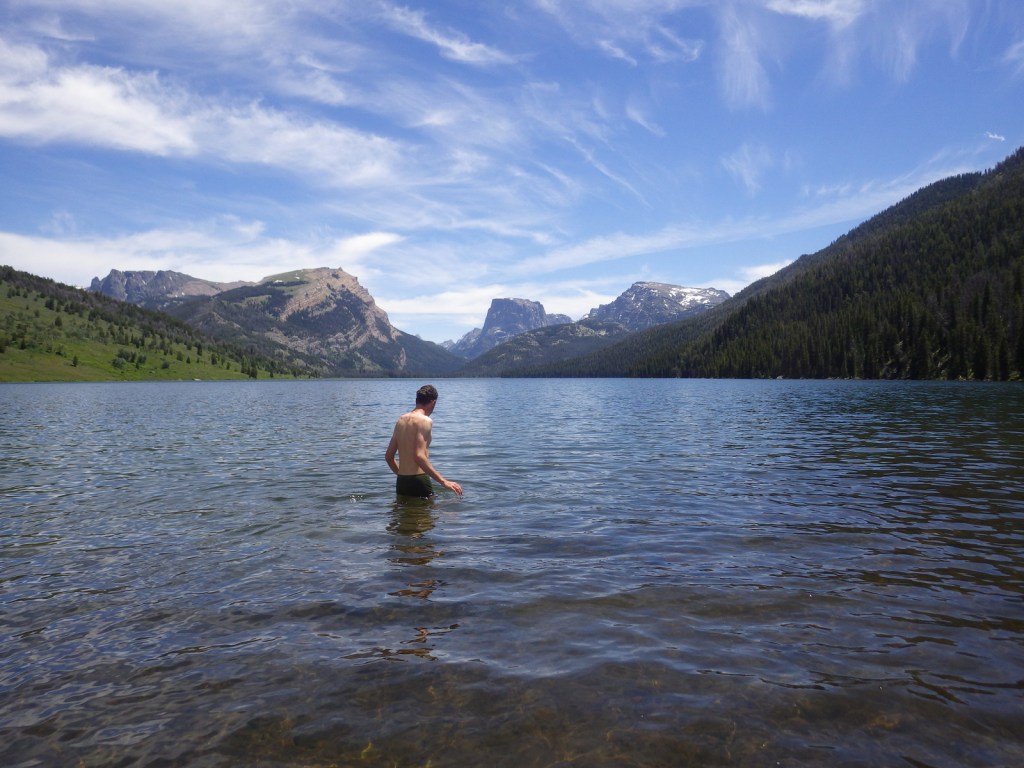
The peaks of the Wind River Range not only represent the Continental Divide, but also a division between Bridger-Teton National Forest and Shoshone National Forest which happen to be in two different U.S. Forest Service Regions.  These mountains are our favorite place to go backpacking in the entire world with jagged peaks that rival the Teton Range for picturesqueness and a fraction of the visitors (except at overcrowded Titcomb Basin and the Cirque of the Towers).  Read more about our 120-mile trip on the Highline Trail in our newspaper article.

Know someone who loves the National Forests? Gift them our travel guidebook Out in the Woods so they can learn more about this and the 154 other National Forests.

Highlights

Fremont Lake, Kendall Warm Springs, Green River Lakes, Wind River Range, Titcomb Basin, Periodic Spring geyser, Lake Alice, Wyoming Range National Recreation Trail, Highline Trail, Continental Divide National Scenic Trail

Must-Do Activity

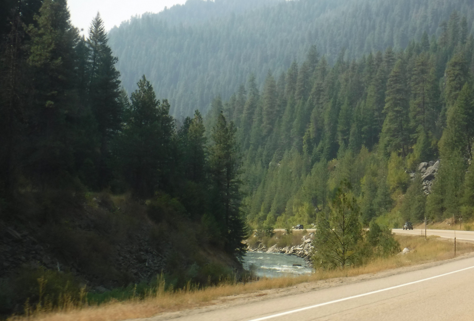
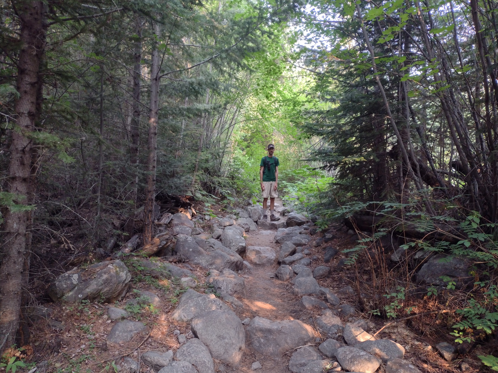
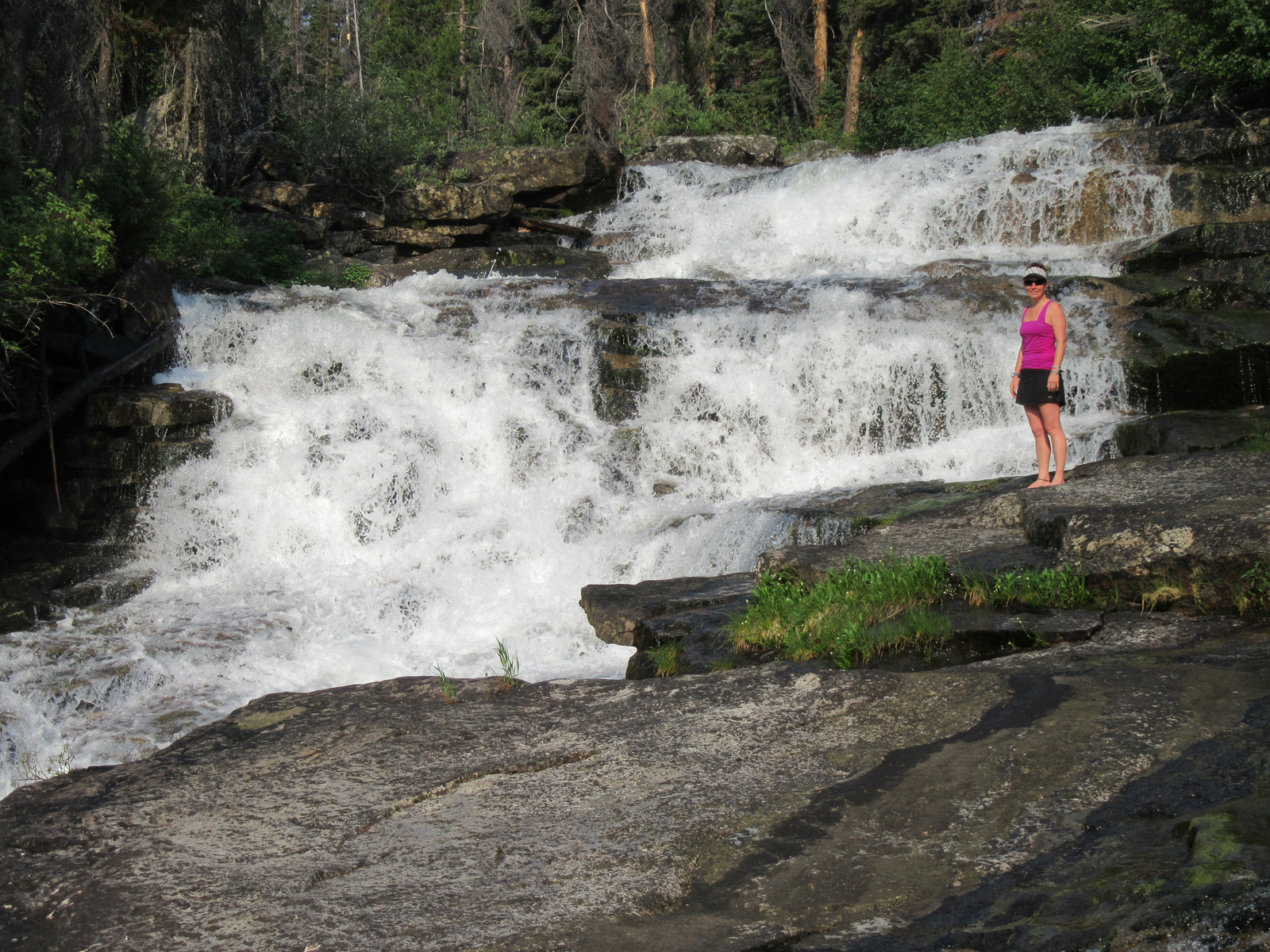
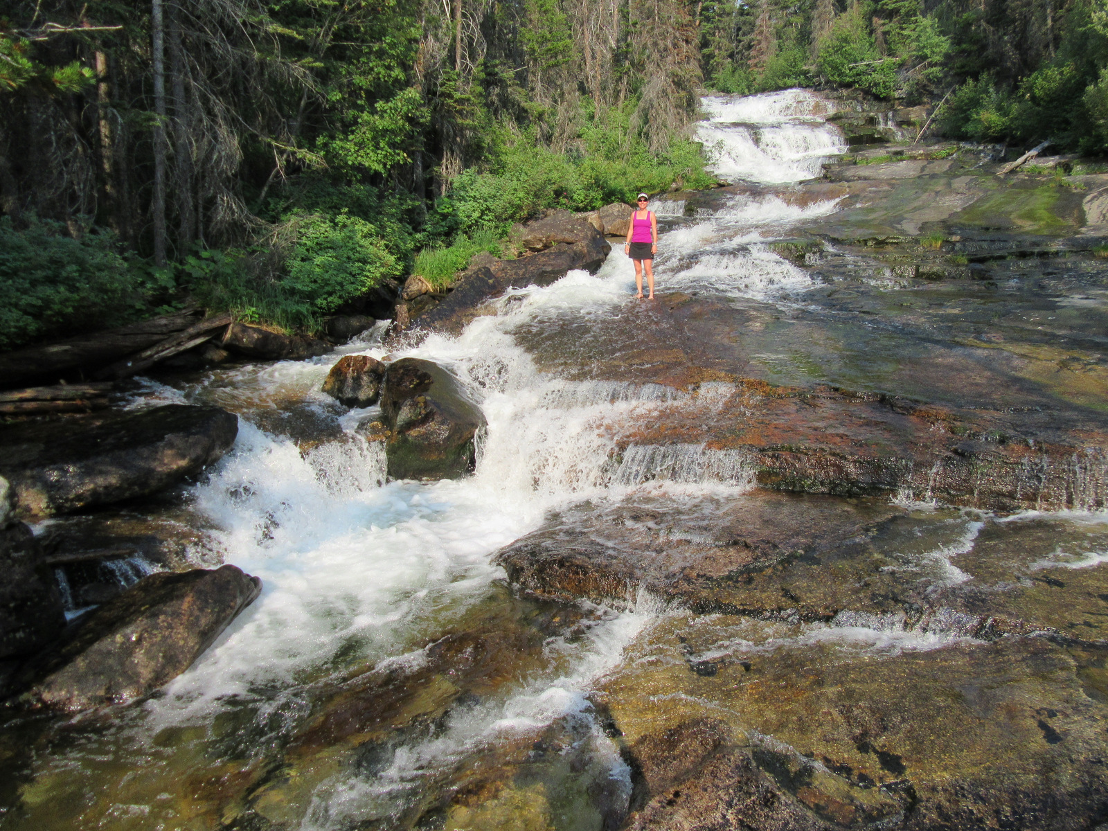
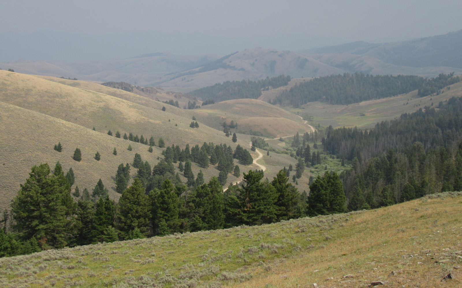
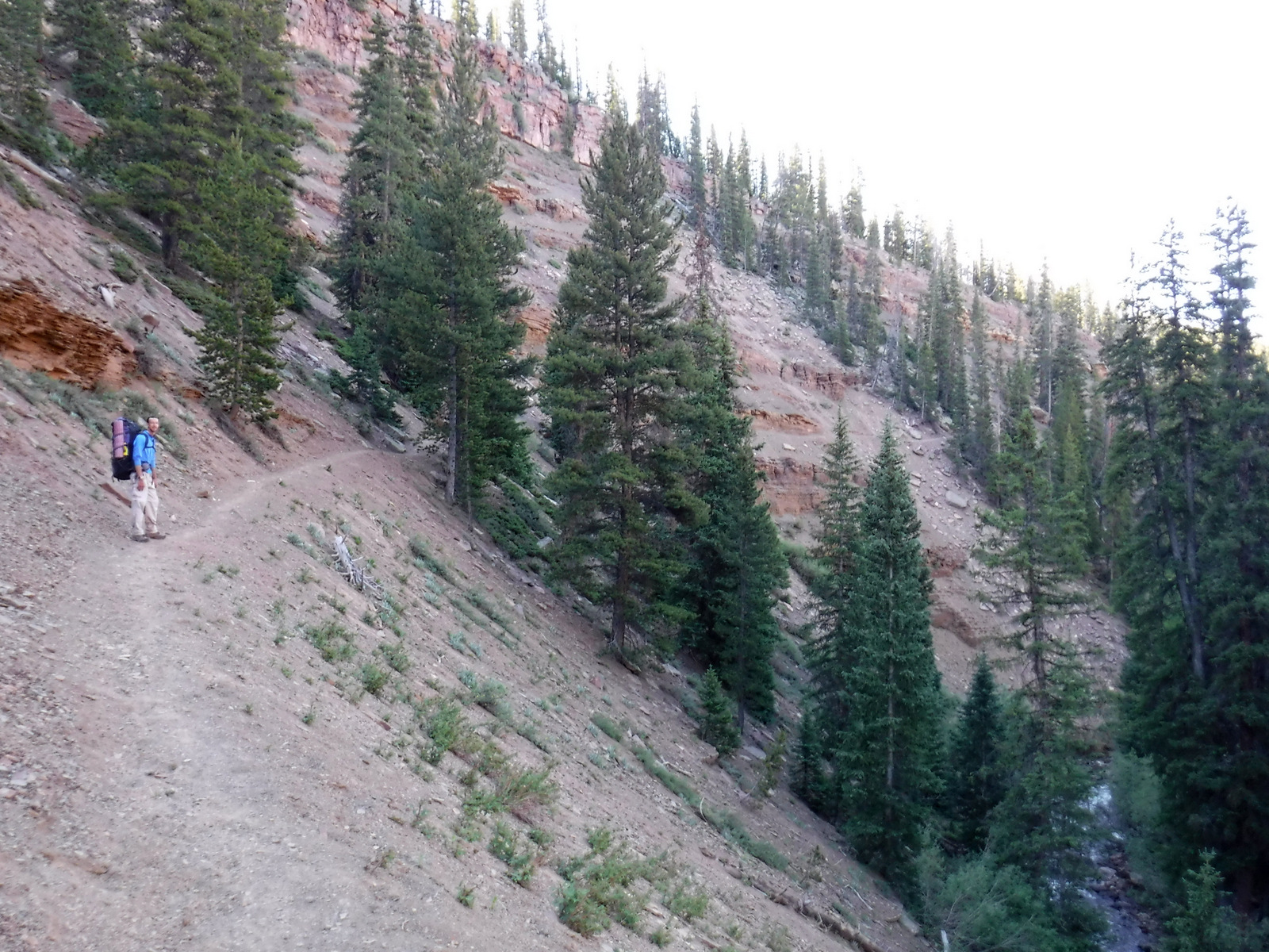
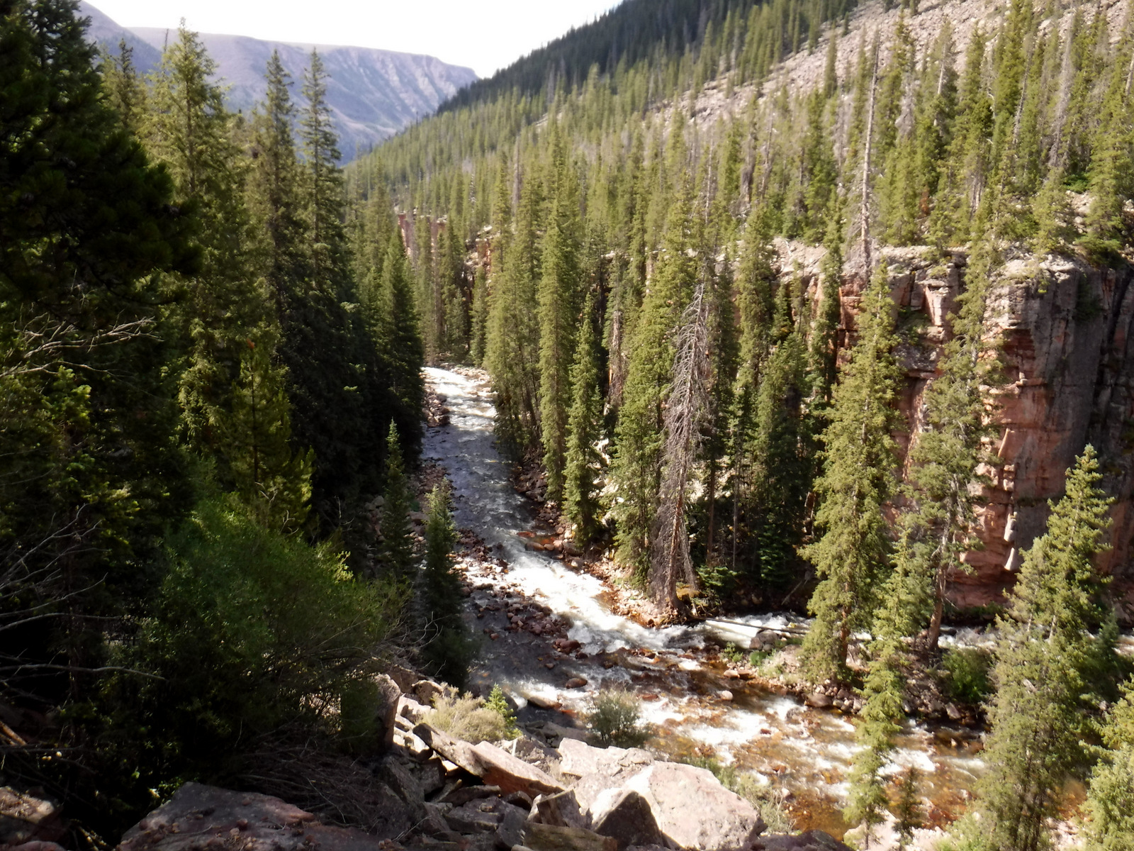
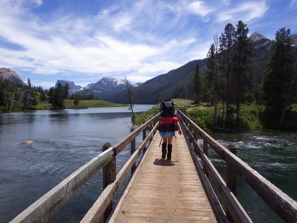
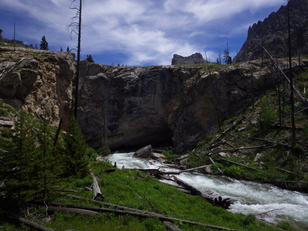
From Pinedale, Wyoming, a 50-mile partially-paved drive leads to the campground at Green River Lakes, which opens up into a beautiful valley that frames photogenic Squaretop Mountain.  Hiking around the northerly of the two lakes makes a great couple-hour jaunt, but if you are looking for a unique destination add the two-mile spur to fascinating Clear Creek Natural Bridge.  Here the water pours through and continues to widen a four-foot tall gap in the limestone.  Starting from the campground, the Highline Trail is a 72-mile one-way trek popular with backpackers.  The first ten miles are very flat following the river to Beaver Meadows, which offers 360° mountain views. 

Best Trail

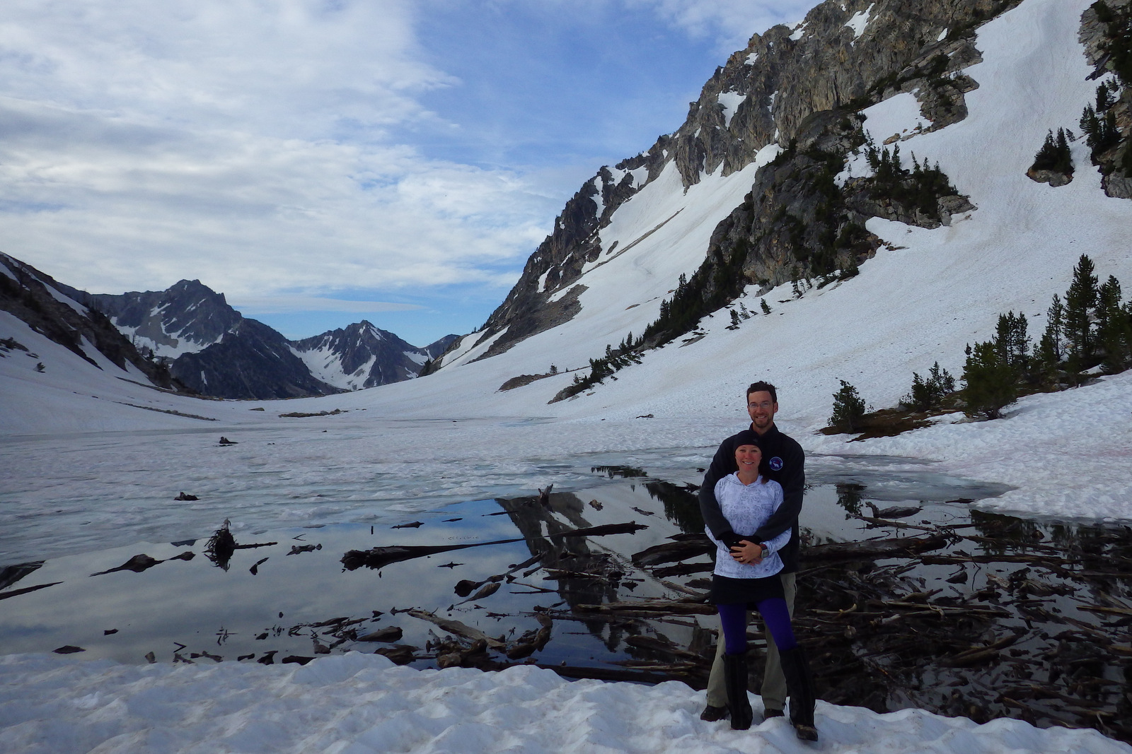
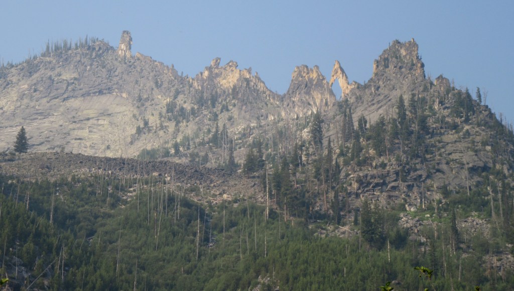
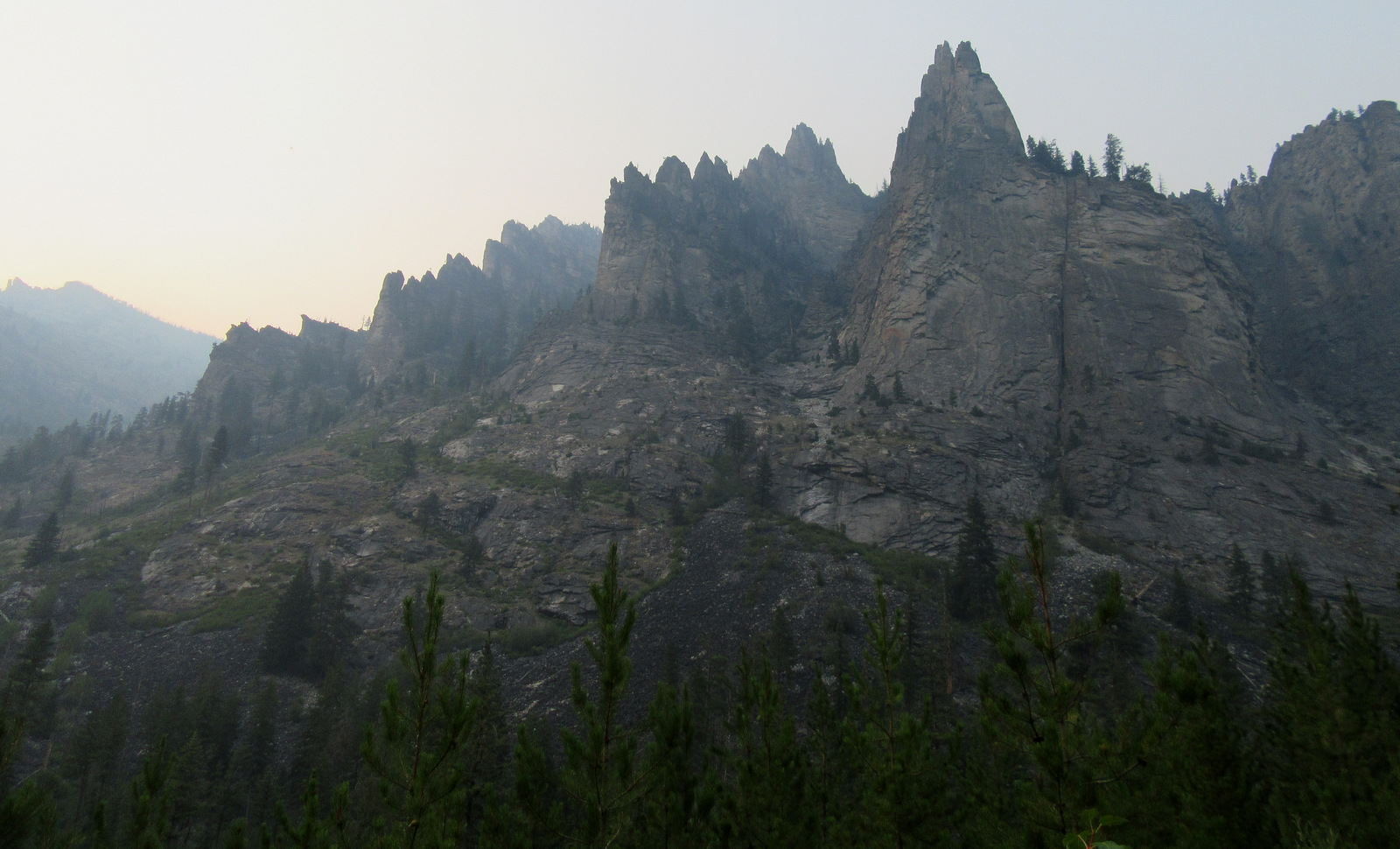
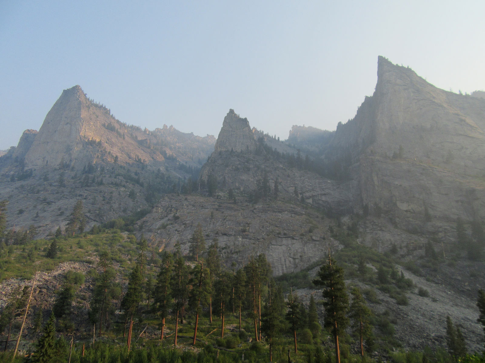
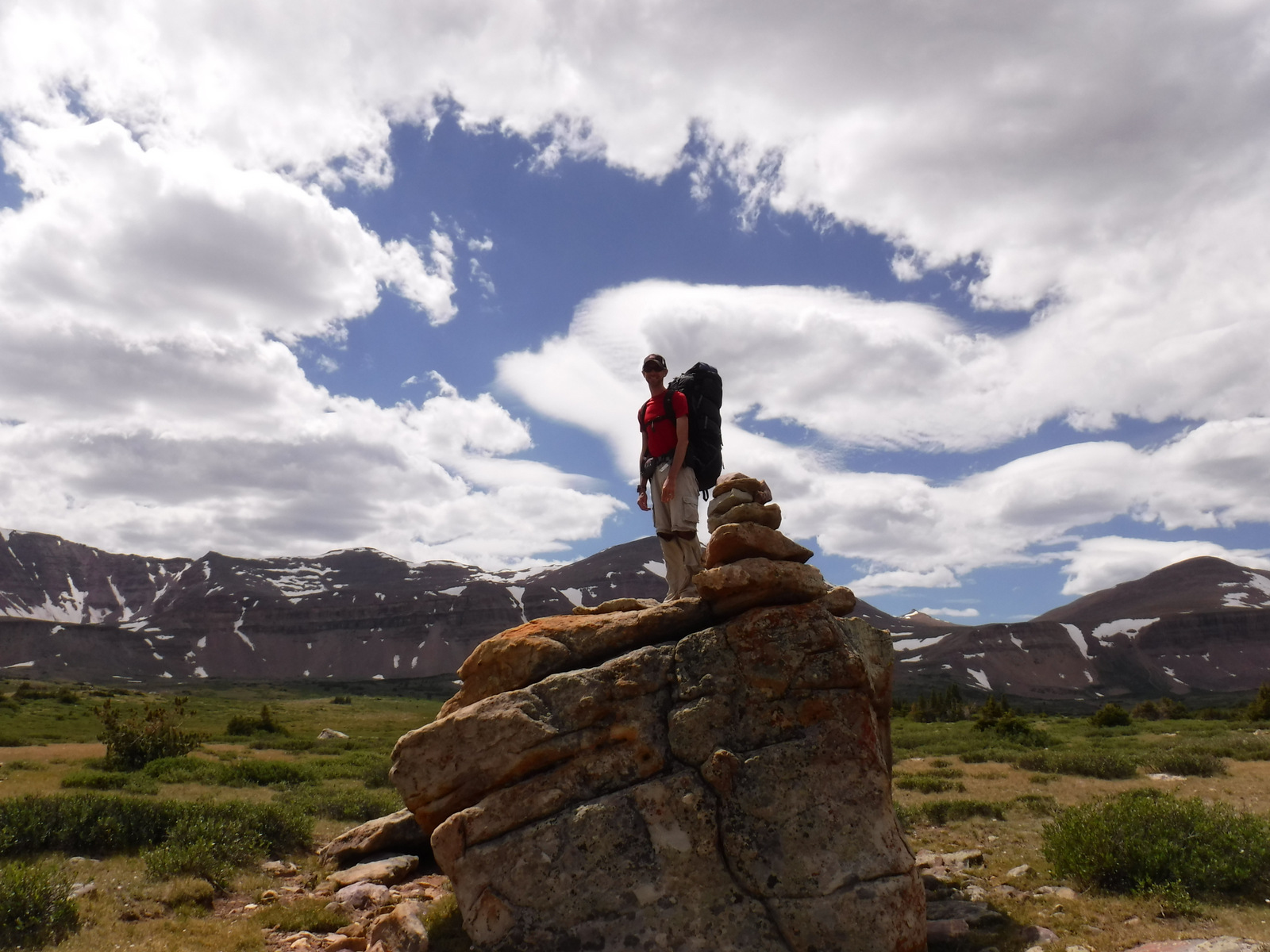
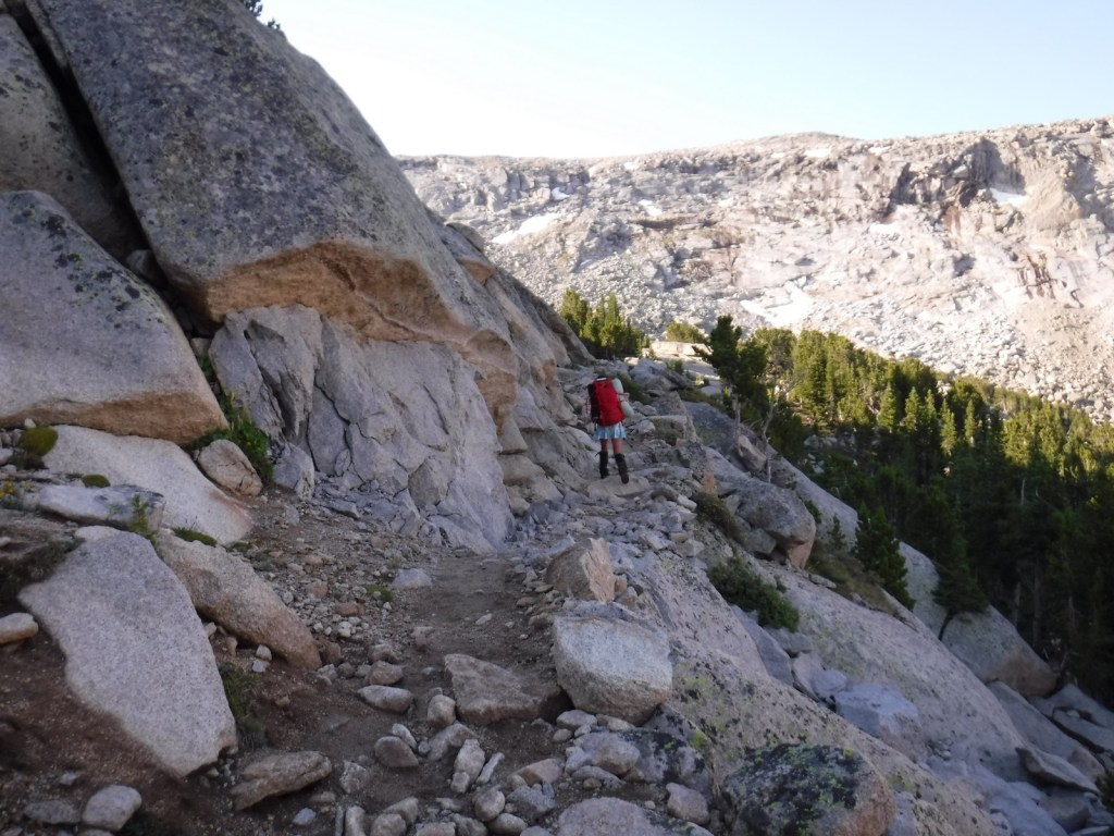
Further south in the Wind River Range than stunning Squaretop Mountain, it is only eight miles from Big Sandy Trailhead to the Cirque of the Towers, which is famous among rock climbers and actually in neighboring Shoshone National Forest.  Even though there were a lot of campers back there, we found a secluded spot between Big Sandy Lake and Clear Lake in Bridger National Forest.  When we finally made it over 10,800-foot Jackass Pass to the cirque, it was full of fog and hail was dropping from the sky.  Although we have been back on a sunny day, that was the more memorable experience, which is why we selected a photo from that morning for the cover of our new guidebook Out in the Woods (see bottom of this post).

Watchable Wildlife

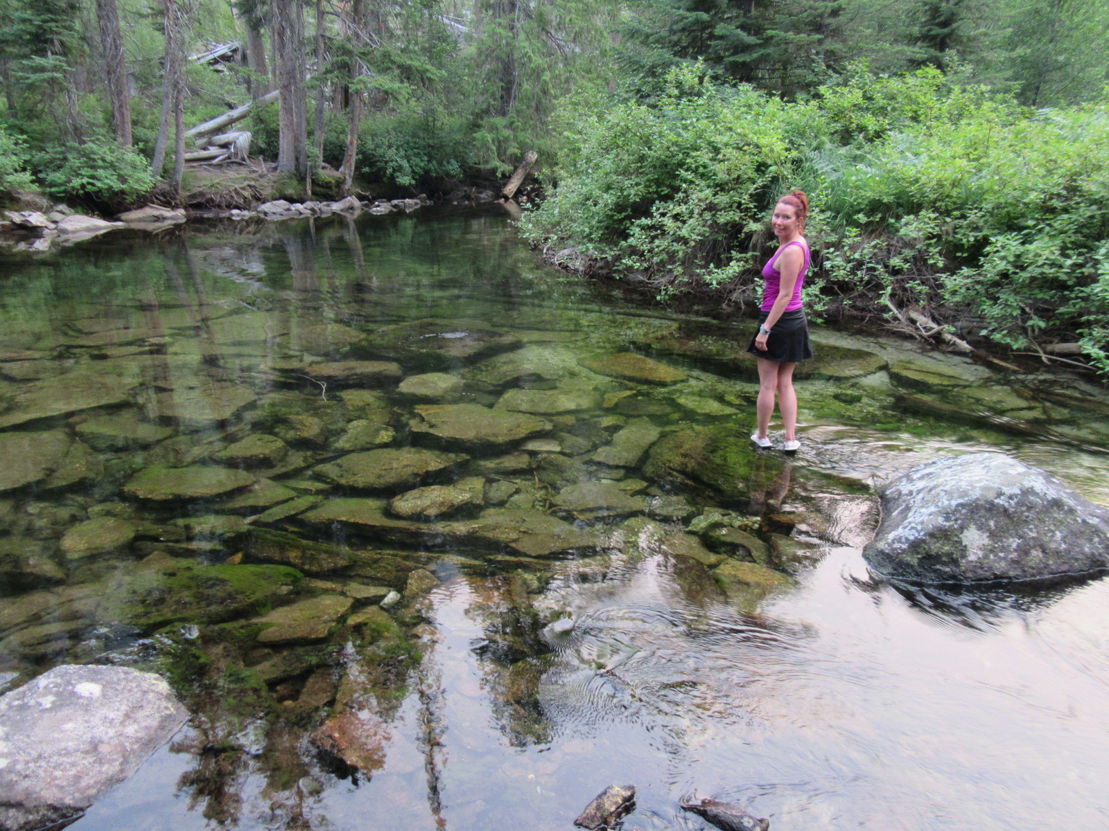
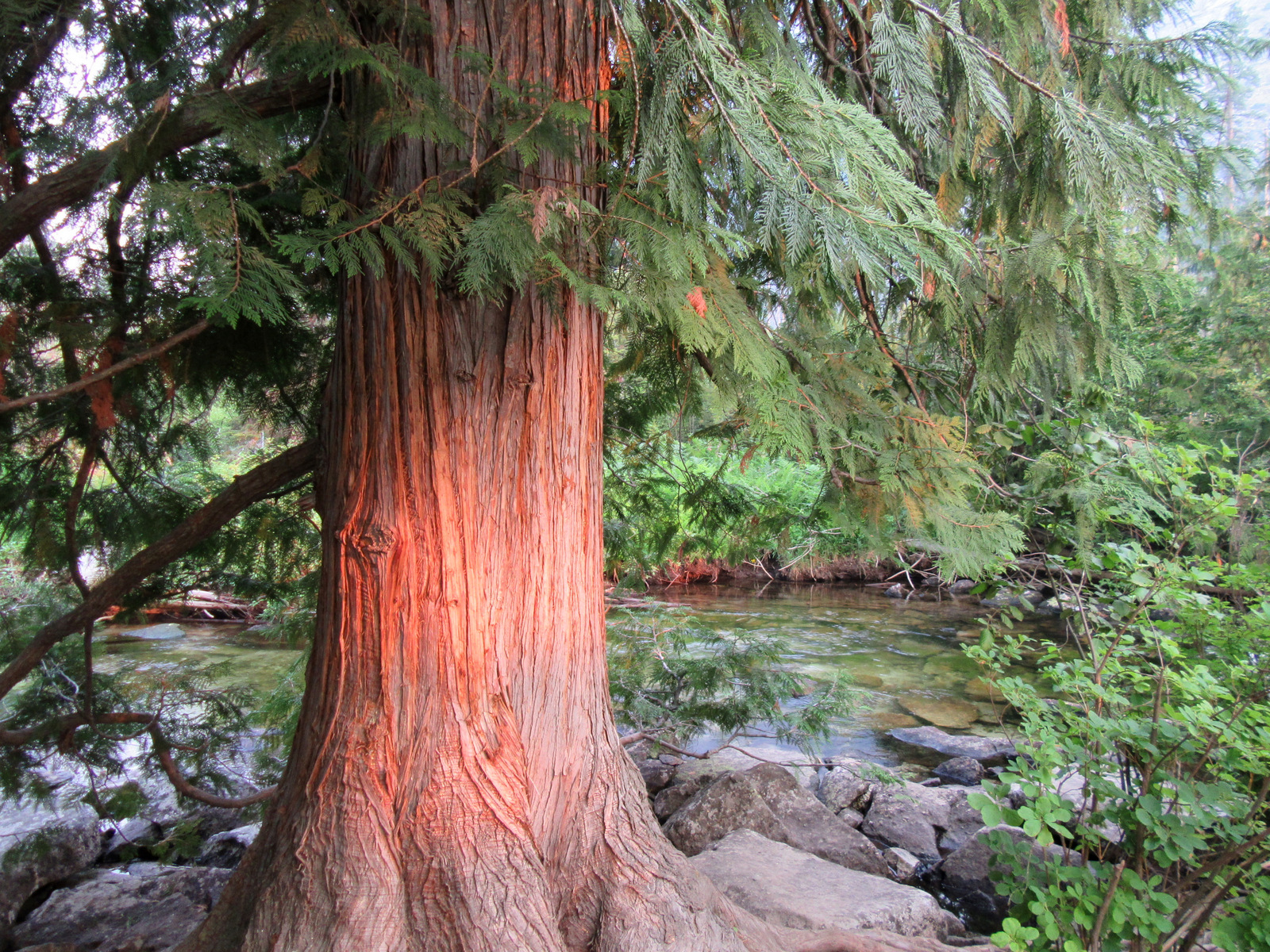
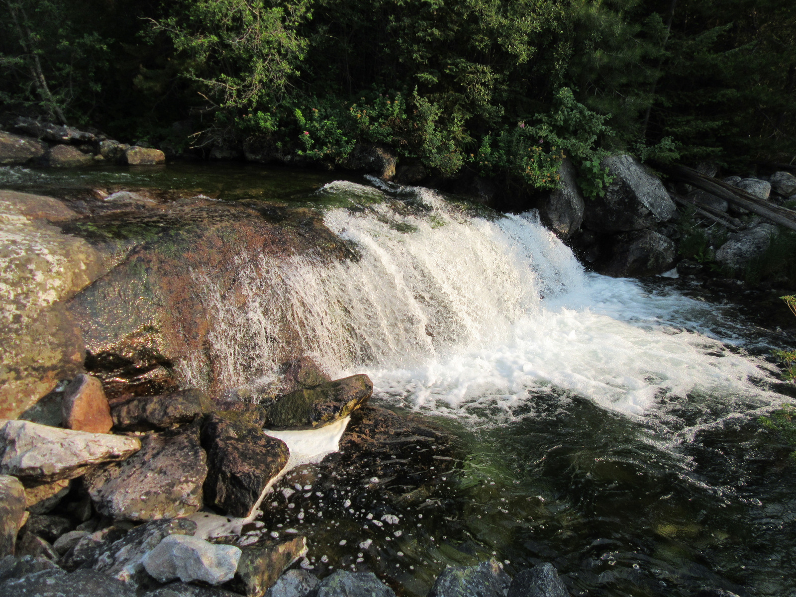
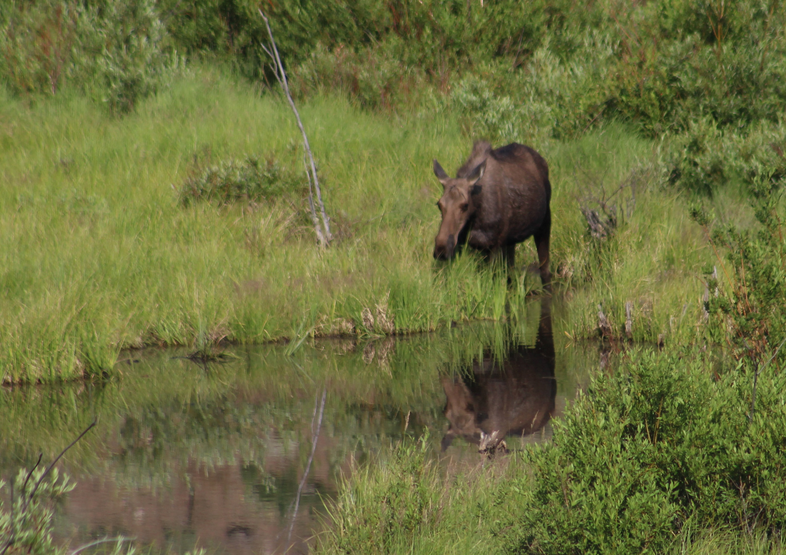
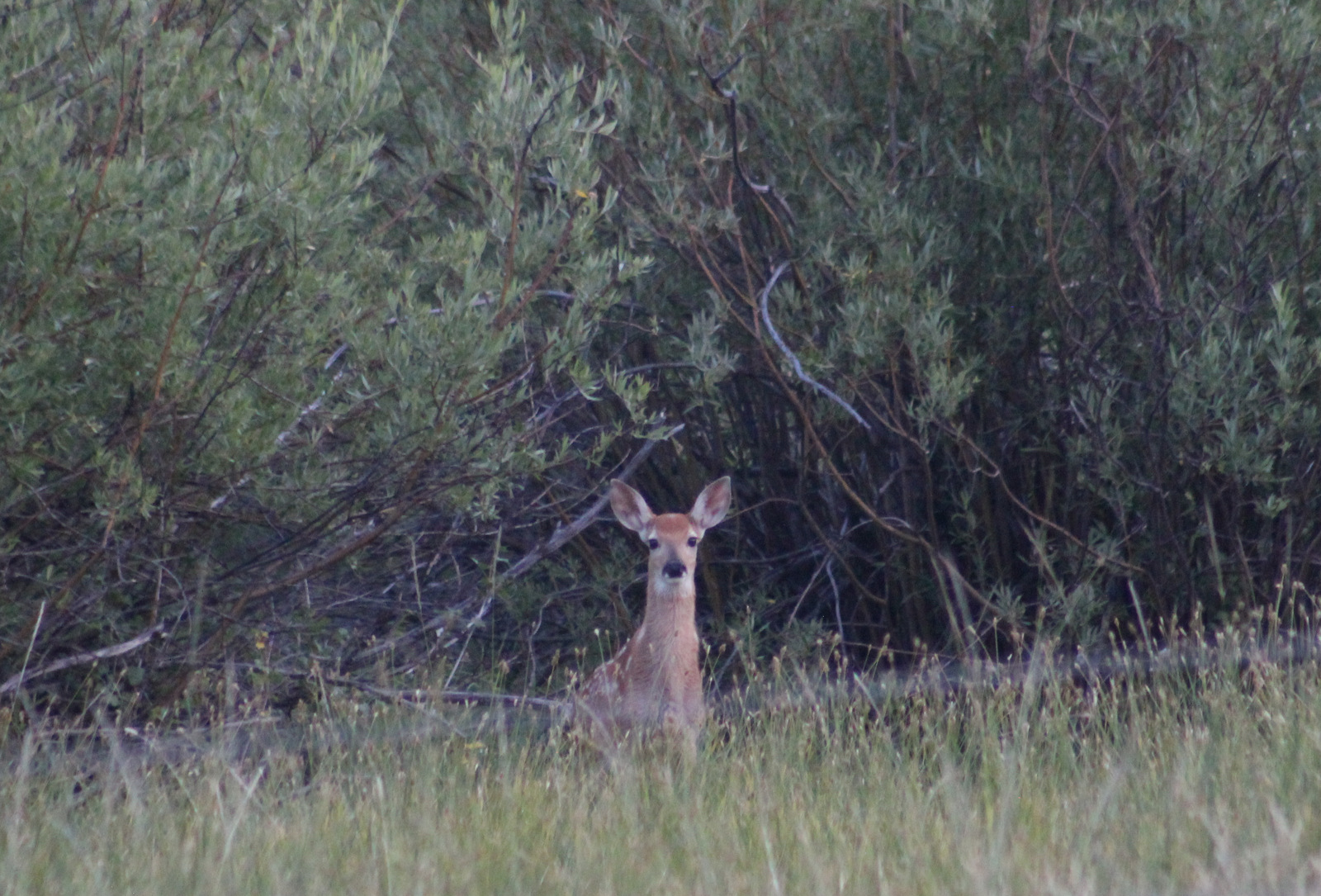
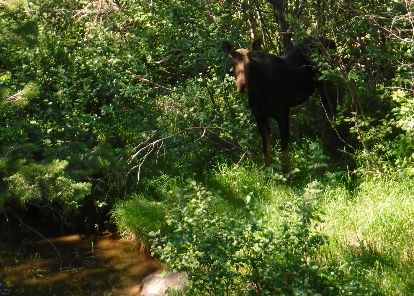
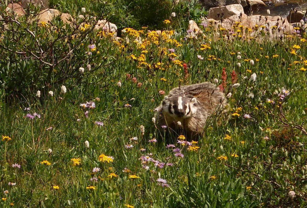
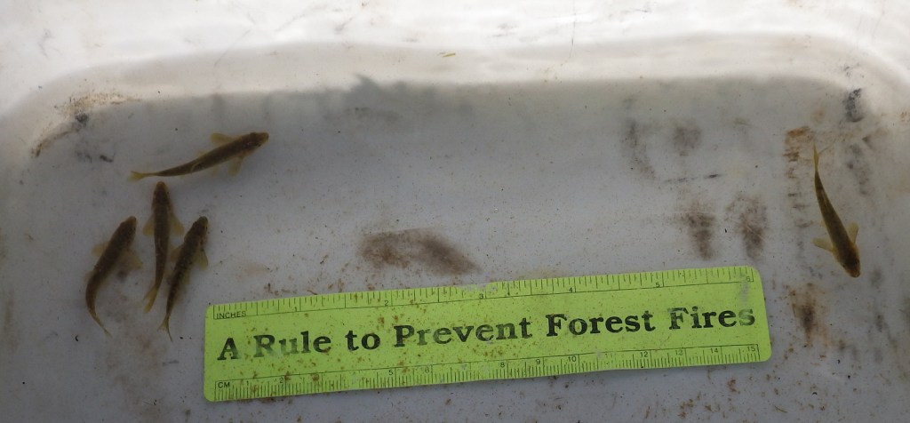
On the way to Green River Lakes outside Pinedale, Wyoming, make time for a quick stop at Kendall Warm Springs where the water is a constant 85°F but is protected from human bathing.  The main attraction is a fish less than 2-inches long, the endangered Kendall Warm Springs dace.  During spawning (which occurs frequently throughout the year due to the warm water), the males turn purple and the females light green.  U.S. Forest Service biologists keep careful track of the population and if you’re lucky, you’ll meet them when they are out there conducting a survey.  On the trails and roads, keep an eye out for moose, elk, mule deer, pronghorns, both black and grizzly bears, and badgers (even in the middle of the day).  Trout fishing is also a major attraction to this area’s many lakes and streams.

Instagram-worthy Photo

This incredible view of Squaretop Mountain and Green River Lakes is at the end of a long drive down a washboard dirt road; maybe that is why it is on the Wyoming license plate.

Peak Season

Summer

Fees

None

Road Conditions

The long dirt roads back to the trailheads at Big Sandy and Green River Lakes are well maintained, and we have never had a problem accessing them in a passenger vehicle.  Limited parking when you get there is the bigger problem.
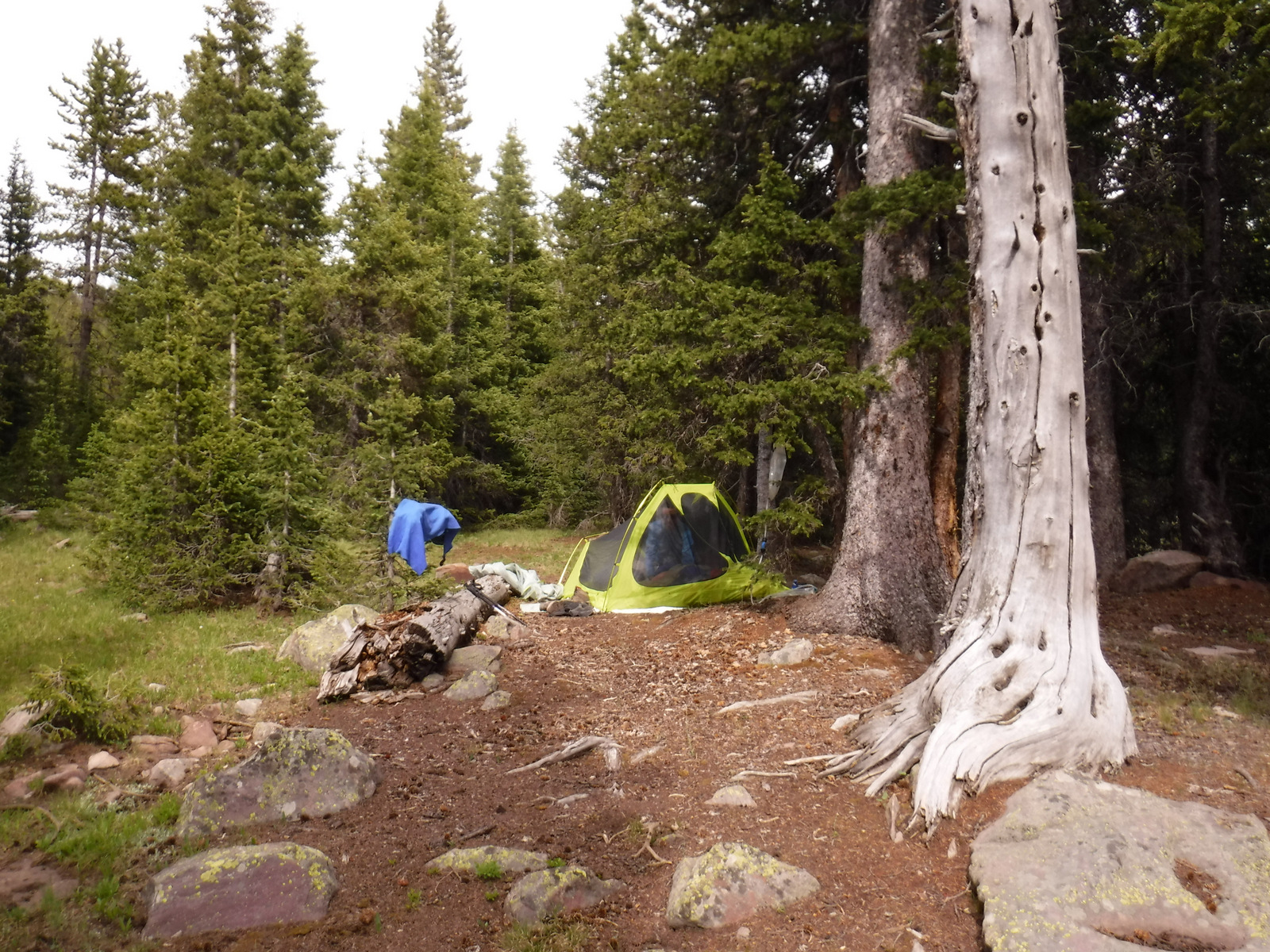
Camping

The campground at Green River Lakes has an incredible view of Squaretop Mountain (which is on the 2010s Wyoming license plate).  There are more dispersed campsites on the road to Big Sandy Trailhead than Green River Lakes.

Wilderness Areas

Bridger Wilderness

Related Sites

Shoshone National Forest (Wyoming)

Fossil Butte National Monument (Wyoming)

Yellowstone National Park (Wyoming-Montana-Idaho)

Nearest National Park

Grand Teton (Wyoming)

Conifer Tree Species

Engelmann spruce, subalpine fir, Douglas-fir, lodgepole pine, ponderosa pine, limber pine, whitebark pine

Flowering Tree Species

quaking aspen, Rocky Mountain maple, bog birch, Booth’s willow, red osier dogwood, sagebrush

Explore More – What is the entire length of the stream that is the only place where the endangered Kendall Warm Springs dace lives (before it pours into the chilly Green River, home to a genetically distinct dace population)?

Know someone who loves the National Forests? Gift them our travel guidebook Out in the Woods so they can learn more about this and the 154 other National Forests.

Boise National Forest

Boise National Forest

Idaho

Managed by U.S. Forest Service, Intermountain Region

2,959,305 acres (2,654,004 federal/ 305,301 other)

Website: https://www.fs.usda.gov/boise

Overview

Boise National Forest is famous for its gold rush ghost towns and hot springs along the South Fork of the Payette River.  The best way to explore this National Forest is by stopping along three scenic byways: Ponderosa Pine (Highway 21), Wildlife Canyon (Highway 24), and Payette River (Highway 55) Scenic Byways.  Ghost towns dating back to the 1860s include Atlanta, Banner, Brummer, Graham, Pioneerville, Quartzburg, Thunder, and the more-developed Idaho City.

Highlights

Sawtooth National Recreation Area, Payette River Scenic Byway, Big Falls, Ponderosa Pine Scenic Byway, Kirkham Hot Springs, Sage Hen Reservoir, Dagger Falls, Atlanta ghost town, Trinity Recreation Area, Ardeth Lake, Velvet Falls, Baron Lakes, Kirkham Ridge Trail, Idaho Centennial Trail

Must-Do Activity

Starting in Boise, Idaho, the Ponderosa Pine Scenic Byway (Highway 21) leads 131 miles northeast through Boise National Forest.  Be sure to stop (and try some delicious huckleberry ice cream) in Idaho City, where wooden board sidewalks and unpaved streets take you back to the gold rush era.  Ponderosa Pine Scenic Byway continues to Lowman where it follows the South Fork of the Payette River past the campgrounds at Kirkham and Bonneville Hot Springs (reservations recommended) and up to 7,056-foot Banner Summit at the boundary with Challis National Forest.

Best Trail

Located just three miles east of Highway 55 and Lake Cascade along paved Warm Creek Road is the Eagle Nest Trail.  Look for the parking pullout on the south side of the road across from the big rock that marks the entrance to the Eagle Nest neighborhood.  After crossing the road, the Eagle Nest Trail steadily climbs (from 4,850 to 6,050 feet in the first 2.5 miles) and occasionally opens up for views of the mountains above Cascade Lake.  Located further south, Fool Creek Trail drops 2,728 feet in 4.1 miles to the Middle Fork of the Payette River.

Watchable Wildlife

On a smoky September morning on the Eagle Nest Trail, we saw fresh turkey and mule deer prints in the dirt.  Other common large animals include elk, moose, pronghorns, coyotes, and black bears.  At higher elevations watch for mountain goats, pikas, and yellow-bellied marmots.  In addition to several trout species, chinook and sockeye salmon migrate up the Columbia and Snake Rivers.  Non-migratory Kokanee salmon are native to Warm Lake, plus introduced into Anderson Ranch, Arrowrock, Lucky Peak, and Deadwood Reservoirs.  

Instagram-worthy Photo

In Sawtooth National Recreation Area, 10,190-foot Mt. Regan stands at the south end of Sawtooth Lake marking the boundary between Challis and Boise National Forests.

Peak Season

Summer

Fees

There is a day-use fee at parking areas near hot springs

Road Conditions

Ponderosa Pine Scenic Byway is winding and full of switchbacks, so take your time.  Warm Creek Road is paved to the roadside trailhead for Eagle Nest.  The Grandjean Road back to the campground is unpaved, but open year round.

Camping

Most of the campgrounds along Highway 21 take reservations due to their popularity.  We have read good things about the 31 sites in the Grandjean Campground (first-come, first-served) on the South Fork of the Payette River (hot springs are 1.5 miles away) near the western boundary of the Sawtooth Wilderness.

Wilderness Areas

Frank Church-River of No Return Wilderness (also in Payette, Salmon-Challis, Bitterroot, and Nez Perce National Forests)

Sawtooth Wilderness (also in Sawtooth and Challis National Forests)

Related Sites

Sawtooth National Recreation Area (Idaho)

Hagerman Fossil Beds National Monument (Idaho)

Nez Perce National Historical Park (Idaho-Oregon-Washington-Montana)

Nearest National Park

Yellowstone (Wyoming-Montana-Idaho)

Conifer Tree Species

ponderosa pine, lodgepole pine, whitebark pine, Douglas-fir, Engelmann spruce, subalpine fir, western larch

Flowering Tree Species

quaking aspen, black cottonwood, narrowleaf cottonwood, thinleaf alder, water birch, Rocky Mountain maple, chokecherry, sagebrush

Explore More – Boise National Forest is full of water with 15,400 acres covered by lakes and reservoirs, plus how many miles of streams and rivers?

Bitterroot National Forest

Bitterroot National Forest

Montana, Idaho

Managed by U.S. Forest Service, Northern Region

1,655,753 acres (1,587,070 federal/ 68,683 other)

Website: https://www.fs.usda.gov/bitterroot

Overview

First established as the 4.1-million-acre Bitter Root Forest Reserve in 1898, the smaller Bitterroot National Forest today flanks both sides of Highway 93 and the Bitterroot River Valley.  This stretch of the Idaho-Montana border is rough, mountainous country and about half this National Forest is designated Wilderness (see below).  The Continental Divide National Scenic Trail follows a portion of the boundary between Bitterroot National Forest and Beaverhead National Forest, heading northeast from Lost Trail Pass where Highway 93 crosses into Idaho.

Highlights

Nez Perce Auto Trail, Lost Trail Pass, Lake Como, Magruder Massacre Site, Trapper Peak, Skalkaho Falls, Blodgett Canyon, Boulder Creek Falls, Palisade Mountain National Recreation Trail, Continental Divide National Scenic Trail

Must-Do Activity

There are trails going west up seemingly every canyon in the Bitterroot Mountains, while Lost Horse Creek has a road that follows it nearly to the Idaho border.  Wildfire smoke obscured the views during our visit in July 2021, but the glacier-carved mountain scenery was still impressive on Blodgett Creek Trail.  We imagine on a clear day the views would rival California’s Yosemite Valley.  There are many more roads (and some trails) to explore in the Sapphire Mountains east of Highway 93.

Best Trail

Blodgett Creek Trail leads 12.6 miles one-way to Blodgett Lake, but you do not have to go that far to appreciate its incredible beauty.  The trail climbs steadily as it follows the creek, passing the memorial to smokejumper Don Mackey on its way to two waterfalls: the first at 4.5 miles hidden in a slot canyon and the second a wide cascade only a half-mile further (for a cumulative elevation gain of 1,637 feet).  Leaving from a nearby trailhead, Blodgett Overlook Trail is a steep 2.8 miles out-and-back.  A similar trek with outstanding views, Bear Creek Overlook Trail climbs about 1,000 feet as it switchbacks 2.6 miles one-way.

Watchable Wildlife

On our backpacking trip into Blodgett Canyon we saw bats, many trout and a beaver dam in the creek, plus a variety of bird life, including a dipper (or ouzel) and a hairy woodpecker.  We also heard hermit thrushes and pikas calling in the rocky scree slopes.  The Bitterroot and Sapphire Mountains are home to elk, mule deer, white-tailed deer, bighorn sheep, mountain goats, and moose, as well as mountain lions, black bears, and grizzly bears (which were reintroduced starting in 2003).  Wildlife watchers should drive the U.S. Forest Service’s Sula Deer, Elk, and Bighorn Driving Tour.

Instagram-worthy Photo

As you hike the Blodgett Creek Trail keep an eye on the ridgeline to the south for a massive natural arch that punches a hole in the skyline.

Peak Season

Summer

Fees

None

Road Conditions

The last three miles to Blodgett Trailhead were well-groomed dirt road and the route from Hamilton, Montana had signs at every turn.

Camping

Located on a creek, Blodgett Campground (fee) seemed like a nice spot, though it was a bit noisy and smoky on a weekend in mid-July.  We also read that Deep Creek Campground is nice and is located near the ruins of a 1930s Civilian Conservation Corps camp.

Wilderness Areas

Anaconda-Pintler Wilderness (also in Beaverhead-Deerlodge National Forest)

Frank Church-River of No Return Wilderness (also in Payette, Salmon-Challis, Boise, and Nez Perce National Forests)

Selway-Bitterroot Wilderness (also in Nez Perce, Clearwater, and Lolo National Forests)

[Allan Mountain Roadless Area]

Related Sites

Beaverhead National Forest (Montana)

Big Hole National Battlefield (Montana)

Yellowstone National Park (Wyoming-Montana-Idaho)

Nearest National Park

Glacier (Montana)

Conifer Tree Species

ponderosa pine, whitebark pine, lodgepole pine, Douglas-fir, western redcedar, subalpine larch, Engelmann spruce, subalpine fir, grand fir, western yew

Flowering Tree Species

quaking aspen, black cottonwood, bog birch, Rocky Mountain maple, red alder, red-osier dogwood, sagebrush

Explore More – How tall is Trapper Peak, the highest point in Bitterroot National Forest?

Beaverhead National Forest

Beaverhead National Forest

Montana

Managed by U.S. Forest Service, Northern Region

2,199,013 acres (2,130,671 federal/ 68,342 other)

Website: https://www.fs.usda.gov/bdnf

Overview

Co-managed since 1996, Beaverhead-Deerlodge National Forest is spread across multiple mountain ranges in the southwest corner of Montana.  The dividing boundaries between the two forests are unclear, though Beaverhead National Forest tends to be more southeast than Deerlodge National Forest and includes portions of the Beaverhead, Bitterroot, Centennial, Gravelly, Madison, Pioneer, Tendoy, and Tobacco Root Mountains.  Bordering Idaho’s Salmon National Forest, 7,323-foot Lemhi Pass is located on the Lewis and Clark National Historic Trail.  This is where the Corps of Discovery crossed the Continental Divide in 1805 and is why the Sacajawea Memorial Area was established here in 1932.

Highlights

Pioneer Mountains Scenic Byway, Lemhi Pass, Sacajawea Memorial, Chief Joseph Pass, Pintler Falls, Upper Potosi Hot Springs, Charcoal Kilns, Gravelly Range Auto Tour, Nez Perce National Historic Trail, Continental Divide National Scenic Trail

Must-Do Activity

It is about a 17-mile drive from Harrison, Montana back to the free Potosi Campground, but it is well signed and worth the effort.  From here a 0.8-mile trail leads to Upper Potosi Hot Springs, a clear 100°F pool with room for about six adults.  Further west, about ten miles north of Highway 278, is the privately owned Elkhorn Hot Springs (fee), a great place to relax after hiking around Big Hole National Battlefield (managed by the National Park Service).  If you keep driving north on Wise River Polaris Road (FR 484), there are plenty of dispersed campsites and trailheads for several long hikes into the Pioneer Mountains.

Best Trail

We only hiked less than a mile trail to Upper Potosi Hot Springs, but that trail keeps climbing three miles to the top of the ridge.  We read good reviews for Louise Lake National Recreation Trail (see note on Road Conditions below), Pioneer Lake National Recreation Trail, Browns Lake Trail, Blue Creek Trail, Sand Lake/Lily Lake Trail, and Gold Butte Trail.  Hopefully we will make it back here to go backpacking someday.

Watchable Wildlife

Beaverhead National Forest still has most of its pre-settlement carnivores: grizzly bears, black bears, mountain lions, Canadian lynx, coyotes, and gray wolves.  Grazing ungulate species include moose, elk, mule deer, white-tailed deer, bighorn sheep, mountain goats, and pronghorns.  We saw bald eagles and ospreys on our drive out from Upper Potosi Hot Springs.  Mountain whitefish, golden trout, cutthroat trout, rainbow trout, brook trout, lake trout, arctic grayling, and burbot are some of the gamefish sought by fishermen.

Instagram-worthy Photo

The ruins of a developed hot springs resort (located on private land) are visible from Upper Potosi Hot Springs.  Watch for moose downhill in South Willow Creek and a cute little garter snake that hangs out in the rocks by the pool (possibly year round if it stays warm enough not to hibernate).

Peak Season

Summer

Fees

None

Road Conditions

The dirt roads to Potosi Campground and over Lemhi Pass are both in very good condition, but we do not know about all the other dirt roads that cross the Continental Divide.  We read the access road to Louise Lake National Recreation Trail is pretty rough, requiring four-wheel drive the last two miles.

Camping

There are more than 20 spots to set up at Potosi Campground, which is free and located near the trailhead for Upper Potosi Hot Springs.  You will want a high-clearance vehicle to drive across South Willow Creek to the official trailhead, but there are also pedestrian bridges.

Wilderness Areas

Anaconda-Pintler Wilderness (also in Deerlodge and Bitterroot National Forests)

Lee Metcalf Wilderness (also in Gallatin National Forest)

Related Sites

Deerlodge National Forest (Montana)

Big Hole National Battlefield (Montana)

Grant-Kohrs Ranch National Historic Site (Montana)

Nearest National Park

Yellowstone (Wyoming-Montana-Idaho)

Conifer Tree Species

lodgepole pine, whitebark pine, ponderosa pine, Douglas-fir, Engelmann spruce, subalpine fir, subalpine larch

Flowering Tree Species

quaking aspen, balsam poplar, Bebb willow, sagebrush

Explore More – How tall is Hilgard Peak, the highest point in Beaverhead National Forest?

Ashley National Forest

Ashley National Forest

Utah, Wyoming

Managed by U.S. Forest Service, Intermountain Region

1,402,656 acres (1,382,346 federal/ 20,310 other)

Website: https://www.fs.usda.gov/ashley

Overview

Ashley National Forest is located on the Utah-Wyoming border and includes the High Uintas Wilderness and Flaming Gorge National Recreation Area (which we will discuss in our next blog post).  The Uinta Mountains are a popular destination for campers, hikers, mountain bikers, horseback riders, and anybody who is into magnificent mountain peaks and picturesque lakes.  It is one of the few east-west running ranges in North America and includes the highest point in Utah: 13,528-foot tall Kings Peak.  In 2019, Congress set aside 173,475 acres of the National Forest as the Ashley Karst National Recreation and Geologic Area, the first such designation in the U.S.

Highlights

Flaming Gorge National Recreation Area, Red Cloud Loop Scenic Backway, Flaming Gorge-Uinta Scenic Byway, Indian Canyon Scenic Byway, Outlaw ATV Trail, Moon Lake, Strawberry Peak, Swett Ranch, Kings Peak, Highline Trail

Must-Do Activity

The High Uintas Wilderness is a premier backpacking destination with numerous lakes and 545 miles of trails.  The Wilderness is actually found in both the Wasatch and Ashley National Forests, but not Uinta National Forest.  Even if that makes sense to you, you will probably still need a good map to navigate your way to the highest point in Utah.  Summiting Kings Peak is a minimum 30 miles roundtrip from the Henrys Fork Trailhead in Wasatch National Forest to the north, and even further from the southern trailheads.

Best Trail

We backpacked into the High Uintas Wilderness on a 41-mile lollipop loop leaving from the Uinta Canyon Trailhead.  The first portion along the Uinta River Trail was flat, then started climbing when we split off on the Chain Lakes-Atwood Trail to cross Roberts Pass and Trail Rider Pass into Painter Basin, a beautiful area that sits below Kings Peak.  At more than 90 miles in length, the Highline Trail runs east-west through the area and is accessible from many side-trails, including the ones we were on.

Watchable Wildlife

Flaming Gorge Reservoir is known for its large population lake trout, as well as kokanee salmon, rainbow trout, brown trout, smallmouth bass, channel catfish, and burbot.  The reservoir also hosts a large nesting colony of ospreys, as well as many other raptors.  In the mountains, watch for moose, elk, mule deer, mountain goats, and black bears.

Instagram-worthy Photo

Leaving from the Uinta Canyon Trailhead, after about an hour of walking the Uinta River Trail reaches a bridge across its namesake.  The river is popular with fisherman and we spotted a moose grazing near the water.

Peak Season

Summer

Fees

Every boat launch and day-use area in Flaming Gorge National Recreation Area requires a recreation pass ($5 per day, $15 per week) or America the Beautiful pass, but there is no charge to drive the Flaming Gorge-Uinta Scenic Byway or cross the dam.  We did not encounter any fees in the rest of Ashley National Forest, except in campgrounds.

Road Conditions

The 82-mile Flaming Gorge-Uinta Scenic Byway is paved the whole way, but there are many unpaved roads off it including access to popular Red Canyon and Sheep Creek National Geological Area.  Many roads are closed seasonally, like Red Cloud Loop and Spirit Lake Scenic Backways.

Camping

There are numerous campgrounds on and off the lake in Flaming Gorge National Recreation Area, mostly open May to September, although Dripping Springs is open year round.  There are also campgrounds near most of the trailheads that access the High Uintas Wilderness.  We found dirt roads off Highway 191 to be packed with dispersed campers and RVs in mid-July 2020.

Wilderness Areas

High Uintas Wilderness (also in Wasatch National Forest)

Related Sites

Dinosaur National Monument (Utah-Colorado)

Timpanogos Cave National Monument (Utah)

Fossil Butte National Monument (Wyoming)

Nearest National Park

Arches (Utah)

Conifer Tree Species

lodgepole pine, limber pine, ponderosa pine, pinyon pine, Douglas-fir, subalpine fir, white fir, Engelmann spruce, Rocky Mountain juniper

Flowering Tree Species

quaking aspen, blue elderberry, Gambel oak, bigtooth maple, boxelder, western birch, red osier dogwood, narrowleaf cottonwood, sagebrush

Explore More –Ashley National Forest is named after whom?