Tag Archives: architecture

Fort Frederica National Monument

Overview

The colony of Georgia was established by James Oglethorpe to be an alcohol-free utopia open to commoners in debtors’ prison back in England.  The aristocrats quickly discarded those ideals and introduced slavery after founding a town on the Savannah River in 1733.  That same year, to the south the Spanish constructed Fort Mose as a sanctuary to slaves who fled the British.  In response, Oglethorpe created Fort Frederica on St. Simons Island, with a palisade and 10-foot wide moat around the entire town.  Further, he led an unsuccessful siege of St. Augustine, Florida in 1740.  The Spanish retaliated, but were defeated at Bloody Marsh despite owning a two-to-one advantage in soldiers.

Highlights

Museum, ruins of colonial fort, Bloody Marsh Battle Site

Must-Do Activity

Fort Frederica’s regiment was disbanded in 1749 and the town was abandoned within a decade when it was mostly destroyed by fire.  Today, visitors can walk the ruins underneath picturesque live oak trees draped in Spanish moss.  Fort Frederica National Monument is part of the Gullah/Geechee Cultural Heritage Corridor that honors the unique traditions brought by slaves from West Africa and retained over the centuries on these isolated Atlantic coastal islands.  Cooking gumbo with okra, weaving sweetgrass baskets, and using the word “guber” for peanut are all examples of how the Gullah/Geechee culture has survived into modern times. 

Best Trail

A self-guided tour passes excavated foundations of the town underneath Spanish moss-draped live oak trees.  During our visit in 2016, Hurricane Matthew had knocked down trees closing some of the trails.

Instagram-worthy Photo

The British established Fort Frederica to stop Spanish encroachment from Florida into their American colonies.  The town that formed around the fort peaked at a population of 1,000.  Today it is a beautiful setting with tabby wall ruins and Spanish moss-draped trees.

Peak Season

Spring and fall

Hours

https://www.nps.gov/fofr/planyourvisit/hours.htm

Fees

None, there is no longer a toll for the F.J. Torras Causeway that accesses St. Simons Island.

Road Conditions

All roads paved

Camping

Jekyll Island State Park offers camping 13 miles southeast of Brunswick, Georgia.

Related Sites

Fort Pulaski National Monument (Georgia)

Cumberland Island National Seashore (Georgia)

Fort Caroline National Memorial (Florida)
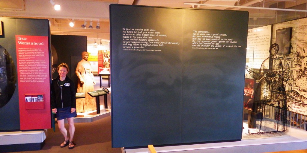
Explore More – Fort Frederica was named for which member of the British royalty?

Minidoka National Historic Site

Overview

One of the many things that makes this country great is its willingness to remember inglorious moments in its past, such as the internment of 110,000 Japanese-Americans during World War II.  Most of the 13,000 Japanese-Americans imprisoned in central Idaho were from Oregon, Alaska, and Washington, including Bainbridge Island where a memorial stands today that is considered part of Minidoka National Historic Site.

Highlights

Guard tower, film, Honor Roll, barrack, mess hall, baseball field, root cellar

Must-Do Activity

The site in Jerome, Idaho now has a new visitor center that shows an excellent film.  From there (or the guard tower) you can access the 1.6-mile interpretive trail.  There was a portion of the museum at Hagerman Fossil Beds National Monument dedicated to Minidoka National Historic Site, but that may not be there anymore.

Best Trail

A 1.6-mile trail passes historic structures lined with many interpretive signs.  Highlights include the root cellar, baseball field, and a tarpaper mess hall. 

Instagram-worthy Photo

The guard tower on the North Side Canal stands near the Honor Roll, which was recreated to match one from the 1940s that listed Japanese-Americans serving in the U.S. armed forces.

Peak Season

Summer

Hours

https://www.nps.gov/miin/planyourvisit/hours.htm

Fees

None

Road Conditions

The main access road is paved, but some of the surrounding farm roads are dirt.  Follow driving directions on the park website, and note that the site is about an hour away from the town of Minidoka, Idaho. You can park at the guard tower or just down the road at the new visitor center’s gravel parking lot.

Camping

Bruneau Dunes State Park offers camping south of Interstate 90 and is a fun spot to visit with sandboards available for rental.

Related Sites

Manzanar National Historic Site (California)

Tule Lake National Monument (California)

Hagerman Fossil Beds National Monument (Idaho)

Explore More – Minidoka War Relocation Center was the seventh largest city in Idaho on March 1, 1943; what was its maximum population?

Upper Delaware Scenic and Recreational River

Overview

Authorized in 1978, this 73-mile stretch of the Upper Delaware River is the longest free-flowing river in the northeast United States.  Forming the Pennsylvania-New York borderline, only 30 of its 55,575 acres are federally owned.  Upper Delaware Scenic and Recreational River is one of 43 designated National Wild and Scenic Rivers, 10 of which are managed by the National Park Service (NPS).

Highlights

Zane Grey Museum, Roebling Aqueduct, fishing

Must-Do Activity

The Upper Delaware River is famous for year-round bald eagle viewing, Class I and II whitewater rafting, and fishing for smallmouth bass and walleye.  The NPS runs the Zane Grey Museum, which celebrates the “Father of the Western Novel” who lived in Lackawaxen, Pennsylvania from 1905 to 1918 and loved fishing here (and throughout his worldwide travels).  It was in this house that the former dentist (Zane Grey) wrote many articles about his outdoor adventures, as well as his novels, including Riders of the Purple Sage (published in 1912).

Best Trail

There are six trails you are required to complete in order to earn your Upper Delaware Hikes patch from the NPS, ranging in length from the quarter-mile Minisink Battleground (Revolutionary War) to the three-mile Tusten Mountain Trail, which provides an excellent view of the river valley.

Instagram-worthy Photo

Within eyeshot of the Zane Grey Museum, the Roebling Aqueduct operated between 1848 and 1898 to allowed coal-laden canal boats to cross over the Upper Delaware River.  Its architect is better known for the Brooklyn Bridge, but this aqueduct was converted to a one-lane car bridge before being purchased by the NPS in 1980.

Peak Season

Spring through fall

Hours

https://www.nps.gov/upde/planyourvisit/hours.htm

Fees

None

Road Conditions

All major roads paved, with Highway 97 in New York following the river for most of its length.

Camping

There are no NPS campgrounds, but many private ones along the Upper Delaware River.

Related Sites

Delaware Water Gap National Recreation Area (Pennsylvania-New Jersey)

Buffalo National River (Arkansas)

Minute Man National Historical Park (Massachusetts)

Explore More – Although they live in the Delaware River for most of their lives, what is the name of the sea in the Atlantic Ocean where eels migrate to spawn and die?

Springfield Armory National Historic Site

Overview

The arsenal at Springfield, Massachusetts began manufacturing guns during the American Revolution and became the first National Armory in 1794.  For nearly 200 years it served its purpose before being donated by the military for the creation of Springfield Technical Community College in 1967.  The National Park Service (NPS) maintains a museum and former officer’s quarters on 55 acres at the back of the gated campus.

Highlights

Museum, film, Organ of Muskets

Must-Do Activity

Start your visit with the 14-minute film, then peruse the two halves of the museum, one side dedicated to weaponry and the other to industry.  Watch the scale model of the Blanchard Eccentric Lathe as it demonstrates the shaping of wood to match a metal template.  This technology was first introduced here and is commonly used today to create keys, furniture, and baseball bats. 

Best Trail

There are no trails, but you can walk the sidewalks around the brick buildings that once housed the armory and are now the campus of Springfield Technical Community College.

Instagram-worthy Photo

The “Organ of Muskets” inspired the 1845 anti-war poem by Henry Wadsworth Longfellow, a Harvard professor with his own NPS site. 

Peak Season

Summer

Hours

https://www.nps.gov/spar/planyourvisit/hours.htm

Fees

None

Road Conditions

Follow street signs from Interstate 91 exits to the main gate for Springfield Technical Community College then back to the free parking lot by the NPS museum.

Camping

Granville State Forest is located 20 miles west of Springfield, Massachusetts on Highway 57.

Related Sites

Longfellow House – Washington’s Headquarters National Historic Site (Massachusetts)

Minute Man National Historical Park (Massachusetts)

Coltsville National Historical Park (Connecticut, authorized in 2014 but remains unfunded)

Explore More – Who was the Springfield Armory employee who invented the M 1 rifle used throughout World War II?

Women’s Rights National Historical Park

Overview

In 1848, Seneca Falls was a small rural town in New York and it still remains that way, but on July 19 of that year it became the focus of the world when it hosted the first Women’s Rights Convention.  Women’s Rights National Historical Park was established on seven acres here in 1980.  Some of the National Park Service (NPS) museum exhibits have not been updated since then, but they still make you think, which is the important point.

Highlights

Museum, film, sculptures, 1843 Wesleyan Chapel, Declaration Park, Elizabeth Cady Stanton house

Must-Do Activity

Nearly two centuries after the convention, some positive changes have been made, but walking through the second-story NPS museum reminds you that we have a long way to go.  The reactions in the newspapers from 1848 are not very different to those written in response to the women’s marches of 2017.  Next door, visitors can enter the reconstructed 1843 Wesleyan Chapel where the two-day meeting was held and read the still relevant Declaration of Sentiments written during the convention.  The NPS also offers free tours of the Elizabeth Cady Stanton house, a short drive away.  Two other houses in Waterloo, New York are also part of the park.

Best Trail

There is a walking tour through historic downtown Seneca Falls that includes the National Women’s Hall of Fame (admission charged), only a short distance from the NPS museum. 

Instagram-worthy Photo

Declaration Park between the NPS museum and the Wesleyan Chapel has a waterfall wall inscribed with the Declaration of Sentiments and its signers’ names.

Peak Season

Summer

Hours

https://www.nps.gov/wori/planyourvisit/hours.htm

Fees

None, except at the unaffiliated National Women’s Hall of Fame.

Road Conditions

All roads paved, but street parking is limited.

Camping

Cayuga Lake State Park has a large campground only 4 miles east of Seneca Falls, New York.

Explore More – Why is there a sculpture of abolitionist Frederick Douglass in the lobby of the visitor center?