Overview
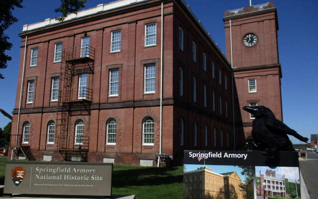
The arsenal at Springfield, Massachusetts began manufacturing guns during the American Revolution and became the first National Armory in 1794. For nearly 200 years it served its purpose before being donated by the military for the creation of Springfield Technical Community College in 1967. The National Park Service (NPS) maintains a museum and former officer’s quarters on 55 acres at the back of the gated campus.
Highlights
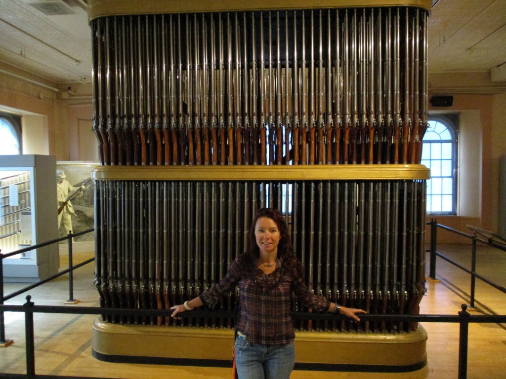
Museum, film, Organ of Muskets
Must-Do Activity
Start your visit with the 14-minute film, then peruse the two halves of the museum, one side dedicated to weaponry and the other to industry. Watch the scale model of the Blanchard Eccentric Lathe as it demonstrates the shaping of wood to match a metal template. This technology was first introduced here and is commonly used today to create keys, furniture, and baseball bats.
Best Trail
There are no trails, but you can walk the sidewalks around the brick buildings that once housed the armory and are now the campus of Springfield Technical Community College.
Instagram-worthy Photo
The “Organ of Muskets” inspired the 1845 anti-war poem by Henry Wadsworth Longfellow, a Harvard professor with his own NPS site.
Peak Season
Summer
Hours
https://www.nps.gov/spar/planyourvisit/hours.htm
Fees
None
Road Conditions
Follow street signs from Interstate 91 exits to the main gate for Springfield Technical Community College then back to the free parking lot by the NPS museum.
Camping
Granville State Forest is located 20 miles west of Springfield, Massachusetts on Highway 57.
Related Sites
Longfellow House – Washington’s Headquarters National Historic Site (Massachusetts)
Minute Man National Historical Park (Massachusetts)
Coltsville National Historical Park (Connecticut, authorized in 2014 but remains unfunded)

Tiff signing the guest book with a rifle pen 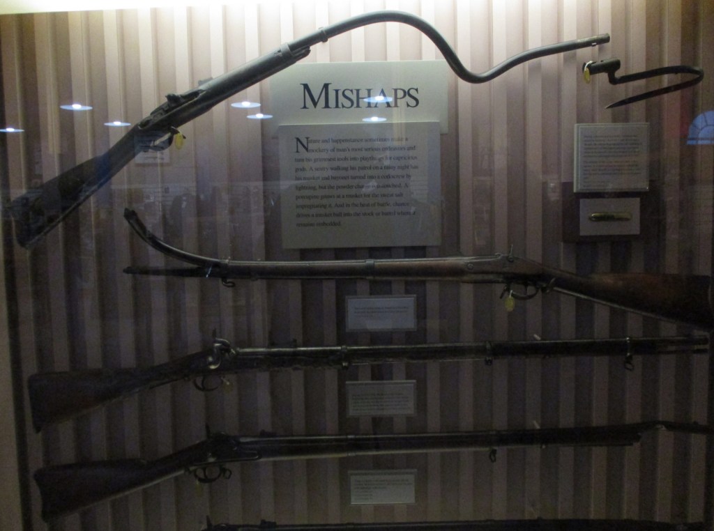
The bayonet on top was struck by lightning! 


Tiff with the historic Blanchard Eccentric Lathe 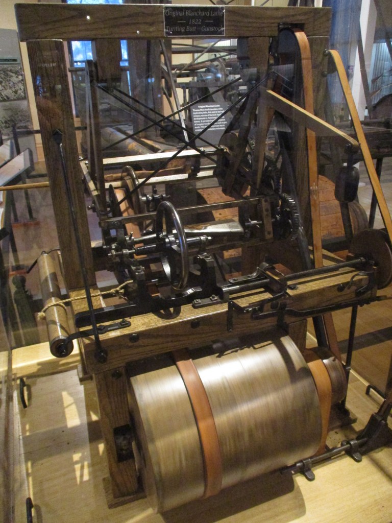
This scale model of the Blanchard Eccentric Lathe actually runs 
An example of casting and forming a gun part 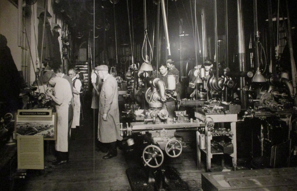
Historic photo from inside the armory 
The spiral staircase in the armory tower. 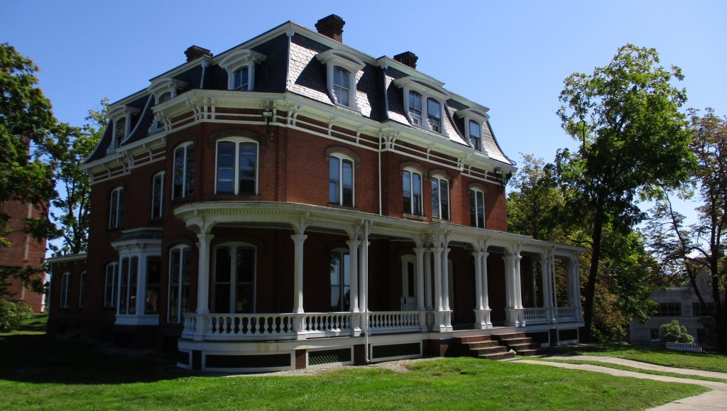
Former officer’s quarters outside the NPS museum
Explore More – Who was the Springfield Armory employee who invented the M 1 rifle used throughout World War II?