Cedar River National Grassland

Cedar River National Grassland

North Dakota

Managed by U.S. Forest Service, Northern Region

6,717 acres (6,717 federal/ 0 other)

Website: https://www.fs.usda.gov/recarea/dpg/recarea/?recid=79471

Overview

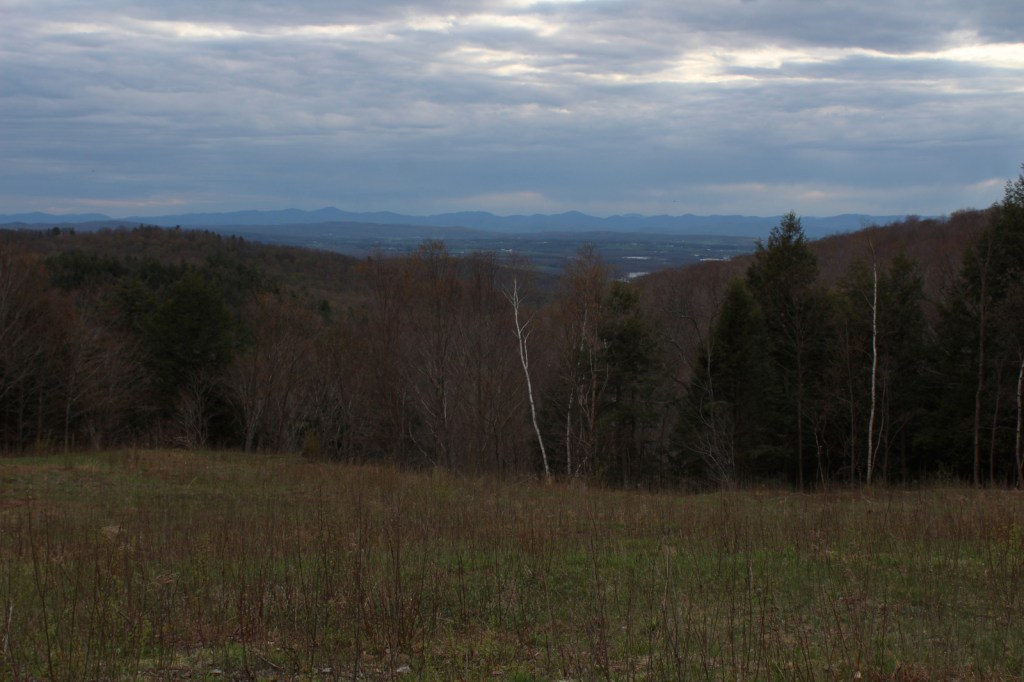
Cedar River National Grassland was created in 1998 from part of Custer National Forest, as is true of all four of the units managed as The Dakota Prairie Grasslands by the U.S. Forest Service.  The number above showing 0 acres of private inholdings is a little misleading since Cedar River National Grassland is a patchwork of public lands surrounded by the Standing Rock Reservation of the Lakota Sioux.  It is administered from the office just across the state border in Lemmon, South Dakota along with 154,783-acre Grand River National Grassland.  Although situated close to the Cedar River, the grassland contains no river bottomlands and is primarily composed of rolling hills cut by dry gullies.

Highlights

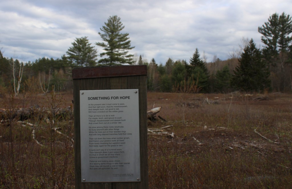
Knispel Wildlife Area, Cedar River

Must-Do Activity

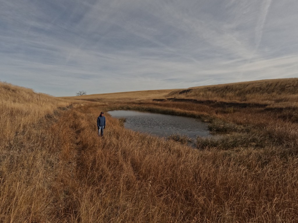
The soils of Cedar River National Grassland are mostly clay, but we found some interesting rocks on the surface near the buttes at Knispel Wildlife Area off Highway 31.  Although it is not in the National Grassland, you should try to drive across one of the bridges over the namesake Cedar River.  Using the Forest Service app, we hiked to a small pond with cattails we could see on the aerial photos near the North Community Allotment.

Best Trail

There are no designated trails in Cedar River National Grassland, so we just walked cross-country.  We do recommend a stop at the World’s Largest Petrified Wood Park in nearby Lemmon, South Dakota.

Watchable Wildlife

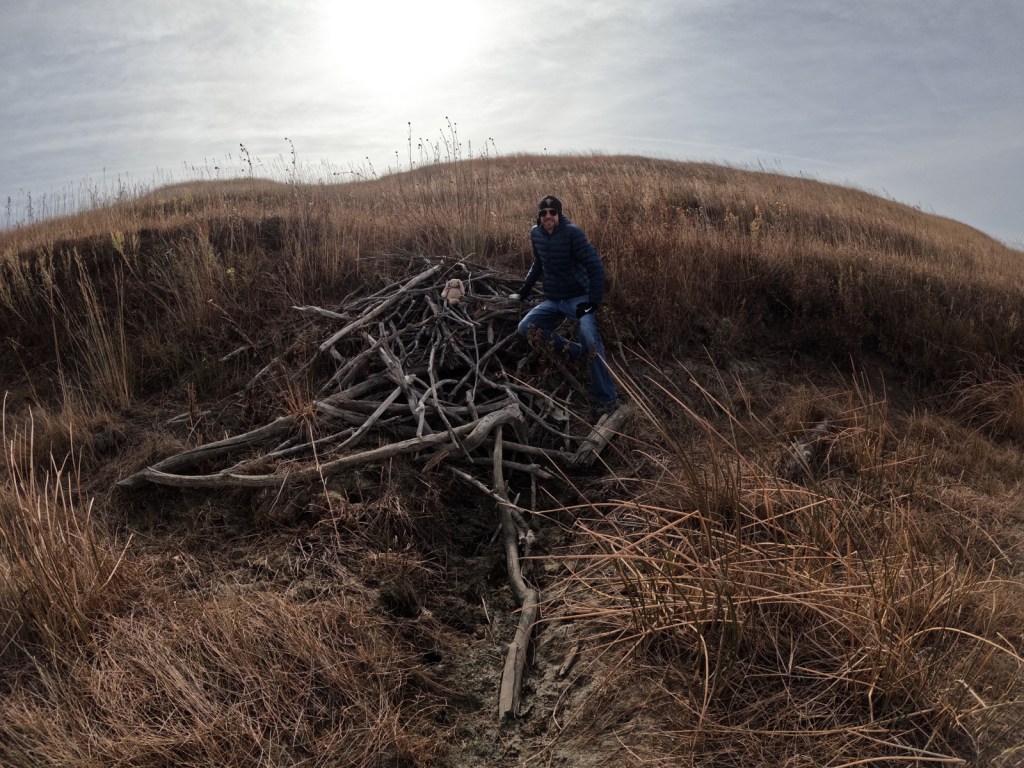
About 25% of the National Grassland was reseeded with crested wheatgrass providing good grazing for white-tailed deer, pronghorn, and cattle.  Sharp-tailed grouse and exotic pheasants are also found in this area and the neighboring farm fields (primarily growing sunflowers).  Potholes and stock ponds provide habitat for blue-winged teals, gadwalls, and mallards, as well as fathead minnows, painted turtles, and northern leopard frogs.  In the summer, listen for the songs of western meadowlarks.  Birds of prey reported are red-tailed hawks, ferruginous hawks, Swainson’s hawks, northern harriers, American kestrels, golden eagles, and bald eagles.  We saw evidence of a hut on a dry stream built by a beaver, and there are also or muskrats, raccoons, coyotes, red foxes, and badgers. 

Instagram-worthy Photo

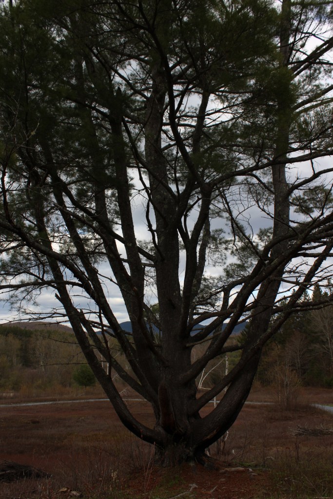
Cottonwood trees are about the only subject that will break the horizon in a photograph at Cedar River National Grassland.

Peak Season

Summer

Fees

None

Road Conditions

Highway 31 is paved, but most of the roads were unpaved; those with gravel were in good shape in October, although the clay could turn to gumbo during wet spring months.

Camping

There is not a designated campground and dispersed camping might be tough due to the lack of pullouts and the predominance of private land.  It is probably better to head south to Grand River National Grassland, which has campgrounds.

Related Sites

Cimarron National Grassland (Kansas)

Knife River Indian Villages National Historic Site (North Dakota)

Fort Union Trading Post National Historic Site (North Dakota-Montana)

Nearest National Park

Theodore Roosevelt

Explore More – After the federal government acquired about 48,000 acres of the Standing Rock Reservation from homesteads in the 1930s, how many acres did they later return to the Lakota Sioux (although the tribe would like it all returned)?

Moosalamoo National Recreation Area

Moosalamoo National Recreation Area

Vermont

Managed by U.S. Forest Service, Eastern Region

15,875 acres

Website: https://www.fs.usda.gov/recarea/gmfl/recreation/recarea/?recid=64903&actid=29

Overview

Created by the New England Wilderness Act of 2006, Moosalamoo National Recreation Area is located in the northern portion of Vermont’s Green Mountain National Forest.  Moosalamoo (pronounced moose-ah-la-moo) comes from the Abenaki word for a moose call.  Recreation here is centered around water, with the Falls of Lana on Sucker Brook, a hike-in campground on Silver Lake, and boating on Sugar Hill Reservoir formed by Goshen Dam.  There are 70 miles of hiking trails, which are also open to mountain bikers, equestrians, and cross-country skiers in the winter.  Blueberry picking is a fun activity in the fall along trails and in cultivated fields at Blueberry Hill Inn in Goshen.

Highlights

Falls of Lana, Silver Lake, Voter Brook Overlook, Sugar Hill Reservoir , Robert Frost Interpretive Trail, Goshen Trail, Chandler Ridge-Leicester Hollow Loop, Mt. Moosalamoo Trail

Must-Do Activity

A short, steep hike from Silver Lake South Trailhead takes you underneath a welded steel penstock (or water pipe) that is part of a hydroelectric project.  From here, carefully go left down the rocks on an unmarked route to the base of the Falls of Lana.  The trail continues to the Rattlesnake Cliffs (closed seasonally due to raptor nesting) and Silver Lake, which has a backcountry campground.  Another popular hike climbs about 1,500 feet in 2.5 miles to the top of Mt. Moosalamoo, with an additional 0.2-mile sidetrip to the South Vista.

Best Trail

Robert Frost, a four-time Pulitzer Prize winner in poetry, spent his summers at the Bread Loaf School of English, which he cofounded.  On Highway 125, the Robert Frost Interpretive Trail is a handicap accessible boardwalk with posted poems by the author that also connects into the Crosswalk, North Star, Afternoon Delight, and Sundown Trails.  Look for evidence of beavers near the ponds and the South Branch of the Middlebury River, as well as blueberries and huckleberries growing in old fields (maintained with prescribed fire).  Unique to Forest Service trailheads, this one is a bus stop on the Tri-Valley Transit route.

Instagram-worthy Photo

Voter Brook Overlook was clearcut and planted with apple trees to provide a nice viewshed in this otherwise dense hardwood forest.

Peak Season

Summer

Fees

None

Road Conditions

All the gravel roads we drove were in good shape during the spring and we were so impressed by one new road culvert we stopped to take a photo (see below).

Camping

Open from Memorial Day through Labor Day, Moosalamoo Campground has 18 campsites located at the base of the Mt. Moosalamoo Trail, near Voter Brook Overlook.  There are a couple dispersed campsites also on the road, but we had one of our worst nights camping here with college kids blasting music late and another group waking us up before sunrise.  The backpacking campground at Silver Lake is nice, or you can stay at Branbury State Park on Lake Dunmore.

Related Sites

Green Mountain National Forest (Vermont)

White Rocks National Recreation Area (Vermont)

Marsh-Billings-Rockefeller National Historical Park (Vermont)

Saint-Gaudens National Historical Park (New Hampshire)

Nearest National Park

Acadia

Explore More – Although his name is not Lana, the Falls of Lana are named for which U.S. Army General who served in the 1848 Mexican-American War?

Black Kettle National Grassland

Black Kettle National Grassland

Oklahoma, Texas

Managed by U.S. Forest Service, Southern Region

33,113 acres (31,286 federal/ 1,827 other)

Website: https://www.fs.usda.gov/detail/cibola/home/?cid=stelprdb5397425

Overview

Like Cimarron National Grassland in Kansas, Black Kettle National Grassland was purchased by the federal government during the 1930s Dust Bowl.  This is one of the only National Grasslands with a visitor center, shared with the National Park Service (NPS) who manages Washita Battlefield National Historic Site at the site of an 1868 massacre that took the life of Chief Black Kettle of the Southern Cheyenne.  Even though the downstairs U.S. Forest Service office was closed on our Saturday visit, the NPS ranger at the desk provided a map and information on the National Grassland.  We also walked the paved interpretive trail at the visitor center that explained homesteading, prescribed burning, and preserving the rare shinnery oak species. 

Highlights

Black Kettle Recreation Area, Lake Marvin, Spring Creek Lake, Croton Creek Watchable Wildlife Area, Skipout Lake, Cheyenne Nature Walk

Must-Do Activity

Recreation here surrounds four reservoirs, including a tiny parcel around 63-acre Lake Marvin in Texas.  In Oklahoma, there are 60-acre Skipout Lake, 50-acre Spring Creek Lake, and 80-acre Dead Warrior Lake.  Fishing, picnicking, and free primitive camping are allowed at all four reservoirs, with a 1.75-mile trail circling Skipout Lake and wooded trails south of Dead Warrior Lake in Black Kettle Recreation Area. 

Best Trail

Unlike some other National Grasslands, there are multiple marked and maintained trails here, including two loops totaling 1.6 miles at Croton Creek Watchable Wildlife Area (south of Highway 47) lined by small signs describing native grasses, trees, and birds.  A slightly hidden trail is shown on the Forest Service app in the town of Cheyenne where a sidewalk heads into the woods leaving from the parking lot at the high school baseball field.  The Cheyenne Nature Walk is paved and has a gazebo and boardwalk crossing a wetland area that was dry during our May visit.

Watchable Wildlife

Three unique bird species we spotted during our May visit were Mississippi kites, northern bobwhite quail, and scissor-tailed flycatchers.  In addition, we saw cardinals and woodpeckers, and heard whippoorwills, barn owls, and barred owls overnight.  Wild turkeys, cedar waxwings, and lesser prairie chickens are also among the 277 bird species identified.  Tracks of white-tailed deer and raccoons were abundant on the Croton Creek Trail, plus there are bobcats, mountain lions, and beavers in the area.  Fishermen can catch black bass, saugeye, catfish, and other types of pan fish. 

Instagram-worthy Photo

This area is more heavily wooded than some other prairie National Grasslands, which can be experienced on the Croton Creek Trail and Cheyenne Nature Walk (watch for poison-ivy).

Peak Season

Spring and fall

Fees

None

Road Conditions

Highways 283, 33, and 47 are paved roads that run through the National Grassland, and despite abundant spring rainstorms, we did not have any difficulty with the unpaved roads.

Camping

All four lakes offer free primitive campsites with some picnic tables, as does Croton Creek Watchable Wildlife Area where we stayed only six miles west of Cheyenne.  RV campsites with hookups at Lake Marvin cost $20 a night.

Related Sites

Washita Battlefield National Historic Site (Oklahoma)

Alibates Flint Quarries National Monument (Texas)

Cimarron National Grassland (Kansas)

Nearest National Park

Great Sand Dunes

Explore More – The South Canadian River flows north of Black Kettle National Grassland, but what is the river that runs through the middle of it?

Top 10 States for National Forests

We are currently finishing up our newest travel guidebook 50 States of Great (for sale now on Amazon), which focuses on our favorite National Forest, State Park, Roadside Attraction, and nine other categories for every state in America.  There are a few states with only one National Forest (and ten without any), which made the selection process easy, but others like California (with 19) that were a real challenge to pick.  With that in mind, we thought it would be fun to select the top states for National Forest biodiversity and recreational opportunities.  Click here to see all of our Top 10 Lists, including our Top 10 States for State Parks and Top 10 Day Hiking Trails in National Forests.

10. Florida

Apalachicola, Ocala, and Osceola National Forests

1,434,931 acres (1,176,287 federal/ 258,649 other)

Crystal clear natural springs and biodiverse forests with endemic species make this a fun state to visit, just not so much during the muggy and buggy summers

9. Oregon

Deschutes, Fremont, Malheur, Mt. Hood, Ochoco, Rogue River, Siuslaw, Umpqua, Willamette, Winema, Siskiyou, Wallowa, Whitman, and Umatilla National Forests

17,314,842 acres (15,555,804 federal/ 1,759,038 other)

From sand dunes on the Pacific Ocean to Cascade Range stratovolcanoes, from countless waterfalls to dry hillsides above the Columbia and Snake Rivers

8. Alabama

Conecuh, Talladega, Tuskegee, and William B. Bankhead National Forests

1,288,521 (670,983 federal/ 617,538 other)

A state with surprisingly great backpacking opportunities and long trails through pine and hardwood forests

7. Alaska

Chugach and Tongass National Forests

24,359,118 (21,956,783 federal/ 2,402,335 other)

Some of the most rugged terrain in America is found in these temperate rainforests on the Pacific Coast

6. Utah

Ashley, Cache, Dixie, Fishlake, La Sal, Manti, Sawtooth, Uinta, and Wasatch National Forests

9,157,444 acres (8,152,640 federal/ 1,004,804 other)

Alpine peaks and red rock beauty stretch from the northern border to the south

5. Kentucky

Daniel Boone National Forest and Land Between The Lakes National Recreation Area

2,153,550 (813,138 federal/ 1,340,412 other)

Bison herds, sandstone arches, waterfalls, and caves await in the forested hills of Kentucky

4. Wyoming

Bighorn, Bridger, Medicine Bow, Shoshone, and Teton National Forests

9,123,212 acres (8,694,111 federal/ 429,101 other)

Our favorite places to backpack in the world are all in our home state of Wyoming

3. Arizona (Click here to view our 7-Day Road Trip Itinerary)

Apache, Coconino, Coronado, Kaibab, Prescott, Sitgreaves, and Tonto National Forests

11,891,457 acres (11,264,619 federal/ 626,838 other)

Sky Islands that rise above the Sonoran Desert, the red rocks of Sedona, and extensive conifer forests

2. Washington

Colville, Gifford Pinchot, Mt. Baker, Okanogan, Olympic, Snoqualmie, and Wenatchee National Forests

10,109,600 acres (9,287,525 federal/ 822,075 other)

Glacier-clad peaks and beautiful lakes abound in the soggy and scenic Pacific Northwest

…and finally our #1 state for National Forests:

1. California

Angeles, Cleveland, Eldorado, Inyo, Klamath, Lassen, Los Padres, Mendocino, Modoc, Plumas, San Bernardino, Sequoia, Shasta, Sierra, Six Rivers, Stanislaus, Tahoe, Toiyabe, and Trinity National Forests

24,266,631 acres (20,790,923 federal/ 3,475,708 other)

Incredible endemic tree species like giant sequoia and coast redwood make these 19 National Forests the most biodiverse in America

.

Honorable Mentions

Colorado

Arapaho, Grand Mesa, Gunnison, Pike, Rio Grande, Roosevelt, Routt, San Isabel, San Juan, Uncompahgre, and White River National Forests

15,339,248 acres (13,884,722 federal/ 1,454,526 other)

There is a short summer season to hike in Colorado’s mountains, but ski resorts and snowshoes open up the country in the winter

Michigan

Hiawatha, Huron, Manistee, and Ottawa National Forests

4,880,281 acres (2,866,752 federal/ 2,013,529 other)

Lighthouses on three Great Lakes, plus wonderful waterfalls, sand dunes, and hiking trails

Idaho (Click here to view our 7-Day Road Trip Itinerary)

Boise, Caribou, Challis, Clearwater, Idaho Panhandle (Coeur d’Alene, Kaniksu, St. Joe), Nez Perce, Payette, Salmon, Sawtooth, and Targhee National Forests

21,582,915 acres (20,416,960 federal/ 1,165,955 other)

Worth including if only for stunning Sawtooth National Recreation Area and the massive Frank Church River of No Return Wilderness

New Hampshire

White Mountain National Forest

828,356 acres (735,823 federal/ 92,533 other)

Only one National Forest in New Hampshire, but one of the few that could easily be a National Park

Puerto Rico

El Yunque National Forest

56,097 acres (28,434 federal/ 27,663 other)

Puerto Rico is not technically a state, but the only tropical rainforest in the National Forest system deserves recognition

Saugus Iron Works National Historic Site

Saugus Iron Works National Historic Site

Massachusetts

Managed by National Park Service

Established 1969

8.5 acres

Website: nps.gov/sair

Overview

Situated in the middle of the town of Saugus, this interesting little park preserves North America’s first integrated iron works dating back to 1646.  The site was chosen because of access to local bog iron, gabbro, ample trees for making charcoal, and the Saugus River for providing power and shipping.  Molten iron was poured into long sow bars that were forged into wrought iron, some of which went into a rolling and slitting mill that provided material for easily producing nails.  In addition to cast products like pots, other items made include hinges, hoes, shovels, kettle hooks, and tongs.  In the 1660s, bankruptcy led skilled iron workers (mostly indentured servants) from here to start mills throughout New England.  Saugus Iron Works National Historic Site is part of Essex Saugus National Heritage Area, along with Salem Maritime National Historic Site in northeast Massachusetts.

Highlights

Saugus River, blast furnace, forge, Iron Works House, free mushed penny machine

Must-Do Activity

Start your visit in the National Park Service (NPS) museum located in the former chicken coop and blacksmith shop, where a 12-minute video is played.  Do not forget to crush your own penny in the only free coin-smashing machine we have encountered at a NPS site.  Rangers offer tours throughout the day or a self-guided tour takes you to a blast furnace, forge, rolling mill, warehouse, and dock area on the Saugus River.  The Iron Works House is a 1680s mansion containing period furnishings and is the only original building left standing.  Other structures were rebuilt in the 1950s by the First Iron Works Association funded by the American Iron and Steel Institute.

Best Trail

A half-mile nature trail follows along the banks of the Saugus River.

Instagram-worthy Photo

Huge bellows made of wood and leather provided a steady blast of air to maintain the high temperature required to smelt ore into molten iron.

Peak Season

Summer

Hours

https://www.nps.gov/sair/planyourvisit/basicinfo.htm

Fees

None

Road Conditions

All roads are paved to the small parking lot.

Camping

Harold Parker State Forest offers 130 campsites about 13 miles to the northwest.

Related Sites

Hopewell Furnace National Historic Site (Pennsylvania)

Salem Maritime National Historic Site (Massachusetts)

Springfield Armory National Historic Site (Massachusetts)

Explore More – How heavy was the cast iron hammer head used in the forge and lifted by the waterwheel?