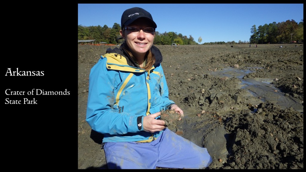
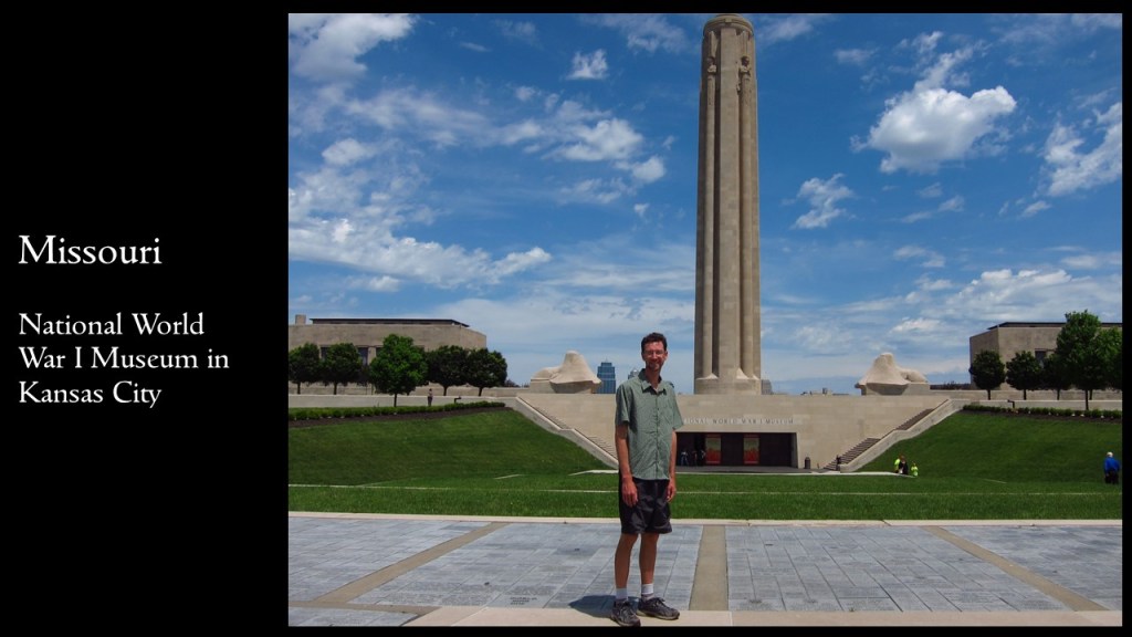
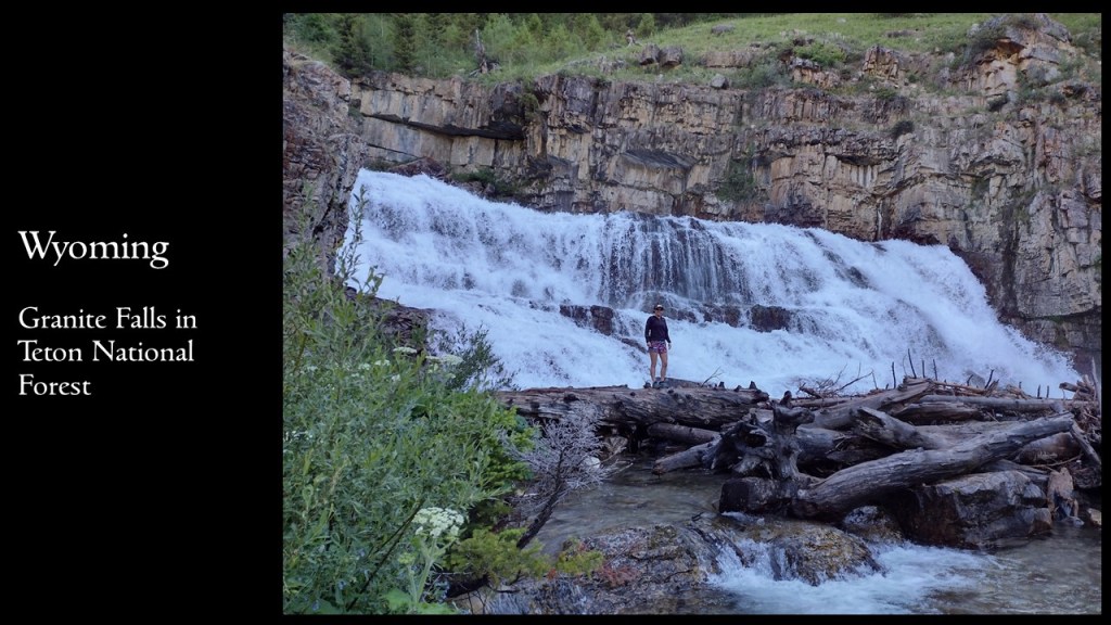
We are giving a presentation on road tripping in the U.S.A. at the Laramie County Library in Cheyenne, Wyoming. It will be held in the Cottonwood Room (1st floor) at 7 p.m. on Tuesday, December 5, 2023. We will have all our books for sale before and after the talk and would be happy to sign them for you.
50 States of Great: Road Trip Guide to America is a starting point for planning a road trip of any length, covering the best of each state in 12 categories: scenic drive, State Park, museum, waterfall, roadside attraction, National Forest, campsite, and more. 50 States of Great is a culmination of our extensive travels through the United States of America seeking out well-known destinations and less-frequented spots. The goal of our book is to be useful whether you are taking a cross-country road trip or exploring your home state.
We hope to see you Tuesday!
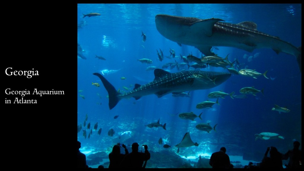
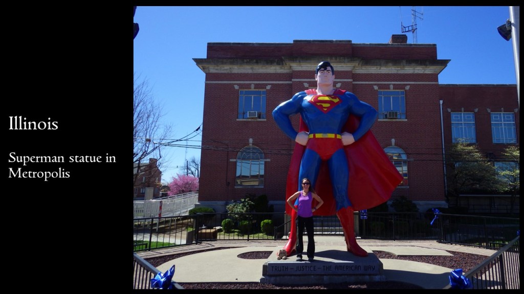
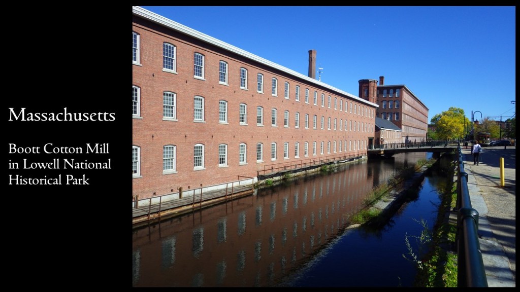
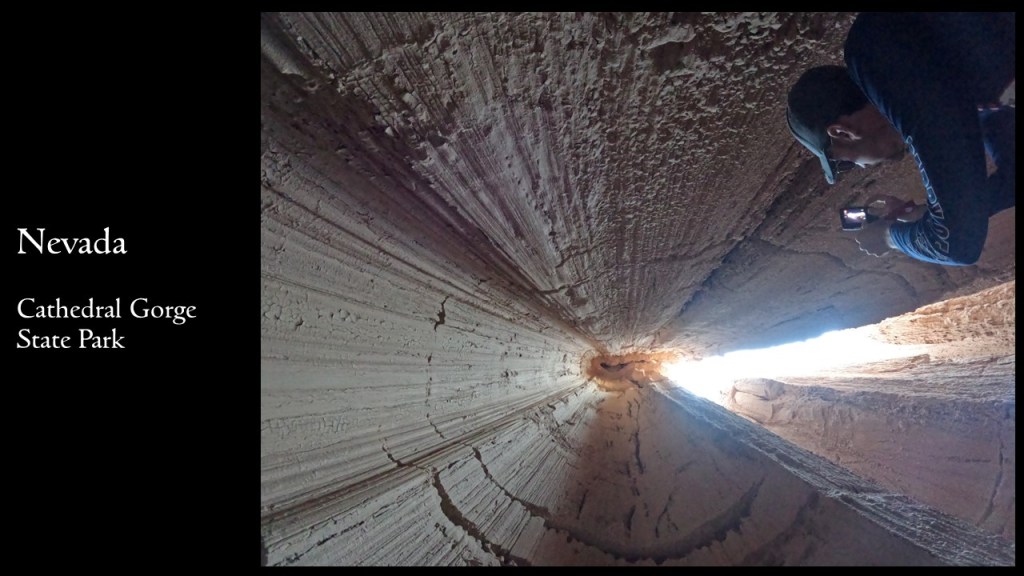
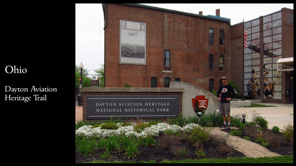
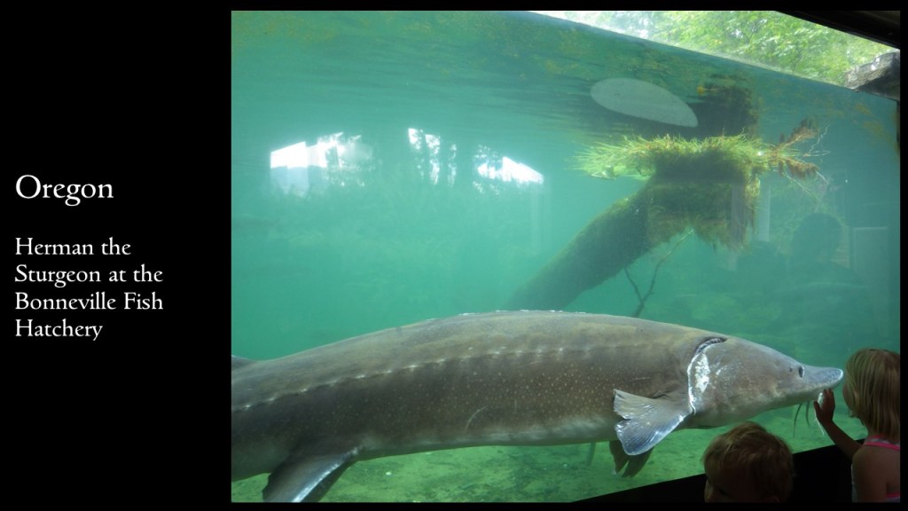
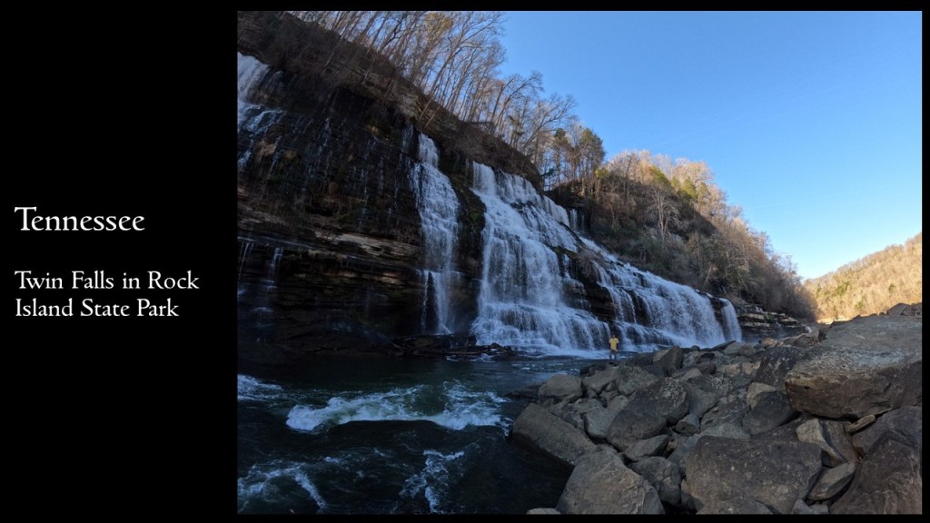
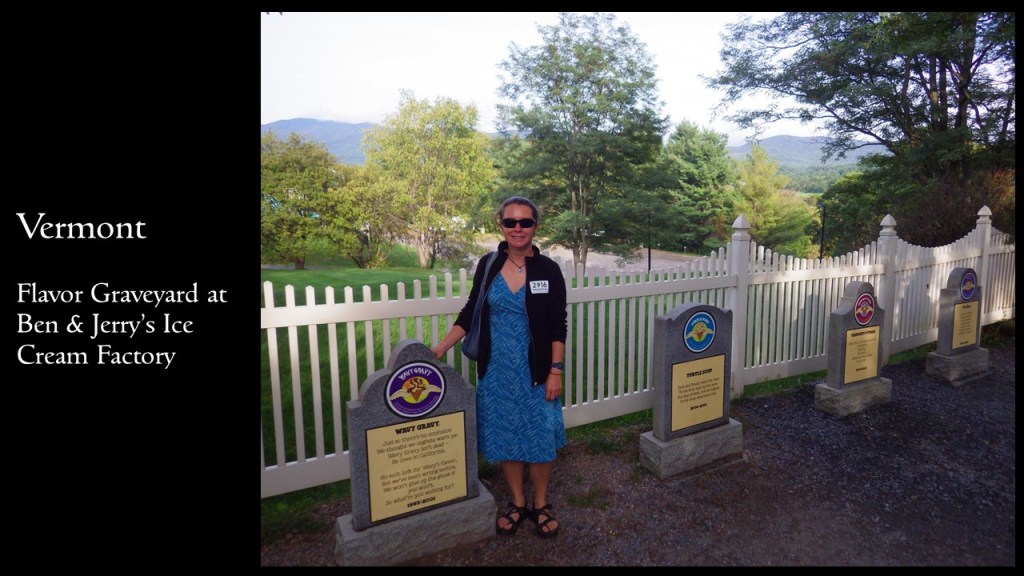
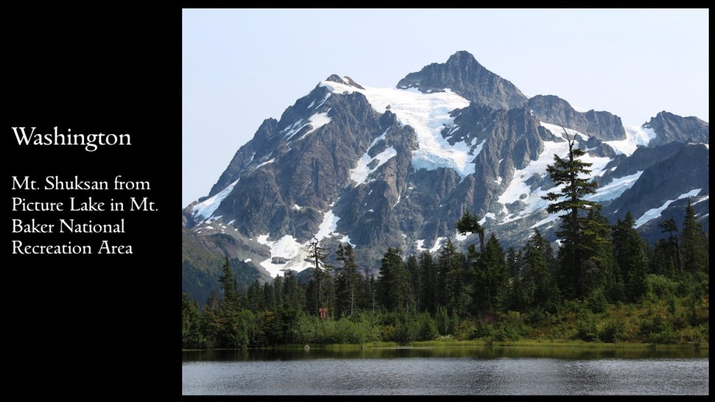
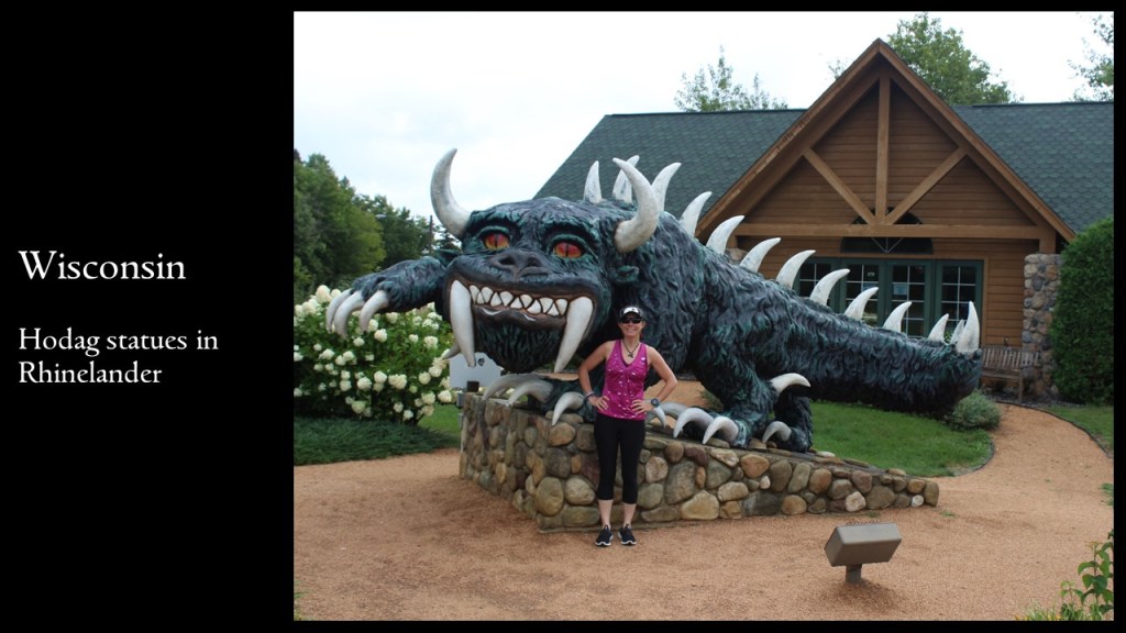
If you can’t make it, you can still check out our slide deck of one (mostly) off-the-beaten-path destination we love in each of the 50 states.
We are a participant in the Amazon Services LLC Associates Program, an affiliate advertising program designed to provide a means for us to earn fees by linking to Amazon.com and affiliated sites.
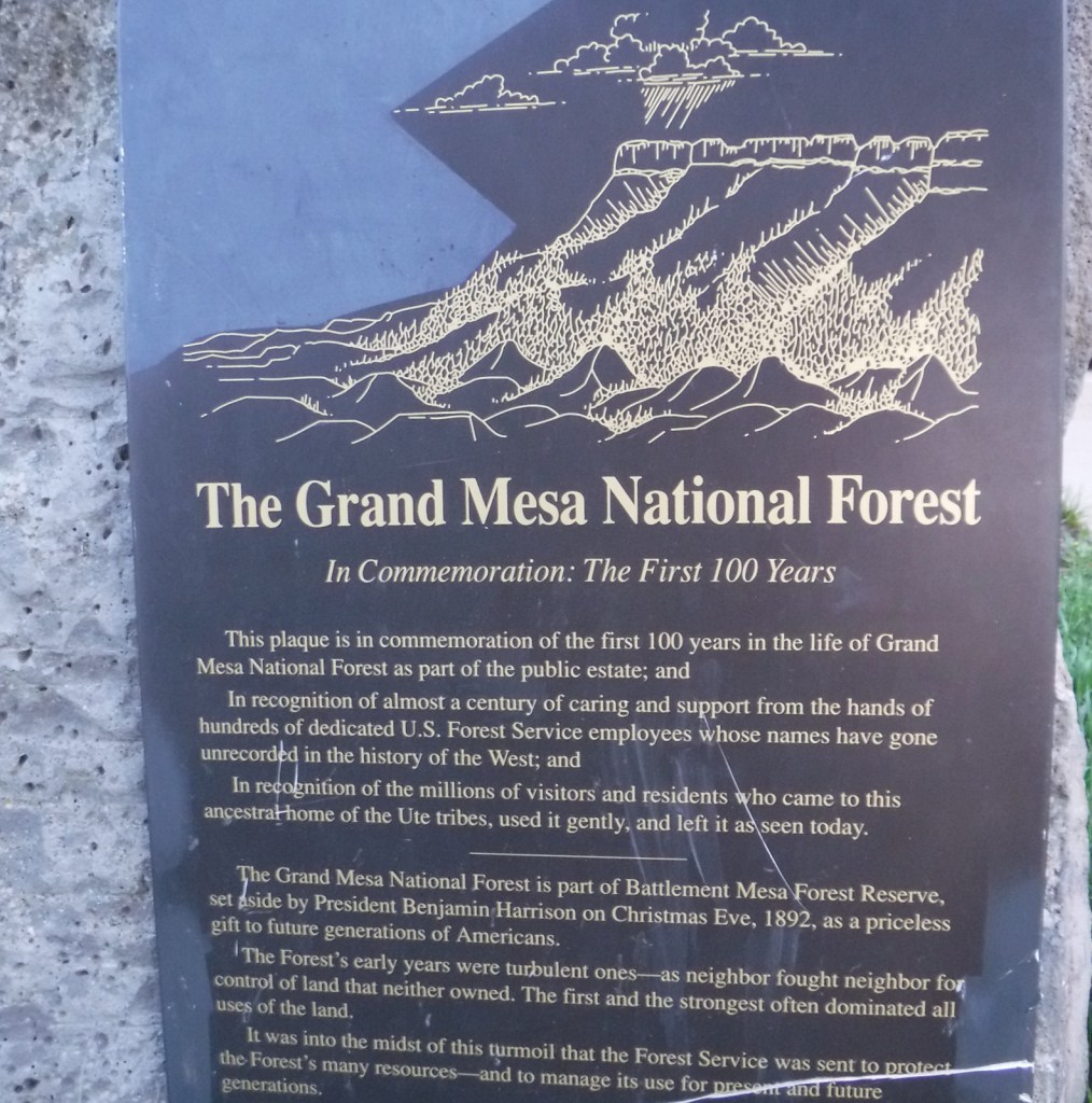
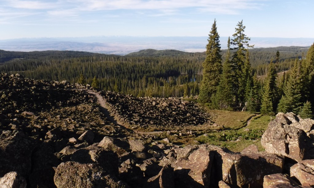
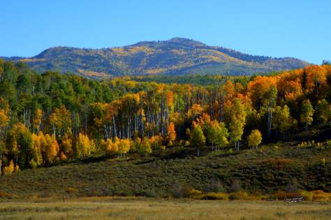
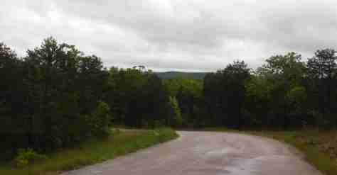
Covering 540 square-miles, Grand Mesa is the largest flattop mountain in the world and has an average elevation of 10,500 feet. It rises east of Grand Junction and is easily explored via paved Highway 65, also known as Grand Mesa Scenic Byway. Due to its high elevation, Grand Mesa National Forest is a popular destination for snowmobiles in the winter. This area was first set aside by President Harrison in 1892 as Battlement Mesa Forest Reserve, only the third such designation in U.S. history. It is now co-managed with Colorado’s Gunnison and Uncompahgre National Forests.
Highlights
Grand Mesa Scenic Byway, Land’s End Ranger Observatory, Ward Lake, Island Lake Interpretive Trail, Crag Crest National Recreation Trail, Eggleston Lake, Leon Peak, Battlement Trail
Must-Do Activity
Also covering a portion of Battlement Mesa, Grand Mesa National Forest contains more than 300 lakes, several of which have campgrounds. The Grand Mesa Visitor Center on Highway 65 near Island Lake is a great place to start, with a 20-minute film shown detailing the 1999 Land’s End archaeological excavation that found evidence of 8,000 years of human activity at 9,000 feet in elevation. Dirt roads travel east from there deeper into the National Forest, or you can take a side trip west on the Grand Mesa Scenic Byway to the visitor center at Land’s End Ranger Observatory for views all the way into Utah’s La Sal National Forest.
Best Trail
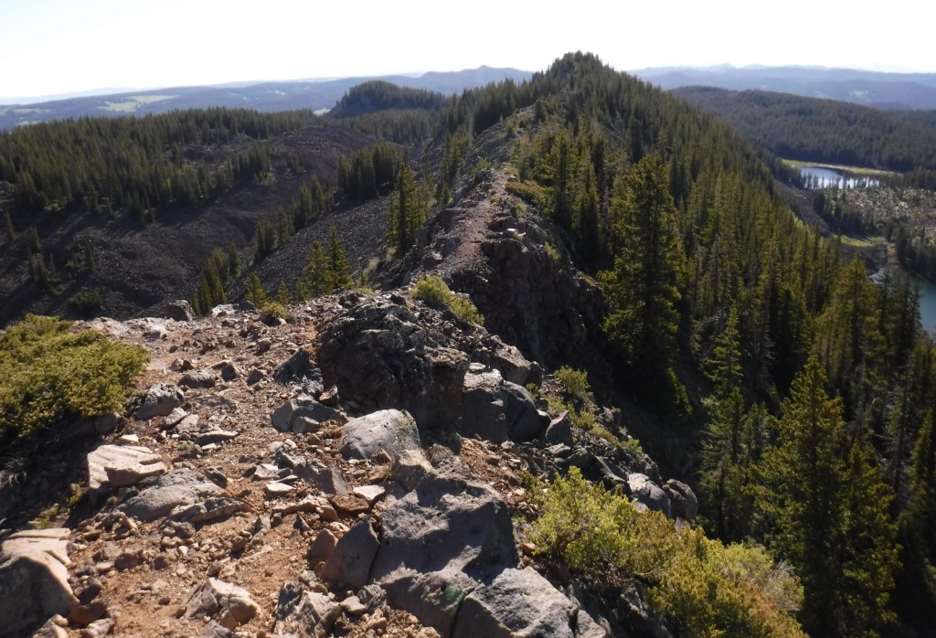
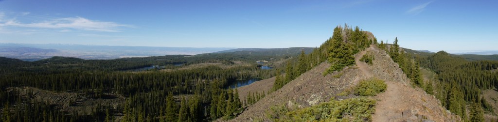
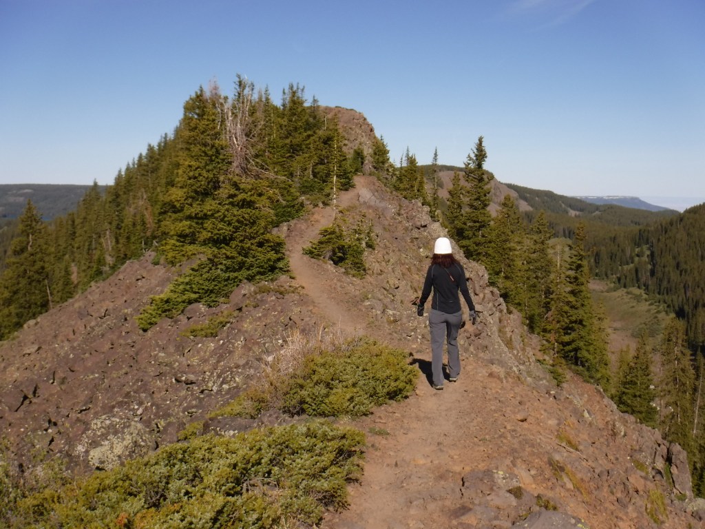
The best trail in Grand Mesa National Forest is without a doubt Crag Crest National Recreation Trail. It can be hiked as a 10.3-mile loop from two trailheads, one at Island Lake (paved access) and the other at Eggleston Lake (that requires some dirt road driving). The crest portion of the hike is the highlight as it follows a narrow ridge of volcanic rock that offers spectacular views. Due to its exposure and the high altitude (up to 11,189 feet) it is recommended that you get an early start to avoid afternoon thunderstorms. For those not wishing to do the entire loop, we found that by starting out counterclockwise from Eggleston Lake the trail climbs steeply providing panoramas within two miles. We completed five miles out-and-back with a cumulative elevation gain of 1,100 feet and felt we had gotten the full experience.
Watchable Wildlife
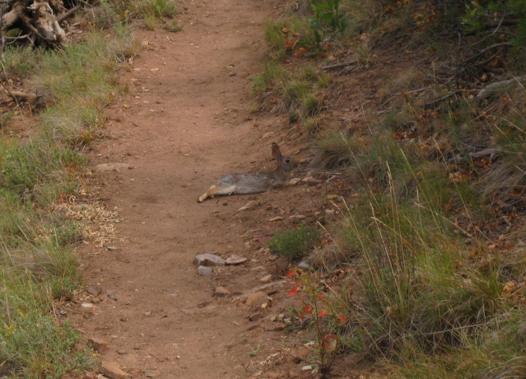
Trout fishing is one of the main draws to the 300 lakes in Grand Mesa National Forest. The lakes and streams also attract elk, mule deer, bighorn sheep, raccoons, red foxes, black bears, and mountain lions, in addition to large birds like bald eagles, golden eagles, peregrine falcons, common ravens, and wild turkeys. Due to its high elevation, look for pikas in the rocks along Crag Crest National Recreation Trail.
Instagram-worthy Photo
Starting counterclockwise on the Crag Crest National Recreation Trail from Eggleston Lake, we climbed to stunning panoramas within two miles.
Peak Season
Summer
Fees
None
Road Conditions
Grand Mesa Scenic Byway follows paved Highway 65 up above 10,000 feet in elevation, as well as west to Land’s End Ranger Observatory. The unpaved Land’s End Road continues switchbacking down the mesa to Highway 50, but is not recommended for vehicles more than 21 feet in length. The unpaved roads on Grand Mesa were in good shape during our June visit, but are closed in the winter.
Camping
There are campgrounds at several lakes in Grand Mesa National Forest, as well as dispersed camping options along the dirt roads.
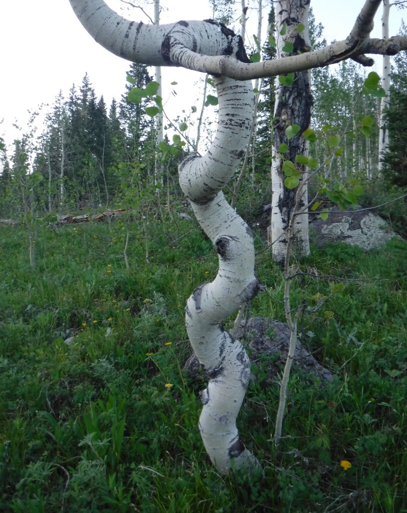
Quaking aspenEggleston LakeCrag Crest National Recreation TrailCrag Crest National Recreation TrailCrag Crest National Recreation TrailTiff on Crag Crest National Recreation TrailScott on Crag Crest National Recreation TrailBook Cliffs from Crag Crest TrailTiff on Crag Crest National Recreation TrailPikaRaven about the forest
Explore More – Now a geological term, what does “mesa” mean in Spanish?
Learn more about this and the 154 other National Forests in our new guidebook Out in the Woods
We are a participant in the Amazon Services LLC Associates Program, an affiliate advertising program designed to provide a means for us to earn fees by linking to Amazon.com and affiliated sites.
Perhaps a bit dated now, but this is a cherished travelogue from the national treasure who wrote The Grapes of Wrath (a novel which is sort of a road trip book itself)
This classic does not really have a plot, just a bunch of interesting characters to drive back and forth across 1950s America with (it is often considered fiction, but it is based on real people and events)
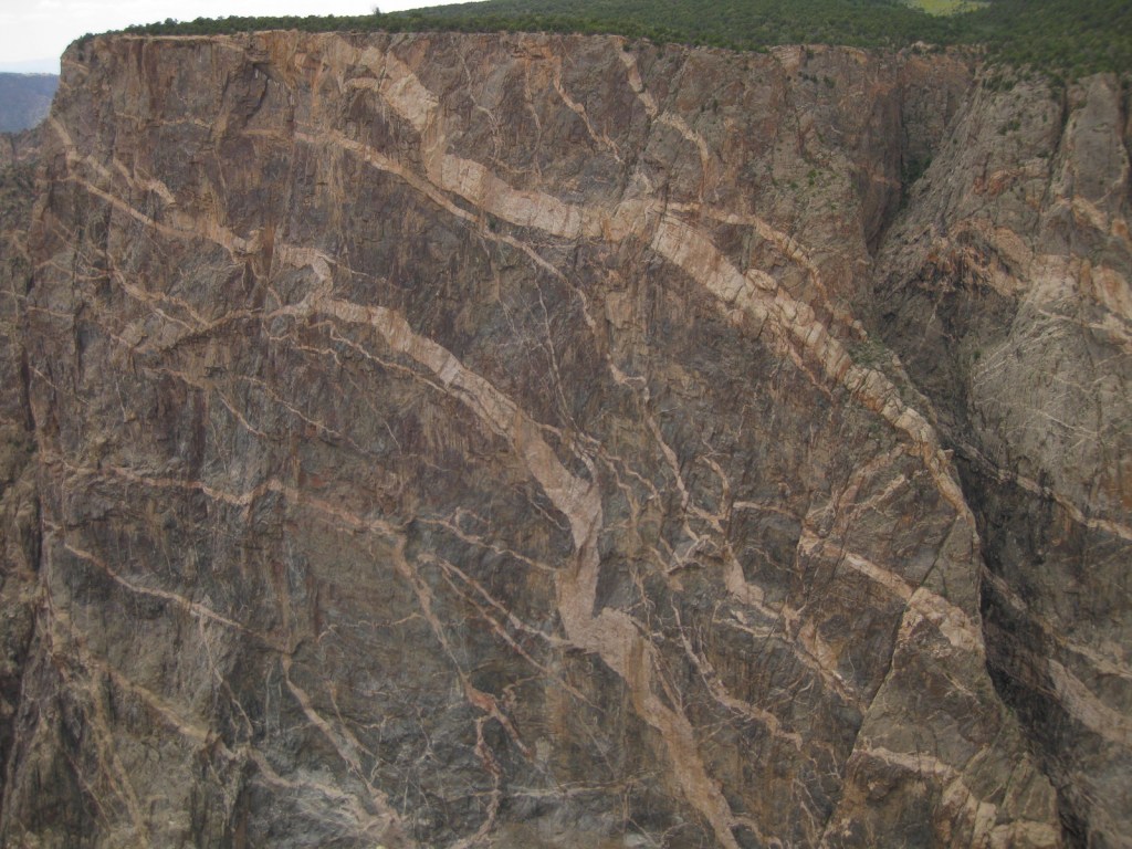
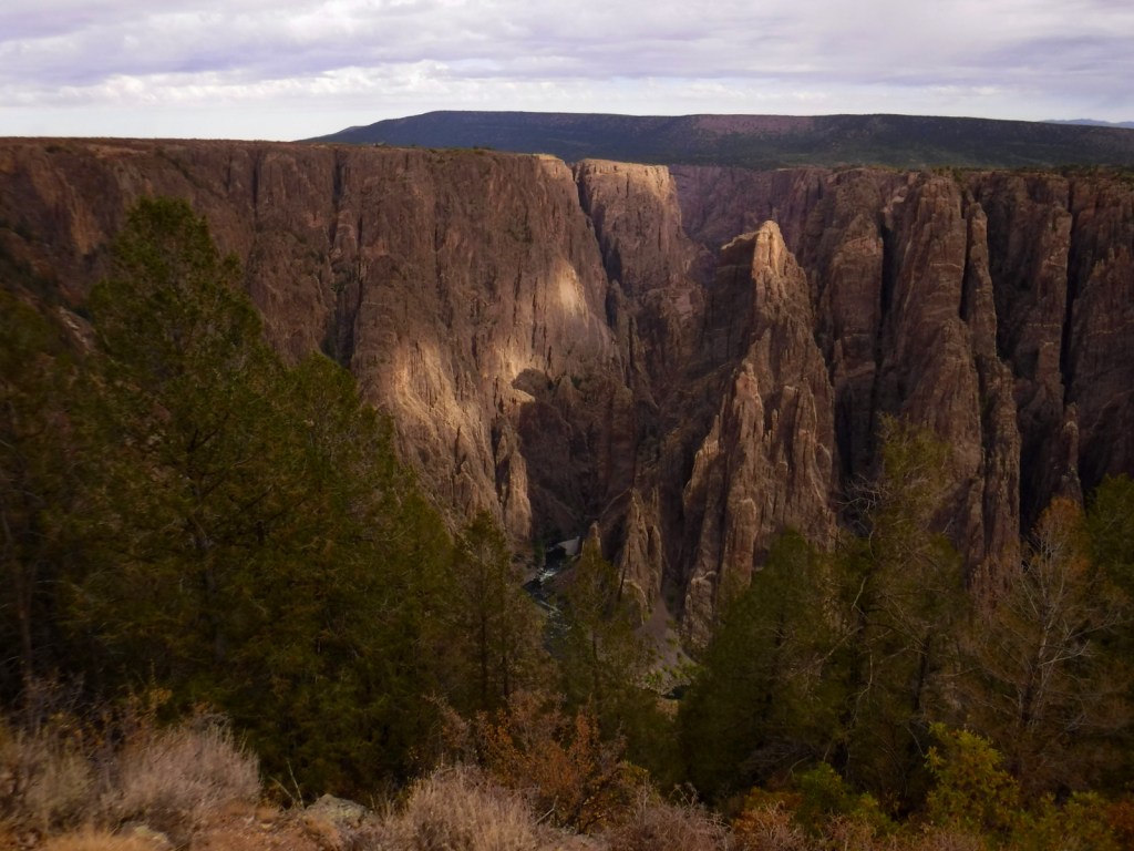
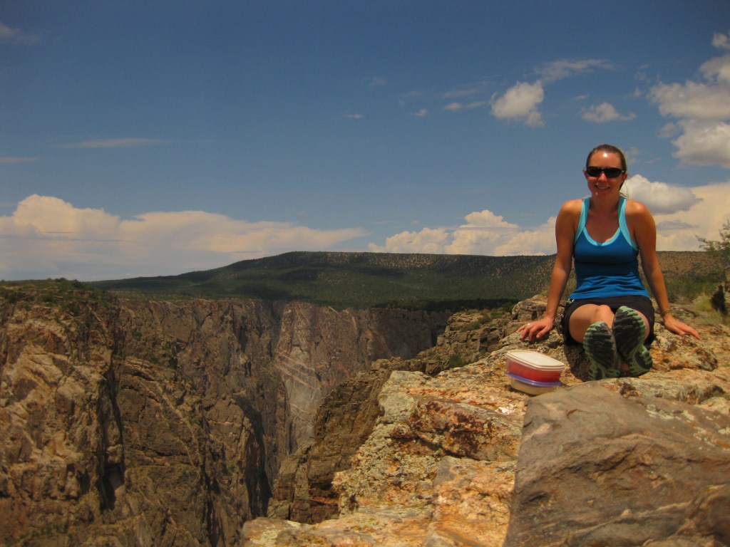
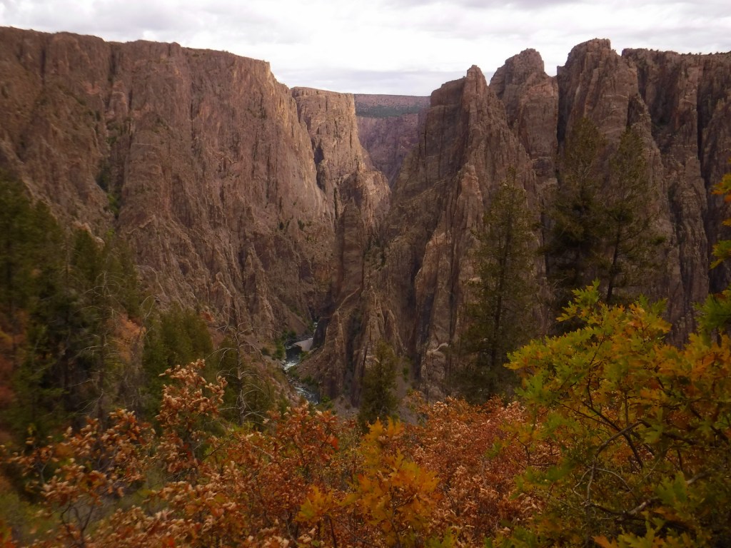
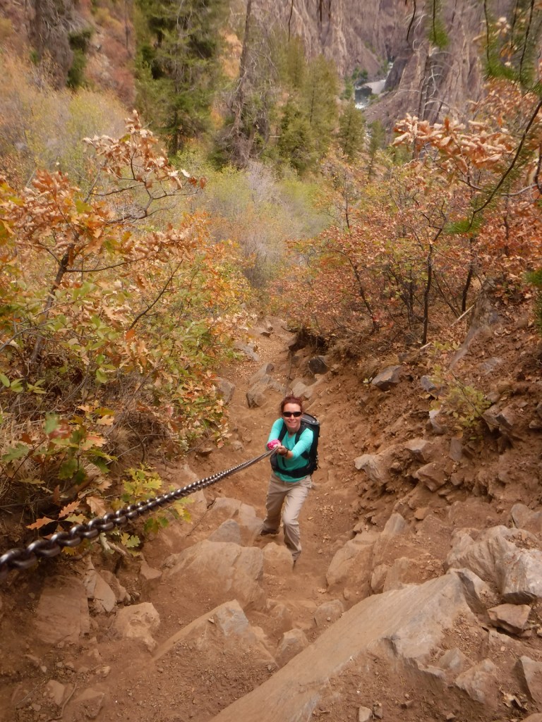
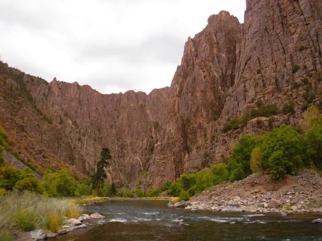
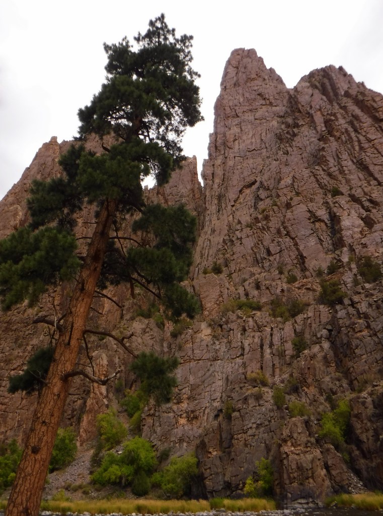
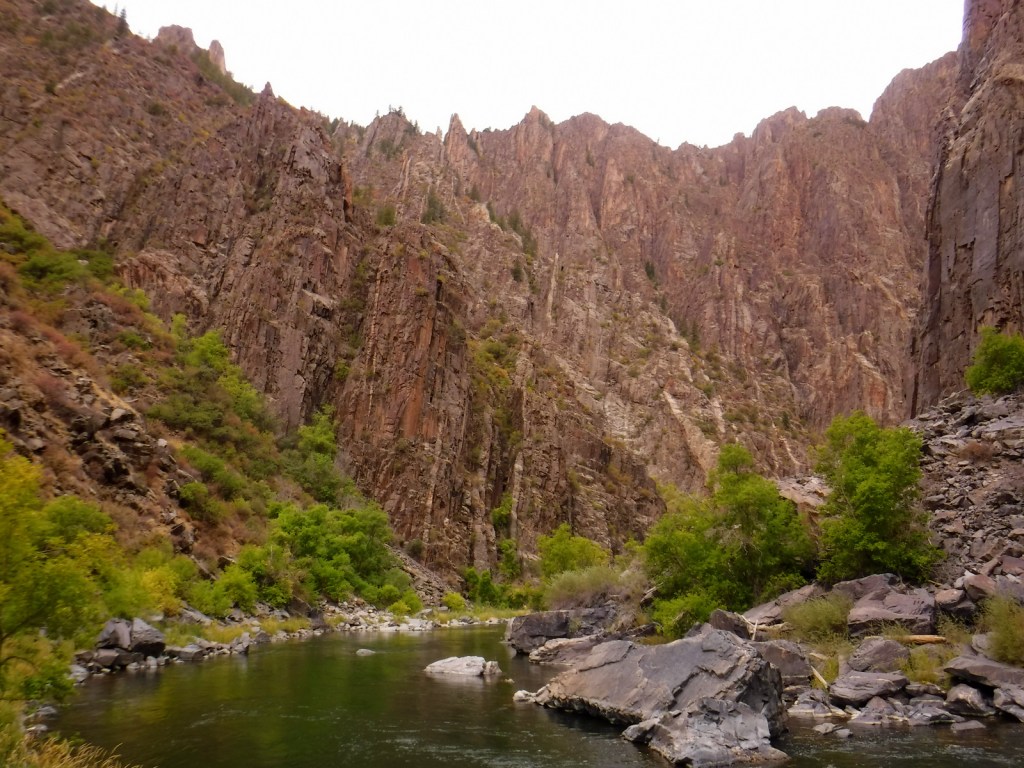
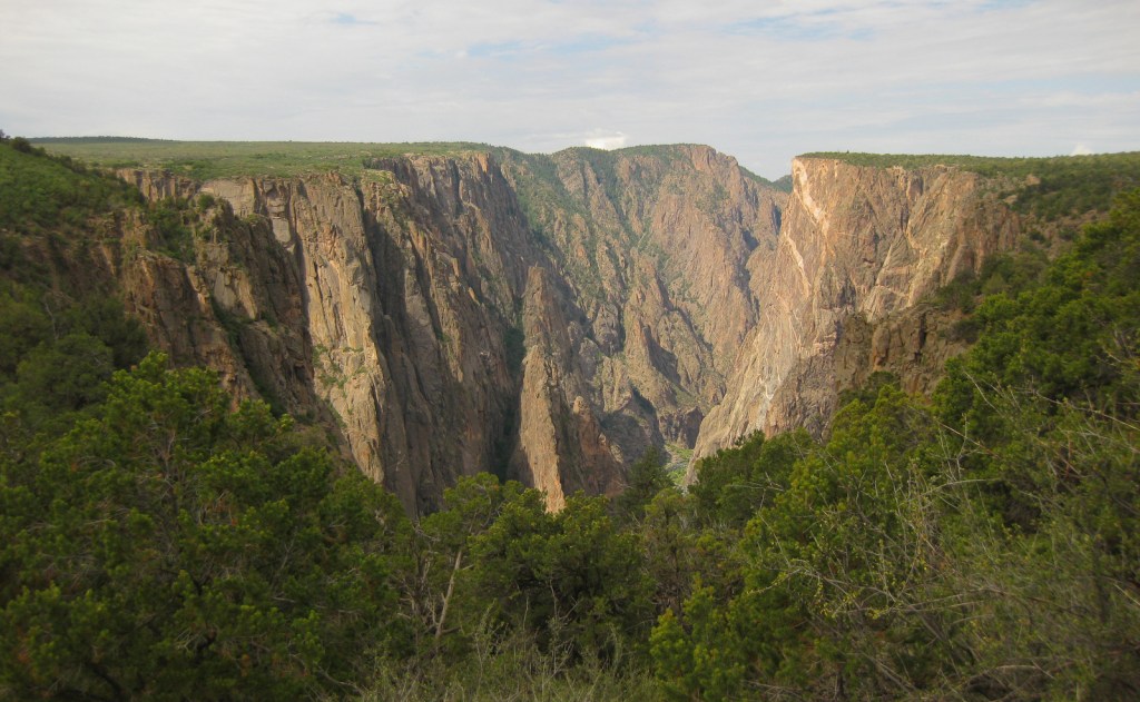
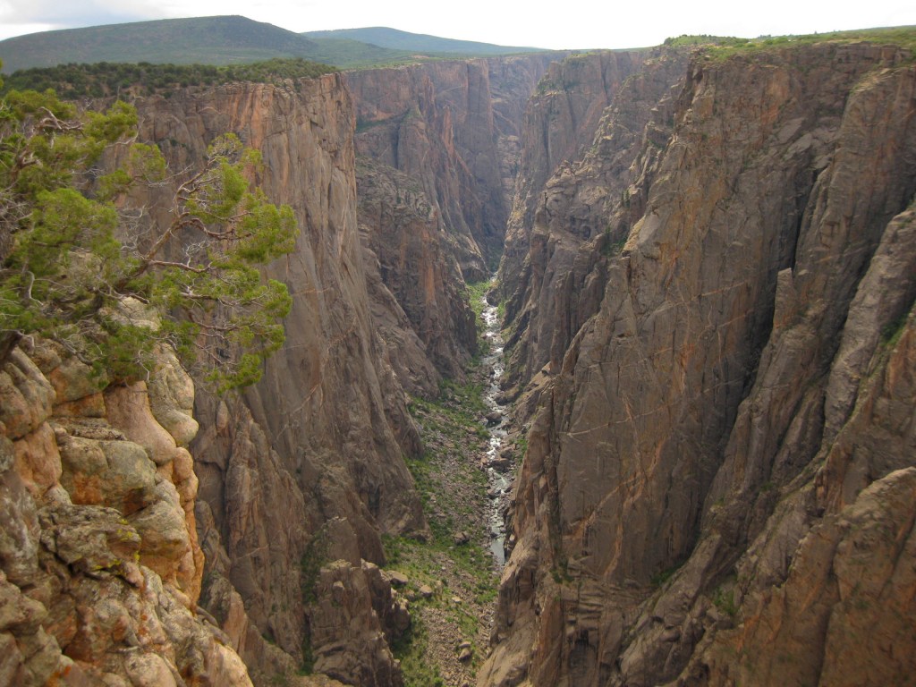
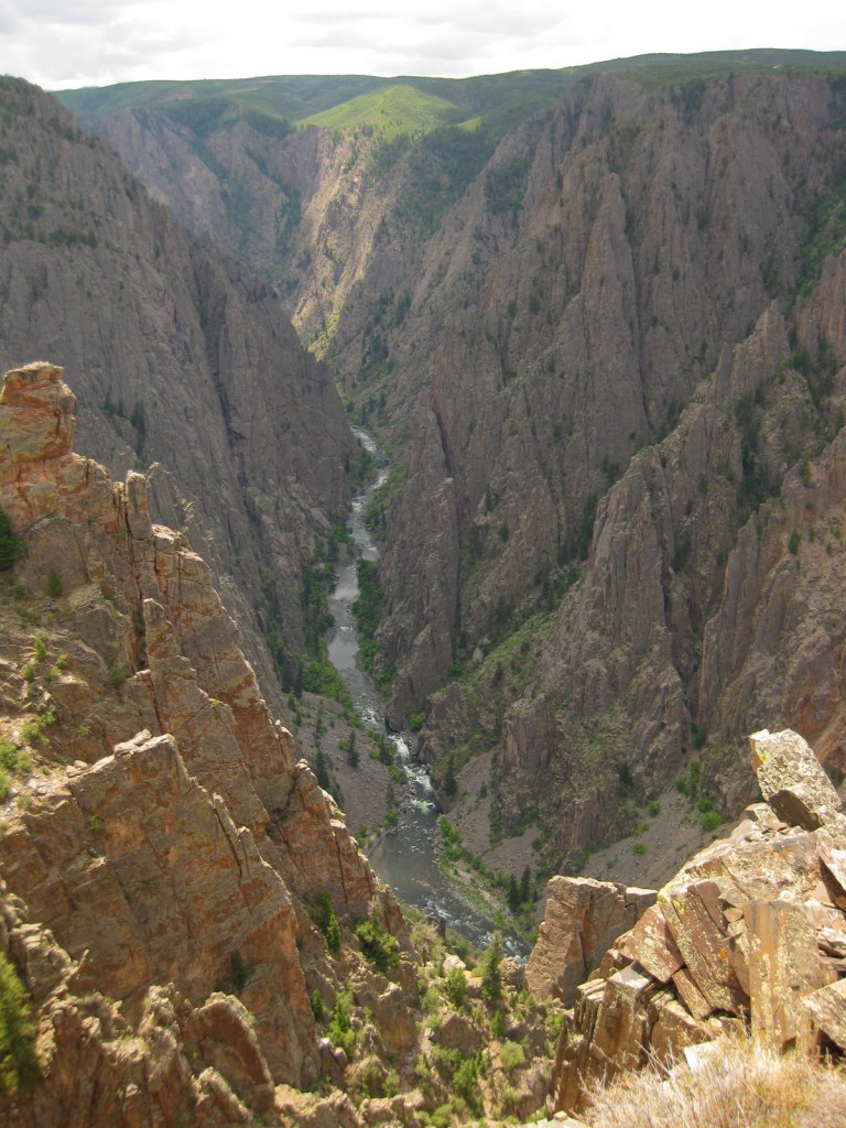
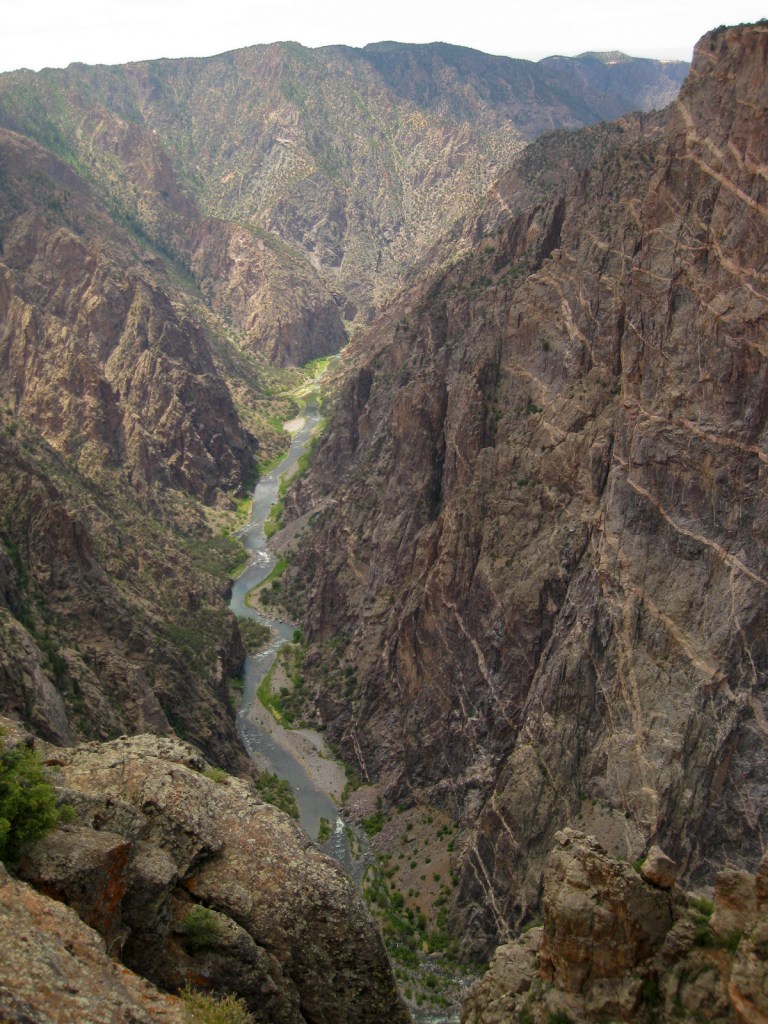
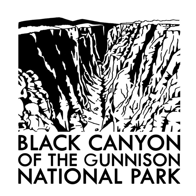
Located in a remote part of central Colorado, visiting Black Canyon of the Gunnison National Park will require hours of driving no matter where you are coming from, but to experience this phenomenal place is well worth the trip. The canyon is incredibly photogenic; its dark cliff faces of gneiss and schist are adorned with white stripes of pegmatite crystals. Although the canyon is less than a quarter-mile across at Chasm View, to get from one rim to the other is a three-hour drive. The best panoramas are found on the rims, but talk to a ranger if you wish to take an unmarked trek 2,000 feet down to the Gunnison River. Even the easiest Gunnison Route (free permit required) is a strenuous and steep effort on loose rock with fixed chains in many sections. It is also possible to drive to the bottom by driving the 16% grades to the end of paved East Portal Road in neighboring Curecanti National Recreation Area.
Pulpit Rock Overlook, Painted Wall View, Exclamation Point, Oak Flat Trail, Warner Point Nature Trail, Rim Rock Trail
Must-Do Activity
Do not miss the opportunity to picnic with an incredible canyon backdrop, just hold onto your food since the cliffs are always windy at spots like Sunset View. Swallows and swifts love to dart around on the thermals here and will get so close that you cannot help but duck as they zip by your head. Bring layers to wear, as it can be gusty and cold year round at around 8,000 feet in elevation.
Best Trail
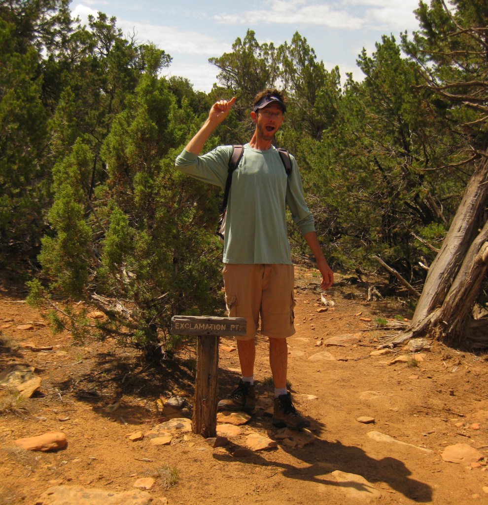
Most visitors to Black Canyon of the Gunnison National Park arrive on the south rim, but we recommend a first stop at the north rim when the dirt road is open in the summer. It is easy to drive right to an overlook for your first view of this geologic wonder, but we think it is better to hike up to one. This can be accomplished by hiking North Vista Trail three miles to Exclamation Point or Rim Rock Trail from the main campground.
Instagram-worthy Photo
One particular outline of white rock intrusion on the north wall is referred to as the Dragon. A short trail leads to the south rim overlook from the Dragon Point parking pullout.
South Rim Road (paved) past the visitor center, East Portal Road (paved), and the dirt road to the north rim are all closed in the winter. Although less than a quarter-mile across at Chasm View, to get between the north and south rims, it is a minimum three-hour drive. Luckily, the eastern route takes you on scenic winding roads that overlook gorgeous Curecanti National Recreation Area. If you drive around the west side of the park instead, you will skirt 62,844-acre Gunnison Gorge National Conservation Area, a Wilderness area known for its whitewater rafting.
Camping
South Rim Campground (closed in winter) has 88 total sites and provides RV sites that can be reserved in advance. There is also primitive camping available on the north rim and at end of East Portal Road within Curecanti National Recreation Area.
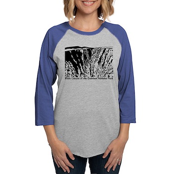
Tiff on the route to the bottomGunnison River at the bottom of the canyonTiff looking over the north rimScott exclaiming at Exclamation PointFlopped out cottontail rabbit on Rim Rock TrailMountain-mahogany achenesAfternoon rainstormTiff on the route to the bottomThis design we created to celebrate this National Park is available on a variety of products at Cafe Press and Amazon.Cafe Press
Explore More – How high is the Painted Wall, which is the tallest cliff in Colorado?
We are a participant in the Amazon Services LLC Associates Program, an affiliate advertising program designed to provide a means for us to earn fees by linking to Amazon.com and affiliated sites.
Yesterday we published our newest guidebook to all 50 states available for sale on Amazon
In yesterday’s post we included the book’s Introduction and, as promised, today we are sharing a sample chapter on Delaware (proving the second smallest state in the U.S. has a lot to do).
We are also giving a presentation on road tripping in the U.S.A. at the Laramie County Library in Cheyenne, Wyoming. It will be held in the Cottonwood Room (1st floor) at 7 p.m. on Tuesday, December 5, 2023. We will have all our books for sale before and after the talk and would be happy to sign them for you. We hope to see you there!
Delaware
1,247,066 acres (0.06%)
Statehood 1787 (1st)
Capital: Dover
Population: 989,948 (45th)
High Point: Ebright Azimuth (449 feet)
Name Origin
Delaware is named for the bay christened in 1610 by British Captain Samuel Argall for Thomas West, the third Baron of De La Warr (and Governor of Virginia, although he never stepped foot there).
Nickname
The First State won the race to ratify the U.S. Constitution on December 7, 1787 inside Elizabeth Battell’s Golden Fleece Tavern in Dover.
Background
Delaware was settled by the Dutch in 1631 (see Unique Museum) and the Swedish seven years later, then dominion changed hands multiple times over the years until the British established it as part of Pennsylvania in 1664. The state has the strangest borders of all with the straight lines laid out by Mason and Dixon in 1764 (see Maryland) and a curving northern border that follows a 12-mile radius arc from the spire atop New Castle Court House. However, that circle left a thin wedge of land before hitting Maryland’s eastern border, which was not fully granted to Delaware until Pennsylvania formally gave up its dispute in 1921. Delaware is often called the “Nation’s Summer Capital” since many politicians and government officials vacation around its Atlantic coast to escape the muggy weather in Washington, D.C. Much of the state’s 381 miles of coastline along Delaware Bay are protected as State Parks and National Wildlife Refuges. The capital is home to the Dover Green, Monster Mile, John Dickinson Plantation, and an Air Force Base where the free Air Mobility Command Museum is open to the public without passing through a security checkpoint.
Must-Do Activity
Originally laid out by Quakers in 1731, Wilmington is the state’s largest city and much of its history is tied to one family: the DuPonts. Pierre Samuel du Pont de Nemours fled the French Revolution to settle in the Brandywine Valley in early 1800s. Éleuthère Irénée du Pont and his two sons started a successful gunpowder business allowing the family to put money into constructing public schools and museums. They also built lavish mansions like Nemours, Winterthur, Gibraltar, Eleutherian Mills, and Longwood (in Pennsylvania). Similar to California’s Hearst Castle, there are multiple tour options to explore 175-room Winterthur, which became a museum in 1951 with a 60-acre outdoor garden, Enchanted Woods, 1830s general store, tram ride, and Touch-It Room for kids. The Hagley Museum and Library is located on the 235-acre site of the original Du Pont mills, and exhibits a fully-functional 1875 machine shop, patent models, and many historic structures. Today the du Pont family is closely associated with the chemical research company they started, known for inventing polymers like nylon, neoprene, Teflon, Mylar, Kevlar, Nomex, and Lycra. Wilmington is also home to the Delaware Art Museum, 178-acre Brandywine Park designed by Frederick Law Olmsted, Delaware History Museum, gilded Hotel du Pont that opened in 1913, DuPont Environmental Education Center, Delaware Center for the Contemporary Arts, and a historic riverfront shopping district.
No National Forest, So Try This Instead
Approximately 1.5-million birds fly over Delaware annually on the Atlantic Flyway migratory route. Some species, like bald eagles, overwinter in 15,978-acre Bombay Hook National Wildlife Refuge near where the Delaware River opens into the Atlantic Ocean. The Migratory Bird Festival is held here every May, when more than 250 species of birds can be spotted. Not coincidentally, this is the same month that horseshoe crabs come ashore to lay their eggs that are eagerly devoured by migrating shorebirds. The refuge was established in 1937 and the next year the Civilian Conservation Corps came in to plant over 50,000 trees, build a dike to create three freshwater impoundments, and construct several buildings. Now there is a 12-mile driving tour, plus five walking trails including the popular Boardwalk Trail and one that leads to a 30-foot-tall observation tower above Shearness Pool. Bombay Hook National Wildlife Refuge was featured on the state’s quarter in the America the Beautiful coin series, which depicted a great blue heron and great egret in a salt marsh. Further south near Rehoboth Beach, 10,144-acre Prime Hook National Wildlife Refuge was established in 1963 to protect marshes, woodlands, ponds, and Fowler Beach, an official sanctuary for horseshoe crabs. The refuge has a small visitor contact station with an excellent gift shop and the nearby Cape Henlopen State Park (see Backpacking Destination) has the Seaside Nature Center with a touch tank, five huge fish tanks, and osprey nest cam.
National Parks: none
Only National Park Service Site
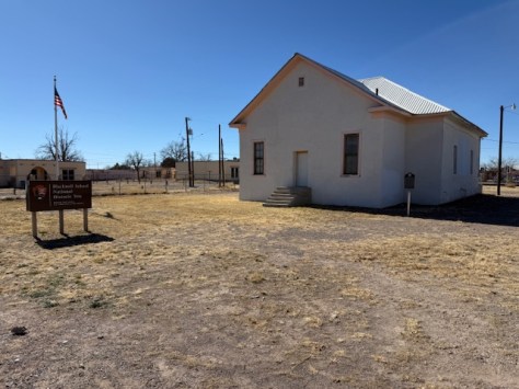
Delaware was the last of the 50 states to gain a National Park Service (NPS) site. Finally in 2013, First State National Historical Park was created from a group of buildings associated with Delaware being the first state to ratify the U.S. Constitution on December 7, 1787 inside The Golden Fleece Tavern in Dover (see photo). The tavern is long gone, but you can still read the marker on the corner of State Street when you visit the lovely Dover Green, which is surrounded by photogenic red-brick buildings. The NPS does not yet have a visitor center at any of the multiple sites across the state and relies on its partners to provide tours and information. Less than an hour’s drive north of Dover, we recommend you take a tour inside the historic New Castle Court House where the legislature met from 1732 to 1777. The New Castle Court House occasionally still holds minor court proceedings and flies the flags of the Netherlands, Sweden, Great Britain, and U.S. Outside on the historic New Castle Green stands a statue of William Penn, who is considered the founder of Delaware since it was part of Pennsylvania until 1776.
Most Scenic Drive
Highway 1 is a coastal road that runs north on Fenwick Island from Ocean City, Maryland to the Delaware border where three miles of the barrier island are protected as Fenwick Island State Park. This is the beginning of 28 miles of beautiful beaches that end at Cape Henlopen State Park (see Backpacking Destination). Across the Indian River Inlet the road enters Delaware Shores State Park, which encompasses six miles of coast with a campground, beach volleyball nets, and beaches perfect for surf fishing, clamming, horseback riding, and surfing. The most developed area for tourists is around Rehoboth Beach, with its historic boardwalk lined by arcades and saltwater taffy stands, plus Funland amusement park and Jungle Jim’s water park. It also hosts a jazz festival, sandcastle contest, independent film festival, Halloween festival, and Championships of Skimboarding at nearby Dewey Beach.
#1 Roadside Attraction
Dover International Speedway hosts auto races throughout the year, but is best known for its two annual NASCAR events held here since 1969. This racetrack is known as the Monster Mile, and has a sculpture of 46-foot-tall Miles the Monster out front for photo-ops (see photo). The imposing gray beast has red-eyes and is crushing a full-size stock car in his right hand. Before the cars start running, visitors can get up close to them in the FanZone. Miles the Monster is available for photos year round by parking at the gates off Dover Leipsic Road.
Unique Museum
The town of Lewes was founded in 1631 just west of Cape Henlopen (see Backpacking Destination), but its Dutch colonists lasted less than a year before being massacred by the native Lenape. The Dutch returned in 1659 and built many cypress-shingled structures that still stand, including the Ryves Holt House that serves as the Lewes Historical Society’s visitor center. The town’s name at that time was Zwaanendael, which means “Valley of the Swans.” A maritime museum currently occupies the 1765 Cannonball House, struck during the British bombardment in 1813. It does not have to be open to see the cannonball lodged in the brick, as it is visible from the street. The free Zwaanendael Museum is located inside a stone building constructed in 1931 based on the city hall of Hoorn in the Netherlands (see photo). Exhibits cover a range of topics from the 1798 sinking of a British brig offshore to a foot-long Fiji merman, a common feature of sideshows where the top half of a juvenile monkey was sewn to the back half of a fish.
That’s So Delaware
Every September, Dover hosts the Amish Country Bike Tour when more than 2,000 cyclists tackle bike courses that range in length from 15 to 100 miles. Also known as “the ride for pie,” the event begins behind a horse and buggy at the starting gun. It is best known for its rest stops with delicious snacks, including homemade pie. To top it all off, there is a huge barbecue for everyone at the end of the tour, regardless of how far you peddled.
Top State Park
Fort Delaware State Park is located on Pea Patch Island, accessed from Delaware City by a ten-minute passenger ferry ride then an even shorter trip on a small bus. According to legend, Pea Patch Island got its name because a ship full of peas sank on a shallow sandbar and the cargo washed ashore, sprouted, and eventually the roots collected more sand until the island now covers nearly two acres. The fort and its moat were built over twenty years starting in 1848, and during the Civil War the fort held 16,000 Confederate prisoners. Tour guides dress in historical clothing, as do the soldiers, blacksmith, and laundress, who will teach you how to use a washboard. In September, overnight tent camping is allowed on certain weekends, when there are nighttime scavenger hunts and fireside ghost stories. At an observation platform on the Prison Camp Trail, you can look out over the marshland where up to 5,000 herons and egrets nest in trees in summer.
Favorite Short Hike
Redden State Forest encompasses 44 miles of trails and an Education Center with exhibits on the importance of forestry in Delaware. It is spread across 18 separate tracts covering 12,900 acres north of Georgetown on both sides of Highway 113. The forest is open for hiking, biking, horseback-riding, and in-season hunting. It also has several buildings listed on the National Register of Historic Places: Ellendale State Forest Picnic Facility, Redden Lodge (built around 1903), the Manager’s House, and the Horse Barn, which opened in 2000 as the Education Center. The Redden State Forest Loop Trail is very flat and covers 4.8 miles through stands of mixed hardwood trees.
Backpacking Destination
We searched all over Delaware for a place that allows backpacking, but it was the only state where we could not identify a single one. As an alternative, we recommend camping at one of the 159 campsites in Cape Henlopen State Park and exploring its trails during the day. The park’s hiking options include the Seaside Nature Trail, Walking Dune Hiking Trail, and Beach Loop Trail (closed in summer for piping plover nesting). The Junction and Breakwater National Recreation Trail is a 5.8-mile-long rail trail popular with bikers (the park has a Loan-a-Bike program) and passes through wetlands, forests, and farmland. The railroad used to take passengers between Lewes and Rehoboth Beach before being abandoned in the 1970s. To extend the hike you can connect to the Georgetown-Lewes Trail or the Gordons Pond Trail. If you are up for an epic backpacking trip, the beach here is the eastern terminus of the 6,800-mile American Discovery Trail. Cape Henlopen State Park’s other recreational opportunities include swimming, kayaking, kiteboarding, beachcombing, and climbing up the 83-foot-tall Observation Tower. While at the State Park, visit the Seaside Nature Center to see its touch tank and five 1,000-gallon fish tanks.
Cool Campsite
Trap Pond State Park encloses 3,300 acres, including a large stand of baldcypress trees. It was these trees that originally brought loggers here, so they excavated Trap Pond to power their sawmill. Following the cutting, the peat bogs dried out and wildfires blazed in the 1930s, including one that continued for eight months straight. At this point the federal government acquired the land and this area became Delaware’s first State Park in 1951. Today visitors can learn more history at the nature center before heading down the road to one of 142 tent and RV campsites. Canoeing is a popular activity, and the park offers the Cypress Point Trail boardwalk into the swamp and the 4.9-mile Loblolly Bicycle Trail (with a Loan-a-Bike program).
Wonderful Waterfall
Delaware does not have much vertical topography, which means its rivers slowly drop without the dramatic cliffs and falls found in other states. One place to see these cascading streams is Alapocas Run State Park, where the 1.8-mile Alapocas Woods Trail gains 226 feet of elevation and the Greenway Trail climbs 300 feet over four miles. At Brandywine Creek State Park, the River Loop covers about five miles and changes 250 feet in elevation, while Rocky Run Loop undulates up a cumulative 300 feet over three miles.
Start your U.S. National Parks, National Forests, and National Monuments adventure here!