Overview
Big Cypress National Preserve was originally planned to be a part of Everglades National Park (established in 1947), but this wild area to the north did not gain federal protection until 1974. There are few roads and trails in the 729,000-acre preserve, which makes it ideal habitat for the endangered Florida panther. The easiest access points are along Alligator Alley (Interstate 75) or the Tamiami Trail (Highway 41). While many of the “trails” require route-finding and slogging through deep water, there are also designated ATV and canoe trails located throughout the park.

Highlights
Kirby Storter Roadside Park, Big Cypress Bend Trail, canoeing
Must-Do Activity
Many of the baldcypress and pond cypress trees that once stood here were logged in the 1930s and 1940s. At the Kirby Storter Roadside Park, you can still see some large examples of these trees famous for their buttressed boles and root nodules, or “knees,” that stand above the high water level. We previously reported on these unique deciduous conifers at Congaree National Park in South Carolina, but here they grow right alongside tall palm trees that we typically associate with sandy beaches.
Best Trail
Many of the trails in the park are underwater and require slogging. Two exceptions with boardwalks are at Kirby Storter Roadside Park and Big Cypress Bend (technically within Fakahatchee Strand Preserve State Park).
Instagram-worthy Photo
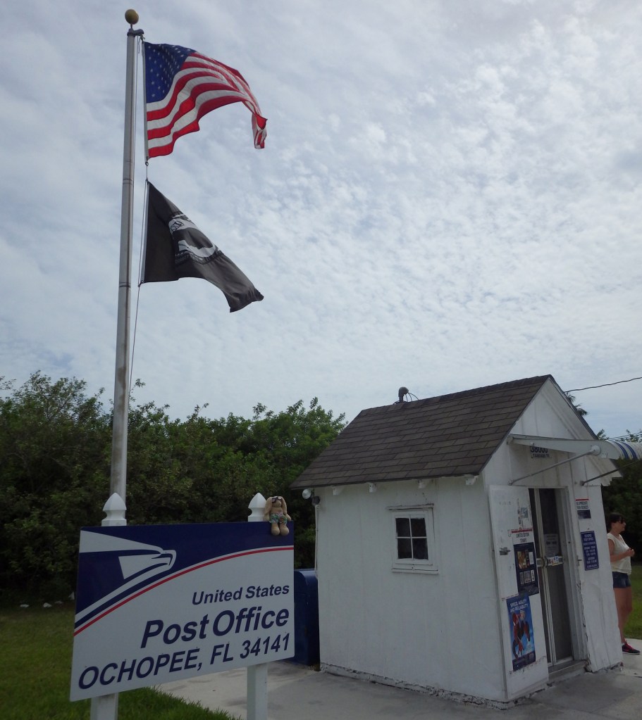
Wherever you look, you are likely to spot an alligator or two in this wild section of south Florida. An extra photo-op can be found at the smallest post office in the United States, a former irrigation pipe shed located in Ochopee, Florida since 1953.
Peak Season
Winter
Hours
https://www.nps.gov/bicy/planyourvisit/hours.htm
Fees
None (except for off-road vehicle permits)
Road Conditions
Highway 41 and Interstate 75 are paved, but just about every other road in the park is sandy (and/or submerged) and should only be attempted with an ATV or swamp buggy.
Camping
The NPS offers two campgrounds along Highway 41 (there is also one in Collier-Seminole State Park), as well as designated primitive wilderness sites.
Related Sites
Everglades National Park (Florida)
De Soto National Memorial (Florida)
Big Thicket National Preserve (Texas)

Kirby Storter Roadside Park 
Tiff with baldcypress tress at Kirby Storter Roadside Park 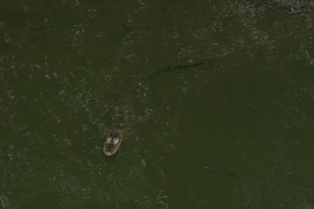
Baby alligator 
Scott on the boardwalk at Kirby Storter Roadside Park 
Extreme grasshopper close-up! 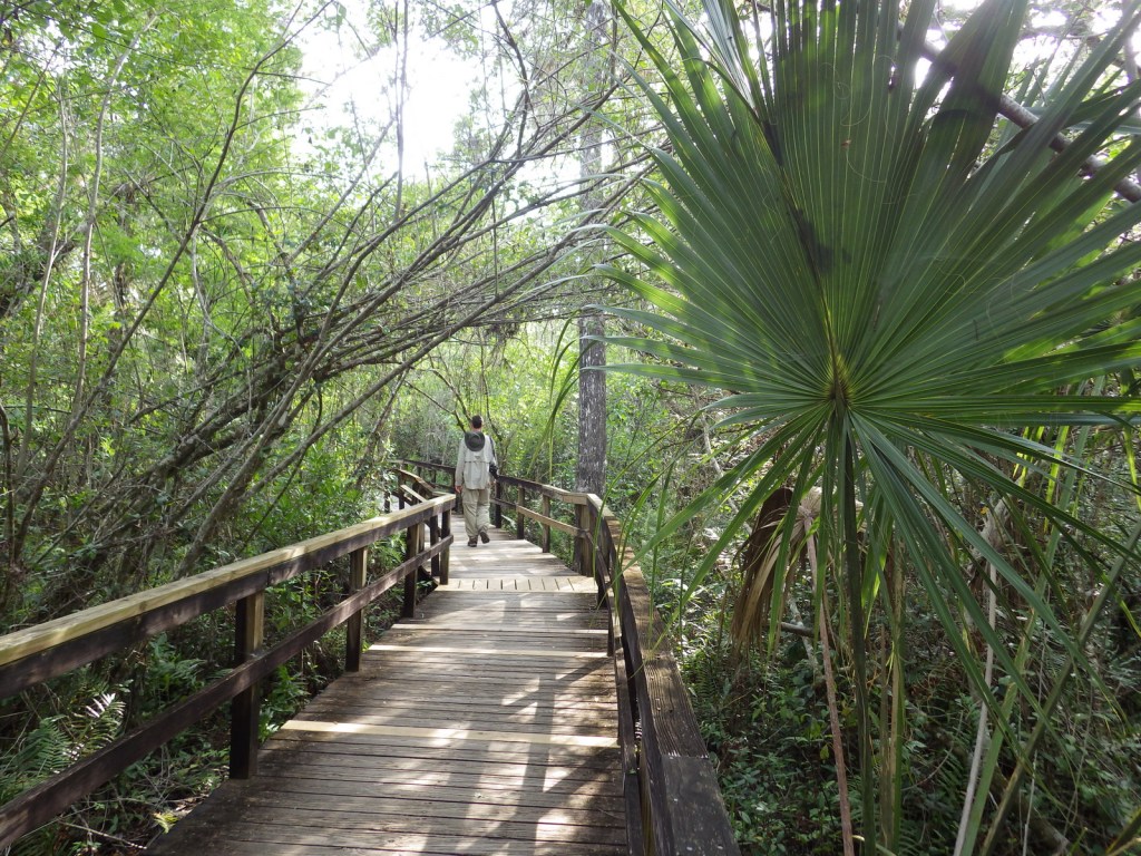
Scott on the boardwalk at Big Cypress Bend 
Dragonfly 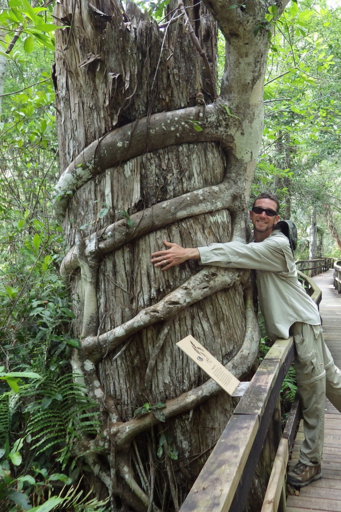
Scott hugging a tree being killed by a strangler fig 
Anhinga 
Epiphytic plants 
Tiff with two huge trees 
Alligator
Explore More – What are the five main habitat types protected within the preserve?