Only 16 of the 138 U.S. National Monuments are found in National Forests, and many of those are jointly administered with the Bureau of Land Management (the BLM ones will be covered in a future Top 10 List). Moreover, ten of them are located in only two states (California and Colorado). However, that does not mean they are not worth checking out. We have visited 15 with the exception of Admiralty Island in Alaska (but did read Alone in the Fortress of the Bears by Bruce L. Nelson), so we have an educated opinion in our ranking. Click here to see all our Top 10 Lists, including our Top 10 National Monuments Managed by the National Park Service.
10. Santa Rosa and San Jacinto Mountains (California)
A gondola ride up into Mt. San Jacinto State Park is the easiest way to access these mountains south of Palm Springs where the Pacific Crest Trail (PCT) runs
9. Camp Hale–Continental Divide (Colorado)
During World War II, the 10th Mountain Division trained in this section of the Rocky Mountains
8. Browns Canyon (Colorado)
The only legal way to access these lands is on a whitewater rafting trip
…and finally our #1 National Monument in a National Forest
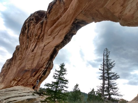
1. Giant Sequoia (California)
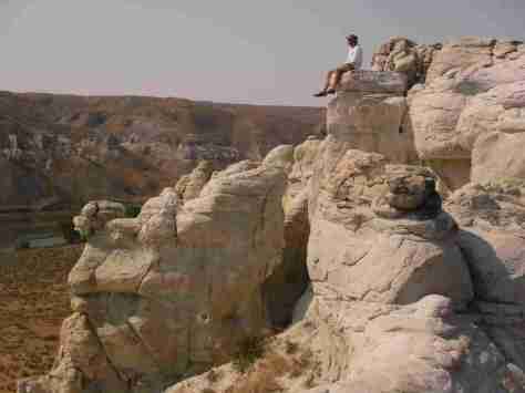
Not as busy as Sequoia National Park, there are some impressive giant sequoia trees found here (including the Boole Tree, one of our favorites)
.
Honorable Mentions
Sand to Snow (California)
We are mostly familiar with the BLM part of this National Monument, but it stretches up into the San Gorgonio Wilderness of San Bernardino National Forest
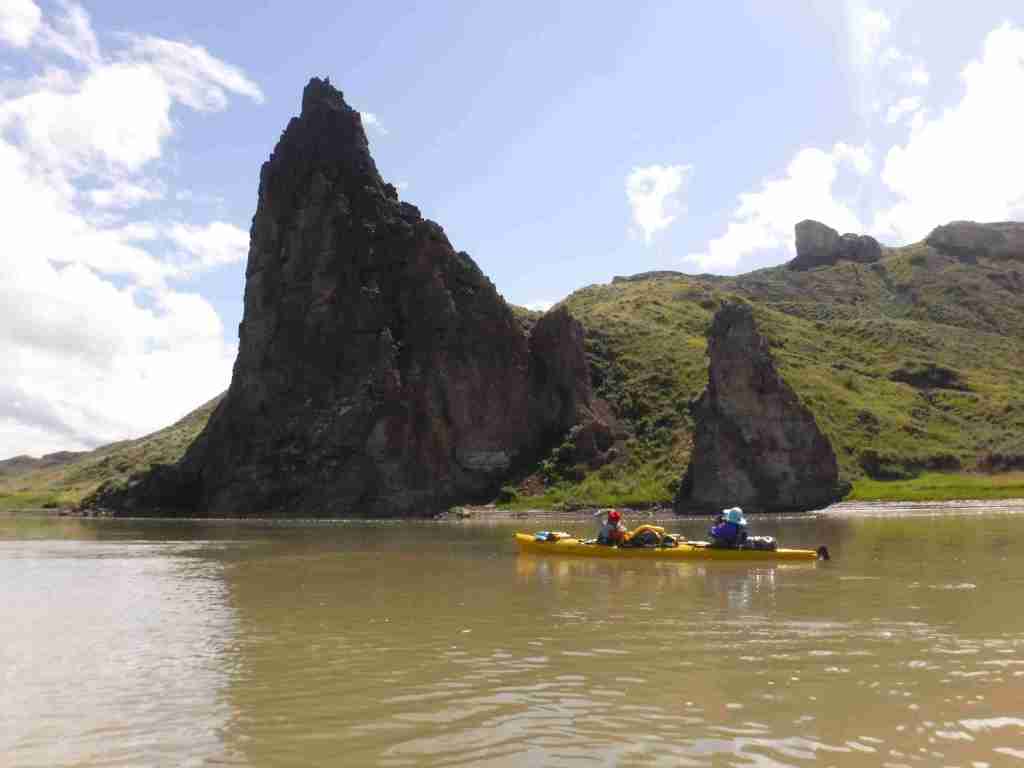
In central Montana, 149 miles of the Upper Missouri River were designated as a National Wild and Scenic River in 1976, upstream from the reservoir in Charles M. Russell National Wildlife Refuge. This stretch of the river still looks much the way it did when the Lewis and Clark expedition first explored it in 1805 and their former campsites are marked by posts. The breaks are a topographic area where the Missouri River eroded sedimentary rock that formed as horizontal layers laid down at the bottom of an ancient sea. The National Monument comprises public land in a matrix with private ranches, with cattle making the water unfit for filtering. There are a couple places to drive to along the river, but the best way to experience it is by floating a canoe or kayak down the non-motorized sections
Fort Benton, Decision Point, Neat Coulee, Citadel Rock, Hole-in-the-Wall, Lewis and Clark National Historic Trail
Must-Do Activity
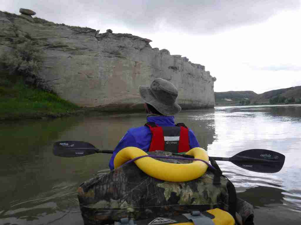
In Fort Benton, start your visit at the free interpretive center run by the Bureau of Land Management (BLM), then head downtown to learn more history by walking the riverfront of Fort Benton National Historic Landmark, including its many museums (admission fees charged) and sculptures of Lewis, Clark, Sacagawea and her son Pompey, and Shep (a local dog famous for his faithfulness). To find out more about the Corps of Discovery, check out the Lewis and Clark Interpretive Center upstream in Great Falls. The most scenic stretch to float lies in the 44 miles between Coal Banks Landing and Judith Landing where there are no rapids and the river current is so strong that paddling is mostly reserved for steering. A permit (fee) is required from the BLM, and we recommend you purchase a Boaters’ Guide and W.A.G. bags. Wildlife we spotted along the river included bighorn sheep, bald eagles, white pelicans, great blue herons, and beavers.
Best Trail
Only accessible by boat, the hike up the slot canyon at Neat Coulee from the Eagle Creek Developed Boat Camp is worth a stop. It is also possible to scramble up to the eight-foot-tall Hole-in-the-Wall arch that comes into view on the south side of the river just past Citadel Rock.
Photographic Opportunity
One of the few places with road access in Upper Missouri River Breaks National Monument, at Decision Point, Captains Lewis and Clark were not sure which was the main route: the Marias or Missouri River.
Peak Season
Summer
Fees
There is a small fee charged per person per day to be on the river, which helps pay for the maintenance of vault toilets along the route (other waste must be packed out in W.A.G. bags). An America the Beautiful pass covers the admission fee for the small museum at the BLM visitor center in Ft. Benton.
Road Conditions
Dirt roads doable by passenger vehicles lead to Coal Banks Landing and Judith Landing, while paved roads lead to put-ins at Chouteau County Fairgrounds in Ft. Benton and Kipp Recreation Area at the western edge of Charles M. Russell National Wildlife Refuge.
Camping
There are campgrounds at Chouteau County Fairgrounds, Coal Banks Landing, and Kipp Recreation Area. Throughout the National Monument developed riverside campgrounds can be accessed by boat, with dispersed camping allowed anywhere on public land (a good map is essential to avoid private land).
In our previous post, we promised to share the Introduction to the book, which is included in the post below.
Check out our Amazon.com Author Page and Shop tab for all four of our U.S. travel guidebooks, plus our coloring book and other products!
Introduction
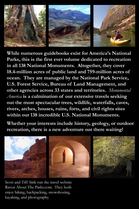
While numerous guidebooks exist for the United States of America’s National Parks, this is the first ever volume dedicated to recreation in all 138 National Monuments. Altogether, they cover 18.4-million acres of public land across 33 states and territories, plus 759-million acres of ocean in the five expansive Marine National Monuments created since 2006. Only 40 National Monuments have an entry fee, while the others provide free opportunities to learn about history or enjoy the outdoors. The mission of this guidebook is to introduce readers to the diversity of National Monuments by providing information on what makes each of them worthy of protection and how to go about experiencing what they have to offer.
National Monuments feature internationally recognized icons like the Statue of Liberty, as well as overlooked places that even locals rarely visit. They protect fossil quarries, historic homes of important Americans, caves open for exploration, sites significant to the Civil Rights Movement, volcanic wonders, relics of indigenous cultures, old military forts, and whitewater rafting spots. Select National Monuments have visitor centers and guided tours, while others are undeveloped wildlands encompassing everything from deserts to glaciers, including wetlands, sand dunes, and coastlines that provide habitat for countless species of wildlife. Whatever you are interested in, there is a new adventure out there waiting.
Monumental America is a culmination of our extensive travels seeking out the most spectacular trees, wildlife, waterfalls, caves, rivers, arches, houses, ruins, forts, and civil rights sites in National Monuments. Less than 80 of the 138 National Monuments are managed exclusively by the National Park Service, while others fall under the jurisdiction of the U.S. Forest Service, Bureau of Land Management, U.S. Fish and Wildlife Service, National Oceanic and Atmospheric Administration, and Department of Defense, as well as some state agencies and tribal governments. The federal agencies provide a plethora of information on their websites, including maps, updated hours and entry fees, and current road conditions.
We focused on hiking in this book as a way to explore each National Monument without needing any special equipment or skills. America’s National Monuments offer a variety of other recreational opportunities to enjoy the outdoors: camping, backpacking, picnicking, wildlife watching, birding, photography, hunting, fishing, swimming, whitewater rafting, boating, kayaking, canoeing, stand-up paddleboarding, horseback riding, mountain biking, road biking, rock climbing, caving, rockhounding, four-wheeling, scenic driving, snowshoeing, and cross-country skiing, not to mention the more extreme sports like hang gliding and ice climbing. National Monuments have something for everyone.
History
Most National Monuments have been created unilaterally by the U.S. President under the authority of the Antiquities Act of 1906 without Congressional approval. The Antiquities Act states that the president may set aside “historic landmarks, historic and prehistoric structures, and other objects of historic or scientific interest.” President Theodore Roosevelt was the first to utilize this power to protect small cultural sites like Gila Cliff Dwellings and vast wildernesses like the Grand Canyon. The legality of this executive action has been questioned and debated for over a century.
While Roosevelt was a Republican, the last member of that party to create a new National Monument in the western U.S. was President Herbert Hoover when in 1933 he set aside 10,288 acres of the Black Canyon of the Gunnison in Colorado. Smaller historic sites, like Kentucky’s Fort Nelson in 2018, have continued to be preserved by executives of both political parties. Many of our treasured 63 National Parks started as National Monuments, including all three in Arizona, five of nine in California, four of five in Utah, and, most recently, White Sands in New Mexico after nearly 90 years as a National Monument. On the other end of the spectrum, South Carolina’s Reconstruction Era National Historical Park (established in 2019) was a National Monument for only two years.
Less often, National Monuments are established through congressional bills that go through both the Senate and House of Representatives, such as George Washington Birthplace in Virginia, Hagerman Fossil Beds in Idaho, Grand Portage in Minnesota, Newberry Volcanic in Oregon, and Mill Springs Battlefield in Kentucky.
While Wyoming boasts the first National Monument ever established at Devils Tower, in 1950 it became the first state to block any future U.S. President from unilaterally designating new National Monuments larger than 5,000 acres after residents protested the creation of Jackson Hole National Monument (now part of Grand Teton National Park). Congress did use their authority to make 8,198-acre Fossil Butte National Monument in the state in 1972.
On December 1, 1978, President Jimmy Carter utilized the Antiquities Act to set aside 56-million acres within 17 National Monuments across Alaska. His actions led many Alaskans to protest and Fairbanks residents to burn the president in effigy. Two years later, with the congressional passage of the Alaska National Interest Lands Conservation Act (ANILCA), most of the land was redesignated under different categories, mainly as National Parks and National Preserves. Later, Congress effectively created a 5,000-acre limit on presidential National Monument designations in Alaska, which has been respected in the decades since.
The court system has continually approved the U.S. President’s ability to use the Antiquities Act in this way, although it has not always been popular, especially with industries based on natural resource extraction. Recently, Bears Ears and Grand Staircase–Escalante National Monuments in Utah have been the subject of political ping-pong as their boundaries have been adjusted. There is a long history of abolishing and redesignating National Monuments, which we highlighted in the introduction for each state.
Monumental America is organized alphabetically by state and each of the 138 National Monuments features the same categories for ease of navigation, starting with the total acreage and the year each was officially designated.
When To Visit
These are the preferred seasons to visit for the best weather. Some places are snowed-in most of the year while others get unbearably hot in the summer, and a few are pleasant year-round. It is worthwhile to check online before making a trip since many of the historic sites are closed seasonally and only open certain days of the week.
How It Got Its Name
When we started writing this book, we were unsure of the pronunciation of some of the names of the National Monuments, so we enjoyed learning the history and etymology of why each of them got their specific moniker.
Why It Was Created
Some National Monuments were established to protect a small historic site, while others preserve thousands of acres of undeveloped public land. We provided some basic background information as to why each place was deemed worthy of its special designation, plus a basic history of the site.
What To See
Presented in list form, these are the places that we frequently came across in our research of a particular National Monument. They may not be the busiest spots, or include everyone’s personal favorite, but they do tend to be more developed for visitation.
How To Visit
National Monuments vary greatly in size and development for recreation, so we provided a basic introduction on how most visitors approach their first trip, although there is no wrong way to do it.
How Much Does It Cost
98 National Monuments have no entry fee! We noted this at the beginning of each chapter, although we still covered relevant costs for guided tours and ferries, if applicable. Most admission fees apply at sites managed by the National Park Service where it may save money to purchase an annual America the Beautiful Pass (and if you qualify for discounted senior, access, and military cards you also receive half-off on all tours and campsites).
Where To Hike
A few National Monuments have extensive trail networks, so we chose one hike that is reasonably easy and provides a good introduction to the area. Not every site has designated trails, though, and a hike may instead involve city sidewalks or cross-country exploration.
What To Photograph
In this book we used black-and-white photography in homage to Ansel Adams, who did so much with his stunning imagery to popularize Canyon de Chelly and other National Monuments that later became National Parks. We selected one original photograph for the 127 National Monuments we have personally visited (not including four Marine National Monuments, three fly-in sites in Alaska, two that are closed to public access in Arizona and Texas, and two new ones in Maine and Pennsylvania).
How Are The Roads
Not all roads in National Monuments are paved, so we explained which ones actually require a high-clearance vehicle and should be avoided by RVs, as well as covering seasonal road closures.
Where To Camp
Most National Monuments managed by the National Park Service do not allow camping and some of the undeveloped areas do not have any campgrounds. In these cases, we researched where to stay at nearby State Parks or private campgrounds with RV hookups. There are often dispersed primitive options for car camping on back roads managed by the U.S. Forest Service and Bureau of Land Management. Backpacking is a popular activity in some National Monuments, so we clarified if permits are required and where to get them.
We have posts on many National Monuments and other public lands with color photographs on our travel website (RavenAboutTheParks.com).
We hope that Monumental America provides inspiration for your own monumental explorations.
The mission of our guidebook is to introduce readers to the diversity of National Monuments by providing information on what makes each of them worthy of protection and how to go about experiencing what they have to offer. National Monuments cover a broad range of sites of historic and geologic interest from as small as 0.07 of an acre up to 2.2-million acres in size.
While numerous guidebooks exist for the United States of America’s National Parks, this is the first ever volume dedicated to recreation in all 138 National Monuments. Altogether, they cover 18.4-million acres of public land across 33 states and territories, plus 759-million acres of ocean in the five expansive Marine National Monuments created since 2006. Only 40 National Monuments have an entry fee, while the others provide free opportunities to learn about history or enjoy the outdoors.
National Monuments feature internationally recognized icons like the Statue of Liberty, as well as overlooked places that even locals rarely visit. They protect fossil quarries, historic homes of important Americans, caves open for exploration, sites significant to the Civil Rights Movement, volcanic wonders, relics of indigenous cultures, old military forts, and whitewater rafting spots. A select few National Monuments have visitor centers and guided tours, while others are undeveloped wildlands encompassing everything from deserts to glaciers, including wetlands, sand dunes, and coastlines that provide habitat for countless species of wildlife.
Whatever you are interested in, there is a new adventure out there waiting!
Please keep your eye out for our next post with the Introduction to our new guidebook. Check out our entire selection of U.S. travel guidebooks on our Amazon.com Author Page.
We are a participant in the Amazon Services LLC Associates Program, an affiliate advertising program designed to provide a means for us to earn fees by linking to Amazon.com and affiliated sites.
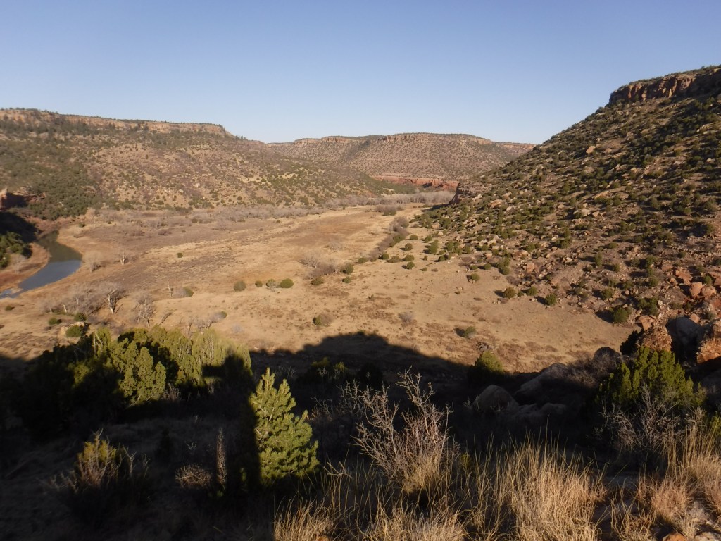
Kiowa National Grassland encompasses two discrete units in northeast New Mexico, the eastern one bordering Texas and Oklahoma’s Rita Blanca National Grassland. This patchwork of public and private lands is administered together with the larger Cibola National Forest and Black Kettle National Grassland. Elevations range from 4,500 up to 6,300 feet in the western unit where La Frontera del Llano Scenic Byway (NM 39) runs north to south. Shortgrass prairie is the dominant cover type, with sand sagebrush and pinyon-juniper woodland mostly found in the west. Ponderosa pines are dispersed on wetter hill faces and riparian areas support Fremont cottonwoods and willows.
Highlights
Mills Canyon, Santa Fe National Historic Trail
Must-Do Activity
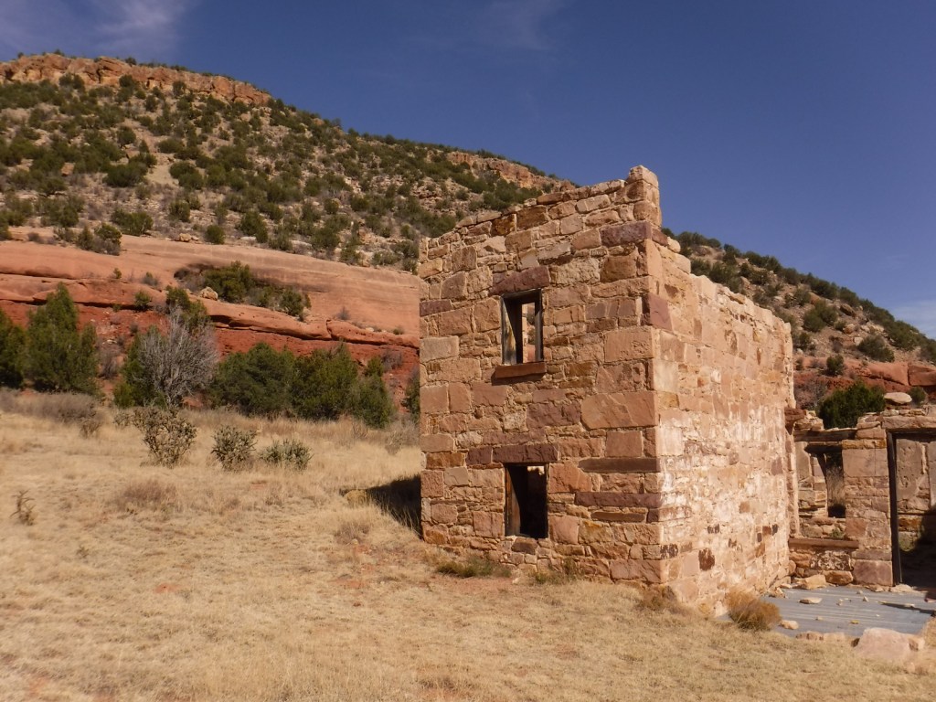
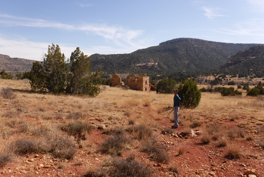
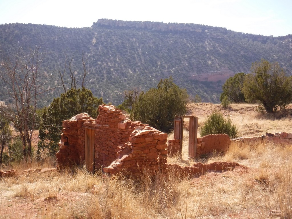
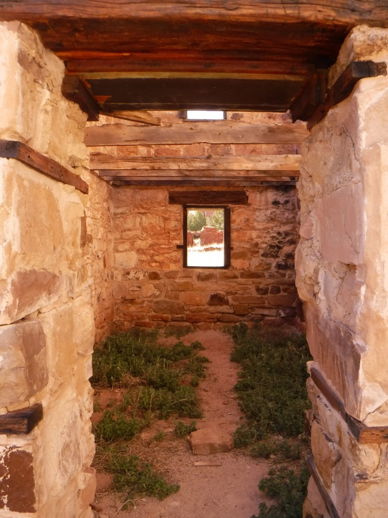
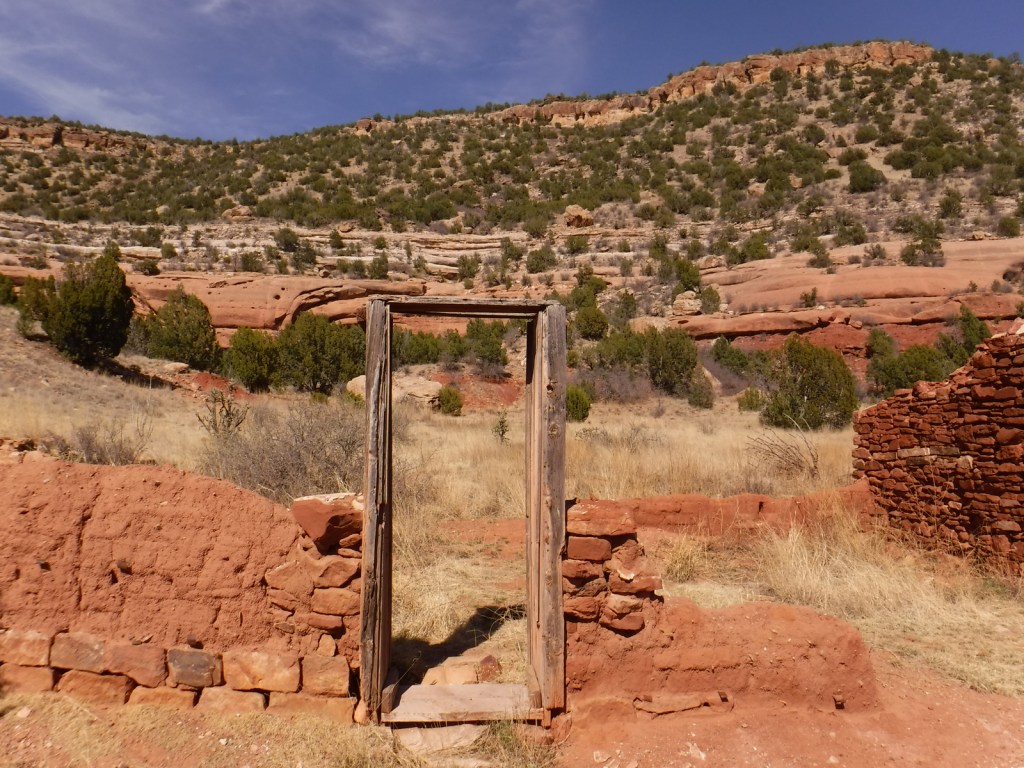
Melvin Mills (an attorney, territorial legislator, and entrepreneur) established the Mills Orchard and Ranch along the Canadian River in 1881. Flash flooding devastated the orchard in 1904, leading to the ranch’s abandonment a decade later. In 2005, the U.S. Forest Service and National Park Service collaborated to restore three ranch buildings, and for their efforts they won the Windows on the Past Award for historic preservation. There are also interpretive signs and a free campground at the bottom of Mills Canyon, located nine miles down unpaved Mills Canyon Road.
Best Trail
A three-mile stretch of the Santa Fe National Historic Trail’s Cimarron Route is marked by rock posts 17 miles north of Clayton, and it is open for walking and horseback riding. There are interpretive signs along the route and wagon ruts remain visible.
Watchable Wildlife
An introduced herd of Barbary sheep are thriving in the Mills Canyon area. The Canadian River supports largemouth bass and channel catfish. Nomadic Naturalists blog reported seeing swift foxes, spiny softshell turtles, black-chinned sparrows, and pinyon jays on their visit.
Photographic Opportunity
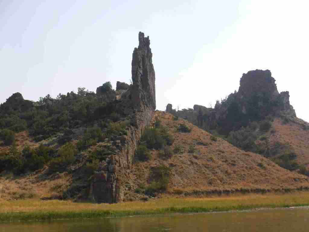
Mills Canyon was cut by the Canadian River through sedimentary rocks ranging in age from 200-million to 90-million years old.
Peak Season
Summer
Fees
None
Road Conditions
Past Mills Canyon Rim Campground, the unpaved Mills Canyon Road #600 is not recommended for trailers or passenger vehicles as it switchbacks down into Mills Canyon. A high-clearance vehicle is also recommended for the two-track paralleling the Santa Fe National Historic Trail’s Cimarron Route.
Camping
Both the Mills Canyon Rim Campground (6 campsites) and Mills Canyon Campground (12 sites) are free with vault toilets, but no water. Dispersed camping is allowed in the eastern unit around the Santa Fe National Historic Trail.
Scott exploring Mills CanyonTiff exploring the Canadian RiverHeading out of Mills Canyon
Explore More – As an attorney, Melvin Mills’ work often involved outlaws, American Indians, and politicians; who saved his life when he was nearly hanged by an angry mob?
Start your U.S. National Forests, National Parks, and National Monuments adventure here!