Overview
These expansive ruins built in the desert between AD850-1150 represent the best collection of Ancestral Puebloan architecture in the southwest U.S. Over 400 miles of historic roads led to this ceremonial center. Its multiple great houses were first protected in 1907 and can take days to explore fully.

Highlights
Pueblo Bonito, Chetro Ketl, petroglyphs, supernova pictograph
Must-Do Activity
Walking through the short doorways inside D-shaped Pueblo Bonito, you can admire the intricacy of the walls that have stood over 1,000 years. So much effort was put into building monumental structures in this challenging locale, then it was mysteriously abandoned, making this remarkable park is an awesome place to ponder human civilization, past and future.
Best Trail
A free backcountry permit is required to hike all trails in the park. Our favorite passes Kin Kletso and Casa Chiquita 3 miles one-way to a unique pictograph that may depict a supernova that occurred in AD1054.
Instagram-worthy Photo
While mostly made of mud bricks, the wood used in the structures had to be carried over 50 miles from the nearest forests to reach this spot. An estimated 200,000 trees were moved over 300 years of construction without the use of pack animals or wheels.

Peak Season
Summer, though it can be hot with no shade.
Hours
https://www.nps.gov/chcu/planyourvisit/hours.htm
Fees
$25 per vehicle or America The Beautiful pass
Road Conditions
All access roads to the park are dirt, with the recommended entry route via County Roads 7900 and 7950, 21 miles west of Highway 550. The roads from the south are more difficult, especially when wet.
Camping
The small Gallo Campground lies within the park, but we recommend the free campground in Angel Peak Recreation Area run by the Bureau of Land Management east of Highway 550.

From your first view of Fajada Butte, you will feel this is a special place 
Scott and his mother at Chetro Ketl 
The awe-inspiring great kiva at Chetro Ketl 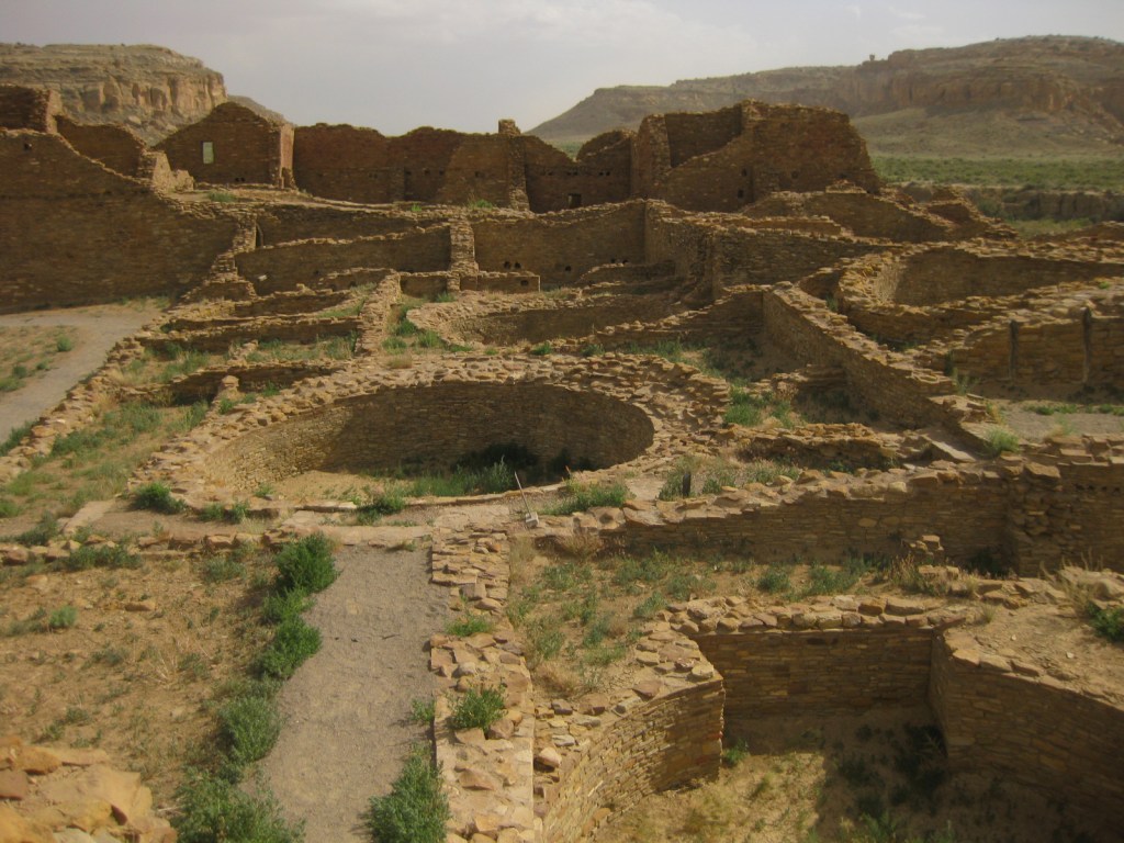
Pueblo Bonito 

Supernova pictograph 
Raven above a picnic shelter 
Elk herd in December
Explore More – Why do visitors strive to arrive for the summer and winter solstices each year?